


: Final Warning, peak intensity was 70knots(CAT 1US)")

 is forecast to begin extratropical transition in 12hours")
, category 1 US, is tracking close to Ha'apai and Nuku'alofa/Tonga")
, extremely intense convection, tracking less than 100km to Lambasa/Fiji")
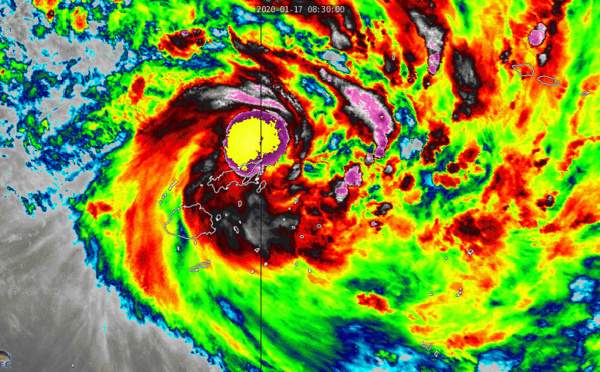
, intensifying, tracking less than 100km east of Labasa/Fiji within 6/12hours")
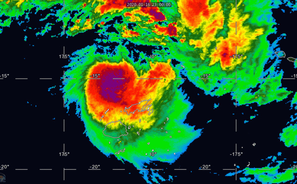
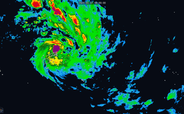
, gradually intensifying and rapidly approaching Fiji")
 : Final Warning. Peak intensity was 80knots( top CAT 1US)")

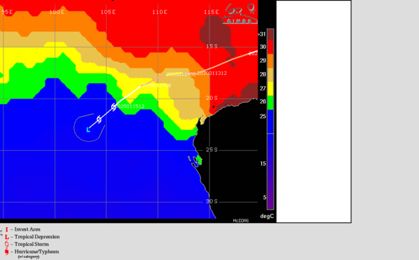
 close to minimal cyclone intensity, tracking over cool SSTs")
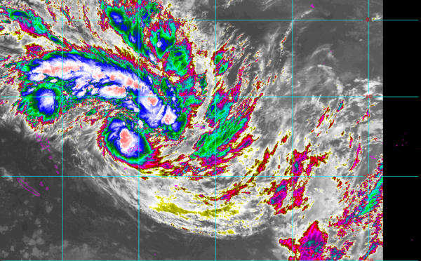
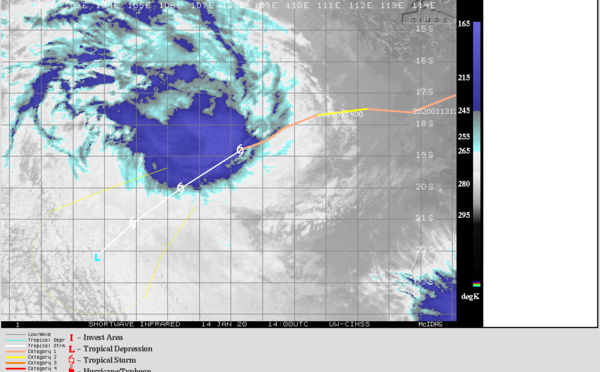
 is now rapidly decaying as a sheared system")
 probably peaking as a borderline cat 1/2 US")
 still a category 1 US but intensifying over open waters")
 has reached Typhoon intensity, still intensifying over open waters")
 forecast to reach Typhoon intensity within 12hours")
 forecast to reach category 2 US in 36h")

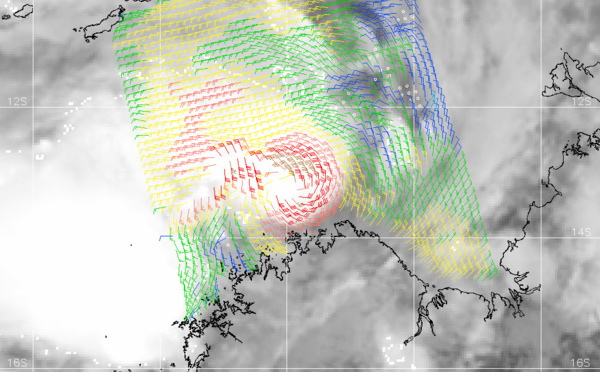

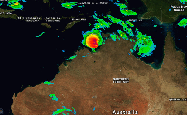
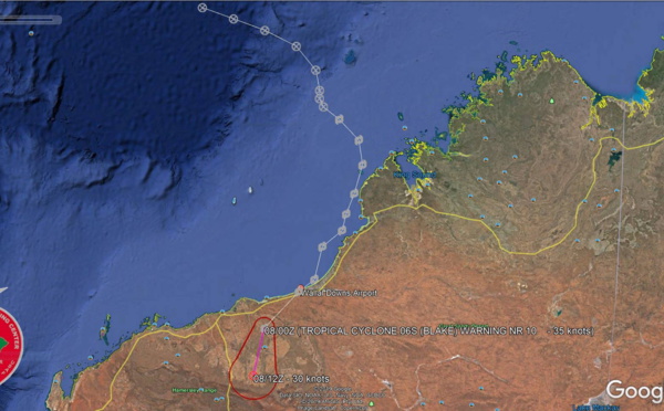
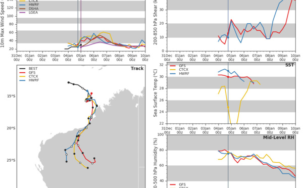
 made landfall near Wallal Downs, lifetime peak intensity was 50knots")
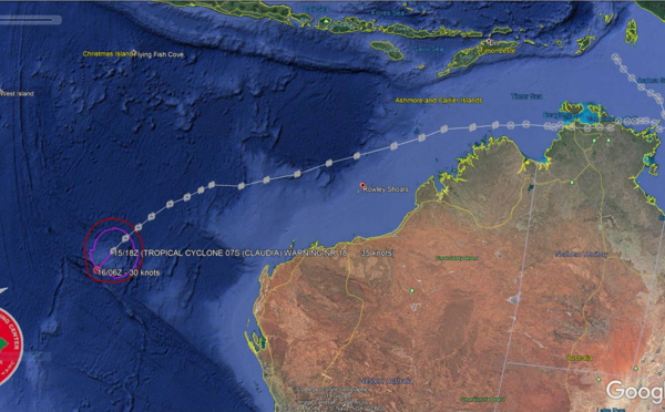
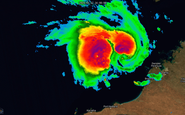
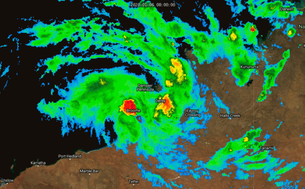
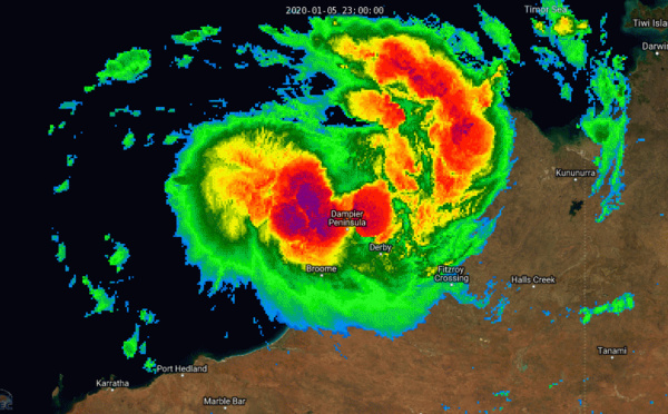
 tracking close to the coastline of WA with welcome rainfall")
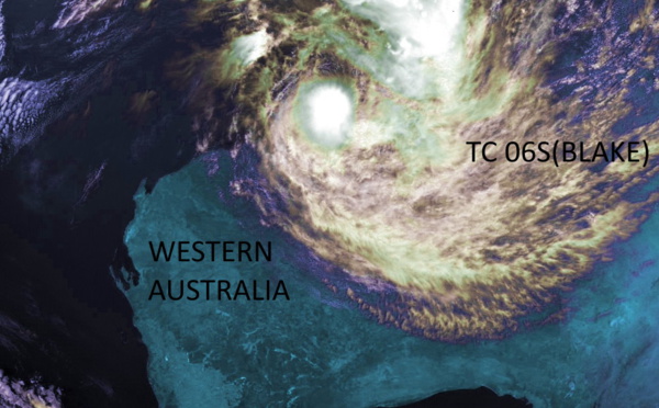
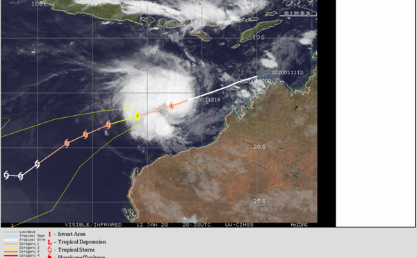
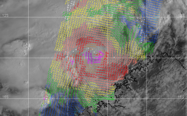
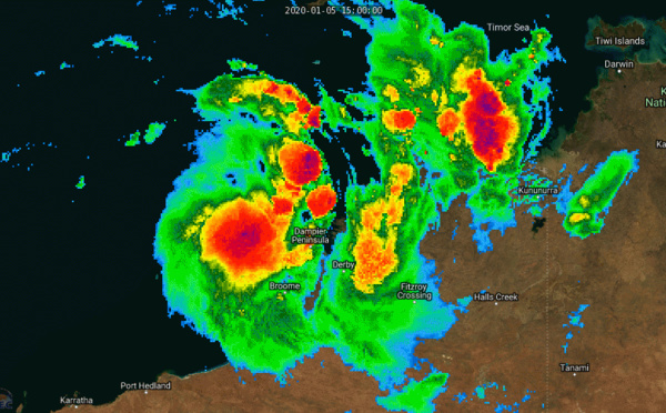
 tracking just west of Broome as a 50knots cyclone")
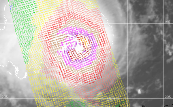
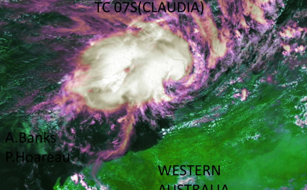
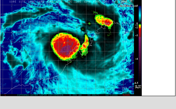
 intensifying North-West of Broome(WA)")

")

Les News
WESTERN PACIFIC:TY 07W(MEKKHALA) approaching OKINAWA while weakening/08W(HIGOS) to merge with 07W in approx 60h/Invest 95W//24@1030 UTC
06/24/2026
- PATRICK HOAREAU
WESTERN PACIFIC:Typhoon 07W(MEKKHALA) Rapid Intensification likely next 24h forecast Peak Intensity at CAT 4 US in 48h/ Invest 94W//21@1000 UTC
06/21/2026
- PATRICK HOAREAU
WESTERN PACIFIC: TS 07W(MEKKHALA) forecast to reach Typhoon Intensity by 24h, forecast to peak at CAT 3 US in 72h//20@1000 UTC
06/20/2026
- PATRICK HOAREAU
WESTERN PACIFIC: Invest 92W/ SOUTH PACIFIC: Invest 96P/3 Week Tropical Cyclone Formation Probability//17@1030 UTC
06/17/2026
- PATRICK HOAREAU
WESTERN PACIFIC: Invest 92W/SOUTH PACIFIC: Subtropical Storm 96P/EASTERN PACIFIC: Invest 93E//15@0730 UTC
06/15/2026
- PATRICK HOAREAU
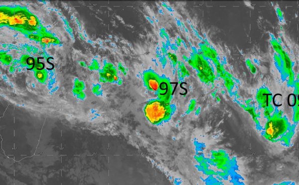
SOUTH INDIAN: Subtropical Storm 95S// 11/0900 UTC
06/11/2026
- PATRICK HOAREAU

Liens utiles
WESTERN PACIFIC:Typhoon 07W(MEKKHALA) Rapid Intensification likely next 24h forecast Peak Intensity at CAT 4 US in 48h/ Invest 94W//21@1000 UTC
WESTERN PACIFIC: TS 07W(MEKKHALA) forecast to reach Typhoon Intensity by 24h, forecast to peak at CAT 3 US in 72h//20@1000 UTC
WESTERN PACIFIC: Invest 92W/ SOUTH PACIFIC: Invest 96P/3 Week Tropical Cyclone Formation Probability//17@1030 UTC
WESTERN PACIFIC: Invest 92W/SOUTH PACIFIC: Subtropical Storm 96P/EASTERN PACIFIC: Invest 93E//15@0730 UTC
SOUTH INDIAN: Subtropical Storm 95S// 11/0900 UTC
S'identifier