meteo


ILES SOEURS: nuit très agitée à la RÉUNION, pluies localement orageuses et rafales probables à MAURICE ces prochaines 12heures
07/03/2021 par PATRICK HOAREAU


Actualité météo
M974World


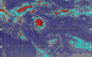
Image Météosat-8 de 14heures ce samedi. La zone active( nuages actifs en blanc avec des sommets très froids( -88°Celsius pour les plus actifs) se développe à l'Ouest Nord-Ouest de la RÉUNION. Eumetsat.PH.

ILES SOEURS: la Perturbation (91S/14) au large des côtes de Madagascar se rapproche, mise à jour le 06/14heures

Analyse de la situation de surface ce Mercredi. L'instabilité sur le CANAL DE MOZ est repérable en rouge. Au Nord de Rodrigues existe la circulation de la zone suspecte INVEST 90S. MTOTEC.

ILES SOEURS: une dégradation pluvio-orageuse possible à partir de Dimanche?

Splendide point de vue depuis les Colimaçons/RÉUNION ce matin à 8h25. Les nuages orageux ceinturaient l'horizon. Spectacle somptueux. MÉTÉO RÉUNION.

ILES SOEURS: terres d'orages!

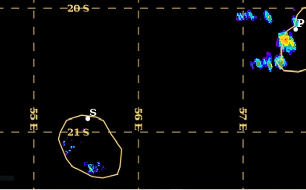
14h30. L'épisode pluvio-orageux est encore actif sur le Sud de MAURICE mais en voie de dissipation. A la RÉUNION il s'intensifie. Notez l'instabilité sur la zone à la fois à l'Est de MAURICE( echos intenses sur le radar ce matin) et à l'Ouest Nord-Ouest de la RÉUNION. Eumetsat.

ILES SOEURS: grosses averses orageuses ce Jeudi après-midi à MAURICE et à la RÉUNION, relevés , analyses et observations

18/14h15. Nombreux orages détectés à MAURICE. WEATHER US.

ILES SOEURS: averses orageuses ce Jeudi après-midi, tendances pour Vendredi

Image d'illustration.

ILES SOEURS: rafale de 93km/h et 81.5mm en 24heures les 15 et 16 Février 2021

16/05h20. Des bandes pluvieuses descendent sur les ILES SOEURS par le Nord-Est. Elles intéressent MAURICE en tout début de matinée puis davantage la RÉUNION par la suite. Radar de TAC. MMS/Vacoas.

ILES SOEURS: temps potentiellement instable ces deux à trois prochains jours

Un peu d'humour face à cette situation qui peut inquiéter. Restons positifs...

ILES SOEURS: Janvier 2021: où sont les pluies? On tire la langue à MAURICE et à la RÉUNION

1 2 3 4 5 » ... 97

Les News

SOUTH INDIAN: 24S(HABANA) set to re-intensify after 48hours and 25S(IMAN) analysed at 45knots, 07/21utc updates

08/03/2021 - PATRICK HOAREAU

SOUTH INDIAN: 24S(HABANA) still a US/CAT 4, forecast to weaken next 48h and then undergo a 2nd intensity spike, 07/09utc update

07/03/2021 - PATRICK HOAREAU

ILES SOEURS: nuit très agitée à la RÉUNION, pluies localement orageuses et rafales probables à MAURICE ces prochaines 12heures

07/03/2021 - PATRICK HOAREAU

SOUTH INDIAN: Tropical Cyclone Formation Alert issued for Invest 91S(IMAN) tracking to the west of Réunion island

07/03/2021 - PATRICK HOAREAU

SOUTH INDIAN: 24S(HABANA) still a powerful and compact CAT 4, Invest 91S up-graded to Medium west of Réunion, 06/18utc update

06/03/2021 - PATRICK HOAREAU

SOUTH PACIFIC: 23P(NIRAN), still a US/CAT 2 but will rapidly become subtropical and weaken drastically next 36h, 06/15utc update

06/03/2021 - PATRICK HOAREAU


Liens utiles
Joint Typhoon Warning Center
MMS Vacoas
Météo France Réunion
MétéoR Océan Indien
Météo Réunion
Météo OI
Firinga le site
Le coin météo
Energies Tropicales
Maufox Satellites
MTOTEC


  • Toutes les rubriques
  • M974World
  • Actualité météo

SOUTH INDIAN: 24S(HABANA) set to re-intensify after 48hours and 25S(IMAN) analysed at 45knots, 07/21utc updates

SOUTH INDIAN: 24S(HABANA) still a US/CAT 4, forecast to weaken next 48h and then undergo a 2nd intensity spike, 07/09utc update

SOUTH INDIAN: Tropical Cyclone Formation Alert issued for Invest 91S(IMAN) tracking to the west of Réunion island

SOUTH INDIAN: 24S(HABANA) still a powerful and compact CAT 4, Invest 91S up-graded to Medium west of Réunion, 06/18utc update

SOUTH PACIFIC: 23P(NIRAN), still a US/CAT 2 but will rapidly become subtropical and weaken drastically next 36h, 06/15utc update

SOUTH PACIFIC: 23P(NIRAN), US/CAT 3, is tracking rapidly South of New Caledonia, rapidly weakening, 06/03utc update

SOUTH INDIAN: 24S(HABANA) US/CAT 4 has not weakened so far, 06/03utc update

SOUTH INDIAN: 24S(HABANA) has reached US/CAT 4 with 260km/h top gusts, still intensifying, 05/15utc update

SOUTH PACIFIC: Super Cyclone 23P(NIRAN) has reached US/Category 5, bearing down on Noumea/New Caledonia

South Pacific: 23P(NIRAN) US/Cat 4,still intensifying likely above the forecast/South Indian: 24S(HABANA): explosive intensification,05/09utc updates

ILES SOEURS: des orages près du Sud-Ouest de MAURICE, se décalent la nuit prochaine vers la RÉUNION, mise à jour Dimanche 15h

ILES SOEURS: les pluies de Janvier 2021 à la RÉUNION, Réseau de Météo-R Océan Indien

ILES SOEURS: record de chaleur le 31 Janvier 2021, les données de Décembre 2020 à MAURICE et à la RÉUNION

ILES SOEURS: déluge dans le Nord de Port-Louis en 3 heures

ILES SOEURS: offensive des orages ce jeudi après-midi, tendances pour le weekend

ILES SOEURS: orages et pluies hier Dimanche, les chiffres, les images, plus de 100mm en quelques heures

ILES SOEURS: les régions exposées aux averses parfois orageuses Dimanche et Lundi

ILES SOEURS: on a bien traqué l'activité pluvio-orageuse de Jeudi à la RÉUNION, bien visible aussi sur le radar de MAURICE

ILES SOEURS: le risque pluvio-orageux persiste pour la RÉUNION, MAURICE: chaud et moins humide, ELOISE va s'intensifier sur le Canal de MOZ

ILES SOEURS: prochaines 24h: instable, lourd et humide, proche des records Mardi à MAURICE


S'identifier
 
Mot de passe perdu ?
Mentions légales Contact

  • www.zinfos974.com
  • www.7magazine.re
  • www.zinfos-moris.com
  • www.zautos974.com