CLICK ON THE IMAGERIES BELOW TO GET THEM ENLARGED
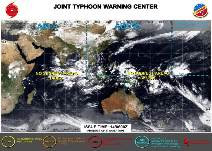
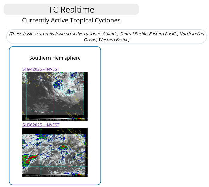
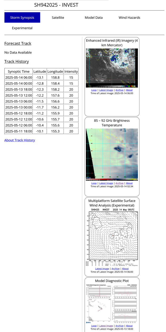
SOUTH PACIFIC OCEAN: INVEST 94P. 14/06UTC LOCATION AND INTENSITY
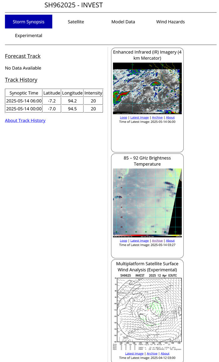
SOUTH INDIAN OCEAN: INVEST 96S. 14/06UTC LOCATION AND INTENSITY
Last Updated - 05/13/25 3 WEEK TROPICAL CYCLONE FORMATION PROBABILITY
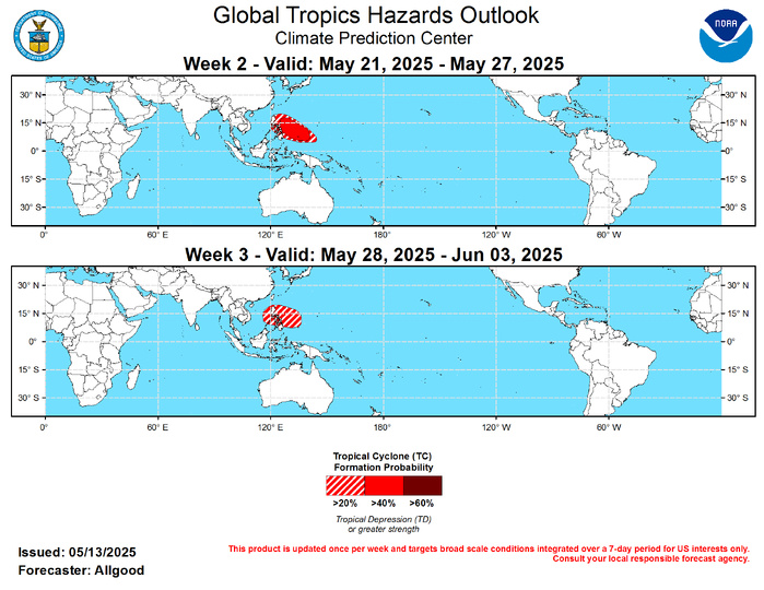
GTH Outlook Discussion Last Updated - 05/13/25 Valid - 05/21/25 - 06/03/25 During the past few days, the spatial structure of upper-level velocity potential anomalies exhibited a coherent Wave-1 structure, consistent with organized intraseasonal MJO activity with an enhanced convective phase centered over the Pacific. This structure has projected well onto the CPC MJO index which is based on the upper-level velocity potential field. Other fields, such as zonal wind anomalies at both the upper and lower levels of the troposphere and the OLR anomalies are less coherent and inconsistent with robust Pacific MJO activity. Additionally, eastward propagation of this upper-level feature has not been established, and it materialized almost instantaneously rather than evolving with robust convection. The RMM-based MJO index remains within the unit circle, reflecting the incoherent pattern overall. Therefore, it is likely that the organized structure in the upper-levels is due more to the superposition of other modes of variability, including Kelvin wave activity crossing the Pacific and Rossby wave activity over the West Pacific and Maritime Continent. Dynamical model MJO index forecasts exhibit considerable spread in their solutions, with the ECMWF generally showing a weak and incoherent evolution, and the GEFS showing a greater potential for more robust MJO evolution, but with significant differences in the placement of the anomaly signatures among the ensemble members. Therefore, with a highly uncertain MJO pattern and ENSO neutral conditions persisting across the Pacific, there are little coherent subseasonal signals present to guide the outlook over the next few weeks. One tropical cyclone developed during the past week, a late season depression (TD-32P) that briefly formed north of the Gulf of Carpentaria. During Week-2, the potential presence of the monsoon trough as a development source along with good support from dynamical model guidance depicting potential tropical cyclogenesis merits the inclusion of a tropical cyclone formation area in the northwestern Pacific, extending from near the Philippines to just south of Guam. There are some indications that a tropical cyclone formation is possible over the Bay of Bengal; however, the evolution of this potential feature is uncertain, and a monsoon low may develop in the area instead. During Week-3, a 20-percent chance for tropical cyclogenesis continues across the Northwest Pacific. Dynamical model guidance is a bit less supportive of formations overall, but development is still possible, especially early in the period in the vicinity of the Philippines. Elsewhere, potentials remain under 20-percent across the other basins; however, there is a slight potential for development over the East Pacific, should a Kelvin wave passage help weaken the shear over the region and provide a period of enhanced convection.
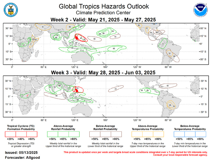
Given the weak seasonal and subseasonal tropical signals, the forecast for above- and below-normal precipitation leans heavily on a skill weighted consensus of operational dynamical model guidance. The strongest remaining low-frequency signal favors persistent enhanced convection across the Maritime Continent, due in part to above-normal ocean temperatures in the vicinity. Dynamical model forecasts generally support a robust onset of the South and Southeast Asia monsoon, with enhanced chances for above-normal precipitation extending during both Week-2 and Week-3 across much of India, the Bay of Bengal, and Southeast Asia. Across the Pacific, enhanced precipitation is favored just northwest of Hawaii, while a drier signal is favored to persist to the south, possibly extending as far north as the Big Island. Suppressed convection is favored during Week-2 across Central America, southern Mexico, and portions of the Caribbean and Gulf of America, with a potential switch towards a wetter signal across the East Pacific basin in Week-3. Temperature outlooks are based on the dynamical model consensus tool, as well as official forecasts for the contiguous United States during Week-2. Notably, enhanced chances for hazardous heat extend across portions of central South America despite the time of year, with maximum temperatures exceeding 35 degrees C on multiple days during the outlook period. For hazardous weather concerns in your area during the next two weeks, please refer to your local NWS office, the Medium Range Hazards Forecasts produced by the Weather Prediction Center, and the CPC Week-2 Hazards Outlook. Forecasts issued over Africa are made in coordination with the International Desk at CPC.
