
 ,increasingly asymmetrical, update 12/15UTC")
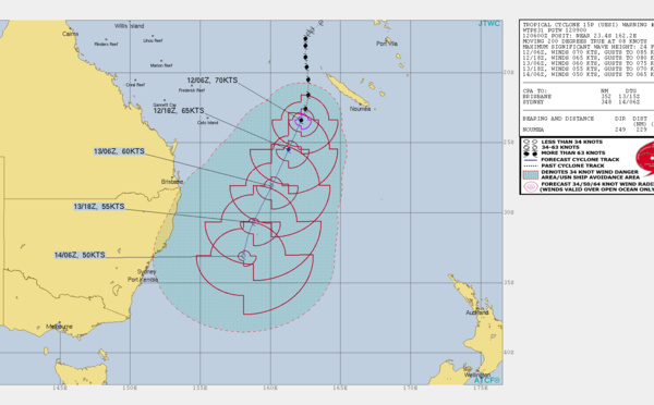
 70knots cyclone, subtropical transition forecast, update 12/09UTC")
 70knots cyclone, update at 11/15UTC")
 75knots cyclone, update at 11/03UTC")
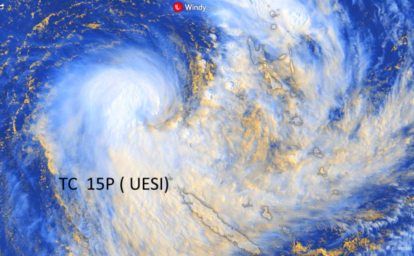
 now a CAT 1 US, update at 10/15UTC")
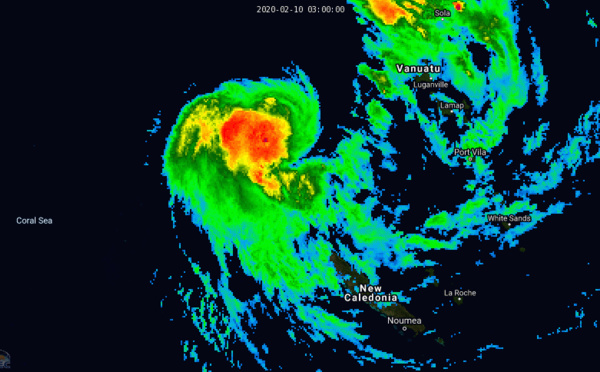
 update at 10/03UTC")
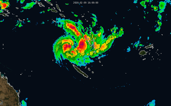
 undergoing rapid intensification, update at 09/21UTC")


 CAT 1 US, intensifying, approaching Karratha, update at 07/15UTC")
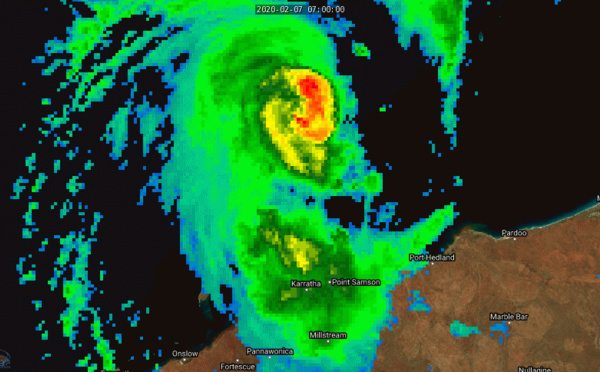
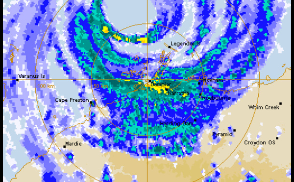
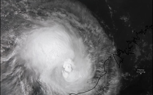
 strong CAT 2 US, landfall near Karratha, top reported gust: 195km/h")
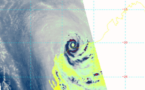

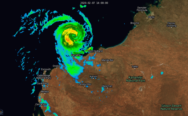
 now CAT 1 US, intensifying and bearing down on Karratha/Western Australia")


 CAT 2 US, making landfall near Karratha within the next hours")
 CAT 2 US, intensifying, approaching Karratha, update at 07/21UTC")
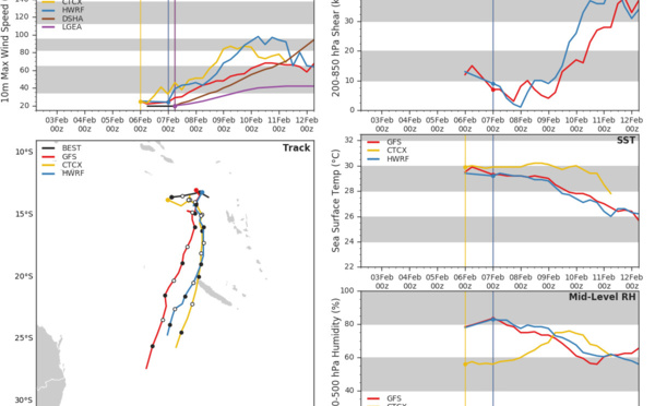
 intensifying, 13S(FRANCISCO) & 91P: updates at 07/03UTC")
 and TC 13S(FRANCISCO) update at 06/09UTC")
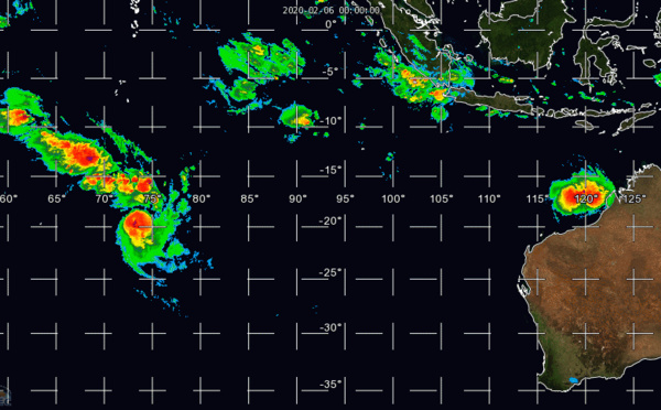
 update at 06/03UTC")
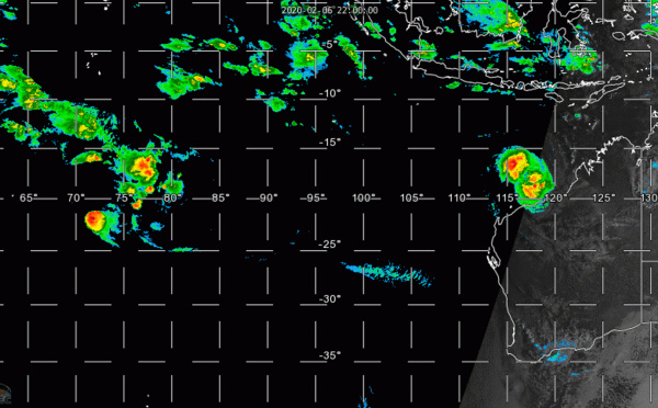
 and 92S update at 05/18UTC")
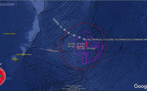


 & 11S(ESAMI) interaction: separation: 950km. 12P update")
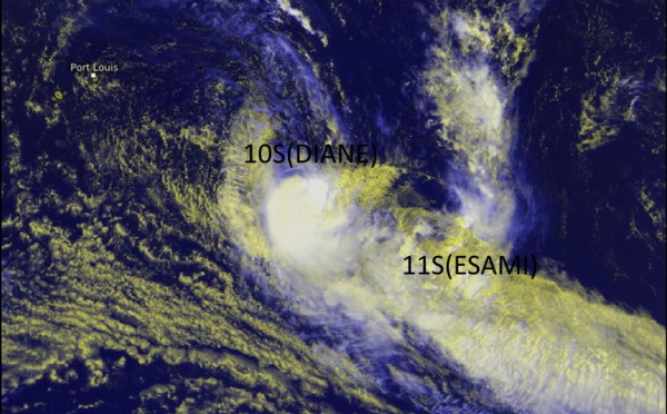
, 11S(ESAMI), 12P: updates")

 & TC 11S(ESAMI) updates + Invest 96P update")

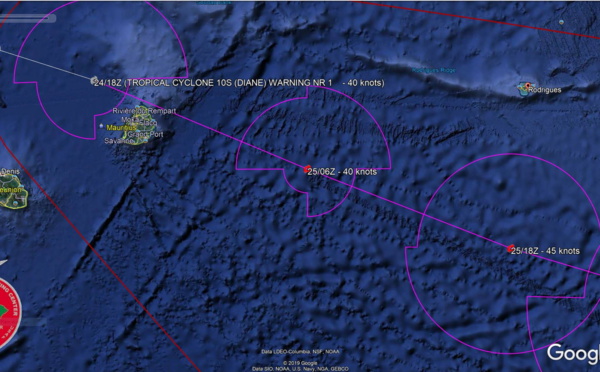
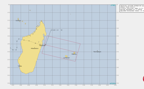
 and TC 11S(97s), 10S tracking very close to Mauritius")


Les News
WESTERN PACIFIC:TY 07W(MEKKHALA) approaching OKINAWA while weakening/08W(HIGOS) to merge with 07W in approx 60h/Invest 95W//24@1030 UTC
06/24/2026
- PATRICK HOAREAU
WESTERN PACIFIC:Typhoon 07W(MEKKHALA) Rapid Intensification likely next 24h forecast Peak Intensity at CAT 4 US in 48h/ Invest 94W//21@1000 UTC
06/21/2026
- PATRICK HOAREAU
WESTERN PACIFIC: TS 07W(MEKKHALA) forecast to reach Typhoon Intensity by 24h, forecast to peak at CAT 3 US in 72h//20@1000 UTC
06/20/2026
- PATRICK HOAREAU
WESTERN PACIFIC: Invest 92W/ SOUTH PACIFIC: Invest 96P/3 Week Tropical Cyclone Formation Probability//17@1030 UTC
06/17/2026
- PATRICK HOAREAU
WESTERN PACIFIC: Invest 92W/SOUTH PACIFIC: Subtropical Storm 96P/EASTERN PACIFIC: Invest 93E//15@0730 UTC
06/15/2026
- PATRICK HOAREAU
SOUTH INDIAN: Subtropical Storm 95S// 11/0900 UTC
06/11/2026
- PATRICK HOAREAU

Liens utiles
WESTERN PACIFIC:Typhoon 07W(MEKKHALA) Rapid Intensification likely next 24h forecast Peak Intensity at CAT 4 US in 48h/ Invest 94W//21@1000 UTC
WESTERN PACIFIC: TS 07W(MEKKHALA) forecast to reach Typhoon Intensity by 24h, forecast to peak at CAT 3 US in 72h//20@1000 UTC
WESTERN PACIFIC: Invest 92W/ SOUTH PACIFIC: Invest 96P/3 Week Tropical Cyclone Formation Probability//17@1030 UTC
WESTERN PACIFIC: Invest 92W/SOUTH PACIFIC: Subtropical Storm 96P/EASTERN PACIFIC: Invest 93E//15@0730 UTC
SOUTH INDIAN: Subtropical Storm 95S// 11/0900 UTC
S'identifier