
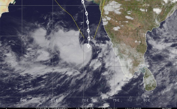
 is forecast to peak as a 55knots TC within 24hours over open seas")


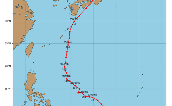

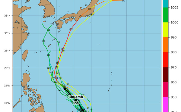
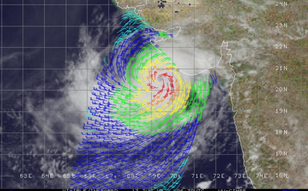
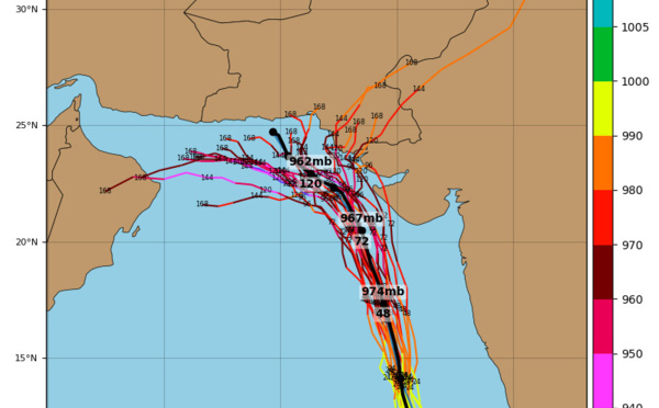
: Final Warning issued by the JTWC. Peak intensity was raised at 100knots, Category 3 US")
 is now a disorganized system and weakening rapidly")
 is forecast to weaken rapidly from now on")
 is forecast to turn sharply northeastward after 12h and weaken rapidly after 24hours")
 still \"good-looking\" but expected to weaken rapidly after 24hours")
 category 1 US is forecast to weaken rapidly after 24hours due to vertical shear")
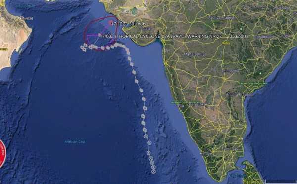
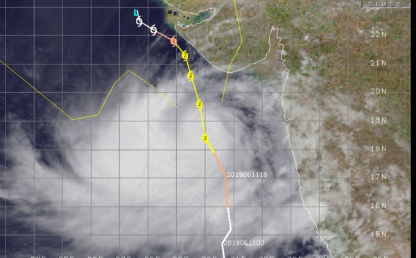
 slow-moving, forecast to turn northeast after 36h and weaken markedly, landfall near India/Pakistan border after 72h")
 is forecast to weaken gradually and make landfall near the India/Pakistan border after 72hours")
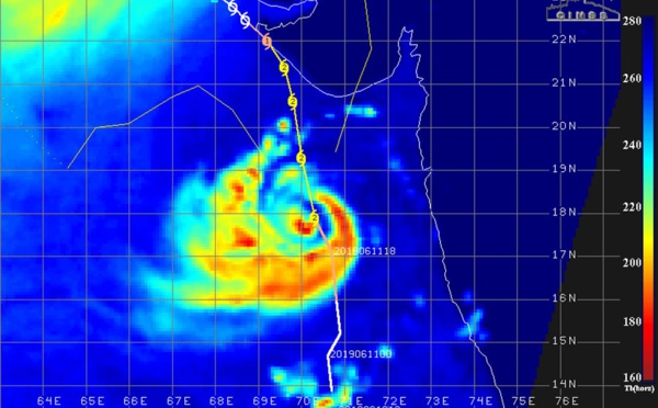
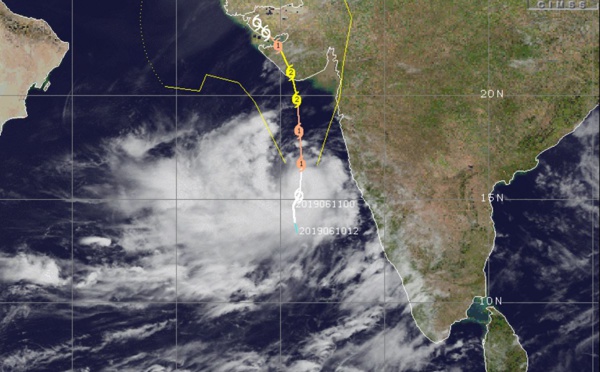
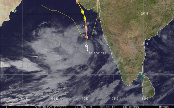
 meandering, intensity being capped due to dry air entrainment")
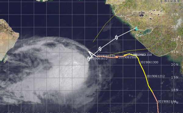
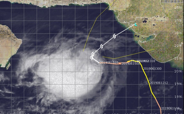
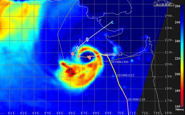
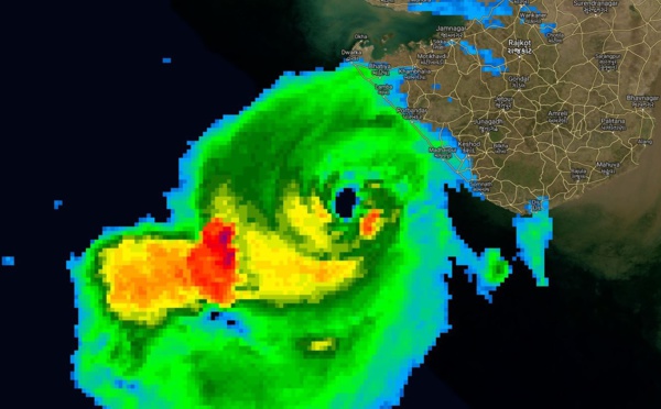
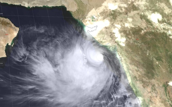
 strong category 2 US tracking slowly 110km to the southwest of Gujarat")
 category 2 US is showing signs of intensification 130km to Porbandar")
 category 2 US forecast to track more than 100km to the west of Porbandar")
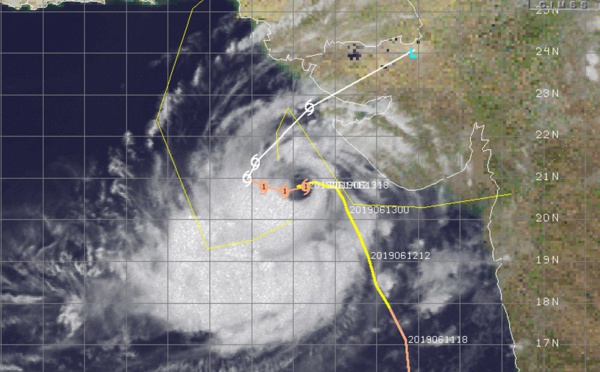
 category 2 US is gradually approaching Porbandar area")
 category 2 US, peaking within 24hours, gradually approaching Porbandar/Gujarat")
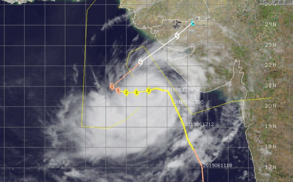
 now a category 2 US, intensifying, gradually approaching Porbandar/Gujarat")
 now a category 1 US, intensifying with landfall as a strong category 2 forecast just after 36h")
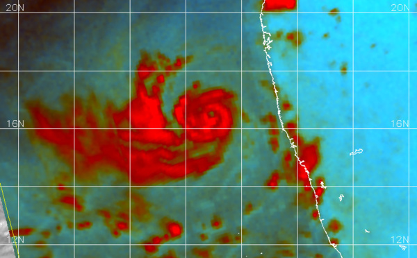
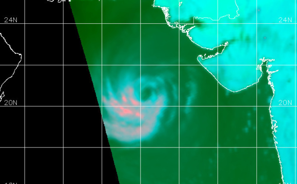
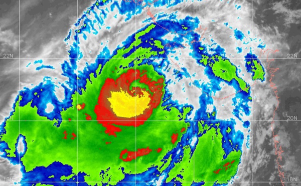
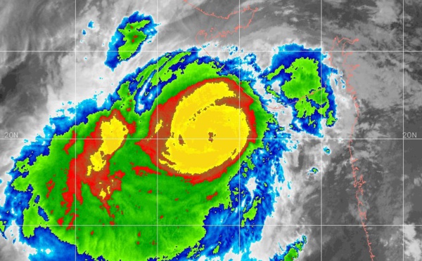
 is developing an eye and is intensifying rather rapidly")
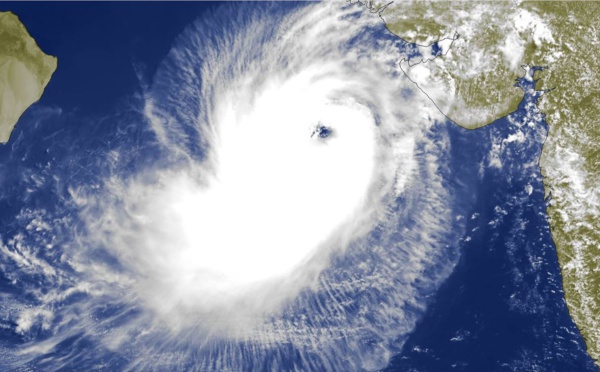
 could reach category 2 US within 36hours")


Les News
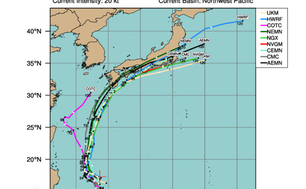
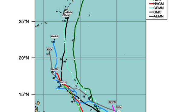
WESTERN PACIFIC:TY 07W(MEKKHALA) approaching OKINAWA while weakening/08W(HIGOS) to merge with 07W in approx 60h/Invest 95W//24@1030 UTC
06/24/2026
- PATRICK HOAREAU
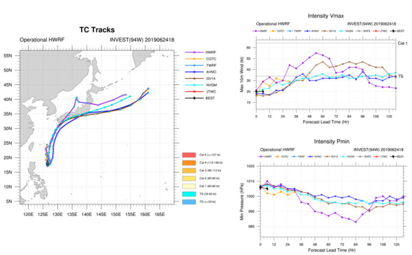
WESTERN PACIFIC:Typhoon 07W(MEKKHALA) Rapid Intensification likely next 24h forecast Peak Intensity at CAT 4 US in 48h/ Invest 94W//21@1000 UTC
06/21/2026
- PATRICK HOAREAU
WESTERN PACIFIC: TS 07W(MEKKHALA) forecast to reach Typhoon Intensity by 24h, forecast to peak at CAT 3 US in 72h//20@1000 UTC
06/20/2026
- PATRICK HOAREAU
WESTERN PACIFIC: Invest 92W/ SOUTH PACIFIC: Invest 96P/3 Week Tropical Cyclone Formation Probability//17@1030 UTC
06/17/2026
- PATRICK HOAREAU
WESTERN PACIFIC: Invest 92W/SOUTH PACIFIC: Subtropical Storm 96P/EASTERN PACIFIC: Invest 93E//15@0730 UTC
06/15/2026
- PATRICK HOAREAU
SOUTH INDIAN: Subtropical Storm 95S// 11/0900 UTC
06/11/2026
- PATRICK HOAREAU

Liens utiles
WESTERN PACIFIC:Typhoon 07W(MEKKHALA) Rapid Intensification likely next 24h forecast Peak Intensity at CAT 4 US in 48h/ Invest 94W//21@1000 UTC
WESTERN PACIFIC: TS 07W(MEKKHALA) forecast to reach Typhoon Intensity by 24h, forecast to peak at CAT 3 US in 72h//20@1000 UTC
WESTERN PACIFIC: Invest 92W/ SOUTH PACIFIC: Invest 96P/3 Week Tropical Cyclone Formation Probability//17@1030 UTC
WESTERN PACIFIC: Invest 92W/SOUTH PACIFIC: Subtropical Storm 96P/EASTERN PACIFIC: Invest 93E//15@0730 UTC
SOUTH INDIAN: Subtropical Storm 95S// 11/0900 UTC
S'identifier