
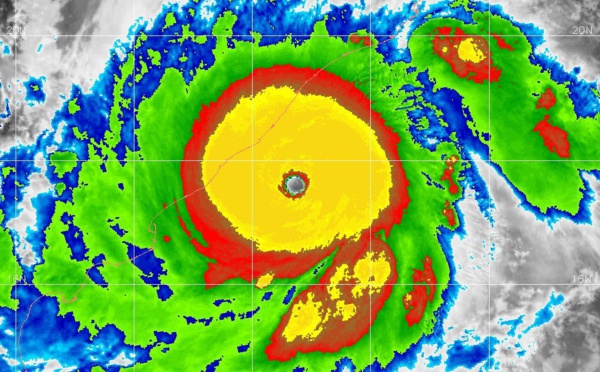
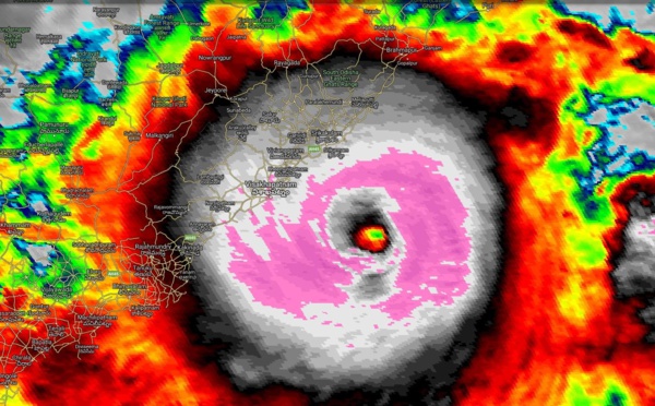
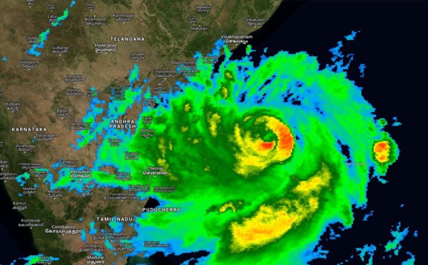
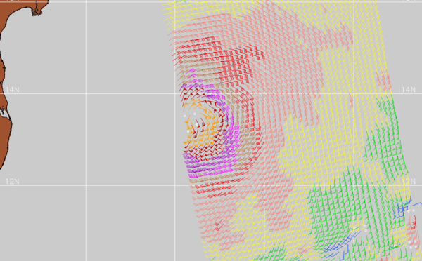
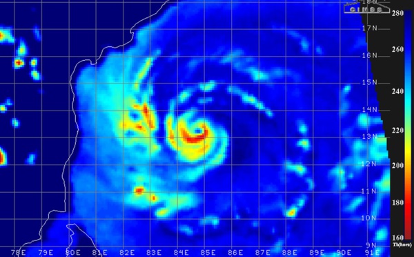
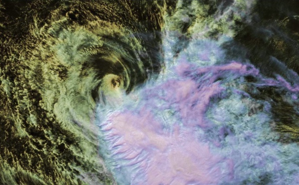
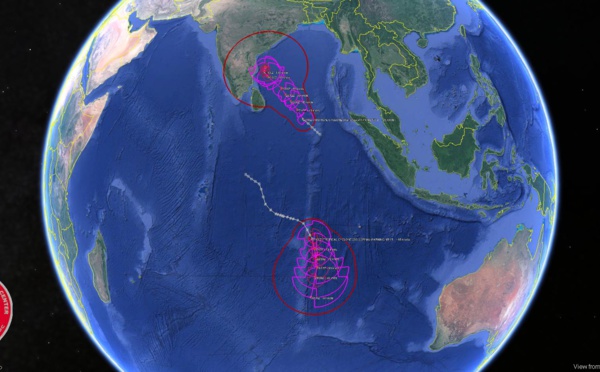
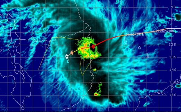
, almost category 5 US, very dangerous cyclone, landfall near PURI shortly after 12h(VIDEO)")
 category 4 US, is a huge potential threat to the Brahmapur/Puri/Bhubaneswar area(VIDEO)")

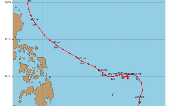
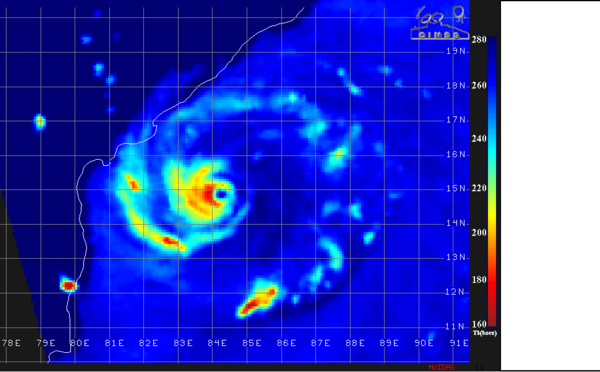
 strong category 3 US, gradually approaching Puri/Bhubaneshwar. FANI is a powerful and dangerous cyclone")

 category 3 US, intensifying, forecast to hit Puri/Bhubaneshwar area shortly after 36hours(VIDEO)")
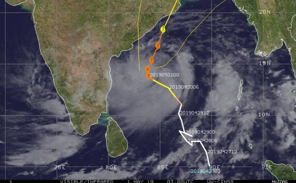
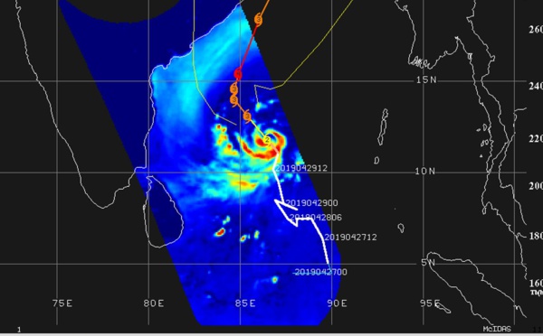
 category 3 US, forecast to be close to the Puri/Ratanpur area in 48hours")
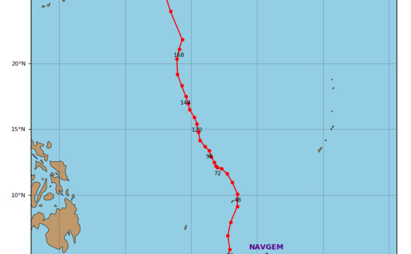
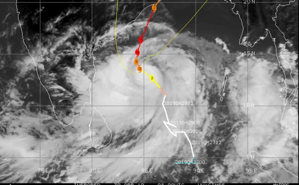
 category 3 US, possible landfall near Puri/India shortly after 48hours(VIDEO)")
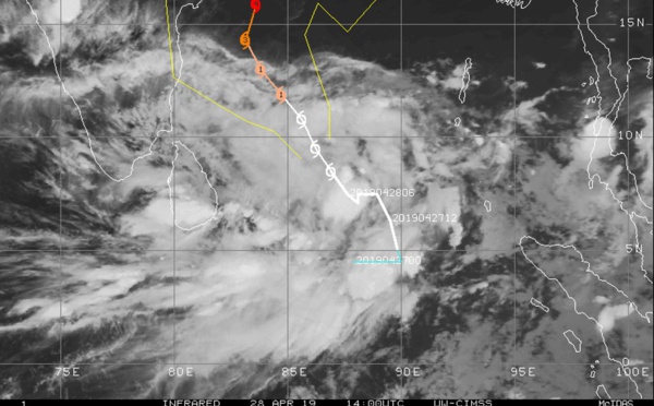
 category 3 US, intensifying and slowly approaching northeast India(VIDEO)")
 near category 3 US, intensifying and being a serious threat to north-east India(VIDEO)")
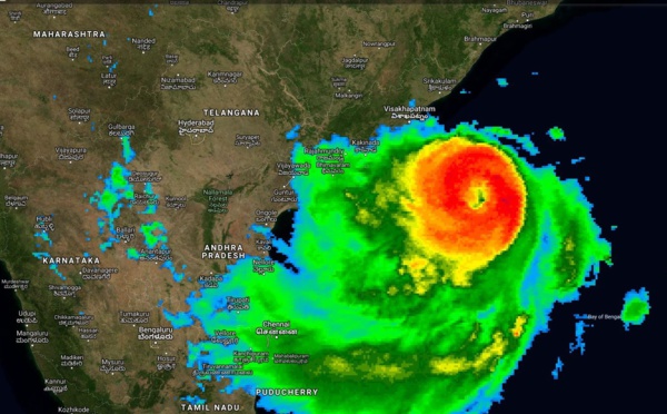
: category 2 US, intensifying, forecast to be a serious threat to Bhubaneswar and Kolkata in 3 to 4 days")
 now category 2 US is intensifying and could hit Kolkata region in less than 4 days as a powerful cyclone(VIDEO)")
 forecast to weaken rapidly within 24hours")
: significant intensification forecast and possible threat to the north-east coasts of India in 4 to 5 days")
: wind shear=stalled intensification so far but improved envrionment=marked intensification forecast next 4 days")
 category 1 US is forecast to weaken next 36hours and be fully extratropical in 48hours(satellite animation)")
 near peak intensity, forecast to be extratropical in 72hours")
 slowly intensifying but rapid intensification possible next 4 days")
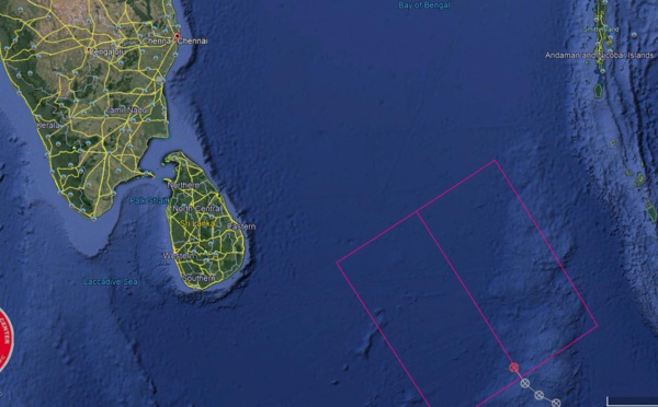
 over open seas")
: significant weakening forecast after 12hours")
 category 1 intensity to peak next 24hours")
: category 1 US, recent signs of intensification, remaining over open seas")
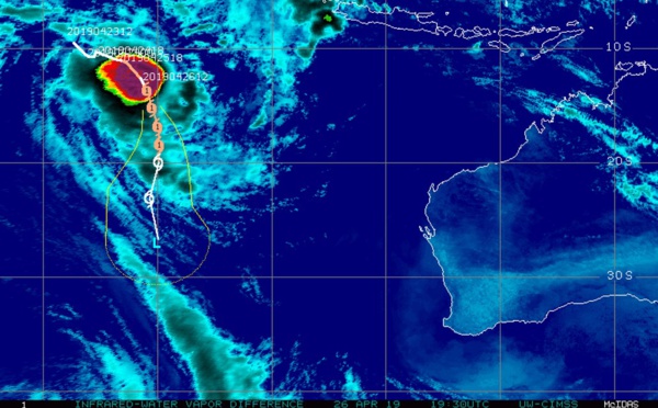
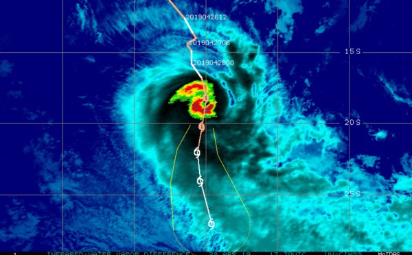
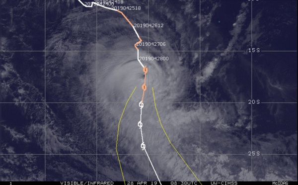
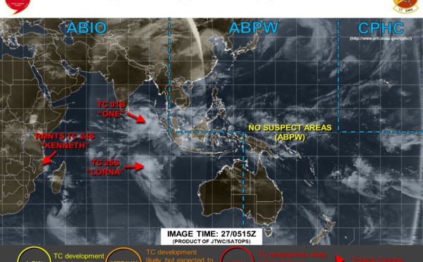
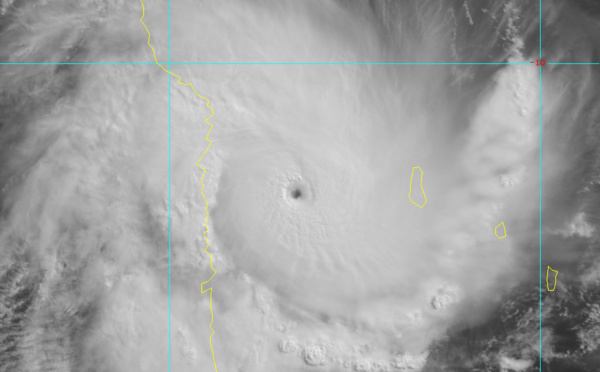
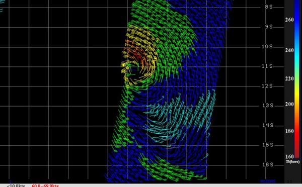
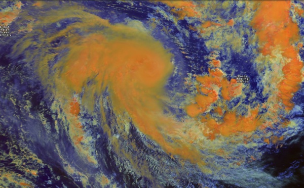
 reached maximum intensity of 125knots, category 4 US, a remarkable cyclone across the northern MOZ Channel")
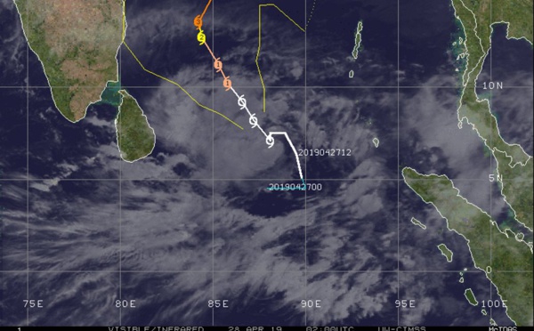
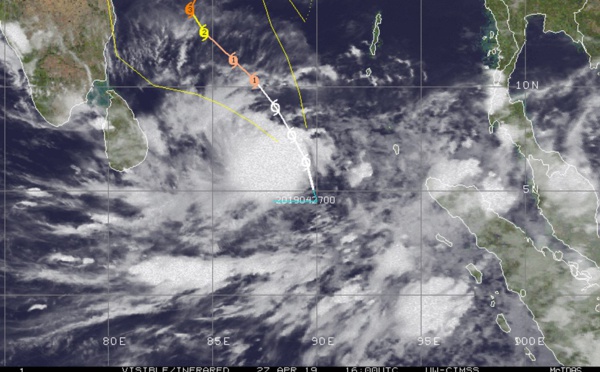
: TC LORNA(25S) category 1 US, shear limiting intensification")

: TC LORNA(25S) now category 1 US, intensifying over open seas")
, category 4 US making landfall 30km north of Quisanga/Mozambique")


 powerful and compact cateogry 4 US, forecast to weaken slightly,landfall before 24h near Quiterajo/Mozambique")
Les News
ECMWF 10 Day Storm Tracks// 3Week TC Formation Probability// 2403utc
04/24/2024
- PATRICK HOAREAU
TC 22P(PAUL)// Remnants of TC 21S(OLGA)// ECMWF 10 Day Storm Tracks// 1103utc
04/11/2024
- PATRICK HOAREAU
TC 21S(OLGA) SAR reveals still a bit stronger than expected// INVEST 97P// ECMWF 10 Day Storm Traccks// 0903utc
04/09/2024
- PATRICK HOAREAU
TC 21S(OLGA) peaked as a powerful CAT 4 US// ECMWF 10 Day Storm Tracks// 0803utc
04/08/2024
- PATRICK HOAREAU
TC 21S(OLGA) reaches CAT 3 US still intensifying// ECMWF 10 Day Storm Tracks// 0709utc
04/07/2024
- PATRICK HOAREAU
TC 21S(OLGA) intensifying and peaking within 24H may reach CAT 2 US// ECMWF 10 Day Storm Tracks, 0615utc
04/06/2024
- PATRICK HOAREAU

Liens utiles
TC 22P(PAUL)// Remnants of TC 21S(OLGA)// ECMWF 10 Day Storm Tracks// 1103utc
TC 21S(OLGA) SAR reveals still a bit stronger than expected// INVEST 97P// ECMWF 10 Day Storm Traccks// 0903utc
TC 21S(OLGA) peaked as a powerful CAT 4 US// ECMWF 10 Day Storm Tracks// 0803utc
TC 21S(OLGA) reaches CAT 3 US still intensifying// ECMWF 10 Day Storm Tracks// 0709utc
TC 21S(OLGA) intensifying and peaking within 24H may reach CAT 2 US// ECMWF 10 Day Storm Tracks, 0615utc
S'identifier