

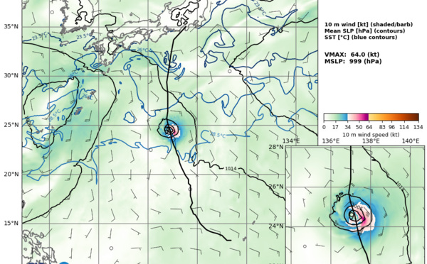

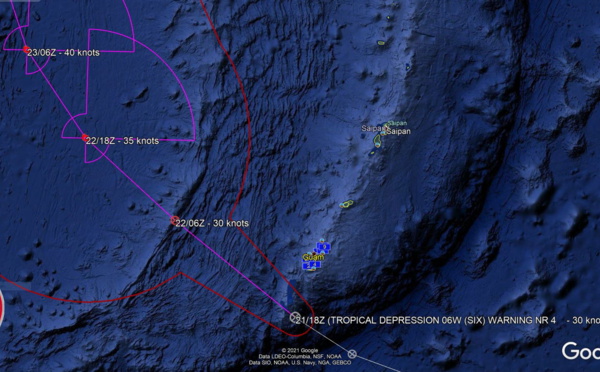

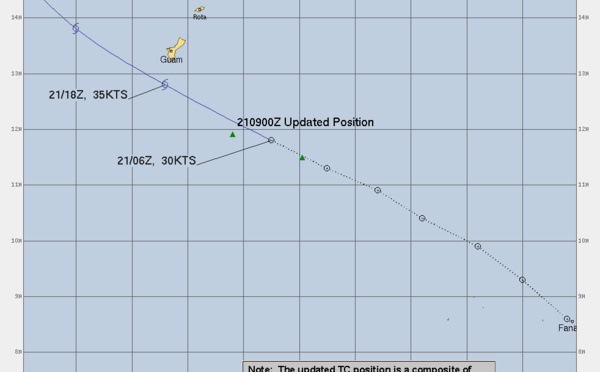
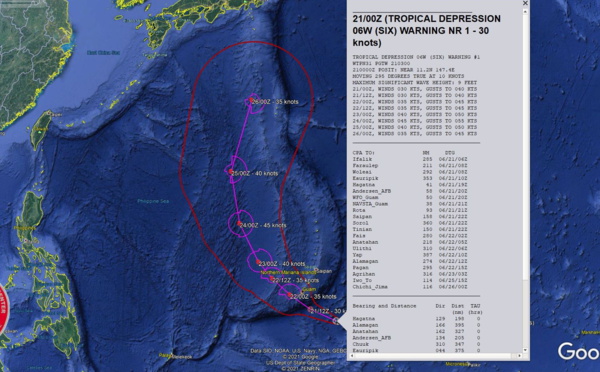
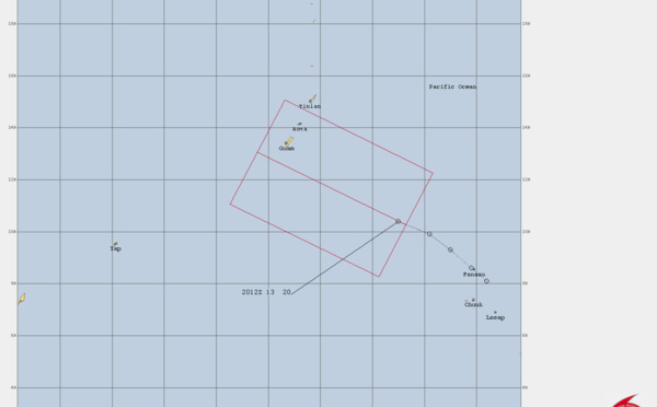
 approaching Guam and slowly intensifying, 21/03utc update")


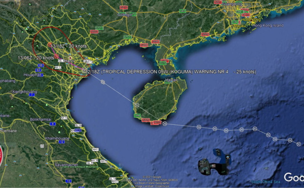
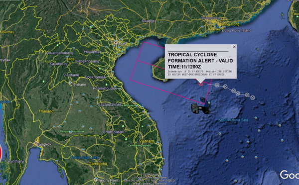
 peaked over the Golf of Tonkin, now Southeast of Hanoi// Tropical Cyclone Formation Alert for Invest 92E, 12/21utc updates")


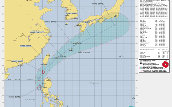
 has begun to turn Northeastward, clipping Southern Taiwan,forecast to dissipate by 48h South of Kyushu, 03/21utc update")
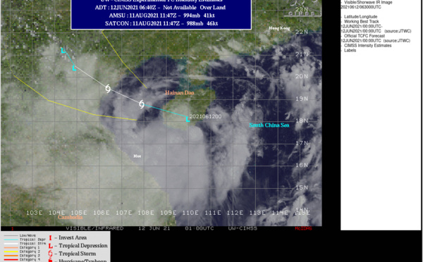
 is back to Tropical Storm intensity, extended forecast track to include likely extra-tropical transition in 4/5 days")
 is forecast to intensify a bit within 24hours, track Southwest of Manila and then over the South China Sea, 02/09utc update")
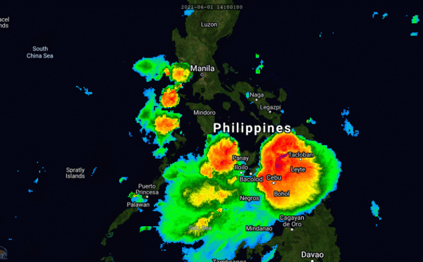
 : forecast to track over the Sibuyan Sea within 24hours as a 35knot Tropical Storm, 01/21utc update")
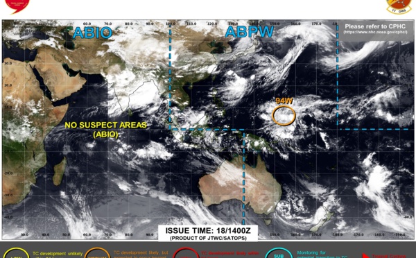
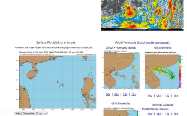
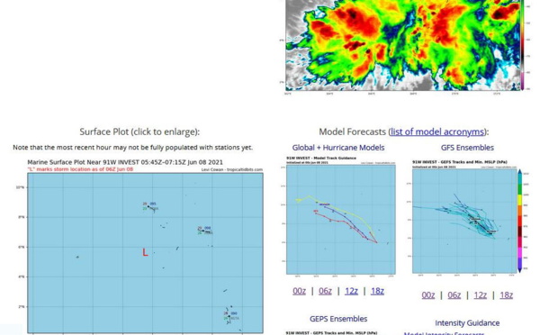
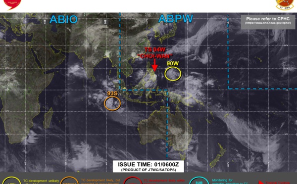
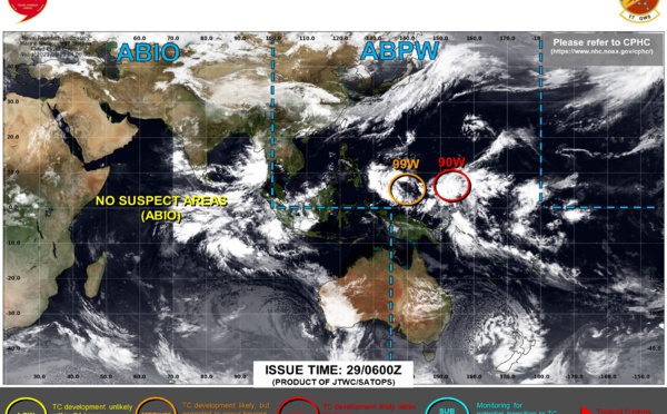
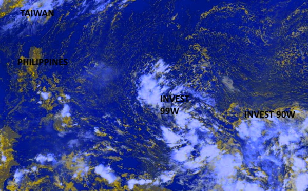
 : struggling to organize, forecast intensity is much lower than the previous forecast// Invest 93S and Invest 90W on the map, 01/03utc update")
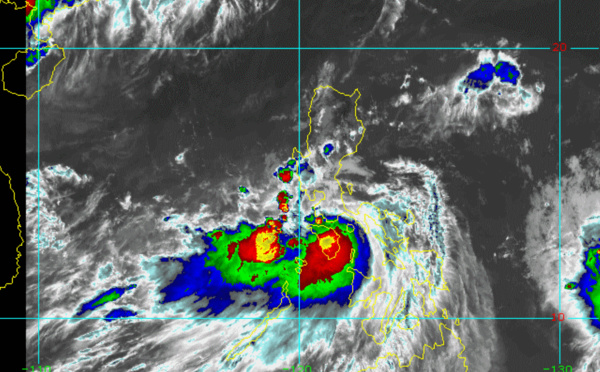
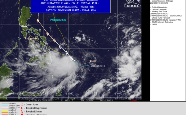
 : the forecast track is now closer to Samar in 24h, Confidence in the forecast is moderate, 31/21utc update")
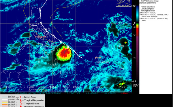
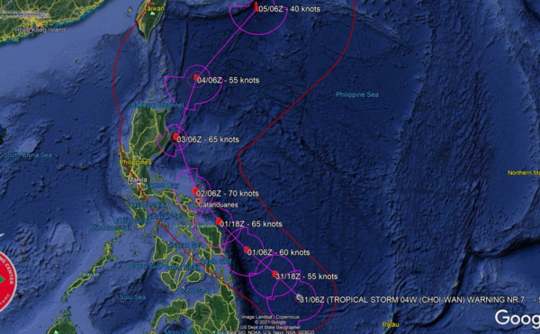
 is forecast to intensify to Typhoon/CAT 1 in 36hours and then track close to the East of Catanduanes, 31/09utc update")


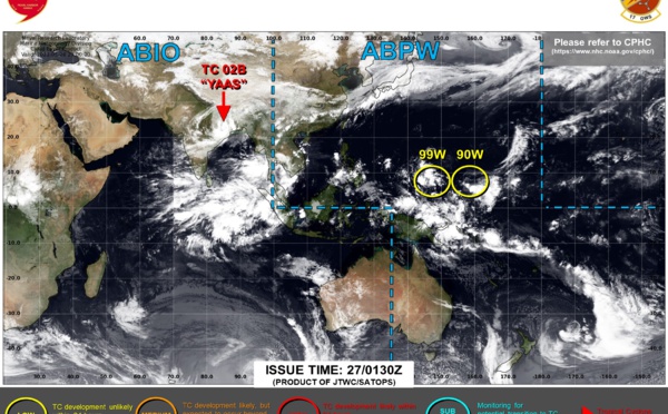
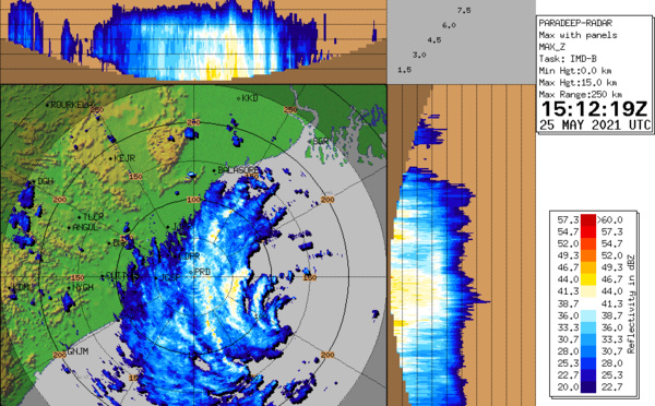
 is close to be making landfall near Balasore/Odisha with 150km/h top gusts, 26/03utc update")
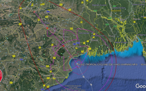

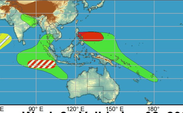
 has reached US/CAT 1 and is forecast to make landfall near Balasore/Odisha with top gusts in excess of 150km/h shortly before 24h, 25/15utc update")
Les News
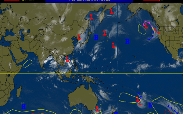
ECMWF 10 Day Storm Tracks// 3Week TC Formation Probability// 2403utc
04/24/2024
- PATRICK HOAREAU
TC 22P(PAUL)// Remnants of TC 21S(OLGA)// ECMWF 10 Day Storm Tracks// 1103utc
04/11/2024
- PATRICK HOAREAU
TC 21S(OLGA) SAR reveals still a bit stronger than expected// INVEST 97P// ECMWF 10 Day Storm Traccks// 0903utc
04/09/2024
- PATRICK HOAREAU
TC 21S(OLGA) peaked as a powerful CAT 4 US// ECMWF 10 Day Storm Tracks// 0803utc
04/08/2024
- PATRICK HOAREAU
TC 21S(OLGA) reaches CAT 3 US still intensifying// ECMWF 10 Day Storm Tracks// 0709utc
04/07/2024
- PATRICK HOAREAU
TC 21S(OLGA) intensifying and peaking within 24H may reach CAT 2 US// ECMWF 10 Day Storm Tracks, 0615utc
04/06/2024
- PATRICK HOAREAU

Liens utiles
TC 22P(PAUL)// Remnants of TC 21S(OLGA)// ECMWF 10 Day Storm Tracks// 1103utc
TC 21S(OLGA) SAR reveals still a bit stronger than expected// INVEST 97P// ECMWF 10 Day Storm Traccks// 0903utc
TC 21S(OLGA) peaked as a powerful CAT 4 US// ECMWF 10 Day Storm Tracks// 0803utc
TC 21S(OLGA) reaches CAT 3 US still intensifying// ECMWF 10 Day Storm Tracks// 0709utc
TC 21S(OLGA) intensifying and peaking within 24H may reach CAT 2 US// ECMWF 10 Day Storm Tracks, 0615utc
S'identifier