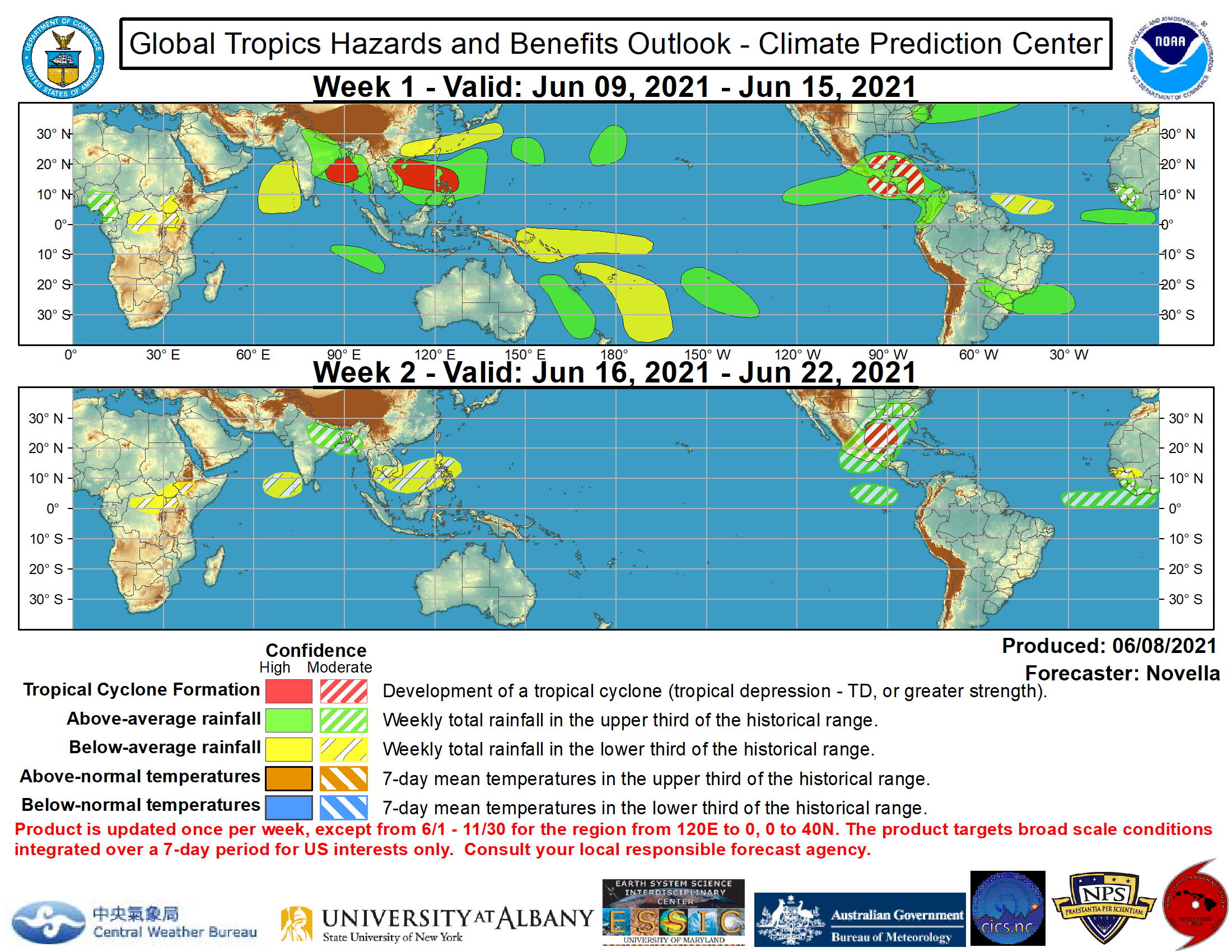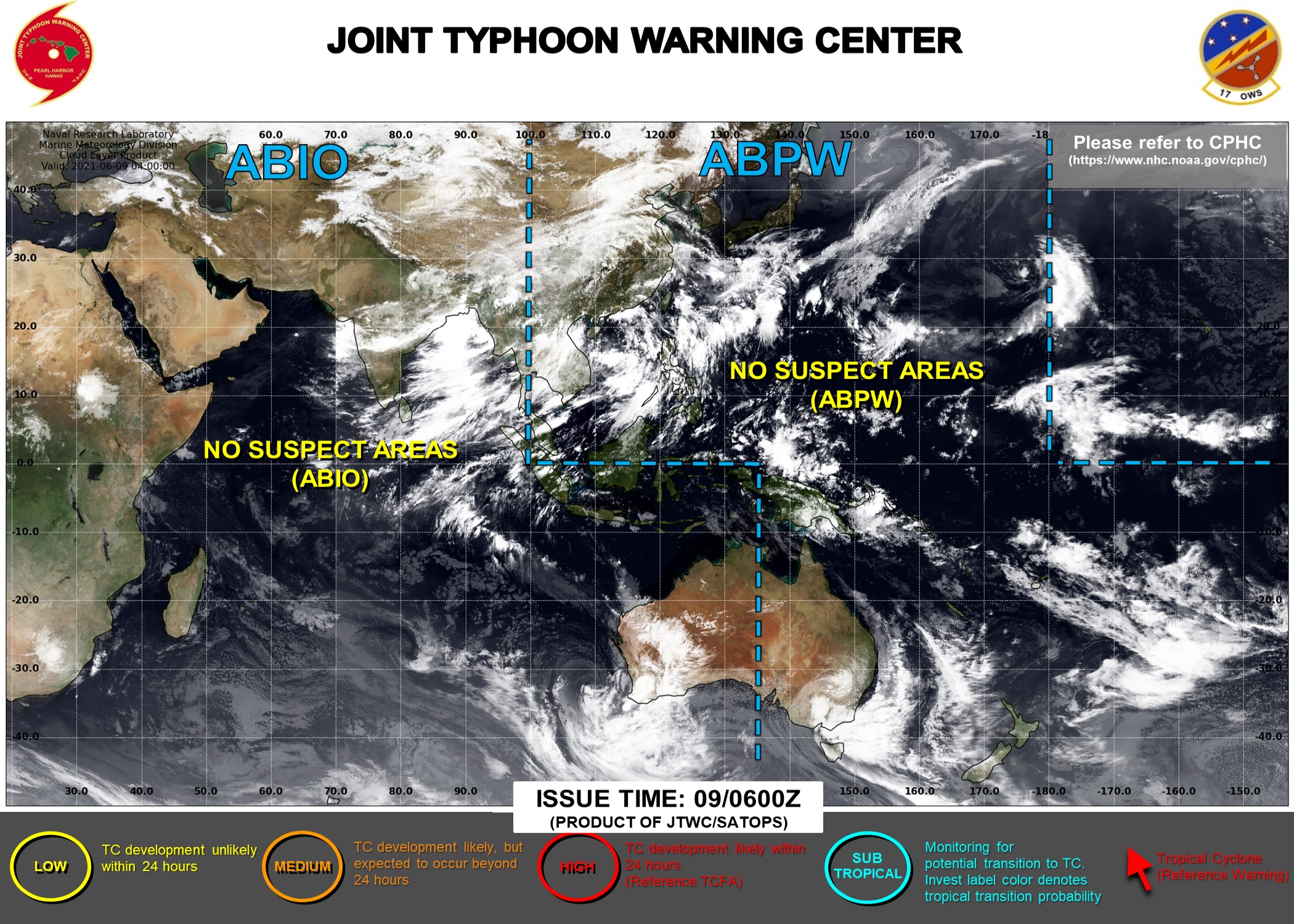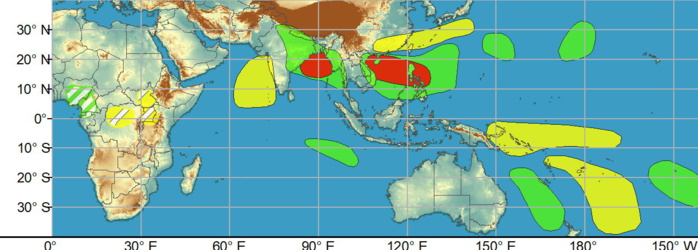
WEEK 1: JUNE 09 TO JUNE 15. While no TCs formed during the last week, there are several areas across the global tropics with heightened potential for development through mid-June. In the eastern Hemisphere, the Joint Typhoon Warning Center (JTWC) is currently monitoring an area of convection east of the Mariana Islands. Although there is good agreement between the GEFS and ECMWF ensembles favoring some strengthening over the next day or so, this potential system is expected to soon encounter a high shear environment to inhibit development, thus no corresponding TC area is included in the week-1 outlook. However, high confidence areas for TC development are issued farther west for week-1 over the West Pacific (extending from the South China Sea through the Philippines), as well as over the Indian Ocean (northern Bay of Bengal) due to the aforementioned Rossby and Kelvin wave activity as well as continued agreement in ensemble guidance and probabilistic TC tools.
Issued at 08/1730UTC by NOAA.
In collaboration with the JTWC and several well known organizations.
Archives: HERE
Cheers,
Patrick Hoareau
JTWC PH
ILES SOEURS
Joint Typhoon Warning Center
In collaboration with the JTWC and several well known organizations.
Archives: HERE
Cheers,
Patrick Hoareau
JTWC PH
ILES SOEURS
Joint Typhoon Warning Center

For week-2, there is more uncertainty in the TC perspective across the Pacific and Indian Basins. Ensembles favor an area of surface low pressure to persist over western India and the Bay of Bengal which may lead to additional tropical cyclogenesis in the region, however confidence is too low at this time to include in the outlook.
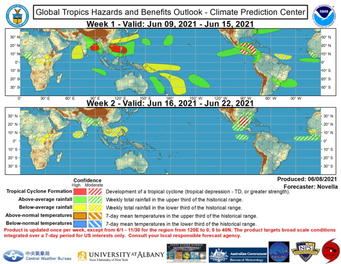
In the western Hemisphere, the National Hurricane Center (NHC) anticipates the development of a broad trough of low pressure located to the south of Central America and extending into the Gulf of Tehuantepec. There is good model support for the enhancement of the Central American Gyre (CAG) late in week-1, and with probabilistic TC tools indicating moderate chances for development in the region a moderate confidence area is highlighted in the outlook for week-1. Tied to this favorable circulation environment, the NHC also anticipates the development of an area of low pressure across the southwestern Caribbean. The GEFS continues to depict several ensemble member low centers shifting northwestward into the Gulf of Honduras and into the Bay of Campeche by late in week-1. Given lesser support of this realization in the ECMWF guidance, a moderate confidence area is present for week-1. By the early portion of week-2, probabilistic TC tools maintain elevated chances of formation focused in the western Gulf of Mexico associated with mean low pressure in the ensembles. In the event a system does not develop further south during the week-1 period, a moderate confidence region is also added over the Gulf of Mexico to account for this potential. Regardless of formation, enhanced precipitation is favored across much of Central America, Mexico, the western Caribbean and into the lower Gulf States of the U.S. during the next two weeks. Elsewhere, increased signals of TC formation also exist in the western Atlantic associated with an area mid-latitude low pressure forecast to move off the Eastern Seaboard and stall offshore near the Southeast and mid-Atlantic. However, there is insufficient confidence this low will gain tropical characteristics and no corresponding TC area is posted. The precipitation outlook during the next two weeks is largely based on a consensus among the CFS, GEFS, and ECMWF ensemble means, anticipated TC tracks, and tropical waves. For hazardous weather concerns across the U.S., please refer to regular tropical updates from the NHC, as well as your local NWS Forecast Office, the Weather Prediction Center's Medium Range Hazards Forecast, and CPC's Week-2 Hazards Outlook. Forecasts over Africa are made in consultation with the International Desk at CPC and can represent local-scale conditions in addition to global scale variability.
