


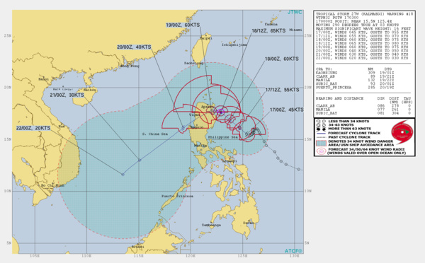

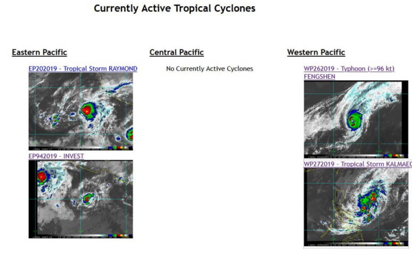


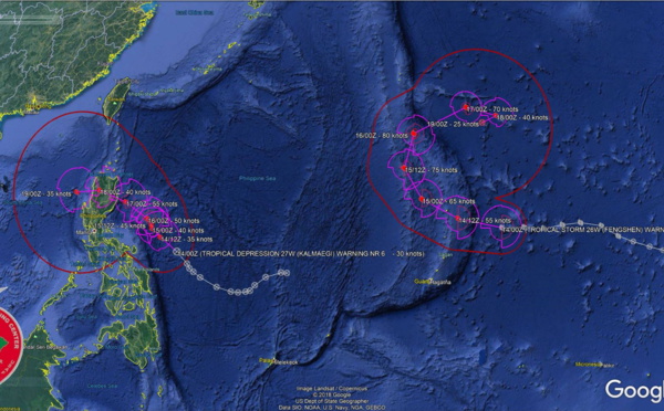
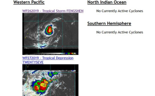
 and TD 27W East of the Philippines: updates at 13/02UTC")

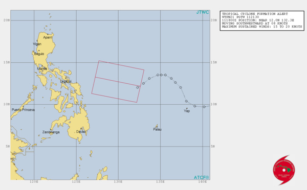
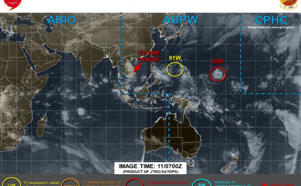
 now over-land,Peak intensity was 65kts. Invest 92W: Tropical Cyclone Formation Alert")
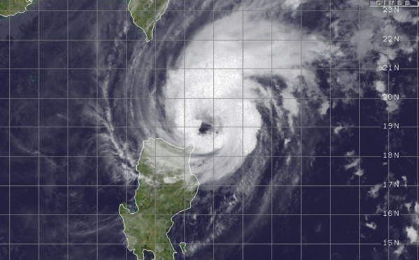
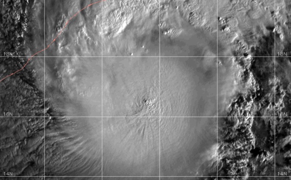
 making landfall as a 55knots cyclone")
 making landfall shortly before 12hours")

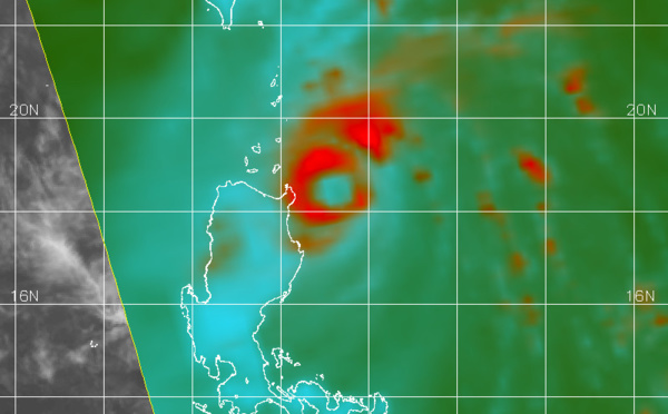
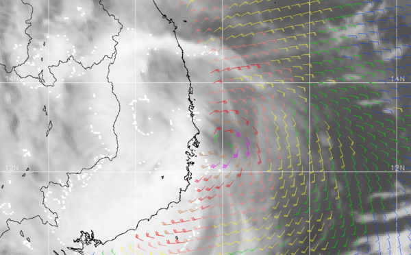
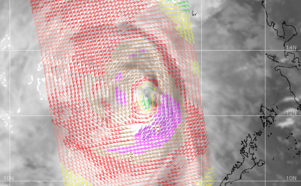
 is fighting vertical wind shear")
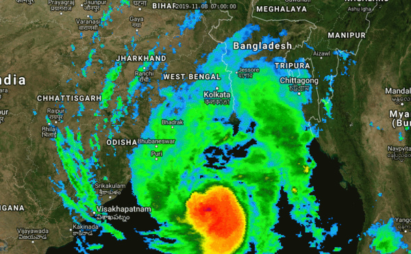
 making landfall shortly after 12hours as a category 1")
 cat 2, Nakri(25W) cat1 and TS Halong(24W): updates")

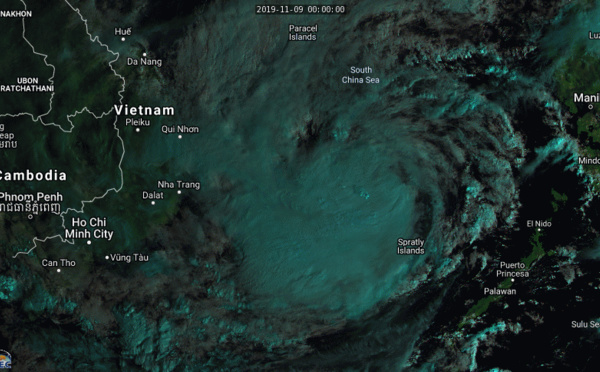
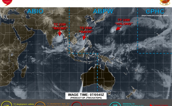
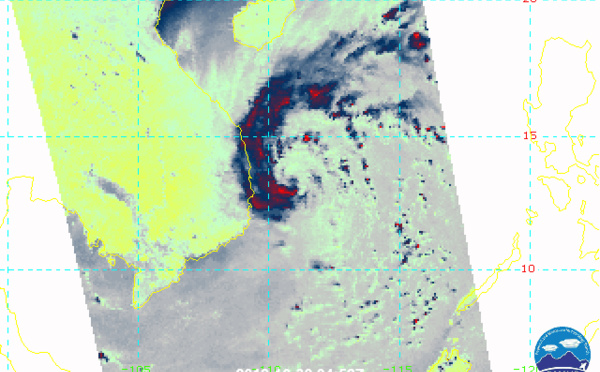
, Nakri(25W) and Matmo(23W) updates.")
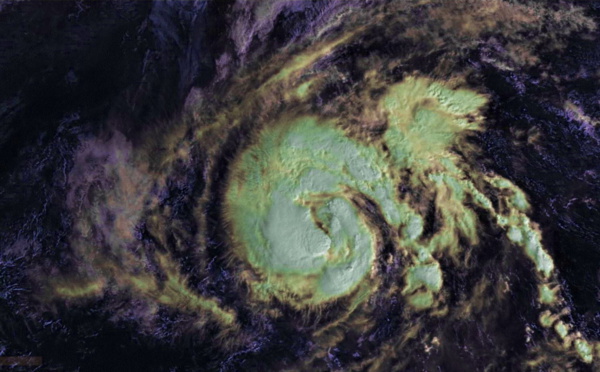
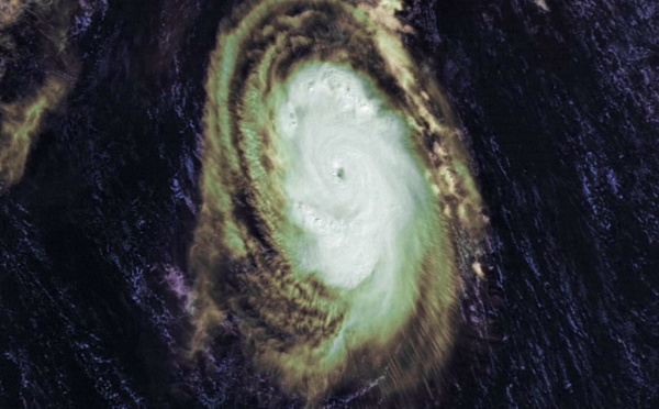
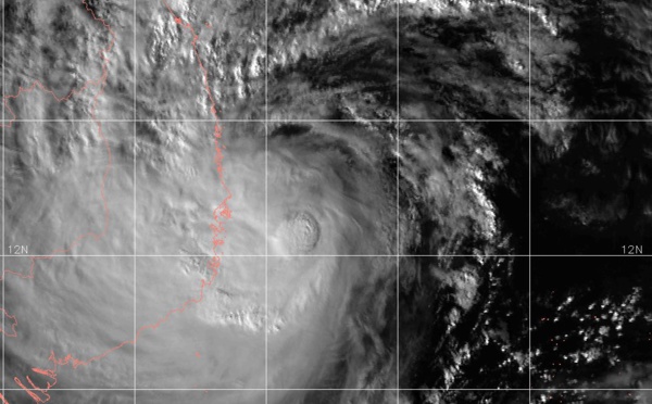
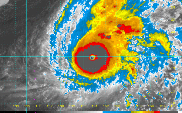
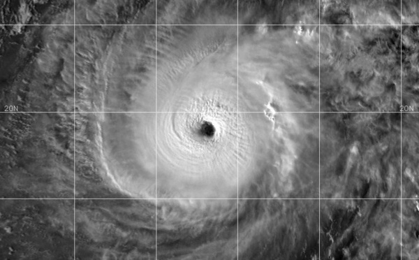
 still a Super Typhoon")
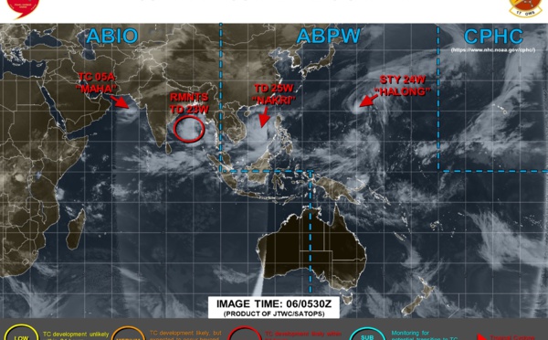

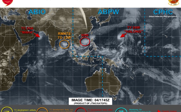
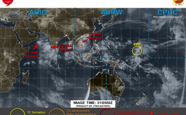
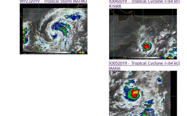
 now a Super Typhoon, Maha(05A), Invest 90W and ex 23W: updates")

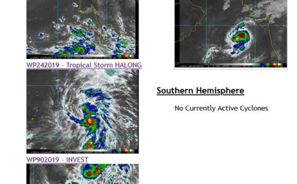
 and Halong(24W) both intensifying over open seas")

 forecast to intensify next 72h. Invest 99W update")
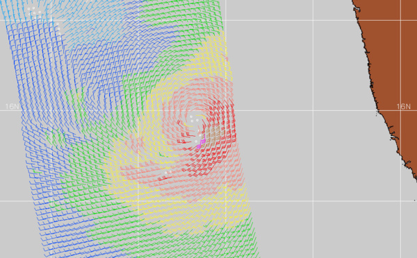

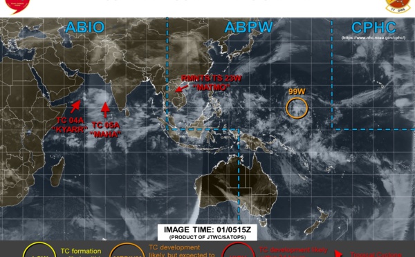
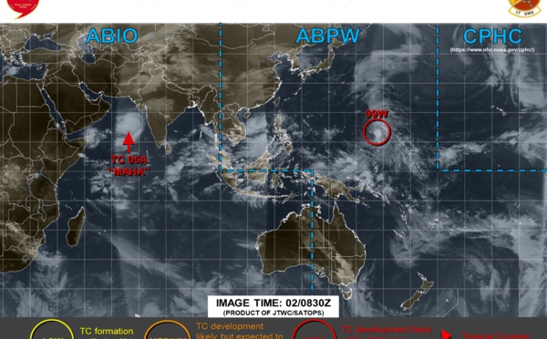
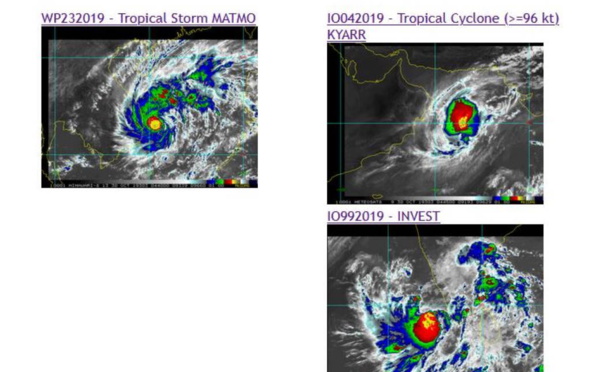
, TC Kyarr(04A), TC Maha(05A) and Invest 99W updates")
: intensifying")
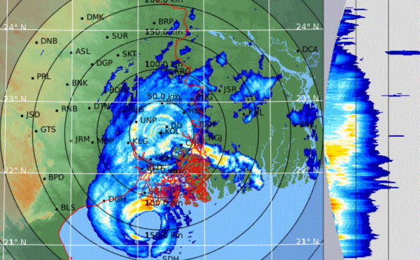
 making landfall. TC Kyarr(04A) and TC 05A updates")
, Kyarr(04A) and Invest 99B updates")
Les News
WESTERN PACIFIC:TY 07W(MEKKHALA) approaching OKINAWA while weakening/08W(HIGOS) to merge with 07W in approx 60h/Invest 95W//24@1030 UTC
06/24/2026
- PATRICK HOAREAU
WESTERN PACIFIC:Typhoon 07W(MEKKHALA) Rapid Intensification likely next 24h forecast Peak Intensity at CAT 4 US in 48h/ Invest 94W//21@1000 UTC
06/21/2026
- PATRICK HOAREAU
WESTERN PACIFIC: TS 07W(MEKKHALA) forecast to reach Typhoon Intensity by 24h, forecast to peak at CAT 3 US in 72h//20@1000 UTC
06/20/2026
- PATRICK HOAREAU
WESTERN PACIFIC: Invest 92W/ SOUTH PACIFIC: Invest 96P/3 Week Tropical Cyclone Formation Probability//17@1030 UTC
06/17/2026
- PATRICK HOAREAU
WESTERN PACIFIC: Invest 92W/SOUTH PACIFIC: Subtropical Storm 96P/EASTERN PACIFIC: Invest 93E//15@0730 UTC
06/15/2026
- PATRICK HOAREAU
SOUTH INDIAN: Subtropical Storm 95S// 11/0900 UTC
06/11/2026
- PATRICK HOAREAU

Liens utiles
WESTERN PACIFIC:Typhoon 07W(MEKKHALA) Rapid Intensification likely next 24h forecast Peak Intensity at CAT 4 US in 48h/ Invest 94W//21@1000 UTC
WESTERN PACIFIC: TS 07W(MEKKHALA) forecast to reach Typhoon Intensity by 24h, forecast to peak at CAT 3 US in 72h//20@1000 UTC
WESTERN PACIFIC: Invest 92W/ SOUTH PACIFIC: Invest 96P/3 Week Tropical Cyclone Formation Probability//17@1030 UTC
WESTERN PACIFIC: Invest 92W/SOUTH PACIFIC: Subtropical Storm 96P/EASTERN PACIFIC: Invest 93E//15@0730 UTC
SOUTH INDIAN: Subtropical Storm 95S// 11/0900 UTC
S'identifier