

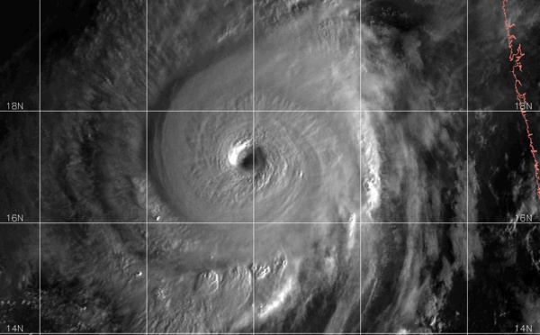
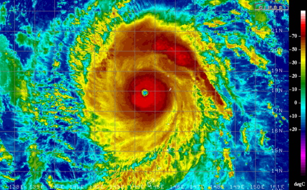
 still a powerful cat 4, but beginning to weaken")
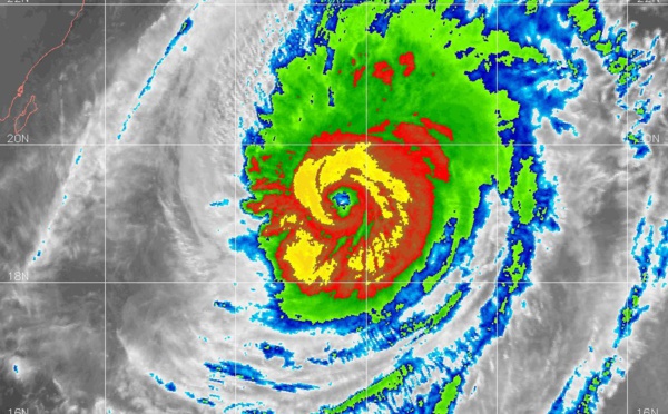
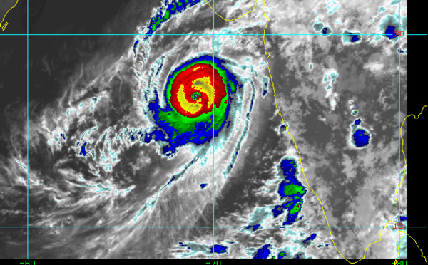
 still impressive, forecast to weaken faster after 36hours")
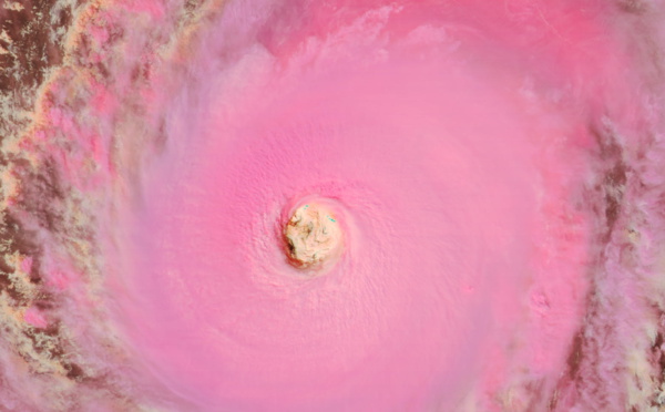

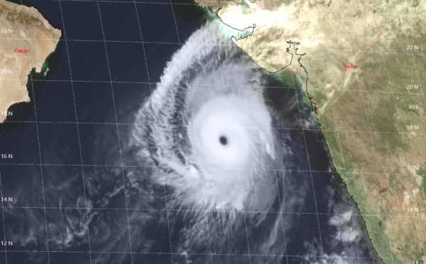
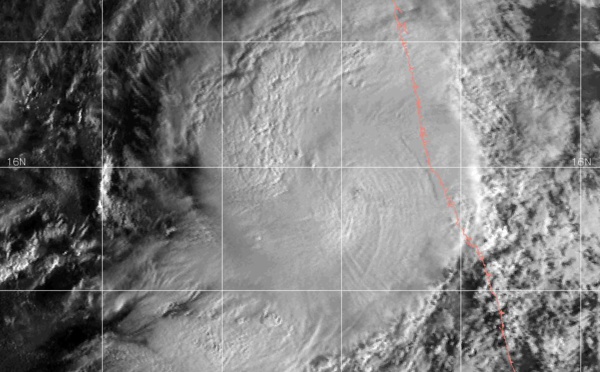
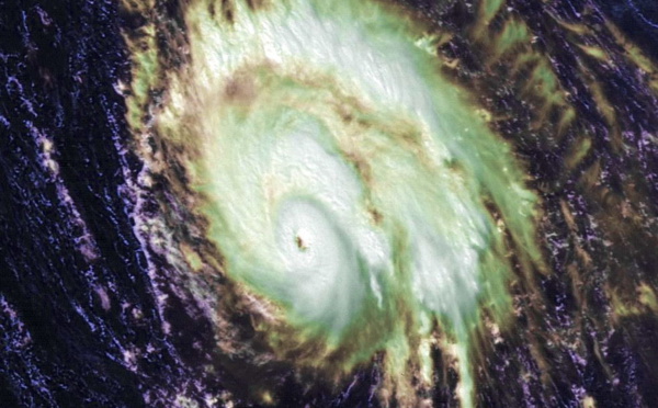
 still a Super Cyclone, models in better agreement")
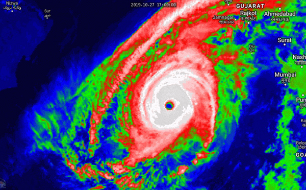
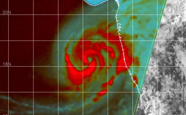
 now a Super Cyclone, the 2nd of the year for the North Indian basin")
 strong category 4 could reach Super Cyclone status shortly")
 undergoing rapid intensification, reaching category 4 very soon")
, category 1, rapid intensification possible next 48h")
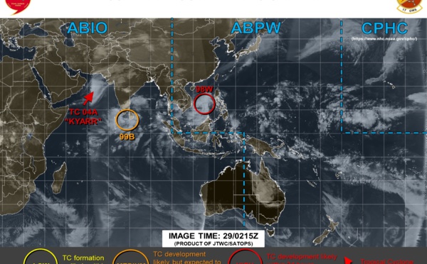
 becoming extratropical. Cyclone 04A likely to intensify next 3 days")
: update")
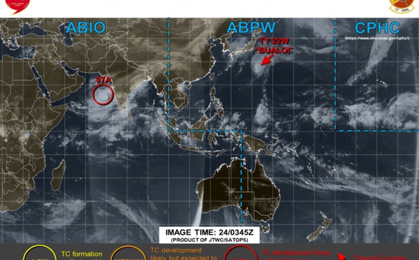
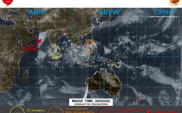
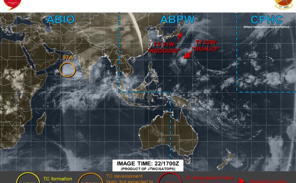
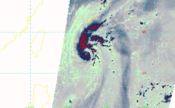
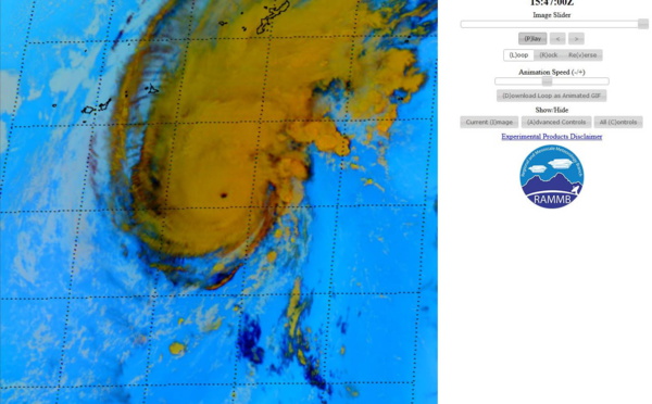
 still a powerful typhoon but weakening. Invest 97A under close watch")
 near Super Typhoon intensity. Invest 97A upgraded to Medium")
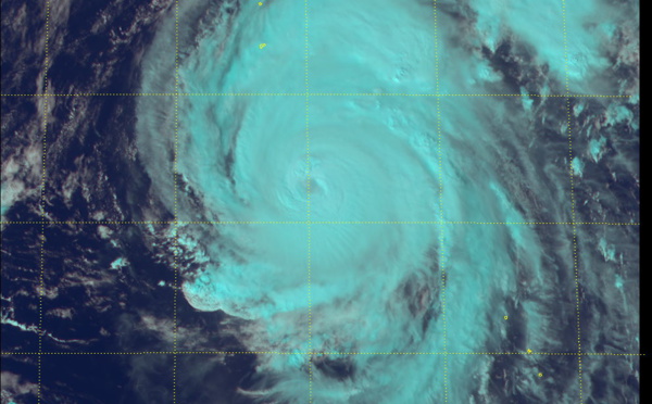
 now a powerful cat4 typhoon but forecast to spare mainland Japan.")
 becoming extratropical. Typhoon Bualoi(22W), cat 2 and intensifying")
 weakening rapidly. Typhoon Bualoi(22W) intensifying")
 strong cat 2 has peaked. Bualoi(22W) gradually intensifying")
: midget and well organized. Bualoi(22W): intensifying system")


 update")
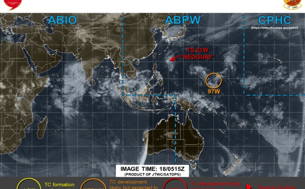
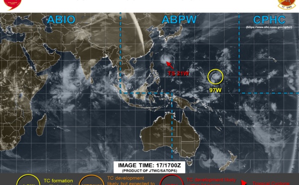
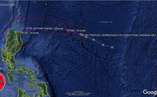
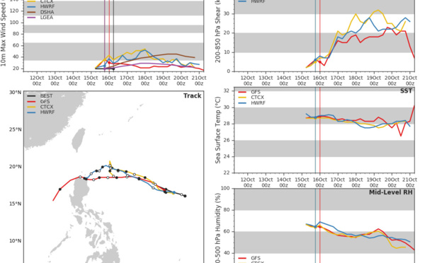
: update and Invest 97W: update")


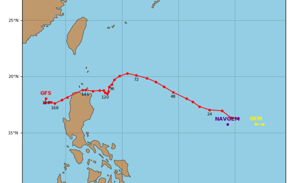

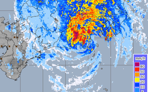
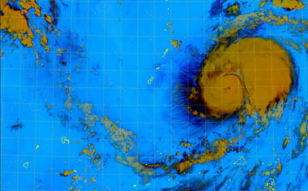
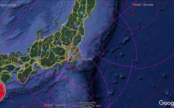
 making landfall in the Tokyo area within 12hours")
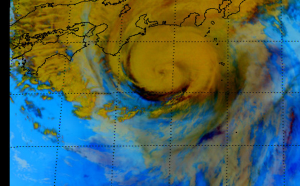

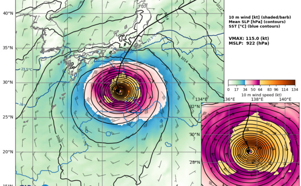

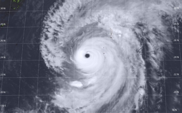
 is bearing down on the Tokyo/Chiba area")
Les News
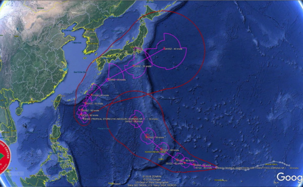
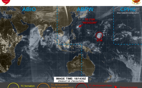
WESTERN PACIFIC:TY 07W(MEKKHALA) approaching OKINAWA while weakening/08W(HIGOS) to merge with 07W in approx 60h/Invest 95W//24@1030 UTC
06/24/2026
- PATRICK HOAREAU
WESTERN PACIFIC:Typhoon 07W(MEKKHALA) Rapid Intensification likely next 24h forecast Peak Intensity at CAT 4 US in 48h/ Invest 94W//21@1000 UTC
06/21/2026
- PATRICK HOAREAU
WESTERN PACIFIC: TS 07W(MEKKHALA) forecast to reach Typhoon Intensity by 24h, forecast to peak at CAT 3 US in 72h//20@1000 UTC
06/20/2026
- PATRICK HOAREAU
WESTERN PACIFIC: Invest 92W/ SOUTH PACIFIC: Invest 96P/3 Week Tropical Cyclone Formation Probability//17@1030 UTC
06/17/2026
- PATRICK HOAREAU
WESTERN PACIFIC: Invest 92W/SOUTH PACIFIC: Subtropical Storm 96P/EASTERN PACIFIC: Invest 93E//15@0730 UTC
06/15/2026
- PATRICK HOAREAU
SOUTH INDIAN: Subtropical Storm 95S// 11/0900 UTC
06/11/2026
- PATRICK HOAREAU

Liens utiles
WESTERN PACIFIC:Typhoon 07W(MEKKHALA) Rapid Intensification likely next 24h forecast Peak Intensity at CAT 4 US in 48h/ Invest 94W//21@1000 UTC
WESTERN PACIFIC: TS 07W(MEKKHALA) forecast to reach Typhoon Intensity by 24h, forecast to peak at CAT 3 US in 72h//20@1000 UTC
WESTERN PACIFIC: Invest 92W/ SOUTH PACIFIC: Invest 96P/3 Week Tropical Cyclone Formation Probability//17@1030 UTC
WESTERN PACIFIC: Invest 92W/SOUTH PACIFIC: Subtropical Storm 96P/EASTERN PACIFIC: Invest 93E//15@0730 UTC
SOUTH INDIAN: Subtropical Storm 95S// 11/0900 UTC
S'identifier