
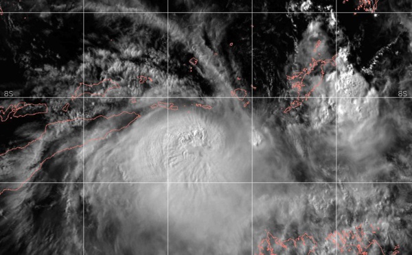
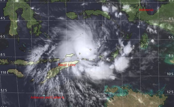
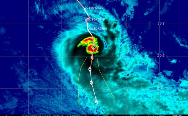
 has formed near Timor, potential threat of strong winds and heavy rain to the island")
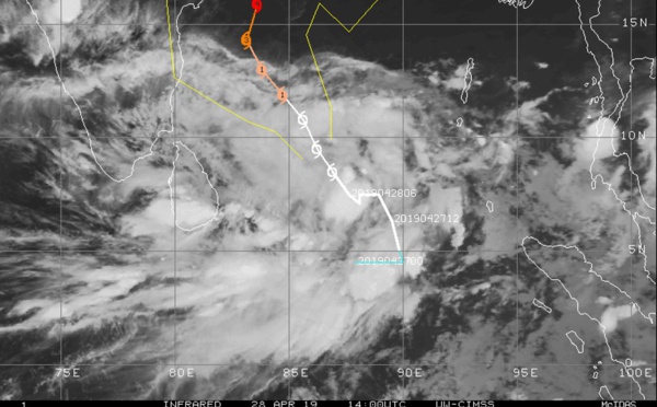
, 06UTC: 90W near Palau: no longer suspect . 92W: models less aggressive but area still under close watch")
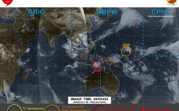

/18UTC : 90W and 92W updated positions : 92W still likely to develop next 48/72hours")


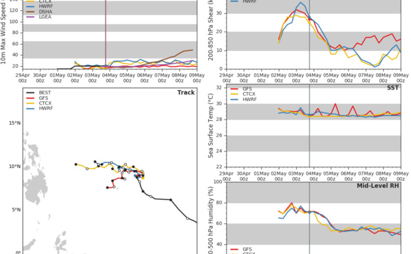
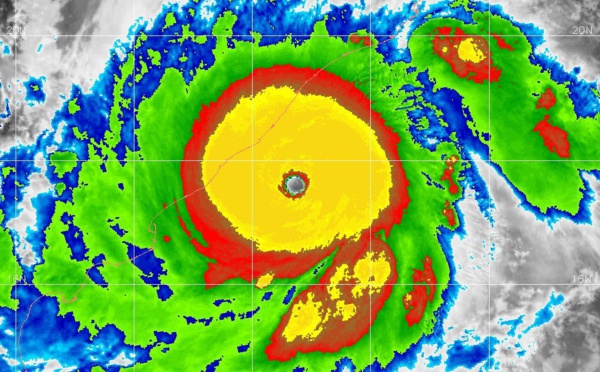
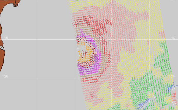
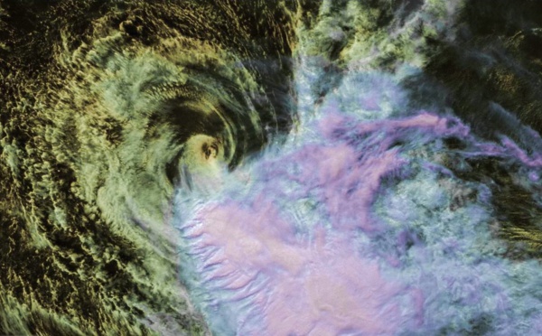
 was the 1st \"Super Cyclone\" over the North Indian basin since CHAPALA(04A) in October 2015")
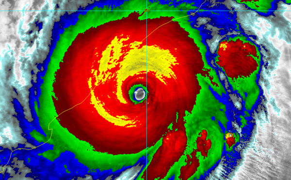
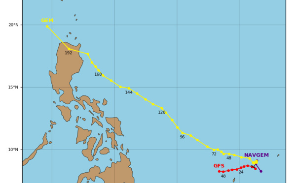
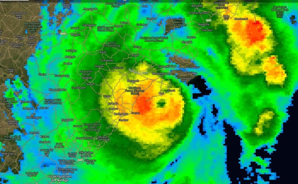
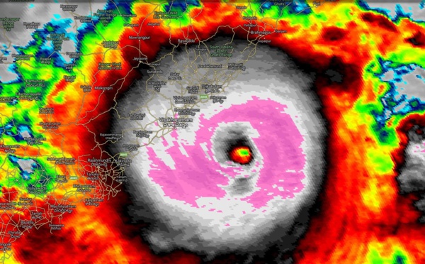
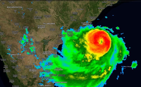
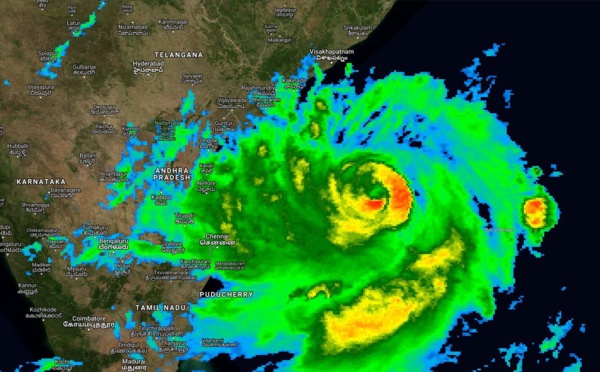
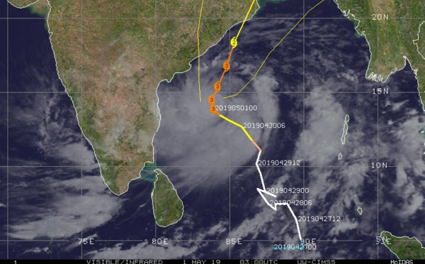
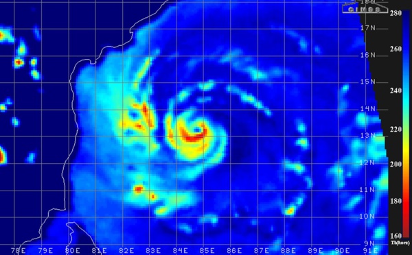
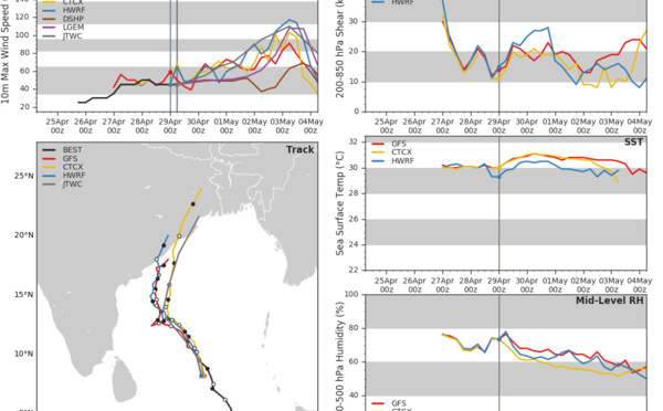
 made landfall very close to Puri, weakening,expected to be a CAT1 US near Kolkata in apprx 12hours ( VIDEO)")


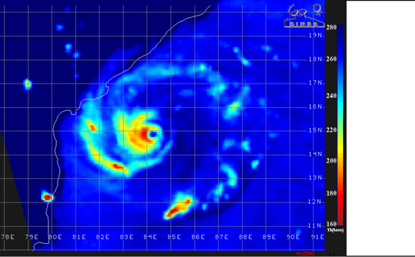
: category 4 US, imminent landfall near PURI with extremely high winds ( VIDEO)")
, almost category 5 US, very dangerous cyclone, landfall near PURI shortly after 12h(VIDEO)")
 category 4 US, is a huge potential threat to the Brahmapur/Puri/Bhubaneswar area(VIDEO)")

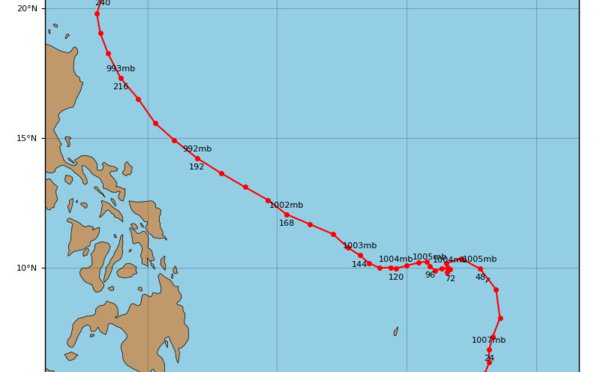
 strong category 3 US, gradually approaching Puri/Bhubaneshwar. FANI is a powerful and dangerous cyclone")

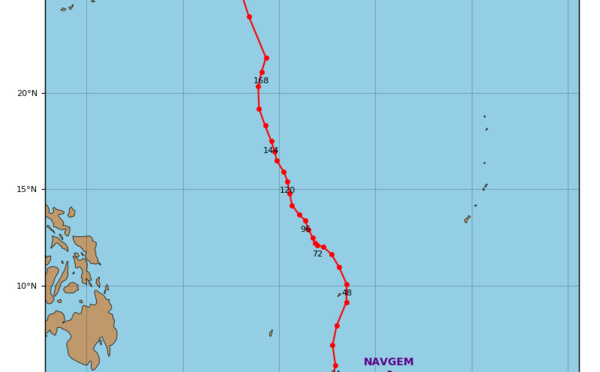
 category 3 US, intensifying, forecast to hit Puri/Bhubaneshwar area shortly after 36hours(VIDEO)")
 category 3 US, forecast to be close to the Puri/Ratanpur area in 48hours")
 category 3 US, possible landfall near Puri/India shortly after 48hours(VIDEO)")
 category 3 US, intensifying and slowly approaching northeast India(VIDEO)")
 near category 3 US, intensifying and being a serious threat to north-east India(VIDEO)")
: category 2 US, intensifying, forecast to be a serious threat to Bhubaneswar and Kolkata in 3 to 4 days")
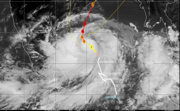
 now category 2 US is intensifying and could hit Kolkata region in less than 4 days as a powerful cyclone(VIDEO)")
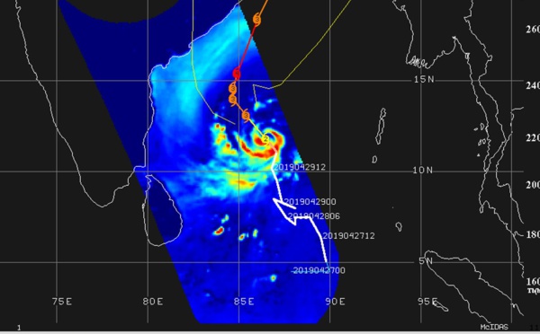
 forecast to weaken rapidly within 24hours")
: significant intensification forecast and possible threat to the north-east coasts of India in 4 to 5 days")
: wind shear=stalled intensification so far but improved envrionment=marked intensification forecast next 4 days")
 category 1 US is forecast to weaken next 36hours and be fully extratropical in 48hours(satellite animation)")
 near peak intensity, forecast to be extratropical in 72hours")
Les News
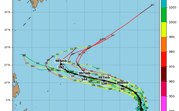
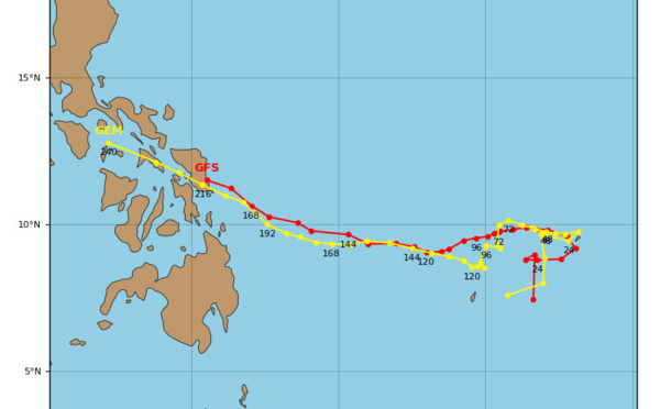
WESTERN PACIFIC:TY 07W(MEKKHALA) approaching OKINAWA while weakening/08W(HIGOS) to merge with 07W in approx 60h/Invest 95W//24@1030 UTC
06/24/2026
- PATRICK HOAREAU
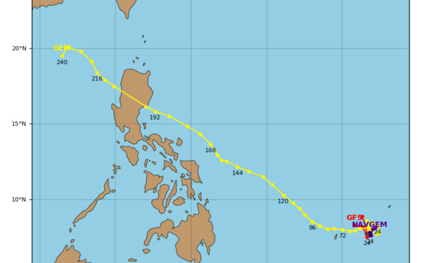
WESTERN PACIFIC:Typhoon 07W(MEKKHALA) Rapid Intensification likely next 24h forecast Peak Intensity at CAT 4 US in 48h/ Invest 94W//21@1000 UTC
06/21/2026
- PATRICK HOAREAU
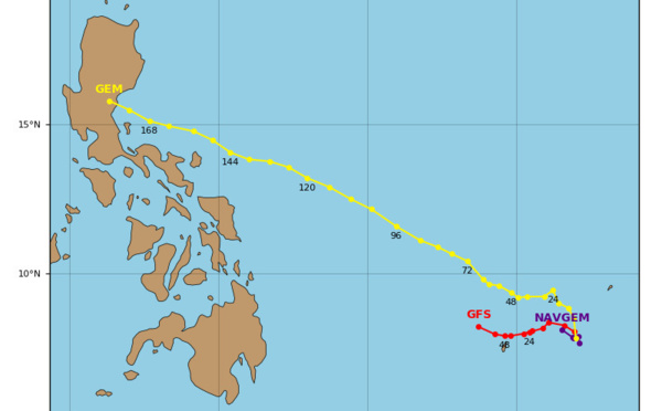
WESTERN PACIFIC: TS 07W(MEKKHALA) forecast to reach Typhoon Intensity by 24h, forecast to peak at CAT 3 US in 72h//20@1000 UTC
06/20/2026
- PATRICK HOAREAU
WESTERN PACIFIC: Invest 92W/ SOUTH PACIFIC: Invest 96P/3 Week Tropical Cyclone Formation Probability//17@1030 UTC
06/17/2026
- PATRICK HOAREAU
WESTERN PACIFIC: Invest 92W/SOUTH PACIFIC: Subtropical Storm 96P/EASTERN PACIFIC: Invest 93E//15@0730 UTC
06/15/2026
- PATRICK HOAREAU
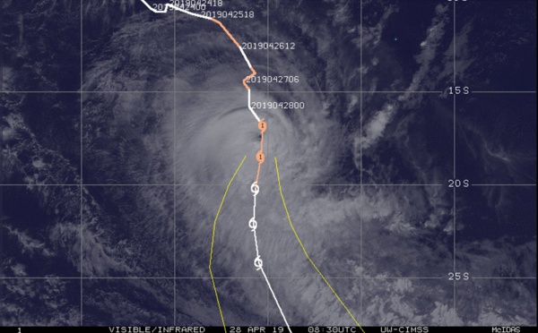
SOUTH INDIAN: Subtropical Storm 95S// 11/0900 UTC
06/11/2026
- PATRICK HOAREAU

Liens utiles
WESTERN PACIFIC:Typhoon 07W(MEKKHALA) Rapid Intensification likely next 24h forecast Peak Intensity at CAT 4 US in 48h/ Invest 94W//21@1000 UTC
WESTERN PACIFIC: TS 07W(MEKKHALA) forecast to reach Typhoon Intensity by 24h, forecast to peak at CAT 3 US in 72h//20@1000 UTC
WESTERN PACIFIC: Invest 92W/ SOUTH PACIFIC: Invest 96P/3 Week Tropical Cyclone Formation Probability//17@1030 UTC
WESTERN PACIFIC: Invest 92W/SOUTH PACIFIC: Subtropical Storm 96P/EASTERN PACIFIC: Invest 93E//15@0730 UTC
SOUTH INDIAN: Subtropical Storm 95S// 11/0900 UTC
S'identifier