


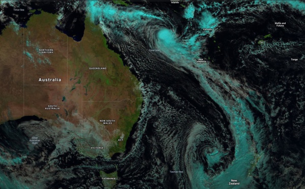
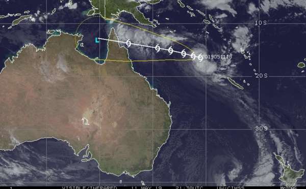
 forecast landfall near Coen shortly after 12hours as a 35knots TC")
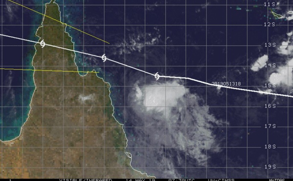
 forecast to make landfall near Coen in 24 hours as a 35knots cyclone")
 on a weakening trend, forecast landfall near Coen in 36 hours")
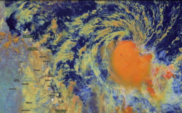
 forecast to make landfall near Coen as a 45knots cyclone shortly after 36 hours")
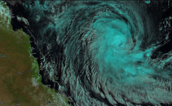
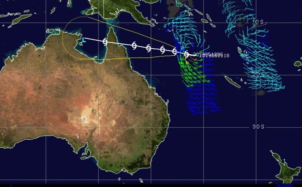
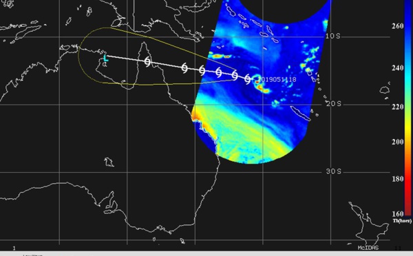
 is forecast to make landfall over Cape York near Coen in 48hours")
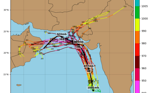
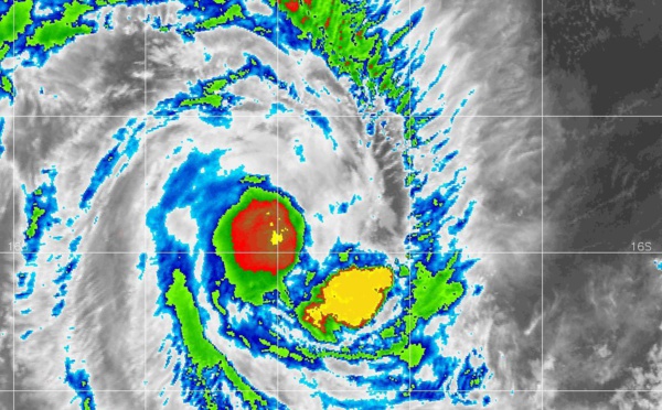
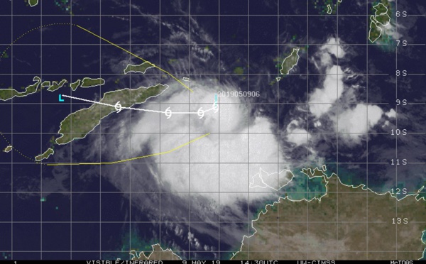
 has probably peaked ( 130km/h gusts) , landfall forecast over Cape York shortly before 48hours")
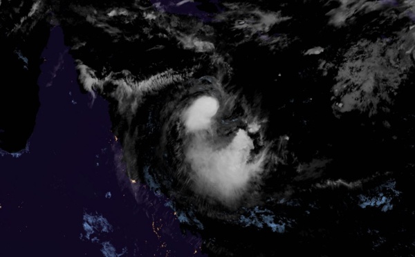
 forecast to peak within 12/24hours and make landfall over Cape York shortly before 48hours")
: landfall over Cape York forecast shortly after 72hours")
 has formed, forecast to intensify next 24hours maybe faster than indicated")

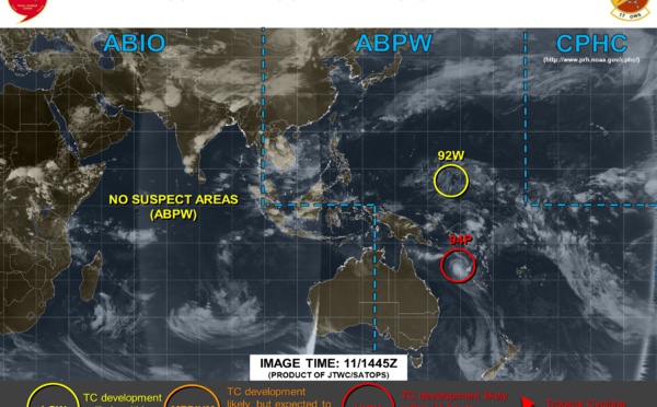
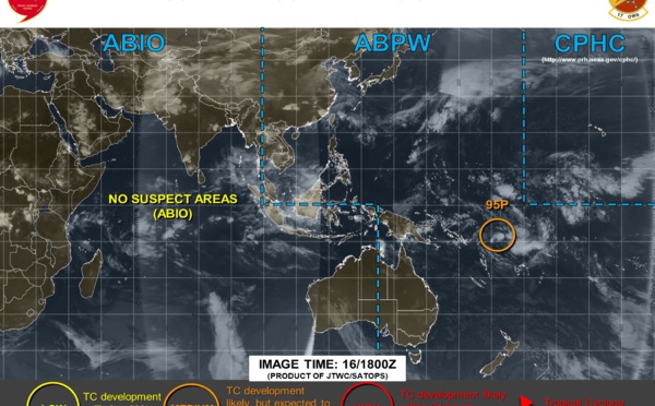
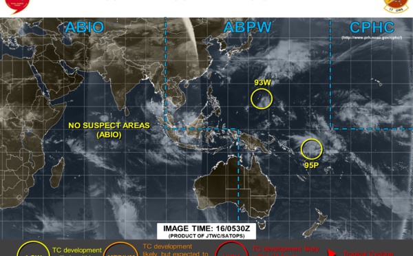
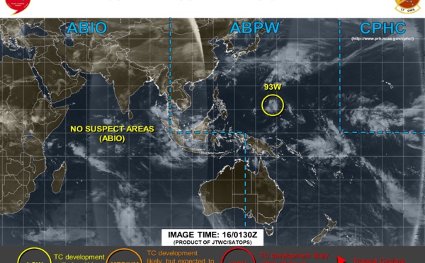
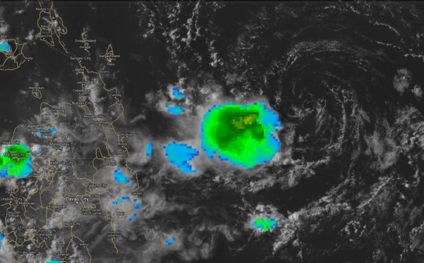
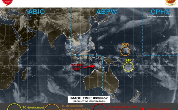
 Philippines: remnants of INVEST 90W to the east of Mindanao ( satellite animations )")

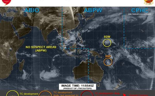
 should be weakening due to dry air in the atmosphere and land interaction with East Timor")
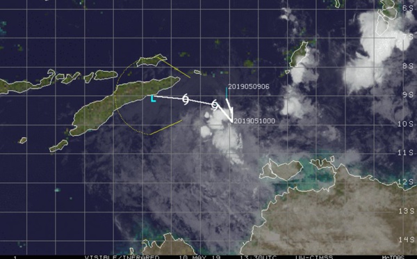

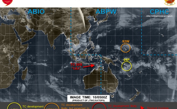
 is weakening, maybe quickly next 12/24hours")
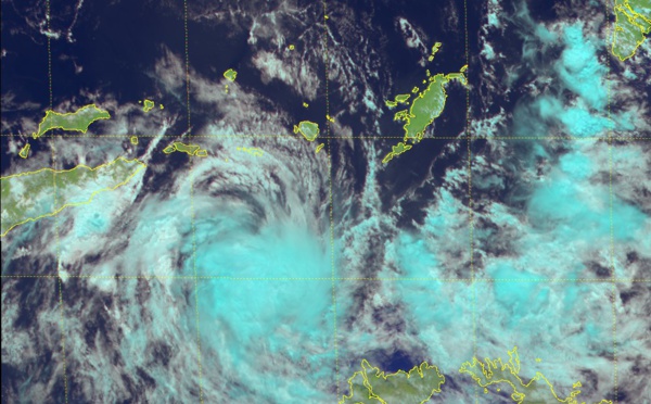
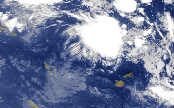
 getting a little bit stronger, potential threat to East Timor with heavy rain and strong winds")

Les News
WESTERN PACIFIC:TY 07W(MEKKHALA) approaching OKINAWA while weakening/08W(HIGOS) to merge with 07W in approx 60h/Invest 95W//24@1030 UTC
06/24/2026
- PATRICK HOAREAU
WESTERN PACIFIC:Typhoon 07W(MEKKHALA) Rapid Intensification likely next 24h forecast Peak Intensity at CAT 4 US in 48h/ Invest 94W//21@1000 UTC
06/21/2026
- PATRICK HOAREAU
WESTERN PACIFIC: TS 07W(MEKKHALA) forecast to reach Typhoon Intensity by 24h, forecast to peak at CAT 3 US in 72h//20@1000 UTC
06/20/2026
- PATRICK HOAREAU
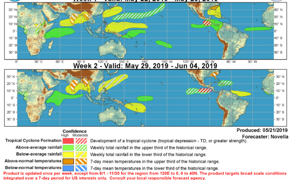
WESTERN PACIFIC: Invest 92W/ SOUTH PACIFIC: Invest 96P/3 Week Tropical Cyclone Formation Probability//17@1030 UTC
06/17/2026
- PATRICK HOAREAU
WESTERN PACIFIC: Invest 92W/SOUTH PACIFIC: Subtropical Storm 96P/EASTERN PACIFIC: Invest 93E//15@0730 UTC
06/15/2026
- PATRICK HOAREAU
SOUTH INDIAN: Subtropical Storm 95S// 11/0900 UTC
06/11/2026
- PATRICK HOAREAU

Liens utiles
WESTERN PACIFIC:Typhoon 07W(MEKKHALA) Rapid Intensification likely next 24h forecast Peak Intensity at CAT 4 US in 48h/ Invest 94W//21@1000 UTC
WESTERN PACIFIC: TS 07W(MEKKHALA) forecast to reach Typhoon Intensity by 24h, forecast to peak at CAT 3 US in 72h//20@1000 UTC
WESTERN PACIFIC: Invest 92W/ SOUTH PACIFIC: Invest 96P/3 Week Tropical Cyclone Formation Probability//17@1030 UTC
WESTERN PACIFIC: Invest 92W/SOUTH PACIFIC: Subtropical Storm 96P/EASTERN PACIFIC: Invest 93E//15@0730 UTC
SOUTH INDIAN: Subtropical Storm 95S// 11/0900 UTC
S'identifier