
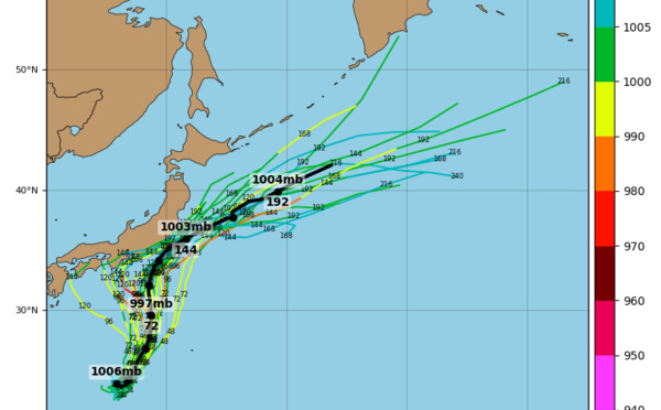
 near landfall in Honshu/Japan as a weak tropical storm")
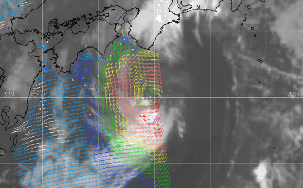
 is forecast to weaken over Japan after 18hours")
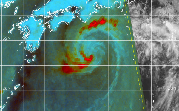


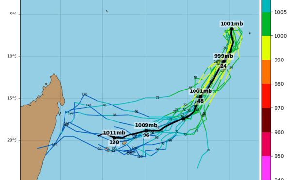
: peak intensity reached was 45knots, JMV File included")
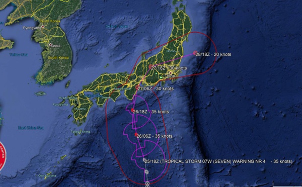
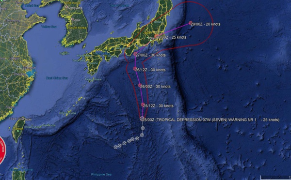
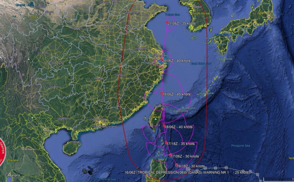
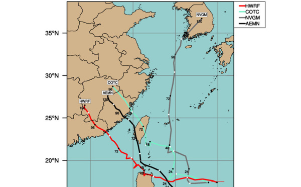
 should weaken rapidly over the mountainous terrain of South Korea after 12hours")
 peak intensity within 12hours. Dissipation forecast over South Korea after 48hours")
 is forecast to dissipate by 72hours over the mountainous terrain of South Korea")

 no significant intensification expected, forecast to dissipate over South Korea in 72hours")
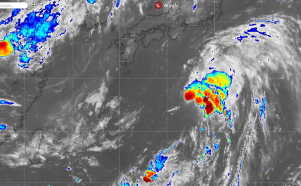
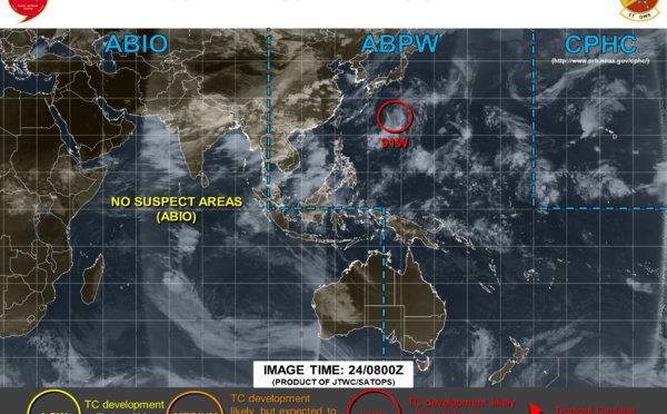
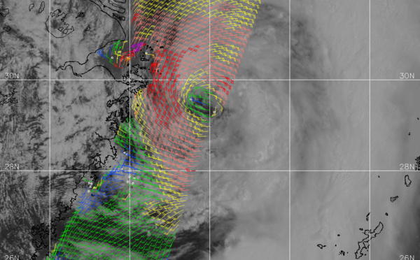
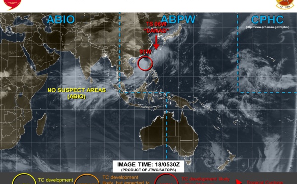
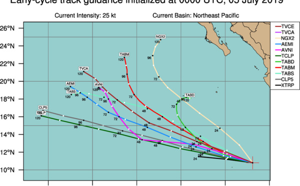
 still weak whereas INVEST 91W and INVEST 99W are now being closely monitored")
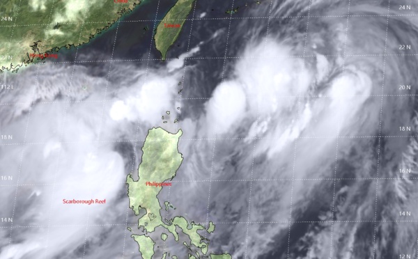
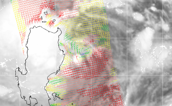
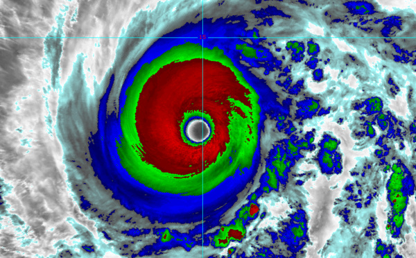
 still poorly organized with a fully exposed center")
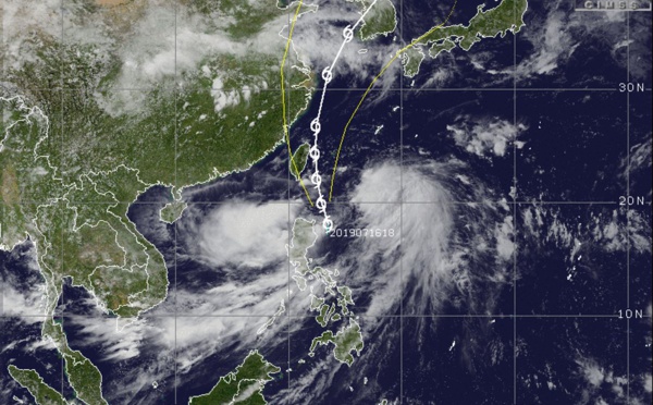
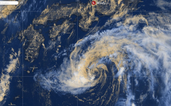
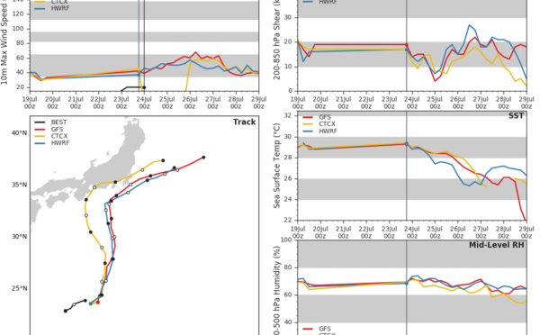
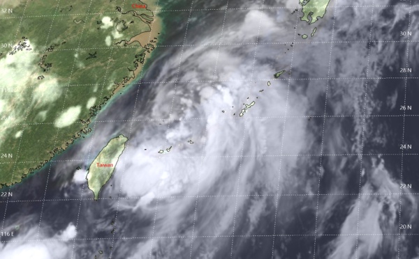
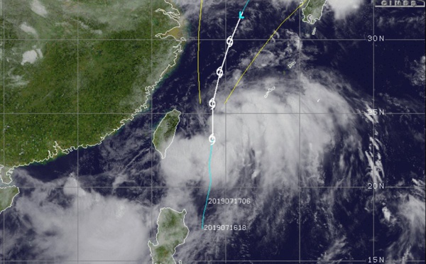
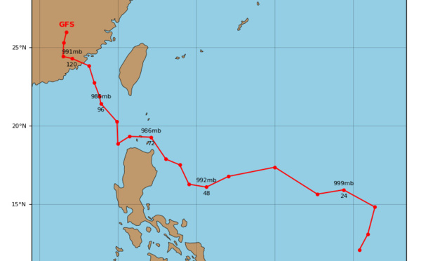
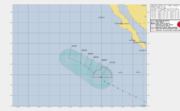
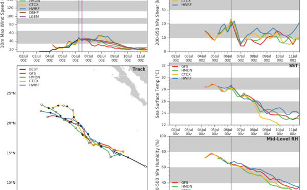
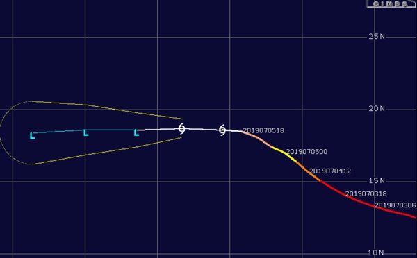
: slow intensification expected next 72hours while confidence in the forecast track is low")
, slowly intensifying")


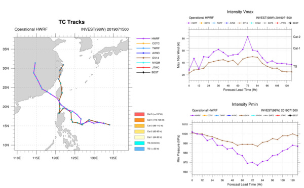

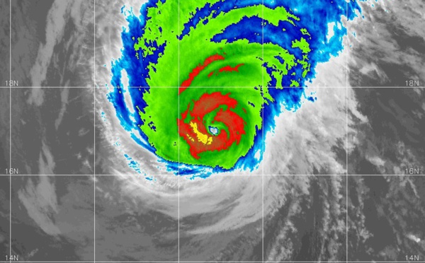
 maximum intensity reached was 135knots(almost category 5 US). JMV File included.")
 is a weak and sheared system, intensity is forecast to fall below 35knots within 12hours")
, not expected to intensify further")
 is a now reduced to a 45knots cyclone weakening further")
 category 2 US, intensity is forecast to fall below 35knots after 48hours")

Les News
WESTERN PACIFIC:TY 07W(MEKKHALA) approaching OKINAWA while weakening/08W(HIGOS) to merge with 07W in approx 60h/Invest 95W//24@1030 UTC
06/24/2026
- PATRICK HOAREAU
WESTERN PACIFIC:Typhoon 07W(MEKKHALA) Rapid Intensification likely next 24h forecast Peak Intensity at CAT 4 US in 48h/ Invest 94W//21@1000 UTC
06/21/2026
- PATRICK HOAREAU
WESTERN PACIFIC: TS 07W(MEKKHALA) forecast to reach Typhoon Intensity by 24h, forecast to peak at CAT 3 US in 72h//20@1000 UTC
06/20/2026
- PATRICK HOAREAU
WESTERN PACIFIC: Invest 92W/ SOUTH PACIFIC: Invest 96P/3 Week Tropical Cyclone Formation Probability//17@1030 UTC
06/17/2026
- PATRICK HOAREAU
WESTERN PACIFIC: Invest 92W/SOUTH PACIFIC: Subtropical Storm 96P/EASTERN PACIFIC: Invest 93E//15@0730 UTC
06/15/2026
- PATRICK HOAREAU
SOUTH INDIAN: Subtropical Storm 95S// 11/0900 UTC
06/11/2026
- PATRICK HOAREAU

Liens utiles
WESTERN PACIFIC:Typhoon 07W(MEKKHALA) Rapid Intensification likely next 24h forecast Peak Intensity at CAT 4 US in 48h/ Invest 94W//21@1000 UTC
WESTERN PACIFIC: TS 07W(MEKKHALA) forecast to reach Typhoon Intensity by 24h, forecast to peak at CAT 3 US in 72h//20@1000 UTC
WESTERN PACIFIC: Invest 92W/ SOUTH PACIFIC: Invest 96P/3 Week Tropical Cyclone Formation Probability//17@1030 UTC
WESTERN PACIFIC: Invest 92W/SOUTH PACIFIC: Subtropical Storm 96P/EASTERN PACIFIC: Invest 93E//15@0730 UTC
SOUTH INDIAN: Subtropical Storm 95S// 11/0900 UTC
S'identifier