
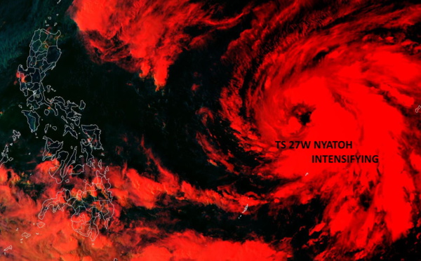
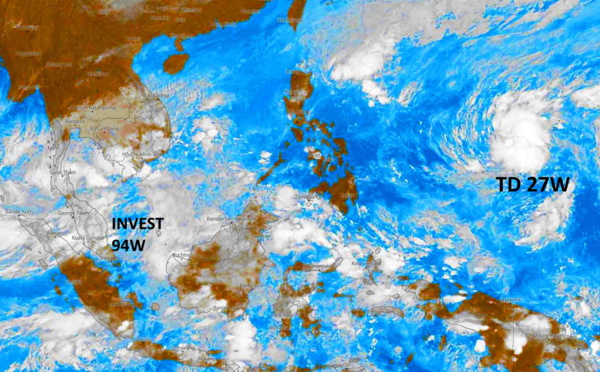
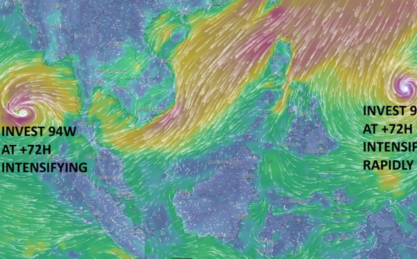
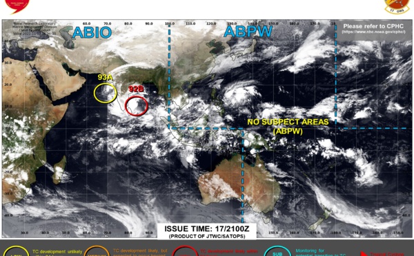
 intensity to peak(CAT 3) within 36h then will decay (dry air and shear)//Invest 92S: TCFA(High),Invest 94W still Medium")
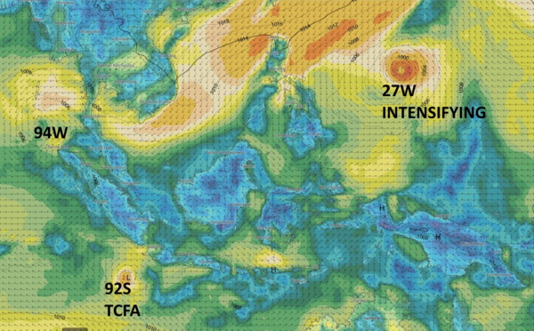
: rapid intensification likely next 48hours//Invest 94W: intensification expected by 48hours/Invest 92S on the map, 30/09utc")


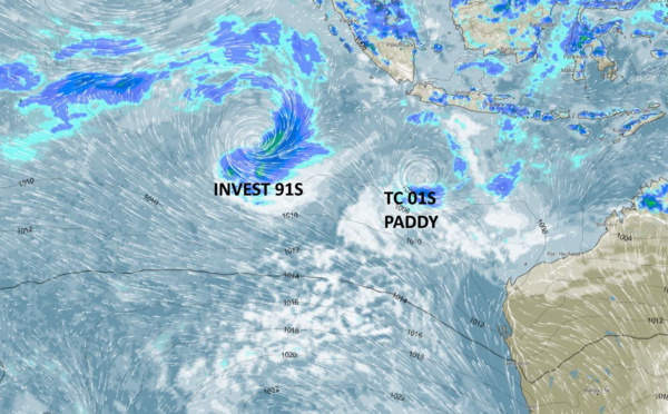
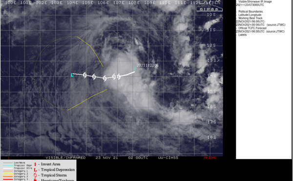
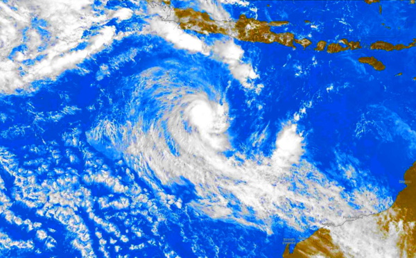
 with Invest 91S displaying flaring convection, 25/06utc")
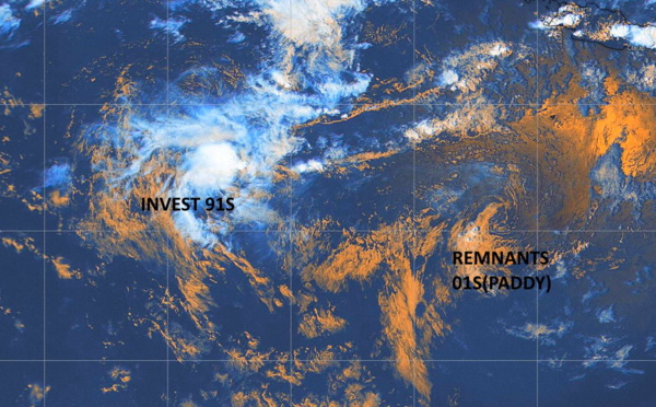
 slowly moving westward/ Invest 91S now on the map, 24/03utc")
, 23/09utc")
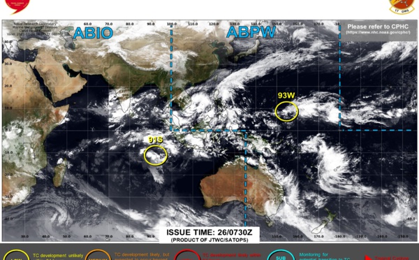
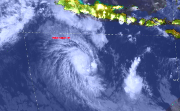
 opens the 2021/22 Southern Hemisphere cyclone season, 22/09utc")
, 22/04utc")

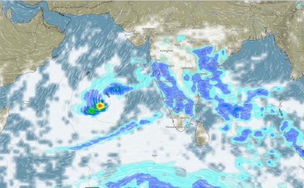


 and possible development over the Arabian Sea,03/11")
 is subtropical and intensifying, 31/10utc updates")

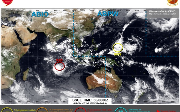
 reached CAT 2 but now rapidly becoming extra-tropical/Invest 93S up-graded to Medium, 29/0330utc")
 is still forecast to reach CAT 2 within 24hours, 28/06utc update")
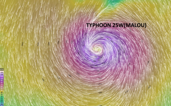
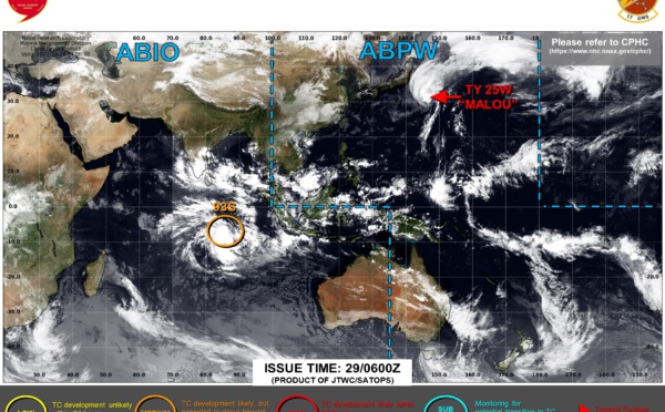
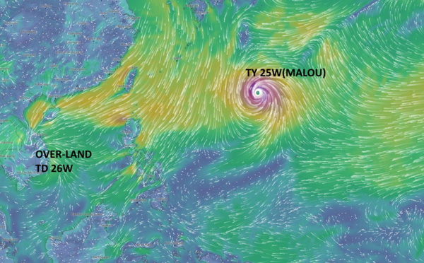
 forecast to reach CAT 2 by 24hours/TD 26W now over-land, 27/09utc updates")
 intensifying to Typhoon level by 24h/26W making landfall within 12/18h//17E(RICK) reached CAT 2 and made landfall,26/09utc updates")
 intensifying next 3 days/Tropical cyclone Formation alert for Invest 99W//17E(RICK) reaching CAT 2 and making landfall,25/06utc")
 set to reach Hurricane CAT 3 within 24hours and make landfall,24/06utc updates")
 forecast to rapidly intensify, 23/06utc")


Les News
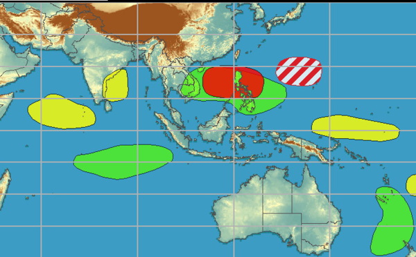
WESTERN PACIFIC:TY 07W(MEKKHALA) approaching OKINAWA while weakening/08W(HIGOS) to merge with 07W in approx 60h/Invest 95W//24@1030 UTC
06/24/2026
- PATRICK HOAREAU
WESTERN PACIFIC:Typhoon 07W(MEKKHALA) Rapid Intensification likely next 24h forecast Peak Intensity at CAT 4 US in 48h/ Invest 94W//21@1000 UTC
06/21/2026
- PATRICK HOAREAU
WESTERN PACIFIC: TS 07W(MEKKHALA) forecast to reach Typhoon Intensity by 24h, forecast to peak at CAT 3 US in 72h//20@1000 UTC
06/20/2026
- PATRICK HOAREAU
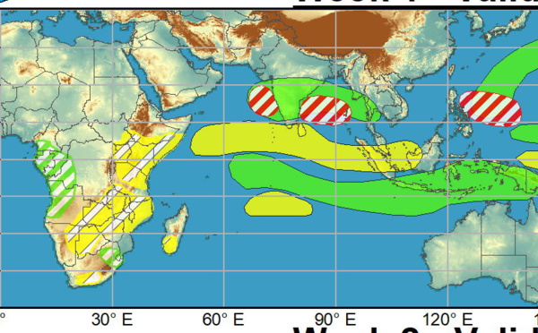
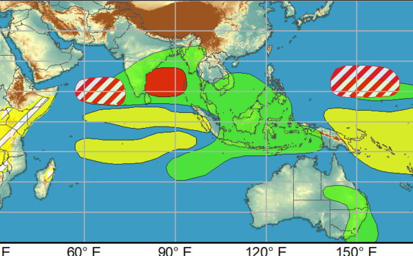
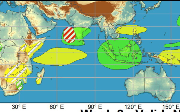
WESTERN PACIFIC: Invest 92W/ SOUTH PACIFIC: Invest 96P/3 Week Tropical Cyclone Formation Probability//17@1030 UTC
06/17/2026
- PATRICK HOAREAU
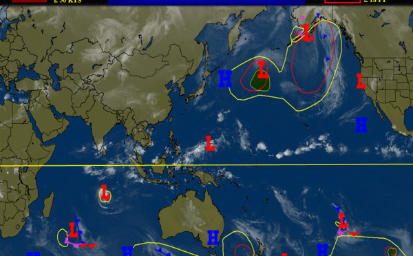
WESTERN PACIFIC: Invest 92W/SOUTH PACIFIC: Subtropical Storm 96P/EASTERN PACIFIC: Invest 93E//15@0730 UTC
06/15/2026
- PATRICK HOAREAU
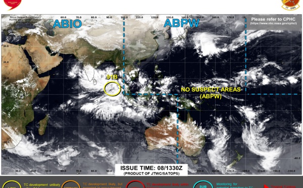
SOUTH INDIAN: Subtropical Storm 95S// 11/0900 UTC
06/11/2026
- PATRICK HOAREAU

Liens utiles
WESTERN PACIFIC:Typhoon 07W(MEKKHALA) Rapid Intensification likely next 24h forecast Peak Intensity at CAT 4 US in 48h/ Invest 94W//21@1000 UTC
WESTERN PACIFIC: TS 07W(MEKKHALA) forecast to reach Typhoon Intensity by 24h, forecast to peak at CAT 3 US in 72h//20@1000 UTC
WESTERN PACIFIC: Invest 92W/ SOUTH PACIFIC: Invest 96P/3 Week Tropical Cyclone Formation Probability//17@1030 UTC
WESTERN PACIFIC: Invest 92W/SOUTH PACIFIC: Subtropical Storm 96P/EASTERN PACIFIC: Invest 93E//15@0730 UTC
SOUTH INDIAN: Subtropical Storm 95S// 11/0900 UTC
S'identifier