
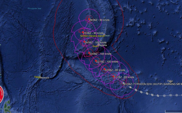
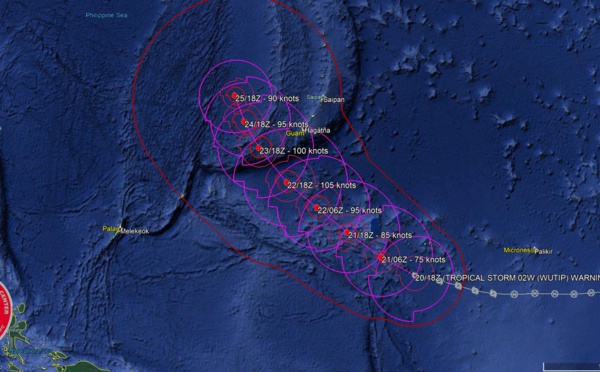
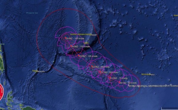
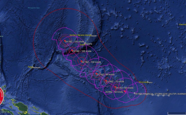
 forecast to reach Category 3 US in 36hours while approaching Guam")
: slow-moving and slowly weakening next 5 days")
 now a typhoon, forecast to reach Category 3 US in 36hours while approaching Guam")
: slow-moving and slowly weakening next 5 days")
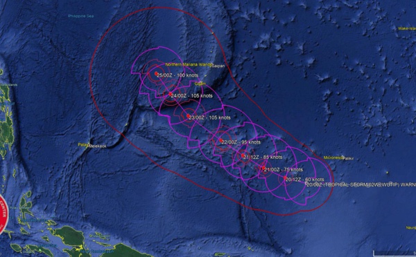
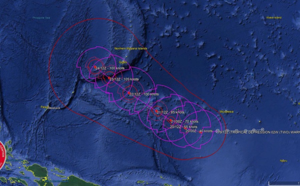
 intensifying and forecast to reach CAT3 US in less than 2 days while approaching the Guam/Yap area")
: slow-moving and slowly weakening, changed forecast track after 48hours")
 intensifying and forecast to reach CAT3 US in less than 2 days while approaching the Guam/Yap area")
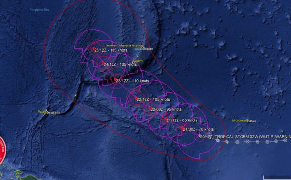
: slow-moving and forecast to weaken next 5 days")
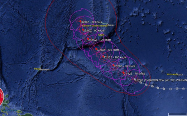
 forecast to intensify rapidly to a CAT3 US in less than 3 days while approaching the Guam/Yap area")
: slow-moving and forecast to weaken next 4 days")
 forecast to intensify rapidly to a CAT3 US in less than 3 days while approaching the Guam/Yap area")
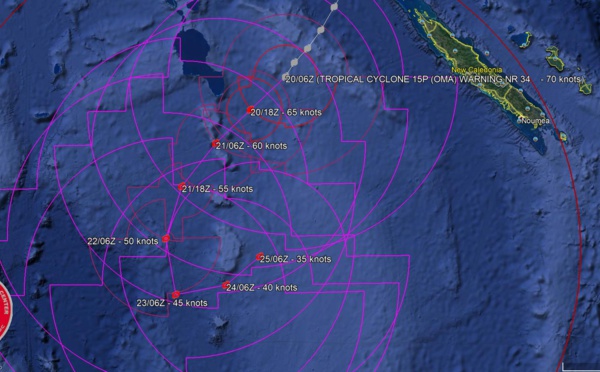
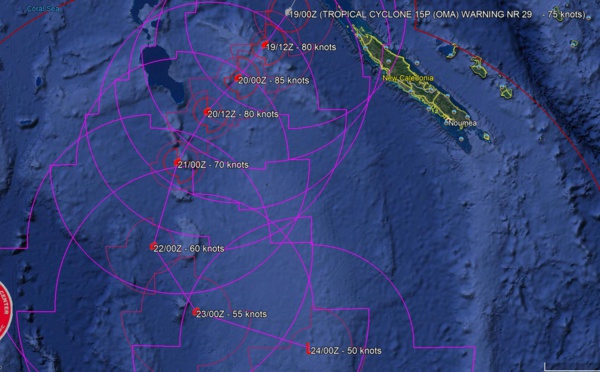
 Category 1 US, no longer expected to intensify")
 forecast to intensify rapidly to a CAT3 US in 3 days while approaching the Guam/Yap area")

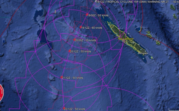
 Category 1 US may intensify to Category 2 within 12hours")
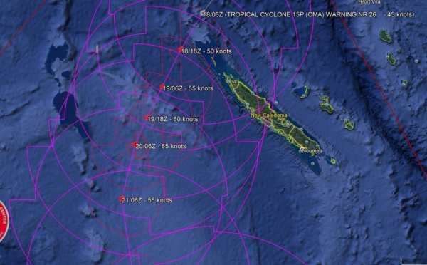
 expected to peak as a CAT2 US within the next 24hours")


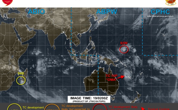
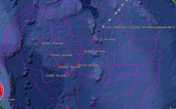
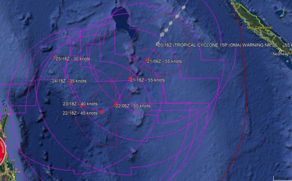
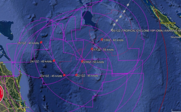
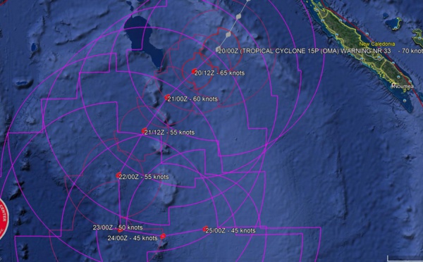
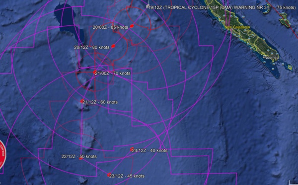
, Category 1US, tracking 130km west of the Belep islands where 140km/h gusts are reported")
: moving southwest and intensifying, approaching the Belep islands")


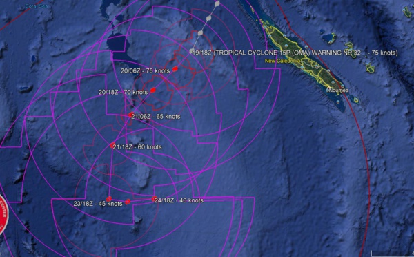
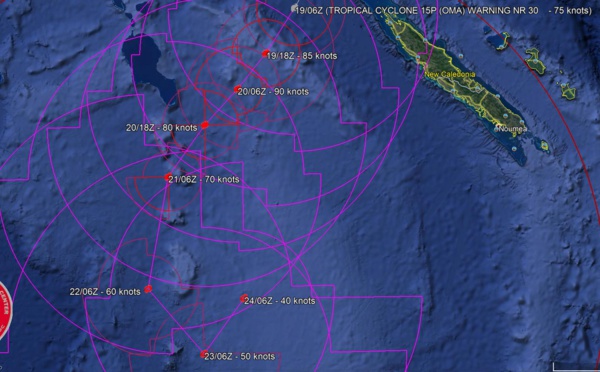
: struggling over cooler seas, but pushing south-southwest and forecast to intensify after 12/24hours")

 pushing slowly southward and forecast to intensify gradually after 24H.")


Les News
ECMWF 10 Day Storm Tracks// 3Week TC Formation Probability// 2403utc
04/24/2024
- PATRICK HOAREAU
TC 22P(PAUL)// Remnants of TC 21S(OLGA)// ECMWF 10 Day Storm Tracks// 1103utc
04/11/2024
- PATRICK HOAREAU
TC 21S(OLGA) SAR reveals still a bit stronger than expected// INVEST 97P// ECMWF 10 Day Storm Traccks// 0903utc
04/09/2024
- PATRICK HOAREAU
TC 21S(OLGA) peaked as a powerful CAT 4 US// ECMWF 10 Day Storm Tracks// 0803utc
04/08/2024
- PATRICK HOAREAU
TC 21S(OLGA) reaches CAT 3 US still intensifying// ECMWF 10 Day Storm Tracks// 0709utc
04/07/2024
- PATRICK HOAREAU
TC 21S(OLGA) intensifying and peaking within 24H may reach CAT 2 US// ECMWF 10 Day Storm Tracks, 0615utc
04/06/2024
- PATRICK HOAREAU

Liens utiles
TC 22P(PAUL)// Remnants of TC 21S(OLGA)// ECMWF 10 Day Storm Tracks// 1103utc
TC 21S(OLGA) SAR reveals still a bit stronger than expected// INVEST 97P// ECMWF 10 Day Storm Traccks// 0903utc
TC 21S(OLGA) peaked as a powerful CAT 4 US// ECMWF 10 Day Storm Tracks// 0803utc
TC 21S(OLGA) reaches CAT 3 US still intensifying// ECMWF 10 Day Storm Tracks// 0709utc
TC 21S(OLGA) intensifying and peaking within 24H may reach CAT 2 US// ECMWF 10 Day Storm Tracks, 0615utc
S'identifier