
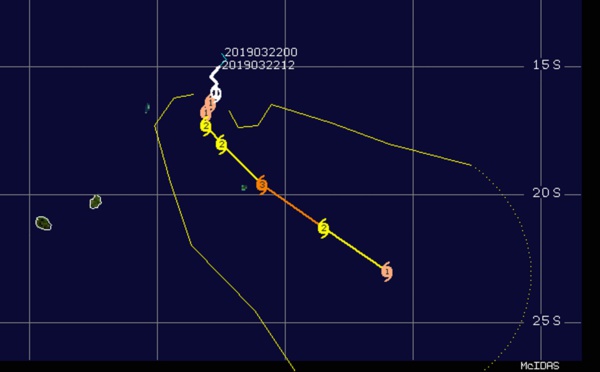
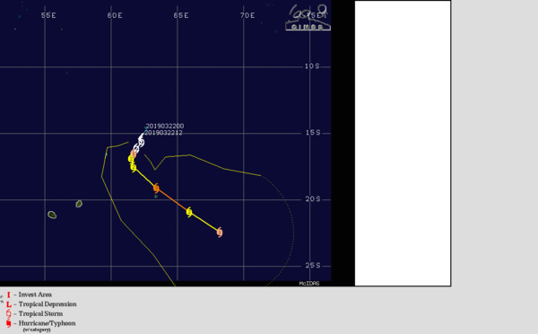
 top category 3 US, slowly moving away from ROD, may still peak as a category 4 US")
 top category 3 US tracking about 60/70km to the north-east of Rodrigues within the next 3/6hours")
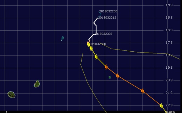
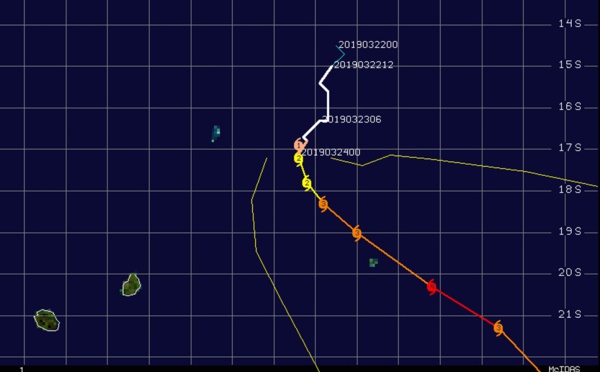
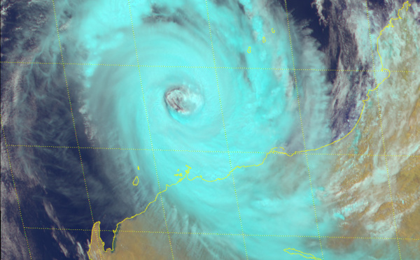
 category 3 US still intensifying and forecast to track 55km east Cotton Bay/ROD near noon/local time")
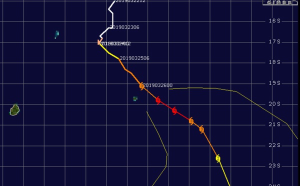
 category 3 US, still intensifying and forecast to track less than 50km to ROD shortly before 24h")
: intensity forecast to fall below 35knots in 36h")
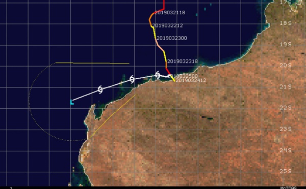
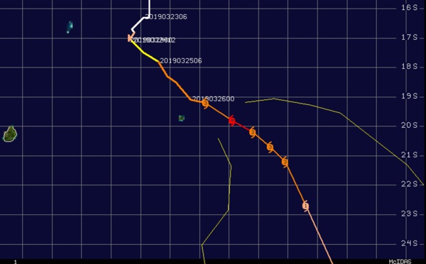
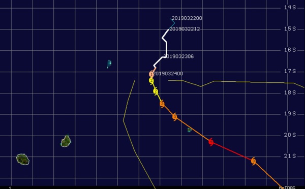
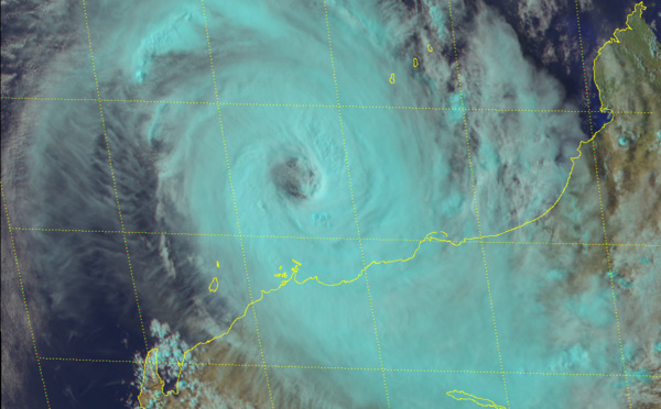
 category 3 US, forecast to pass 55km east of Rodrigues in 24h")
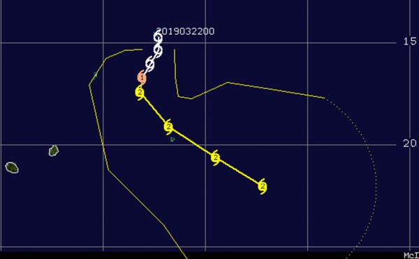
 category 2 US, could intensify to category 3 within 24h while slowly approaching Rodrigues")
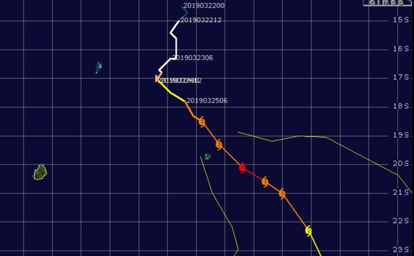
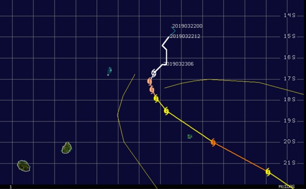
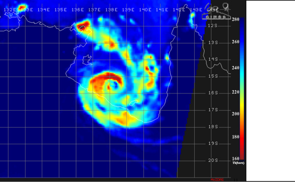
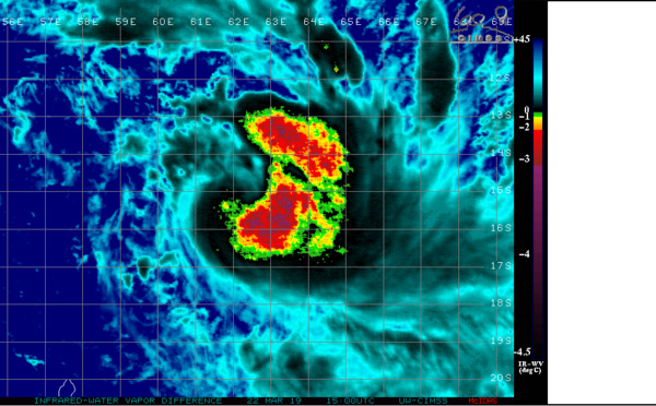
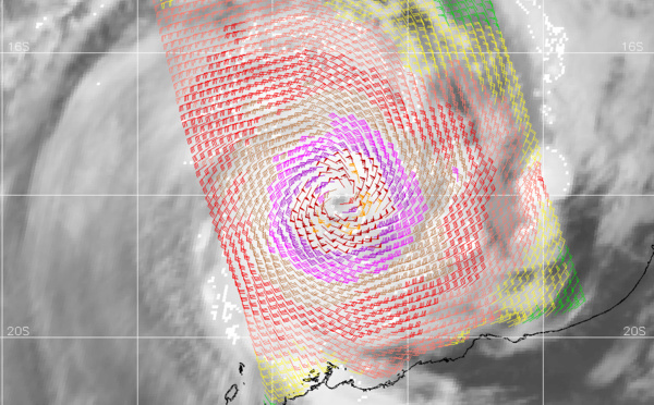
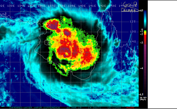
 intensifying to category 3 US within 12hours, tracking very close to the east of Rodrigues shortly after 36h")
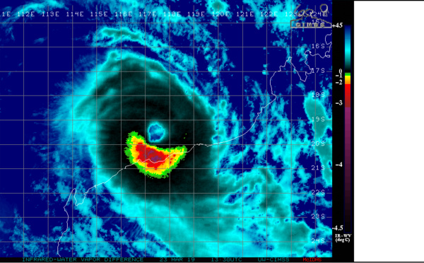
 category 2 US, reaching category 3 within 36h while approaching slowly but dangerously Rodrigues island")
 category 2 US, inland moving close to the coastline but weakening significantly next 48hours")
 category 1 US, intensifying to category 3 within 36h and slowly heading for Rodrigues island")
 category 3 US, moving almost parallel to the coastline while weakening quickly next 24h")
 category 1 US, intensifying to category 3 within 36hours and slowly heading for Rodrigues island")
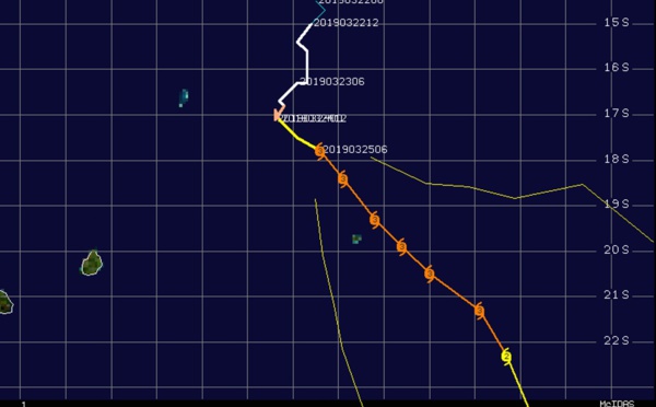
 powerful category 4 US, 95km northeast of Karratha slowly approaching the coast")
 expected to intensify steadily next 48/72h and slowly approach Rodrigues island")
 category 2 US, 165km northwest of Port Hedland, slowly approaching the coast")
 strong category 1 US, 200km northwest of Port Heldand, slowly approaching the coast")
 gradually approaching Port Hedland as a category 1 US.")
 slow-moving and expected to intensify rapidly next 24hours, slowly approaching Rodrigues")
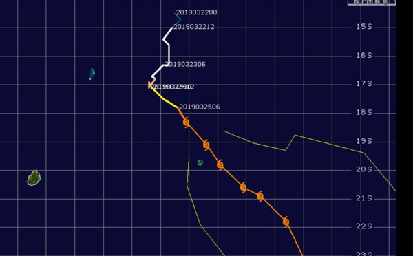
, intensifying steadily and slowly approaching Rodrigues island")
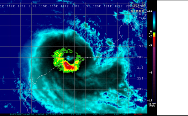
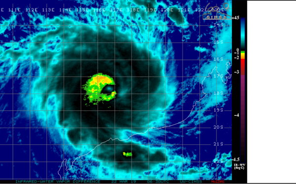
 near landfall as a strong category 3 US with top gusts approaching 250km/h")
 slow-moving, set to intensify significantly next 48hours")
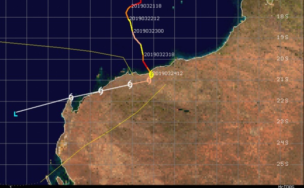
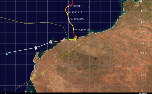
 category 2 US forecast to weaken until landfall in approx 36hours to the west of Port Hedland(WA)")
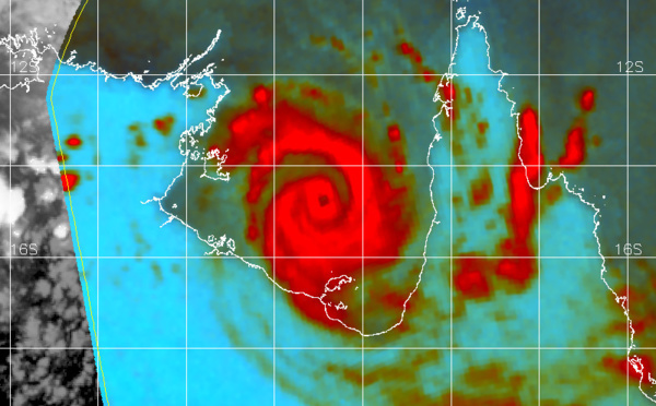
 is set to make landfall as at least a category 3 US north-east of BORROLOOLA shortly after 12hours.")

 category 3 US slowly approaching the Pilbara coast")
 category 2 US, forecast to make landfall near BORROLOOLA in 18hours as a category 3 US")

 category 3 US, may re-intensify while slowly approaching the Pilbara coast of Western Australia")
 category 1 US, intensifying rapidly over the Gulf of Carpentaria ,landfall forecast in 24h")
Les News
WESTERN PACIFIC:TY 07W(MEKKHALA) approaching OKINAWA while weakening/08W(HIGOS) to merge with 07W in approx 60h/Invest 95W//24@1030 UTC
06/24/2026
- PATRICK HOAREAU
WESTERN PACIFIC:Typhoon 07W(MEKKHALA) Rapid Intensification likely next 24h forecast Peak Intensity at CAT 4 US in 48h/ Invest 94W//21@1000 UTC
06/21/2026
- PATRICK HOAREAU
WESTERN PACIFIC: TS 07W(MEKKHALA) forecast to reach Typhoon Intensity by 24h, forecast to peak at CAT 3 US in 72h//20@1000 UTC
06/20/2026
- PATRICK HOAREAU
WESTERN PACIFIC: Invest 92W/ SOUTH PACIFIC: Invest 96P/3 Week Tropical Cyclone Formation Probability//17@1030 UTC
06/17/2026
- PATRICK HOAREAU
WESTERN PACIFIC: Invest 92W/SOUTH PACIFIC: Subtropical Storm 96P/EASTERN PACIFIC: Invest 93E//15@0730 UTC
06/15/2026
- PATRICK HOAREAU
SOUTH INDIAN: Subtropical Storm 95S// 11/0900 UTC
06/11/2026
- PATRICK HOAREAU

Liens utiles
WESTERN PACIFIC:Typhoon 07W(MEKKHALA) Rapid Intensification likely next 24h forecast Peak Intensity at CAT 4 US in 48h/ Invest 94W//21@1000 UTC
WESTERN PACIFIC: TS 07W(MEKKHALA) forecast to reach Typhoon Intensity by 24h, forecast to peak at CAT 3 US in 72h//20@1000 UTC
WESTERN PACIFIC: Invest 92W/ SOUTH PACIFIC: Invest 96P/3 Week Tropical Cyclone Formation Probability//17@1030 UTC
WESTERN PACIFIC: Invest 92W/SOUTH PACIFIC: Subtropical Storm 96P/EASTERN PACIFIC: Invest 93E//15@0730 UTC
SOUTH INDIAN: Subtropical Storm 95S// 11/0900 UTC
S'identifier