
 category 3 US, moving almost parallel to the coastline while weakening quickly next 24h")
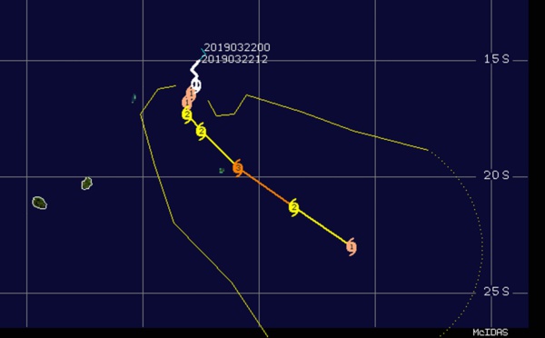
 category 1 US, intensifying to category 3 within 36hours and slowly heading for Rodrigues island")
 powerful category 4 US, 95km northeast of Karratha slowly approaching the coast")
 expected to intensify steadily next 48/72h and slowly approach Rodrigues island")
 category 2 US, 165km northwest of Port Hedland, slowly approaching the coast")
 strong category 1 US, 200km northwest of Port Heldand, slowly approaching the coast")
 gradually approaching Port Hedland as a category 1 US.")
 slow-moving and expected to intensify rapidly next 24hours, slowly approaching Rodrigues")
, intensifying steadily and slowly approaching Rodrigues island")
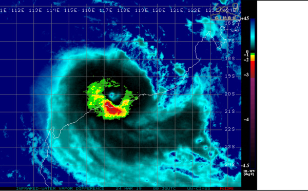
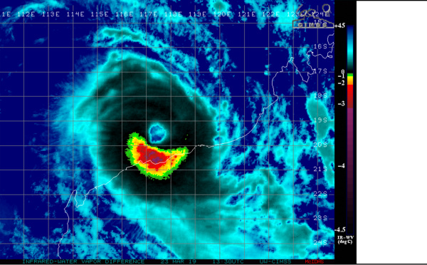
 near landfall as a strong category 3 US with top gusts approaching 250km/h")
 slow-moving, set to intensify significantly next 48hours")
 category 2 US forecast to weaken until landfall in approx 36hours to the west of Port Hedland(WA)")
 is set to make landfall as at least a category 3 US north-east of BORROLOOLA shortly after 12hours.")

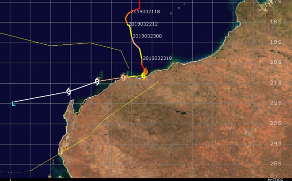
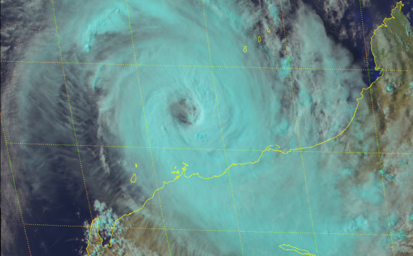
 category 3 US slowly approaching the Pilbara coast")
 category 2 US, forecast to make landfall near BORROLOOLA in 18hours as a category 3 US")

 category 3 US, may re-intensify while slowly approaching the Pilbara coast of Western Australia")
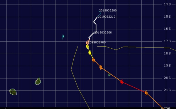
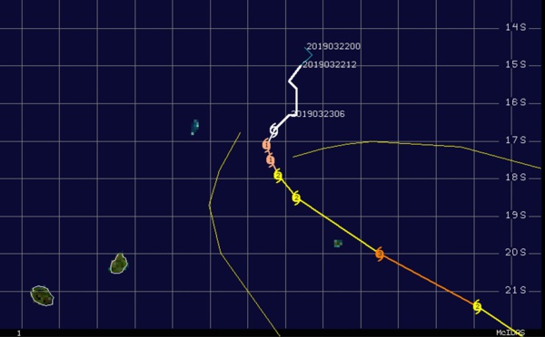
 category 1 US, intensifying rapidly over the Gulf of Carpentaria ,landfall forecast in 24h")

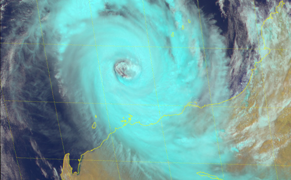
 category 4 US, gradually approaching the Pilbara coast of WA")
 intensifying next 36h over the Gulf of Carpentaria")
 category 4 US, may intensify to Super Cyclone intensity within 24hours")

: expected to intensify very rapidly next 48hours over the Gulf of Carpentaria")
 category 4 US, may reach category 5 within 12 hours")
 intensifying rapidly next 48hours north-west of Western Australia")

: flaring convection, slow-moving system")
 intensifying rapidly next 48h to the north-west of Western Australia")
Les News
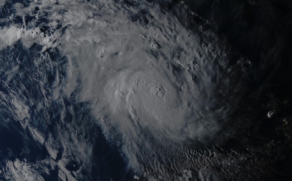
TC 23S(HIDAYA) peaked at 80 knots/CAT 1 US A NEW RECORD AS THE MOST INTENSE TC IN THIS REGION//0315utc
05/03/2024
- PATRICK HOAREAU
INVEST 90S Tropical Cyclone Formation Alert//ECMWF 10 Day Storm Tracks//3 Week TC Formation Probability//0103utc
05/01/2024
- PATRICK HOAREAU
ECMWF 10 Day Storm Tracks// 3Week TC Formation Probability// 2403utc
04/24/2024
- PATRICK HOAREAU
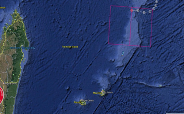
TC 22P(PAUL)// Remnants of TC 21S(OLGA)// ECMWF 10 Day Storm Tracks// 1103utc
04/11/2024
- PATRICK HOAREAU
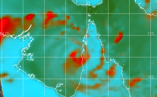
TC 21S(OLGA) SAR reveals still a bit stronger than expected// INVEST 97P// ECMWF 10 Day Storm Traccks// 0903utc
04/09/2024
- PATRICK HOAREAU
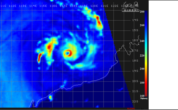
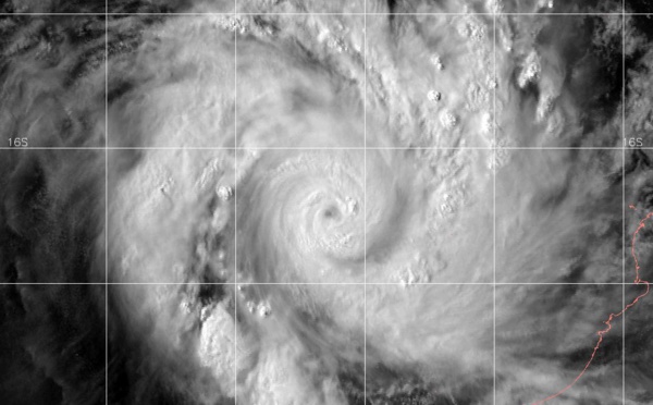
TC 21S(OLGA) peaked as a powerful CAT 4 US// ECMWF 10 Day Storm Tracks// 0803utc
04/08/2024
- PATRICK HOAREAU

Liens utiles
INVEST 90S Tropical Cyclone Formation Alert//ECMWF 10 Day Storm Tracks//3 Week TC Formation Probability//0103utc
ECMWF 10 Day Storm Tracks// 3Week TC Formation Probability// 2403utc
TC 22P(PAUL)// Remnants of TC 21S(OLGA)// ECMWF 10 Day Storm Tracks// 1103utc
TC 21S(OLGA) SAR reveals still a bit stronger than expected// INVEST 97P// ECMWF 10 Day Storm Traccks// 0903utc
TC 21S(OLGA) peaked as a powerful CAT 4 US// ECMWF 10 Day Storm Tracks// 0803utc
S'identifier