
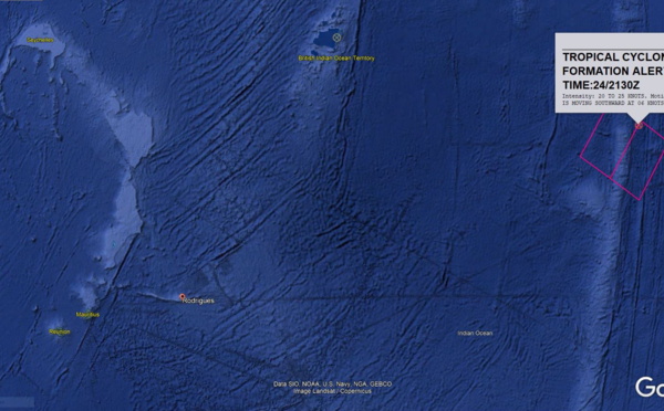
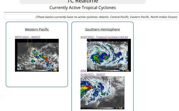
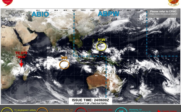
: CAT 3 US slowly approaching Madagascar//Invest 90S: Tropical Cyclone Fomation Alert//TC 09: Final Warning,04/03utc")
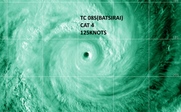
: CAT 4 US , forecast to make landfall over Madagasar near Mahanoro by 48h, 03/15utc")
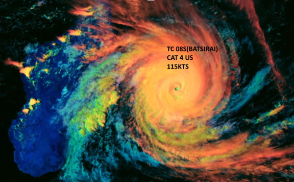
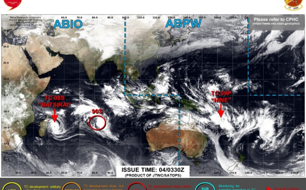
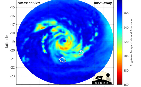
: CAT 4 US tracking apprx 200km North of Réunion island// TC 09P, Invest 90S updates, 03/03utc")
: CAT 4 US tracking North of Réunion island// TC 09P struggling under dry air// Invest 90S: now Medium,02/15utc")
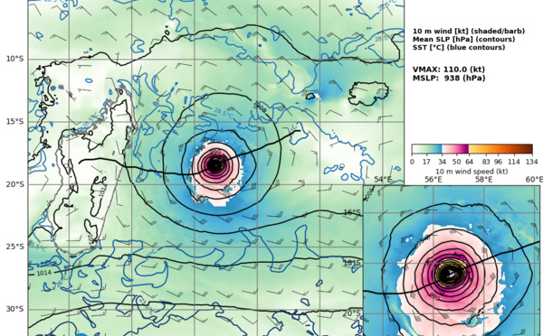
: powerful CAT 4, eye-wall replacement cycle possible within 24hours//TC 09P: struggling due to mid-level dry air,02/03utc")
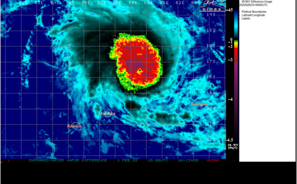
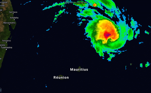
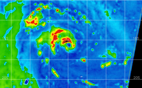
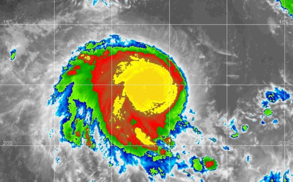
 CAT 2 US: intensifying & approaching Mauritius/Réunion islands// TC 09P: slow intensification after 36h, 01/15utc")
: microwave and Cimss analysis suggest intensification possible next 24h// TC 09P up-date, 01/03utc")
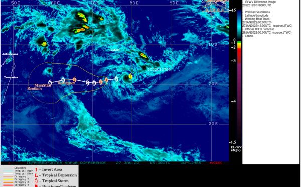
: CAT 2 US ,microwave eye well depicted again, forecast track up-date//Invest 98P: Tropical Cyclone Formation Alert,31/15utc")
: CAT 2 US , peak intensity forecast by 72h// Invest 98P and Invest 99S updates, 31/03utc")
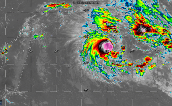
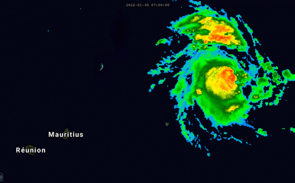
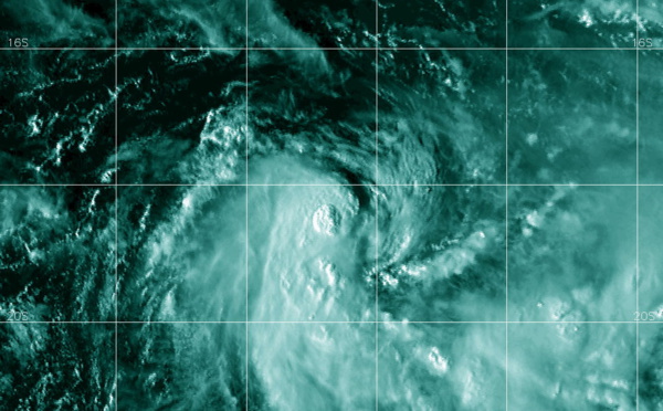
 near CAT 3 US, intensifying with a small pinhole eye// Invest 98P now on the map, 30/15utc")
 high end CAT 1 US will be intensifying next 72h up to CAT 3, approaching the Mascarenes, Invests 98P/97P updates,30/03utc")
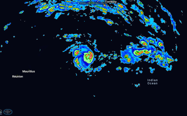
 now a CAT 1 US is forecast to reach CAT 2 by 24h and carry on intensifying, 29/15utc")

 is re-intensifying and gradually approaching the Mascarene islands")
 approaching the Mascarenes area and set to re-intensify// Invest 91W & Invest 97P up-dates, 28/15utc")
: challenging forecast intensity-wise// Invest 91W down-graded to LOW//Invest 97P, 28/03utc")
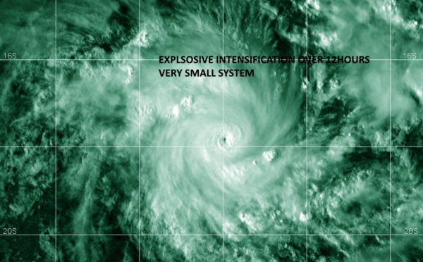
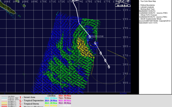
 under-went a very rapid intensifcation span// Invest 91W is Medium// Invest 97P, 27/15utc")


 updates, 25/13utc")
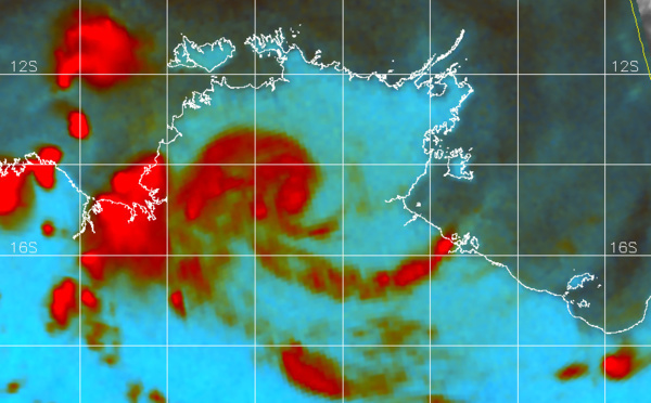
 made landfall near Angoche/MOZ// Invest 91W and Invest 96S updates, 24/15utc")
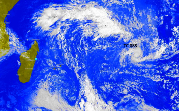
 intensifying and bearing down on MOZ// Invest 96W now MEDIUM and Invest 91W on the map, 24/03utc")

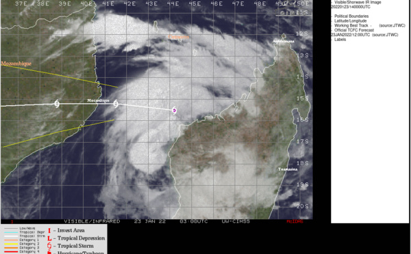


 for Invest 93S, 21/02utc")

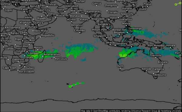

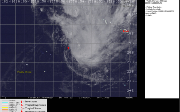
, over-land TC 06P(TIFFANY) and Invest 91P updates+Ecmwf 240h maps, 14/03utc")
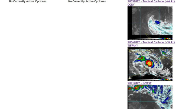
 and over-land TC 06P(TIFFANY) updates, 13/03utc")
 forecast to overcome dry air and increasing shear over 24hours// Over-land TC 06P(TIFFANY) still monitored, 12/15utc")
Les News
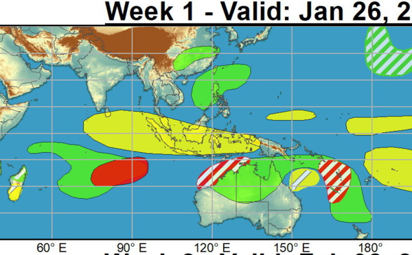
ECMWF 10 Day Storm Tracks// 3Week TC Formation Probability// 2403utc
04/24/2024
- PATRICK HOAREAU
TC 22P(PAUL)// Remnants of TC 21S(OLGA)// ECMWF 10 Day Storm Tracks// 1103utc
04/11/2024
- PATRICK HOAREAU
TC 21S(OLGA) SAR reveals still a bit stronger than expected// INVEST 97P// ECMWF 10 Day Storm Traccks// 0903utc
04/09/2024
- PATRICK HOAREAU
TC 21S(OLGA) peaked as a powerful CAT 4 US// ECMWF 10 Day Storm Tracks// 0803utc
04/08/2024
- PATRICK HOAREAU
TC 21S(OLGA) reaches CAT 3 US still intensifying// ECMWF 10 Day Storm Tracks// 0709utc
04/07/2024
- PATRICK HOAREAU
TC 21S(OLGA) intensifying and peaking within 24H may reach CAT 2 US// ECMWF 10 Day Storm Tracks, 0615utc
04/06/2024
- PATRICK HOAREAU

Liens utiles
TC 22P(PAUL)// Remnants of TC 21S(OLGA)// ECMWF 10 Day Storm Tracks// 1103utc
TC 21S(OLGA) SAR reveals still a bit stronger than expected// INVEST 97P// ECMWF 10 Day Storm Traccks// 0903utc
TC 21S(OLGA) peaked as a powerful CAT 4 US// ECMWF 10 Day Storm Tracks// 0803utc
TC 21S(OLGA) reaches CAT 3 US still intensifying// ECMWF 10 Day Storm Tracks// 0709utc
TC 21S(OLGA) intensifying and peaking within 24H may reach CAT 2 US// ECMWF 10 Day Storm Tracks, 0615utc
S'identifier