


category 2, could hit Florida as a powerful cyclone in 4 days")
 : landfall over eastern Vietnam in 12h, rapidly dissipating afterwards")
 forecast to become a serious threat to Florida after 72h")
 tracking to the south of Hainan but has failed to intensify")
 relocated, intensifying a bit over the South China Sea")
 now over the South China Sea and intensifying a bit")
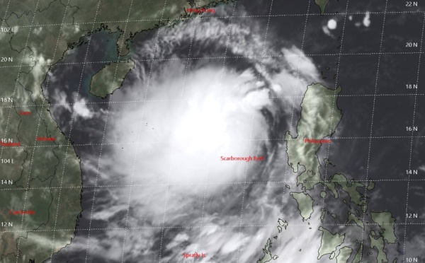
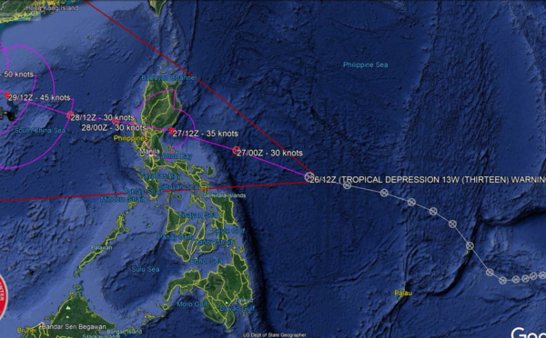
 over South China Sea within 12h, landfall southern Hainan in72h with 50knots winds")
 forecast over the South China Sea in 18h when intensification is likely")


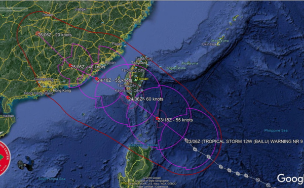
 : Final Warning, Maximum intensity reached was 55knots. JMV file included")

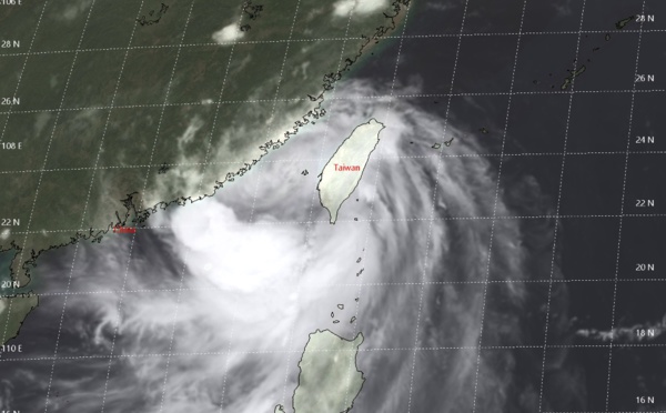
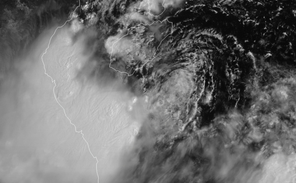
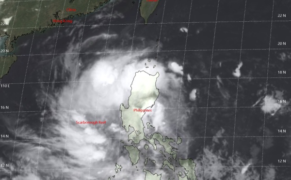
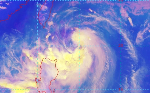
 over southern Taiwan, landfall over China shortly after 12h")
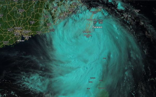
 85km to Lanyu island, landfall in China shortly before 24h")


 forecast to track over southern Taiwan shortly after 12h near minimal typhoon intensity")
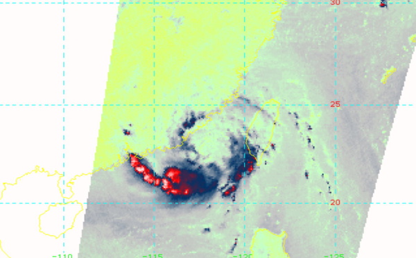
 showing signs of organisation, approaching southern Taiwan")
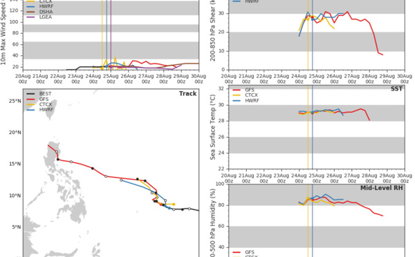
 has been struggling to intensify so far")

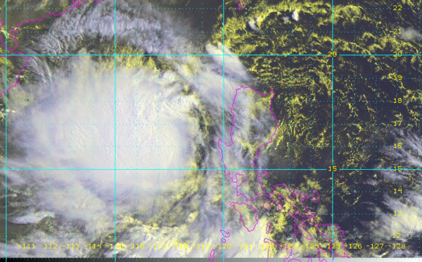
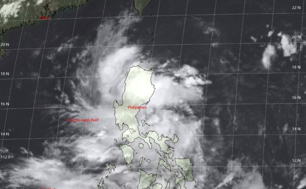
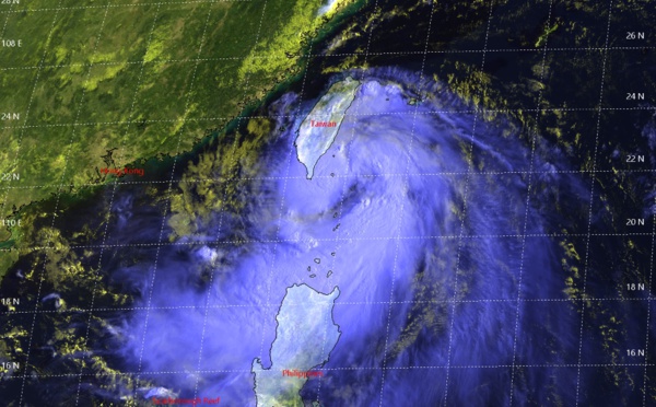
 gradually intensifying to Typhoon intensity within 36h")
 forecast to be a Typhoon within 24h, landfall in Taiwan shortly before 72h")
 forecast to reach Typhoon intensity near Taiwan before 72h")
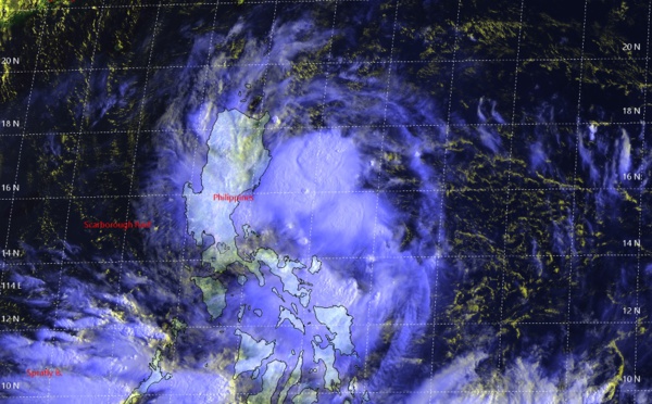
. Intensifying, landfall over Taiwan shortly after 72h")


Les News
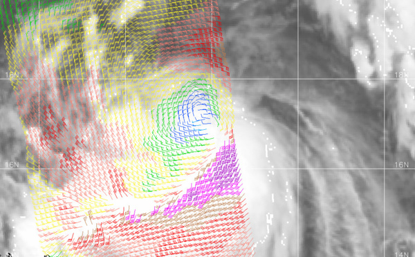
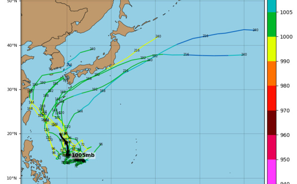
WESTERN PACIFIC:TY 07W(MEKKHALA) approaching OKINAWA while weakening/08W(HIGOS) to merge with 07W in approx 60h/Invest 95W//24@1030 UTC
06/24/2026
- PATRICK HOAREAU
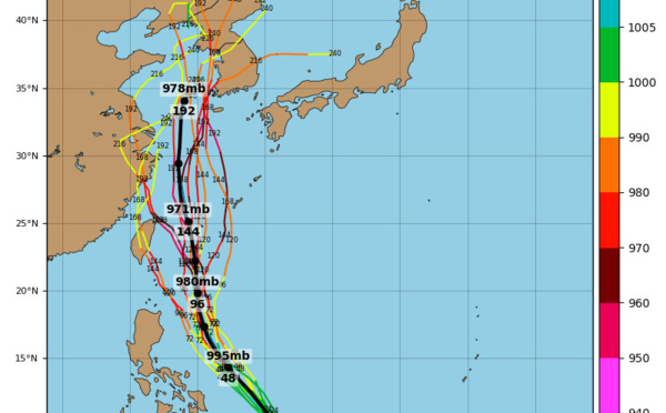
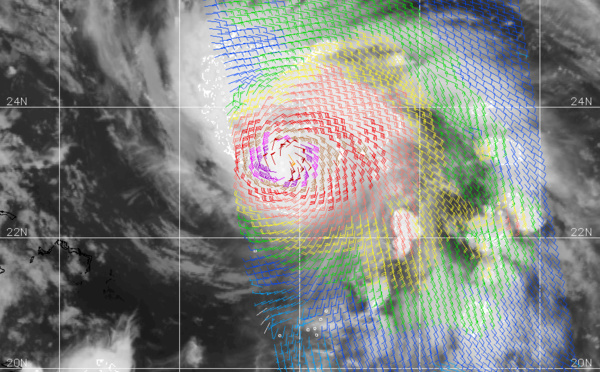
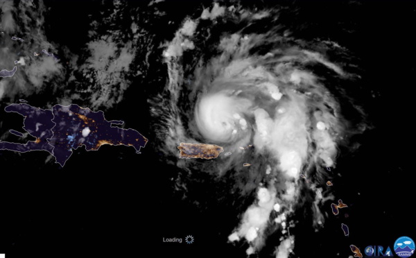
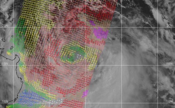
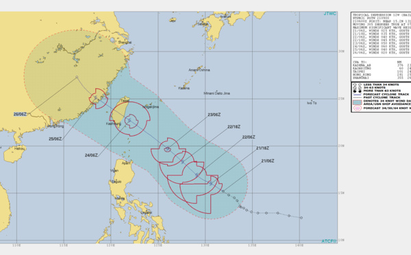
WESTERN PACIFIC:Typhoon 07W(MEKKHALA) Rapid Intensification likely next 24h forecast Peak Intensity at CAT 4 US in 48h/ Invest 94W//21@1000 UTC
06/21/2026
- PATRICK HOAREAU
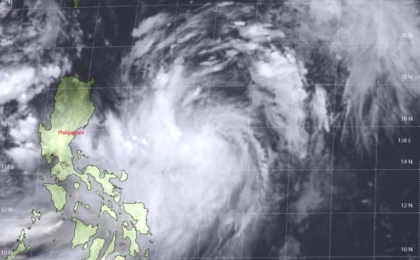
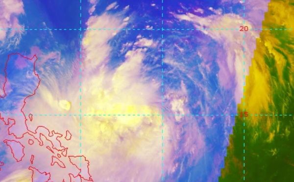
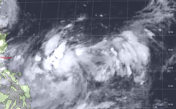
WESTERN PACIFIC: TS 07W(MEKKHALA) forecast to reach Typhoon Intensity by 24h, forecast to peak at CAT 3 US in 72h//20@1000 UTC
06/20/2026
- PATRICK HOAREAU
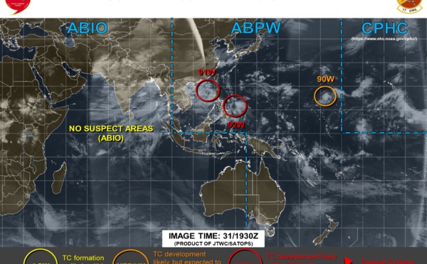
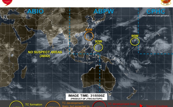
WESTERN PACIFIC: Invest 92W/ SOUTH PACIFIC: Invest 96P/3 Week Tropical Cyclone Formation Probability//17@1030 UTC
06/17/2026
- PATRICK HOAREAU
WESTERN PACIFIC: Invest 92W/SOUTH PACIFIC: Subtropical Storm 96P/EASTERN PACIFIC: Invest 93E//15@0730 UTC
06/15/2026
- PATRICK HOAREAU
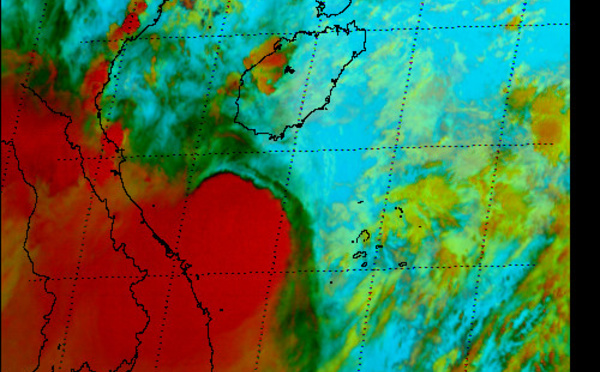
SOUTH INDIAN: Subtropical Storm 95S// 11/0900 UTC
06/11/2026
- PATRICK HOAREAU

Liens utiles
WESTERN PACIFIC:Typhoon 07W(MEKKHALA) Rapid Intensification likely next 24h forecast Peak Intensity at CAT 4 US in 48h/ Invest 94W//21@1000 UTC
WESTERN PACIFIC: TS 07W(MEKKHALA) forecast to reach Typhoon Intensity by 24h, forecast to peak at CAT 3 US in 72h//20@1000 UTC
WESTERN PACIFIC: Invest 92W/ SOUTH PACIFIC: Invest 96P/3 Week Tropical Cyclone Formation Probability//17@1030 UTC
WESTERN PACIFIC: Invest 92W/SOUTH PACIFIC: Subtropical Storm 96P/EASTERN PACIFIC: Invest 93E//15@0730 UTC
SOUTH INDIAN: Subtropical Storm 95S// 11/0900 UTC
S'identifier