

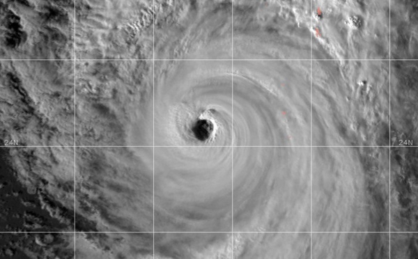


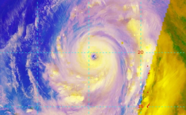


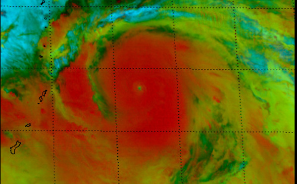
: developing a microwave eye feature, rapid intensification possible")


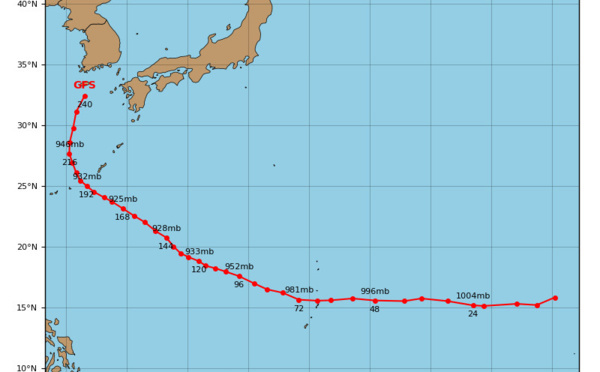
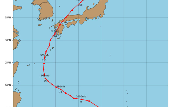
: JMV File. Peak intensity was 90kts(cat 2)")
 becoming extratropical")
: landfall over South Korea within 12hours")
 tracking close to the Chinese coastline, weakening next 48h")
 has been rapidly losing organization")
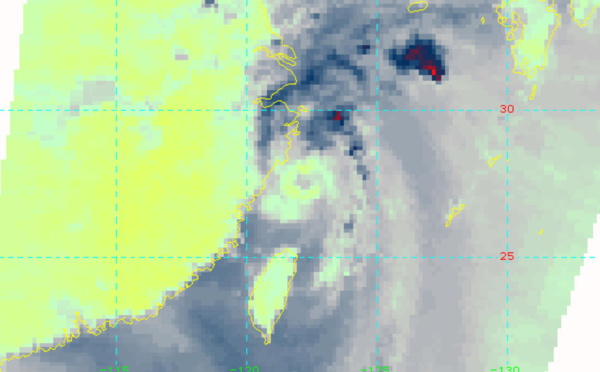
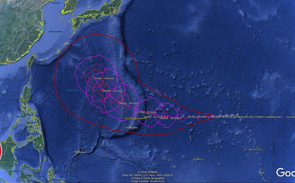
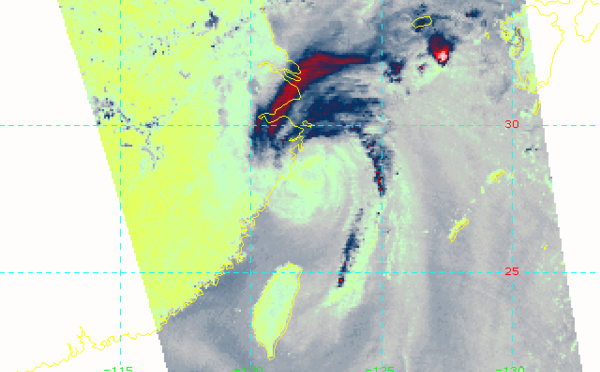
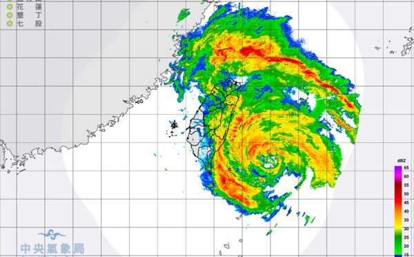
 passed over Yonaguni as a category 2 typhoon")
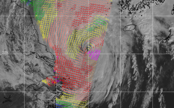
 is tracking between Eastern Taiwan and Ishigakijima")
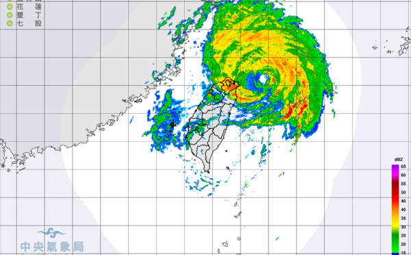
 moving closer to Eastern Taiwan and intensifying a bit")
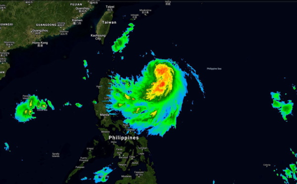
 is forecast to reach Typhoon intensity within 24h")

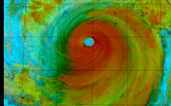
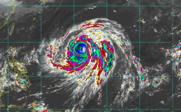
: peak intensity reached was 85knots, cat 2")
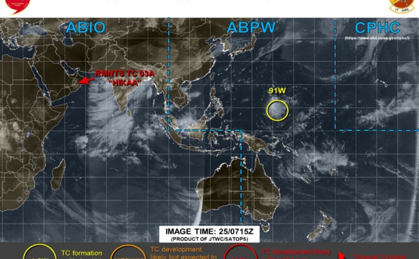
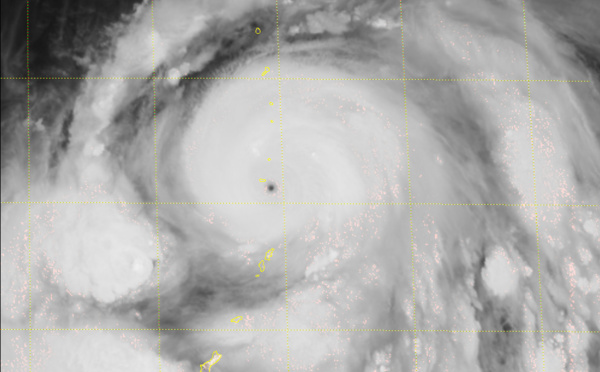
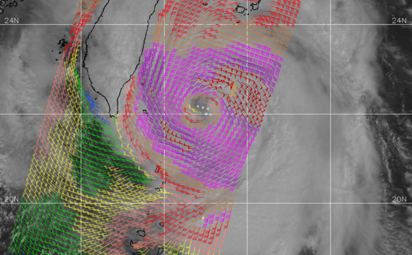
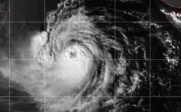
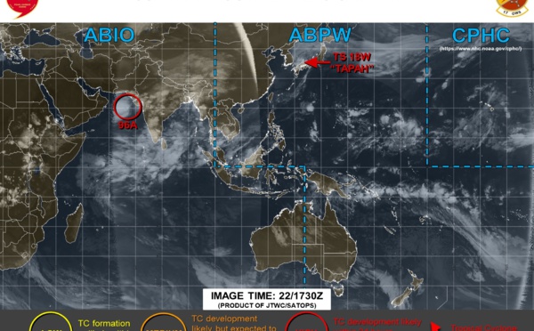
 strong category 1 just south of Masirah, landfall over Oman within 12h")
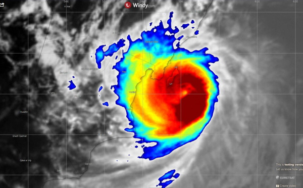
 tiny but well organized category 1 cyclone has probably peaked, near Masirah in 12h")
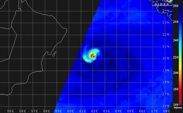
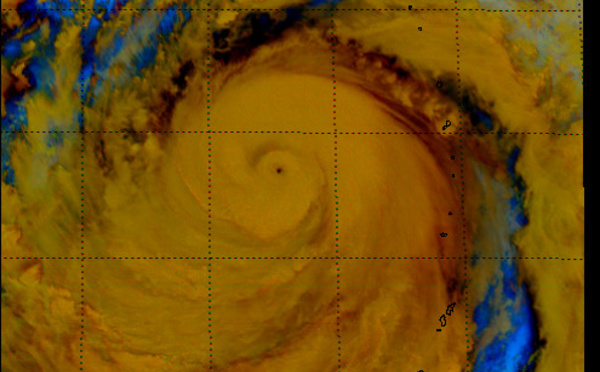
 has been rapidly intensifying over the Arabian Sea")
: over the Sea of Japan")
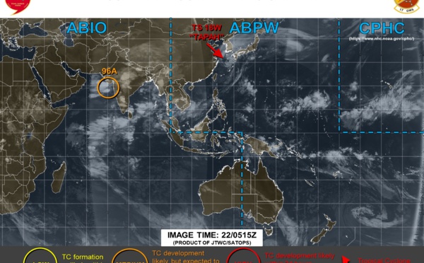
 becoming extratropical and accelerating. Invest 96A: upgraded to medium")
Les News
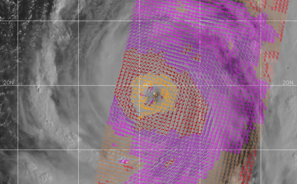
WESTERN PACIFIC:TY 07W(MEKKHALA) approaching OKINAWA while weakening/08W(HIGOS) to merge with 07W in approx 60h/Invest 95W//24@1030 UTC
06/24/2026
- PATRICK HOAREAU
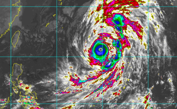
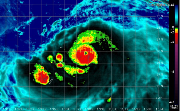
WESTERN PACIFIC:Typhoon 07W(MEKKHALA) Rapid Intensification likely next 24h forecast Peak Intensity at CAT 4 US in 48h/ Invest 94W//21@1000 UTC
06/21/2026
- PATRICK HOAREAU
WESTERN PACIFIC: TS 07W(MEKKHALA) forecast to reach Typhoon Intensity by 24h, forecast to peak at CAT 3 US in 72h//20@1000 UTC
06/20/2026
- PATRICK HOAREAU
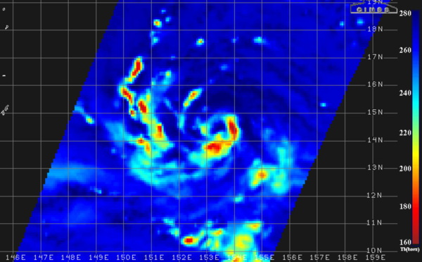
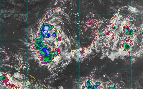
WESTERN PACIFIC: Invest 92W/ SOUTH PACIFIC: Invest 96P/3 Week Tropical Cyclone Formation Probability//17@1030 UTC
06/17/2026
- PATRICK HOAREAU
WESTERN PACIFIC: Invest 92W/SOUTH PACIFIC: Subtropical Storm 96P/EASTERN PACIFIC: Invest 93E//15@0730 UTC
06/15/2026
- PATRICK HOAREAU
SOUTH INDIAN: Subtropical Storm 95S// 11/0900 UTC
06/11/2026
- PATRICK HOAREAU

Liens utiles
WESTERN PACIFIC:Typhoon 07W(MEKKHALA) Rapid Intensification likely next 24h forecast Peak Intensity at CAT 4 US in 48h/ Invest 94W//21@1000 UTC
WESTERN PACIFIC: TS 07W(MEKKHALA) forecast to reach Typhoon Intensity by 24h, forecast to peak at CAT 3 US in 72h//20@1000 UTC
WESTERN PACIFIC: Invest 92W/ SOUTH PACIFIC: Invest 96P/3 Week Tropical Cyclone Formation Probability//17@1030 UTC
WESTERN PACIFIC: Invest 92W/SOUTH PACIFIC: Subtropical Storm 96P/EASTERN PACIFIC: Invest 93E//15@0730 UTC
SOUTH INDIAN: Subtropical Storm 95S// 11/0900 UTC
S'identifier