
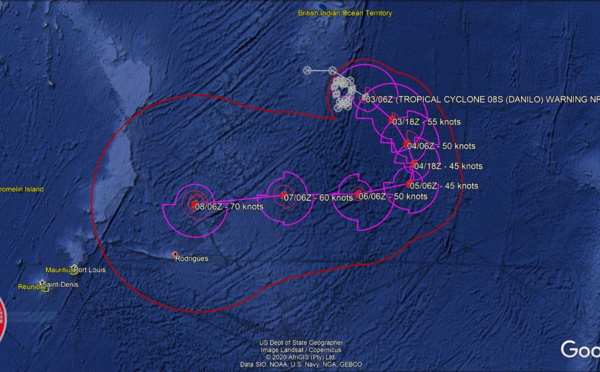
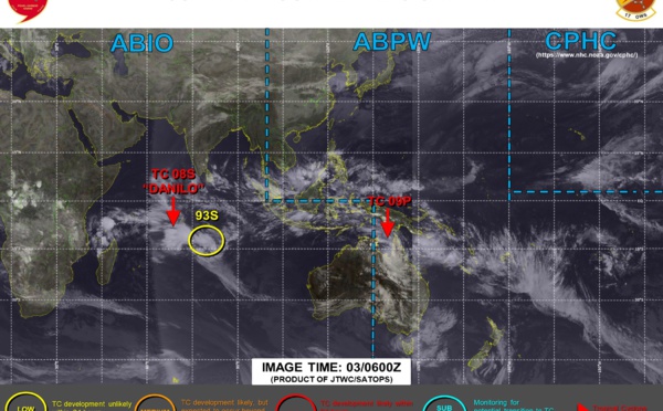
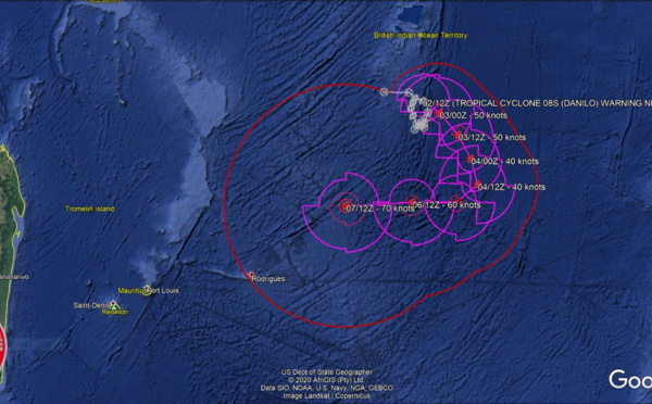
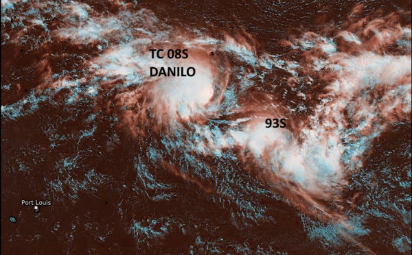
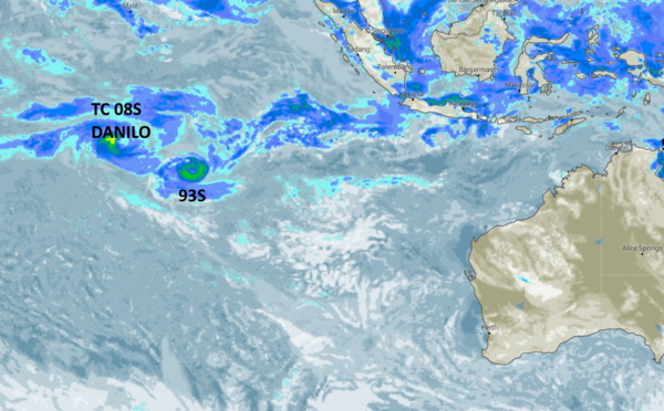
 & Invest 93S: 370km apart, will merge in 36/48hours, still low confidence in the forecast track, 03/15utc update")
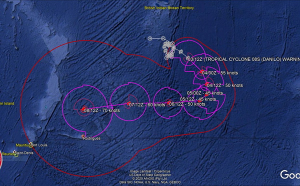
 is expected to make a sharp turn westward in 72h but confidence in the forecast remains low")
 has formed but should be short-lived, Mornigton island reports 96km/h gust")
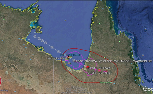
 and Warning 1 for TC 09P will be posted near 03/0930UTC.")
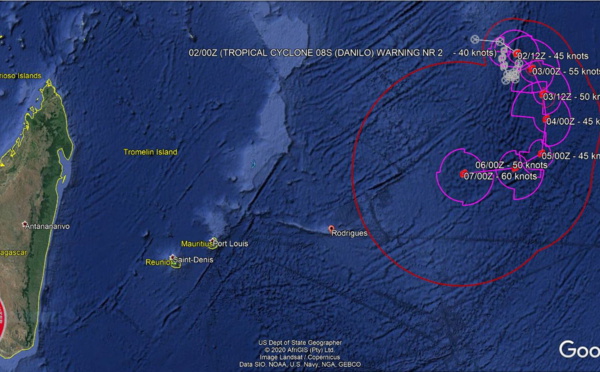
 warning 5, Tropical Cyclone Formation Alert issued for Invest 97P, 02/21utc update")
 forecast to intensify significantly after 48h after kiiling off Invest 93S. Invest 97P still Medium in the GOC")
 and Invest 93S getting closer whereas Invest 97P is up-graded to Medium in the Gulf of Carpentaria")
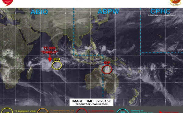
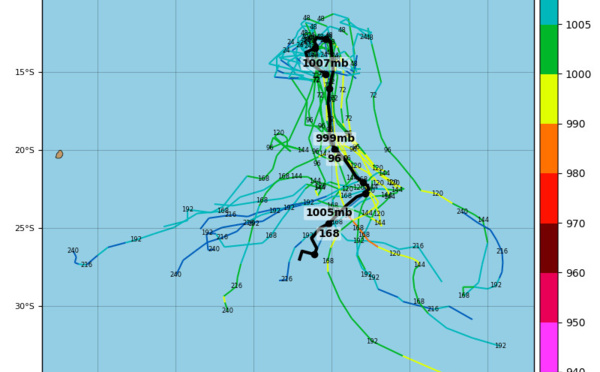
 potential Fujiwhara with Invest 93S, Invest 97P under watch in the Gulf of Carpentaria, 02/03UTC update")
 will be interacting with Invest 93S and may absorb it, Invest 97P now on the map")

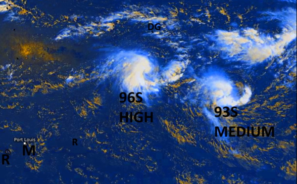

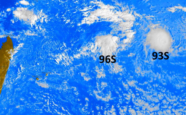
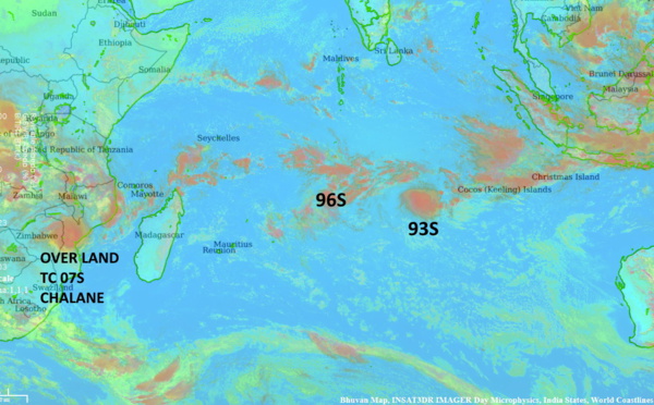
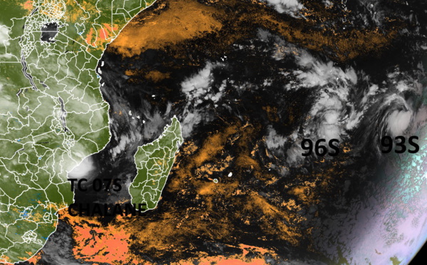
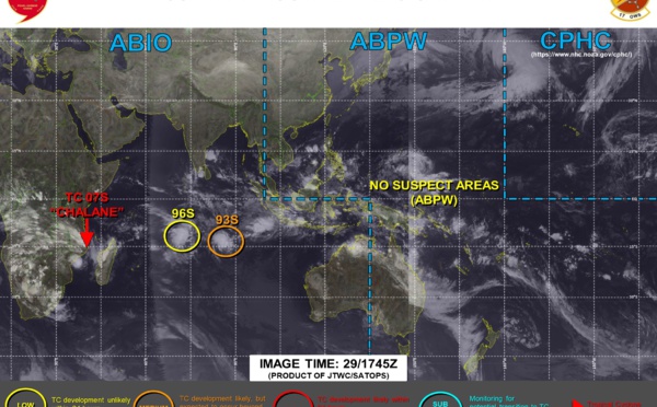
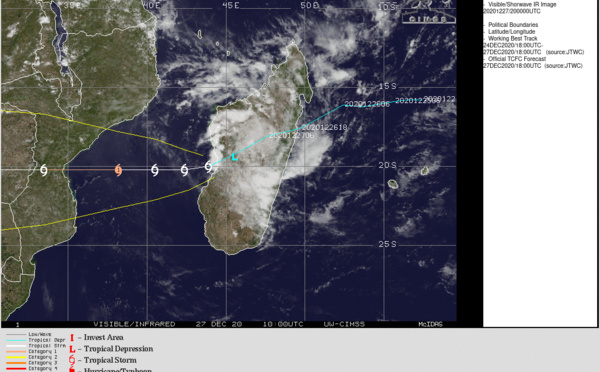
 made landfall over MOZ, Invest 93S & 96S still under watch")
 close to Beira/MOZ, 30/00UTC Updates for Invest 93S & 96S")
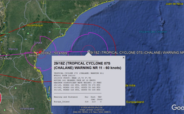
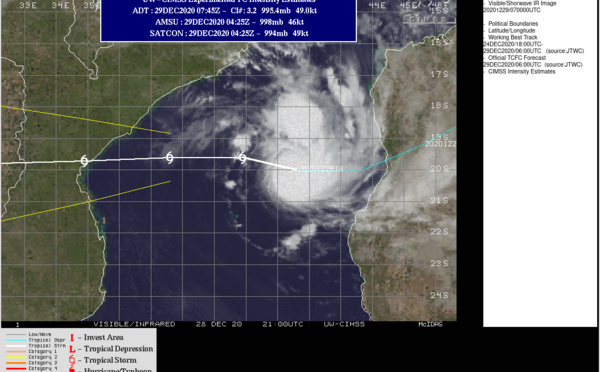
 is bearing down on Beira/MOZ with top gusts nearing 150km/h close to the center, 29/18UTC Update")
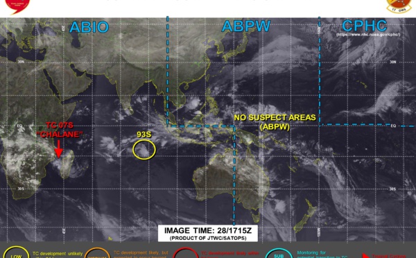
 and two other Suspect Areas under watch, update 29/18UTC")
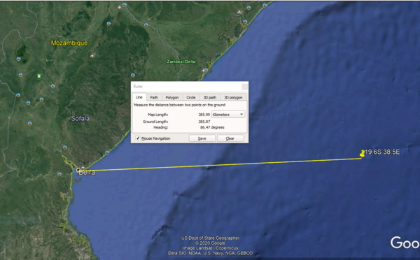
 Update at 29/12UTC: intensifying 385km to Beira, possible rapid intensifcation next 6/12 hours")
 intensifying and forecast to make landfall near Beira/MOZ with winds close to US/CAT 1")
 intensifying and slowly approaching Beira/Mozambique, 93S not doing much")
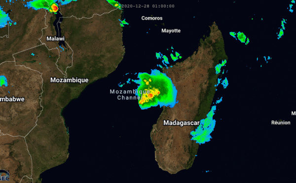
 intensifying over the MOZ Channel, Update 28/09UTC")
 forecast to intensify significantly over the Mozambique Channel")


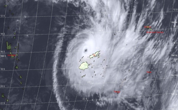


 rapidly approaching Fiji")
 peaked as a CAT 5 US, weakening trend forecast from now on")
 2nd Super Cyclone this season after 03S(AMBALI)")
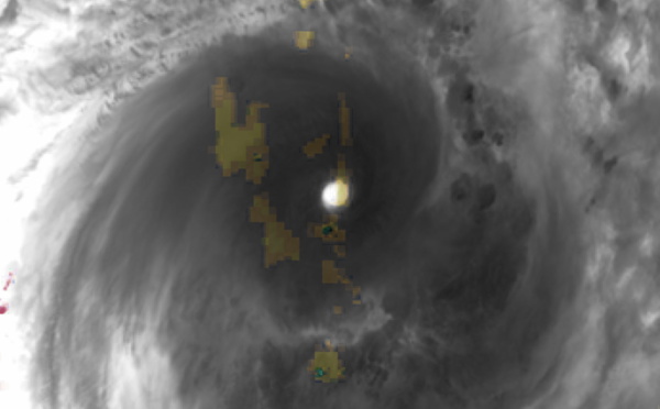
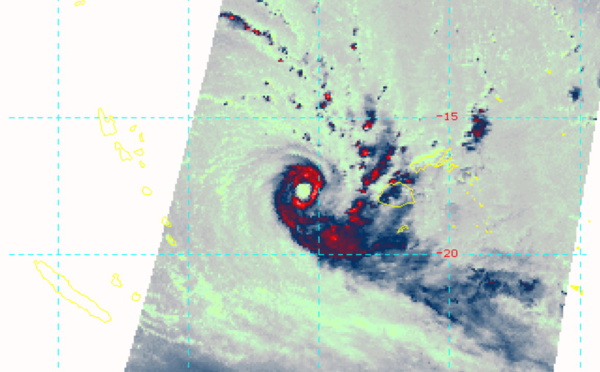
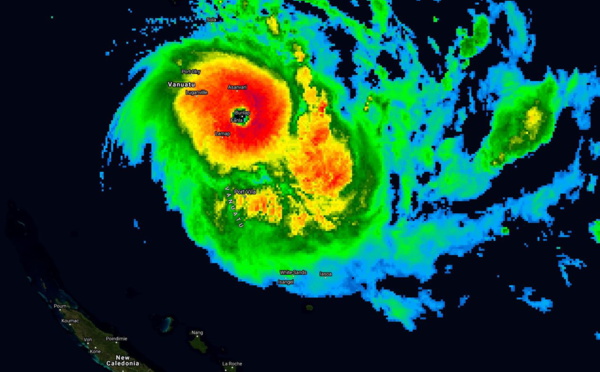
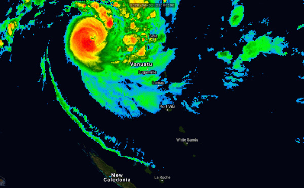
 over Northern Vanuatu as a CAT 4 US/ 24S(IRONDRO) weakening rapidly")
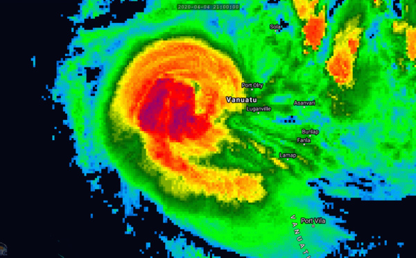
 now near Cat 4, approaching Vanuatu.TC 24S(IRONDRO) peaking near Cat 3US")
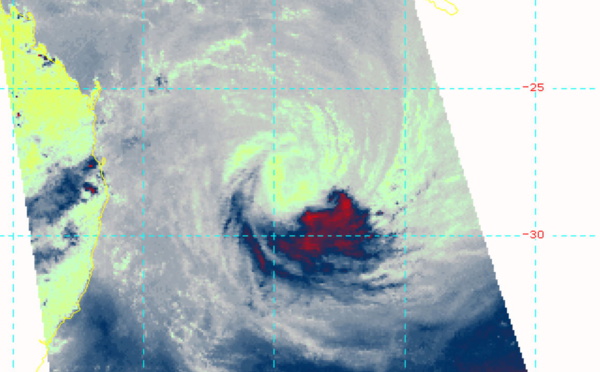
 ,Final Warning, peak intensity was 80knots ( CAT 1US)")

Les News
WESTERN PACIFIC:TY 07W(MEKKHALA) approaching OKINAWA while weakening/08W(HIGOS) to merge with 07W in approx 60h/Invest 95W//24@1030 UTC
06/24/2026
- PATRICK HOAREAU
WESTERN PACIFIC:Typhoon 07W(MEKKHALA) Rapid Intensification likely next 24h forecast Peak Intensity at CAT 4 US in 48h/ Invest 94W//21@1000 UTC
06/21/2026
- PATRICK HOAREAU
WESTERN PACIFIC: TS 07W(MEKKHALA) forecast to reach Typhoon Intensity by 24h, forecast to peak at CAT 3 US in 72h//20@1000 UTC
06/20/2026
- PATRICK HOAREAU
WESTERN PACIFIC: Invest 92W/ SOUTH PACIFIC: Invest 96P/3 Week Tropical Cyclone Formation Probability//17@1030 UTC
06/17/2026
- PATRICK HOAREAU
WESTERN PACIFIC: Invest 92W/SOUTH PACIFIC: Subtropical Storm 96P/EASTERN PACIFIC: Invest 93E//15@0730 UTC
06/15/2026
- PATRICK HOAREAU
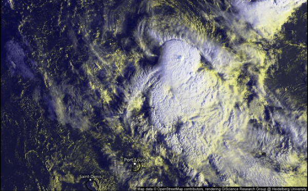
SOUTH INDIAN: Subtropical Storm 95S// 11/0900 UTC
06/11/2026
- PATRICK HOAREAU

Liens utiles
WESTERN PACIFIC:Typhoon 07W(MEKKHALA) Rapid Intensification likely next 24h forecast Peak Intensity at CAT 4 US in 48h/ Invest 94W//21@1000 UTC
WESTERN PACIFIC: TS 07W(MEKKHALA) forecast to reach Typhoon Intensity by 24h, forecast to peak at CAT 3 US in 72h//20@1000 UTC
WESTERN PACIFIC: Invest 92W/ SOUTH PACIFIC: Invest 96P/3 Week Tropical Cyclone Formation Probability//17@1030 UTC
WESTERN PACIFIC: Invest 92W/SOUTH PACIFIC: Subtropical Storm 96P/EASTERN PACIFIC: Invest 93E//15@0730 UTC
SOUTH INDIAN: Subtropical Storm 95S// 11/0900 UTC
S'identifier