


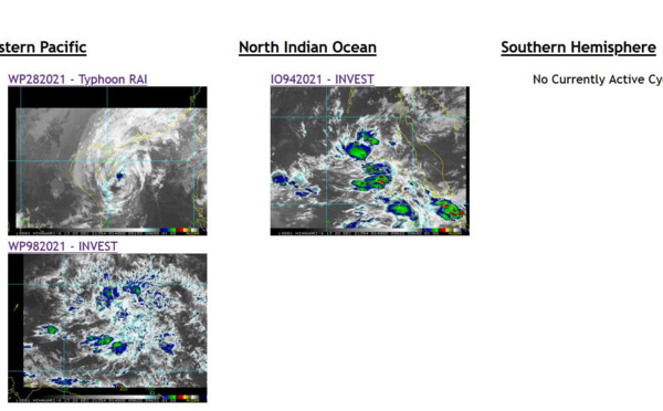
: Final Warning for an infamous cyclone! // Invest 94B: Medium// Invest 98W, 21/00utc")
 down 55knots in 24H, intensity to fall below 35knots in 36h// Invest 94B and Invest 98W, 20/03utc")
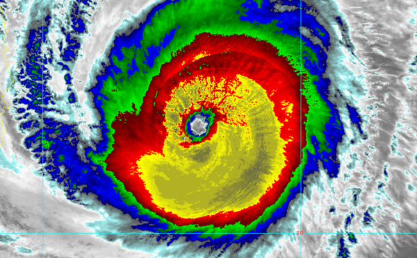
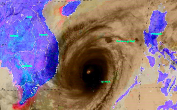
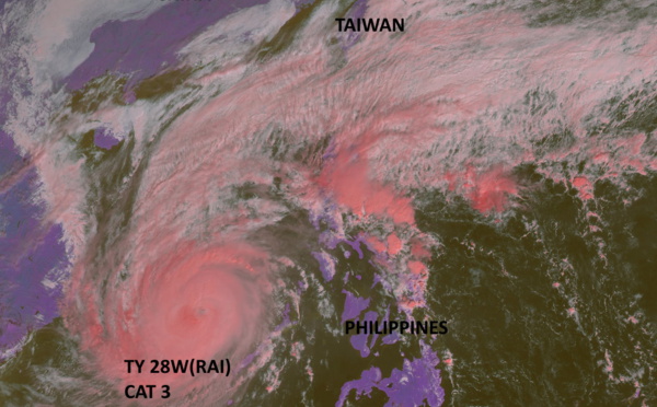
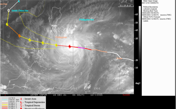
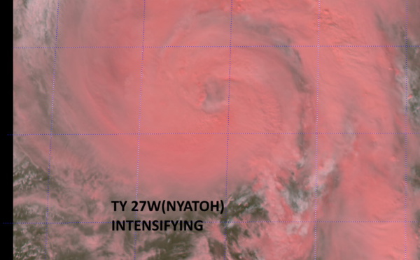
: making history over the South China Sea, 19/03utc")
 looking ominous once again as a powerful CAT 4// Invest 94B and Invest 96S, 18/15utc")
 once again a strong CAT 3 to the West of the Philippines// Invest 94B over the BOB, 18/03utc")
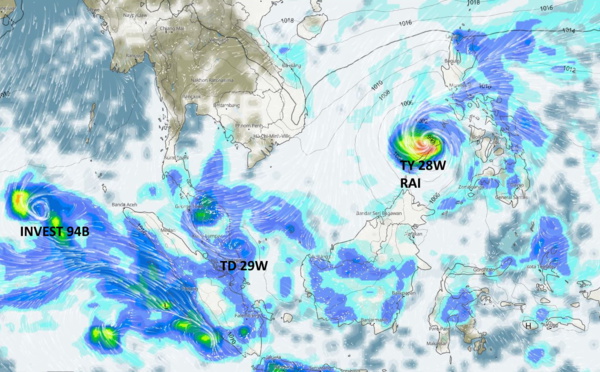
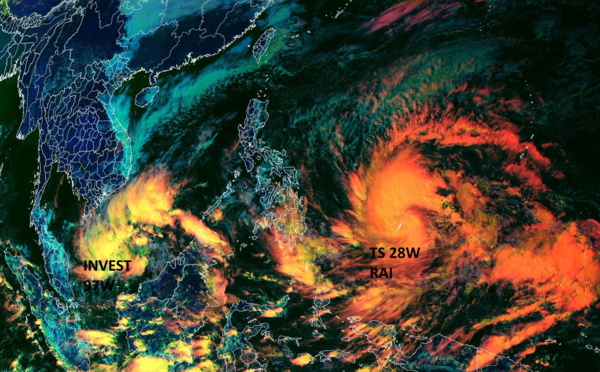
 to pass over Palawan within 12hours,2nd intensity peak forecast in 36hours//TD 29W short-lived Northwest of Singapore,17/03utc")
 crossing multiple islands and then Palawan within 24hours, 2nd intensity peak forecast over the SCS")
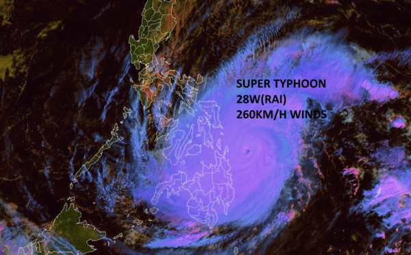
: explosive intensification from CAT 1 to CAT 5 over 24hours//Landfall imminent , 16/03utc")
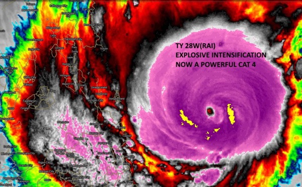
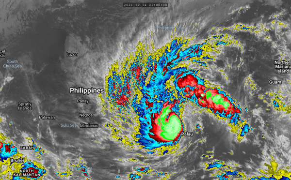
: extremely rapid intensification: now a powerful CAT 4, forecast to hit Surigao City as a formidable cyclone in 12/15hours,15/21utc")
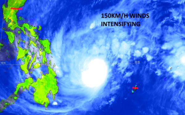
 intensifying, landfall over Surigao/Philippines by 18H, then tracking across the archipelago, peak intensity forecast in 72H, 15/15utc")
 now at Typhoon intensity, forecast to reach CAT 2 by 24hours, but rapid intensifcation still possible before crossing the Philippines,15/03utc")
: gradual then rapid intensification forecast to Typhoon/CAT 3 by 48hours ,clipping northern Mindanao//TC 03P(RUBY) update,14/09utc")
: peaking by 24H close to New Caledonia,13/03utc")
: forecast to reach US/CAT2 by 36H,12/09utc")


: Final Warning, 09/09utc")

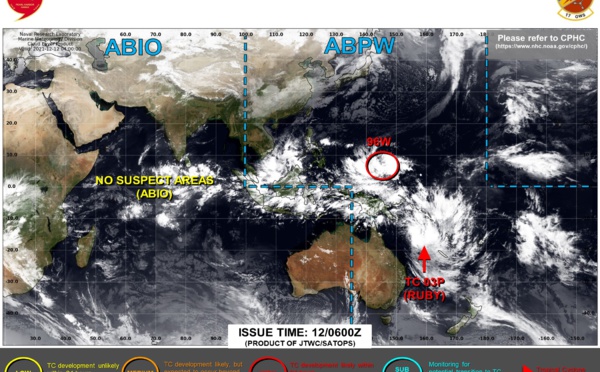
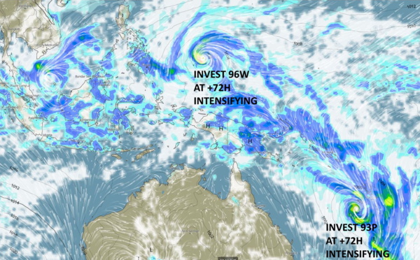
 making a come-back// Invest 95W and Invest 93P updates, 07/22h30utc, JTWC map up-dated at 08/06utc")
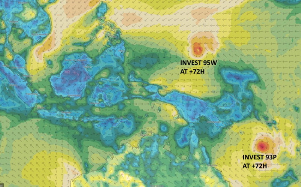
: possible new and short lease of life(TCFA)//Invest 95W: possible significant development beyond 5 days, 07/09utc")
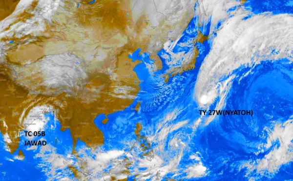
, remnants of TC 05B(JAWAD), 06/06utc updates")
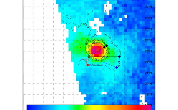
 re-analysed as a Super Typhoon. SMAP read winds near 125/130knots")
: deep convection being blown away// TC 05B(JAWAD) expected to intensify a bit next 24hours, 03/15utc")
: smap validates 125knot intensity(CAT 4): expected dramatic weakening next 48h// TC 05B develops over the BOB,03/03utc")
 now a Typhoon/CAT 3 will peak within 12 hours: CAT 4 possible// Invest 94W still high over the BOB")
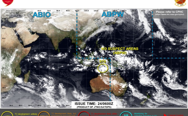
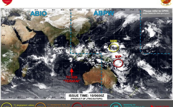
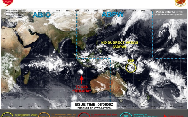
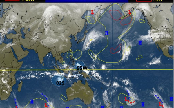
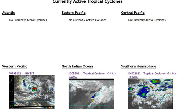
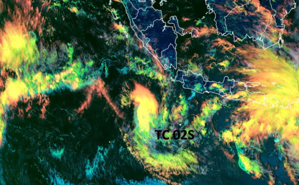
 to peak within 12/18hours before being decapitated//Invest 94W: now High over the BOB// TC 02S(TERATAI): Final Warning,02/03utc")

Les News
WESTERN PACIFIC:TY 07W(MEKKHALA) approaching OKINAWA while weakening/08W(HIGOS) to merge with 07W in approx 60h/Invest 95W//24@1030 UTC
06/24/2026
- PATRICK HOAREAU
WESTERN PACIFIC:Typhoon 07W(MEKKHALA) Rapid Intensification likely next 24h forecast Peak Intensity at CAT 4 US in 48h/ Invest 94W//21@1000 UTC
06/21/2026
- PATRICK HOAREAU
WESTERN PACIFIC: TS 07W(MEKKHALA) forecast to reach Typhoon Intensity by 24h, forecast to peak at CAT 3 US in 72h//20@1000 UTC
06/20/2026
- PATRICK HOAREAU
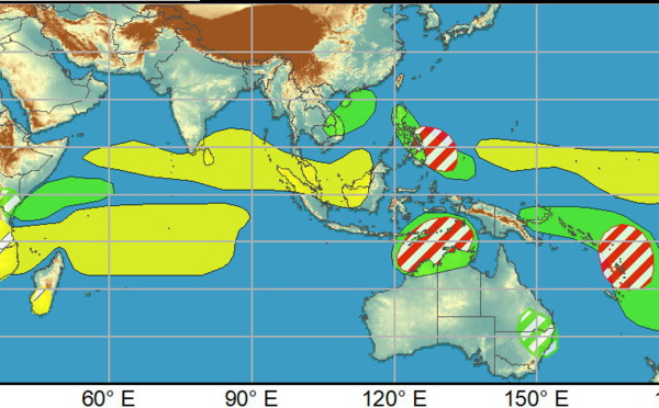
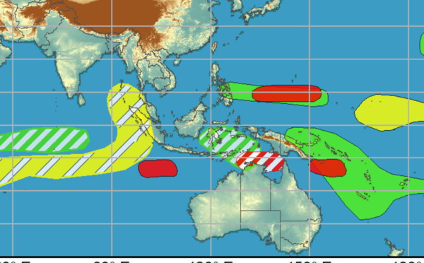
WESTERN PACIFIC: Invest 92W/ SOUTH PACIFIC: Invest 96P/3 Week Tropical Cyclone Formation Probability//17@1030 UTC
06/17/2026
- PATRICK HOAREAU
WESTERN PACIFIC: Invest 92W/SOUTH PACIFIC: Subtropical Storm 96P/EASTERN PACIFIC: Invest 93E//15@0730 UTC
06/15/2026
- PATRICK HOAREAU
SOUTH INDIAN: Subtropical Storm 95S// 11/0900 UTC
06/11/2026
- PATRICK HOAREAU

Liens utiles
WESTERN PACIFIC:Typhoon 07W(MEKKHALA) Rapid Intensification likely next 24h forecast Peak Intensity at CAT 4 US in 48h/ Invest 94W//21@1000 UTC
WESTERN PACIFIC: TS 07W(MEKKHALA) forecast to reach Typhoon Intensity by 24h, forecast to peak at CAT 3 US in 72h//20@1000 UTC
WESTERN PACIFIC: Invest 92W/ SOUTH PACIFIC: Invest 96P/3 Week Tropical Cyclone Formation Probability//17@1030 UTC
WESTERN PACIFIC: Invest 92W/SOUTH PACIFIC: Subtropical Storm 96P/EASTERN PACIFIC: Invest 93E//15@0730 UTC
SOUTH INDIAN: Subtropical Storm 95S// 11/0900 UTC
S'identifier