Menu

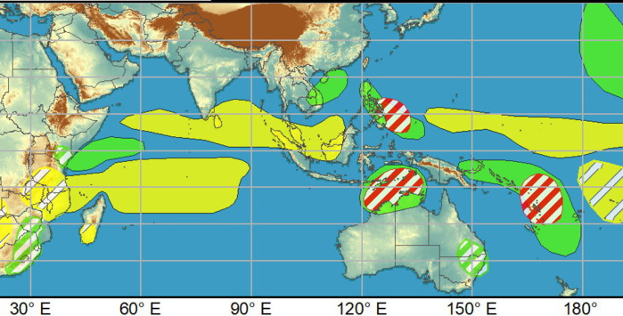
2 WEEK CYCLONIC DEVELOPMENT POTENTIAL: TC development possible: Southeast Indian , Southwest Pacific, Philippine Sea, 12/21


WEEK 1: DEC 22/28

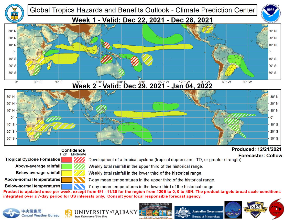
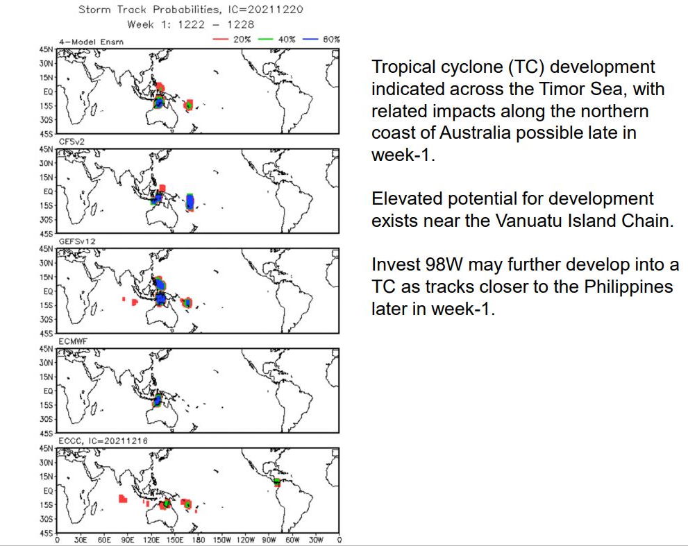
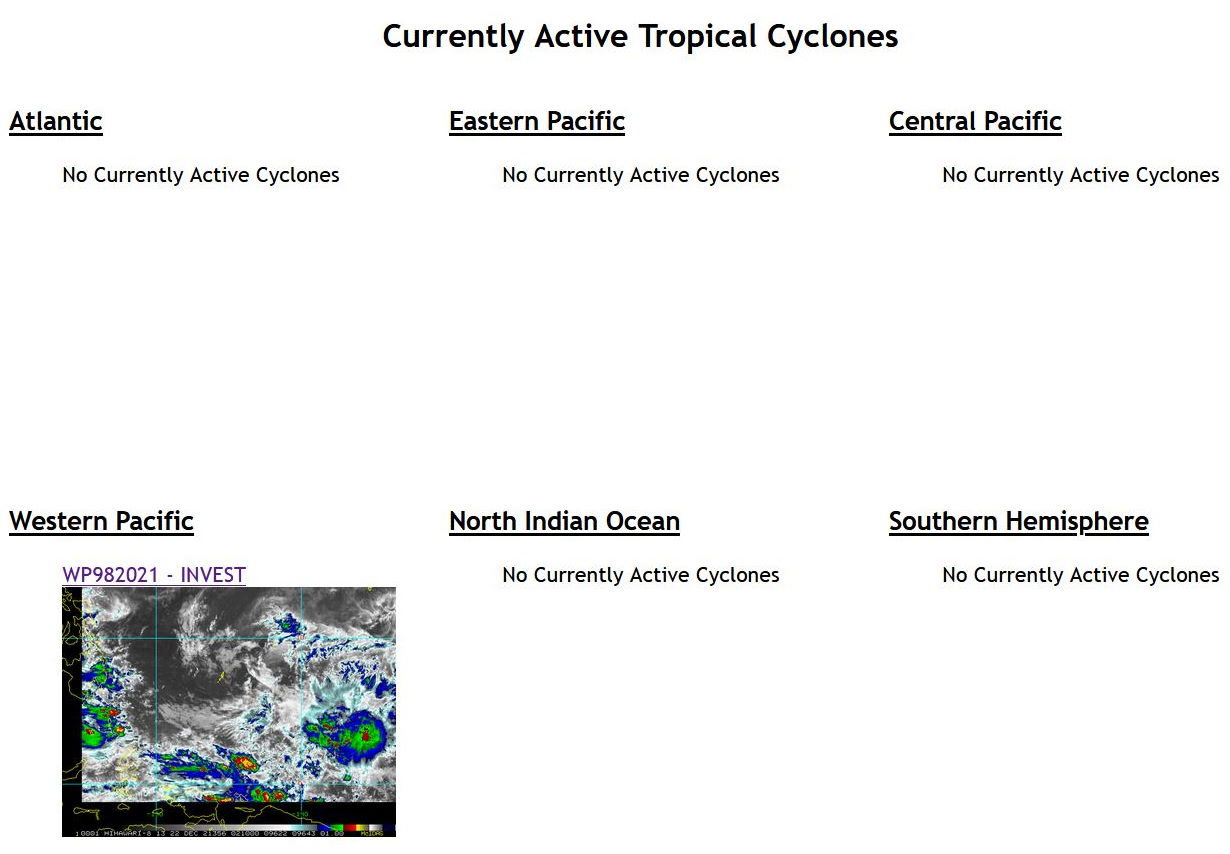
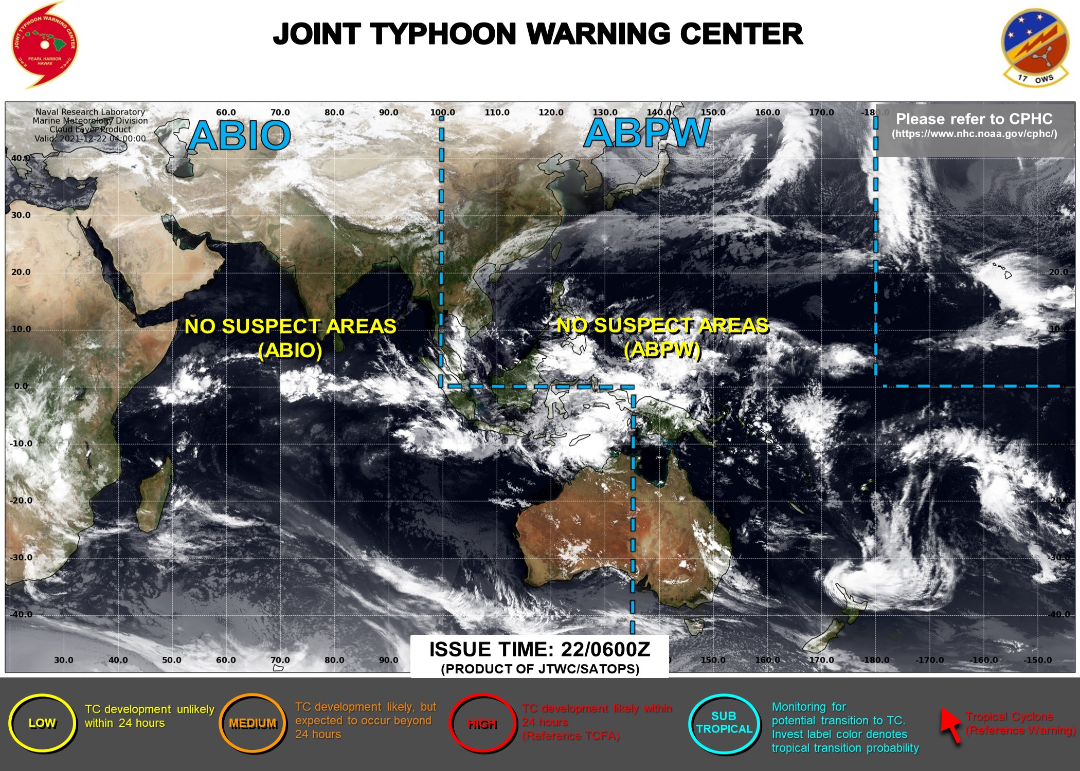
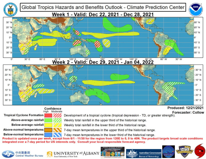
The tropics remain modestly active across the Western Pacific, on each side of the equator. Tropical depression 28W (formerly Rai) is located off the coast of southeast China and is forecast to become a remnant low. Tropical Depression 29W developed on 12/16 just to the east of Malaysia and made landfall the same day. Although the system did not maintain tropical characterics once it reemerged into the Malacca Strait, it brought severe flooding to Central Malaysia as it crossed the peninsula.  Additional tropical cyclone (TC) development is possible over the Southern Indian Ocean and South Pacific during week-1, with moderate confidence areas depicted over the Timor Sea, to the north of Australia, and near the Vanuatu island chain. The system over the Timor Sea has the potential to impact portions of the Kimberley Coast of Australia later in week-1. Invest 98W is also being monitored over the Western Pacific, which may develop into a TC as it approaches the Philippines later in week-1 (moderate confidence) as indicated by the GEFS and CFS ensembles. NOAA.
The tropics remain modestly active across the Western Pacific, on each side of the equator. Tropical depression 28W (formerly Rai) is located off the coast of southeast China and is forecast to become a remnant low. Tropical Depression 29W developed on 12/16 just to the east of Malaysia and made landfall the same day. Although the system did not maintain tropical characterics once it reemerged into the Malacca Strait, it brought severe flooding to Central Malaysia as it crossed the peninsula. Additional tropical cyclone (TC) development is possible over the Southern Indian Ocean and South Pacific during week-1, with moderate confidence areas depicted over the Timor Sea, to the north of Australia, and near the Vanuatu island chain. The system over the Timor Sea has the potential to impact portions of the Kimberley Coast of Australia later in week-1. Invest 98W is also being monitored over the Western Pacific, which may develop into a TC as it approaches the Philippines later in week-1 (moderate confidence) as indicated by the GEFS and CFS ensembles. NOAA.

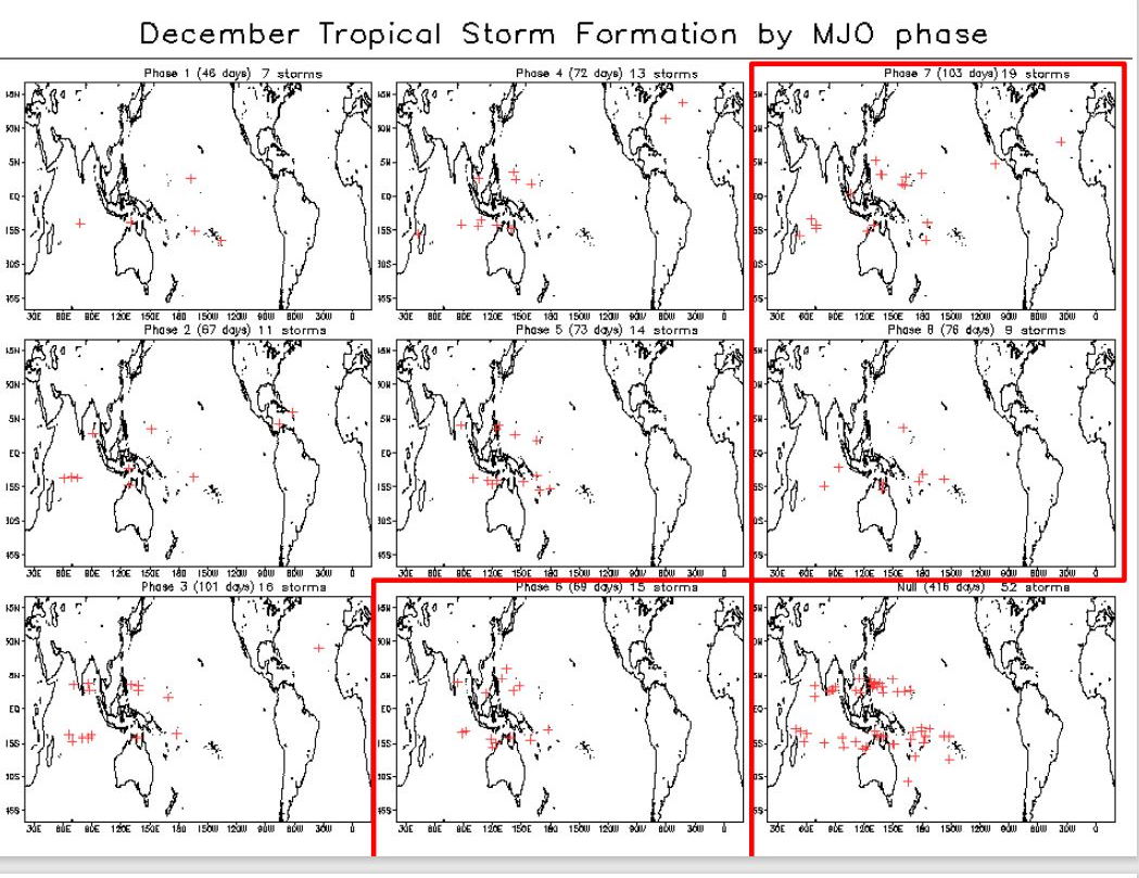
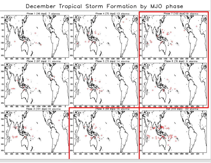
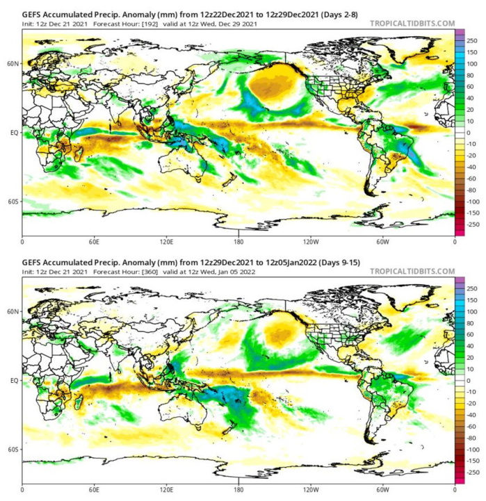
The Madden Julian Oscillation (MJO) remains active across the Western Pacific, however, the amplitude of the intraseasonal signal has decreased compared to last week, in part due to destructive interference with Rossby Wave activity and the low frequency La Nina base state. Chances are decreasing that the MJO will be able to propagate much further to the east, with the GEFS and ECMWF ensembles depicting a nearly stationary MJO in RMM phase 7 for the next 2 weeks, although there is large ensemble spread regarding its amplitude. Additionally, the low level westerly wind burst that was observed across the Western Pacific in early December has weakened, suggestive of decreased MJO propagation.  The tropics remain modestly active across the Western Pacific, on each side of the equator. Tropical depression 28W (formerly Rai) is located off the coast of southeast China and is forecast to become a remnant low. Tropical Depression 29W developed on 12/16 just to the east of Malaysia and made landfall the same day. Although the system did not maintain tropical characterics once it reemerged into the Malacca Strait, it brought severe flooding to Central Malaysia as it crossed the peninsula.  Additional tropical cyclone (TC) development is possible over the Southern Indian Ocean and South Pacific during week-1, with moderate confidence areas depicted over the Timor Sea, to the north of Australia, and near the Vanuatu island chain. The system over the Timor Sea has the potential to impact portions of the Kimberley Coast of Australia later in week-1. Invest 98W is also being monitored over the Western Pacific, which may develop into a TC as it approaches the Philippines later in week-1 (moderate confidence) as indicated by the GEFS and CFS ensembles.  The precipitation outlook during the next two weeks is based on a consensus of GEFS, CFS, and ECMWF guidance, and most likely TC tracks. There is high confidence for heavy precipitation along the west coast of the contiguous U.S. due to a high amplitude trough over the East Pacific and associated enhanced moisture flow. The Weather Prediction Center indicates 3-6 inches of liquid equivalent precipitation over the parts of California during week-1. Surface low pressure over the Central Pacific is likely to bring above normal rainfall to the Hawaiian Islands during the next 2 weeks. There is a robust wet signal across portions of the southwest Pacific, consistent with the current MJO phase. Dry conditions are favored across the Indian Ocean, in the wake of the departing MJO, and also across much of the equatorial Pacific, resulting from La Nina conditions.  For hazardous weather concerns during the next two weeks across the U.S., please refer to your local NWS Forecast Office, the Weather Prediction Center's Medium Range Hazards Forecast, and CPC's Week-2 Hazards Outlook. Forecasts over Africa are made in consultation with the International Desk at CPC and can represent local-scale conditions in addition to global scale variability. NOAA.
The Madden Julian Oscillation (MJO) remains active across the Western Pacific, however, the amplitude of the intraseasonal signal has decreased compared to last week, in part due to destructive interference with Rossby Wave activity and the low frequency La Nina base state. Chances are decreasing that the MJO will be able to propagate much further to the east, with the GEFS and ECMWF ensembles depicting a nearly stationary MJO in RMM phase 7 for the next 2 weeks, although there is large ensemble spread regarding its amplitude. Additionally, the low level westerly wind burst that was observed across the Western Pacific in early December has weakened, suggestive of decreased MJO propagation. The tropics remain modestly active across the Western Pacific, on each side of the equator. Tropical depression 28W (formerly Rai) is located off the coast of southeast China and is forecast to become a remnant low. Tropical Depression 29W developed on 12/16 just to the east of Malaysia and made landfall the same day. Although the system did not maintain tropical characterics once it reemerged into the Malacca Strait, it brought severe flooding to Central Malaysia as it crossed the peninsula. Additional tropical cyclone (TC) development is possible over the Southern Indian Ocean and South Pacific during week-1, with moderate confidence areas depicted over the Timor Sea, to the north of Australia, and near the Vanuatu island chain. The system over the Timor Sea has the potential to impact portions of the Kimberley Coast of Australia later in week-1. Invest 98W is also being monitored over the Western Pacific, which may develop into a TC as it approaches the Philippines later in week-1 (moderate confidence) as indicated by the GEFS and CFS ensembles. The precipitation outlook during the next two weeks is based on a consensus of GEFS, CFS, and ECMWF guidance, and most likely TC tracks. There is high confidence for heavy precipitation along the west coast of the contiguous U.S. due to a high amplitude trough over the East Pacific and associated enhanced moisture flow. The Weather Prediction Center indicates 3-6 inches of liquid equivalent precipitation over the parts of California during week-1. Surface low pressure over the Central Pacific is likely to bring above normal rainfall to the Hawaiian Islands during the next 2 weeks. There is a robust wet signal across portions of the southwest Pacific, consistent with the current MJO phase. Dry conditions are favored across the Indian Ocean, in the wake of the departing MJO, and also across much of the equatorial Pacific, resulting from La Nina conditions. For hazardous weather concerns during the next two weeks across the U.S., please refer to your local NWS Forecast Office, the Weather Prediction Center's Medium Range Hazards Forecast, and CPC's Week-2 Hazards Outlook. Forecasts over Africa are made in consultation with the International Desk at CPC and can represent local-scale conditions in addition to global scale variability. NOAA.
 Issued at 21/1830UTC by NOAA.
In collaboration with the JTWC and several well known organizations.

 Archives: HERE

CLICK ON THE IMAGERY BELOW TO GET IT ENLARGED.


CLICK ON THE IMAGERY BELOW TO GET IT ENLARGED.


CLICK ON THE IMAGERY BELOW TO GET IT ENLARGED.


21/0210UTC.
21/0210UTC.


Rédigé par PATRICK HOAREAU le Wednesday, December 22nd 2021 à 06:35