Menu

2 WEEK CYCLONIC DEVELOPMENT POTENTIAL: MJO= likely TC development : West Pacific, Southwest Pacific, near northern Australia through mid-December


WEEK 1: DEC 8 TO DEC 14.
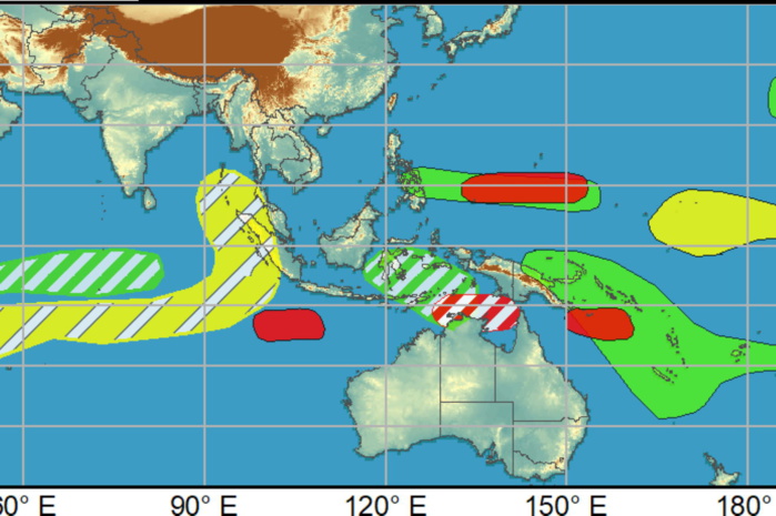
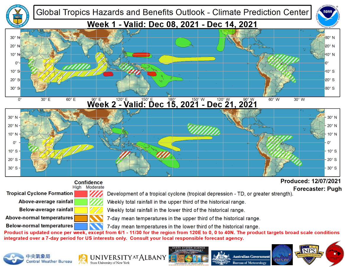
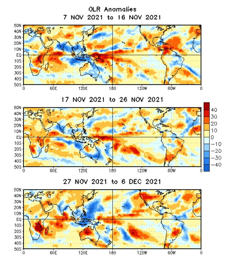
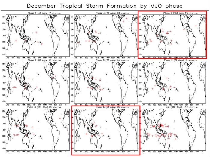
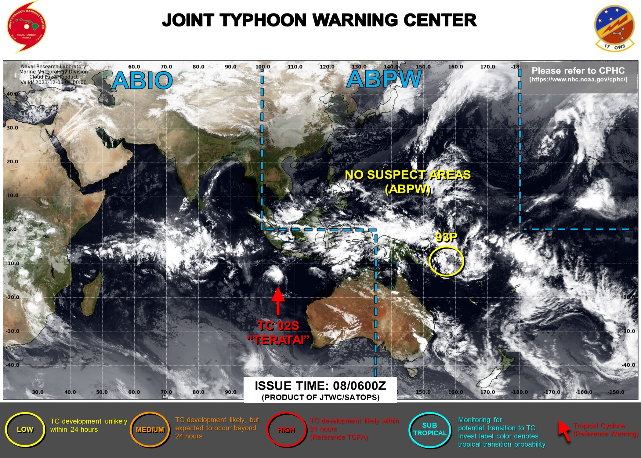
Tropical Cyclone (TC) Jawad developed over the northern Bay of Bengal on Dec 2 and tracked westward into northeast India. Although TC Jawad remained relatively weak, it resulted in heavy rainfall (locally more than 100 mm) in the coastal areas of the Odisha province of India. A short-lived TC formed on Dec 1 to the south of Java, and according to the Joint Typhoon Warning Center, TC development is imminent in this same area. The MJO is likely to provide a favorable large-scale environment, including enhanced convection and reduced wind shear, for TC development across the West Pacific, Southwest Pacific, and near northern Australia through mid-December. The GFS and ECMWF models are in excellent agreement for TC genesis near 10N/140E over the West Pacific during week-1 with a westward track across the southern Philippines and into the South China Sea by week-2. Model guidance is also in excellent agreement for TC development across the Coral Sea early in week-1 with this predicted TC to potentially affect New Caledonia. Based on recent model solutions and the MJO, an increased chance of TC formation continues over the South Pacific through week-2. Although the GFS and ECMWF models on Dec 7 have backed off on TC genesis near northern Australia, moderate confidence for TC development is posted for the Arafura Sea (week-1) and the Kimberley Coast (week-2), based on previous model guidance along with MJO composites for phases 6 and 7. NOAA.
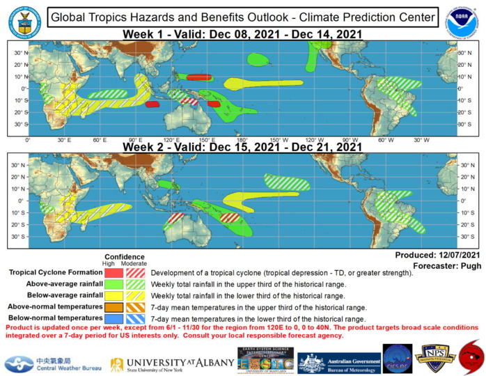

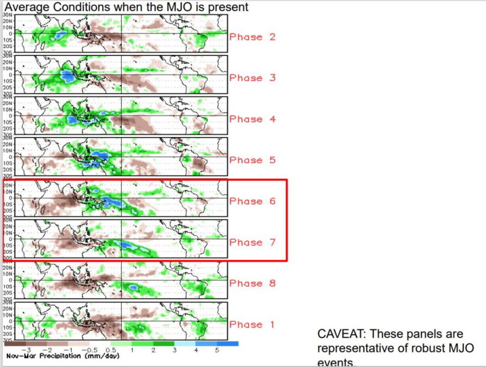
The precipitation outlook during the next two weeks is based on a consensus of GEFS, CFS, and ECMWF guidance, MJO composites for phases 6 and 7, and most likely TC tracks. Forecast confidence for above average rainfall is the highest along the SPCZ and a continuation of a wet pattern is expected to persist near or over the Hawaiian Islands through week-2. An amplified 500-hPa trough is forecast to interact with an enhanced subtropical jet and likely result in above average rainfall along the entire west coast of the U.S. during week-1. The predicted MJO evolution would favor higher latitude blocking over the Northern Hemisphere and anomalous cold overspreading the central CONUS later in week-2. Although model solutions in previous days were depicting a persistent positive Arctic Oscillation pattern, the ECMWF and Canadian ensemble means on Dec 7 are beginning to feature a bridging of positive 500-hPa height anomalies between the Bering Strait and Scandinavia. If this solution verifies and more high latitude blocking develops, then chances for anomalous cold to shift south into the north-central CONUS would increase during late December.  For hazardous weather concerns during the next two weeks across the U.S., please refer to your local NWS Forecast Office, the Weather Prediction Center's Medium Range Hazards Forecast, and CPC's Week-2 Hazards Outlook. Forecasts over Africa are made in consultation with the International Desk at CPC and can represent local-scale conditions in addition to global scale variability. NOAA
The precipitation outlook during the next two weeks is based on a consensus of GEFS, CFS, and ECMWF guidance, MJO composites for phases 6 and 7, and most likely TC tracks. Forecast confidence for above average rainfall is the highest along the SPCZ and a continuation of a wet pattern is expected to persist near or over the Hawaiian Islands through week-2. An amplified 500-hPa trough is forecast to interact with an enhanced subtropical jet and likely result in above average rainfall along the entire west coast of the U.S. during week-1. The predicted MJO evolution would favor higher latitude blocking over the Northern Hemisphere and anomalous cold overspreading the central CONUS later in week-2. Although model solutions in previous days were depicting a persistent positive Arctic Oscillation pattern, the ECMWF and Canadian ensemble means on Dec 7 are beginning to feature a bridging of positive 500-hPa height anomalies between the Bering Strait and Scandinavia. If this solution verifies and more high latitude blocking develops, then chances for anomalous cold to shift south into the north-central CONUS would increase during late December. For hazardous weather concerns during the next two weeks across the U.S., please refer to your local NWS Forecast Office, the Weather Prediction Center's Medium Range Hazards Forecast, and CPC's Week-2 Hazards Outlook. Forecasts over Africa are made in consultation with the International Desk at CPC and can represent local-scale conditions in addition to global scale variability. NOAA
 Issued at 07/1830UTC by NOAA.
In collaboration with the JTWC and several well known organizations.

 Archives: HERE


Rédigé par PATRICK HOAREAU le Wednesday, December 8th 2021 à 11:20