
 slowly intensifying but rapid intensification possible next 4 days")
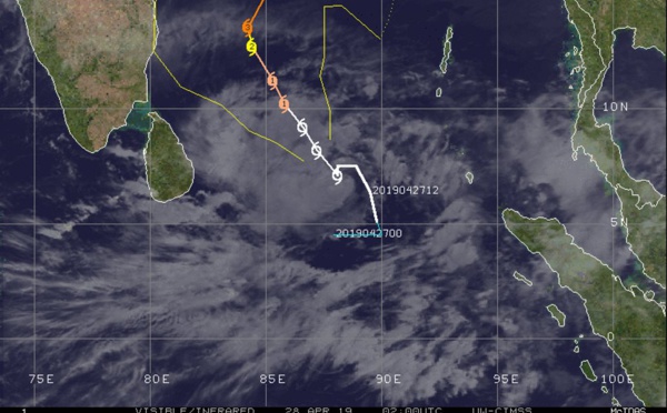
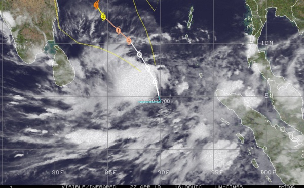
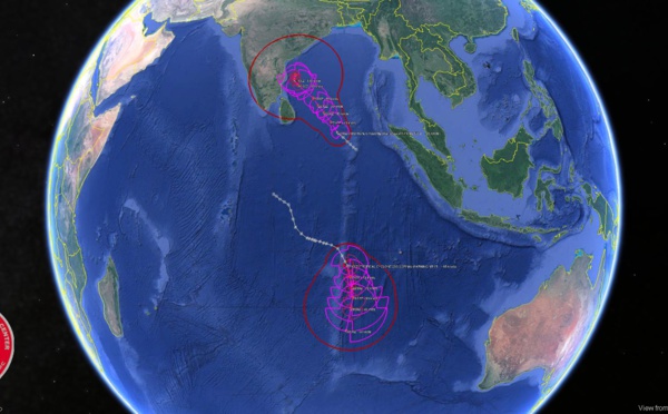
 over open seas")
: significant weakening forecast after 12hours")
 category 1 intensity to peak next 24hours")
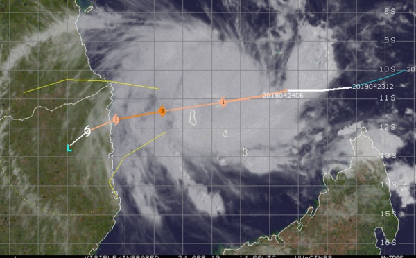
: category 1 US, recent signs of intensification, remaining over open seas")
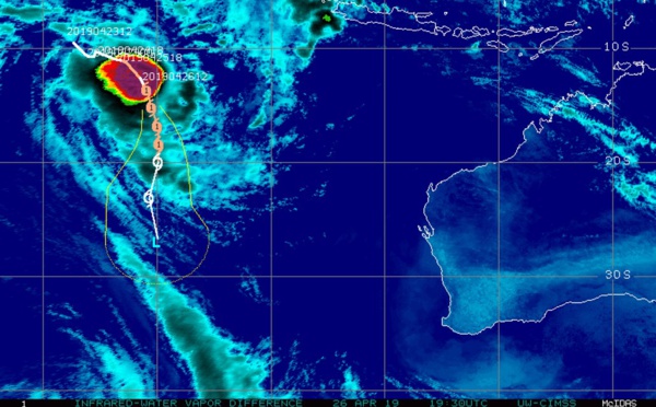
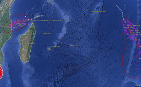
 reached maximum intensity of 125knots, category 4 US, a remarkable cyclone across the northern MOZ Channel")
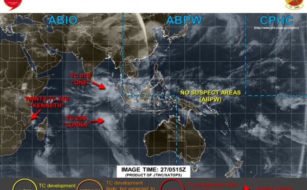
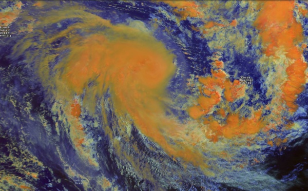
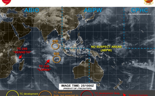
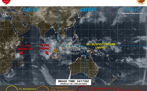
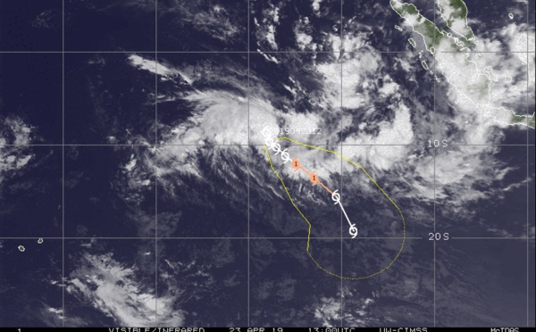
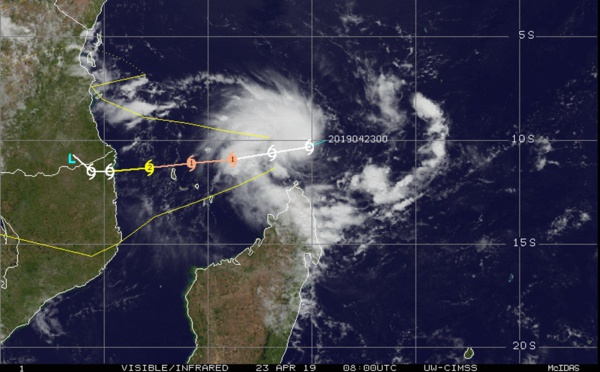
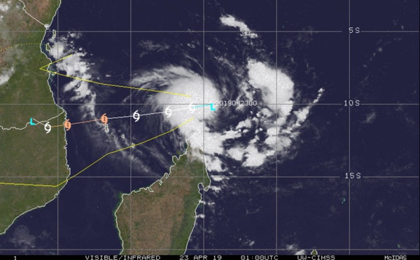
: TC LORNA(25S) category 1 US, shear limiting intensification")
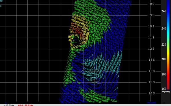

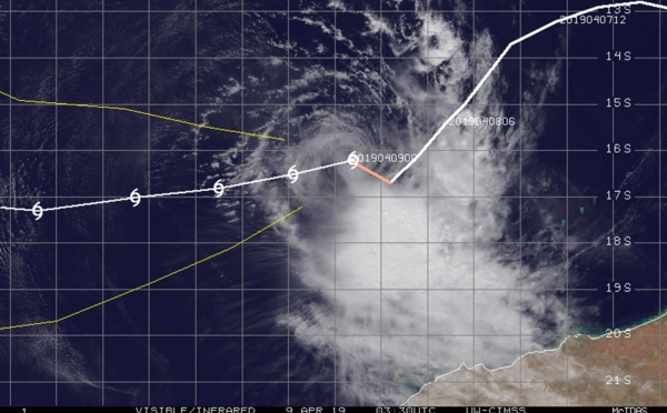
: TC LORNA(25S) now category 1 US, intensifying over open seas")
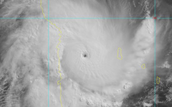
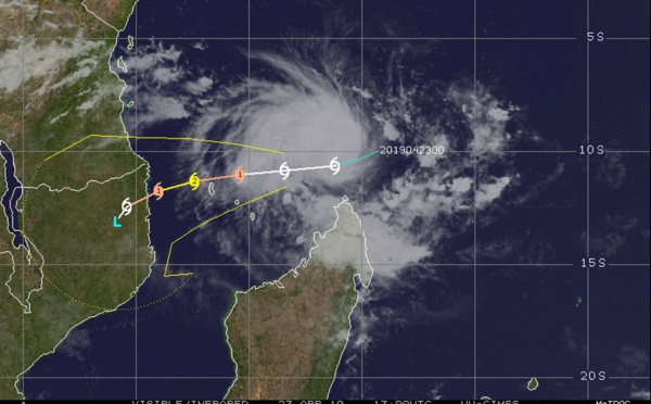
, category 4 US making landfall 30km north of Quisanga/Mozambique")
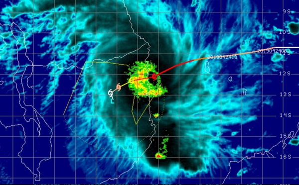


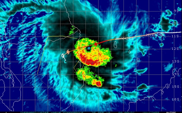
 powerful and compact cateogry 4 US, forecast to weaken slightly,landfall before 24h near Quiterajo/Mozambique")
 after 48hours")
 now category 3 US, tracking 15/20km north of Grande Comore, still intensifying, approaching Mozambique")
 forecast to intensify to category 1 US in 36hours with some interaction with developing 92S possible in 72h")
 category 1 US, intensifying and tracking very close to Grande Comore within the next 6/12hours")
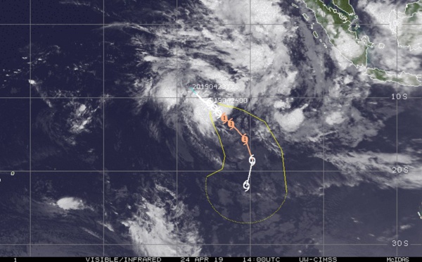
 intensifying and heading for Grande Comore/ TC LORNA(25S): slowly intensifying over open waters")

 intensifying and potential direct threat to Grande Comore. TC LORNA(25S) over open seas")

 forecast to peak as a category 2 US in 48hours, potential direct threat to Grande Comore")


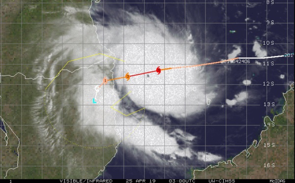
: intensity forecast to fall below 35knots in 36hours(maybe sooner)")
 fleetingly analyzed at 65knots(category 1 US) is now collapsing under vertical wind shear")
Les News
WESTERN PACIFIC:TY 07W(MEKKHALA) approaching OKINAWA while weakening/08W(HIGOS) to merge with 07W in approx 60h/Invest 95W//24@1030 UTC
06/24/2026
- PATRICK HOAREAU
WESTERN PACIFIC:Typhoon 07W(MEKKHALA) Rapid Intensification likely next 24h forecast Peak Intensity at CAT 4 US in 48h/ Invest 94W//21@1000 UTC
06/21/2026
- PATRICK HOAREAU
WESTERN PACIFIC: TS 07W(MEKKHALA) forecast to reach Typhoon Intensity by 24h, forecast to peak at CAT 3 US in 72h//20@1000 UTC
06/20/2026
- PATRICK HOAREAU
WESTERN PACIFIC: Invest 92W/ SOUTH PACIFIC: Invest 96P/3 Week Tropical Cyclone Formation Probability//17@1030 UTC
06/17/2026
- PATRICK HOAREAU
WESTERN PACIFIC: Invest 92W/SOUTH PACIFIC: Subtropical Storm 96P/EASTERN PACIFIC: Invest 93E//15@0730 UTC
06/15/2026
- PATRICK HOAREAU
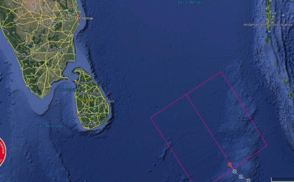
SOUTH INDIAN: Subtropical Storm 95S// 11/0900 UTC
06/11/2026
- PATRICK HOAREAU

Liens utiles
WESTERN PACIFIC:Typhoon 07W(MEKKHALA) Rapid Intensification likely next 24h forecast Peak Intensity at CAT 4 US in 48h/ Invest 94W//21@1000 UTC
WESTERN PACIFIC: TS 07W(MEKKHALA) forecast to reach Typhoon Intensity by 24h, forecast to peak at CAT 3 US in 72h//20@1000 UTC
WESTERN PACIFIC: Invest 92W/ SOUTH PACIFIC: Invest 96P/3 Week Tropical Cyclone Formation Probability//17@1030 UTC
WESTERN PACIFIC: Invest 92W/SOUTH PACIFIC: Subtropical Storm 96P/EASTERN PACIFIC: Invest 93E//15@0730 UTC
SOUTH INDIAN: Subtropical Storm 95S// 11/0900 UTC
S'identifier