
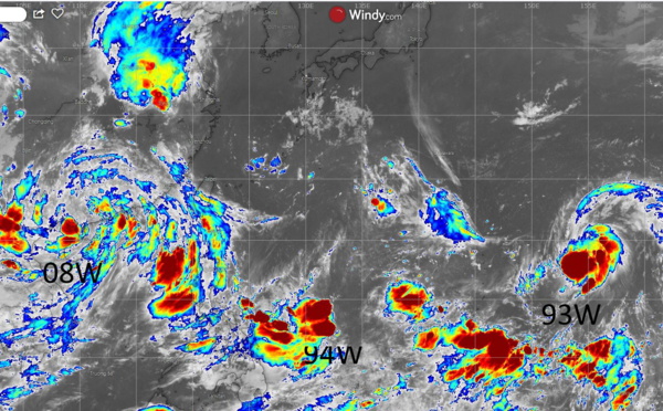
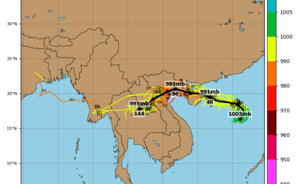
 forecast to dissipate near Hanoi in 36h. 09W: slowly intensifying")
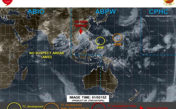
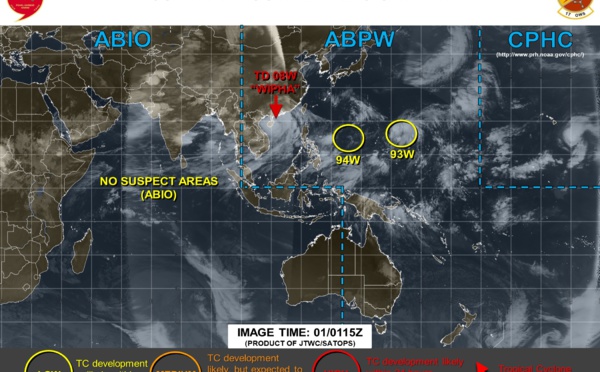
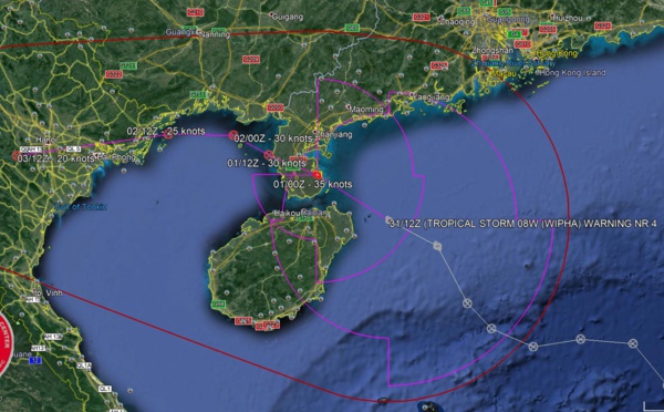
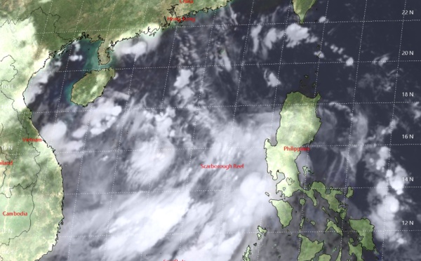
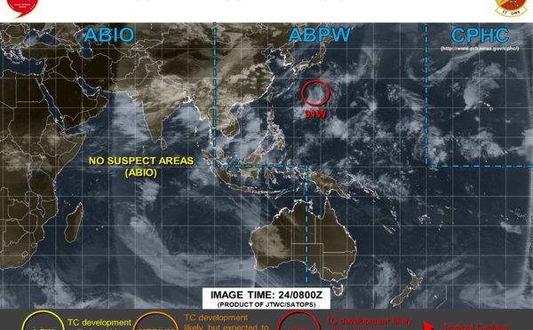
:over the Leizhou Peninsula,Tropical Cyclone Formation Alert issued for 93W")
: near the Leizhou Peninsula, Invest 93W upgraded to MEDIUM")

 passing over the Leizhou Peninsula, struggling intensity")
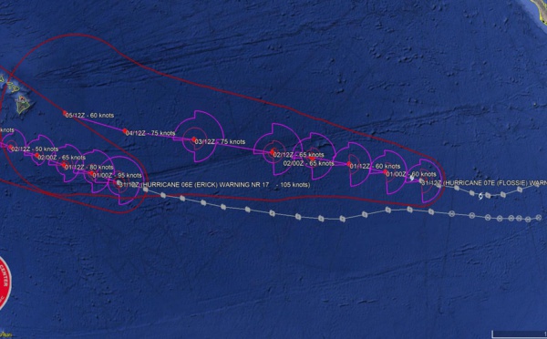
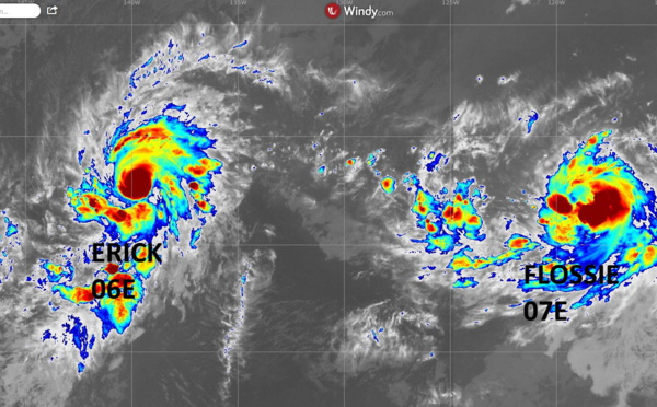
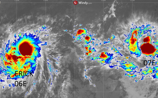
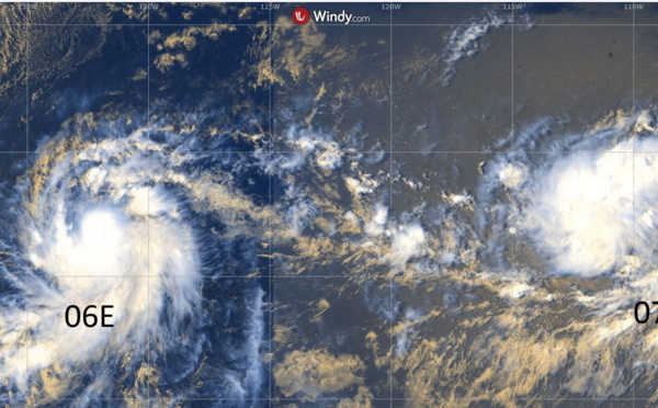
 still a major hurricane, FLOSSIE(07E) not so much")
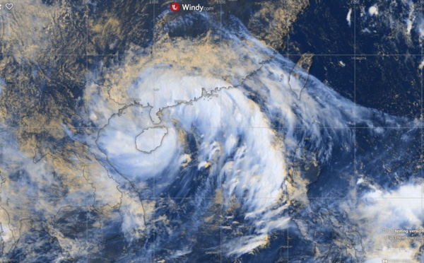
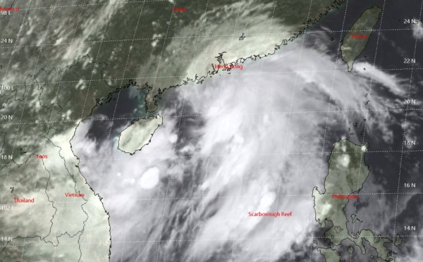
![TS WIPHA(08W): over the Leizhou Peninsula in approx 12hours [sat animation]](https://www.meteo974.re/photo/art/large_16_9/36071290-32380828.jpg?v=1564588178 "TS WIPHA(08W): over the Leizhou Peninsula in approx 12hours [sat animation]")
, top category 3 US, intensity to fall below 65knots in 48hours")
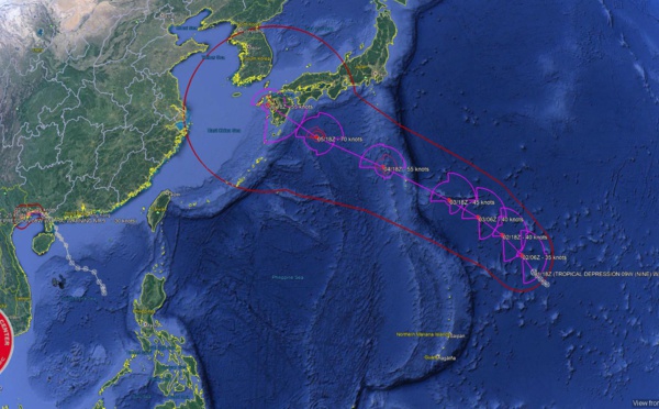
 will be entering the Gulf of Tonkin in approx 24hours")
, powerful category 4 US, expected to weaken rapidly after 36hours")
 reaching peak intensity close to Hainan")
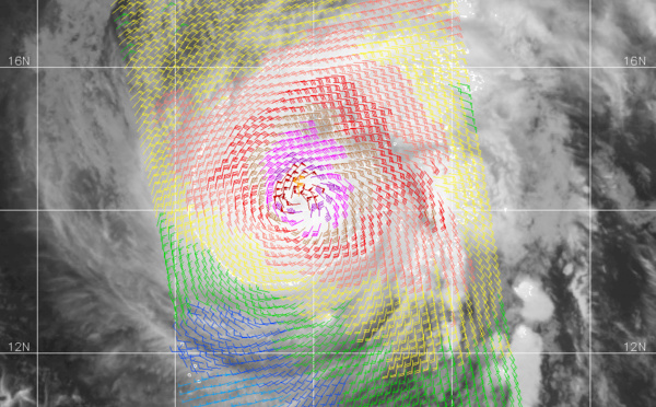
 category 3 US,intensity to peak within 24hours (satellite animation included)")
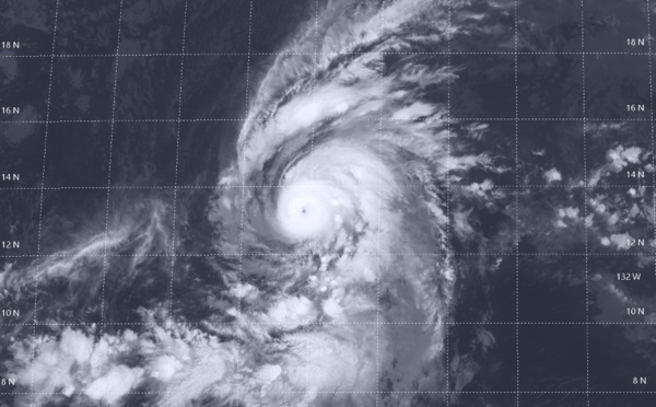
 now a category 1 US, peaking in 36hours, followed by FLOSSIE(07E)")


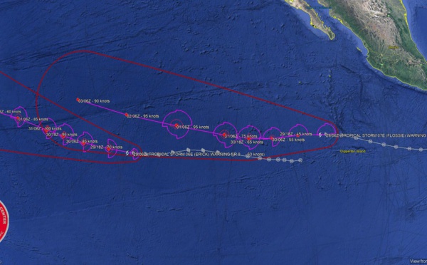
 forecast to intensify rapidly next 48h up to Category 3 US")
 is forecast to intensify to Category 2 US in 72hours")
 is making landfall and will be rapidly decaying")
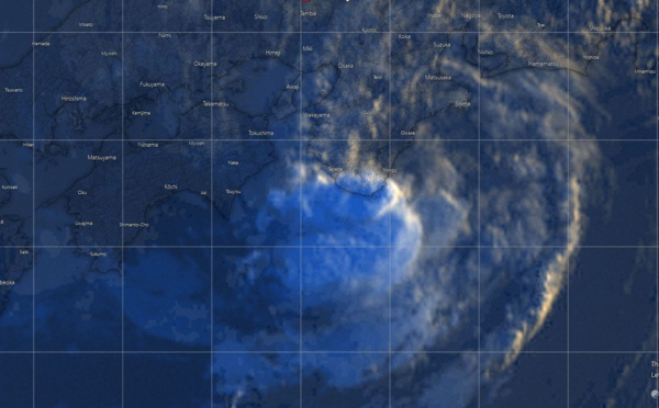
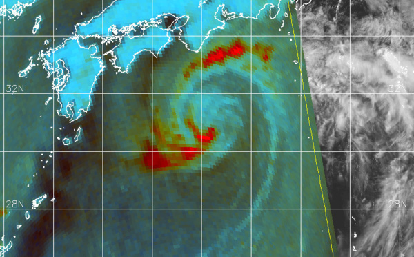
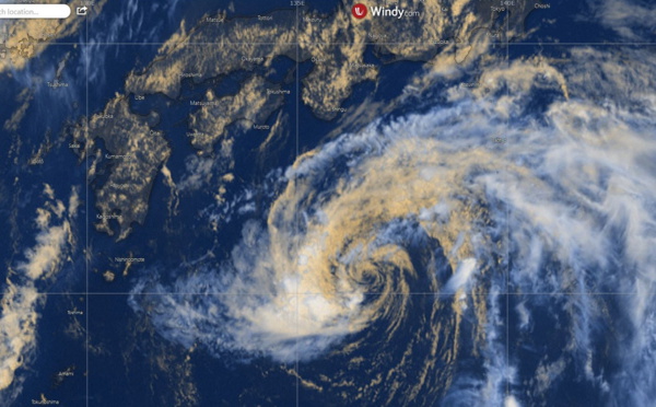
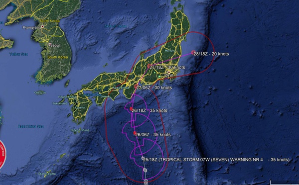
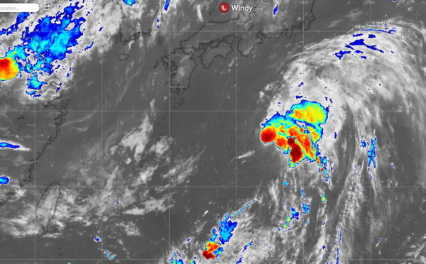
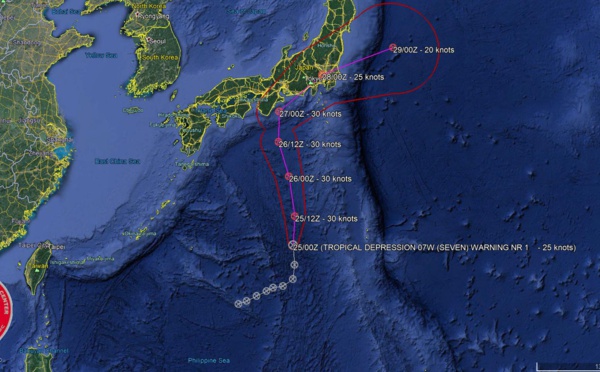
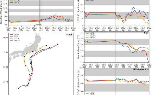
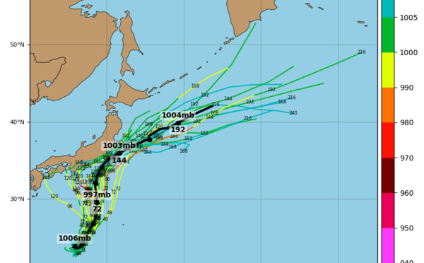
 near landfall in Honshu/Japan as a weak tropical storm")
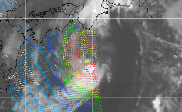
 is forecast to weaken over Japan after 18hours")


Les News
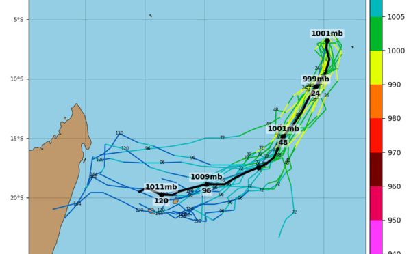
TC 23S(HIDAYA) peaked at 80 knots/CAT 1 US A NEW RECORD AS THE MOST INTENSE TC IN THIS REGION//0315utc
05/03/2024
- PATRICK HOAREAU
INVEST 90S Tropical Cyclone Formation Alert//ECMWF 10 Day Storm Tracks//3 Week TC Formation Probability//0103utc
05/01/2024
- PATRICK HOAREAU
ECMWF 10 Day Storm Tracks// 3Week TC Formation Probability// 2403utc
04/24/2024
- PATRICK HOAREAU
TC 22P(PAUL)// Remnants of TC 21S(OLGA)// ECMWF 10 Day Storm Tracks// 1103utc
04/11/2024
- PATRICK HOAREAU
TC 21S(OLGA) SAR reveals still a bit stronger than expected// INVEST 97P// ECMWF 10 Day Storm Traccks// 0903utc
04/09/2024
- PATRICK HOAREAU
TC 21S(OLGA) peaked as a powerful CAT 4 US// ECMWF 10 Day Storm Tracks// 0803utc
04/08/2024
- PATRICK HOAREAU

Liens utiles
INVEST 90S Tropical Cyclone Formation Alert//ECMWF 10 Day Storm Tracks//3 Week TC Formation Probability//0103utc
ECMWF 10 Day Storm Tracks// 3Week TC Formation Probability// 2403utc
TC 22P(PAUL)// Remnants of TC 21S(OLGA)// ECMWF 10 Day Storm Tracks// 1103utc
TC 21S(OLGA) SAR reveals still a bit stronger than expected// INVEST 97P// ECMWF 10 Day Storm Traccks// 0903utc
TC 21S(OLGA) peaked as a powerful CAT 4 US// ECMWF 10 Day Storm Tracks// 0803utc
S'identifier