
 near peak intensity, forecast to weaken rather rapidly after 24hours")

 short period of intensification forecast before environment degrades")
 is slowly intensifying but forecast to weaken after 36hours as environment degrades")
 is forecast to briefly intensify within the next 36hours before the environment degrades once again")
 poorly organized still forecast to intensify slowly next 36/48 hours")
: conditions become more conducive for intensification next 48hours")
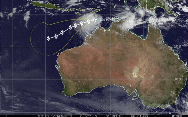
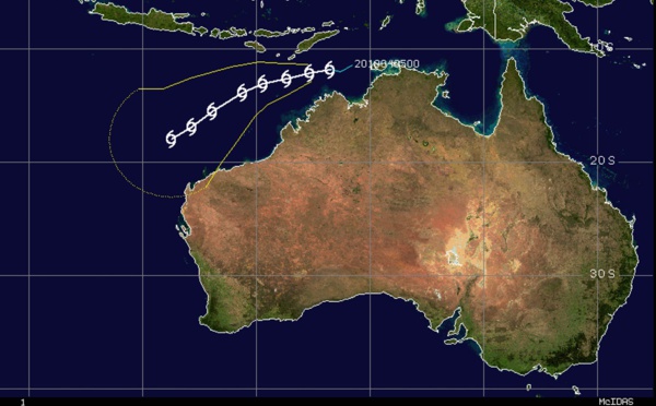
 forecast to intensify slowly next 48hours and remain over open seas")
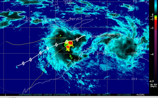
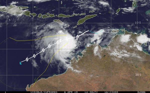
 still fighting wind shear, flaring convection")


: Final Warning, maximum intensity reached was 105knots category 3 US")
: Final Warning, Maximum intensity reached was 125knots category 4 US")


, final warning, maximum intensity reached was 115knots, Category 4 US")
 still has estimated winds gusting near 140km/h")
 is forecast to begin subtropical transition in 72h")
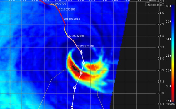
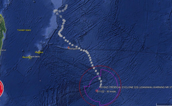
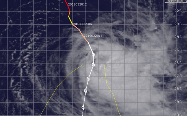
 category 2 US, steady to rapid weakening expected next 120hours but intensity should remain above 35knots")
 category 3 US is weakening rapidly")
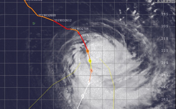
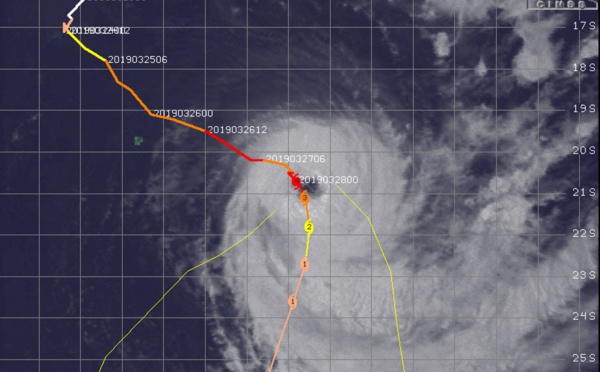
 still a powerful category 4 has turned poleward and is forecast to weaken rapidly after 24h")
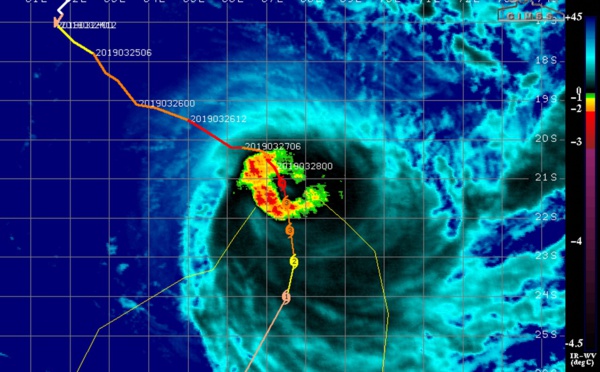

 category 4 US, is turning south and should be weakening rapidly after 24hours")
 back to category 4 is refusing to weaken!")
 still top category 3 US forecast to weaken slowly next 24hours")
 top category 3 US, still slow-moving forecast to accelerate poleward after 48hours while weakening gradually")
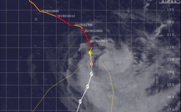
 category 4 US still benefiting from good environment now away from Rodrigues")
 now a powerful category 4 US is thankfully moving away from Rodrigues")
Les News
WESTERN PACIFIC:TY 07W(MEKKHALA) approaching OKINAWA while weakening/08W(HIGOS) to merge with 07W in approx 60h/Invest 95W//24@1030 UTC
06/24/2026
- PATRICK HOAREAU
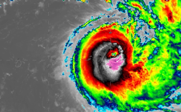
WESTERN PACIFIC:Typhoon 07W(MEKKHALA) Rapid Intensification likely next 24h forecast Peak Intensity at CAT 4 US in 48h/ Invest 94W//21@1000 UTC
06/21/2026
- PATRICK HOAREAU
WESTERN PACIFIC: TS 07W(MEKKHALA) forecast to reach Typhoon Intensity by 24h, forecast to peak at CAT 3 US in 72h//20@1000 UTC
06/20/2026
- PATRICK HOAREAU
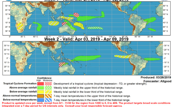
WESTERN PACIFIC: Invest 92W/ SOUTH PACIFIC: Invest 96P/3 Week Tropical Cyclone Formation Probability//17@1030 UTC
06/17/2026
- PATRICK HOAREAU
WESTERN PACIFIC: Invest 92W/SOUTH PACIFIC: Subtropical Storm 96P/EASTERN PACIFIC: Invest 93E//15@0730 UTC
06/15/2026
- PATRICK HOAREAU
SOUTH INDIAN: Subtropical Storm 95S// 11/0900 UTC
06/11/2026
- PATRICK HOAREAU

Liens utiles
WESTERN PACIFIC:Typhoon 07W(MEKKHALA) Rapid Intensification likely next 24h forecast Peak Intensity at CAT 4 US in 48h/ Invest 94W//21@1000 UTC
WESTERN PACIFIC: TS 07W(MEKKHALA) forecast to reach Typhoon Intensity by 24h, forecast to peak at CAT 3 US in 72h//20@1000 UTC
WESTERN PACIFIC: Invest 92W/ SOUTH PACIFIC: Invest 96P/3 Week Tropical Cyclone Formation Probability//17@1030 UTC
WESTERN PACIFIC: Invest 92W/SOUTH PACIFIC: Subtropical Storm 96P/EASTERN PACIFIC: Invest 93E//15@0730 UTC
SOUTH INDIAN: Subtropical Storm 95S// 11/0900 UTC
S'identifier