


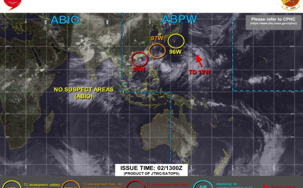
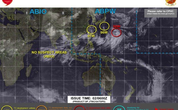
 & TD 10E monitored, 02/06utc updates")
 still at 75knots, 01/18utc updates")
 intensifying, 01/06utc updates")
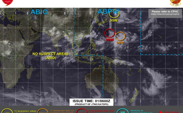
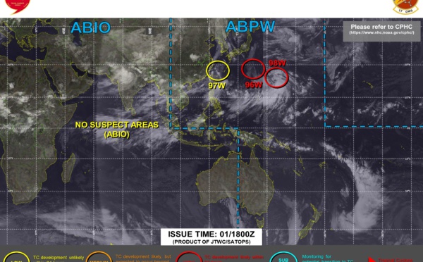
 & TD 09E monitored, 31/06utc updates")

: subtropical system over the Sea of Japan, 28/09utc updates")
 now over-land: peak intensity was 95knots/Cat 2,11W(NEPARTAK) still subtropical is approaching Japan, 27/06utc updates")


 Cat1 Typhoon forecast to landfall South of Shanghai, 11W(NEPARTAK) still subtropical//Eastern Pacific & Atlantic: TCFA issued for Invest 98E & Invest 90L, 25/03utc updates")

 Cat1 Typhoon intensifying a bit next 12/24h, 11W(NEPARTAK) is subtropical, Remnants of 10W(CEMPAKA) still monitored, 24/03utc updates")


 is bearing down on Ishigakijima as a potential CAT 3 Typhoon, 10W(CEMPKAKA) could be back over water by 24h, 22/03utc updates")

 has grown into a Typhoon/CAT2 and is still intensifying, 10W(CEMPAKA) made landfall as CAT1, 21/03utc updates")

 has reached Typhoon/CAT 1 Southwest of Hong Kong, 09W(IN-FA) near Typhoon intensity and intensifying, 20/03utc updates")

 likely to intensify to Typhoon level within 12hours, 09W(IN-FA) forecast to peak at Cat 2 Typhoon by 72hours// 06E(FELICIA) still a Cat 2 Hurricane, 07E(GUILLERMO) has peaked, 19/09utc updates")

 and 10W are both intensifying, 18/21utc updates")

 forecast to reach Typhoon intensity by 48h, Invest 99W likely to become TD 10W// Eastern Pacific: Powerful 06E(FELICIA) and TS 07E(GUILLERMO) monitored, 18/09utc updates")

: powerful Hurricane Cat4, 17/09utc updates")

 Category 3 Hurricane, intensifying, 16/06 updates")


 pushing inland over the US, 08/06utc updates")


 re-intensifying a bit west of Florida, 06/03utc updates")

 South of Cuba, 05/03utc updates")

 approaching Cuba, 04/06utc updates")

Les News
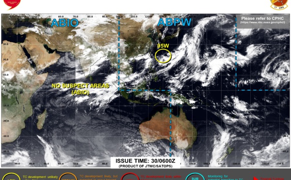
WESTERN PACIFIC:TY 07W(MEKKHALA) approaching OKINAWA while weakening/08W(HIGOS) to merge with 07W in approx 60h/Invest 95W//24@1030 UTC
06/24/2026
- PATRICK HOAREAU
WESTERN PACIFIC:Typhoon 07W(MEKKHALA) Rapid Intensification likely next 24h forecast Peak Intensity at CAT 4 US in 48h/ Invest 94W//21@1000 UTC
06/21/2026
- PATRICK HOAREAU
WESTERN PACIFIC: TS 07W(MEKKHALA) forecast to reach Typhoon Intensity by 24h, forecast to peak at CAT 3 US in 72h//20@1000 UTC
06/20/2026
- PATRICK HOAREAU
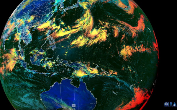
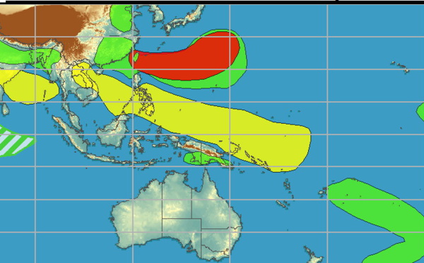
WESTERN PACIFIC: Invest 92W/ SOUTH PACIFIC: Invest 96P/3 Week Tropical Cyclone Formation Probability//17@1030 UTC
06/17/2026
- PATRICK HOAREAU
WESTERN PACIFIC: Invest 92W/SOUTH PACIFIC: Subtropical Storm 96P/EASTERN PACIFIC: Invest 93E//15@0730 UTC
06/15/2026
- PATRICK HOAREAU
SOUTH INDIAN: Subtropical Storm 95S// 11/0900 UTC
06/11/2026
- PATRICK HOAREAU

Liens utiles
WESTERN PACIFIC:Typhoon 07W(MEKKHALA) Rapid Intensification likely next 24h forecast Peak Intensity at CAT 4 US in 48h/ Invest 94W//21@1000 UTC
WESTERN PACIFIC: TS 07W(MEKKHALA) forecast to reach Typhoon Intensity by 24h, forecast to peak at CAT 3 US in 72h//20@1000 UTC
WESTERN PACIFIC: Invest 92W/ SOUTH PACIFIC: Invest 96P/3 Week Tropical Cyclone Formation Probability//17@1030 UTC
WESTERN PACIFIC: Invest 92W/SOUTH PACIFIC: Subtropical Storm 96P/EASTERN PACIFIC: Invest 93E//15@0730 UTC
SOUTH INDIAN: Subtropical Storm 95S// 11/0900 UTC
S'identifier