

CLICK ON THE IMAGERIES BELOW TO GET THEM ENLARGED

TWC PH
JTWC FACEBOOK
Joint Typhoon Warning Center
National Hurricane Center
10/20/2026
10/13/2026
10/06/2026
09/29/2026
09/22/2026
GTH Outlook Discussion
Last Updated - 10/27/26
Valid - 11/04/26 - 11/17/26
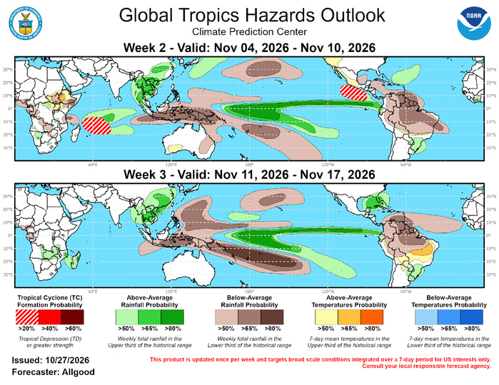
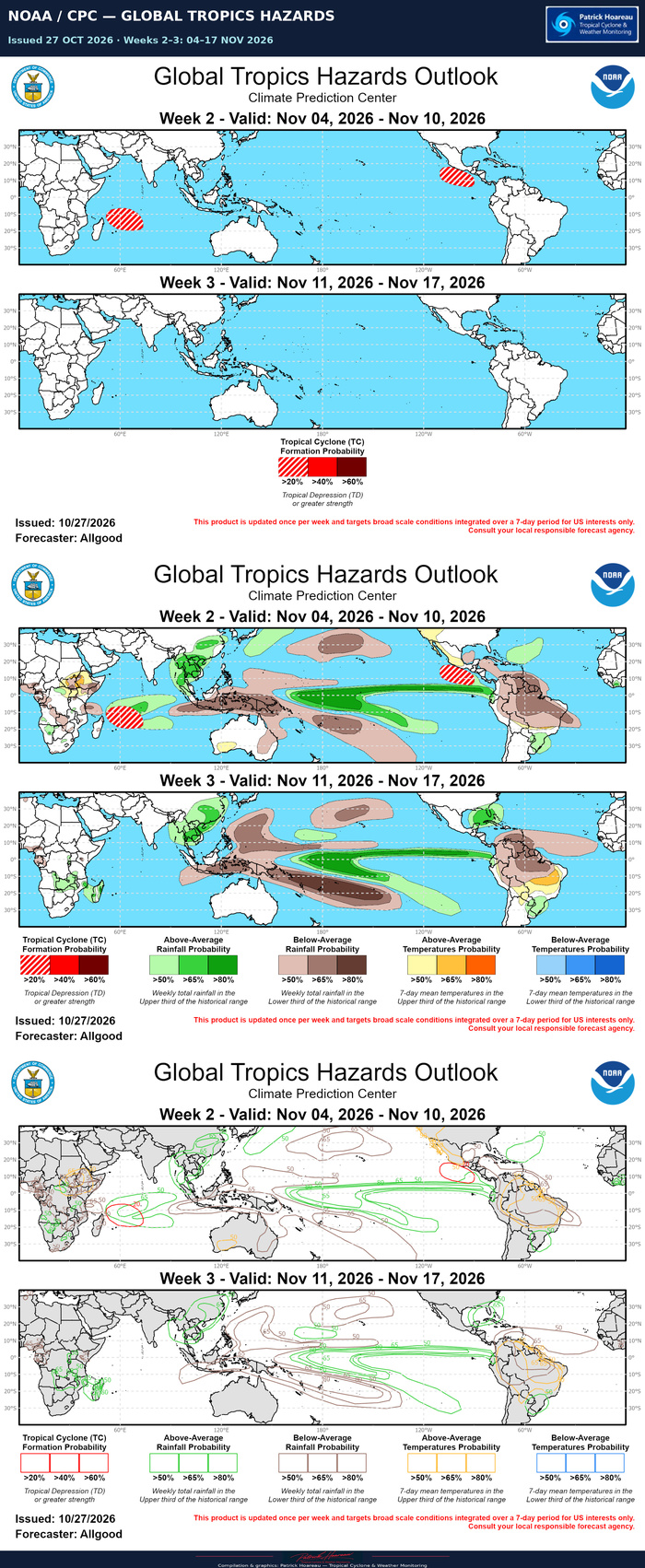
Low frequency base state signals continue to dominate the global tropical convective pattern, most notably the ongoing strong El Niño, which is maintaining a persistent divergent signal aloft over the east-central Pacific,. and strong low-level westerly anomalies along the Equator. Over the last few weeks, a positive phase Indian Ocean Dipole (+IOD) event has emerged over the Indian Ocean, resulting in enhanced trade winds over the basin and strong convective suppression over the Maritime Continent, reinforcing the El Niño signal in the region. Within these strong stationary signals, however, recent observations indicate the presence of an active intraseasonal MJO signal, which has propagated from the Western Hemisphere during early October to the Indian Ocean more recently. The amplitude of the RMM-based MJO index increased recently, possibly due to constructive interference between the MJO and the strengthening +IOD event. Dynamical model MJO index forecasts, however, persist this signal and continue an eastward propagation to the eastern Indian Ocean over the next two weeks. This slow evolution may be due to enhanced easterlies aloft over the Indian Ocean, and possibly a decoupling of faster moving Kelvin waves from enhanced convection as they progress over the suppressed environment of the Maritime Continent. Beyond Week-2, dynamical model forecasts indicate a potential return of the signal to the Western Hemisphere, which may be due to the MJO envelopes becoming lost within the much stronger ENSO signal. Based on these observations and forecasts, the MJO is favored to play a small role in the global tropical convective pattern, primarily through enhanced convection over the Indian Ocean during Week-2, although the ENSO base state remains the dominant driver of convective anomalies. Any contributions from the MJO during Week-3 become much more uncertain and difficult to decipher in the model guidance.
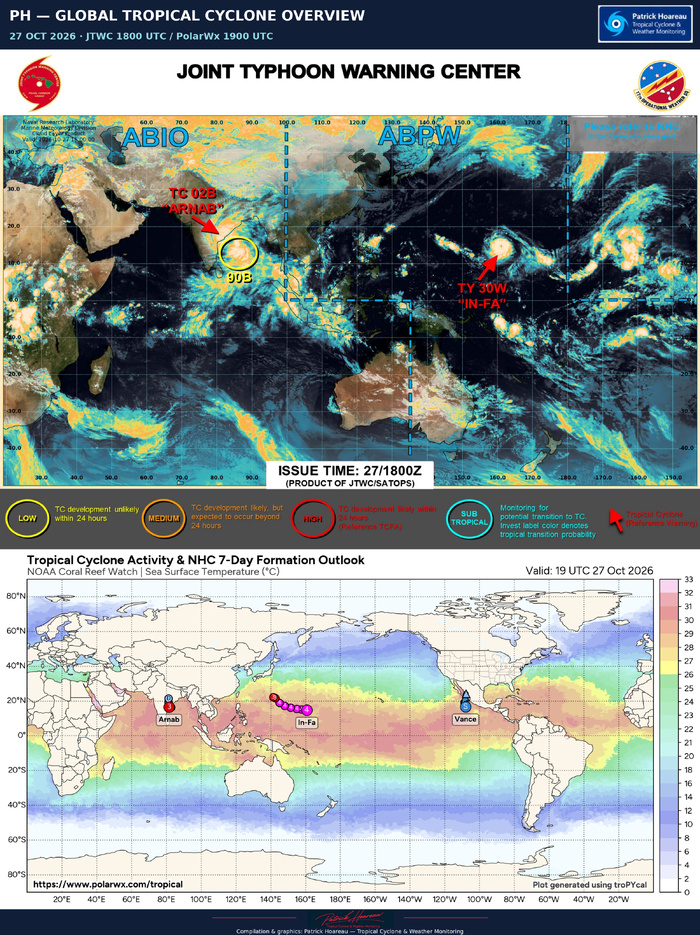
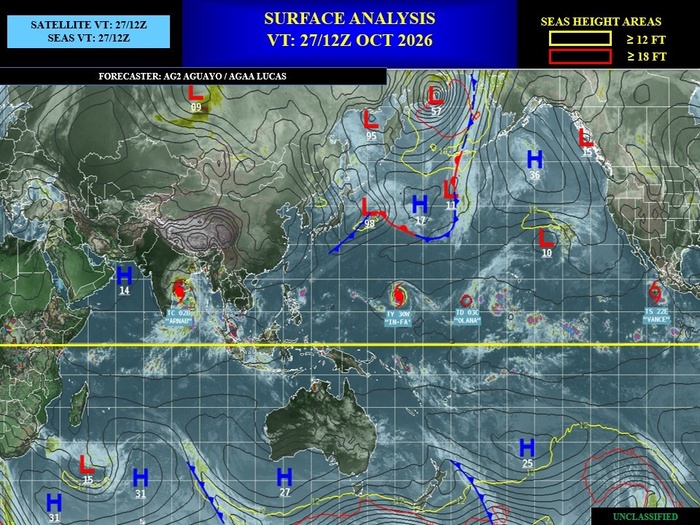
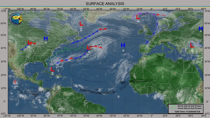
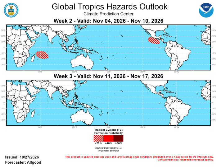
Three tropical cyclones formed during the past week. On October 20, Tropical Storm Agueda formed north of Madagascar in a favorable environment due to both the MJO and the +IOD event. The system meandered well east of Africa for several days before dissipating. On October 23, In-Fa formed over the open Pacific west of the Date Line. Strengthening steadily and now a powerful typhoon, In-Fa is forecast to pass north of Guam in several days, before potentially recurving over the North Pacific early in Week-2. Cyclone Arnab formed on October 26 over the Bay of Bengal. Following a period of rapid intensification, Arnab is about to make landfall over Andhra Pradesh with sustained winds of 120 kt, which could bring devastating impacts. In the eastern Pacific, Vance formed on 10/21 to the south of Mexico. Currently at Tropical Storm strength, the National Hurricane Center (NHC) expects Vance to continue tracking northward and possibly make landfall over western Mexico as a weaker Tropical Depression later this week. During Week-2, the MJO and +IOD background state favor a potential for new tropical cyclone development over the southwestern Indian Ocean, near or northeast of Madagascar. Additionally, a reduction in strong easterly anomalies just south of Mexico during Week-2 may provide a window of favorability for late season tropical cyclogenesis over the East Pacific. Subtropical cyclone development along stalled frontal boundaries is possible over the North Atlantic, but predictability is too low to indicate any hazards on the outlook. During Week-3, there are no clear signals for enhanced favorability for tropical cyclogenesis in any basin. November is a climatologically quiet time of year as well, except for the Indian Ocean basin.

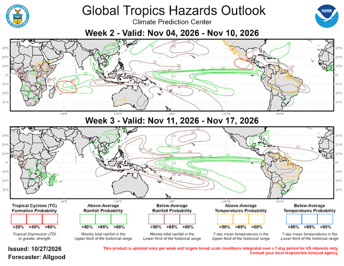
Forecasts for above- and below-normal precipitation are based on potential MJO impacts over the Indian Ocean during Week-2, and El Niño. Enhanced precipitation across East and Southeast Asia is forecast to persist through Weeks 2 and 3, which may increase the potential for localized flooding. In contrast, persistently suppressed rainfall over the Maritime Continent and northern South America, along with above-normal temperatures, may promote drought expansion. Dynamical models favor a potential for stalled frontal activity providing a focus for heavy rainfall in the vicinity of Florida during Week-3. For hazardous weather conditions in your area during the next two weeks, please refer to your local NWS office, the Medium Range Hazards Forecast from the Weather Prediction Center (WPC), and the CPC Week-2 Hazards Outlook. Forecasts over Africa are made in consultation with the International Desk at CPC and can represent local-scale conditions in addition to global-scale variability.