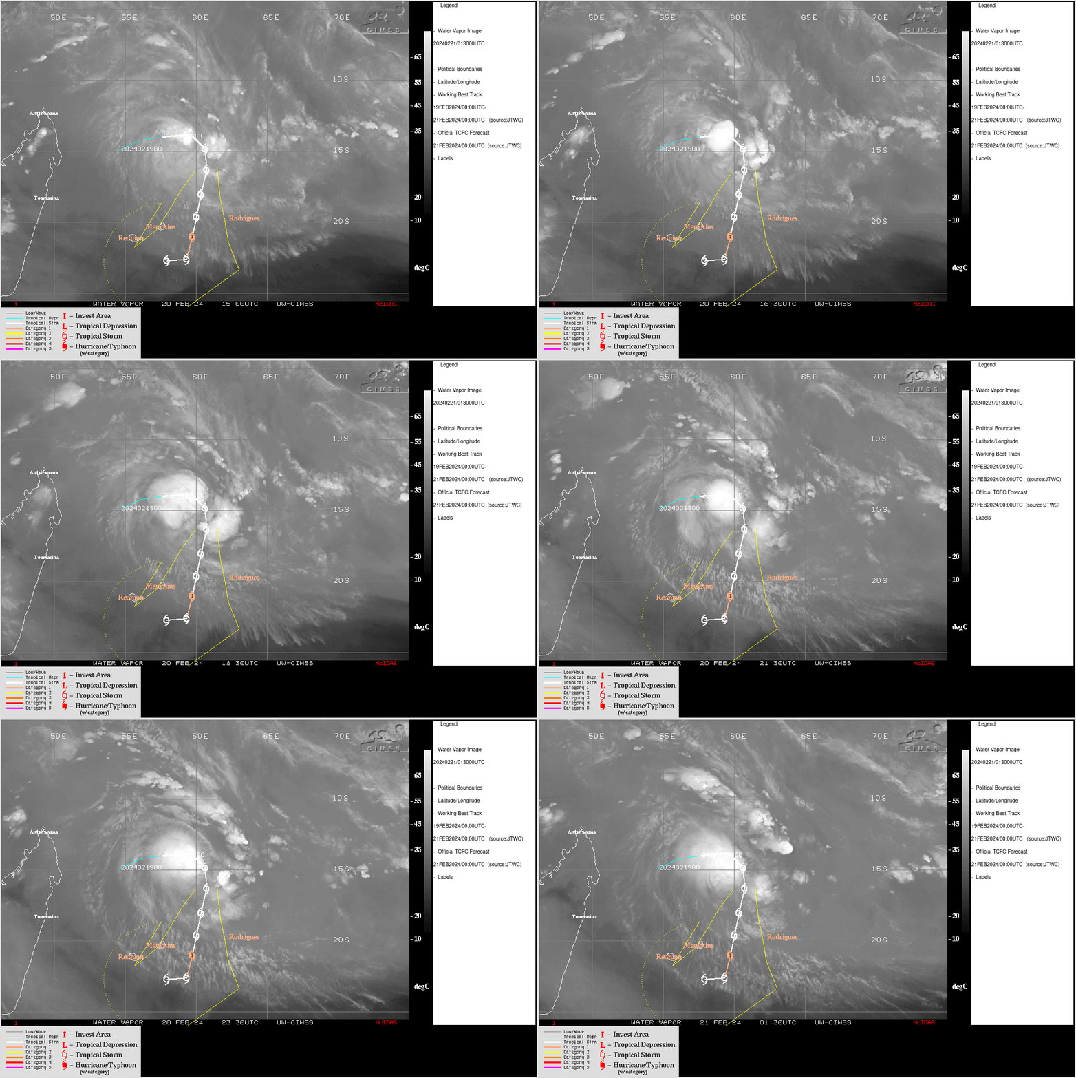
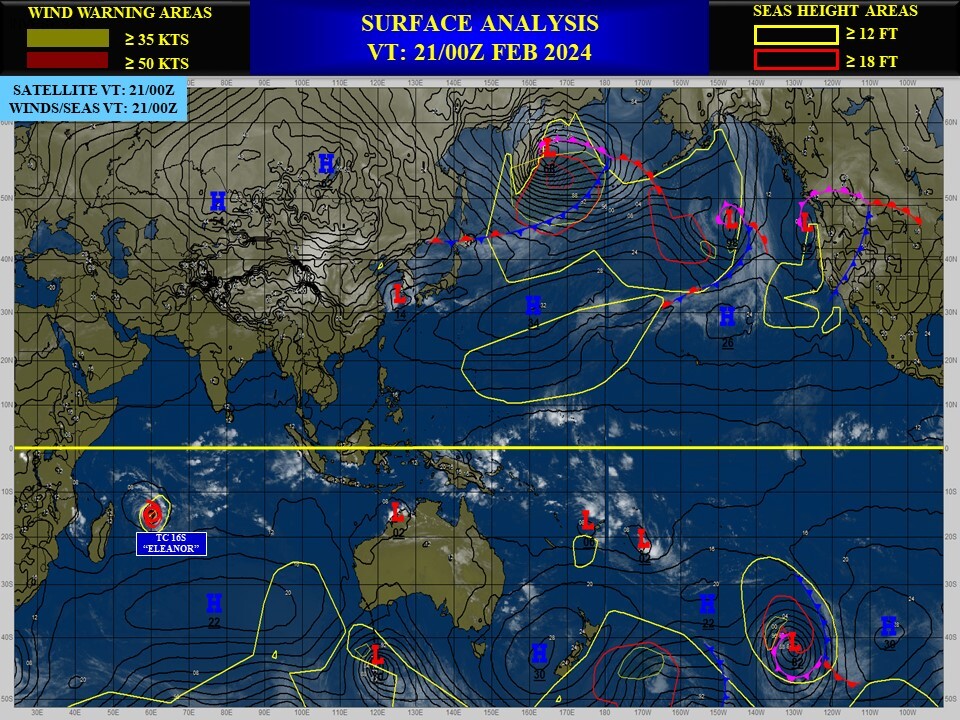
CLICK ON THE IMAGERIES BELOW TO GET THEM ENLARGED

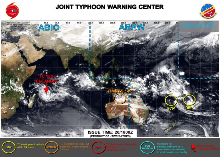
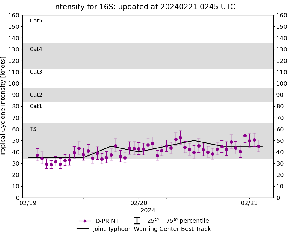
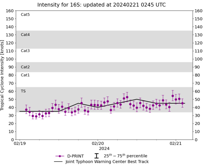
SOUTH INDIAN OCEAN: TC 16S(ELEANOR). ESTIMATED CURRENT INTENSITY IS 45 KNOTS: + 5 KNOTS OVER 24 HOURS
1624021918 139S 567E 45
1624022000 139S 579E 40
1624022006 138S 591E 45
1624022012 139S 597E 50
1624022018 141S 604E 45
1624022100 148S 606E 45
1624022000 139S 579E 40
1624022006 138S 591E 45
1624022012 139S 597E 50
1624022018 141S 604E 45
1624022100 148S 606E 45
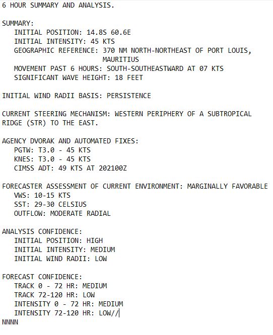
CLICK ON THE IMAGERY BELOW TO GET IT ANIMATED AND ENLARGED.
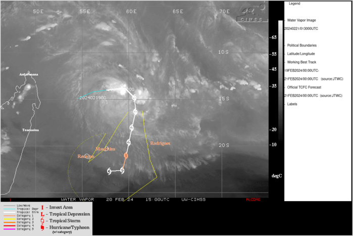
SATELLITE ANALYSIS, INITIAL POSITION AND INTENSITY DISCUSSION: ANIMATED MULTISPECTRAL SATELLITE IMAGERY (MSI) DEPICTS TROPICAL CYCLONE (TC) 16S (ELEANOR) WITH A PARTIALLY EXPOSED LOWER-LEVEL CONVECTION CENTER (LLCC) AND FLARING CONVECTION OBSCURING THE WESTERN HEMISPHERE OF THE SYSTEM. CLEAR SKIES TO THE NORTHEAST AND EAST SHOW DRY AIR ENTRAINING INTO THE SYSTEM. SEA SURFACE TEMPERATURES (SST) ARE FAVORABLE BETWEEN 28-29C. SHEAR IS MARGINAL BETWEEN 15-20KTS. THE INITIAL POSITION WAS BASED ON ANIMATED MSI AND A 202335Z SSMIS 37GHZ MICROWAVE PASS SHOWING A LOWER-LEVEL MICROWAVE EYE-LIKE STRUCTURE AT 14.8S 60.6E. THE INITIAL INTENSITY WAS BASED ON PERSISTENCE, AND THE AGENCY AND OBJECTIVE FIXES LISTED BELOW.
TC Warning Graphic
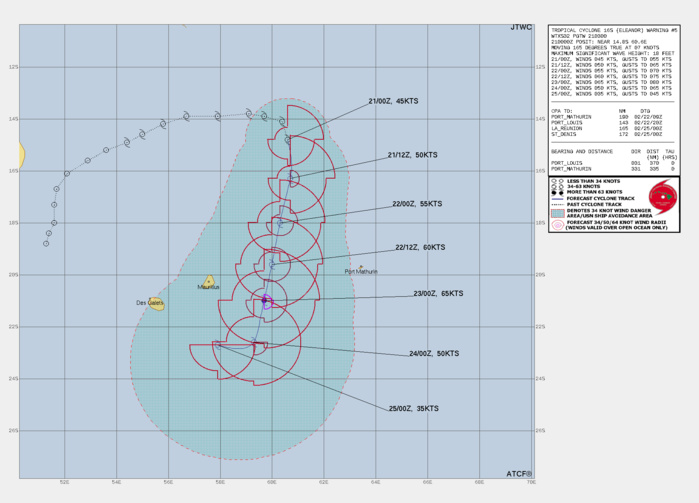
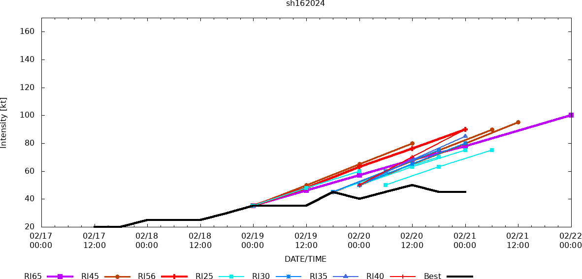
FORECAST REASONING. SIGNIFICANT FORECAST CHANGES: THERE ARE NO SIGNIFICANT CHANGES TO THE FORECAST FROM THE PREVIOUS WARNING. FORECAST DISCUSSION: TC 16S (ELEANOR) IS ANTICIPATED TO TRACK SOUTH THROUGH TAU 12 ON THE WESTERN PERIPHERY OF A SUBTROPICAL RIDGE (STR) TO THE EAST BEFORE CURVING TO THE SOUTH-SOUTHWEST THROUGH TAU 72. BY THE END OF THE FORECAST PERIOD (TAU 96), THE SYSTEM IS ANTICIPATED TO CURVE TO THE WEST-NORTHWEST AS THE STORM WEAKENS AND IS DRIVEN BY THE MID TO LOWER LEVELS. THE STORM IS ANTICIPATED TO INTENSIFY THROUGH TAU 48, STEADILY RISING AS THE SYSTEM ENTERS A REGION OF MARGINAL VERTICAL WIND SHEAR BETWEEN TAU 18-36 (10-15KTS). AFTER TAU 36, JTWC SHIPS GUIDANCE AND CIMSS TC GUIDANCE SHOWS ELEVATED WIND SHEAR ABOVE 25KTS THROUGH THE END OF THE FORECAST PERIOD, CAPPING INTENSITY AT 65KTS AT TAU 48 AND DECLINING TO DISSIPATION (35KTS) BY TAU 96.
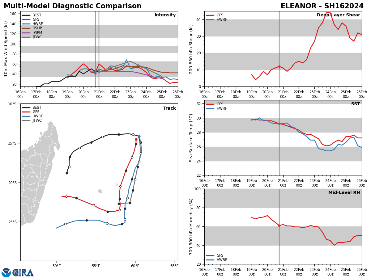
Model Diagnostic Plot

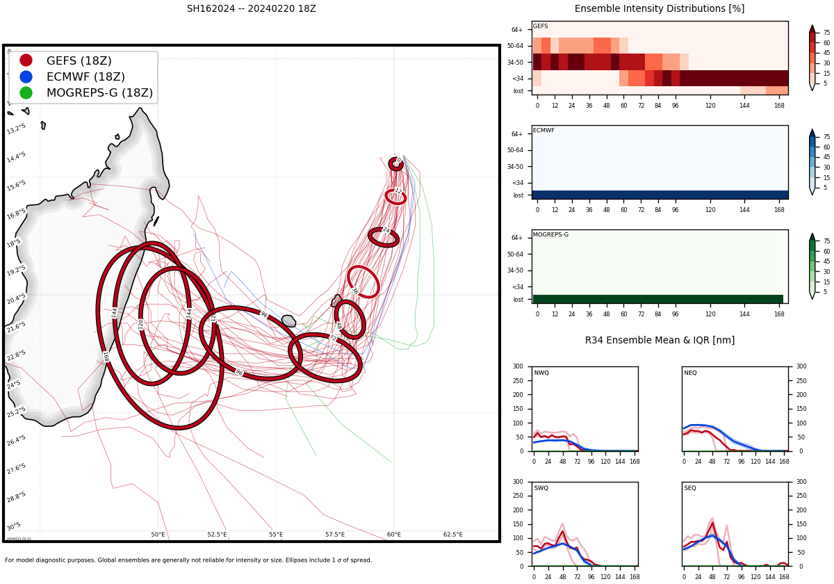
MODEL DISCUSSION: DETERMINISTIC MODEL GUIDANCE IS IN GOOD AGREEMENT THAT TROPICAL CYCLONE (TC) 16S (ELEANOR) WILL TRANSIT GENERALLY SOUTH TO SOUTH-SOUTHWEST THROUGH TAU 72, BUT AT VARYING SPEEDS. MOST MEMBERS OF THE JTWC CONSENSUS BEGIN TO TURN TO THE WEST BETWEEN TAU 72 AND TAU 96, WITH THE STARK EXCEPTION OF NAVGEM WHICH CONTINUES SOUTH-SOUTHEAST. THE CROSS-TRACK ERROR AT TAU 24 IS 100 NM BUT OPENS TO 150 BY TAU 96 (EXCLUDING NAVGEM). THE INTENSITY GUIDANCE HAS LOWERED SIGNIFICANTLY IN THE LAST 12 HOURS, SHOWING A PEAK OF HAFS-A OF 62KTS AT TAU 36 AND A LOWER INTENSITY OF 50KTS AT THE SAME TIME FROM COAMPS-TC. HOWEVER, RAW MODEL HWRF DATA SHOWS SIGNIFICANTLY HIGHER INTENSITY PEAKING AT 85 KTS BY TAU 48.
Ensemble Track Ellipses
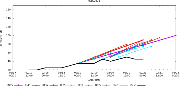
Rapid Intensification Guidance
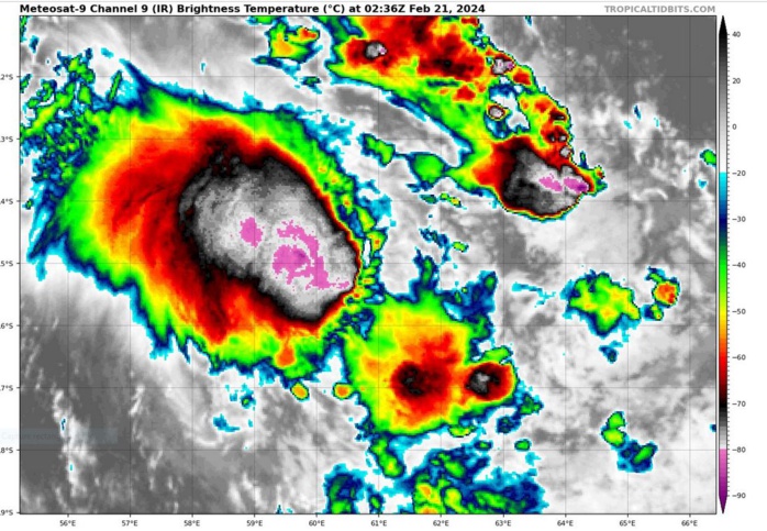
UPDATED SATELLITE BULLETIN AT 21/0230UTC
TPXS13 PGTW 210322
A. TROPICAL CYCLONE 13S (ELEANOR)
B. 21/0230Z
C. 14.86S
D. 60.80E
E. FIVE/MET9
F. T3.0/3.0/W0.5/24HRS STT: S0.0/03HRS
G. IR/EIR
H. REMARKS: 47A/PBO PTLY XPSD LLCC/ANMTN. DENSE OVERCAST SHEARED
10NM FROM LLCC YIELDS A DT OF 3.0. PT AGREES. MET YIELDS 2.5. DBO
DT.
I. ADDITIONAL POSITIONS: NONE
CVACH
A. TROPICAL CYCLONE 13S (ELEANOR)
B. 21/0230Z
C. 14.86S
D. 60.80E
E. FIVE/MET9
F. T3.0/3.0/W0.5/24HRS STT: S0.0/03HRS
G. IR/EIR
H. REMARKS: 47A/PBO PTLY XPSD LLCC/ANMTN. DENSE OVERCAST SHEARED
10NM FROM LLCC YIELDS A DT OF 3.0. PT AGREES. MET YIELDS 2.5. DBO
DT.
I. ADDITIONAL POSITIONS: NONE
CVACH
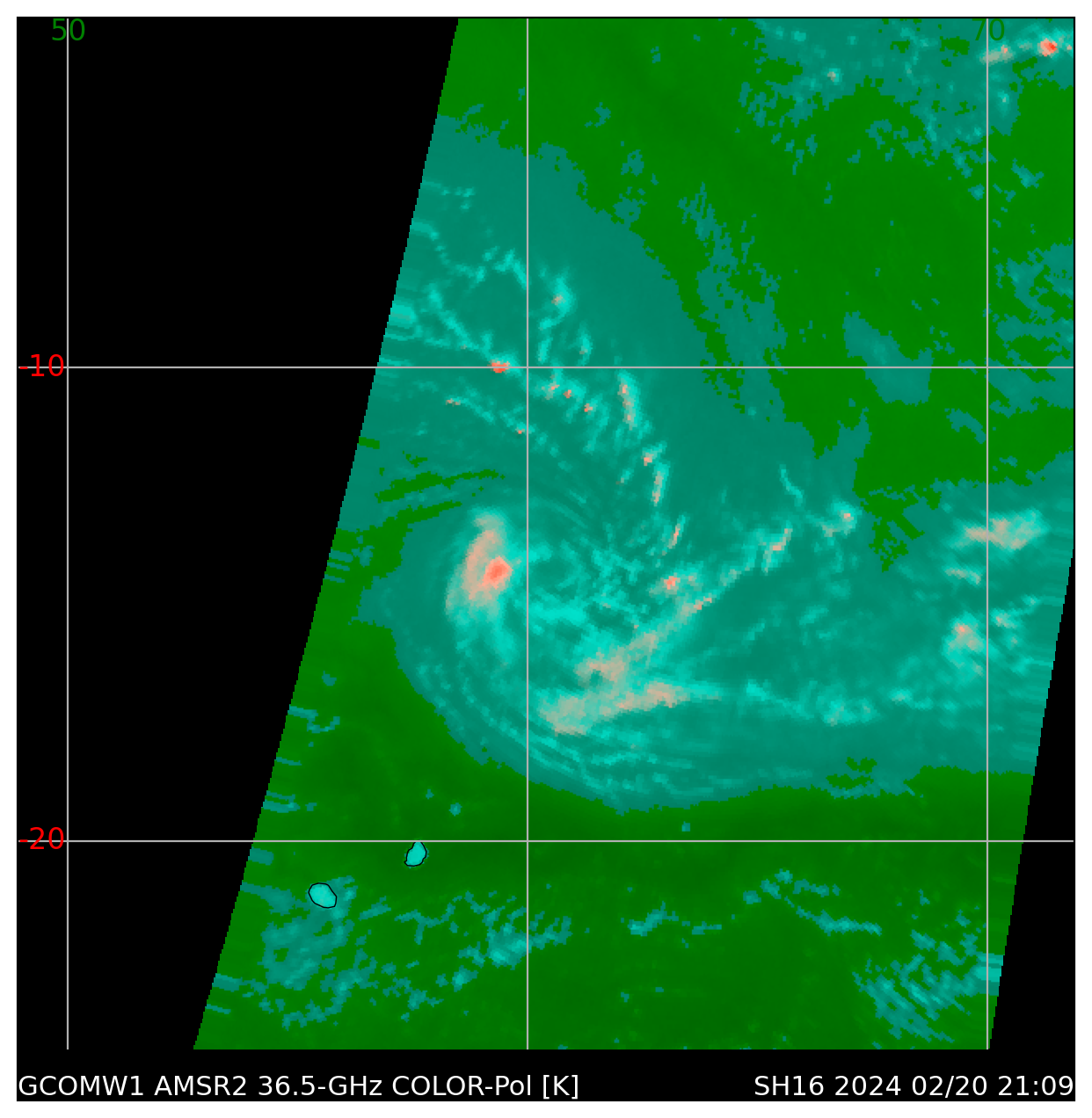
MICROWAVE SIGNATURE AT 20/2110UTC DEPICTTED THE PARTLY EXPOSED AND WELL DEFINED LOW LEVEL CIRCULATION CENTER
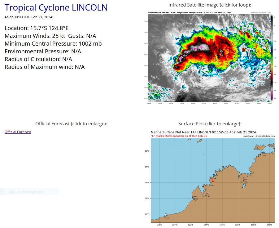
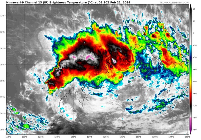
AUSTRALIA: OVERLAND REMNANTS OF TC 14P(LINCOLN). ADVISORY(ABIO) ISSUED AT 20/18UTC

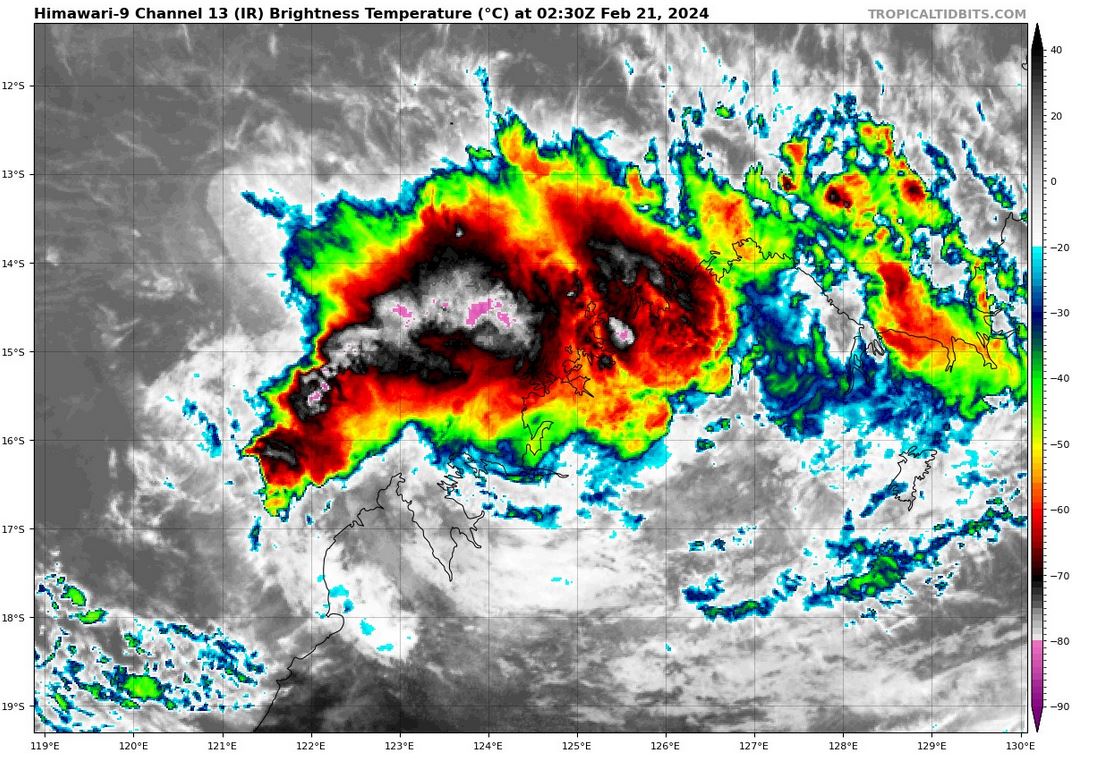
THE AREA OF CONVECTION (INVEST 14P) PREVIOUSLY LOCATED NEAR 18.8S 128.8E IS NOW LOCATED NEAR 16.4S 125.2E, APPROXIMATELY 222 NM EAST OF BROOME, AUSTRALIA. ANIMATED ENHANCED INFRARED (EIR) SATELLITE IMAGERY AND A 2009381Z SSMIS 91GHZ PASS DEPICT A BROAD BUT WELL-DEFINED LOW- LEVEL CIRCULATION WITH ORGANIZED CONVECTION AND SHALLOW BANDING. REMNANTS OF 14P ARE CURRENTLY LOCATED OVER LAND. ENVIRONMENTAL ANALYSIS INDICATES STRONG POLEWARD OUTFLOW ALOFT AND LOW (10-15KTS) VERTICAL WIND SHEAR. GLOBAL NUMERICAL MODEL GUIDANCE IS IN GOOD AGREEMENT THAT REMNANTS OF 14P WILL CONTINUE TRACKING WEST-NORTHWESTWARD WITH POTENTIAL TO FURTHER CONSOLIDATE AS IT NEARS THE NORTHWEST AUSTRALIAN COASTLINE. MAXIMUM SUSTAINED SURFACE WINDS ARE ESTIMATED AT 20 TO 25 KNOTS. MINIMUM SEA LEVEL PRESSURE IS ESTIMATED TO BE NEAR 1000 MB. THE POTENTIAL FOR THE DEVELOPMENT OF A SIGNIFICANT TROPICAL CYCLONE WITHIN THE NEXT 24 HOURS REMAINS MEDIUM.
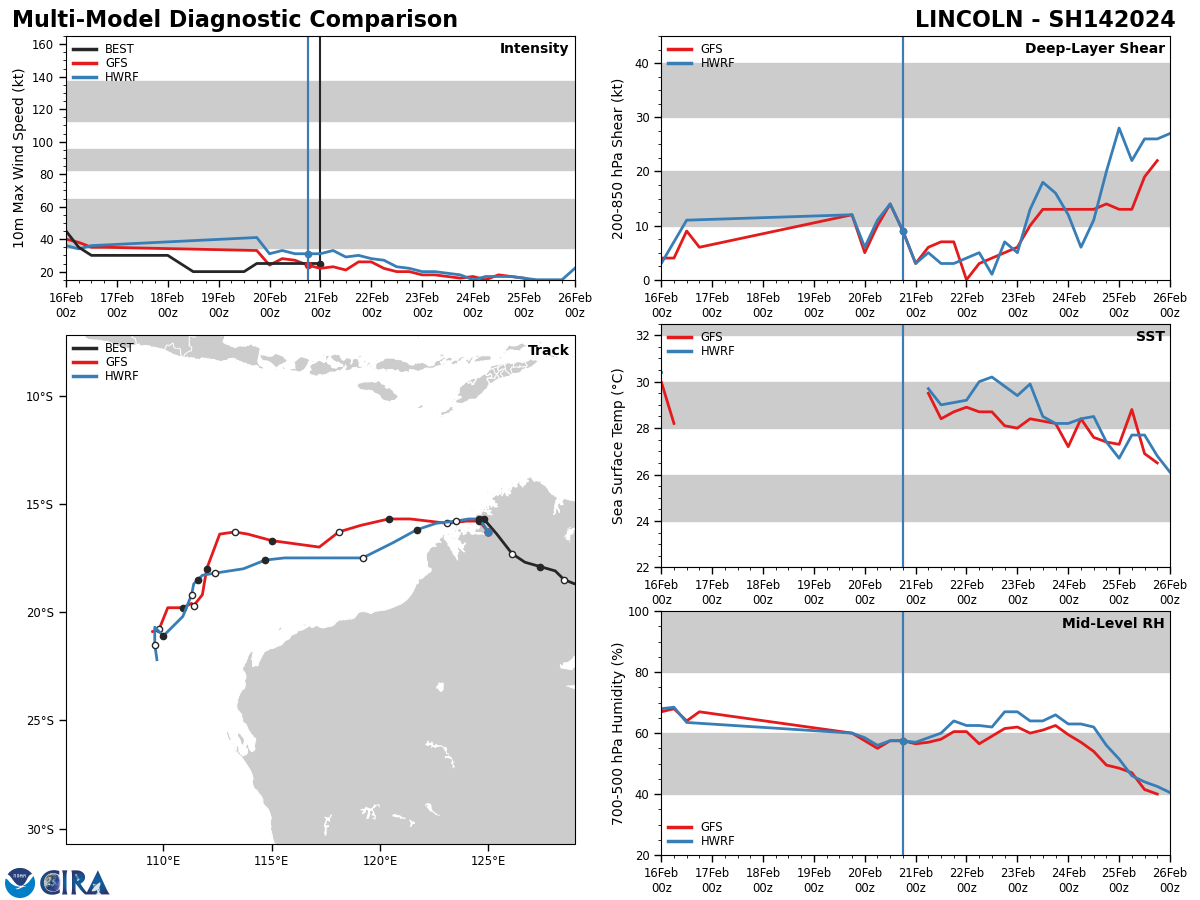
Model Diagnostic Plot

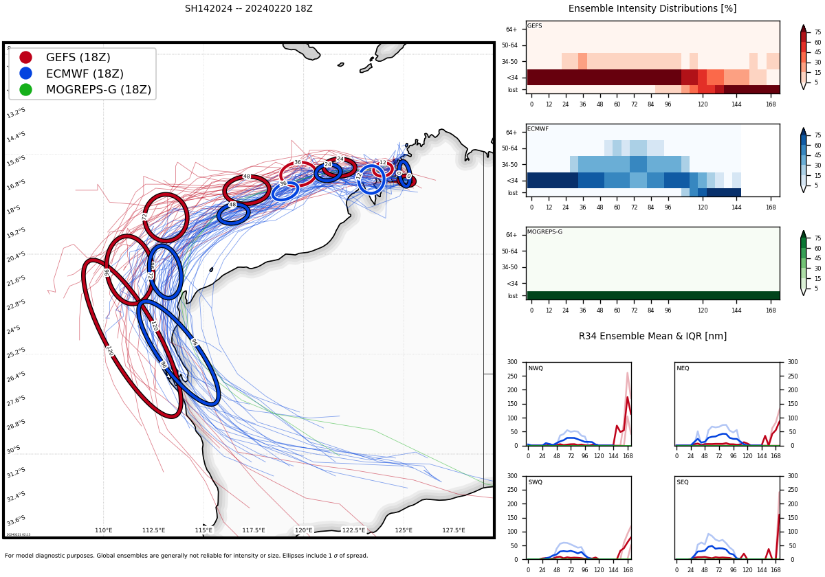
MODEL GUIDANCE IS IN GOOD AGREEMENT THAT REMNANTS OF 14P WILL CONTINUE TRACKING WEST-NORTHWESTWARD WITH POTENTIAL TO FURTHER CONSOLIDATE AS IT NEARS THE NORTHWEST AUSTRALIAN COASTLINE.
Ensemble Track Ellipses
UPDATED SATELLITE BULLETIN AT 21/0230UTC
TPXS10 PGTW 210324
A. REMNANTS OF TROPICAL CYCLONE 14P (LINCOLN)
B. 21/0230Z
C. 15.90S
D. 124.48E
E. FIVE/GK2A
F. N/A
G. IR/EIR/VIS/MSI
H. REMARKS: 63A/PBO PRLY ORGNZD LLCC/ANMTN. INTENSITY ESTIMATE MAY
NOT BE REPRESENTATIVE DUE TO PROXIMITY TO LAND. THIS SYSTEM IS TOO
WEAK TO CLASSIFY.
I. ADDITIONAL POSITIONS: NONE
CVACH
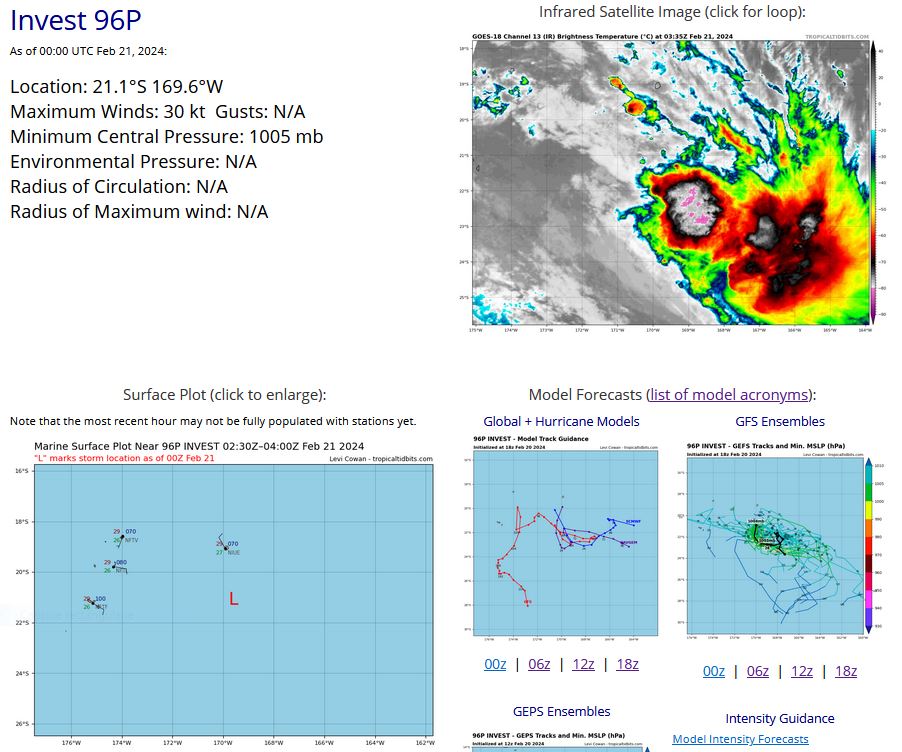
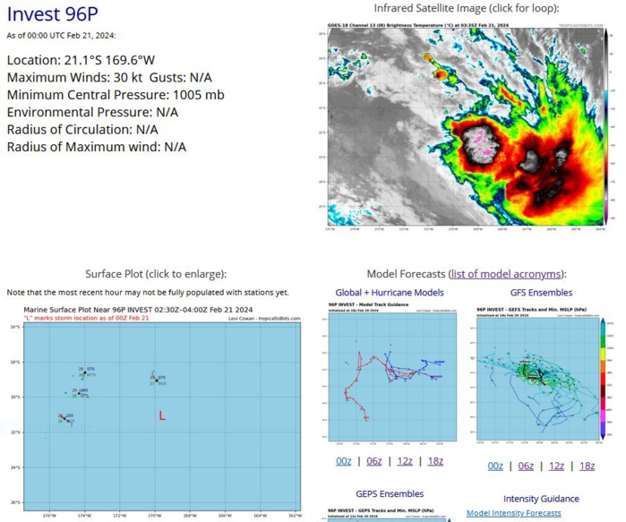
SOUTH PACIFIC OCEAN: INVEST 96P
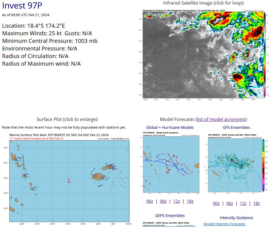
SOUTH PACIFIC OCEAN: INVEST 97P
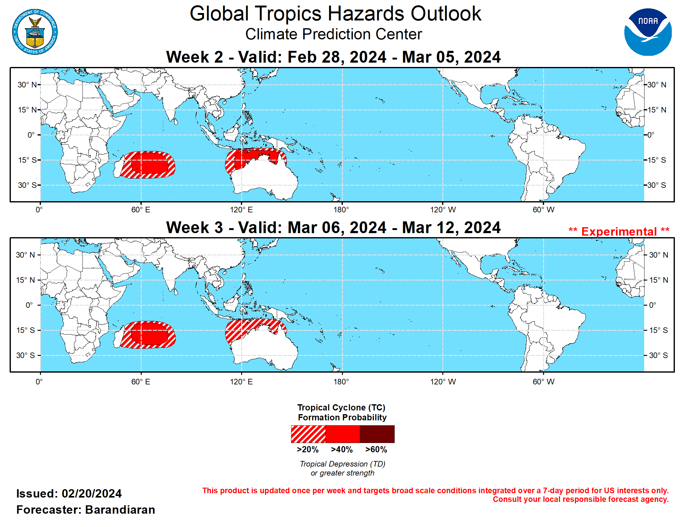
Last Updated - 02/20/24 3 WEEK TROPICAL CYCLONE DEVELOPMENT PROBABILITY

GTH Outlook Discussion Last Updated - 02/20/24 Valid - 02/28/24 - 03/12/24 RMM observations show a westward retreat of the MJO signal over the Western Pacific earlier this month, but the MJO has since resumed its eastward propagation and has moved into phase 8 (Western Hemisphere) in RMM space. Consistent with model guidance since last week, a much weakened MJO is generally favored in the RMM forecasts, with model solutions showing the signal mostly remaining within the unit circle during the next two weeks. However, there is some question as to whether this weakening is reflective of a disorganizing MJO or the removal of the 120-day mean which is strongly skewing the MJO signal to the right in RMM space. Upper-level velocity potential anomaly and OLR forecasts suggest the latter, which depict a more coherent MJO moving forward. Anomalous lower-level westerlies forecast continue to enhance probabilities for tropical cyclone (TC) development for the southwestern Indian Ocean through early March. It has been an active week for TCs around the globe, with 5 TCs that formed in 4 different basins. In the South Pacific, TC 15P formed east of the Cook Islands on February 15 and quickly dissipated. In the Australia region, TC Lincoln formed in the Gulf of Carpentaria on February 15 and moved inland quickly, bringing heavy rain to northwestern Australia. In the South Indian Ocean, on February 17 TC Djoungou formed east of Madagascar. It moved southwestward and became very strong before weakening and transitioning to an extratropical system. On February 18 TC Eleanor formed, also east of Madagascar. It is currently still active, meandering near Mauritius, and is currently forecast to eventually move towards Madagascar. For the latest information on TC Eleanor please refer to the Joint Typhoon Warning Center (JTWC). Finally, a rare South Atlantic TC formed southeast of Rio de Janeiro on February 18. It strengthened and was named Akara on February 19, and is currently tracking south. Despite a relatively weak RMM signal among forecast models, other indicators of MJO activity suggest a stronger MJO than might otherwise be expected. Upper-level velocity potential anomaly forecasts portray a weak to moderate MJO taking shape during weeks 2-3, with increasing anomalous divergence aloft over Africa and into the Indian Ocean as the forecast period progresses. This results in a moderate probability (>40%) for TC activity in the southwestern Indian Ocean during weeks 2-3. Interestingly, Indian Ocean MJO (phases 2 and 3) events historically lead to decreased chances for TC formation near Australia and the Maritime Continent but guidance from both the GEFS and ECMWF suggest a higher chance for TC genesis during the forecast period across the northern Australian coast than might otherwise be indicated, possibly due to Rossby or Kelvin wave interference. The large-scale environment is expected to remain weakly favorable for TC development over the southeastern Indian Ocean during week-3, and 20% chances for TC genesis are issued for portions of the northern Australian coast.
