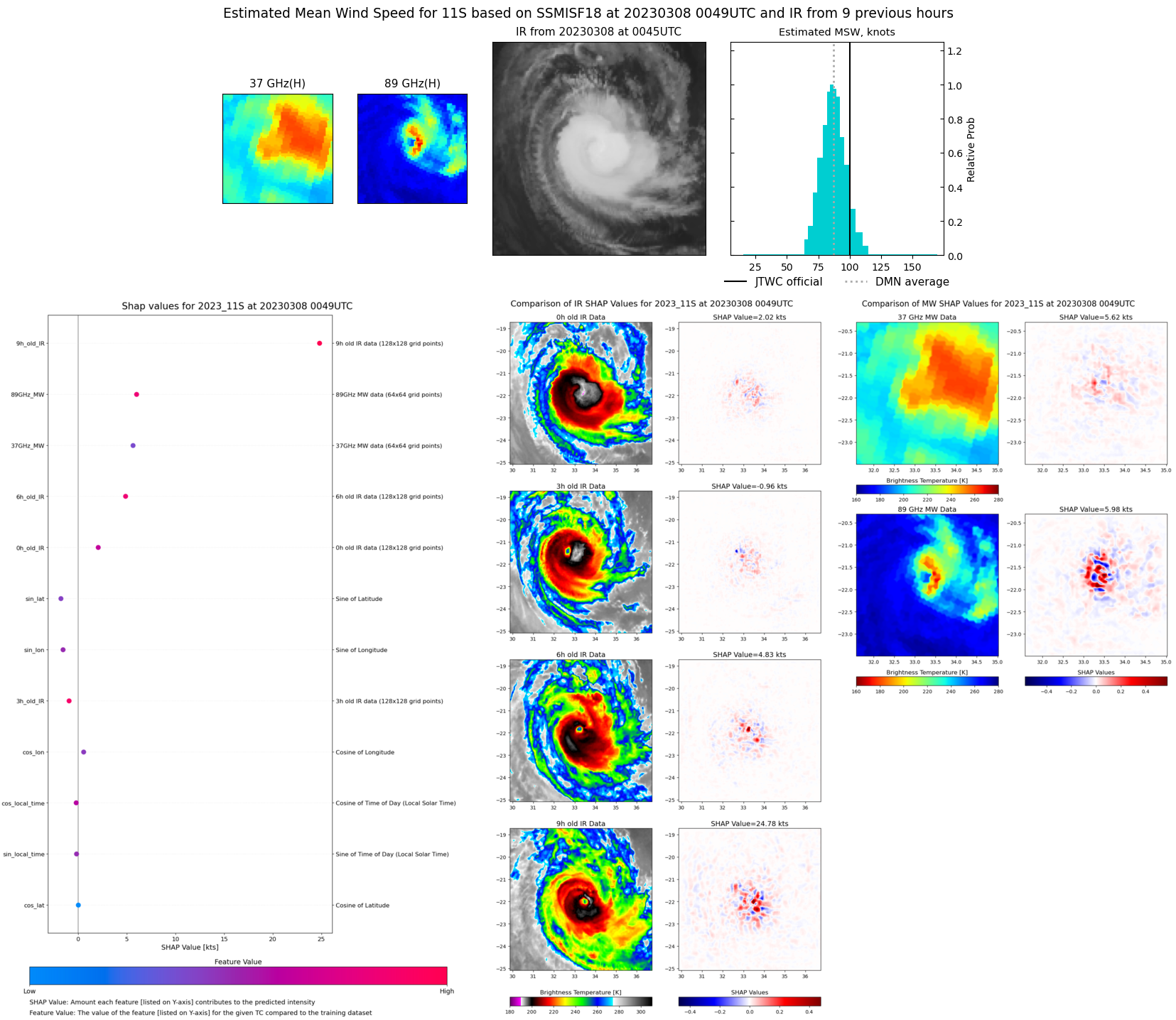
CLICK ON THE IMAGERIES BELOW TO GET THEM ENLARGED
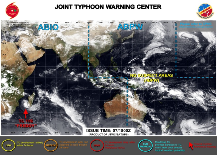
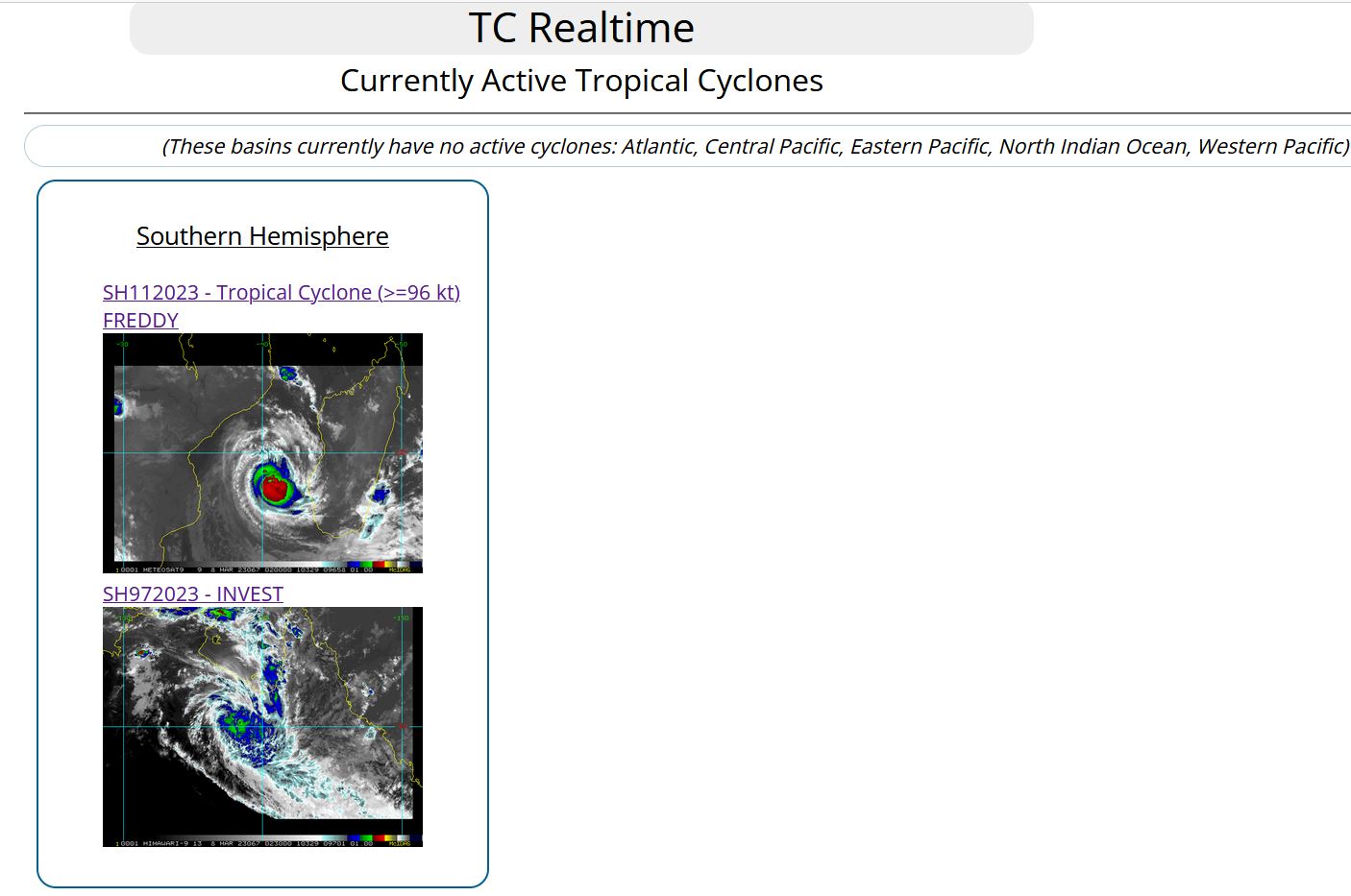
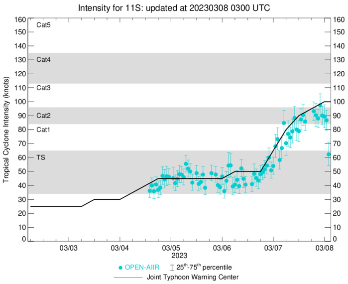
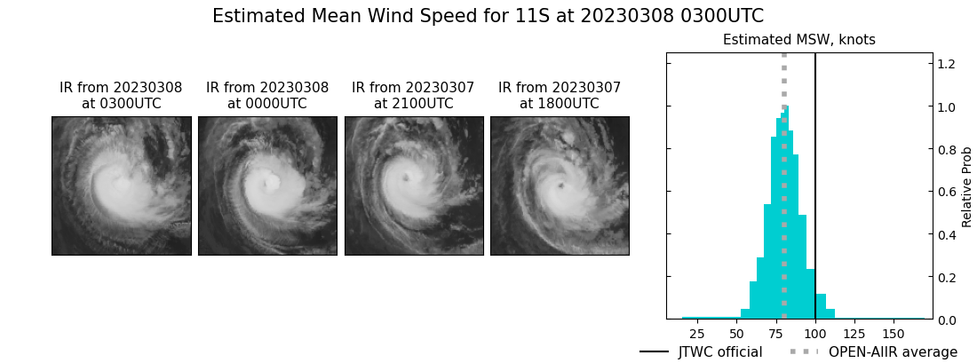
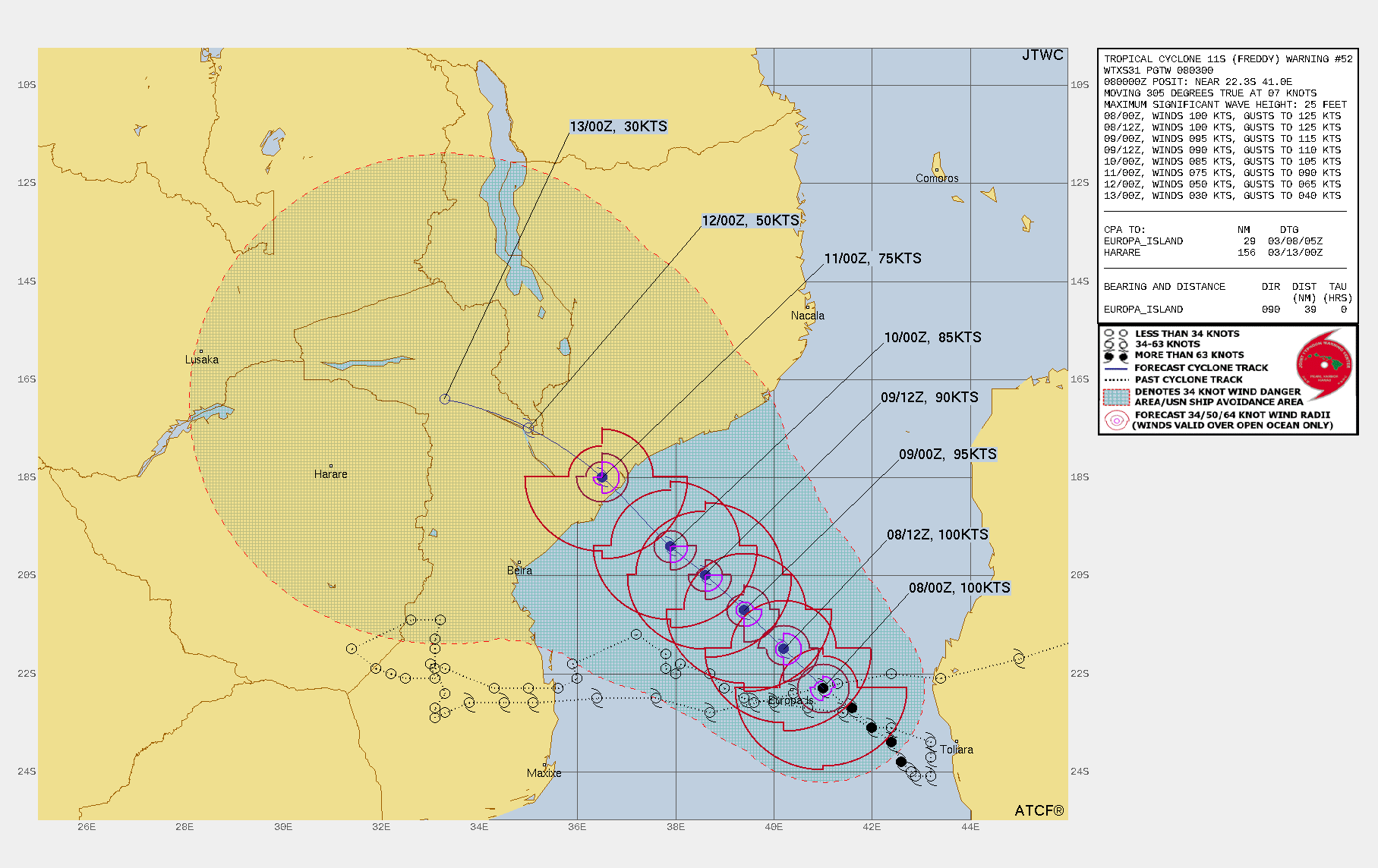
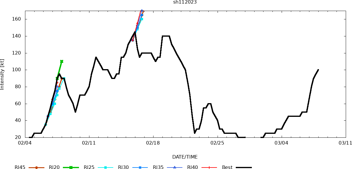
SOUTH INDIAN OCEAN/MOZ CHANNEL: TC 11S(FREDDY). CURRENT ESTIMATED INTENSITY IS 100 KNOTS CATEGORY 3 US AT 08/00UTC.
1123030618 240S 428E 50
1123030700 238S 426E 65
1123030706 234S 424E 80
1123030712 231S 420E 90
1123030718 227S 416E 95
1123030800 223S 410E 100
1123030700 238S 426E 65
1123030706 234S 424E 80
1123030712 231S 420E 90
1123030718 227S 416E 95
1123030800 223S 410E 100
WARNING 52 ISSUED AT 08/03UTC.
CLICK ON THE IMAGERY BELOW TO GET IT ANIMATED AND ENLARGED.

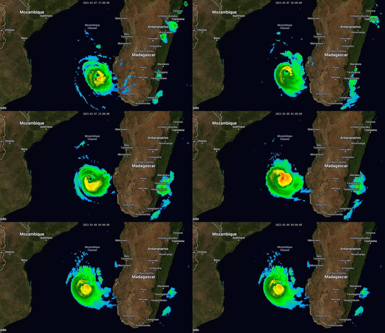
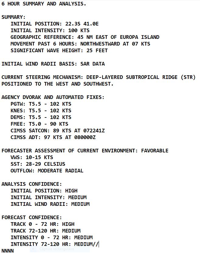
SATELLITE ANALYSIS, INITIAL POSITION AND INTENSITY DISCUSSION: OVER THE PAST 12 HOURS, THE CORE CONVECTIVE STRUCTURE OF TROPICAL CYCLONE (TC) 11S HAS FLUCTUATED RAPIDLY WITH A WELL-FORMED, SYMMETRIC EYE FORMING NEAR 071800Z BUT BECOMING MORE OBLONG AFTER 072100Z. SINCE 072350Z, THE EYE HAS FILLED AND THE CENTRAL DENSE OVERCAST FEATURE HAS BECOME MORE ASYMMETRIC AS INDICATED IN ANIMATED ENHANCED INFRARED (EIR) SATELLITE IMAGERY. A 080047Z SSMIS 91GHZ MICROWAVE IMAGE ALSO REVEALS ERODING CORE CONVECTION OVER THE WESTERN SEMICIRCLE WITH A PARTIALLY EXPOSED LOW-LEVEL CIRCULATION AND A RAGGED MICROWAVE EYE FEATURE. SURFACE OBSERVATIONS FROM EUROPA ISLAND, APPROXIMATELY 35NM WEST OF THE CURRENT POSITION, INDICATE SOUTHERLY WINDS AT 39 KNOTS WITH SLP NEAR 991.4MB. THE INITIAL POSITION IS PLACED WITH HIGH CONFIDENCE BASED ON EIR AND THE SSMIS IMAGE. THE INITIAL INTENSITY OF 100 KTS IS ASSESSED WITH MEDIUM CONFIDENCE BASED ON THE PGTW, KNES AND DEMS DVORAK ESTIMATES. INITIAL WIND RADII WERE ADJUSTED BASED ON A DETAILED ANALYSIS OF A 071543Z RCM SAR IMAGE, WHICH SHOWED MAXIMUM WINDS OF 95 KNOTS WITH RELATIVELY LOW INCIDENCE ANGLES NEAR 20 DEGREES.
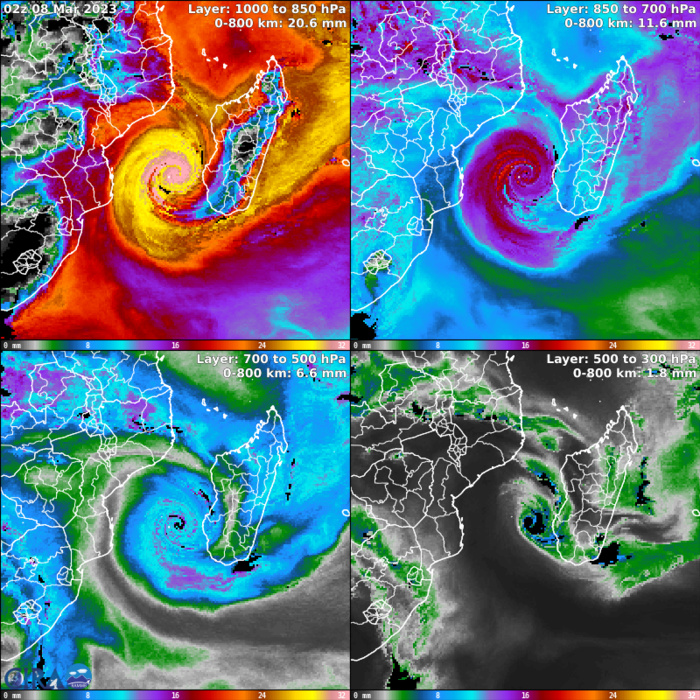
Advected Layer Precipitable Water

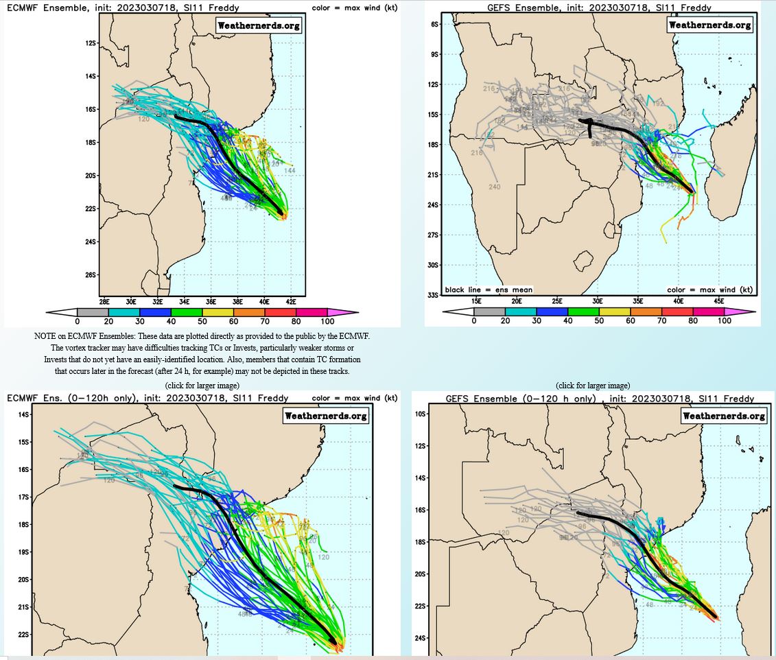
FORECAST REASONING. SIGNIFICANT FORECAST CHANGES: THERE ARE NO SIGNIFICANT CHANGES TO THE FORECAST FROM THE PREVIOUS WARNING. FORECAST DISCUSSION: TC 11S IS EXPECTED TO TRACK NORTHWESTWARD ALONG THE NORTHEASTERN PERIPHERY OF THE STR THROUGH TAU 72. THE SYSTEM WILL MAKE LANDFALL OVER MOZAMBIQUE NEAR TAU 72 AND IS THEN FORECAST TO SLOW AND TURN WEST-NORTHWESTWARD WITH POSSIBLE QUASI-STATIONARY MOTION DUE TO COMPETING STEERING INFLUENCES. TC 11S IS FORECAST TO GRADUALLY WEAKEN THROUGH THE FORECAST PERIOD AS SST VALUES COOL SLIGHTLY. ADDITIONALLY, POLEWARD OUTFLOW SHOULD WEAKEN GRADUALLY AS THE SYSTEM TRACKS EQUATORWARD AWAY FROM THE SUBTROPICAL WESTERLIES WITH WEAK DIVERGENCE ALOFT ANTICIPATED AS THE SYSTEM APPROACHES THE COAST OF MOZAMBIQUE.

MODEL DISCUSSION: DETERMINISTIC MODEL GUIDANCE IS IN GOOD AGREEMENT WITH A 75NM SPREAD IN SOLUTIONS AT TAU 72 THUS HIGH CONFIDENCE IN THE JTWC FORECAST TRACK THROUGH TAU 72. ALTHOUGH THE ECMWF ENSEMBLE (EPS) INDICATES A WIDER SPREAD OF SOLUTIONS, IT GENERALLY SUPPORTS THE JTWC FORECAST TRACK SCENARIO. RELIABLE INTENSITY GUIDANCE INDICATES A STEADY WEAKENING TREND THROUGH THE FORECAST PERIOD WITH RAPID WEAKENING AFTER TAU 72 AS TC 11S TRACKS INLAND. THE UNCOUPLED HWRF IS THE SOLE OUTLIER SHOWING A SHARP INTENSIFICATION TREND AFTER TAU 36 TO A PEAK OF 105 KNOTS BY TAU 60, HOWEVER, THIS IS ASSESSED AS UNLIKELY DUE TO THE DEGRADING ENVIRONMENTAL CONDITIONS.
RIPA Forecast
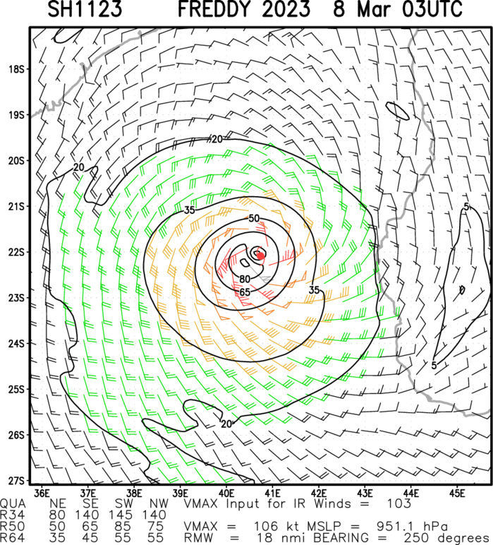
Multiplatform Satellite Surface Wind Analysis (Experimental)
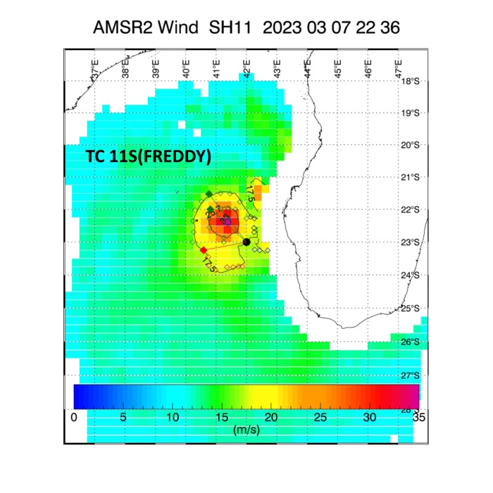
07/2236UTC: AMSR2 READ 10 MINUTE MAXIMUM WINDS: 69 KNOTS= 79 KNOTS(1 MINUTE AVERAGE).
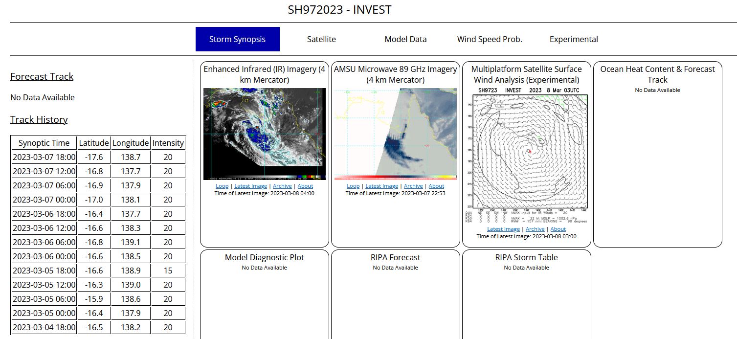
SOUTH PACIFIC OCEAN/GULF OF CARPENTARIA: OVER-LAND INVEST 97P. ESTIMATED LOCATION AND INTENSITY AT 07/18UTC.
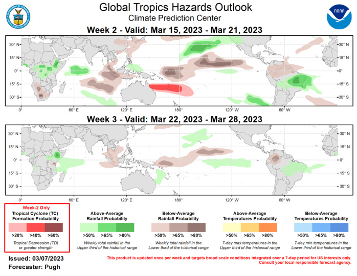
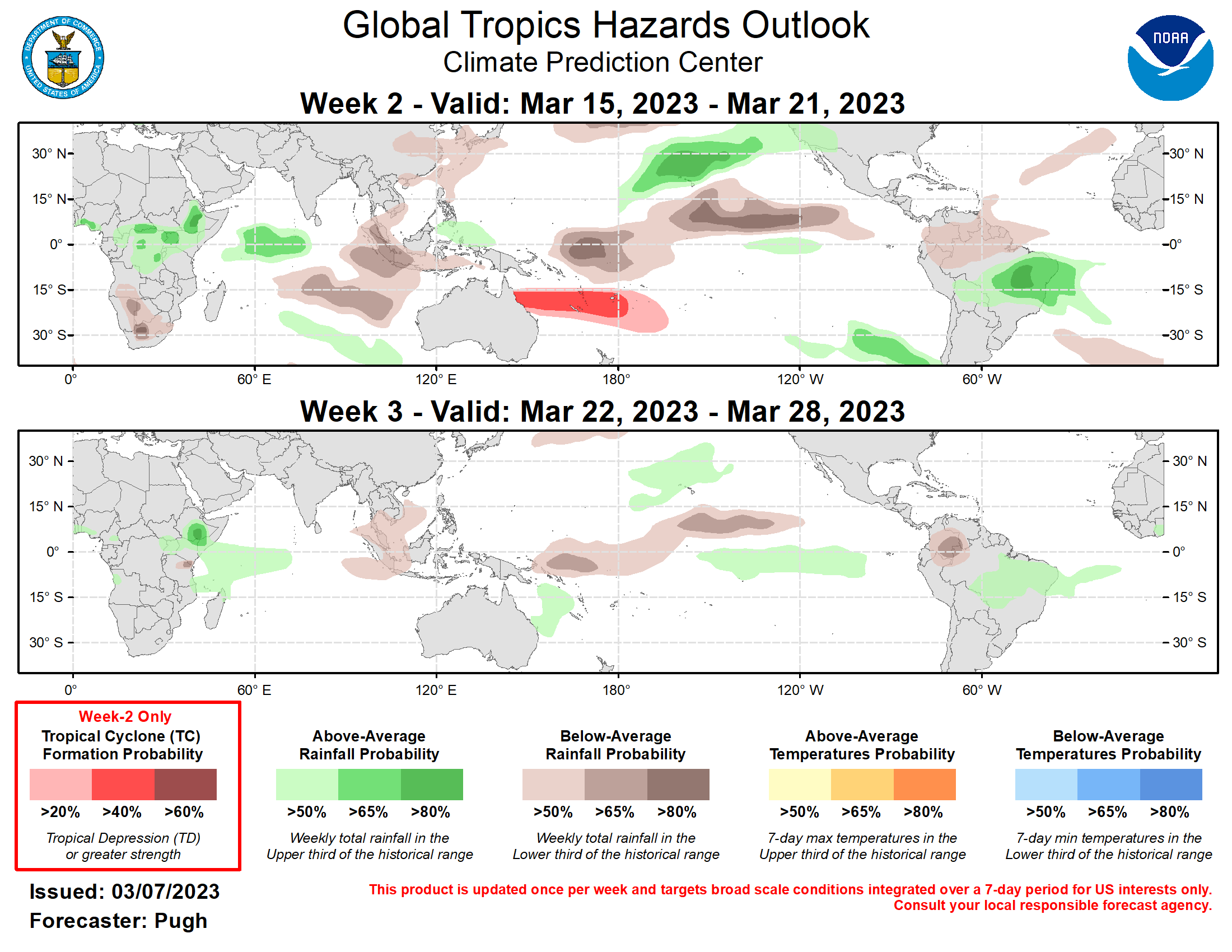
Last Updated - 03/07/23 Valid - 03/15/23 - 03/28/23 The Madden-Julian Oscillation (MJO) strengthened during the first week of March as a more coherent pattern of anomalous upper-level divergence (convergence) developed over the East Pacific (Indian Ocean). The amplitude of the RMM-based index increased since the beginning of the month and dynamical models maintain a strong MJO with eastward propagation over the Western Hemisphere during the next two weeks. By week-3, the MJO is forecast to be centered across Africa and the western Indian Ocean. The magnitude of the 200-hPa velocity anomalies are forecast to be very large through week-2, which raises forecast confidence that the MJO influences global tropical rainfall and modulates tropical cyclone development. In addition, the MJO is likely to enhance subtropical moisture feeding into the west coast of the United States through mid-March. Tropical cyclone (TC) Kevin developed across the South Pacific on March 1 and then intensified to maximum sustained winds of 135 knots on March 4. Kevin made landfall on Vanuatu only a few days after TC Judy crossed the South Pacific island. Long-lived TC Freddy has tracked west across the entire basin during early to mid-February, made its first landfall at Mananjary, Madagascar on February 21, and a second landfall near Vilankulos, Mozambique on February 24. According to the Joint Typhoon Warning Center, Freddy is forecast to make another landfall in central Mozambique on March 10 or 11. Recent model solutions have Freddy reemerging across the Mozambique Channel late in week-1 or by early in week-2. No TC development area is posted for the Mozambique Channel since this would be the remnant low associated with Freddy. Depending on the future track of Freddy, a risk for heavy rainfall, flooding, and high winds may continue for Mozambique and Madagascar from March 15 to 21. However, due to large forecast uncertainty on the fate of Freddy by this time period, a 50 percent chance of above-average rainfall is not posted for these areas. A moderate (40 percent) chance of TC formation is posted for the Coral Sea and South Pacific from March 15 to 21. This favored area for genesis is supported by MJO composites and the deterministic model runs. It should be noted that within the slight (20 percent) chance region, multiple TCs may form prior to the start of week-2, March 15. The large-scale environment is likely to be unfavorable for additional TC development over the South Indian Ocean through week-2, March 15-21. The precipitation outlook for weeks 2 and 3 are based on a historical skill weighted blend of the GEFS, CFS, ECCC, and ECMWF models, MJO precipitation composites for phases 8, 1, 2, and 3, and considerations of the ongoing La Nina background state. The MJO strongly supports above-average rainfall across eastern Brazil during week-2, while below-average rainfall is favored for the western Maritime Continent. From March 15 to 21, increased chances (above 50 percent, or higher) for above-average rainfall are posted from Hawaii eastward to the western United States. During weeks 2 and 3, favored above-average rainfall is forecast across parts of the Horn of Africa and western Indian Ocean.
