Menu

2 week cyclonic development potential: areas under watch for the South Indian and Northwest Australia, 23/1830utc update


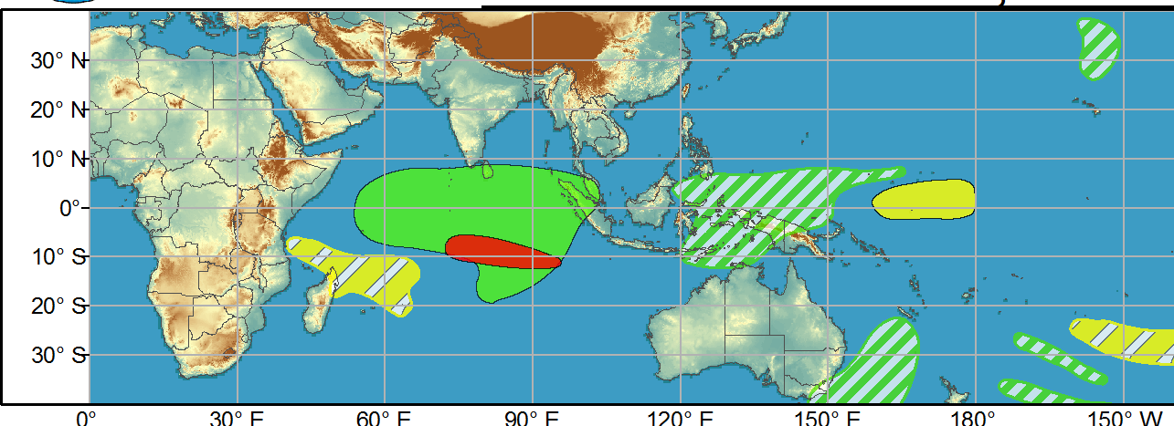
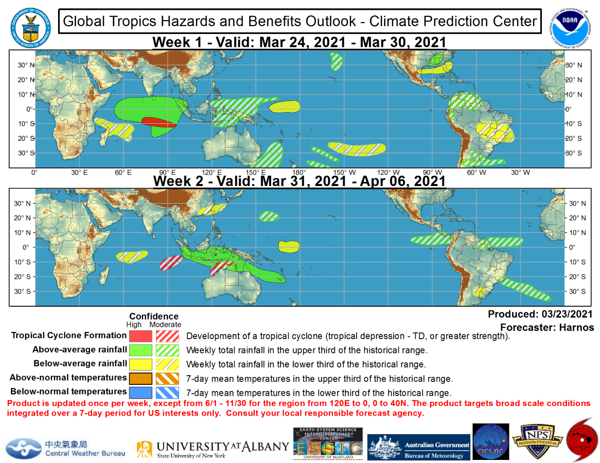
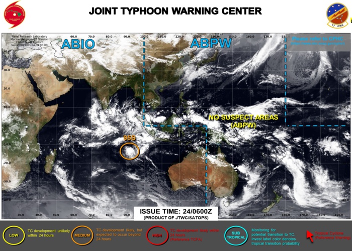
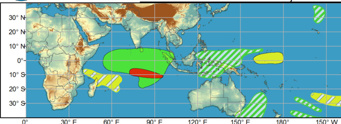
WEEK 1: 24/03 to 30/03. No tropical cyclones (TCs) have formed globally over the past week. The Joint Typhoon Warning Center is currently monitoring a region of convection located near 13S/92E, with an associated forecast of a medium probability of tropical cyclogenesis occurring prior to the forecast period. In the event this system does not form prior to the outlook, high confidence exists for its development during Week-1.


WEEK 1: 24/03 TO 30/03. No tropical cyclones (TCs) have formed globally over the past week. The Joint Typhoon Warning Center is currently monitoring a region of convection located near 13S/92E, with an associated forecast of a medium probability of tropical cyclogenesis occurring prior to the forecast period. In the event this system does not form prior to the outlook, high confidence exists for its development during Week-1.
Issued at 23/1830UTC by NOAA.
In collaboration with the JTWC and several well known organizations.

 Archives: HERE

Cheers,
Patrick Hoareau
M974World
ILES SOEURS

Cyclone Class 4
 Cheers,PH.

Joint Typhoon Warning Center
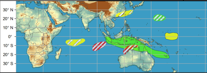
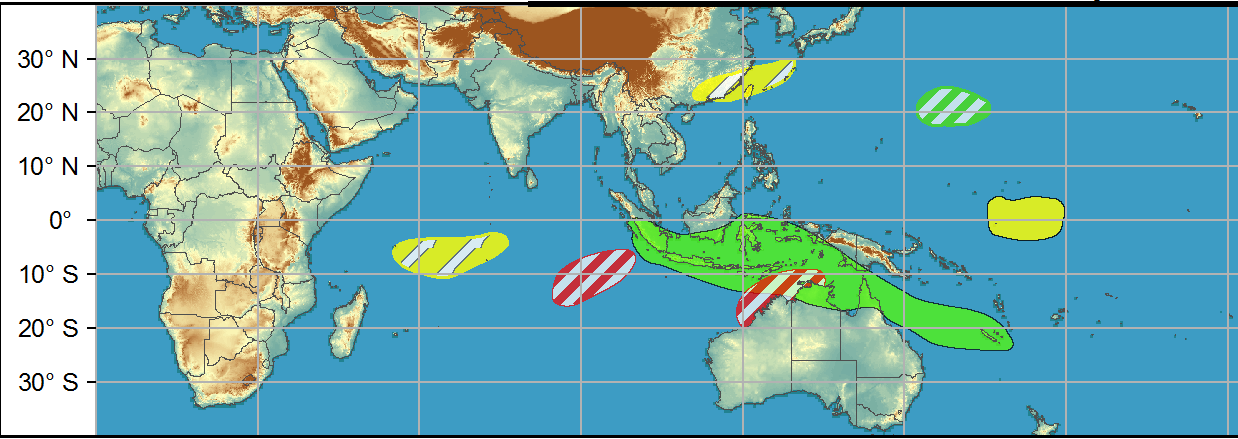
WEEK 2: 31/03 TO 06/04. During Week-2 equatorial Rossby wave activity supports moderate confidence of TC formation over a similar portion of the southeastern Indian Ocean and also off the northern coast of Australia. Lower confidence exists for a "twin" of the latter possible TC developing over the eastern Bay of Bengal during Week-2, but is supported by some GEFS members and likely Rossby wave activity. All of the aforementioned regions are historically supported by an active MJO transiting from the Indian Ocean to West Pacific during the period.
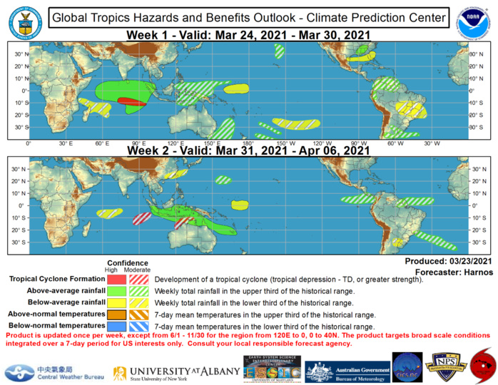


Precipitation forecasts during the next two weeks have the highest confidence across regions influenced by the MJO, possible TC tracks, and the low-frequency suppression of convection east of New Guinea from La Nina. Remaining precipitation forecasts are largely a result of dynamical model consensus but do highlight some key impactful features. Heavy rains may continue during Week-1 for portions of New South Wales which have already seen historic flooding prior to the outlook period. A mid-latitude storm system is forecast to be displaced well south of the climatological storm track over North America and bring heavy rain to portions of the Mississippi River Valley and Southeast during Week-1, but these rains are forecast to miss much of Florida and South Texas where drought concerns already exist. Multiple mesoscale convective systems are forecast to initiate in the lee of the Andes and track toward the South Atlantic during Week-1.

24/06UTC. INVEST 95S IS STILL CURRENTLY ASSESSED AS HAVING MEDIUM CHANCES OF REACHING 35KNOTS WITHIN THE NEXT 24H. JTWC HAS BEEN ISSUING 3HOURLY SATELLITE BULLETINS ON THIS SYSTEM.
Rédigé par PATRICK HOAREAU le Wednesday, March 24th 2021 à 11:10