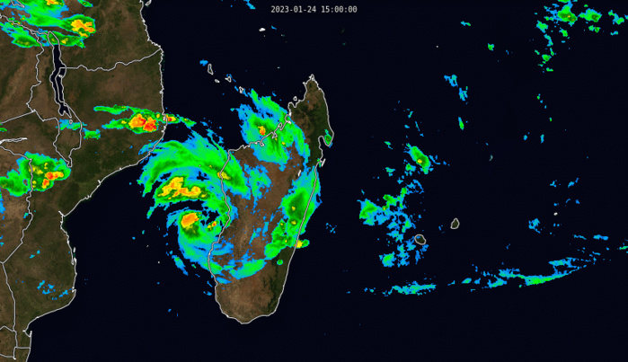
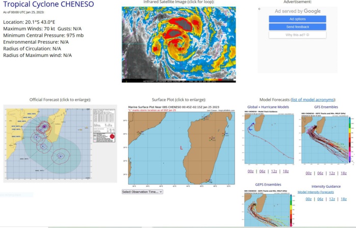
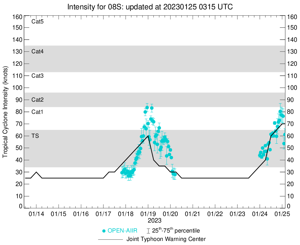
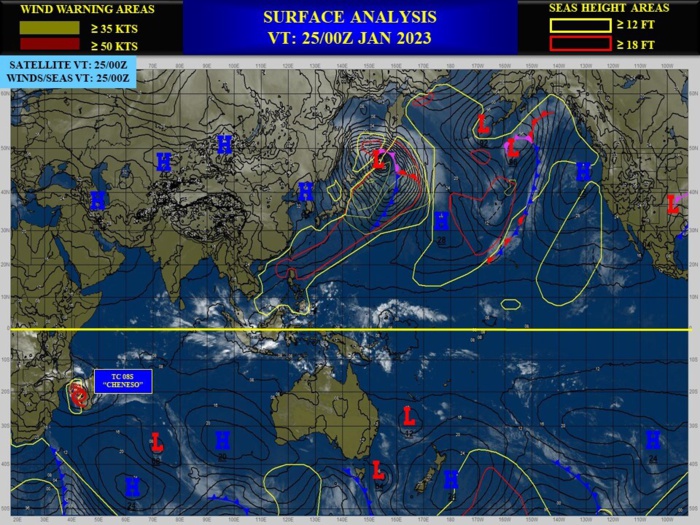
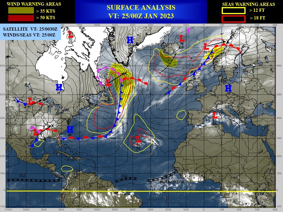
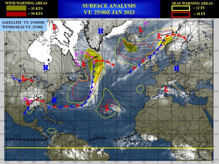
CLICK ON THE IMAGERIES BELOW TO GET THEM ENLARGED
CLICK ON THE IMAGERY BELOW TO GET IT ANIMATED AND ENLARGED.
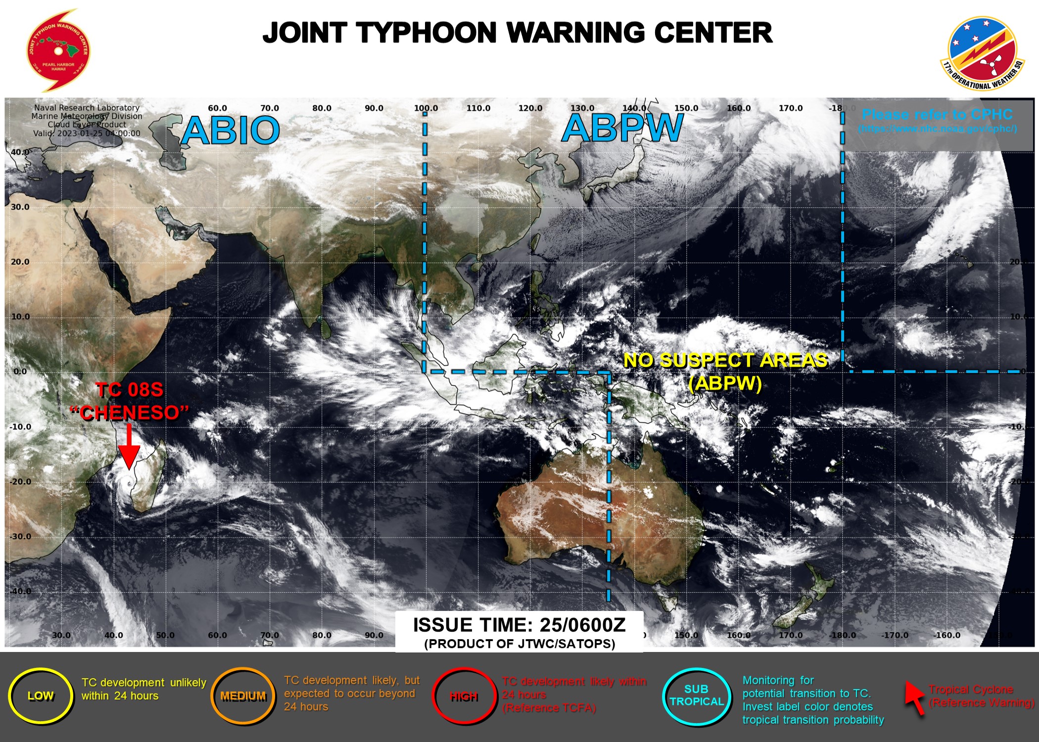
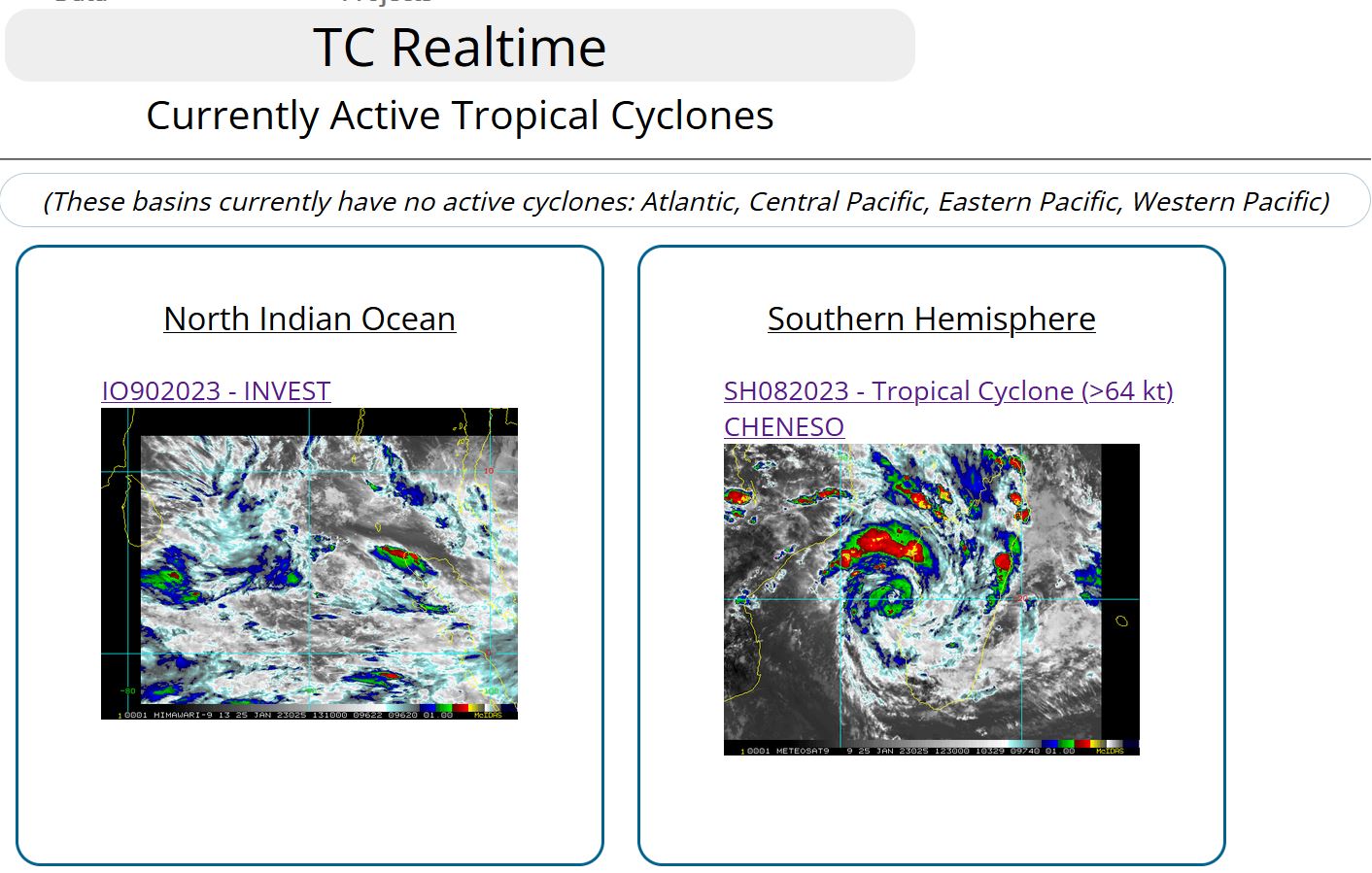
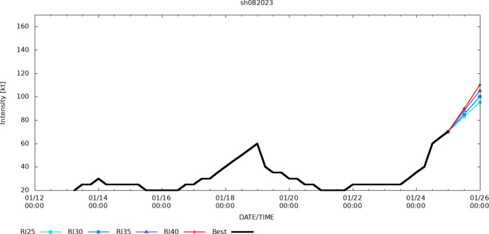
SOUTH INDIAN OCEAN/MOZ CHANNEL: TC 08S(CHENESO). ESTIMATED LOCATION AND INTENSITY AT 25/00UTC.
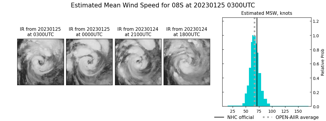
ESTIMATED CURRENT INTENSITY IS 70KNOTS/975MB. CATEGORY 1 US.
0823012318 205S 432E 30
0823012400 201S 427E 35
0823012406 199S 427E 40
0823012412 201S 429E 60
0823012418 201S 429E 65
0823012500 201S 430E 70
0823012400 201S 427E 35
0823012406 199S 427E 40
0823012412 201S 429E 60
0823012418 201S 429E 65
0823012500 201S 430E 70
WARNING 7 ISSUED AT 25/03UTC.

SATELLITE ANALYSIS, INITIAL POSITION AND INTENSITY DISCUSSION: ANIMATED ENHANCED INFRARED (EIR) SATELLITE IMAGERY SCATTEROMETRY AND MICROWAVE IMAGERY OVER THE PAST 12 HOURS CONFIRMS THAT TROPICAL STORM 08S (CHENESO) IS INTENSIFYING SLOWLY BUT STEADILY AS IT MEANDERS OFF THE EAST COAST OF MADAGASCAR. THE SYSTEM HAS DEVELOPED AN EYE ON TWO OCCASIONS DURING THE PAST 24 HOURS WITH THE LATEST OCCURENCE PERSISTING AT BULLETIN ISSUE TIME. UPWELLING INDUCED BY THE NON-MOVEMENT OF CHENESO AND LAND INTERACTION OVER THE EASTERN PERIPHERY IS DEFINITELY ACTING AS A BREAKING MECHANISM ON INTENSIFICATION DESPITE THE NEAR PERFECT ENVIRONMENT. THE SYSTEM IS ENTERING THE DIURNAL MAX PHASE YET NOT JUMPING IN INTENSITY PROVIDING FURTHER EVIDENCE OF THE UPWELLING. ANIMATED WATER VAPOR IMAGERY SHOWS THE SYSTEM IS WELL ENSCONSED FROM THE SUBSIDENCE AND DRIER AIR TO THE DISTANT SOUTHWEST. THE WATER VAPOR ALSO SHOWS SPECTACULAR EQUATORIAL OUTFLOW AND A VIGOROUS POLEWARD OUTFLOW CHANNEL. A MID-HIGH LEVEL RIDGE EXTENDING FROM THE EASTERN ATLANTIC ACROSS THE KALAHARI DESERT AND INTO THE SOUTHWEST INDIAN OCEAN IS COMBINING WITH THE NEAR EQUATORIAL RIDGE TO TRAP THE SYSTEM IN AN ENVIRONMENT CHARACTERIZED BY 29-30C DEGREE SEA WATERS, LESS THAN 10 KNOTS OF VERTICAL WIND SHEAR, AND OUTSTANDING OUTFLOW. UPWELLING IS THE ONLY FACTOR KEEPING CHENESO FROM TURNING INTO A MONSTER. THE CURRENT INTENSITY ESTIMATE COMBINES THE JTWC AND FMEE DVORAKS WITH THE NEW CIMSS DEEP MICRONET INTENSITY ESTIMATOR AND THE OPEN-AIIR SYSTEM, WHICH HAVE BEEN DOING AN OUTSTANDING JOB WITH THE STORM OVER THE PAST 24 HOURS.
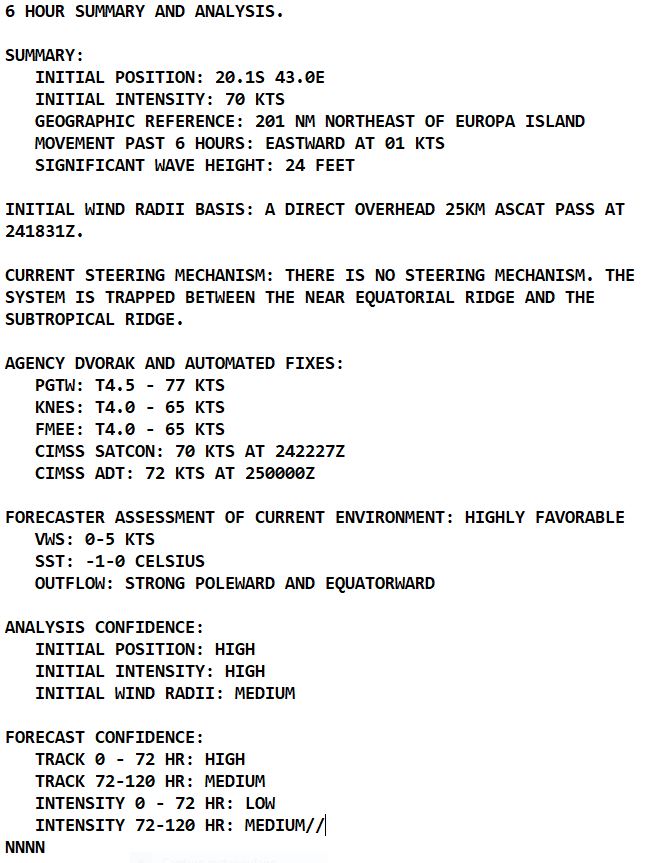
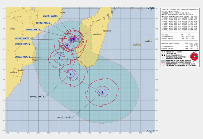
FORECAST REASONING. SIGNIFICANT FORECAST CHANGES: THERE ARE NO SIGNIFICANT CHANGES TO THE FORECAST FROM THE PREVIOUS WARNING. FORECAST DISCUSSION: TC 08S WILL WOBBLE LIKE A SAILOR TRYING TO GET BACK TO THE SHIP BEFORE LIBERTY EXPIRES UNTIL THE SUBTROPICAL RIDGE RETRACTS BEGINNING NEAR TAU 36. AS THE RIDGE RELEASES PRESSURE ON THE SYSTEM IT WILL BEGIN A SLOW SOUTHWESTWARD TRACK AND GRADUALLY INCREASE SPEED. THE TRACK WILL TAKE THE SYSTEM TO THE EAST OF EUROPA ISLAND BUT CLOSE ENOUGH TO INFLICT PENTY OF DAMAGE. THE CORE STRENGTH DURING PASSAGE WILL BE ABOVE 90 KNOTS AT THAT POINT. CHENESO WILL PEAK AT ABOUT 100 KTS AS IT ROUNDS THE RIDGE AXIS NEAR THE 24TH LATITUDE AND TAU 72. ONCE ROUNDING THE RIDGE IT WILL TRACK TOWARDS THE MID-LATITUDE WESTERLIES BUT THE SYSTEM WILL NOT ACCELERATE INTO THE WESTERLIES UNTIL THE LATEST PART OF THE FORECAST PERIOD AND BEYOND. THE TRANSITION PROCESS WILL BE EXTREMELY SLOW DUE TO THE POLAR JET BEING WELL SOUTH OF THE CONTINENT. MID TO HIGH LEVEL MOISTURE FIELDS INDICATE THE CORE WILL NOT BEGIN ERODING UNTIL 291800Z, WHEN THE SYSTEM APPROACHES THE 30TH LATITUDE. AT THAT POINT, THE SYSTEM WILL BE TRACKING THROUGH 26 DEGREE AND BELOW WATERS AND BE UNDERGOING SUBTROPICAL TRANSITION.
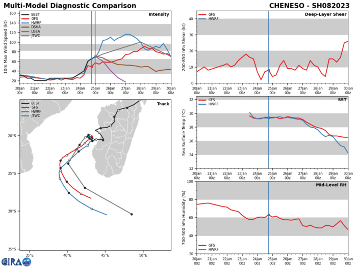
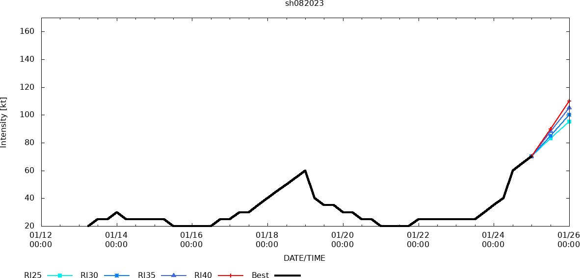
MODEL DISCUSSION: TRACK GUIDANCE HAS DONE NOTHING BUT TIGHTEN UP WITH EACH SUCCESSIVE RUN GIVING MUCH MORE CONFIDENCE TO A TRACK JUST EAST OF EUROPA ISLAND. INTENSITY GUIDANCE HAS BEEN WIDELY SPREAD. SOME RAPID INTENSITY GUIDANCE IS TRIGGERING, BUT NONE ARE OVER 50 PERCENT. THE JTWC FORECAST IS ABOVE THE INTENSITY CONSENSUS BUT DUE TO THE SLOW MOVEMENT OF THE SYSTEM AND ITS ASSOCIATED UPWELLING THE PEAK INTENSITY FORECAST IS BASED ON THE MAXIMUM OUTFLOW EFFECT AS THE SYSTEM ROUNDS THE RIDGE NEAR THE 24TH LATITUDE. WINDFIELDS ARE EXPANDED ONLY SLOWLY AS THICKNESS PROGS DO NOT INDICATE ANY PRONOUNCED STRETCHING UNTIL BEYOND THE END OF THE FORECAST PERIOD.
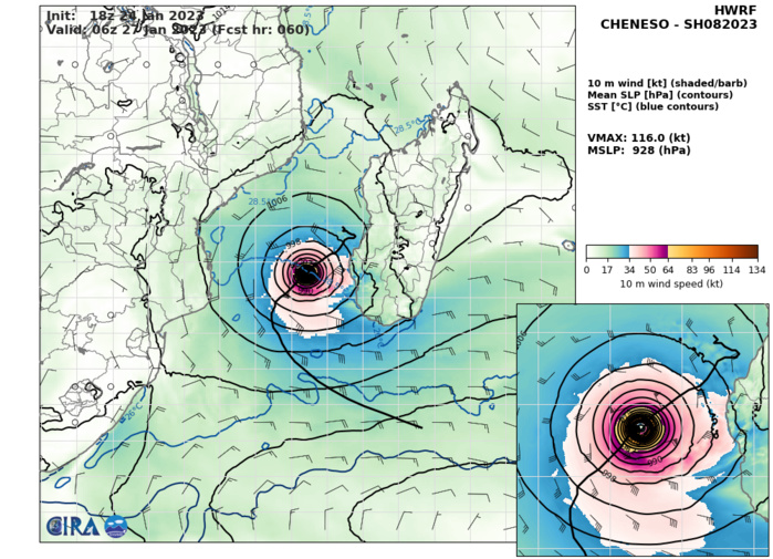
HWRF AT 24/18UTC: 116KNOTS AT +60H.
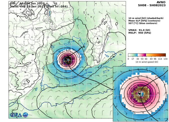
AVNO AT 24/18UTC: 91KNOTS AT +84H.
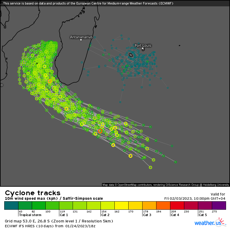
ECMWF ENSEMBLE AT 24/18UTC.
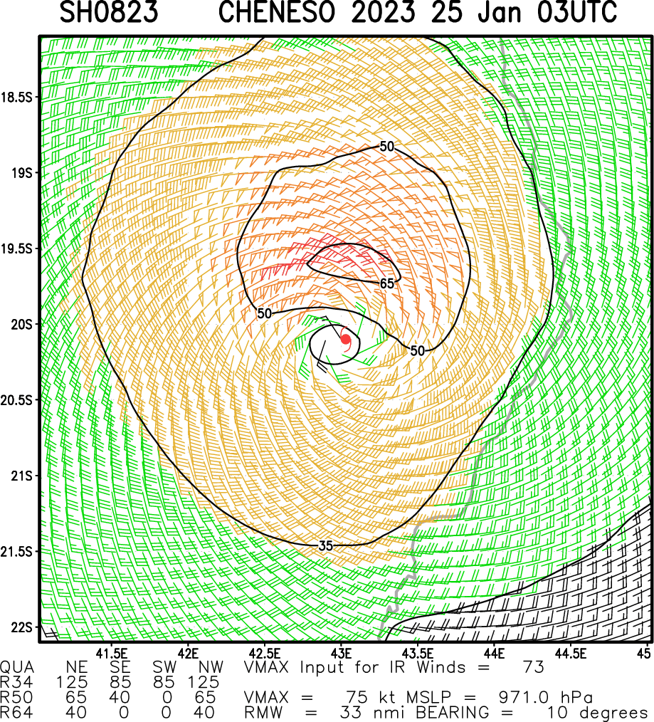
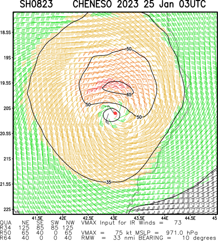
Multiplatform Satellite Surface Wind Analysis (Experimental)
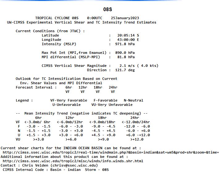
UW-CIMSS Experimental Vertical Shear and TC Intensity Trend Estimates
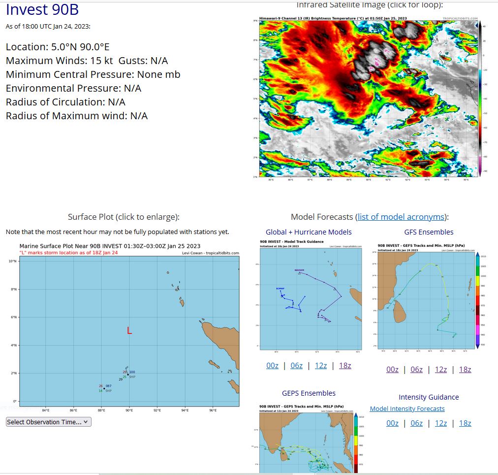
NORTH INDIAN OCEAN/BAY OF BENGAL: INVEST 90B. ESTIMATED LOCATION AND INTENSITY AT 24/18UTC.
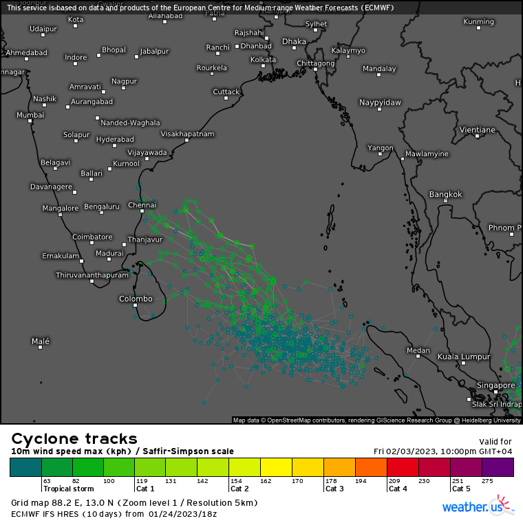
ECMWF ENSEMBLE AT 24/18UTC.

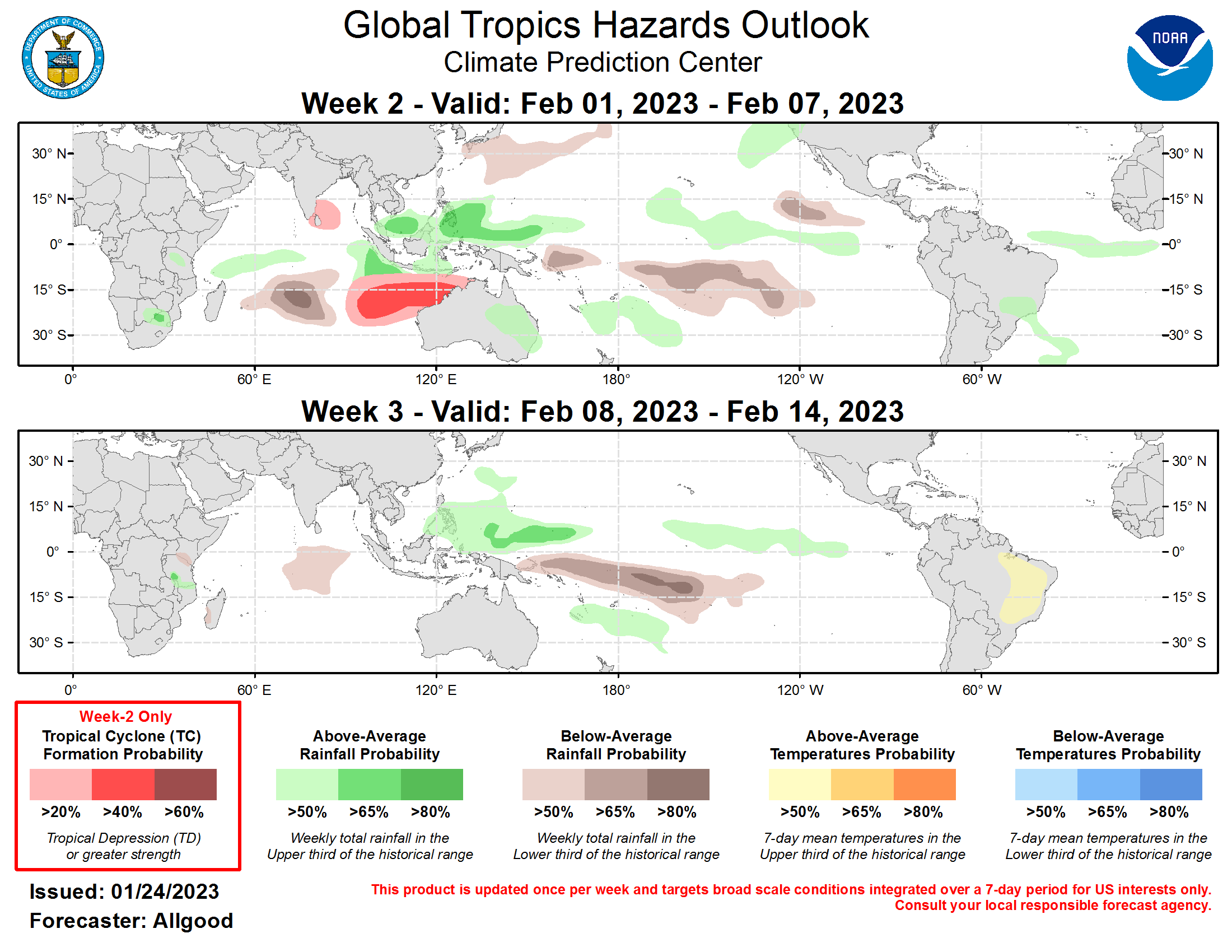
Last Updated - 01/24/23 Valid - 02/01/23 - 02/14/23 The amplitude of the Madden-Julian Oscillation (MJO) RMM-based index increased substantially over the past few days, indicating that the enhanced phase of the MJO is located over the Indian Ocean. This recent amplification was well forecasted by the suite of dynamical model guidance as discussed in the previous outlook last week. As the intraseasonal signal increasingly interferes constructively with the ongoing La Niña base state, widespread enhanced convection has developed across the Maritime Continent. Over the equatorial Pacific, the trade wind regime has strengthened and expanded, and the previously extended East Asian jet has retracted, reducing the extent of Pacific moisture flow over western North America. The MJO has been active over the past several months, and dynamical model MJO index forecasts indicate a continuation of this pattern. Following a stationary period of enhancement over the Indian Ocean during Week-1, the GEFS depicts robust MJO activity crossing the Maritime Continent during Week-2, and entering the Pacific basin during Week-3. The ECMWF shows a similar evolution, albeit with a weaker progression across the Maritime Continent that may be due to aliasing with the low frequency base state that is removed from the analysis. Many GEFS and ECMWF ensemble members depict a strong Pacific MJO event. While previous MJO events have not succeeded in producing a substantial low-level westerly wind burst along the Equator over the West Pacific, the West Pacific Warm Pool has grown considerably, and a strong MJO event has the potential to initiate a strong downwelling oceanic Kelvin wave that could erode the ongoing La Niña. Therefore, both La Niña and the MJO are favored to strongly influence the evolution of the global tropical convective anomalies, which teleconnects well into the northern hemisphere midlatitude pattern this time of year. Indian Ocean and Maritime Continent MJO events are associated with downstream pattern changes favoring increased ridging and warmer temperatures across eastern North America, which is generally consistent with dynamical model forecasts for the Week-3 period. The anticipated height anomaly pattern across North America during the upcoming two weeks is also largely consistent with the cold ENSO response. During the past week, a pair of tropical cyclones formed over the eastern Coral Sea. Tropical Storm Irene developed on January 18, strengthening to near hurricane intensity as it tracked southeastward to the east of New Caledonia. On January 20, Tropical Depression 10 formed just west of New Caledonia, but quickly dissipated in an unfavorable regime. Elsewhere, Tropical Storm Cheneso, which initially formed prior to last week’s outlook period on January 17, made landfall over northern Madagascar, bringing substantial flooding impacts. With an active MJO favored to progress from the Indian Ocean to the West Pacific over the next three weeks, the areas of potential tropical cyclone formation are also expected to progress gradually eastward. During Week-2, tropical cyclogenesis is possible over the southwestern Indian Ocean in the vicinity of the Cocos Islands, or north of Australia’s Kimberley Coast. While climatology does not favor much tropical cyclone activity over the northern Indian Ocean, both the GEFS and ECMWF favor tropical cyclogenesis near southern India or Sri Lanka during Week-2, meriting a 20-percent probability for formation. Forecasts for above- and below-median precipitation are based on a skill-weighted consensus of operational dynamical model guidance, with an anticipated continuation of La Niña conditions and a MJO event propagating from the Maritime Continent to the West Pacific. While the forecasted MJO event is depicted as stronger than the previous event that moved through the West Pacific during late December and early January, dynamical models do not show a robust breakdown in the trade winds over the West Pacific. Therefore, enhanced precipitation due to the MJO will likely be more pronounced to the north and south of the Equator over the Pacific. While cold air outbreaks over the contiguous United States are likely during Week-2, a strong temperature gradient is favored to set up close to the Gulf Coast, and there is uncertainty about how far south the cold air penetrates into regions with subtropical and tropical agriculture. Elsewhere, dynamical models favor increased chances for above-average temperatures across portions of Brazil, which could have a negative impact on agriculture.
