CLICK ON THE IMAGERIES BELOW TO GET THEM ENLARGED
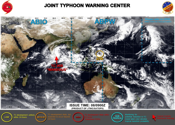
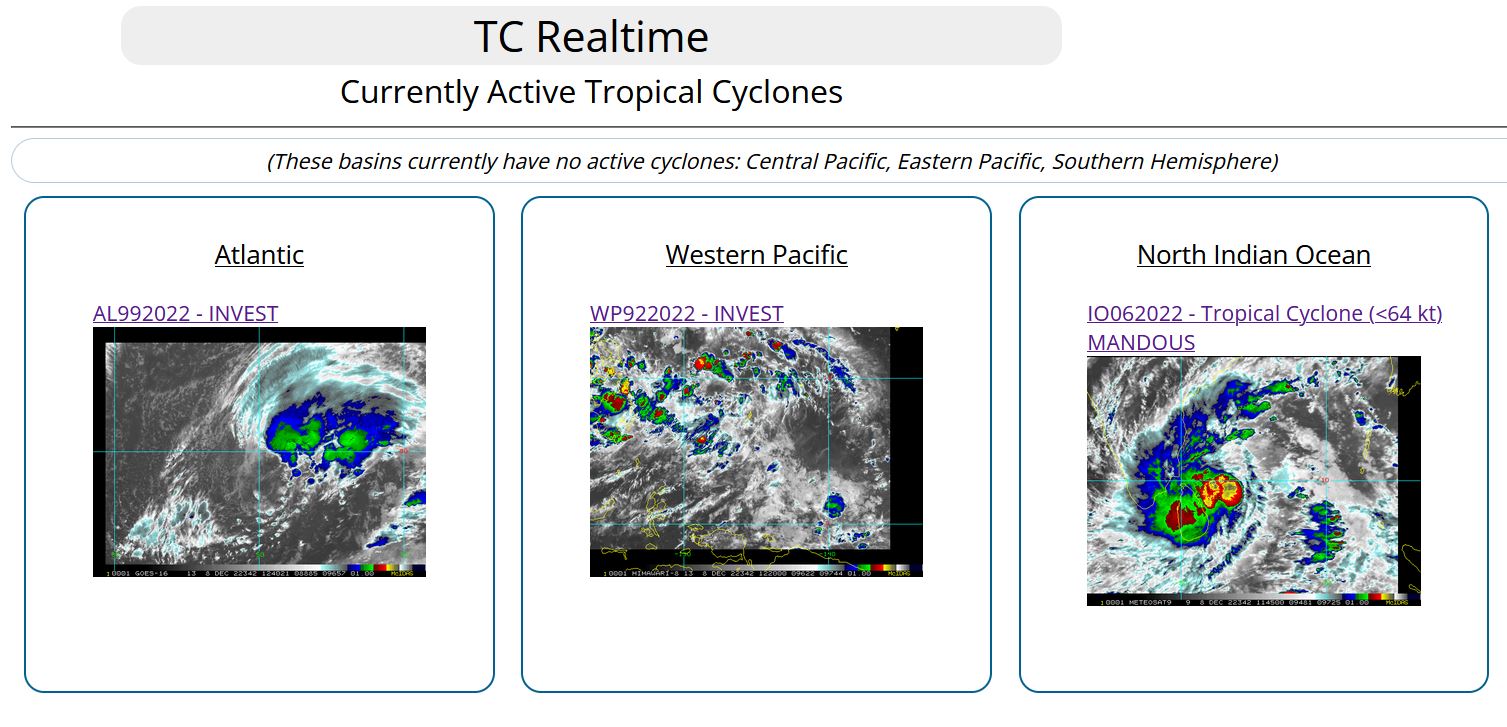
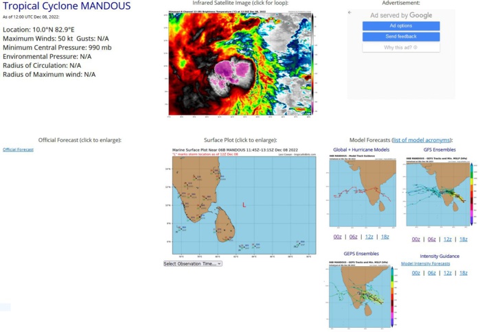
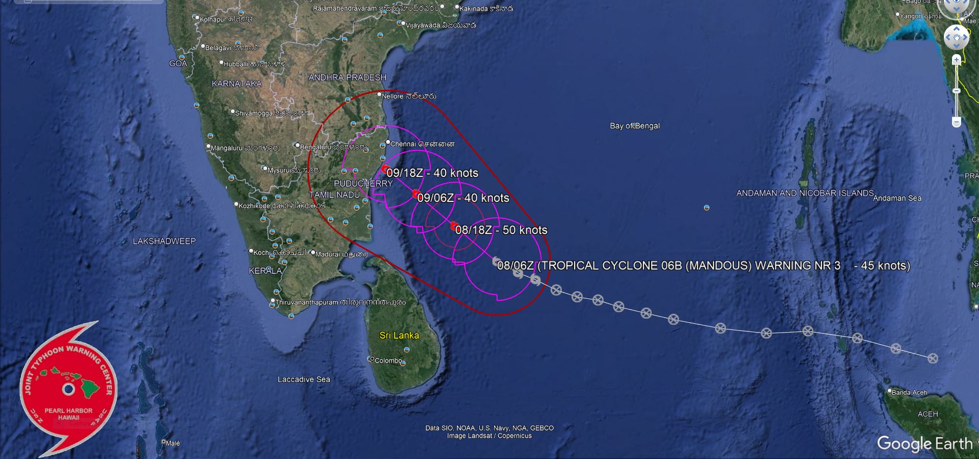
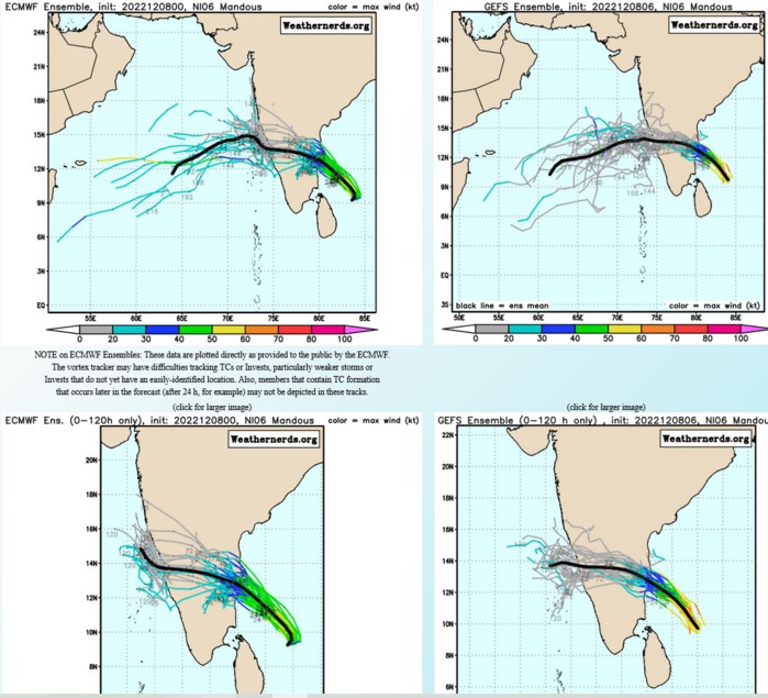
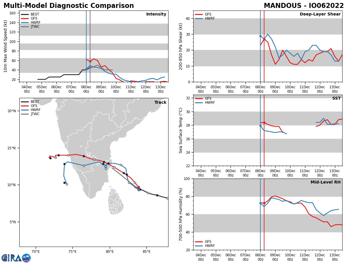
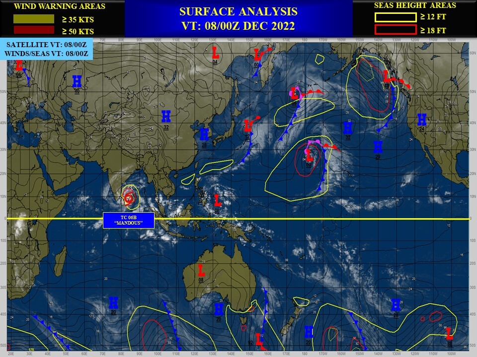
NORTH INDIAN OCEAN/BOB: TC 06B(MANDOUS). ESTIMATED LOCATION AND INTENSITY AT 08/12UTC.
IO, 06, 2022120418,64N, 969E, 20, 1007, DB
IO, 06, 2022120500,68N, 956E, 20, 1006, DB
IO, 06, 2022120506,72N, 943E, 20, 1005, DB
IO, 06, 2022120512,75N, 927E, 25, 1004, TD
IO, 06, 2022120518,75N, 914E, 25, 1004, TD
IO, 06, 2022120600,77N, 900E, 25, 1003, TD
IO, 06, 2022120606,80N, 886E, 25, 1003, TD
IO, 06, 2022120612,82N, 878E, 30, 1000, TD
IO, 06, 2022120618,84N, 870E, 30, 999, TD
IO, 06, 2022120700,86N, 864E, 30, 998, TD
IO, 06, 2022120706,87N, 858E, 30, 1003, TD
IO, 06, 2022120712,89N, 852E, 30, 1003, TD
IO, 06, 2022120718,92N, 846E, 40, 995, TS
IO, 06, 2022120800,94N, 841E, 40, 993, TS
IO, 06, 2022120806,97N, 835E, 45, 992, TS
IO, 06, 2022120812,100N, 829E, 50, 990, TS
WARNING 3 ISSUED AT 08/09UTC.
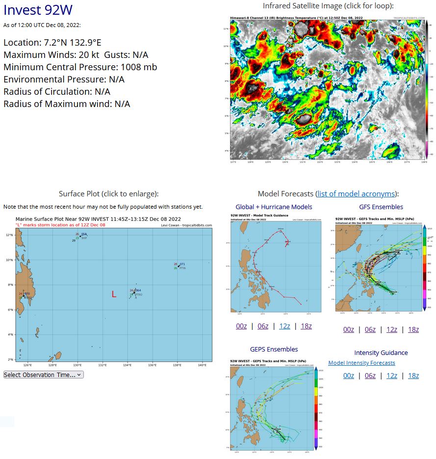
WESTERN NORTH PACIFIC: INVEST 92W. ESTIMATED LOCATION AND INTENSITY AT 08/12UTC. ADVISORY(ABPW) ISSUED AT 08/09UTC.

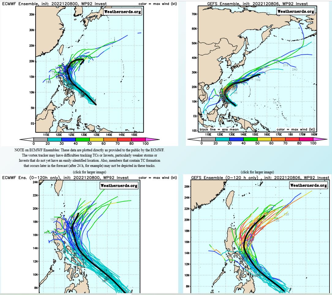
THE AREA OF CONVECTION (INVEST 92W) PREVIOUSLY LOCATED NEAR 6.0N 134.8E IS NOW LOCATED NEAR 6.5N 133.9E, APPROXIMATELY 60 NM SOUTHWEST OF PALAU. ANIMATED MULTISPECTRAL SATELLITE IMAGERY (MSI) AND A 080707Z GMI 89GHZ PASS DEPICT A BROAD LOW LEVEL CIRCULATION (LLC) PARTIALLY OBSCURED BY DEEP CONVECTION IN THE NORTHWESTERN PERIPHERY. UPPER LEVEL ANALYSIS REVEALS IMPROVING CONDITIONS FOR DEVELOPMENT WITH MODERATE EQUATORWARD OUTFLOW AND LOW TO MODERATE (10-20KT) VWS. SEA SURFACE TEMPERATURE REMAINS CONDUCIVE AT 29-30C. GLOBAL MODELS ARE IN GOOD AGREEMENT THAT 92W WILL GRADUALLY INTENSIFY AS IT TRACKS WEST- NORTHWESTWARD TOWARDS LEGAZPI, PHILIPPINES OVER THE NEXT 24-48 HOURS. MAXIMUM SUSTAINED SURFACE WINDS ARE ESTIMATED AT 15 TO 20 KNOTS. MINIMUM SEA LEVEL PRESSURE IS ESTIMATED TO BE NEAR 1007 MB. THE POTENTIAL FOR THE DEVELOPMENT OF A SIGNIFICANT TROPICAL CYCLONE WITHIN THE NEXT 24 HOURS IS UPGRADED TO MEDIUM.
WP, 92, 2022120600,45N, 1407E, 15, 1009, DB
WP, 92, 2022120606,48N, 1395E, 15, 1008, DB
WP, 92, 2022120612,52N, 1387E, 15, 1008, DB
WP, 92, 2022120618,54N, 1381E, 15, 1006, DB
WP, 92, 2022120700,56N, 1376E, 15, 1005, DB
WP, 92, 2022120706,57N, 1372E, 15, 1004, DB
WP, 92, 2022120712,57N, 1367E, 15, 1006, DB
WP, 92, 2022120718,58N, 1361E, 15, 1010, DB
WP, 92, 2022120800,60N, 1348E, 15, 1010, DB
WP, 92, 2022120806,65N, 1339E, 20, 1008, DB
WP, 92, 2022120812,72N, 1329E, 20, 1008, DB

GLOBAL MODELS ARE IN GOOD AGREEMENT THAT 92W WILL GRADUALLY INTENSIFY AS IT TRACKS WEST- NORTHWESTWARD TOWARDS LEGAZPI, PHILIPPINES OVER THE NEXT 24-48 HOURS.
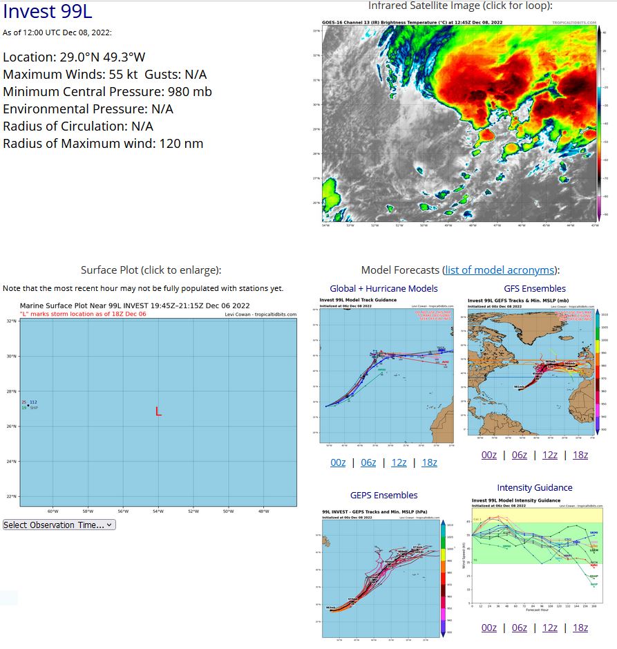
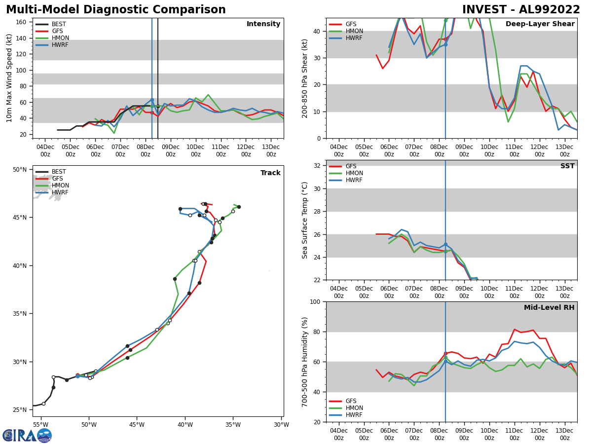
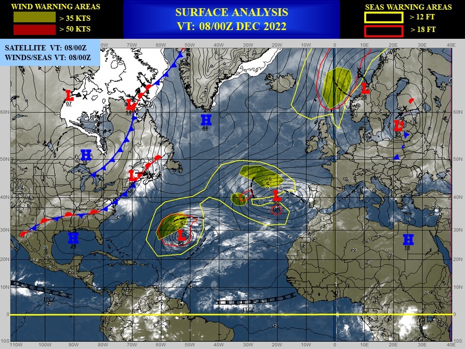
NORTH ATLANTIC OCEAN: INVEST 99L. ESTIMATED LOCATION AND INTENSITY AT 08/12UTC. NHC COMMENTS.

ZCZC MIATWOAT ALL TTAA00 KNHC DDHHMM Special Tropical Weather Outlook NWS National Hurricane Center Miami FL 840 AM EST Thu Dec 8 2022 For the North Atlantic...Caribbean Sea and the Gulf of Mexico: Special Tropical Weather Outlook issued to discuss the potential for subtropical development over the central Atlantic. Central Subtropical Atlantic: 1. A non-tropical low pressure area located about 925 miles east-southeast of Bermuda continues to produce an extensive area of showers and thunderstorms. However, the system remains embedded within a frontal zone, which is expected to become even more pronounced later today as the low begins to move east-northeastward at 20 to 25 mph toward colder waters and interacts with a mid-latitude trough. Therefore, it is unlikely that the low will transition to a subtropical or tropical cyclone. Nevertheless, significant non-tropical development of this low is expected during the next couple of days, and additional information, including hurricane-force wind warnings, can be found in High Seas Forecasts issued by the National Weather Service. 1. This will be the last Special Tropical Weather Outlook issued on this system. Regularly scheduled Tropical Weather Outlooks will resume on May 15, 2023, while Special Tropical Weather Outlooks will be issued as necessary during the off-season. * Formation chance through 48 hours...low...10 percent. * Formation chance through 5 days...low...10 percent. High Seas Forecasts issued by the National Weather Service can be found under AWIPS header NFDHSFAT1, WMO header FZNT01 KWBC, and online at ocean.weather.gov/shtml/NFDHSFAT1.php Forecaster Brown
AL, 99, 2022120412,238N, 617W, 25, 1006, DB
AL, 99, 2022120418,240N, 608W, 25, 1005, DB
AL, 99, 2022120500,242N, 598W, 25, 1005, DB
AL, 99, 2022120506,244N, 589W, 30, 1004, DB
AL, 99, 2022120512,249N, 579W, 30, 1004, DB
AL, 99, 2022120518,253N, 571W, 35, 1002, DB
AL, 99, 2022120600,254N, 563W, 35, 1001, DB
AL, 99, 2022120606,254N, 555W, 35, 1001, LO
AL, 99, 2022120612,256N, 547W, 35, 1001, LO
AL, 99, 2022120618,264N, 540W, 35, 1000, LO
AL, 99, 2022120700,273N, 537W, 45, 994, EX
AL, 99, 2022120706,279N, 536W, 50, 989, EX
AL, 99, 2022120712,284N, 537W, 55, 986, EX
AL, 99, 2022120718,284N, 531W, 55, 981, EX
AL, 99, 2022120800,281N, 523W, 55, 980, EX
AL, 99, 2022120806,285N, 511W, 55, 980, EX
AL, 99, 2022120812,290N, 493W, 55, 980, EX
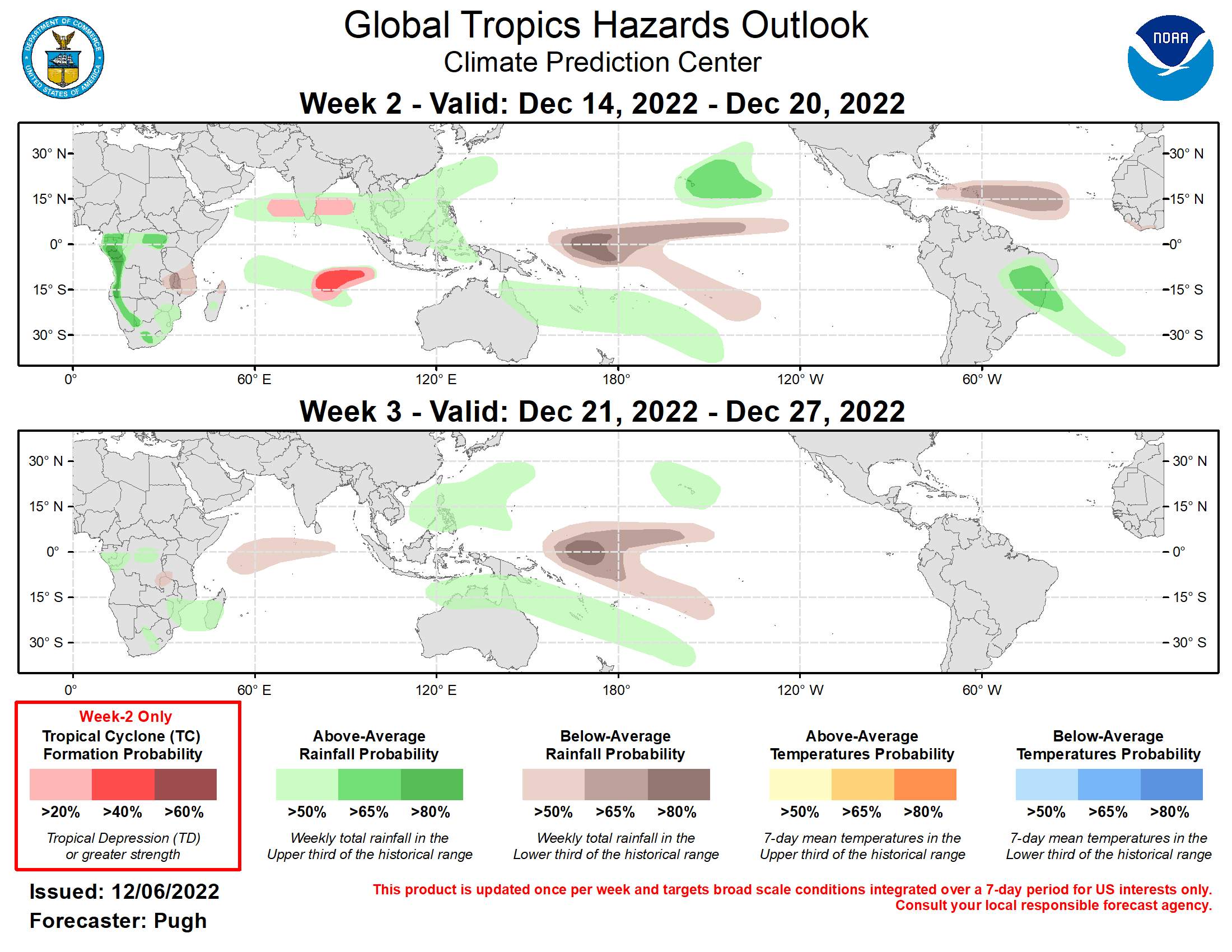
Last Updated - 12/06/22 Valid - 12/14/22 - 12/27/22 La Nina continues to be the major influence on anomalous rainfall across the global tropics, but a relatively strong MJO propagated eastward from the Pacific to the Western Hemisphere during late November. The MJO began to weaken at the beginning of December with the RMM index decreasing in amplitude and the 200-hPa velocity potential field becoming less coherent. Dynamical models diverge on the future MJO evolution with the CFS most bullish with a continued eastward propagation from the Indian to Pacific Ocean during the next three weeks. The GFS and ECMWF models depict an eastward propagation of anomalous upper-level divergence through mid-December, but those model solutions favor La Nina likely becoming the dominant factor in global tropical rainfall by week-3. It is noteworthy that there is a very large dispersion in the ensemble members, as early as week-2, of the predicted MJO phase in RMM space. No tropical cyclones (TCs) formed over the West Pacific or Indian Ocean since mid-November, which is consistent with the suppressed phase of the MJO over the Eastern Hemisphere. As a remnant MJO signal shifts eastward over the Indian Ocean to the West Pacific during the next two weeks, a more favorable large-scale environment for TC development is expected across the Indian Ocean basin for at least week 2. Although a TC may form earlier, a 20 percent chance of TC genesis is posted for the Arabian Sea and Bay of Bengal during week-2. The highest forecast confidence for week-2 formation exists across the South Indian Ocean. The precipitation outlook for weeks 2 and 3 is based on potential TC tracks, ongoing La Nina conditions, and the consensus of GEFS, CFS, and ECMWF ensemble mean solutions. The remnant MJO signal along with dynamical models increase probabilities of above-average rainfall for parts of the Indian Ocean through week-2 with this favored wetness shifting east to the West Pacific and northern Australia by week-3. For week-2, the dynamical model consensus supports above-average rainfall for southern Brazil while a dry signal is forecast for the eastern Caribbean region. During weeks 2 and 3, La Nina supports increased probabilities of below (above)-average rainfall across the equatorial central Pacific (Hawaii).
