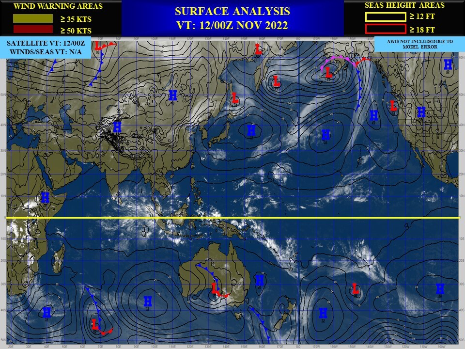
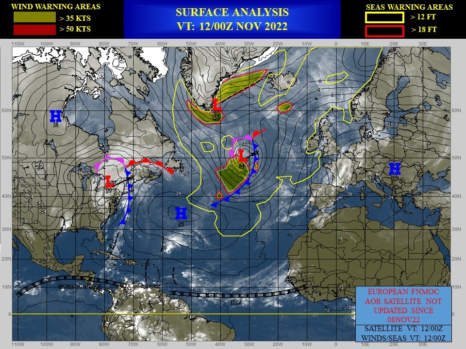
CLICK ON THE IMAGERIES BELOW TO GET THEM ENLARGED
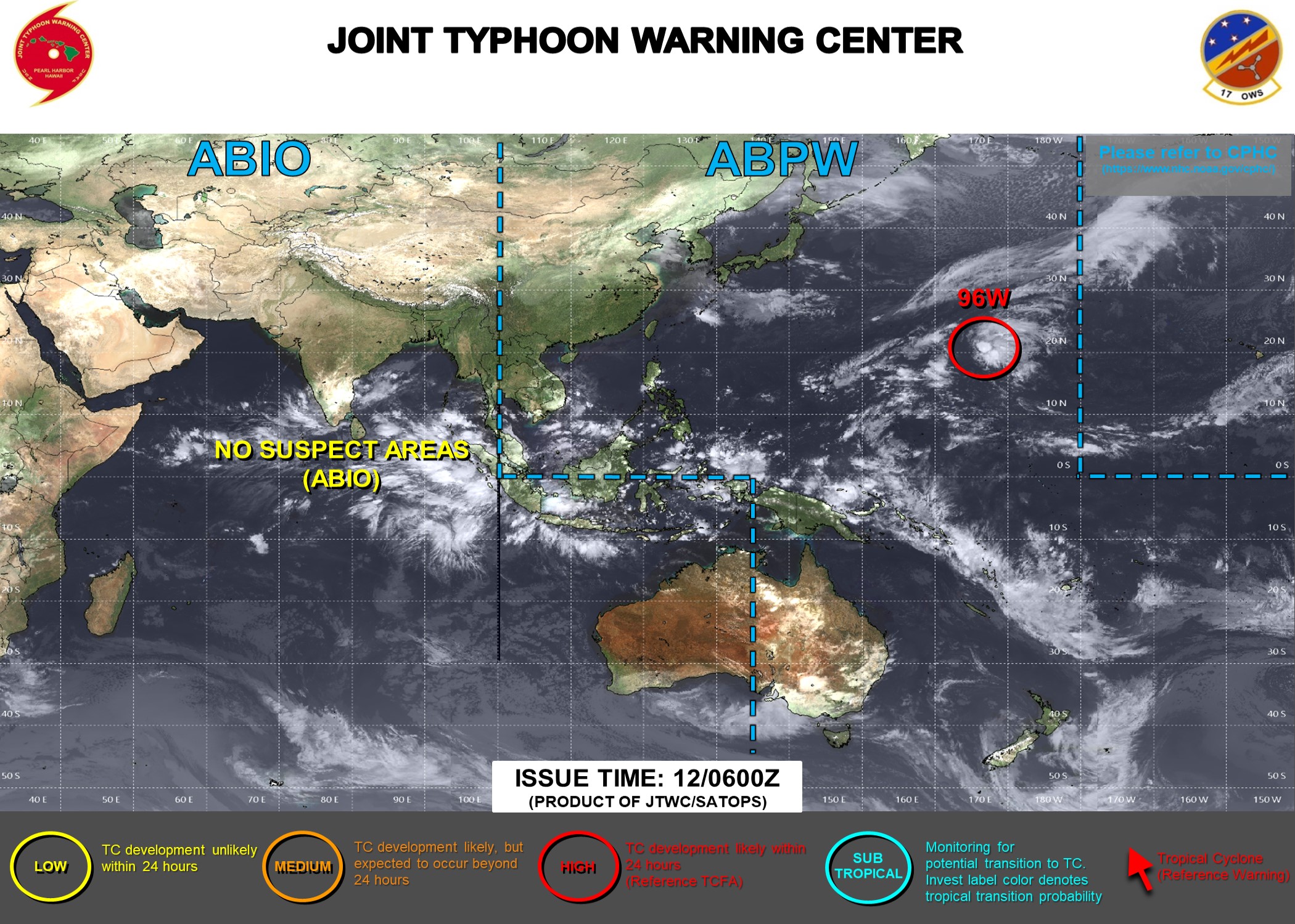
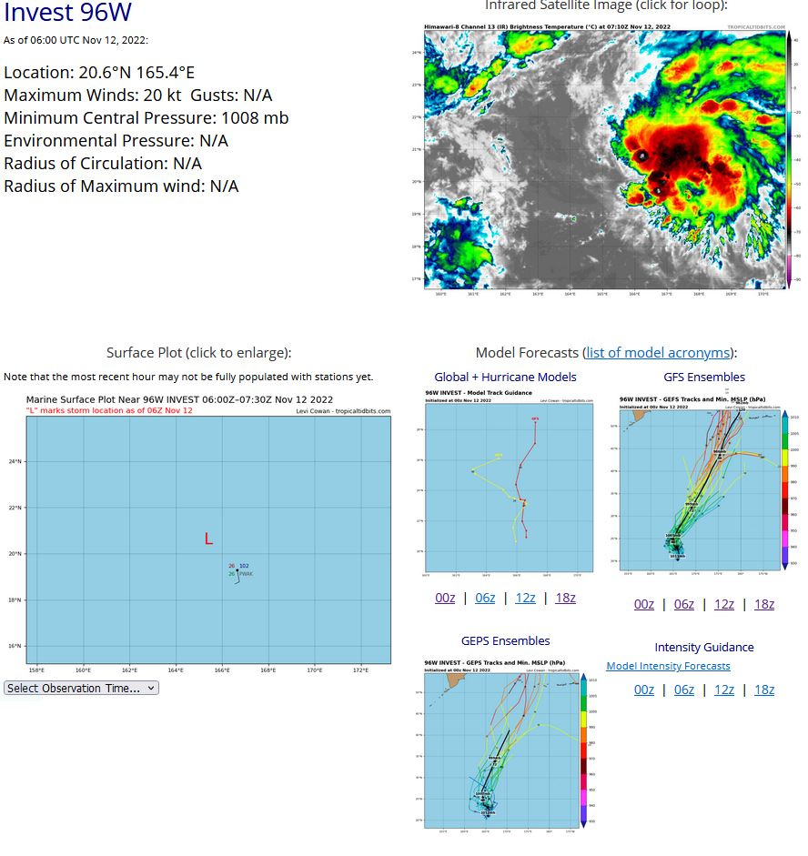
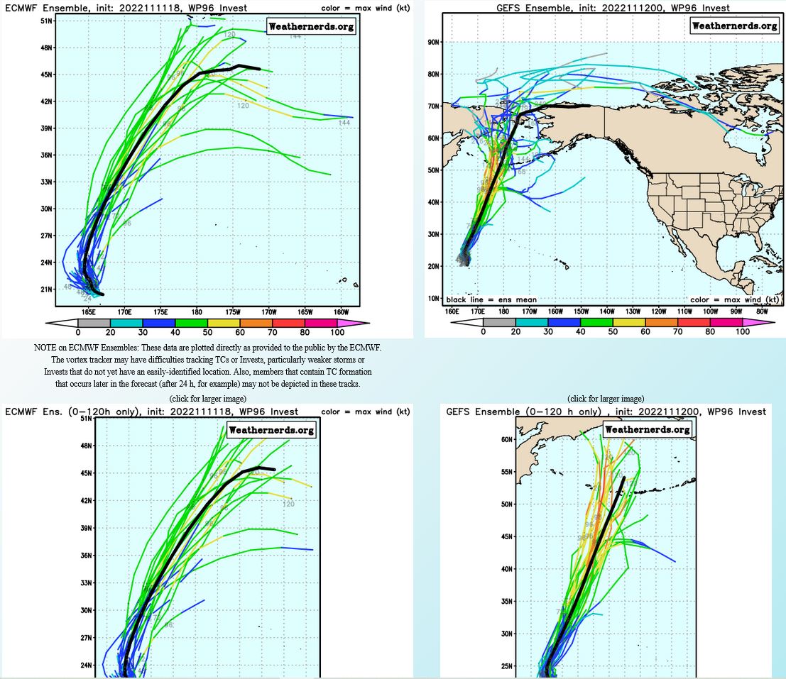
WESTERN NORTH PACIFIC: INVEST 96W. ESTIMATED LOCATION AND INTENSITY AT 12/06TC.
TROPICAL CYCLONE FORMATION ALERT ISSUED AT 12/0130UTC.
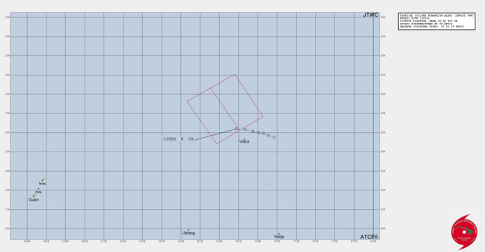
THE AREA OF CONVECTION (INVEST 96W) PREVIOUSLY LOCATED NEAR 20.4N 167.0E IS NOW LOCATED NEAR 20.4N 165.8E, APPROXIMATELY 86 NM NORTHWEST OF WAKE ISLAND. ANIMATED MULTISPECTRAL SATELLITE IMAGERY (MSI) DEPICTS A PARTIALLY EXPOSED, GRADUALLY CONSOLIDATING LOW LEVEL CIRCULATION CENTER (LLCC) WITH WIDESPREAD FAIRLY DISORGANIZED CONVECTION SHEARED OFF TO THE EAST OF THE LLCC. ENVIRONMENTAL ANALYSIS DEPICTS MARGINALLY FAVORABLE CONDITIONS FOR INTENSIFICATION WITH WARM (28-29C) SEA SURFACE TEMPERATURES, WEAK (5-10KTS) VWS, AND WEAK UPPER LEVEL DIVERGENCE. GLOBAL MODELS SUGGEST THE SYSTEM WILL TRACK WESTWARD AND DO A SHARP RECURVE TO THE NORTH-NORTHEAST WITH THE PASSING OF A TRANSIENT RIDGE AND START THE TRANSITIONS TO A SUBTROPICAL AND THEN EXTRATROPICAL LOW OVER THE NEXT SEVERAL DAYS. MAXIMUM SUSTAINED SURFACE WINDS ARE ESTIMATED AT 18 TO 23 KNOTS. MINIMUM SEA LEVEL PRESSURE IS ESTIMATED TO BE NEAR 1008 MB. THE POTENTIAL FOR THE DEVELOPMENT OF A SIGNIFICANT TROPICAL CYCLONE WITHIN THE NEXT 24 HOURS REMAINS HIGH.
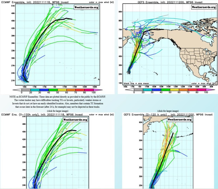
GLOBAL MODELS SUGGEST THE SYSTEM WILL TRACK WESTWARD AND DO A SHARP RECURVE TO THE NORTH-NORTHEAST WITH THE PASSING OF A TRANSIENT RIDGE AND START THE TRANSITIONS TO A SUBTROPICAL AND THEN EXTRATROPICAL LOW OVER THE NEXT SEVERAL DAYS.
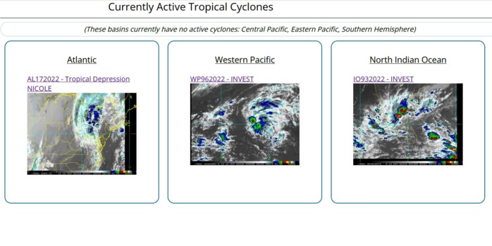
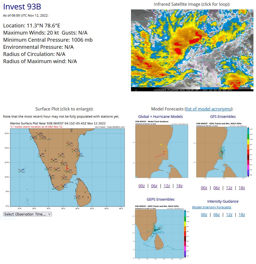
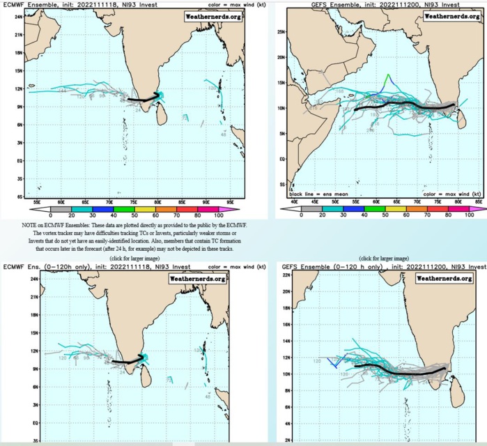
NORTH INDIAN OCEAN: INVEST 93B. ESTIMATED LOCATION AND INTENSITY AT 12/06UTC.

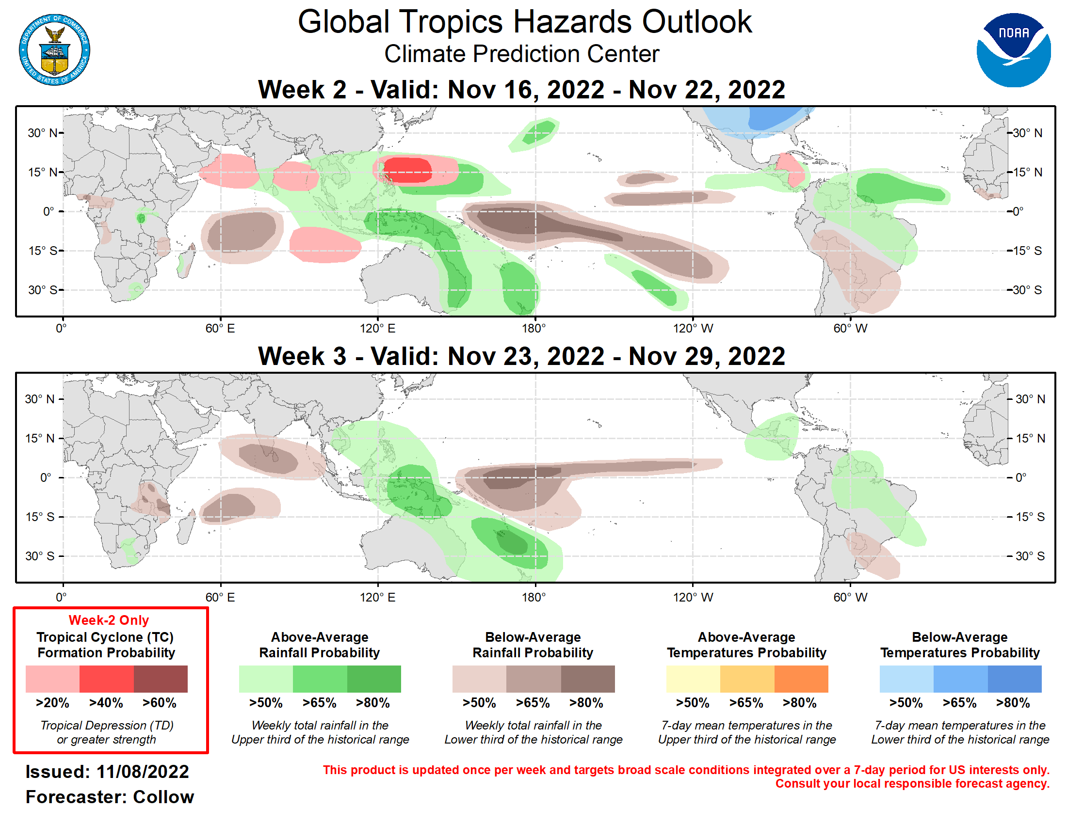
Outlook Discussion Last Updated - 11/08/22 Valid - 11/16/22 - 11/29/22 During the past week, there has been coherent eastward propagation of the RMM-based Madden Julian Oscillation (MJO) index through phase 7. However, the phase speed of the propagation in RMM space is more indicative of a Kelvin Wave rather than a true MJO. The ECMWF, JMA, and GEFS ensembles indicate a weakening of the enhanced convective signal in the short-term, with the RMM index decaying back into the unit circle. However, by week-2, these models depict a renewed MJO event across the Maritime Continent and West Pacific. While the global convective pattern has been spatially disorganized for the past couple of weeks, there has been some reorganization with enhanced convection becoming focused across North America, Atlantic, and Africa, and suppressed convection situated over the West Pacific. This pattern is notably out of phase with the current La Nina state, but is favored to revert back to a typical La Nina pattern in the next few weeks, aided by the forecast reemergence of the MJO over the Maritime Continent. The enhanced convection across the Atlantic has led to an uptick in tropical cyclone (TC) activity with two TCs forming over the basin in the past week. Hurricane Martin tracked across the North Atlantic before dissipating on 11/3. Tropical storm Nicole developed on 11/7 and is forecast to reach hurricane strength before impacting Florida over the next few days. The Eastern and Western Pacific basins have been quiet during the past week, tied to suppressed convection across the Western Pacific and an overall diminishing climatology. A tropical storm (04S) developed across the Southern Indian Ocean on 11/4. This system was short-lived and did not impact any land areas. Looking ahead, TC development chances are likely to diminish across both the North Atlantic and East Pacific basins as the hurricane season draws to a close. The National Hurricane Center is monitoring Invest 97L over the open central Atlantic. This disturbance currently has a 30 percent chance of developing into a TC during the next 5-days, although its potential has been decreasing over the past few days. By week-2, ECMWF and GEFS ensembles indicate surface low pressure in the western Caribbean that may organize into a TC, justifying a 20 percent TC formation area in this region during week-2. Following a relatively quiet period, TC development is forecast to increase across parts of the Indian Ocean and West Pacific, corresponding to a renewed MJO propagation by week-2. There are increased signals in the dynamical model guidance over both the Arabian Sea and Bay of Bengal, as well as over the southern Indian Ocean, which are consistent with climatology and the forecast phase 5-6 of the MJO. Therefore, 20% chances for TC formation are highlighted over these areas. TC development is also possible to the east of the Philippines during week-2 (40% chance) as enhanced convection returns to the region. The precipitation outlook for the next two weeks is based on anticipated TC tracks, ongoing La Nina conditions, and consensus of GEFS, CFS, and ECMWF ensemble mean solutions. Suppressed (enhanced) rainfall continues near and to the east of the Date Line (over the Maritime Continent and western Pacific) due to ongoing La Nina conditions and the forecast reemergence of the MJO signal over the region. Enhanced rainfall is likely to continue across the equatorial Atlantic and northern South America contributing to continued flooding concerns. While elevated rainfall chances are more likely initially over the Indian Ocean early in week-2, the eastward propagation of the MJO favors a trend toward drier conditions for weeks 2 and 3 as a whole. Below normal temperatures are forecast across much of the continental U.S., tied to predicted strong mid-latitude troughing.
