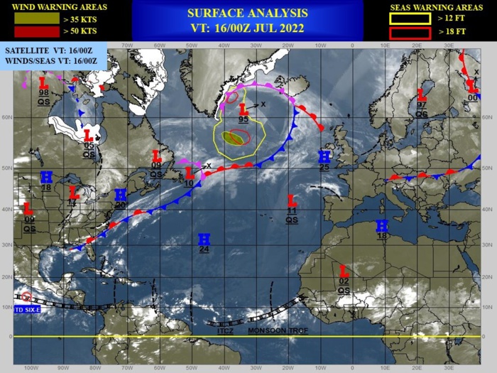
CLICK ON THE IMAGERIES BELOW TO GET THEM ENLARGED.
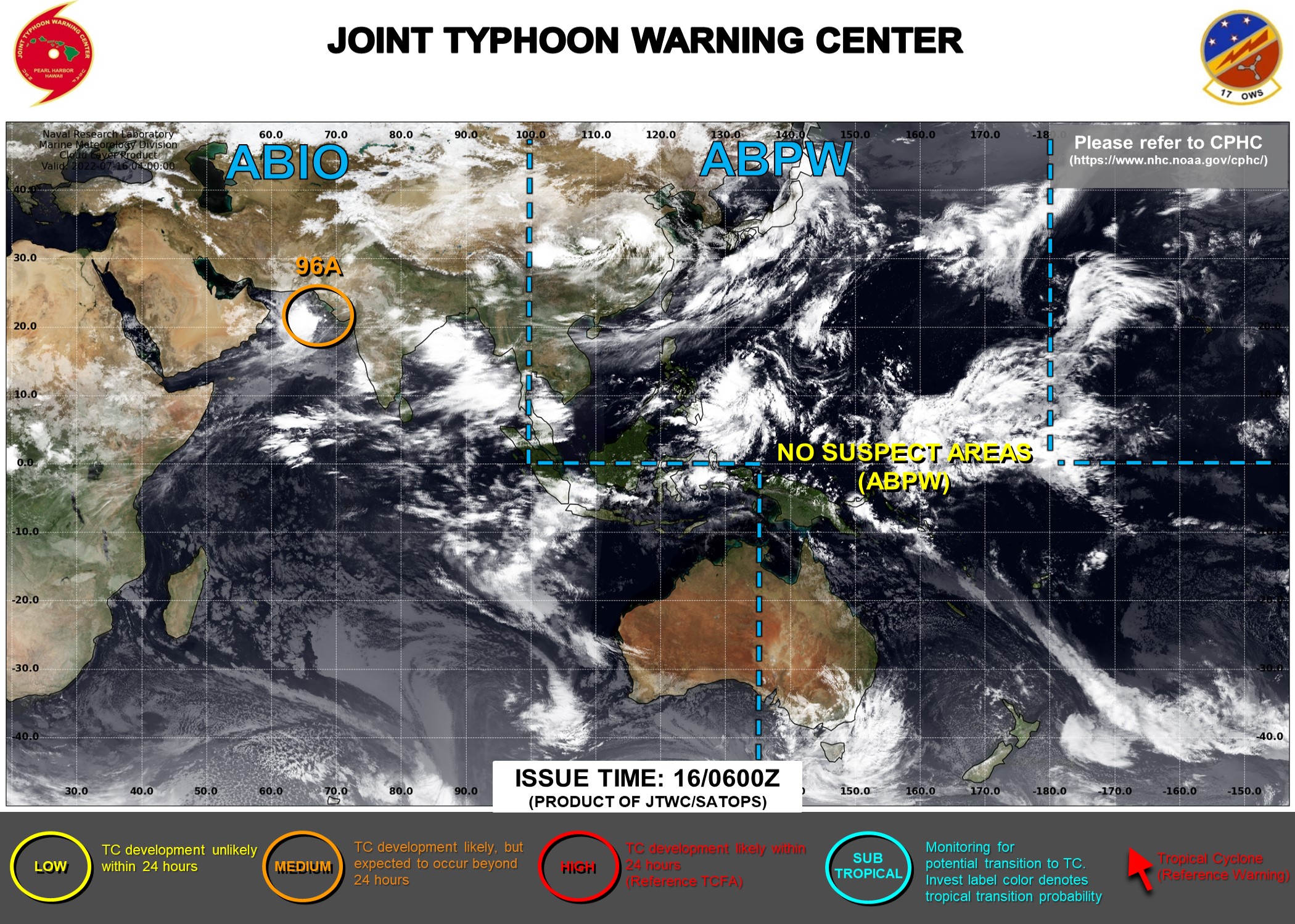
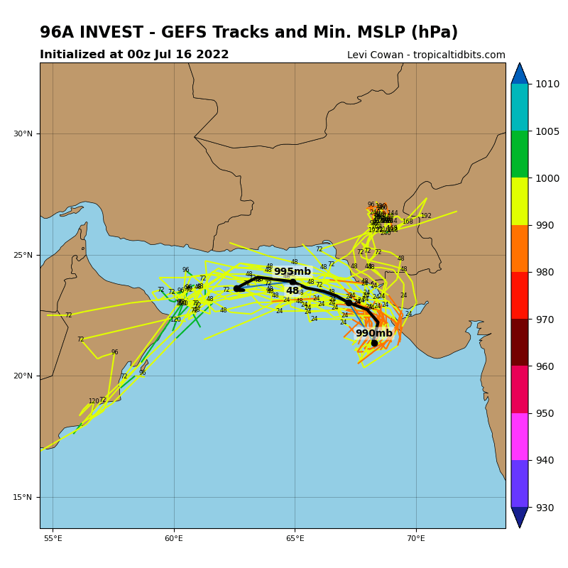
NORTH INDIAN OCEAN/ARABIAN SEA: INVEST 96A. ADVISRORY(ABIO) ISSUED AT 16/06UTC.

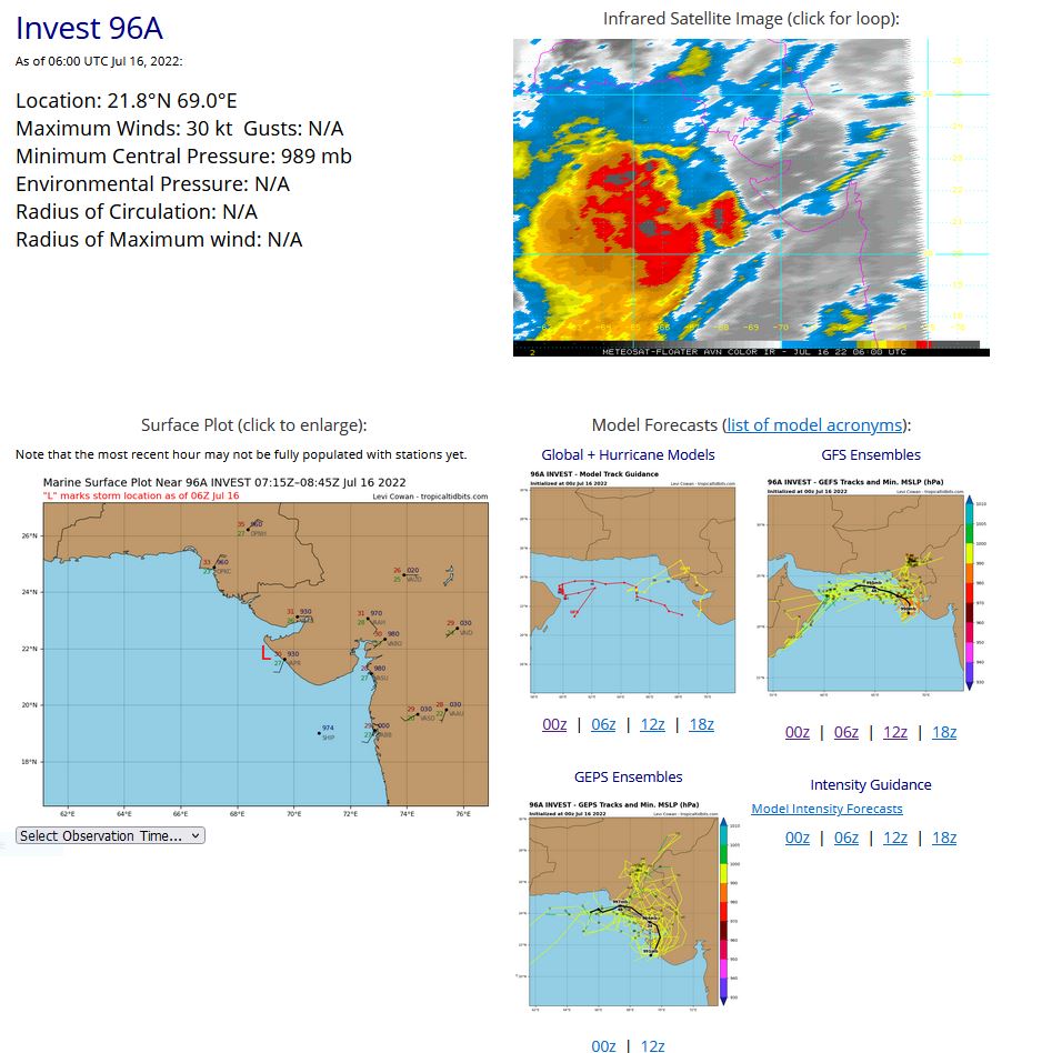
THE AREA OF CONVECTION (INVEST 96A) PREVIOUSLY LOCATED NEAR 21.3N 68.7E IS NOW LOCATED NEAR 21.1N 68.5E, APPROXIMATELY 290 KM WEST-NORTHWEST OF JAFRABAD, INDIA. ENHANCED INFRARED SATELLITE IMAGERY DEPICTS DEEPENING CONVECTION AND IMPROVING CONVECTIVE BANDING TO THE WEST OF AN EXPOSED AND ILL-DEFINED LOW LEVEL CIRCULATION (LLC). ENVIRONMENTAL ANALYSIS INDICATES IMPROVING CONDITIONS FOR DEVELOPMENT WITH STRONG WESTWARD OUTFLOW ALOFT ASSOCIATED WITH THE TEJ, AND WARM (28-29C) SEA SURFACE TEMPERATURES. INVEST 96A IS IN AN AREA OF MODERATE TO HIGH (20-25KT) VERTICAL WIND SHEAR (VWS) AND IS EXPECTED TO TRACK INTO AN AREA OF LOW (5-10KT) VWS. GLOBAL MODELS ARE IN FAIR AGREEMENT THAT 96A WILL TRACK NORTHWARD TOWARDS THE NORTHWESTERN COAST OF INDIA, WHERE GFS SHOWS A MORE WEST-NORTHWESTWARD TRACK. MAXIMUM SUSTAINED SURFACE WINDS ARE ESTIMATED AT 25 TO 30 KNOTS. MINIMUM SEA LEVEL PRESSURE IS ESTIMATED TO BE NEAR 989 MB. THE POTENTIAL FOR THE DEVELOPMENT OF A SIGNIFICANT TROPICAL CYCLONE WITHIN THE NEXT 24 HOURS IS UPGRADED TO MEDIUM.
IO, 96, 2022071506,211N, 685E, 25, 993
IO, 96, 2022071512,212N, 688E, 25, 993
IO, 96, 2022071518,214N, 691E, 25, 991
IO, 96, 2022071600,216N, 693E, 30, 989
IO, 96, 2022071606,218N, 690E, 30, 989
IO, 96, 2022071512,212N, 688E, 25, 993
IO, 96, 2022071518,214N, 691E, 25, 991
IO, 96, 2022071600,216N, 693E, 30, 989
IO, 96, 2022071606,218N, 690E, 30, 989
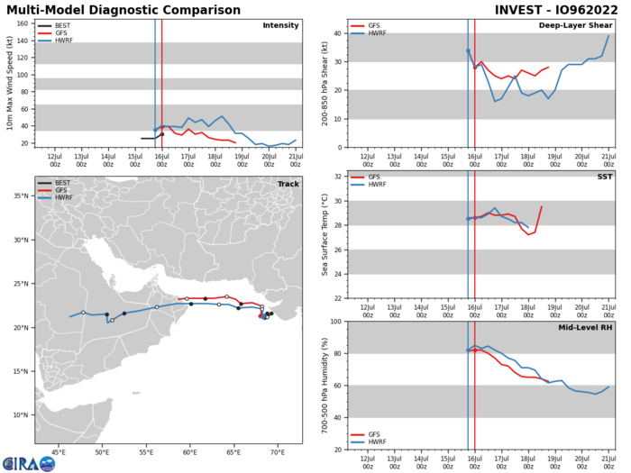
GLOBAL MODELS ARE IN FAIR AGREEMENT THAT 96A WILL TRACK NORTHWARD TOWARDS THE NORTHWESTERN COAST OF INDIA, WHERE GFS SHOWS A MORE WEST-NORTHWESTWARD TRACK.

GLOBAL MODELS ARE IN FAIR AGREEMENT THAT 96A WILL TRACK NORTHWARD TOWARDS THE NORTHWESTERN COAST OF INDIA, WHERE GFS SHOWS A MORE WEST-NORTHWESTWARD TRACK.
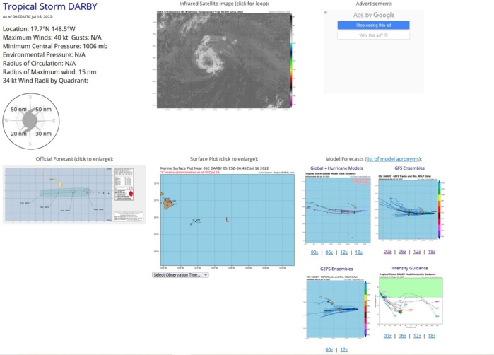
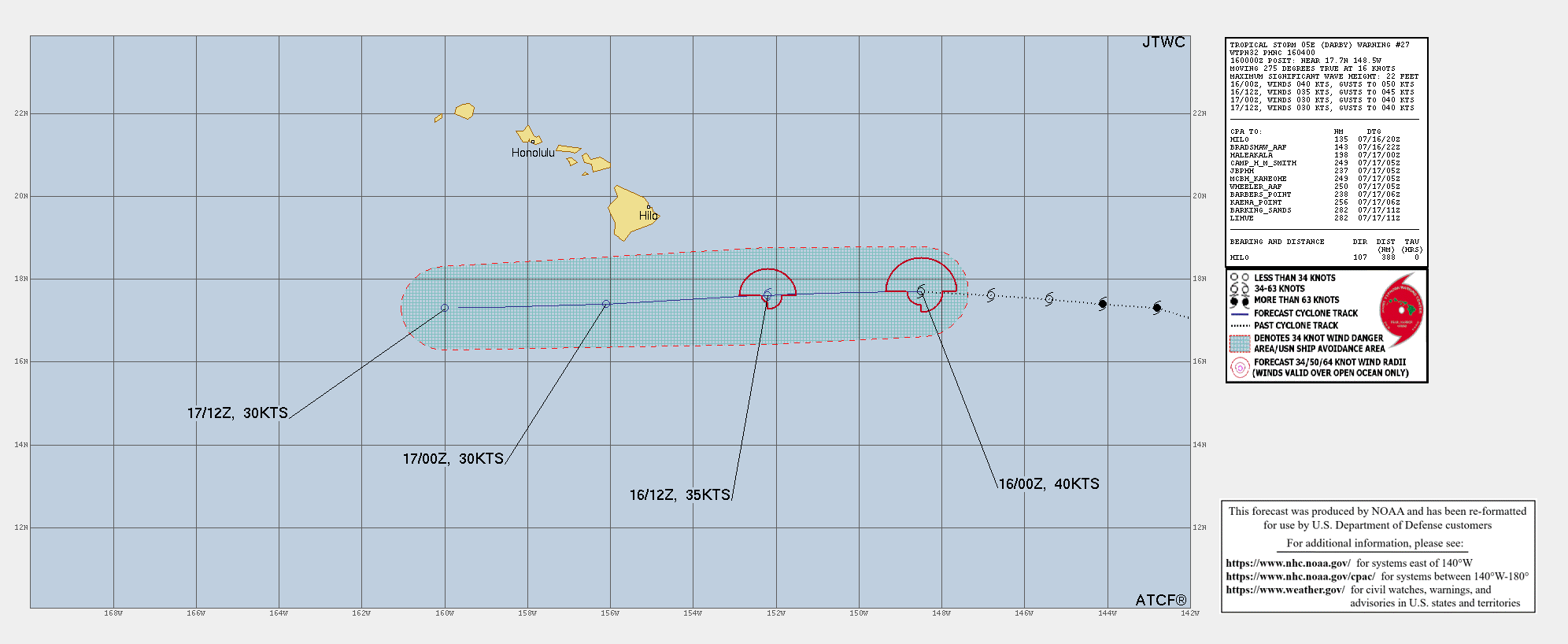
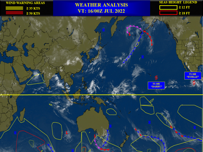
EASTERN NORTH PACIFIC: TS 05E(DARBY). WARNING 27 ISSUED AT 16/04UTC.
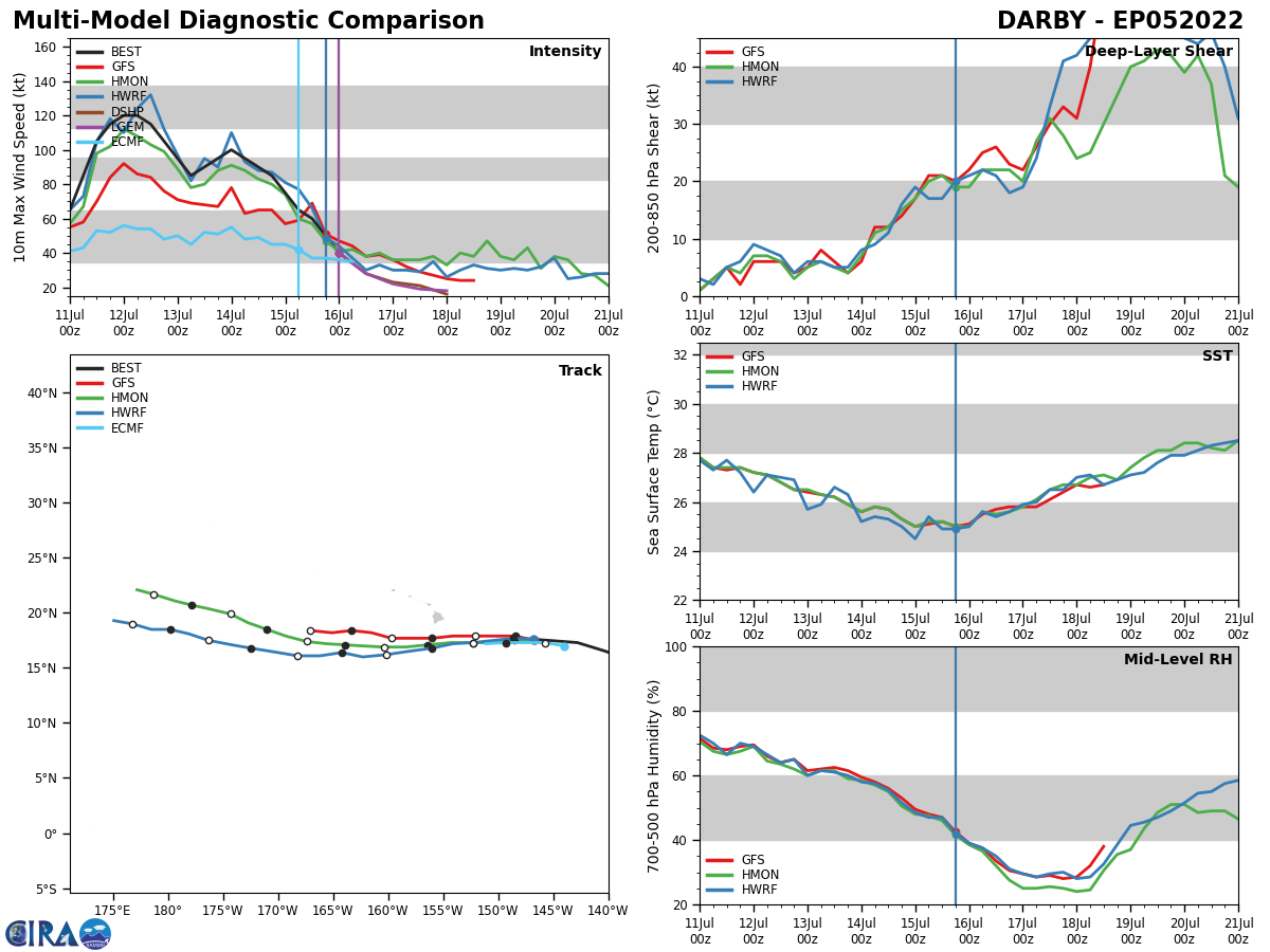
EP, 05, 2022071500,173N, 1428W, 75, 985
EP, 05, 2022071506,174N, 1441W, 65, 990
EP, 05, 2022071506,174N, 1441W, 65, 990
EP, 05, 2022071506,174N, 1441W, 65, 990
EP, 05, 2022071512,175N, 1454W, 60, 993
EP, 05, 2022071512,175N, 1454W, 60, 993
EP, 05, 2022071518,176N, 1468W, 50, 1002
EP, 05, 2022071518,176N, 1468W, 50, 1002
EP, 05, 2022071600,177N, 1485W, 40, 1006
EP, 05, 2022071506,174N, 1441W, 65, 990
EP, 05, 2022071506,174N, 1441W, 65, 990
EP, 05, 2022071506,174N, 1441W, 65, 990
EP, 05, 2022071512,175N, 1454W, 60, 993
EP, 05, 2022071512,175N, 1454W, 60, 993
EP, 05, 2022071518,176N, 1468W, 50, 1002
EP, 05, 2022071518,176N, 1468W, 50, 1002
EP, 05, 2022071600,177N, 1485W, 40, 1006
CPHC COMMENTS.
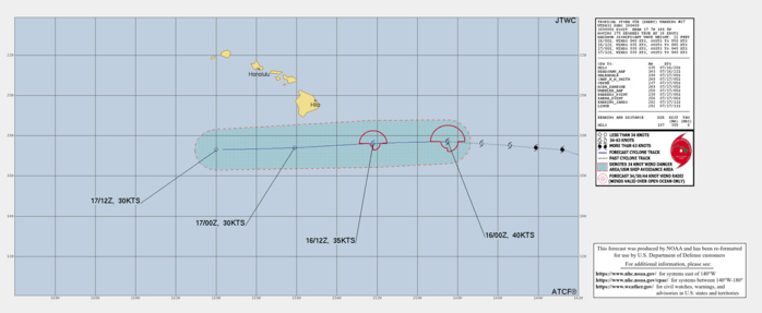
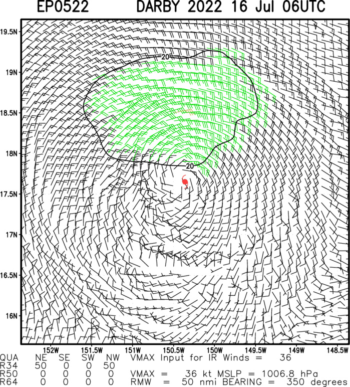
857 WTPA41 PHFO 160234 TCDCP1 Tropical Storm Darby Discussion Number 27 NWS Central Pacific Hurricane Center Honolulu HI EP052022 500 PM HST Fri Jul 15 2022 The UW-CIMSS shear analysis near Darby shows that the westerly shear over the system has actually relaxed just a bit, now only around 20 kt. This may have been enough for a brief burst of deep convection in the northwest quadrant this afternoon. That convection has since dissipated, however, and the last persistent deep convection was about 1400Z. An earlier 1914Z ASCAT-B pass showed three wind barbs of 40-41 kt on the north side of the center. Various Dvorak intensity estimates ranged from 45 kt at PHFO to 33 KT from the UW-CIMSS ADT. CIMSS SATCON from 0050Z had a CI of 37 kt. Based on a blend of these estimates, have gone with an initial intensity of 40 kt. The initial motion is 275/14. A large anticyclone far north of Darby in both the mid- and low-levels will maintain a westerly track over the next few days. The current forecast track remains close to the past track, near the center of the guidance. The forecast track keeps Darby in a moderately sheared environment for the next couple of days, and over sea surface temperatures (SST) of 25-26C. The shear, SST and climatologically meager mid-level relative humidity values near the track all work against persistent deep convection redeveloping with Darby, although the simulated satellite imagery from the GFS and ECMWF both show brief bursts from time to time. A strong high far to the north will maintain a pocket of relatively strong trade winds in the gradient flow as the system dissipates from remnant low to a surface trough.
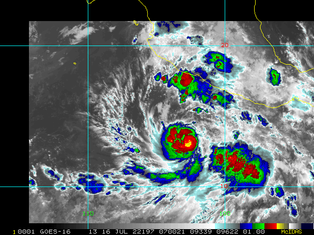
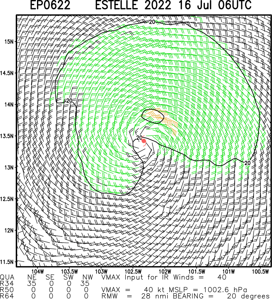
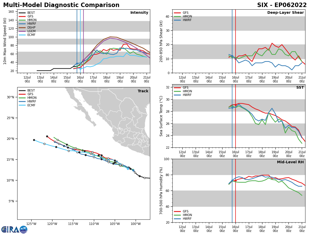
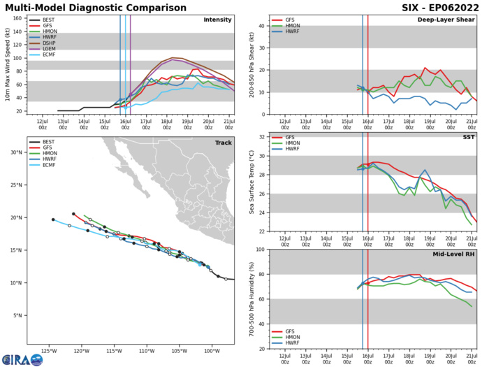
EASTERN NORTH PACIFIC: TS 06E(ESTELLE). WARNING 3 ISSUED AT 16/04UTC.
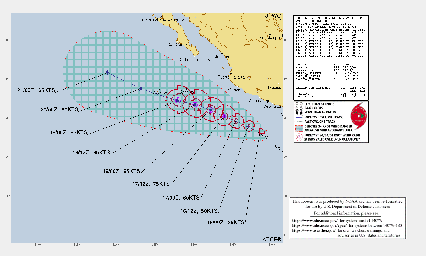
EP, 06, 2022071400,105N, 955W, 25, 1010
EP, 06, 2022071406,105N, 966W, 25, 1010
EP, 06, 2022071412,106N, 979W, 25, 1010
EP, 06, 2022071418,108N, 985W, 25, 1009
EP, 06, 2022071500,110N, 991W, 25, 1009
EP, 06, 2022071506,114N, 997W, 25, 1009
EP, 06, 2022071512,119N, 1002W, 30, 1007
EP, 06, 2022071518,125N, 1007W, 30, 1007
EP, 06, 2022071600,130N, 1016W, 35, 1006
NHC COMMENTS.

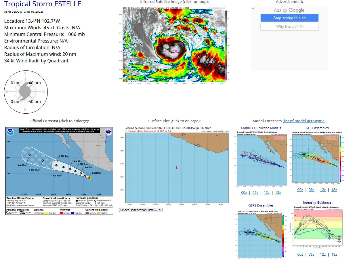
Tropical Storm Estelle Discussion Number 3 NWS National Hurricane Center Miami FL EP062022 1000 PM CDT Fri Jul 15 2022 A series of microwave images since the last advisory show that the depression's low-level structure has become better defined, with the center nearly surrounded by a cyan ring in the 37-GHz channel. In addition, a tight band of deep convection with cloud tops colder than -80 degrees Celsius has been persisting near the center. Dvorak estimates from TAFB and SAB are a consensus T2.5, so the depression is upgraded to Tropical Storm Estelle with 35-kt winds. However, this could be a conservative estimate given the improved structure, and objective intensity estimates are running slightly higher. The initial motion is a little faster toward the northwest, or 310/9 kt, but satellite location fixes suggest the storm is beginning to turn toward the west-northwest as expected. Mid-level ridging is forecast to be entrenched over the southwestern United States for the next 5 days, which should steer Estelle on a general west-northwestward heading for the entirety of the forecast period. There is not much spread among the track guidance, at least cross-track wise, but it is notable that the GFS solution is a bit slower than the other reliable guidance. The NHC track forecast is just a little slower than the consensus aids to account for that slower scenario, and this update is not too different from the previous forecast. Despite Estelle's improved structure, a sharp edge on the eastern side of the deep convection in infrared imagery suggests there is still some shear affecting the cyclone, and SHIPS is showing 10-15 kt of deep-layer shear out of the northeast. The GFS and ECMWF versions of SHIPS differ a bit on when that shear will decrease, although both versions show Estelle benefiting from high values of upper-level divergence for the next 24-48 hours. Combined with high oceanic heat content and the cyclone's well-defined low-level structure, rapid intensification (RI) is a realistic possibility, and some guidance is showing a 50/50 chance of RI during the next 24 hours. The NHC official intensity forecast hedges on the high side of the guidance but stops just short of showing explicit RI given the uncertainties on how much vertical shear will decrease. Continued strengthening could occur through day 3, but colder waters are likely to induce weakening on days 4 and 5.
