CLICK ON THE IMAGERIES BELOW TO GET THEM ENLARGED
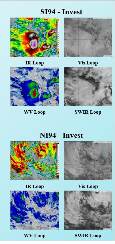
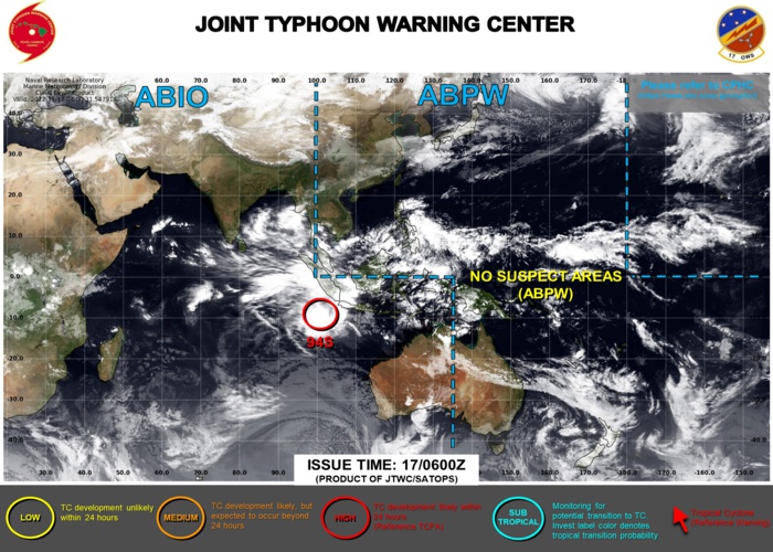
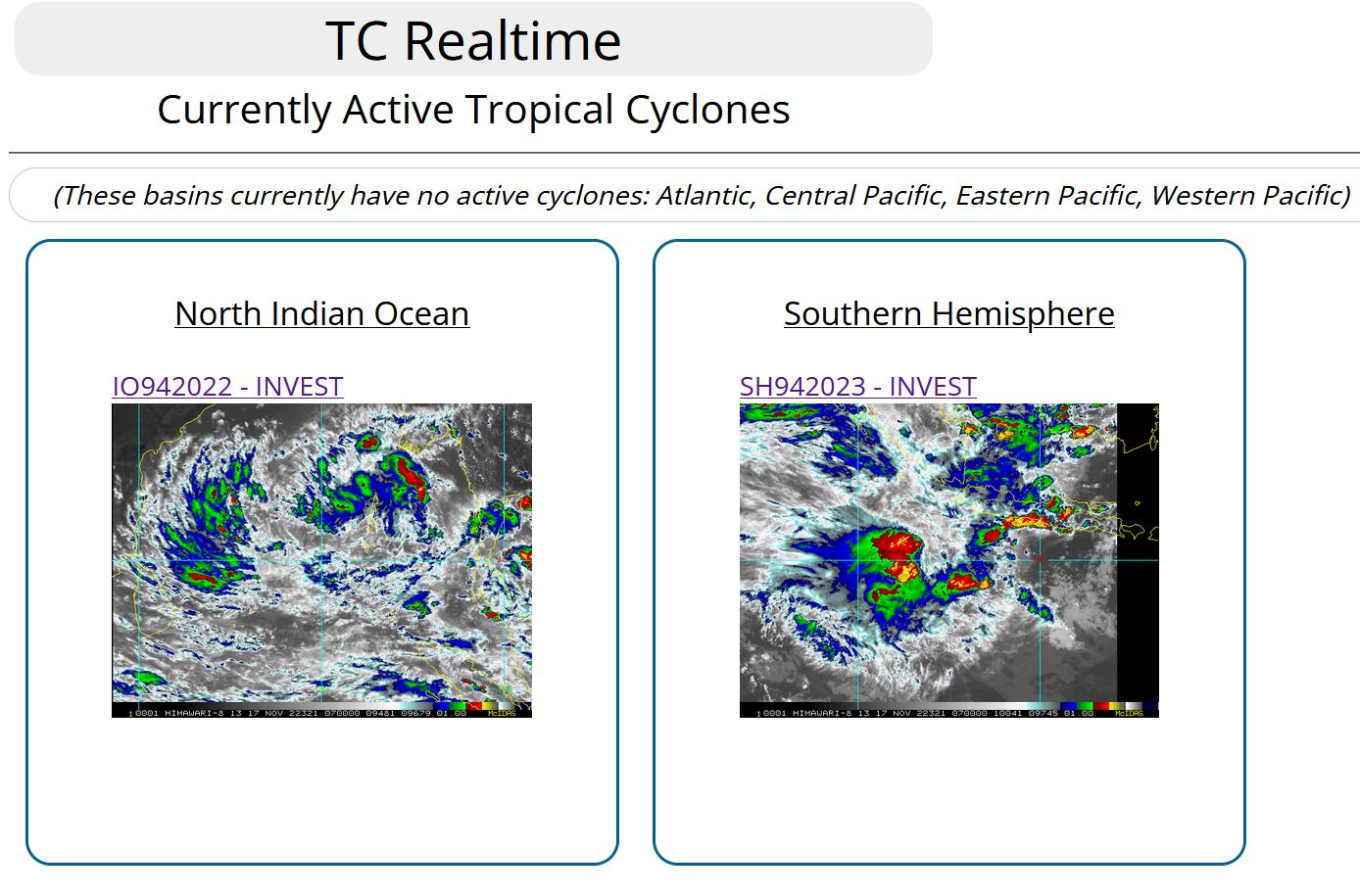
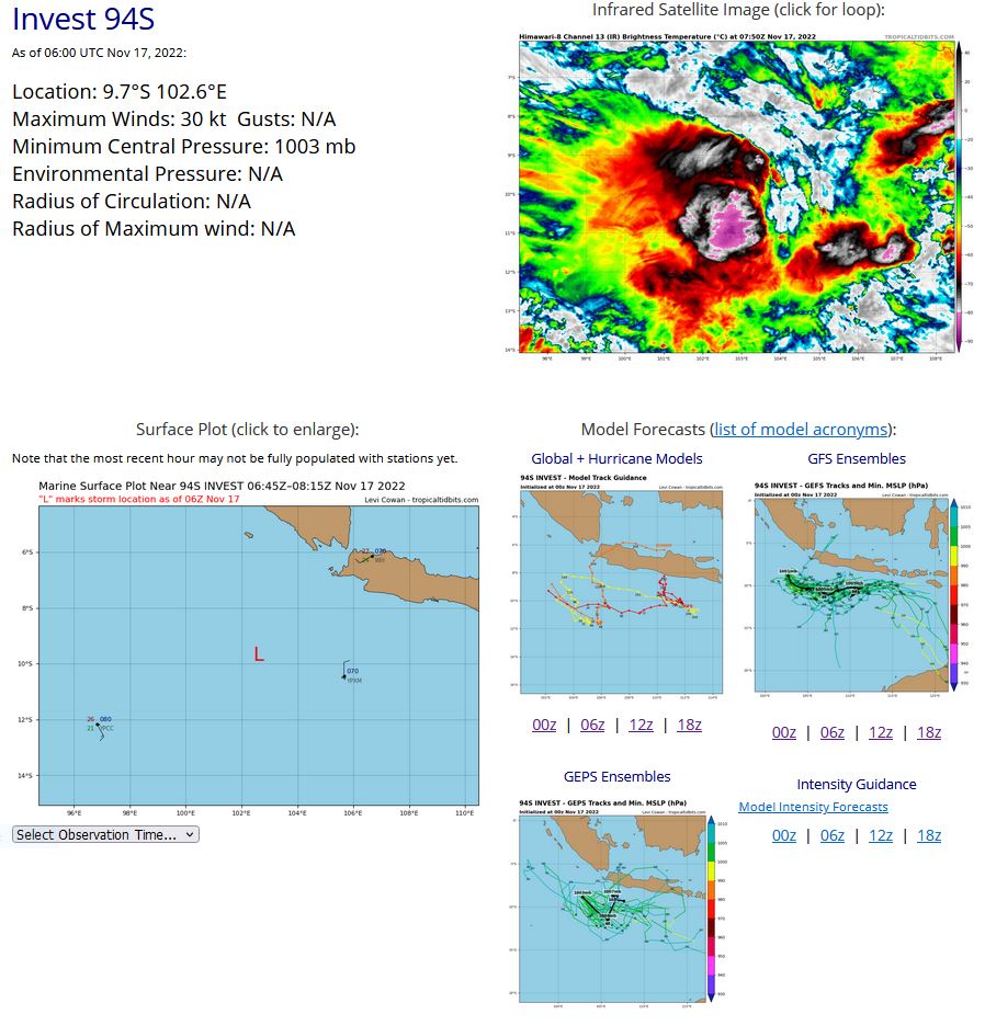
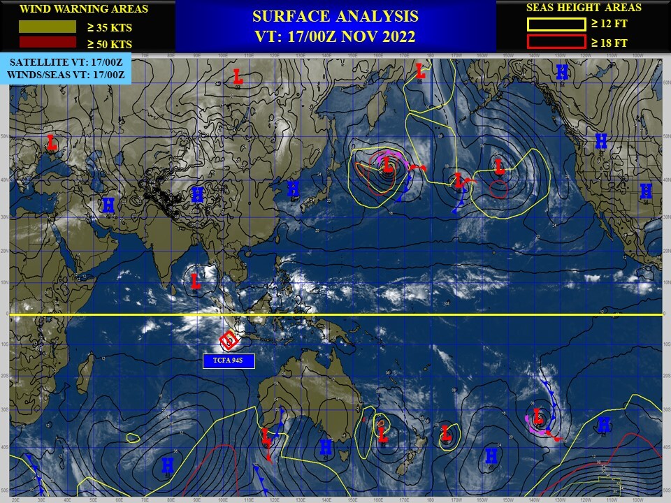
SOUTH INDIAN OCEAN: INVEST 94S. ESTIMATED LOCATION AND INTENSITY AT 17/06UTC.
SH, 94, 2022111500,56S, 983E, 20, 1007, DB
SH, 94, 2022111506,54S, 987E, 20, 1007, DB
SH, 94, 2022111512,53S, 990E, 20, 1006, DB
SH, 94, 2022111518,52S, 994E, 25, 1005, TD
SH, 94, 2022111600,53S, 998E, 25, 1005, TD
SH, 94, 2022111606,61S, 1004E, 25, 1004, TD
SH, 94, 2022111612,71S, 1009E, 25, 1004, TD
SH, 94, 2022111618,82S, 1015E, 25, 1003, TD
SH, 94, 2022111700,91S, 1020E, 25, 1003, TD
SH, 94, 2022111706,97S, 1026E, 30, 1003, TD
TROPICAL CYCLONE FORMATION ALERT RE-ISSUED AT 17/0230UTC.
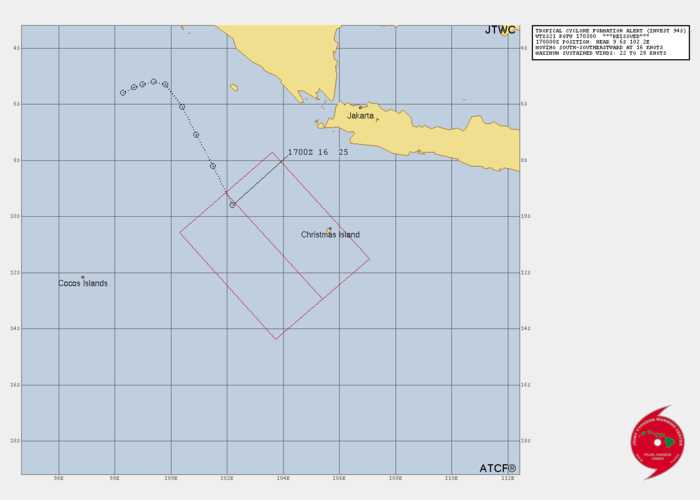
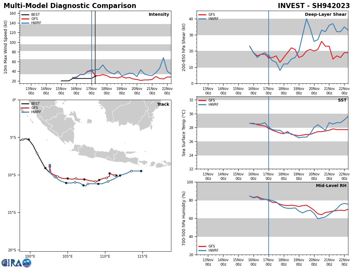
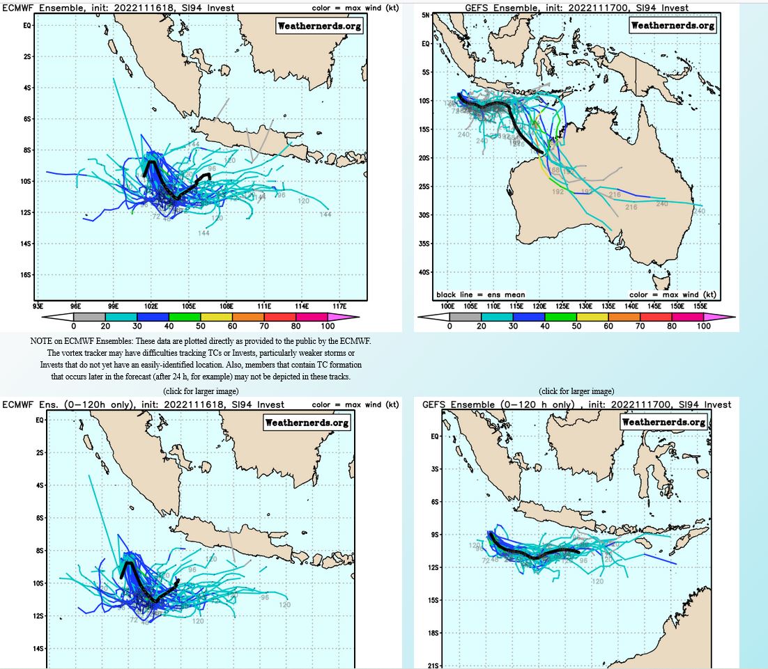
THE AREA OF CONVECTION (INVEST 94S) PREVIOUSLY LOCATED NEAR 5.3S 99.8E IS NOW LOCATED NEAR 9.6S 102.2E, APPROXIMATELY 214 NM WEST- NORTHWEST OF CHRISTMAS ISLAND. ANIMATED ENHANCED INFRARED (EIR) SATELLITE IMAGERY COMBINED WITH A 162219Z SSMIS 91GHZ PASS DEPICT A CONSOLIDATING LOW LEVEL CIRCULATION (LLC) WITH DEEP CONVECTION SLIGHTLY DISPLACED TO THE SOUTH AND EASTERN PORTION OF THE LLC. 94S HAS ITS BACK AGAINST THE WALL WITH THE CURRENT ENVIRONMENT NOT BEING IN ITS FAVOR WITH HIGH 30- 40KT VWS. LUCKILY ITS CURRENT TRAJECTORY HAS IT ON THE UP AND UP WITH MORE FAVORABLE CONDITIONS SOUTH OF JAVA WITH 10-15KT VWS THAT HAS BEEN STEADILY DECREASING, FAIR POLEWARD OUTFLOW, INCREASES IN THE 850MB VORTICITY SIGNATURES, AND SEA SURFACE TEMPERATURES HOLDING STEADY AT 27- 28C. GLOBAL MODELS ARE IN AGREEMENT 94S WILL CONTINUE ON A SOUTHEASTWARD TRACK INTO AN AREA MORE FAVORABLE THAN IT CURRENTLY IS IN OVER THE NEXT 6-12 HOURS AND ALLOW FOR ITS WINDOW OF OPPORTUNITY OF DEVELOPMENT TO OPEN UP SLIGHTLY MORE OVER THE NEXT 12-24 HOURS. INTENSITY GUIDANCE SHOW A STEADY RISE IN 94S GETTING TO TROPICAL STORM STRENGTH WITHIN THE NEXT 24 HOURS THEN TAPERING OFF OVER THE COURSE OF THE NEXT FEW DAYS. MAXIMUM SUSTAINED SURFACE WINDS ARE ESTIMATED AT 22 TO 28 KNOTS. MINIMUM SEA LEVEL PRESSURE IS ESTIMATED TO BE NEAR 1003 MB. THE POTENTIAL FOR THE DEVELOPMENT OF A SIGNIFICANT TROPICAL CYCLONE WITHIN THE NEXT 24 HOURS REMAINS HIGH.
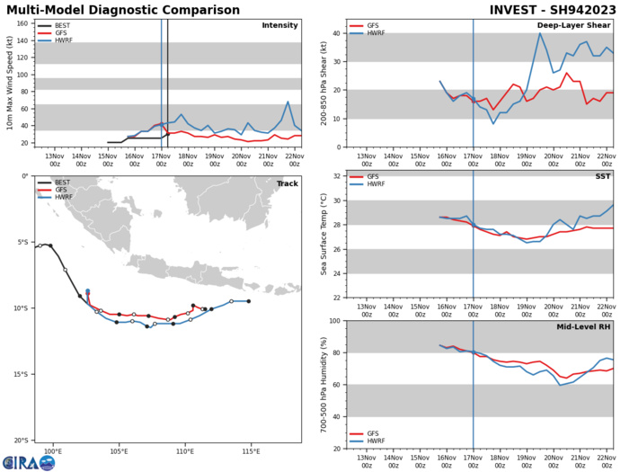
GLOBAL MODELS ARE IN AGREEMENT 94S WILL CONTINUE ON A SOUTHEASTWARD TRACK INTO AN AREA MORE FAVORABLE THAN IT CURRENTLY IS IN OVER THE NEXT 6-12 HOURS AND ALLOW FOR ITS WINDOW OF OPPORTUNITY OF DEVELOPMENT TO OPEN UP SLIGHTLY MORE OVER THE NEXT 12-24 HOURS. INTENSITY GUIDANCE SHOW A STEADY RISE IN 94S GETTING TO TROPICAL STORM STRENGTH WITHIN THE NEXT 24 HOURS THEN TAPERING OFF OVER THE COURSE OF THE NEXT FEW DAYS.
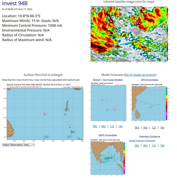
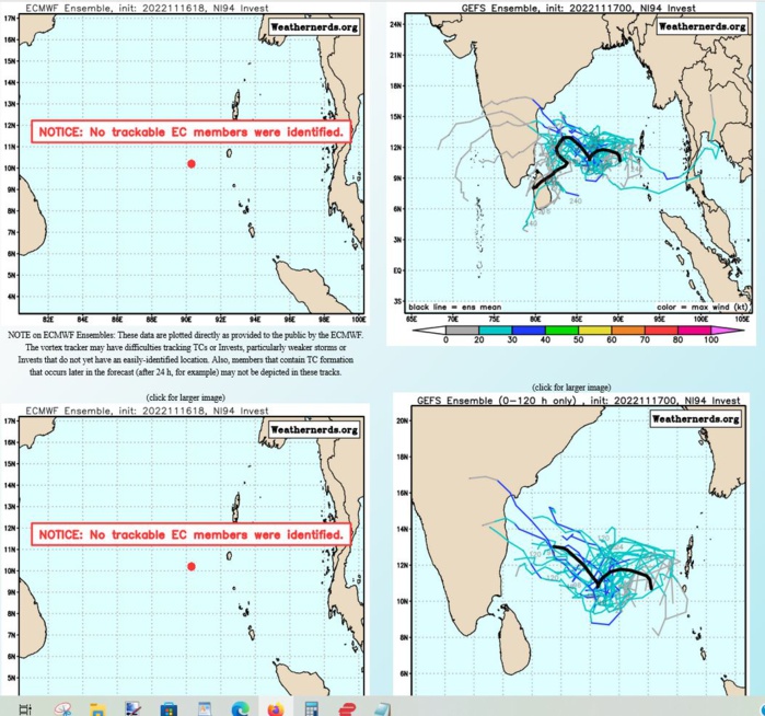
NORTH INDIAN OCEAN/BOB: INVEST 94B. ESTIMATED LOCATION AND INTENSITY AT 17/06UTC.
IO, 94, 2022111612,105N, 907E, 15, 1010, DB
IO, 94, 2022111618,105N, 900E, 15, 1010, DB
IO, 94, 2022111700,106N, 892E, 15, 1010, DB
IO, 94, 2022111706,108N, 883E, 15, 1008, DB
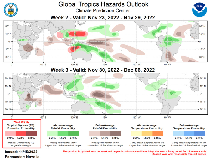
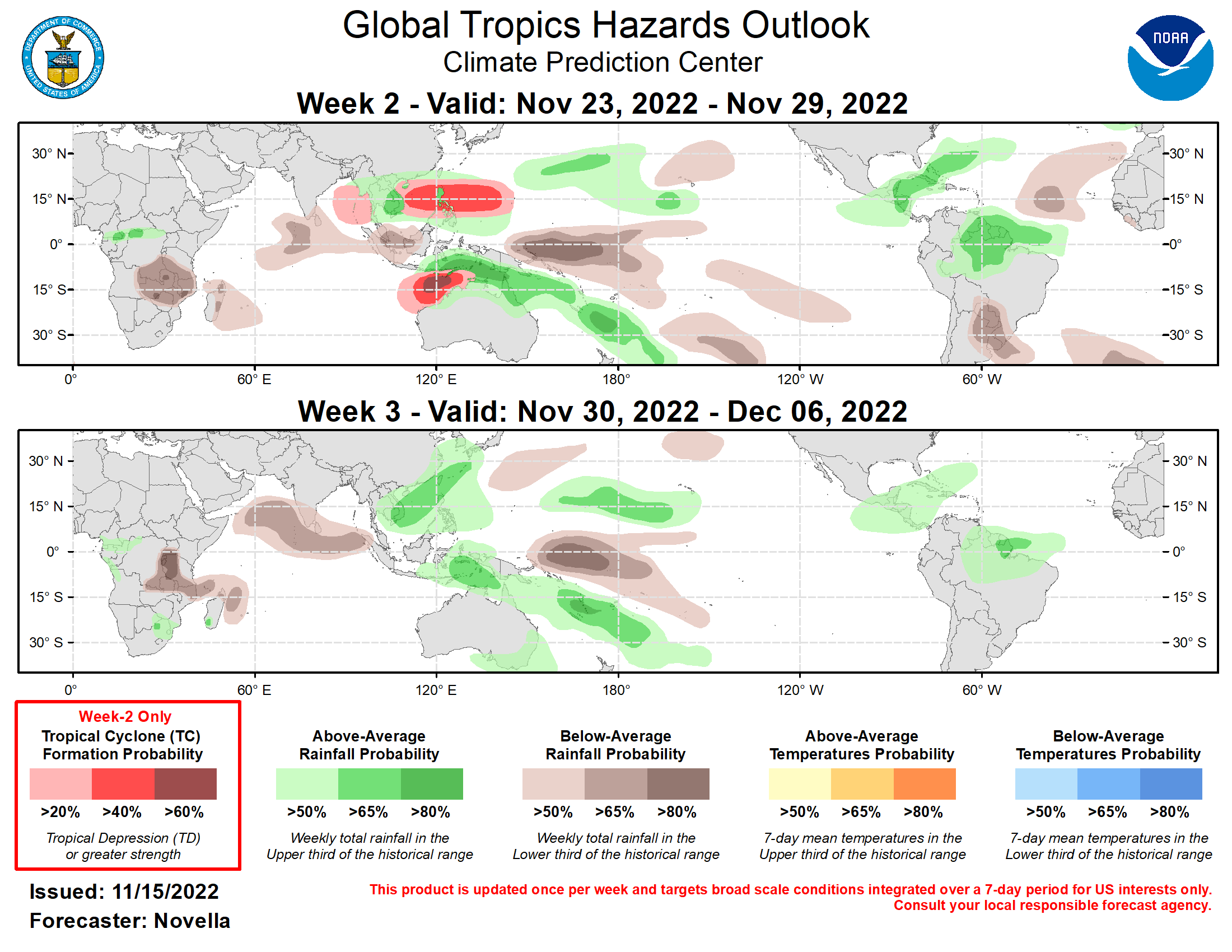
Last Updated - 11/15/22 Valid - 11/23/22 - 12/06/22 During the past week, the RMM index shows a much weakened MJO signal that has continued to propagate eastward over Africa and the Indian Ocean. This evolution is well reflected in the observed upper-level velocity potential anomaly fields, however a more coherent upper-level pattern has emerged more recently across the global tropics. Consistent with previous guidance, dynamical models remain in good agreement favoring a continued uptick in intraseasonal activity, with a potentially strong MJO event emerging over the Maritime Continent during week-1, and propagating eastward into the western Pacific during week-2. Beyond this time, several extended range ensemble member solutions point to the MJO maintaining an organized structure following the destructive interference with the well established La Nina footprint over the equatorial Pacific. However, the last few runs of the bias-corrected ECMWF remain less supportive of this, instead favoring a weakening MJO signal by week-3 which contributes to some uncertainty in the MJO outlook by the beginning of December. Regardless, a renewed MJO supports increased chances for tropical cyclone (TC) development mainly across the eastern Hemisphere during the next two weeks, with drier conditions becoming more prevalent over the Indian Ocean by the week-3 timeframe. Although the large-scale environment may become more favorable for TC development in the western Hemisphere later in the outlook period, formation chances are impeded by an increasingly inactive climatology in both the eastern Pacific and Atlantic basins heading into December. It should be noted that the extratropical response associated with West Pacific MJO events during late boreal autumn historically favors the development of anomalously warm conditions across much of the CONUS by week-2. If realized, this would lead to a welcomed moderation of the much below-normal temperatures that are favored for much of the country during week-1. One TC formed in the global tropics during the past week. TC Yamaneko formed on 11/11 peaked at Tropical Storm intensity to the northeast of Wake Island. This system expired over open waters on 11/14 under the influence of high vertical wind shear and cooler sea surface temperatures with little fanfare. For week-2, there has been good continuity in probabilistic TC genesis tools showing renewed signals over the eastern Bay of Bengal following the dissipation of a potential tropical disturbance favored in the basin during week-1. However, the GEFS and ECMWF ensembles are somewhat divided on this potential, thereby prompting a 20% chance of TC formation in the region. Over the western Pacific, dynamical models continue to favor the development of anomalous lower-level westerlies and Rossby wave activity extending from the South China Sea to the Mariana Islands. Therefore, a 40% chance of TC development is posted as this region also tends to be climatologically active during phase 6 and 7 MJO events during November. South of the equator, high chances (60%) are posted over the Timor Sea where there is agreement between the GEFS and ECMWF ensembles for an area of deepening low pressure with elevated signals in the probabilistic TC genesis tools. Additionally, models also favor the development of anomalous lower-level easterlies over the higher latitudes of western Australia, which coupled with strong westerlies over the Maritime Continent tied to the strengthening MJO, is likely to provide a cyclonic environment favorable for TC development. In the western Hemisphere, there are increased signals in the probabilistic tools in regards to potential disturbance over the eastern Pacific during week-1. However, these signals rapidly weaken before the start of week-2, and no corresponding TC shapes are issued. Over the Atlantic, the last several runs of the GFS and GEFS advertise deepening surface low pressure over the southwestern Caribbean though ECMWF guidance and probabilistic tools are much less supportive of formation in the region, precluding any TC shapes in the outlook. Probabilities for above and below normal precipitation are based on anticipated TC, ongoing La Nina conditions, MJO composites and a historical skill weighted blend of GEFS, ECMWF, CFS and Canadian ensemble forecasts. For hazardous weather concerns in your area during the next two weeks, please refer to your local NWS office, the Medium Range Hazards Forecast from the Weather Predictions Center (WPC), and the CPC Week-2 Hazards Outlook. Forecasts issued over Africa are made in coordination with the International Desk at CPC.
