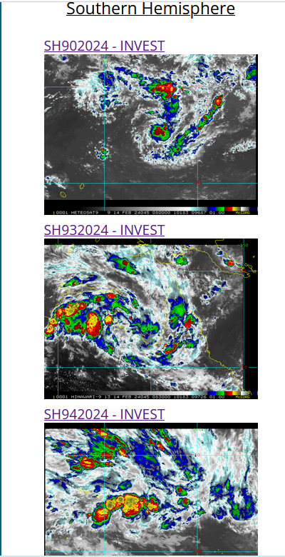
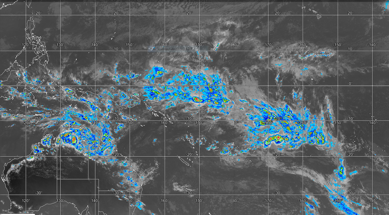
CLICK ON THE IMAGERIES BELOW TO GET THEM ENLARGED

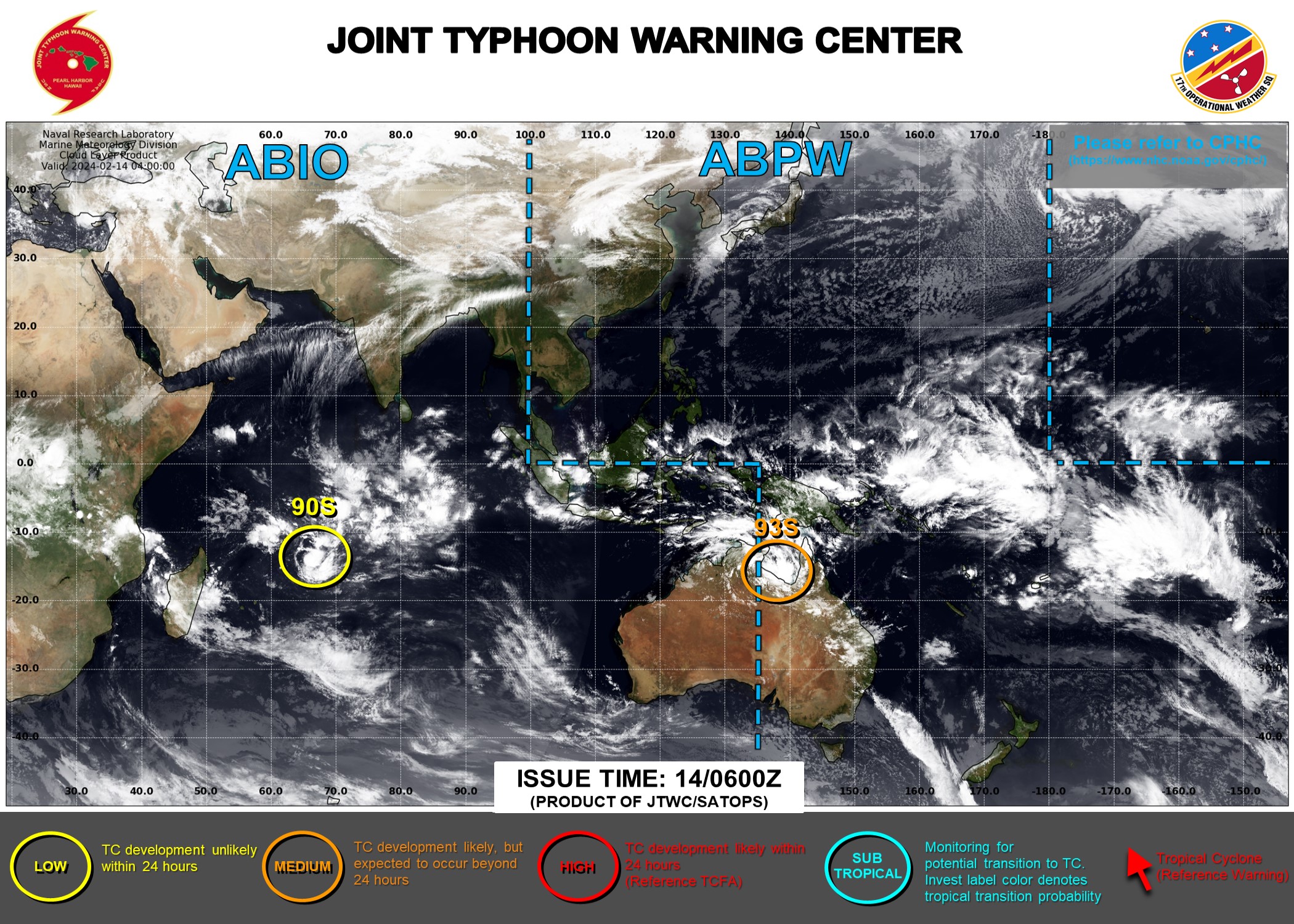
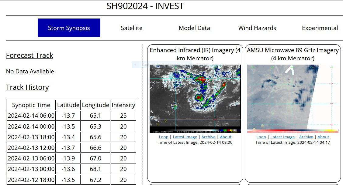
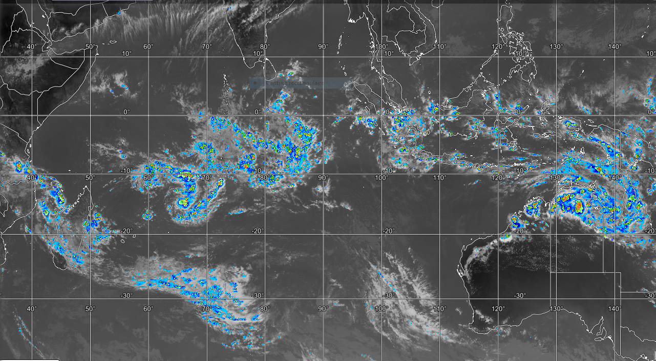
SOUTH INDIAN OCEAN: INVEST 90S. ESTIMATED LOCATION AND INTENSITY AT 14/06UTC. CURRENT INTENSITY IS 25 KNOTS: +5 KNOTS OVER 24 HOURS.
CLICK ON THE IMAGERY BELOW TO GET IT ANIMATED AND ENLARGED. ADVISORY(ABIO) ISSUED AT 13/18UTC.
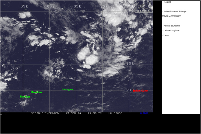
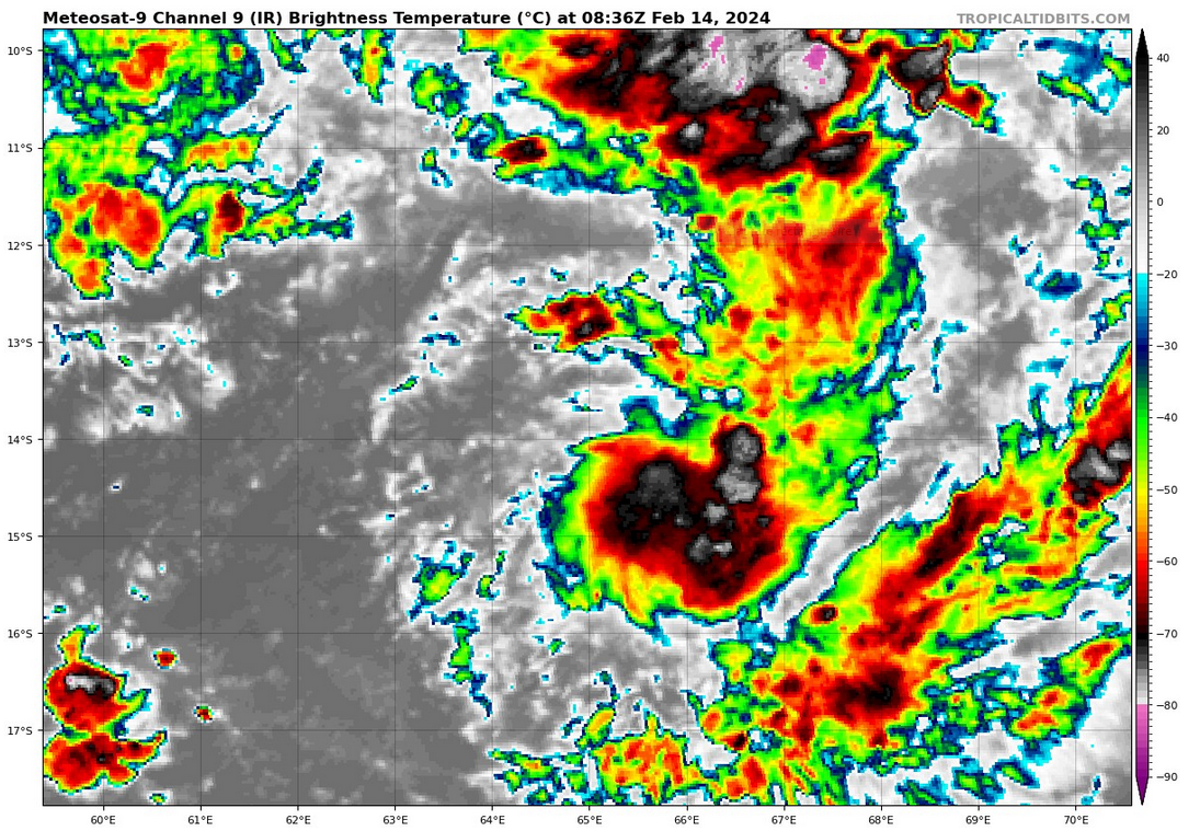
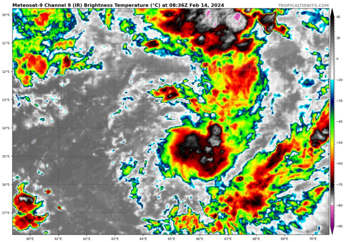
THE AREA OF CONVECTION (INVEST 90S) PREVIOUSLY LOCATED NEAR 13.4S 66.8E IS NOW LOCATED NEAR 13.6S 66.1E, APPROXIMATELY 531 NM SOUTHWEST OF DIEGO GARCIA. ANIMATED MULTISPECTRAL SATELLITE IMAGERY (MSI) DEPICTS A FAIRLY SMALL PARTIALLY EXPOSED LOW LEVEL CIRCULATION CENTER WITH DEEP CONVECTION FLARING ON THE EASTERN PERIPHERY OF THE SYSTEM. DESPITE A FAIRLY WEAK 850MB VORTICITY SIGNATURE, ENVIRONMENTAL ANALYSIS REVEALS FAVORABLE CONDITIONS FOR FURTHER DEVELOPMENT OF INVEST 90S WITH GOOD POLEWARD OUTFLOW ALOFT, LOW (10-15KT) VWS, AND WARM (29-30 C) SST. GLOBAL MODELS ARE IN GENERAL AGREEMENT THAT 90S WILL CONTINUE ON AN EASTWARD TRACK THROUGH THE SUBSIDENT ENVIRONMENT TO FINALLY GET MORE OF A CHIMNEY EFFECT GOING IN ITS FAVOR BEYOND TAU 72, AND CONSOLIDATE AND STRENGTHEN MORE. MAXIMUM SUSTAINED SURFACE WINDS ARE ESTIMATED AT 18 TO 23 KNOTS. MINIMUM SEA LEVEL PRESSURE IS ESTIMATED TO BE NEAR 1007 MB. THE POTENTIAL FOR THE DEVELOPMENT OF A SIGNIFICANT TROPICAL CYCLONE WITHIN THE NEXT 24 HOURS IS LOW.
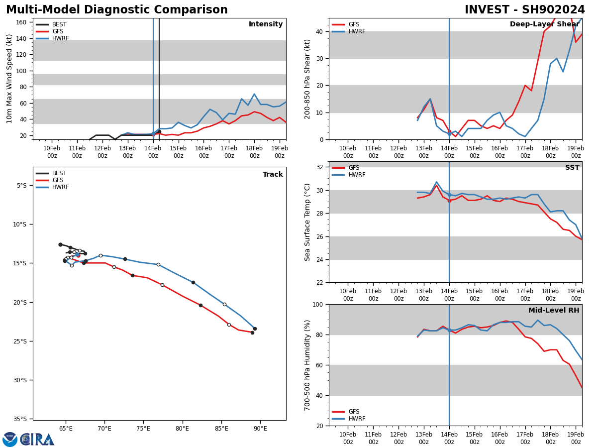
Model Diagnostic Plot

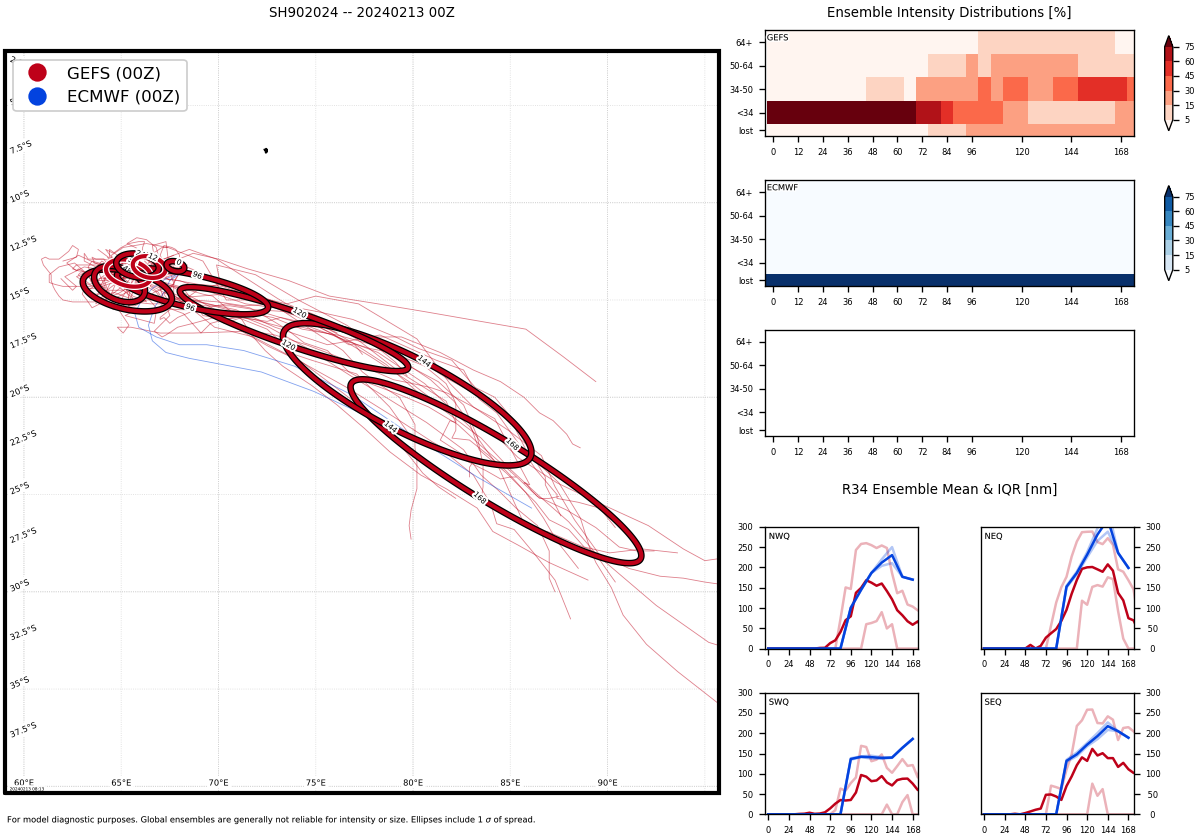
GLOBAL MODELS ARE IN GENERAL AGREEMENT THAT 90S WILL CONTINUE ON AN EASTWARD TRACK THROUGH THE SUBSIDENT ENVIRONMENT TO FINALLY GET MORE OF A CHIMNEY EFFECT GOING IN ITS FAVOR BEYOND TAU 72, AND CONSOLIDATE AND STRENGTHEN MORE.
Ensemble Track Ellipses
UPDATED SATELLITE BULLETIN ISSUED AT 14/0830UTC.
TPXS10 PGTW 140852
A. TROPICAL DISTURBANCE 90S (SW DIEGO GARCIA)
B. 14/0830Z
C. 14.91S
D. 64.96E
E. FIVE/GOES-IO
F. T1.5/1.5 STT: S0.0/03HRS
G. IR/EIR/VIS/MSI
H. REMARKS: 63A/PBO PRLY ORGNZD LLCC/ANMTN. LOOSELY DEFINED CLOUD
LINES LOCATED WITHIN 75NM OF COLD OVERCAST YIELD A DT OF 1.0. MET
AGREES. PT YIELDS 1.5. DBO DT.
I. ADDITIONAL POSITIONS:
14/0438Z 13.98S 65.63E GPMI
CVACH
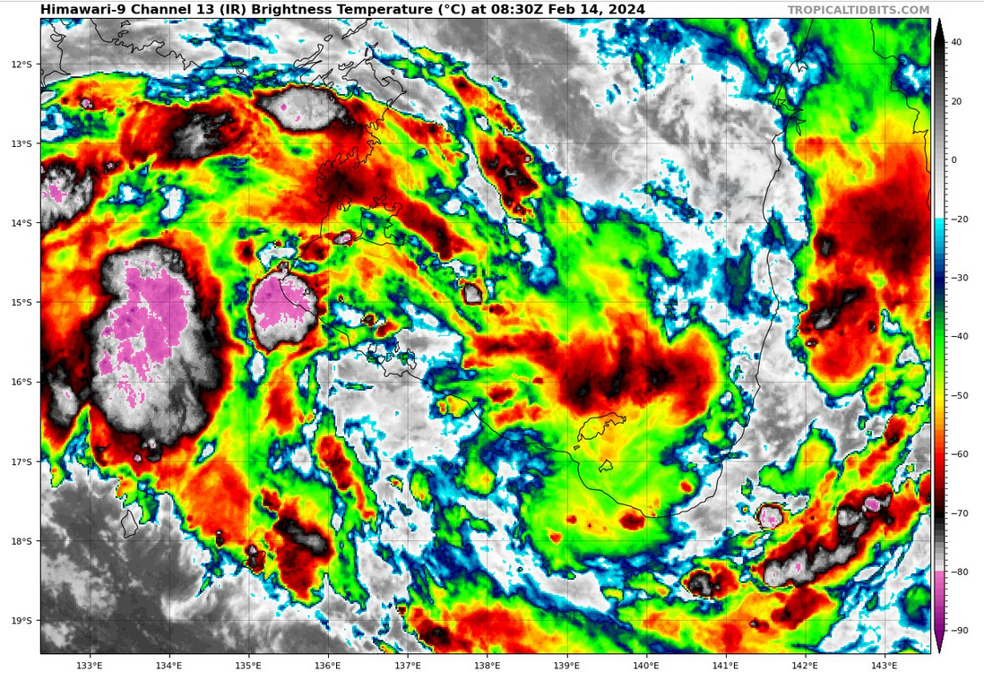
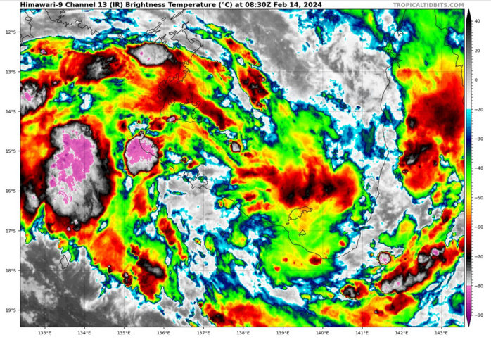
AUSTRALIA/GULF OF CARPENTARIA: INVEST 93S. ESTIMATED LOCATION AND INTENSITY AT 14/06UTC. CURRENT INTENSITY IS 25 KNOTS: +5 KNOTS OVER 18 HOURS.
CLICK ON THE IMAGERY BELOW TO GET IT ANIMATED AND ENLARGED. ADVISORY(ABPW) ISSUED AT 14/06UTC.
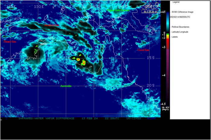
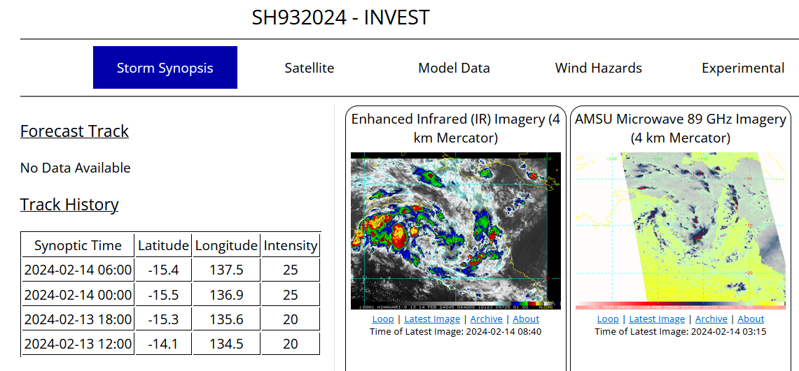
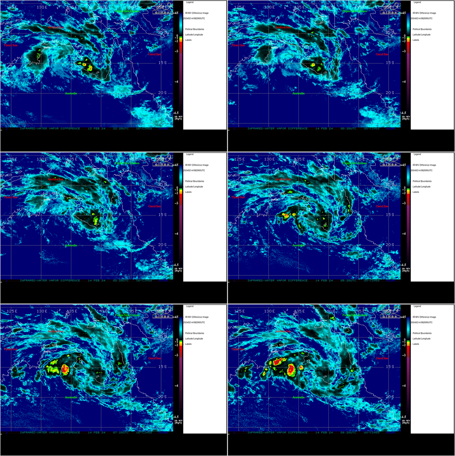
THE AREA OF CONVECTION (INVEST 93S) PREVIOUSLY LOCATED NEAR 15.1S 136.9E IS NOW LOCATED NEAR 15.4S 137.3E, APPROXIMATELY 419 NM EAST-SOUTHEAST OF DARWIN. ANIMATED SATELLITE IMAGERY AND A 132358Z GMI 89GHZ SATELLITE MICROWAVE IMAGERY DEPICTS FORMATIVE SHALLOW BANDS OF CONVECTION, AND A CONSOLIDATING LOW LEVEL CIRCULATION CENTER. ENVIRONMENTAL ANALYSIS REVEALS THAT 93S IS IN A FAVORABLE ENVIRONMENT FOR DEVELOPMENT, WITH VERY WARM (30-31C) SEA SURFACE TEMPERATURES, MODERATE DUAL-CHANNEL OUTFLOW, AND LOW TO MARGINAL VERTICAL WIND SHEAR (10-15 KTS). GLOBAL MODELS ARE IN GOOD AGREEMENT THAT 93S WILL GENERALLY TRACK EASTWARD WITHIN THE NEXT 12 HOURS, MOVING OVER THE SOUTHERN GULF OF CARPENTARIA. OVER THE NEXT 24-36 HOURS, NUMERICAL MODELS ARE IN AGREEMENT THAT 93S WILL TURN SOUTHWARD TOWARDS LAND. MAXIMUM SUSTAINED SURFACE WINDS ARE ESTIMATED AT 23 TO 28 KNOTS. MINIMUM SEA LEVEL PRESSURE IS ESTIMATED TO BE NEAR 1003 MB. THE POTENTIAL FOR THE DEVELOPMENT OF A SIGNIFICANT TROPICAL CYCLONE WITHIN THE NEXT 24 HOURS REMAINS MEDIUM.
Model Diagnostic Plot
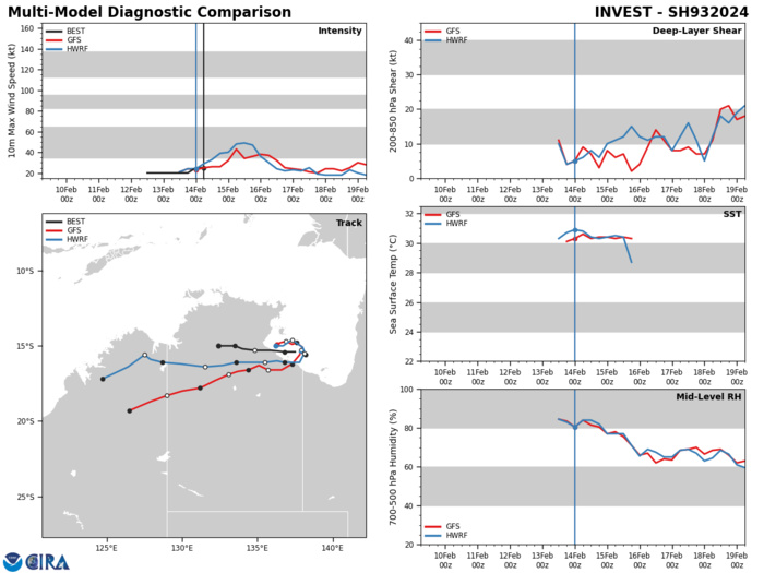
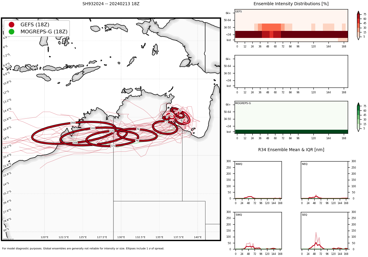
GLOBAL MODELS ARE IN GOOD AGREEMENT THAT 93S WILL GENERALLY TRACK EASTWARD WITHIN THE NEXT 12 HOURS, MOVING OVER THE SOUTHERN GULF OF CARPENTARIA. OVER THE NEXT 24-36 HOURS, NUMERICAL MODELS ARE IN AGREEMENT THAT 93S WILL TURN SOUTHWARD TOWARDS LAND.
Ensemble Track Ellipses
UPDATED SATELLITE BULLETIN ISSUED AT 14/0830UTC.
TPPS11 PGTW 140858
A. TROPICAL DISTURBANCE 93S (N OF VANDERLIN ISLAND)
B. 14/0830Z
C. 15.90S
D. 138.23E
E. FIVE/GK2A
F. N/A
G. IR/EIR/VIS/MSI
H. REMARKS: 71A/PBO XTRP/ANMTN. THIS SYSTEM IS TOO WEAK TO
CLASSIFY. INTENSITY ESTIMATE MAY NOT BE REPRESENTATIVE DUE TO
PROXIMITY TO LAND.
I. ADDITIONAL POSITIONS: NONE
CVACH
A. TROPICAL DISTURBANCE 93S (N OF VANDERLIN ISLAND)
B. 14/0830Z
C. 15.90S
D. 138.23E
E. FIVE/GK2A
F. N/A
G. IR/EIR/VIS/MSI
H. REMARKS: 71A/PBO XTRP/ANMTN. THIS SYSTEM IS TOO WEAK TO
CLASSIFY. INTENSITY ESTIMATE MAY NOT BE REPRESENTATIVE DUE TO
PROXIMITY TO LAND.
I. ADDITIONAL POSITIONS: NONE
CVACH
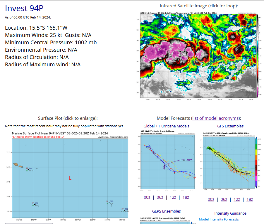
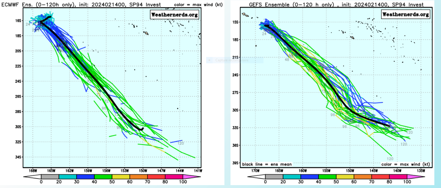
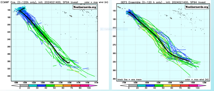
SOUTH PACIFIC OCEAN: INVEST 94P. ESTIMATED LOCATION AND INTENSITY AT 14/06UTC. CURRENT INTENSITY IS 25 KNOTS.
Ensemble Forecasts
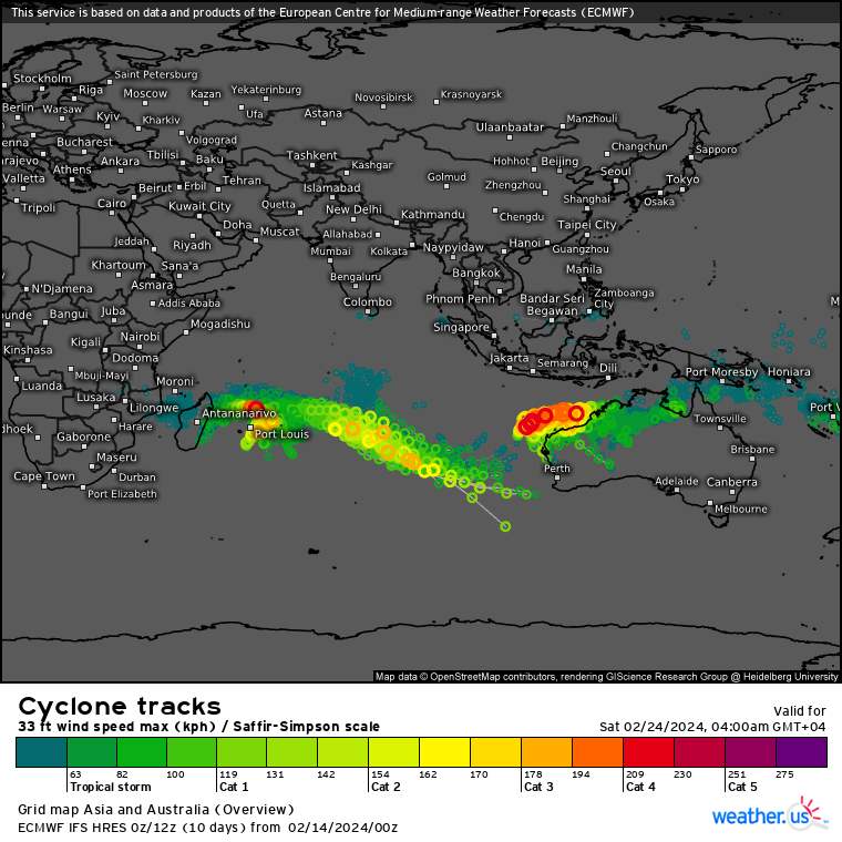
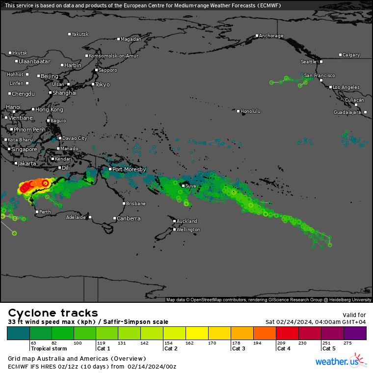
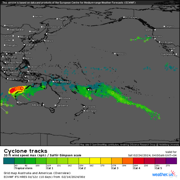
ECMWF Storm Tracks (Ensemble) : 02/14 00UTC+ 10 DAYS
ECMWF Storm Tracks (Ensemble) : 02/14 00UTC+ 10 DAYS
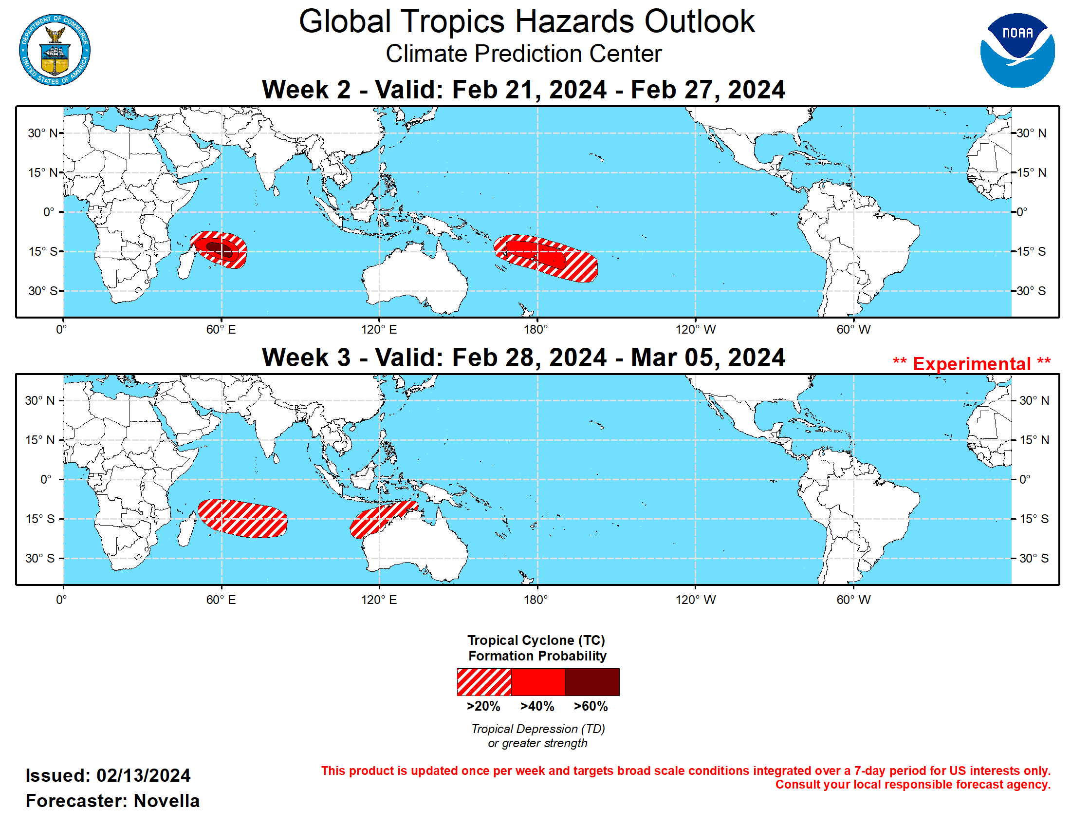
Last Updated - 02/13/24 3 WEEK TROPICAL CYCLONE DEVELOPMENT PROBABILITY

GTH Outlook Discussion Last Updated - 02/13/24 Valid - 02/21/24 - 03/05/24 Since earlier this month, RMM observations show a westward retreat of the MJO signal over the western Pacific, followed by the resumption of a more canonical eastward propagation where it has recently entered the Western Hemisphere (phase 8). The observed behavior appears to be tied to a fairly strong Rossby wave activity in the global tropics which led to a breakdown of the wave-1 spatial pattern in the upper-level velocity potential anomaly fields during the past week. Looking ahead, RMM forecasts have been consistent in favoring a weakened and incoherent MJO through late February, as models remain nearly unanimous with the signal falling within the unit circle in the next two weeks. However, analysis of several MJO variable forecasts reveal a more coherent MJO perspective, and the thinking is that the disorganizing MJO favored in the RMM forecasts may be more of an undesired effect of RMM methodology. A comparison of RMM indices with and without the 120-day running mean shows a sharp left-to-right shift of values in phase space, where the positive Indian Ocean Dipole (+IOD) event that peaked this past fall appears to be exerting a dominating influence in the mean. Because this low frequency response is no longer evident in the tropical circulation (namely, in the absence of enhanced lower-level easterlies over the Indian Ocean), the RMM forecasts may be overcorrecting themselves to the right along the RMM 1 axis, where the eastward propagating signals favored in the Western Hemisphere (phases 8 and 1) are actually higher in amplitude than what is being depicted. As a result, this would suggest stronger MJO activity in the outlook, which is supported by upper-level velocity potential anomaly forecasts favoring more of a wave-1 pattern during the next several weeks. Though, it should be noted that even with this RMM biasing, there remains some uncertainty with the evolution of the MJO given a tendency in the model solutions for faster propagation speeds. This is still contributing to high ensemble spread, placing the enhanced envelope at different phases at the longer leads, which is also featured in the upper-level velocity potential forecasts between the ECMWF and GEFS. Regardless of these differences with timing, the large-scale environment is expected to be favorable for tropical cyclogenesis over the southern Indian Ocean, with increasingly less favorable conditions for additional Tropical Cyclone (TC) formation over the South Pacific heading into early March. During the past week, two TCs developed in the South Pacific associated with a very strong band of anomalous lower-level westerlies ongoing to the south of the equator. TC Osai formed on 2/7 a few hundred miles northwest of American Samoa. This system tracked southeastward and peaked at Tropical Storm intensity before encountering a more hostile environment and quickly dissipating to the north of the Cook Islands on 2/8. Around the same time, TC Twelve formed further west in the Coral Sea and tracked to the east while peaking at Tropical Storm strength. TC Twelve weakened to a Tropical Depression and dissipated to the west of the Fiji Islands on 2/11, however ensemble solutions maintain an area of depression near the Date Line, where reformation or a newly formed area of tropical low pressure is possible in the region during week-1. The Joint Typhoon Warning Center (JTWC) is currently monitoring an area (90S) in the southern Indian Ocean for potential development this week. In the wake of this disturbance, there is good model support for additional TC development to the east of Madagascar, and probabilistic tools indicate higher chances of formation near 15S/60E compared to previous runs. Based on continued ensemble support and trend, 60% chances are issued in the region for week-2. In the South Pacific, both equatorial Rossby and Kelvin wave activity are favored in the basin, prompting 40% chances for additional TC development for week-2. Higher chances were considered, however the aforementioned anomalous lower-level westerlies in the South Pacific are predicted to rapidly ease and possibly flip to easterly during week-2, thereby limiting TC genesis potential. 20% chances for development were also considered to the north of Australia based on continued elevated signals from ECMWF probabilistic tool, however this part of the tropics appears more unfavorable with the suppressed phase of the MJO in the region. For week-3, probabilistic TC genesis tools show increased chances for additional TC development across the southern Indian Ocean, consistent with the enhanced phase of the MJO moving into the basin. However, lower-level wind anomaly forecasts are fairly muted and 20% chances are posted in the outlook. 20% chances are also issued to the north of Australia based on increased signals in the probabilistic tools. Although probabilistic tools feature some modest signals in the South Pacific, no shapes are posted in the basin due to the suppressed phase of the MJO moving into the basin to inhibit development.
