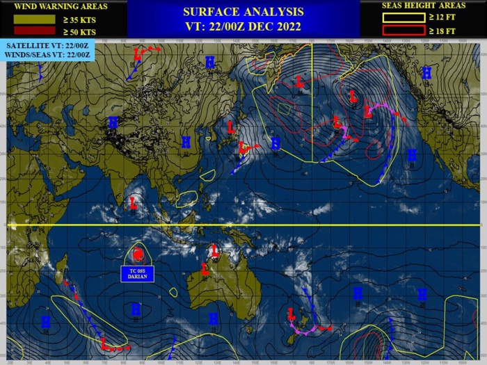
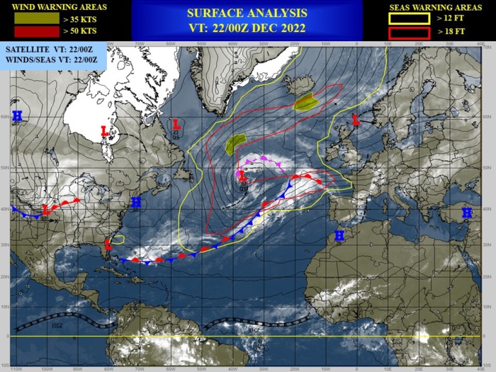
CLICK ON THE IMAGERIES BELOW TO GET THEM ENLARGED
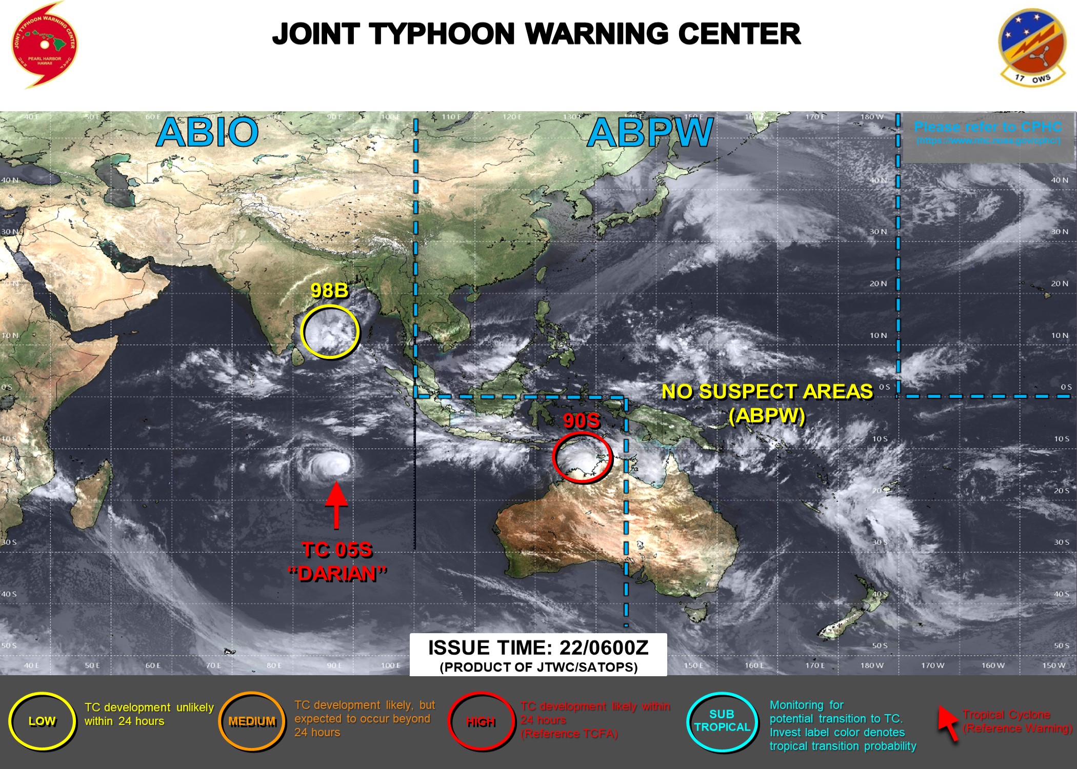
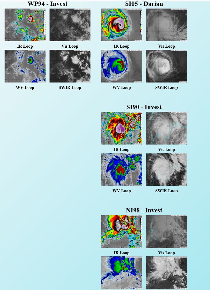
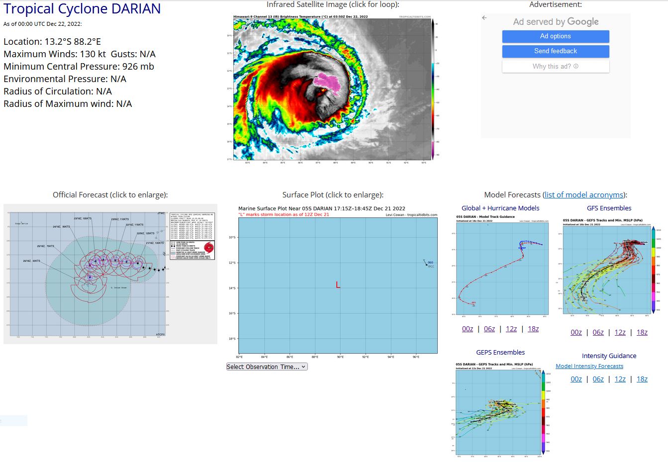
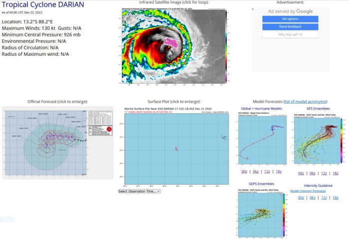
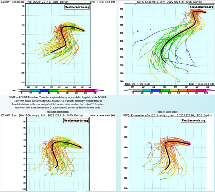
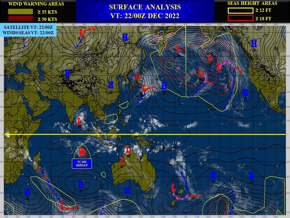
SOUTH INDIAN OCEAN: TC 05S(DARIAN). ESTIMATED LOCATION AND INTENSITY AT 22/00UTC.
SH, 05, 2022122018,142S, 920E, 130, 927, ST
SH, 05, 2022122100,141S, 914E, 130, 926, ST
SH, 05, 2022122106,139S, 907E, 130, 927, ST
SH, 05, 2022122112,138S, 898E, 130, 927, ST
SH, 05, 2022122118,133S, 890E, 130, 926, ST
SH, 05, 2022122200,132S, 882E, 130, 926, ST
SH, 05, 2022122100,141S, 914E, 130, 926, ST
SH, 05, 2022122106,139S, 907E, 130, 927, ST
SH, 05, 2022122112,138S, 898E, 130, 927, ST
SH, 05, 2022122118,133S, 890E, 130, 926, ST
SH, 05, 2022122200,132S, 882E, 130, 926, ST
ESTIMATED CURRENT INTENSITY IS 130KNOTS (SUPER TYPHOON)/CAT 4 US.
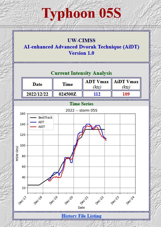
WARNING 9 ISSUED EARLIER AT 21/21UTC.

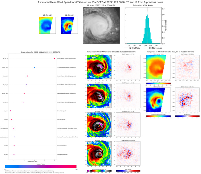
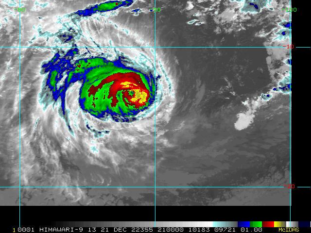
SATELLITE ANALYSIS, INITIAL POSITION AND INTENSITY DISCUSSION: ANIMATED ENHANCED INFRARED (EIR) SATELLITE IMAGERY SHOWS THE SYSTEM HAS MAINTAINED A MEDIUM-SIZED, HIGHLY-SYMMETRICAL STRUCTURE WITH A DEFINED PINHOLE EYE. THE INITIAL POSITION IS PLACED WITH HIGH CONFIDENCE BASED ON A MICROWAVE EYE FEATURE IN THE 211822Z GPM IMAGE AND LINED UP WITH A DEFINED LOW LEVEL CIRCULATION CENTER IN THE 211603Z ASCAT BULLSEYE PASS. THE INITIAL INTENSITY IS BASED ON OVERALL ASSESSMENT OF AGENCY AND AUTOMATED DVORAK ESTIMATES AND REFLECTS THE SUSTAINED CONVECTIVE SIGNATURE. TC DARIAN HAS TRACKED MORE POLEWARD OVER THE LAST SIX HOURS. LIKELY DUE TO STRONGER STEERING STR THAN ANTICIPATED. ALSO, ANALYSIS OF RECENT MICROWAVE SATELLITE IMAGES, INCLUDING THE 211822Z GPM PASS, SHOWS THE SYSTEM MAY BE UNDERGOING A SLOW EYEWALL REPLACEMENT CYCLE.
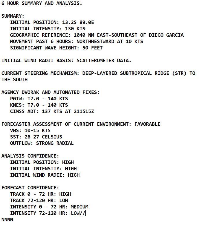
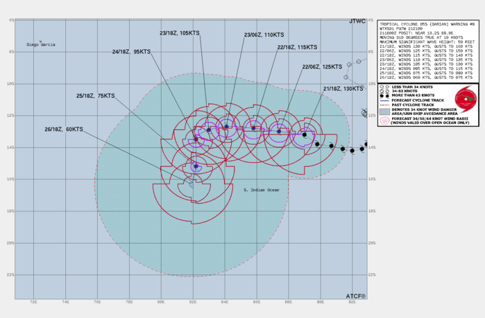
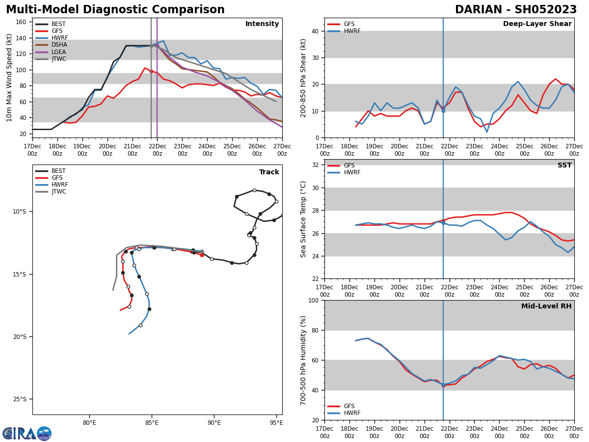
FORECAST REASONING. SIGNIFICANT FORECAST CHANGES: THERE ARE NO SIGNIFICANT CHANGES TO THE FORECAST FROM THE PREVIOUS WARNING. FORECAST DISCUSSION: TC DARIAN WILL TRACK MORE WESTWARD UNDER THE STEERING INFLUENCE OF THE STR TO THE SOUTH THAT IS RECEDING EASTWARD. BY TAU 72, THE CYCLONE WILL BEGIN TO ROUND THE STR AXIS AND TRACK MORE SOUTHWARD. THE UPPER LEVEL ENVIRONMENT WILL REMAIN FAVORABLE WITH LOW VWS AND STRONG RADIAL OUTFLOW; HOWEVER, THE ALONG-TRACK SST IS PROJECTED TO SLOWLY COOL LEADING TO A GRADUAL WEAKENING UP TO TAU 72. AFTERWARD, AS THE SYSTEM TRACKS MORE POLEWARD, SST IS EXPECTED TO COOL MORE RAPIDLY, RESULTING IN A MORE ACCELERATED WEAKENING. BY TAU 120, TC 05S WILL BE REDUCED TO 60 KTS.
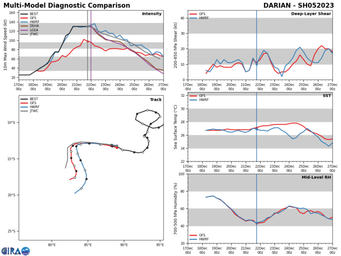
MODEL DISCUSSION: NUMERICAL MODELS ARE IN TIGHT AGREEMENT WITH A GRADUAL AND EVEN SPREADING TO 84NM AT TAU 72. AFTERWARD, THE MEMBERS SPREAD OUT SIGNIFICANTLY ALONG-TRACK AND UP TO 286NM ACROSS-TRACK BY TAU 120 WITH NVGM ON THE RIGHT AND EEMN ON THE LEFT MARGIN OF THE MODEL ENVELOPE. IN VIEW OF THIS, THERE IS HIGH CONFIDENCE IN THE JTWC TRACK FORECAST UP TO TAU 72, THEN LOW CONFIDENCE AFTERWARD.
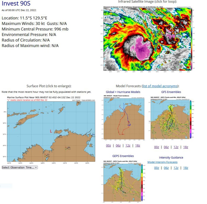
SOUTH INDIAN/TIMOR SEA: INVEST 90S. ESTIMATED LOCATION AND INTENSITY AT 22/00UTC.
SH, 90, 2022122018,103S, 1284E, 15, 1001, DB
SH, 90, 2022122100,105S, 1284E, 25, 999, TD
SH, 90, 2022122106,106S, 1285E, 25, 999, TD
SH, 90, 2022122112,108S, 1288E, 25, 999, TD
SH, 90, 2022122118,111S, 1293E, 25, 997, TD
SH, 90, 2022122200,115S, 1295E, 30, 996, TD
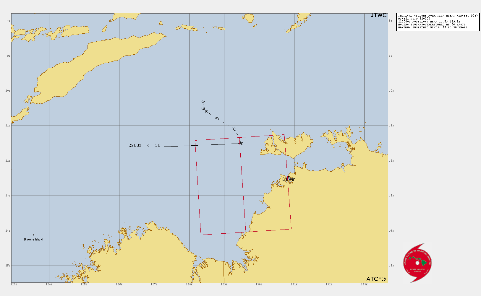
TROPICAL CYCLONE FORMATION ALERT ISSUED AT 21/02UTC.

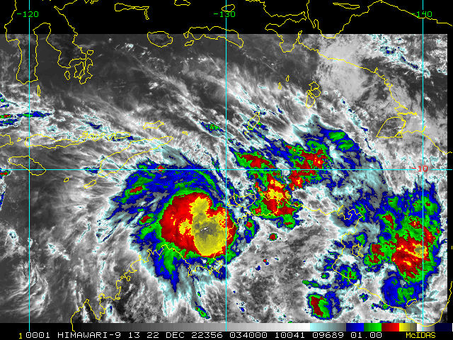
THE AREA OF CONVECTION (INVEST 90S) PREVIOUSLY LOCATED NEAR 10.8S 128.1E IS NOW LOCATED NEAR 11.5S 129.5E, APPROXIMATELY 98 NM NORTHWEST OF DARWIN, AUSTRALIA. ANIMATED ENHANCED INFRARED SATELLITE IMAGERY SHOWS A PERSISTENT AND CONSOLIDATING AREA OF DEEP CONVECTION THAT IS SHEARED WESTWARD OF THE LOW LEVEL CIRCULATION. ANALYSIS INDICATES 90S IS IN A MARGINALLY FAVORABLE ENVIRONMENT FOR DEVELOPMENT WITH GOOD DIVERGENCE ALOFT AND VERY WARM (30-31C) SST IN THE TIMOR SEA OFFSET BY HIGH (25-30 KNOT) EASTERLY VWS. GLOBAL MODELS ARE IN GOOD AGREEMENT THAT 90S WILL MOVE MORE SOUTHWARD OVER THE NEXT 24-48 HOURS AND POSSIBLY INTENSIFY TO WARNING CRITERIA AS IT TRACKS INTO AN AREA OF FAVORABLE VWS JUST BEFORE IT MAKES LANDFALL SOUTH OF JOSEPH BONAPARTE GULF. MAXIMUM SUSTAINED SURFACE WINDS ARE ESTIMATED AT 25 TO 30 KNOTS. MINIMUM SEA LEVEL PRESSURE IS ESTIMATED TO BE NEAR 996 MB. THE POTENTIAL FOR THE DEVELOPMENT OF A SIGNIFICANT TROPICAL CYCLONE WITHIN THE NEXT 24 HOURS IS UPGRADED TO HIGH.
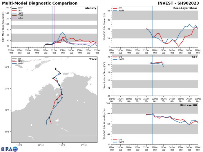
GLOBAL MODELS ARE IN GOOD AGREEMENT THAT 90S WILL MOVE MORE SOUTHWARD OVER THE NEXT 24-48 HOURS AND POSSIBLY INTENSIFY TO WARNING CRITERIA AS IT TRACKS INTO AN AREA OF FAVORABLE VWS JUST BEFORE IT MAKES LANDFALL SOUTH OF JOSEPH BONAPARTE GULF.
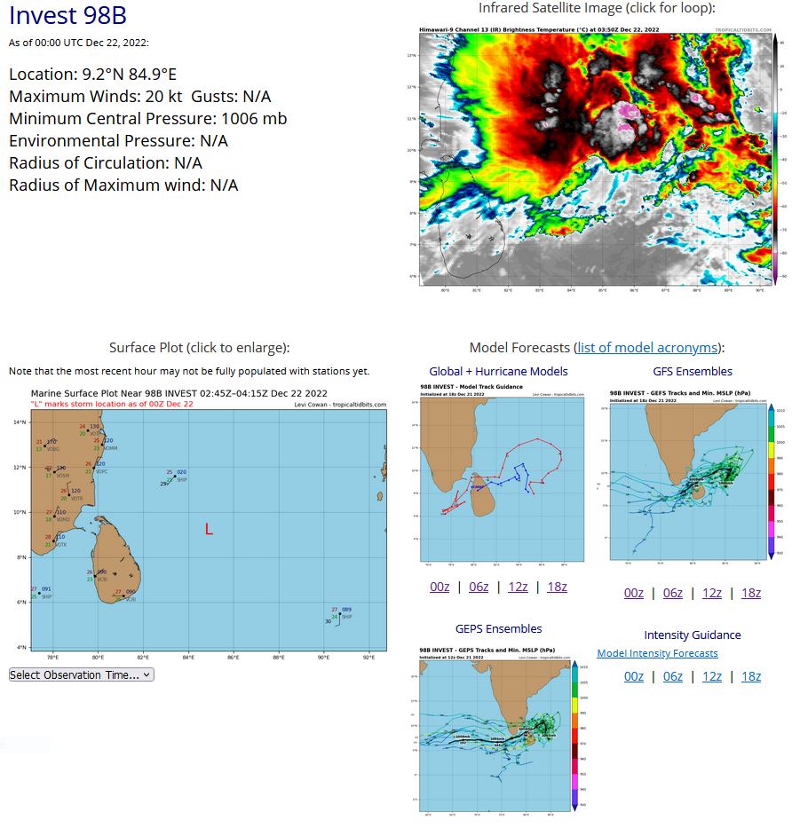
NORTH INDIAN/BOB: INVEST 98B. ESTIMATED LOCATION AND INTENSITY AT 22/00UTC. ADVISORY(ABIO) ISSUED AT 22/0302UTC.

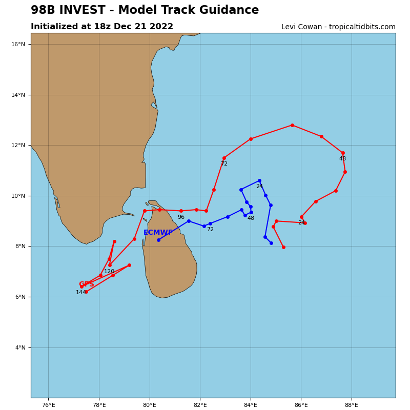
THE AREA OF CONVECTION (INVEST 98B) PREVIOUSLY LOCATED NEAR 7.2N 85.4E IS NOW LOCATED NEAR 9.2N 84.9E, APPROXIMATELY 357 NM SOUTHEAST OF CHENNAI, INDIA. ANIMATED ENHANCED INFRARED SATELLITE IMAGERY (EIR) DEPICTS A BROAD LLC PARTIALLY EXPOSED TO THE SOUTHEAST OF FLARING CONVECTION THAT IS BEING SHEARED TO THE NORTHWEST. ANALYSIS INDICATES 98B IS IN A MARGINALLY FAVORABLE ENVIRONMENT FOR DEVELOPMENT WITH MODERATE TO STRONG (20-25 KNOT) VWS OFFSET BY GOOD DIVERGENCE ALOFT AND WARM (28-29C) SEA SURFACE TEMPERATURES. GLOBAL MODELS ARE IN GOOD AGREEMENT THAT 98B WILL CONTINUE TO TRACK GENERALLY NORTHWARD OVER THE NEXT 24-48 HOURS AND GRADUALLY INTENSIFY; HOWEVER, THE INCREASING VWS WILL LIKELY HINDER DEVELOPMENT INTO A SIGNIFICANT TROPICAL CYCLONE. MAXIMUM SUSTAINED SURFACE WINDS ARE ESTIMATED AT 20 TO 25 KNOTS. MINIMUM SEA LEVEL PRESSURE IS ESTIMATED TO BE NEAR 1006 MB. THE POTENTIAL FOR THE DEVELOPMENT OF A SIGNIFICANT TROPICAL CYCLONE WITHIN THE NEXT 24 HOURS REMAINS LOW.
IO, 98, 2022122018,58N, 866E, 25, 1004, TD
IO, 98, 2022122100,60N, 856E, 25, 1004, TD
IO, 98, 2022122106,66N, 855E, 25, 1004, TD
IO, 98, 2022122112,72N, 854E, 25, 1004, TD
IO, 98, 2022122118,85N, 850E, 20, 1006, DB
IO, 98, 2022122200,92N, 849E, 20, 1006, DB
IO, 98, 2022122100,60N, 856E, 25, 1004, TD
IO, 98, 2022122106,66N, 855E, 25, 1004, TD
IO, 98, 2022122112,72N, 854E, 25, 1004, TD
IO, 98, 2022122118,85N, 850E, 20, 1006, DB
IO, 98, 2022122200,92N, 849E, 20, 1006, DB

GLOBAL MODELS ARE IN GOOD AGREEMENT THAT 98B WILL CONTINUE TO TRACK GENERALLY NORTHWARD OVER THE NEXT 24-48 HOURS AND GRADUALLY INTENSIFY; HOWEVER, THE INCREASING VWS WILL LIKELY HINDER DEVELOPMENT INTO A SIGNIFICANT TROPICAL CYCLONE.
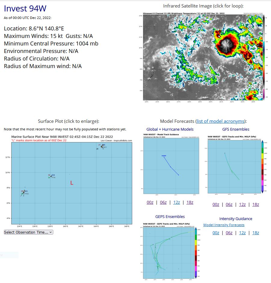
WESTERN NORTH PACIFIC: INVEST 94W. ESTIMATED LOCATION AND INTENSITY AT 22/00UTC.
WP, 94, 2022122018,52N, 1419E, 15, 1003, DB
WP, 94, 2022122100,57N, 1417E, 15, 1003, DB
WP, 94, 2022122106,64N, 1415E, 15, 1003, DB
WP, 94, 2022122112,70N, 1413E, 15, 1002, DB
WP, 94, 2022122118,78N, 1410E, 15, 1004, DB
WP, 94, 2022122200,86N, 1408E, 15, 1004, DB
WP, 94, 2022122100,57N, 1417E, 15, 1003, DB
WP, 94, 2022122106,64N, 1415E, 15, 1003, DB
WP, 94, 2022122112,70N, 1413E, 15, 1002, DB
WP, 94, 2022122118,78N, 1410E, 15, 1004, DB
WP, 94, 2022122200,86N, 1408E, 15, 1004, DB

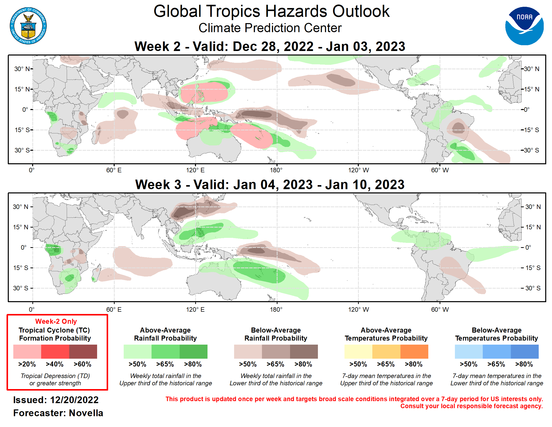
Last Updated - 12/20/22 Valid - 12/28/22 - 01/10/23 During the month of December, the RMM index has continued to depict a weak, and poorly defined Madden-Julian Oscillation (MJO), though there has been a slight uptick in amplitude over the Indian Ocean during the past day or so. Upper-level velocity potential anomalies continue to reveal a more coherent representation of the MJO, with the center of the enhanced phase now located over the eastern Indian Ocean based on objective wavenumber-frequency filtering. Looking ahead, dynamical models generally favor a reemerging MJO in RMM space over the Maritime Continent during week-1, with continued eastward propagation into the western Pacific in week-2. By this time, the GEFS and CFS favor a weakened MJO as it enters the Pacific, which is likely tied to the destructive interference with the background La Nina base state. However, these models also show more of an enhancement of convection and anomalous lower-level westerlies reaching the Date Line south of the equator (5S-15S), suggestive of the MJO maintaining some semblance of an organized structure entering the New Year. Regardless of some of these uncertainties with the MJO, the large-scale environment is expected to remain favorable for tropical cyclone (TC) formation in the eastern Indian Ocean and Pacific during the outlook period, with decreasing chances for development over the western Indian Ocean later in the outlook period. With higher confidence for a reemerging MJO over the Maritime Continent next week, the extratropical response over North America historically favors the development of above-normal temperatures particularly for the central and eastern CONUS. This is consistent with ensemble mean 500-hPa height and temperatures guidance for week-2, where the predicted pattern change is anticipated to provide a welcome moderation of Arctic-like temperatures that are forecast for this part of the U.S. during week-1. The enhanced phase of the MJO likely contributed to a pair of TCs forming over the Indian Ocean during the past week. TC Seven (ARB03) formed in the Arabian Sea on 12/14 and appeared to be a regeneration of the remnants of TC Mandous that formed earlier in December over the Bay of Bengal. After reaching a peak intensity of 45kts while tracking westward, this system dissipated off the Horn of Africa this past weekend. South of the equator, TC Darian formed in the Indian Ocean on 12/18 near 12S/92E. Currently at category 3 strength, the Joint Typhoon Warning Center (JTWC) forecasts Darian to track westward along the 14th parallel and fluctuate in intensity under the influence of a variable sea surface temperature and moisture environment during the next 5 days. Beyond this time, deterministic GFS and ECMCF solutions show Darian accelerating and gaining latitude over open waters, eventually undergoing extratropical transition during the week-2 period. For week-2, there is good agreement between the GEFS and ECMWF ensembles favoring an area of deepening low pressure over the South China and Philippine Seas. With the MJO favored to remerge over the Maritime Continent and propagate into the western Pacific, conditions would become more conducive for development, however this potential is countered by an increasingly inactive climatology for the basin in late December, prompting slight chances (20%) for genesis during the period. Over the southeastern Indian Ocean, dynamical models depict the development of anomalous lower-level westerlies to the north of Australia favorable for TC formation. This is reflected in the probabilistic TC genesis tools, however signals in the Timor Sea have lowered compared to previous runs, reducing forecast confidence and resulting in slight chances (20%) of TC development being issued. As the anomalous lower-level westerlies are forecast to expand eastward with time, an enhanced SPCZ and TC formation is increasingly favored late in week-2 for much of Melanesia and Polynesia and a broad slight chance area for TC development is posted. The precipitation forecast for weeks 2 and 3 is based on a historical skill weighted blend of GEFS, ECMWF, CFS and Canadian ensemble forecasts, ongoing La Nina conditions, and MJO composites. For hazardous weather concerns in your area during the next two weeks, please refer to your local NWS office, the Medium Range Hazards Forecasts from the Weather Prediction Center (WPC), and the CPC Week-2 Hazards Outlook. Forecasts issued over Africa are made in coordination with the International Desk at CPC.
