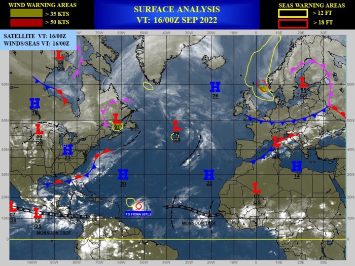
CLICK ON THE IMAGERIES BELOW TO GET THEM ENLARGED
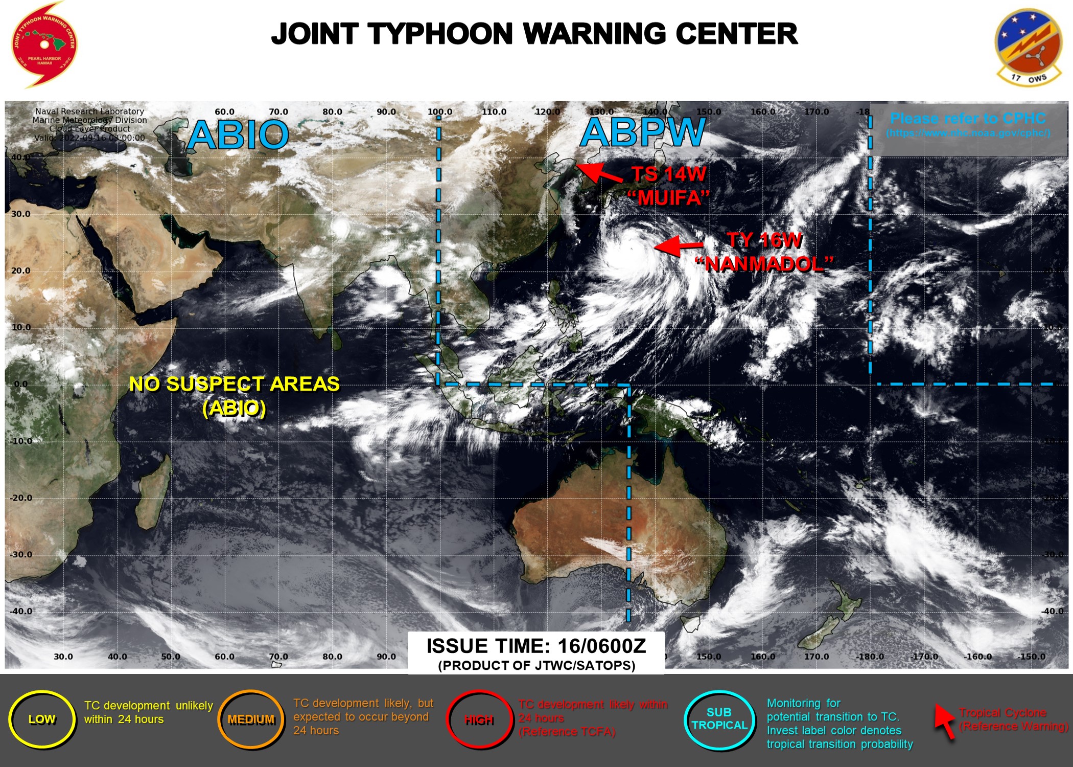
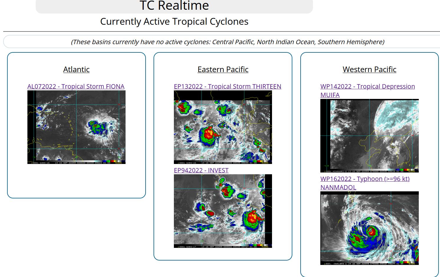
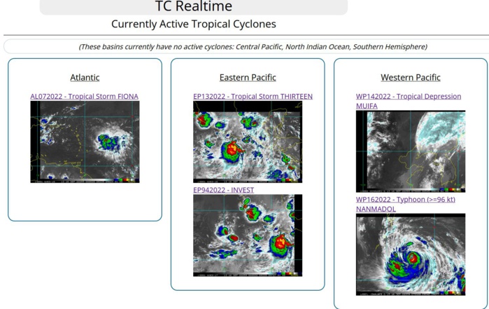
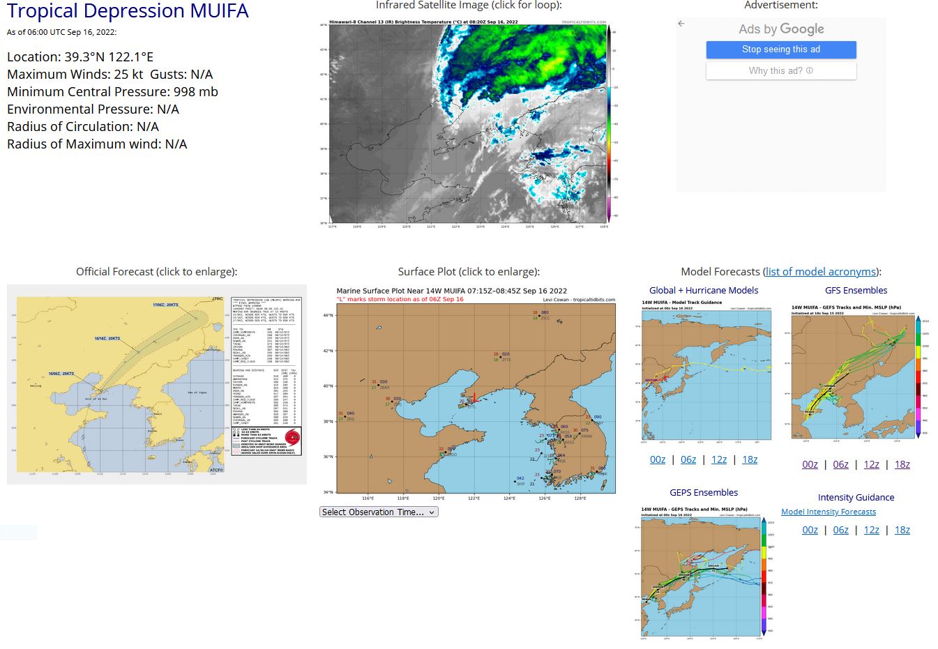
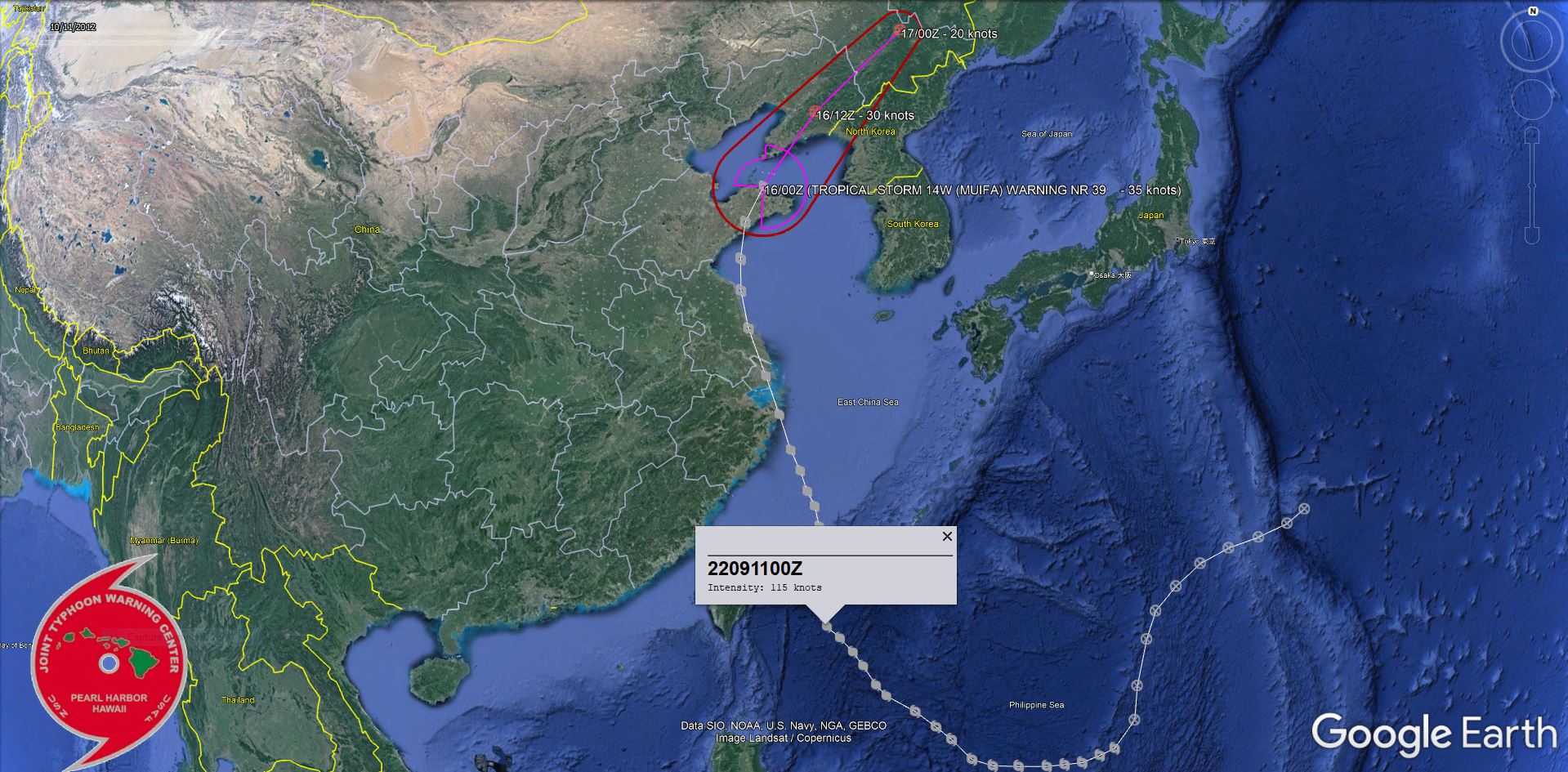
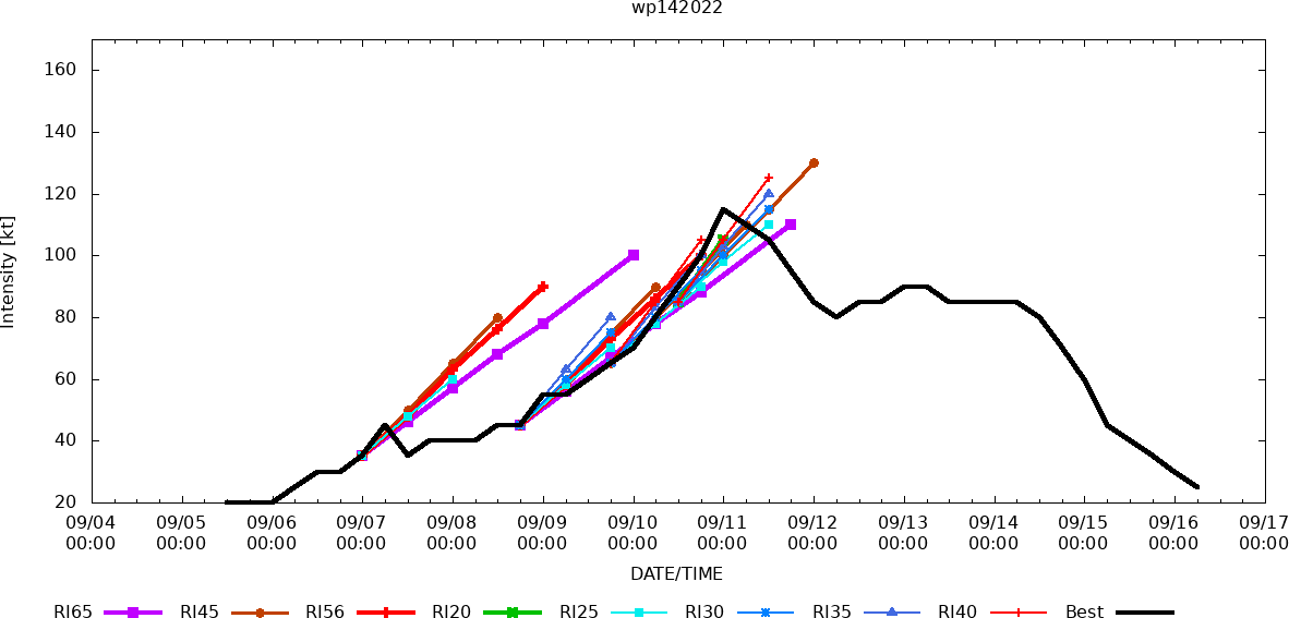
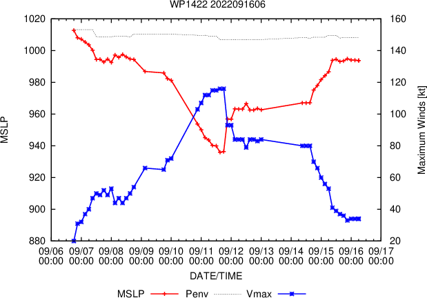
WESTERN NORTH PACIFIC: TD 14W(MUIFA) .ESTIMATED LOCATION AND INTENSITY AT 16/06UTC. WARNING 40/FINAL ISSUED AT 16/09UTC.
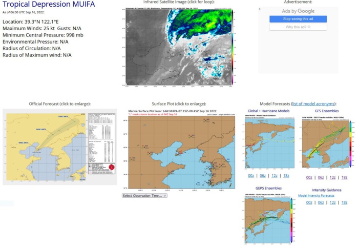
REMARKS: 160900Z POSITION NEAR 40.2N 122.9E. 16SEP22. TROPICAL DEPRESSION 14W (MUIFA), LOCATED APPROXIMATELY 238 NM WEST-NORTHWEST OF INCHON, SOUTH KOREA, HAS TRACKED NORTHEASTWARD AT 16 KNOTS OVER THE PAST SIX HOURS. ANIMATED MULTISPECTRAL SATELLITE IMAGERY SHOWS THE SYSTEM IS STRIPPED OF DEEP CONVECTION DUE TO HIGH (50KTS+) VERTICAL WIND SHEAR AS IT MADE LANDFALL OVER THE BO HAI PENINSULA, NORTHEASTERN CHINA. THE LOW LEVEL CIRCULATION WAS IRREGULAR AND ELONGATED BUT DISCERNIBLE ON COMPOSITE RADAR LOOP BEFORE THE LANDFALL. THE INITIAL INTENSITY OF 25KTS WAS EXTRAPOLATED FRON NEARBY SURFACE OBSERVATIONS AND CONSISTENT WITH THE 6-HR CONVECTIVE DETERIORATION. THE SYSTEM IS RAPIDLY ERODING DUE TO THE HIGH VWS AND LAND INTERACTION AND IS EXPECTED TO DISSIPATE BY TAU 12. THIS IS THE FINAL WARNING ON THIS SYSTEM BY THE JOINT TYPHOON WRNCEN PEARL HARBOR HI.
WP, 14, 2022090412,253N, 1444E, 15,1008
WP, 14, 2022090418,249N, 1435E, 15,1007
WP, 14, 2022090500,246N, 1421E, 15,1007
WP, 14, 2022090506,244N, 1407E, 15,1006
WP, 14, 2022090512,240N, 1394E, 20,1011
WP, 14, 2022090518,233N, 1383E, 20,1008
WP, 14, 2022090600,225N, 1374E, 20,1005
WP, 14, 2022090606,215N, 1370E, 25,1007
WP, 14, 2022090612,198N, 1366E, 30,1002
WP, 14, 2022090618,185N, 1365E, 30,1003
WP, 14, 2022090700,175N, 1357E, 35,1002
WP, 14, 2022090706,173N, 1351E, 45, 998
WP, 14, 2022090712,171N, 1344E, 35,1004
WP, 14, 2022090718,171N, 1337E, 40, 999
WP, 14, 2022090800,171N, 1330E, 40,1002
WP, 14, 2022090806,172N, 1319E, 40,1002
WP, 14, 2022090812,173N, 1309E, 45,1000
WP, 14, 2022090818,176N, 1301E, 45,1000
WP, 14, 2022090900,184N, 1293E, 55, 996
WP, 14, 2022090906,189N, 1287E, 55, 996
WP, 14, 2022090912,195N, 1279E, 60, 993
WP, 14, 2022090918,201N, 1268E, 65, 991
WP, 14, 2022091000,205N, 1264E, 70, 982
WP, 14, 2022091006,212N, 1259E, 80, 978
WP, 14, 2022091012,217N, 1255E, 90, 968
WP, 14, 2022091018,222N, 1250E,100, 958
WP, 14, 2022091100,226N, 1245E,115, 944
WP, 14, 2022091106,229N, 1244E,110, 947
WP, 14, 2022091112,234N, 1243E,105, 949
WP, 14, 2022091118,238N, 1243E, 95, 959
WP, 14, 2022091200,242N, 1242E, 85, 966
WP, 14, 2022091206,246N, 1241E, 80, 968
WP, 14, 2022091212,250N, 1240E, 85, 966
WP, 14, 2022091218,252N, 1241E, 85, 961
WP, 14, 2022091300,257N, 1242E, 90, 956
WP, 14, 2022091306,261N, 1241E, 90, 956
WP, 14, 2022091312,268N, 1239E, 85, 959
WP, 14, 2022091318,273N, 1236E, 85, 959
WP, 14, 2022091400,280N, 1233E, 85, 962
WP, 14, 2022091406,287N, 1229E, 85, 962
WP, 14, 2022091412,299N, 1224E, 80, 963
WP, 14, 2022091418,312N, 1218E, 70, 975
WP, 14, 2022091500,328N, 1210E, 60, 978
WP, 14, 2022091506,341N, 1206E, 45, 992
WP, 14, 2022091512,352N, 1205E, 40, 995
WP, 14, 2022091518,365N, 1206E, 35, 995
WP, 14, 2022091600,380N, 1210E, 30, 997
WP, 14, 2022091606,393N, 1221E, 25, 998
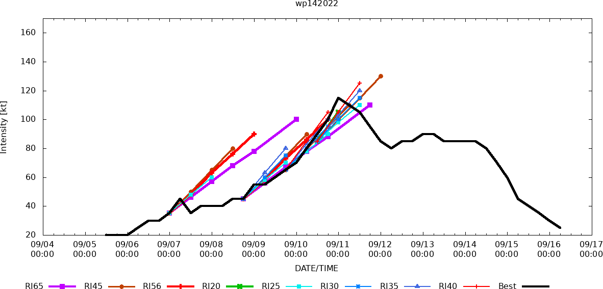
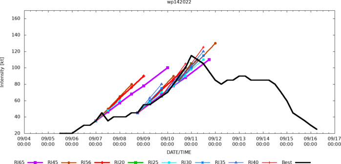
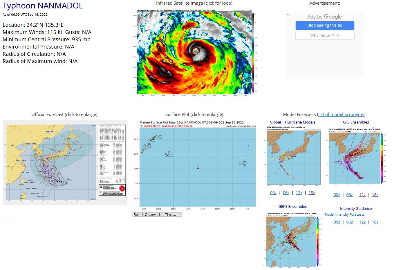
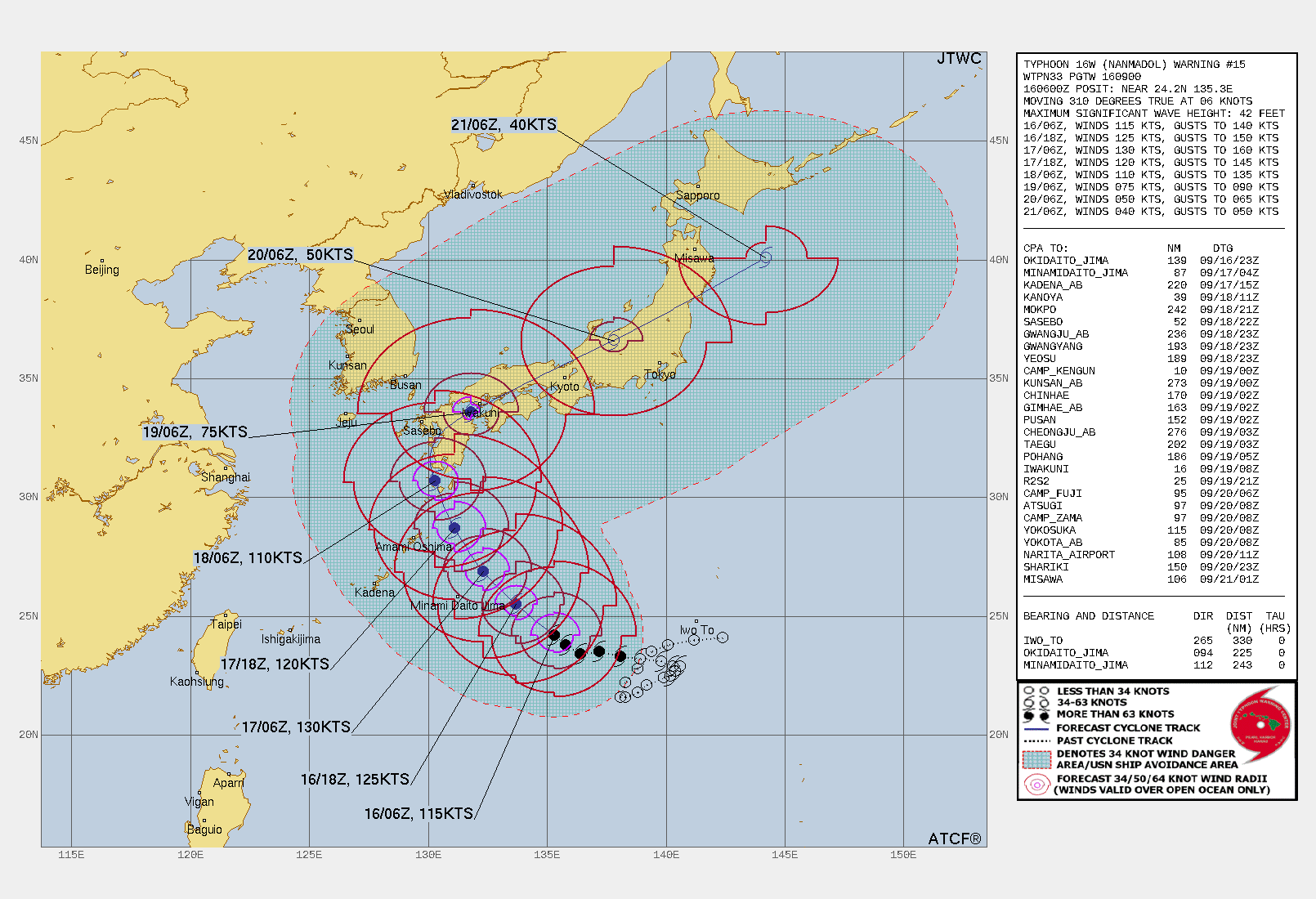
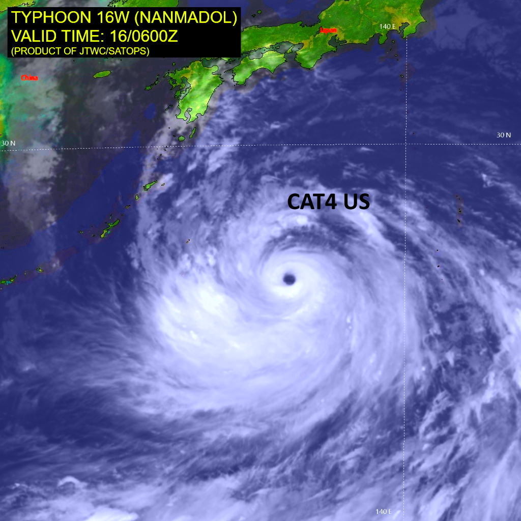
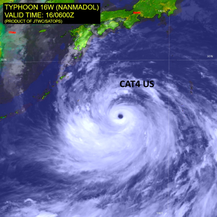
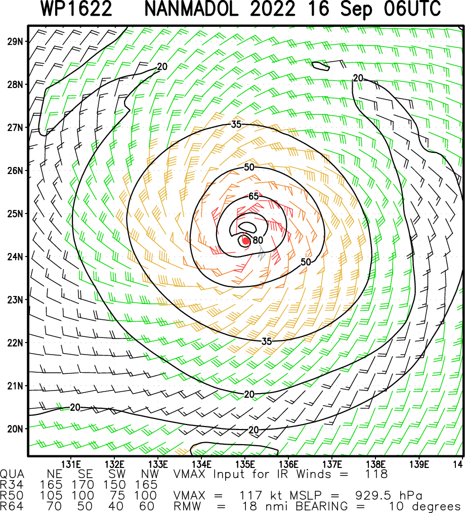
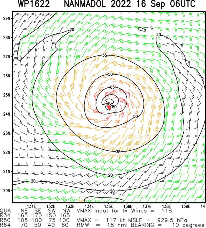
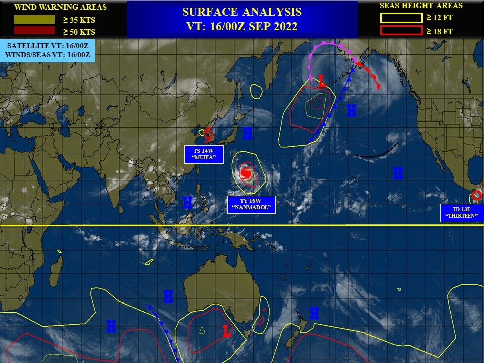
WESTERN NORTH PACIFIC: TY 16W(NANMADOL). ESTIMATED LOCATION AND INTENSITY AT 16/06UTC. WARNING 15 ISSUED AT 16/09UTC.
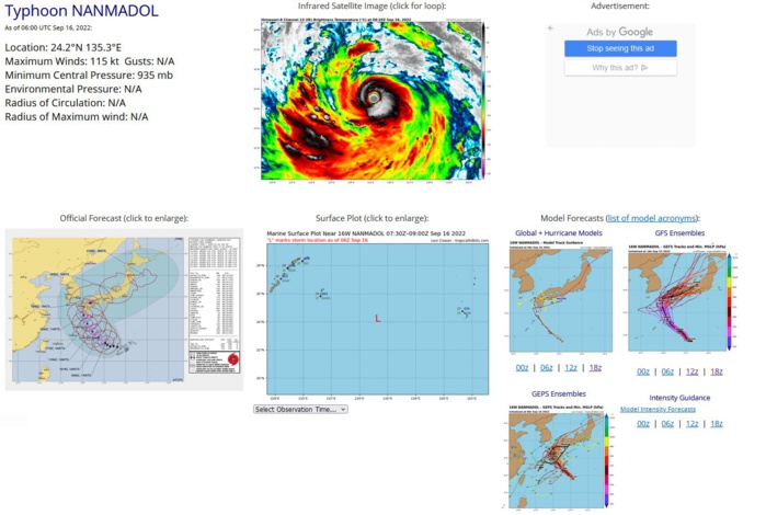
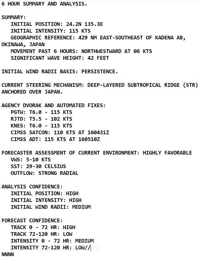
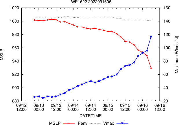
SATELLITE ANALYSIS, INITIAL POSITION AND INTENSITY DISCUSSION: ANIMATED MULTISPECTRAL SATELLITE IMAGERY (MSI) SHOWS THE SYSTEM HAS BECOME MORE COMPACT AS THE FEEDER BANDS, MOSTLY TRAILING TO THE SOUTH, HAVE WRAPPED IN TIGHTER INTO THE CENTRAL CONVECTION THAT HAS MAINTAINED A 15-NM SHARPLY-OUTLINED EYE. CONVECTIVE TOPS ALONG THE EYEWALL CONTINUED TO DEEPEN. THE INITIAL POSITION IS PLACED WITH HIGH CONFIDENCE BASED ON THE EYE FEATURE IN THE MSI LOOP. THE INITIAL INTENSITY OF 115KTS IS ALSO PLACED WITH HIGH CONFIDENCE BASED ON THE HIGH END OF AGENCY AND AUTOMATED DVORAK ESTIMATES AND REFLECTS THE 6-HR IMPROVEMENT.
WP, 16, 2022091506,233N, 1381E, 65, 975,
WP, 16, 2022091512,235N, 1372E, 75, 969
WP, 16, 2022091518,234N, 1364E, 85, 962
WP, 16, 2022091600,238N, 1358E,110, 950
WP, 16, 2022091606,242N, 1353E,115, 935
WP, 16, 2022091512,235N, 1372E, 75, 969
WP, 16, 2022091518,234N, 1364E, 85, 962
WP, 16, 2022091600,238N, 1358E,110, 950
WP, 16, 2022091606,242N, 1353E,115, 935
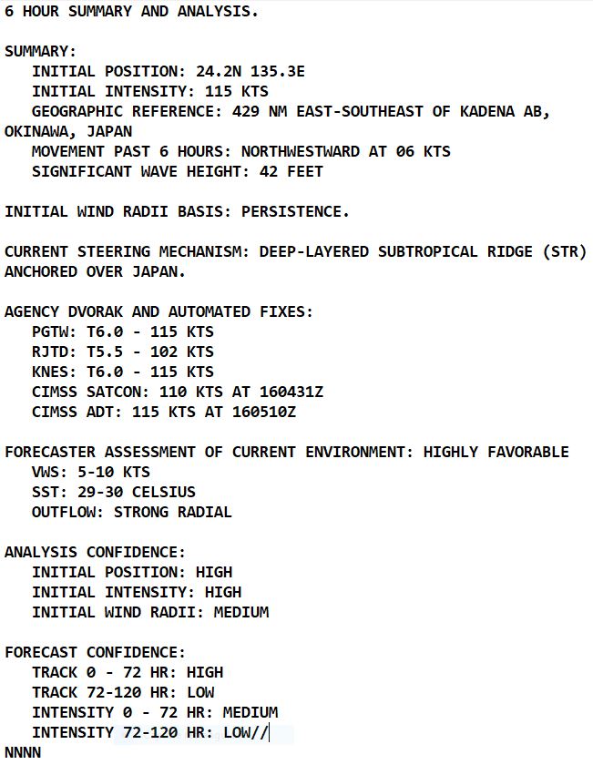
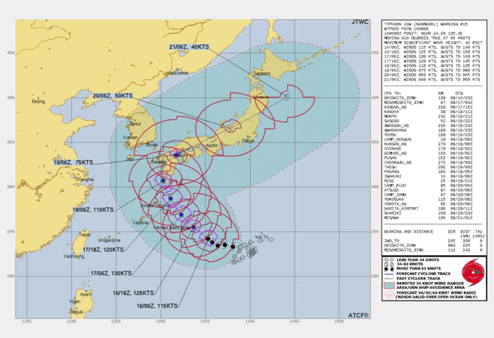
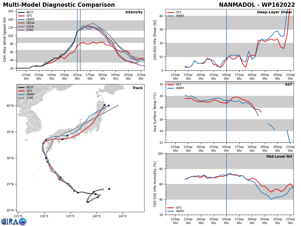
FORECAST REASONING. SIGNIFICANT FORECAST CHANGES: THERE ARE NO SIGNIFICANT CHANGES TO THE FORECAST FROM THE PREVIOUS WARNING. FORECAST DISCUSSION: TY NANMADOL WILL CONTINUE ON ITS CURRENT TRACK UNDER THE STEERING INFLUENCE OF THE STR TO THE NORTH. AFTER TAU 48, IT WILL CREST THE STR AXIS AND RECURVE NORTHEASTWARD, MAKE LANDFALL OVER KYUSHU, JAPAN, NEAR SASEBO BY TAU 60. AFTERWARD, TY 16W WILL ACCELERATE NORTHEASTWARD ACROSS HONSHU AND BY TAU 12O WILL BE BACK IN THE PACIFIC OCEAN EAST OF MISAWA. THE FAVORABLE CONDITIONS WILL FUEL FURTHER INTENSIFICATION TO A PEAK OF 130KTS BY TAU 24 AFTERWARD, COOLING SST INCREASING VWS, AND LAND INTERACTION WILL GRADUALLY ERODE THE SYSTEM. BY TAU 120, THE SYSTEM WILL BE REDUCED TO 40KTS. CONCURRENTLY, BY TAU 96, TY 16W WILL START EXTRA-TROPICAL TRANSITION AS IT ENTERS THE BAROCLINIC ZONE.
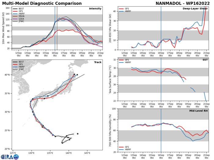
MODEL DISCUSSION: NUMERICAL MODELS ARE IN VERY GOOD AGREEMENT UP TO TAU 72 WITH A GRADUAL AND EVEN SPREAD TO 90NM. AFTERWARD, THE SPREAD INCREASES TO 230 AT TAU 120 WITH NVGM THE ERRATIC OUTLIER TO THE RIGHT OF THE MAIN PACK IN THE MID-POTION AND THEN TO THE LEFT IN THE EXTENDED PORTION OF THE FORECAST. THERE IS ALSO SIGNIFICANT ALONG TRACK VARIATIONS IN THE MODELS BEYOND TAU 72. IN VIEW OF THIS, THERE IS HIGH CONFIDENCE IN THE JTWC TRACK FORECAST UP TO TAU 72 THEN LOW CONFIDENCE AFTERWARD. THE TRACK IS ADJUSTED TO COMPENSATE FOR NVGM. THERE IS MEDIUM CONFIDENCE IN THE INTENSITY FORECAST UP TO TAU 72 WHERE THERE IS SOME VARIABILITY IN THE PEAK INTENSITY, THEN LOW CONFIDENCE AFTER TAU 72 DUE TO THE VARIATIONS IN THE SPEEDS THAT DIRECTLY AFFECT THE FORECAST INTENSITIES.
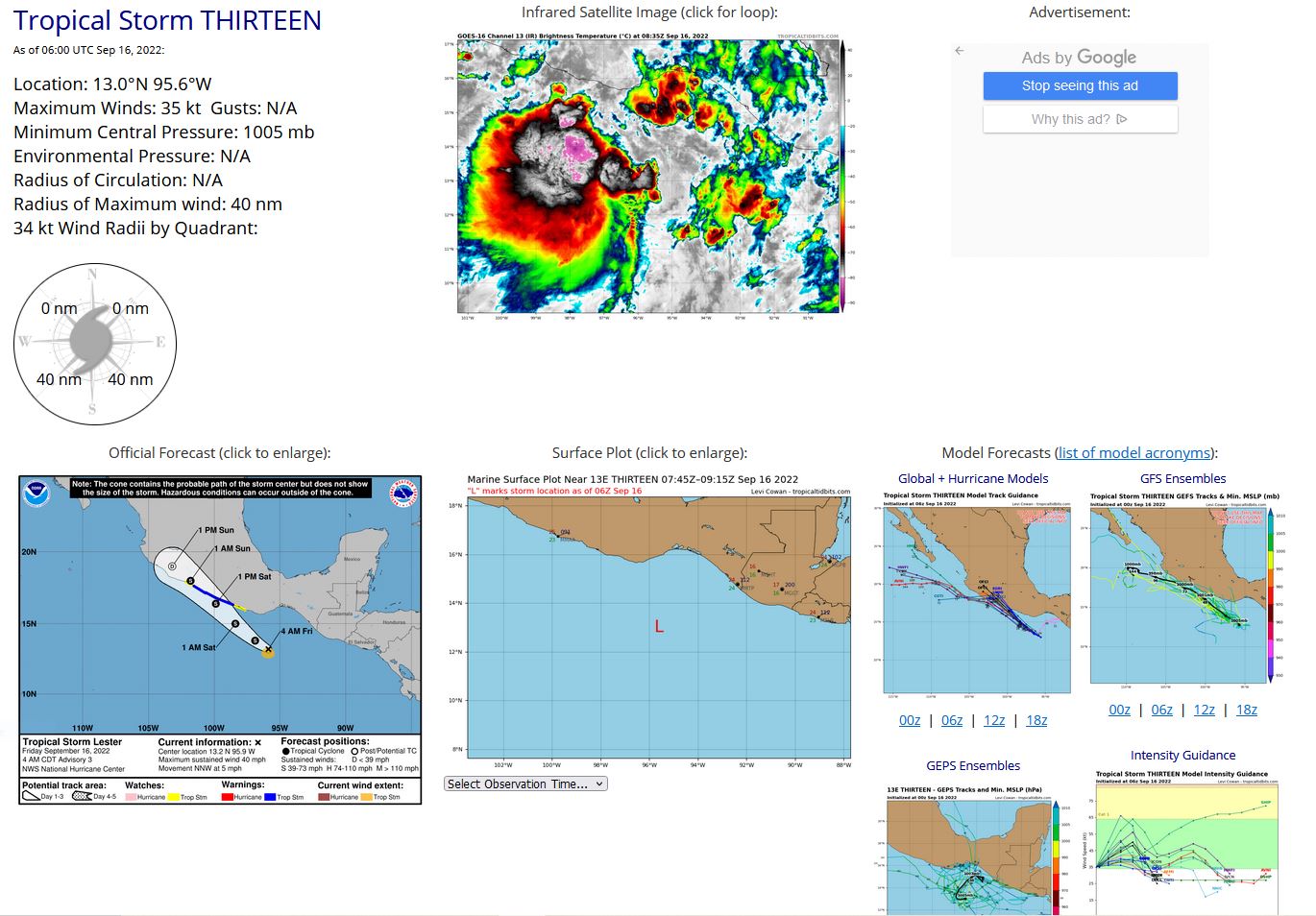
EASTERN NORTH PACIFIC: TS 13E(LESTER). ESTIMATED LOCATION AND INTENSITY AT 16/06UTC. NHC COMMENTS.
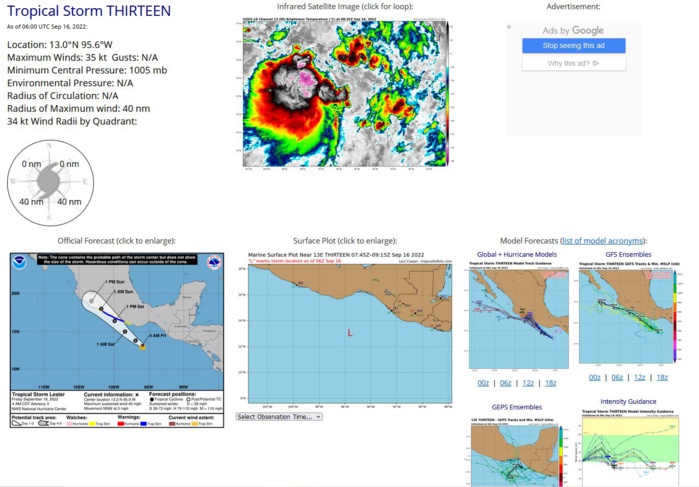
000 WTPZ43 KNHC 160858 TCDEP3 Tropical Storm Lester Discussion Number 3 NWS National Hurricane Center Miami FL EP132022 400 AM CDT Fri Sep 16 2022 Tropical Depression Thirteen-E has been upgraded to Tropical Storm Lester. While the storm still has a sheared appearance, recent scatterometer data indicate that surface wind speeds have increased in the southern half of the circulation and show an area of 30-32 kt winds. Satellite Dvorak estimates from SAB and TAFB range between 30-35 kt. Given the potential for undersampling in the satellite winds, the initial intensity for this advisory is set at 35 kt. The cyclone is currently moving north-northwestward at about 4 kt. Model guidance agrees that the storm should turn northwestward shortly within the eastern portion of the monsoonal flow. Over the next couple of days, Lester is expected to increase in forward speed as it moves toward the Mexican coast, and the center is forecast to cross the coastline sometime Saturday afternoon or evening. The official track forecast is very similar to the previous one and remains close to the model consensus aids. Lester is expected to remain embedded in moderate northeasterly vertical wind shear for the next 48 h. Global model guidance suggests other atmospheric and oceanic conditions, such as environmental moisture and sea surface temperatures, should be conducive for possible strengthening. Therefore, the NHC intensity forecast still shows gradual strengthening until landfall along the coast of Mexico. The storm is expected to rapidly weaken once it moves inland over the mountainous terrain. Key Messages: 1. Heavy rains from Tropical Storm Lester will reach portions of coastal southern Mexico by this evening, increasing in coverage and intensity Saturday and Saturday night, spreading farther west on Sunday. This rainfall may produce flash and urban flooding, along with possible mudslides in areas of higher coastal terrain. 2. Tropical storm conditions are expected along the coast of southern Mexico on Saturday within the Tropical Storm Warning area. FORECAST POSITIONS AND MAX WINDS INIT 16/0900Z 13.2N 95.9W 35 KT 40 MPH 12H 16/1800Z 13.8N 96.9W 40 KT 45 MPH 24H 17/0600Z 15.0N 98.4W 45 KT 50 MPH 36H 17/1800Z 16.4N 99.9W 50 KT 60 MPH 48H 18/0600Z 18.0N 101.8W 40 KT 45 MPH...INLAND 60H 18/1800Z 19.0N 103.2W 25 KT 30 MPH...POST-TROP/INLAND 72H 19/0600Z...DISSIPATED $$ Forecaster Bucci
EP, 13, 2022091318,126N, 953W, 20
EP, 13, 2022091400,126N, 951W, 20
EP, 13, 2022091406,127N, 950W, 20
EP, 13, 2022091412,128N, 951W, 20
EP, 13, 2022091418,128N, 953W, 20,1009
EP, 13, 2022091500,128N, 956W, 20,1009
EP, 13, 2022091506,125N, 959W, 20,1009
EP, 13, 2022091512,124N, 955W, 25,1007
EP, 13, 2022091518,125N, 952W, 30,1007
EP, 13, 2022091600,126N, 955W, 30,1007
EP, 13, 2022091606,130N, 956W, 35,1005
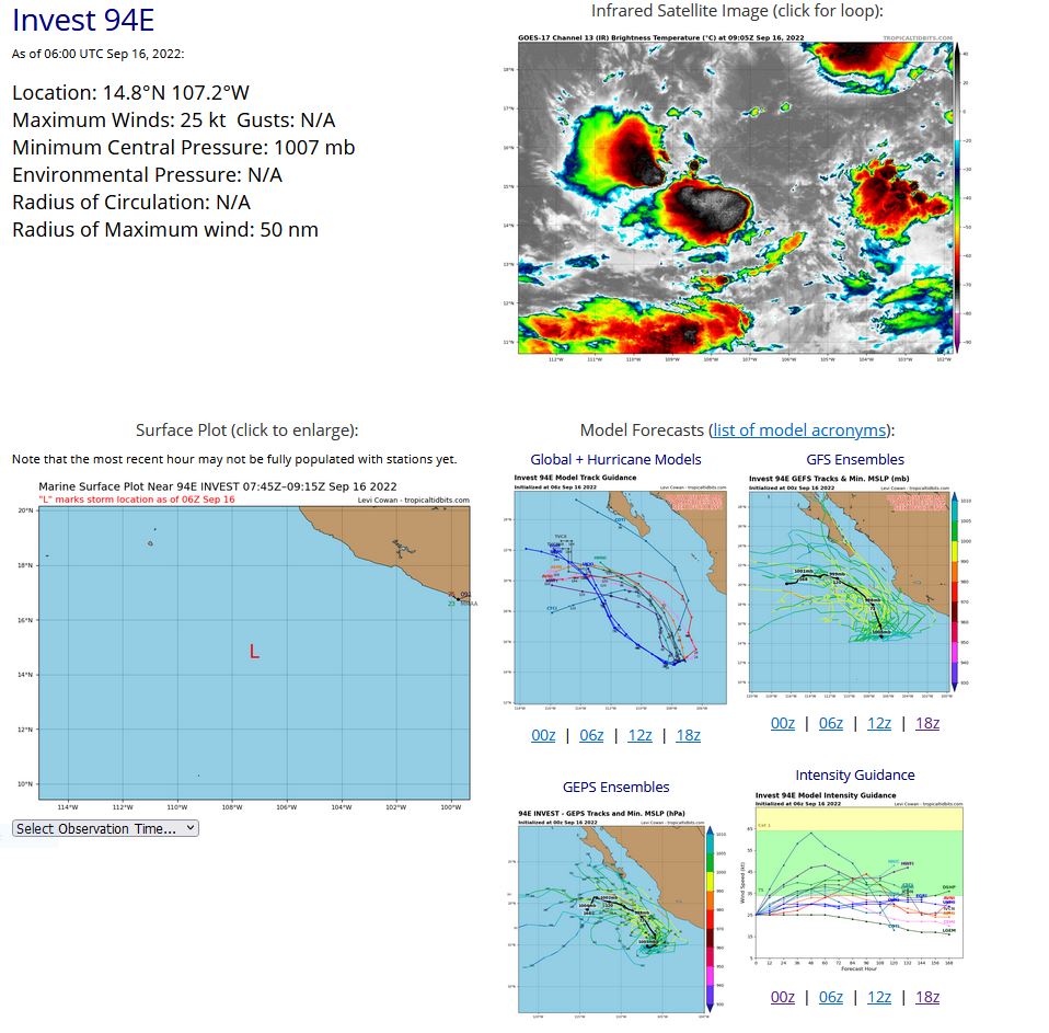
EASTERN NORTH PACIFIC: INVEST 94E. ESTIMATED LOCATION AND INTENSITY AT 16/06UTC. TROPICAL CYCLONE FORMATION ALERT RE-ISSUED AT 15/15UTC.
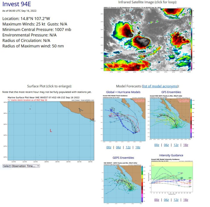
ZCZC MIATWOEP ALL TTAA00 KNHC DDHHMM Tropical Weather Outlook NWS National Hurricane Center Miami FL 1100 PM PDT Thu Sep 15 2022 For the eastern North Pacific...east of 140 degrees west longitude: Active Systems: The National Hurricane Center is issuing advisories on Tropical Depression Thirteen-E, located a couple of hundred miles south-southeast of Puerto Angel, Mexico. 1. Southwest of Southwestern Mexico: An area of low pressure located a few hundred miles south-southwest of Manzanillo, Mexico, continues to produce disorganized showers and thunderstorms. Environmental conditions are forecast to become more conducive for development, and a tropical depression is likely to form within the next couple of days. This disturbance is forecast to meander off the southwestern coast of Mexico through the end of this week, and then begin to move northwestward early next week. * Formation chance through 48 hours...high...70 percent. * Formation chance through 5 days...high...90 percent. Public Advisories on Tropical Depression Thirteen-E are issued under WMO header WTPZ33 KNHC and under AWIPS header MIATCPEP3. Forecast/Advisories on Tropical Depression Thirteen-E are issued under WMO header WTPZ23 KNHC and under AWIPS header MIATCMEP3. Forecaster Bucci
EP, 94, 2022091118,158N, 1049W, 20,1009
EP, 94, 2022091200,158N, 1056W, 20,1009
EP, 94, 2022091206,158N, 1062W, 25,1008
EP, 94, 2022091212,158N, 1068W, 25,1008
EP, 94, 2022091218,158N, 1075W, 25,1008
EP, 94, 2022091300,158N, 1083W, 25,1008
EP, 94, 2022091306,156N, 1082W, 25,1008
EP, 94, 2022091312,159N, 1081W, 20,1008
EP, 94, 2022091318,160N, 1085W, 20,1009
EP, 94, 2022091400,160N, 1086W, 20,1009
EP, 94, 2022091406,160N, 1086W, 20,1009
EP, 94, 2022091412,159N, 1084W, 20,1008
EP, 94, 2022091418,155N, 1080W, 25,1007
EP, 94, 2022091500,154N, 1078W, 25,1007
EP, 94, 2022091506,153N, 1074W, 25,1007
EP, 94, 2022091512,152N, 1063W, 25,1007
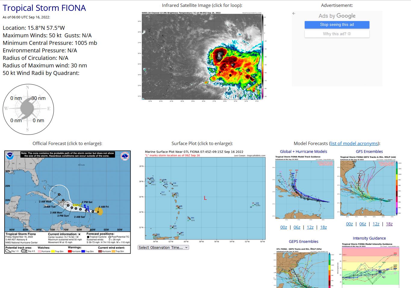
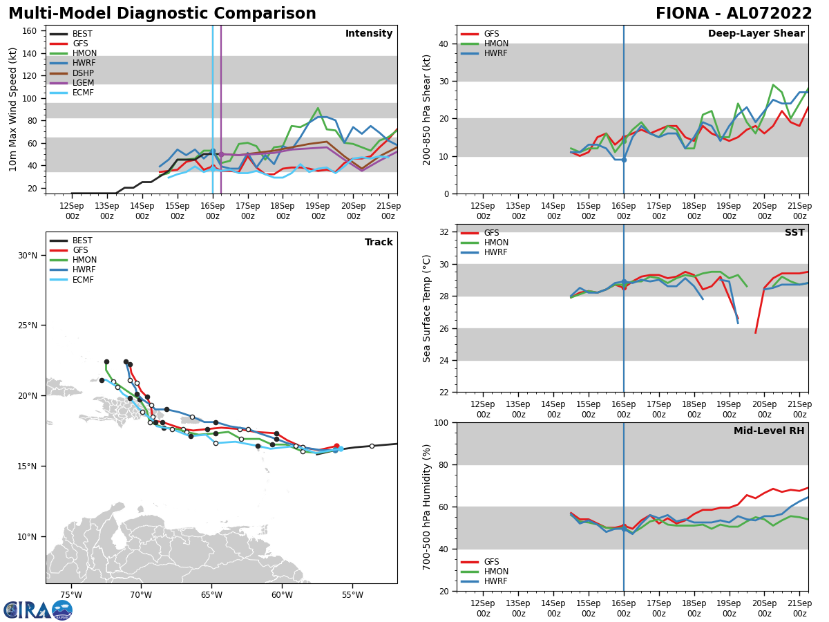
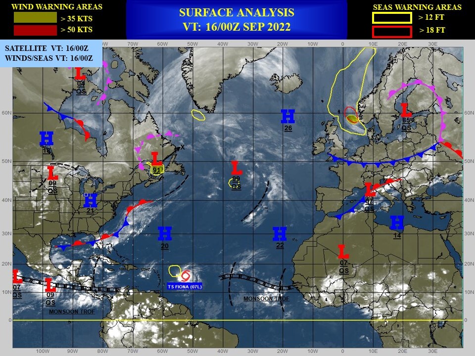
NORTH ATLANTIC: TS 07L(FIONA). ESTIMATED LOCATION AND INTENSITY AT 16/06UTC. NHC COMMENTS.
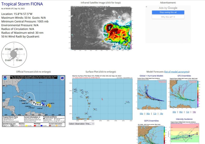
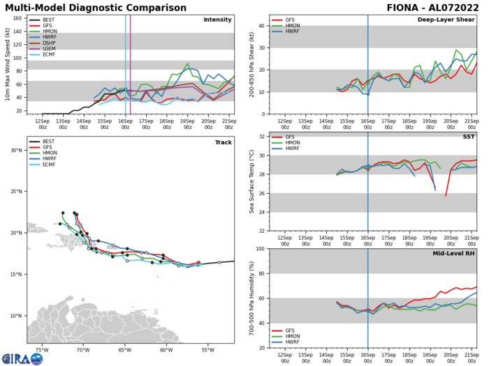
725 WTNT42 KNHC 160858 TCDAT2 Tropical Storm Fiona Discussion Number 8 NWS National Hurricane Center Miami FL AL072022 500 AM AST Fri Sep 16 2022 Fiona remains a sheared tropical cyclone this morning. The center of the storm is fully exposed to the west of a large area of deep convection over much of the eastern portion of the circulation. An Air Force Reserve Hurricane Hunter aircraft that investigated Fiona found peak 925 mb flight-level winds of 60 kt, which would support a surface wind of about 45 kt using a standard reduction factor. Meanwhile, the SFMR data only supported surface winds of 35-40 kt. Earlier scatterometer data showed an area of winds slightly above 40 kt in the northeastern quadrant of the storm. Based on these data, the initial intensity is set at 45 kt for this advisory. The latest aircraft fixes indicate that Fiona is still moving south of due west, and its initial motion is estimated to be 260/13 kt. The models agree that Fiona should move generally westward over the next couple of days, to the south of the subtropical ridge across the central and western Atlantic. This brings the center of the storm across the Leeward Islands tonight and near the Virgin Islands and Puerto Rico on Saturday through early Sunday. Then, a turn toward the west-northwest and northwest is forecast as the storm reaches a weakness in the steering ridge. This would bring the center of Fiona near or over Hispaniola on Monday and then into the southwestern Atlantic by days 4-5. The NHC track forecast has once again been adjusted slightly south of the previous one in the near term, but generally lies near the center of the guidance envelope on days 3-5. Some short-term intensity fluctuations are possible given the sheared, asymmetric structure of the storm. However, there are some indications that the environmental conditions could become more conducive for strengthening as the storm moves into the eastern Caribbean this weekend. In particular, increasing upper-level divergence and mid-level moisture along with decreasing vertical wind shear could allow Fiona to become better organized before it reaches Hispaniola. The latest NHC intensity forecast shows a bit more strengthening through 72 h, but still lies slightly below the guidance consensus. From there, the intensity forecast is of lower confidence as the extent of land interaction is still uncertain. Key Messages: 1. Tropical storm conditions are expected in the Leeward Islands within the warning area by this evening. Tropical storm conditions are possible within the watch area across the Virgin Islands beginning on Saturday, and then reaching Puerto Rico late Saturday and Saturday night. 2. Heavy rains from Fiona will reach the Leeward Islands by this evening, spreading to the British and U.S. Virgin Islands and Puerto Rico Saturday, reaching the Dominican Republic Sunday, and the Turks and Caicos Monday night or Tuesday. This rainfall may produce considerable flood impacts including flash and urban flooding, along with mudslides in areas of higher terrain. 3. Fiona is expected to move near Hispaniola early next week, and watches could be required for parts of the island later today. FORECAST POSITIONS AND MAX WINDS INIT 16/0900Z 15.7N 58.1W 45 KT 50 MPH 12H 16/1800Z 15.9N 60.0W 50 KT 60 MPH 24H 17/0600Z 16.3N 62.5W 50 KT 60 MPH 36H 17/1800Z 16.7N 64.6W 55 KT 65 MPH 48H 18/0600Z 17.0N 66.3W 55 KT 65 MPH 60H 18/1800Z 17.3N 67.8W 60 KT 70 MPH 72H 19/0600Z 18.1N 69.2W 60 KT 70 MPH 96H 20/0600Z 20.0N 71.0W 55 KT 65 MPH 120H 21/0600Z 22.0N 72.5W 60 KT 70 MPH $$ Forecaster Reinhart
AL, 07, 2022091200,145N, 361W, 15
AL, 07, 2022091206,145N, 373W, 15
AL, 07, 2022091212,146N, 386W, 15
AL, 07, 2022091218,146N, 400W, 15
AL, 07, 2022091300,147N, 415W, 15
AL, 07, 2022091306,147N, 429W, 15
AL, 07, 2022091312,148N, 443W, 20,1011
AL, 07, 2022091318,151N, 455W, 20,1011
AL, 07, 2022091400,155N, 466W, 25,1010
AL, 07, 2022091406,160N, 479W, 25,1010
AL, 07, 2022091412,164N, 491W, 30,1009
AL, 07, 2022091418,166N, 501W, 35,1006
AL, 07, 2022091500,166N, 513W, 45,1002
AL, 07, 2022091506,165N, 524W, 45,1002
AL, 07, 2022091512,164N, 536W, 45,1002
AL, 07, 2022091518,163N, 548W, 50,1006
AL, 07, 2022091600,161N, 562W, 50,1005
AL, 07, 2022091606,158N, 575W, 50,1005
