CLICK ON THE IMAGERIES BELOW TO GET THEM ENLARGED
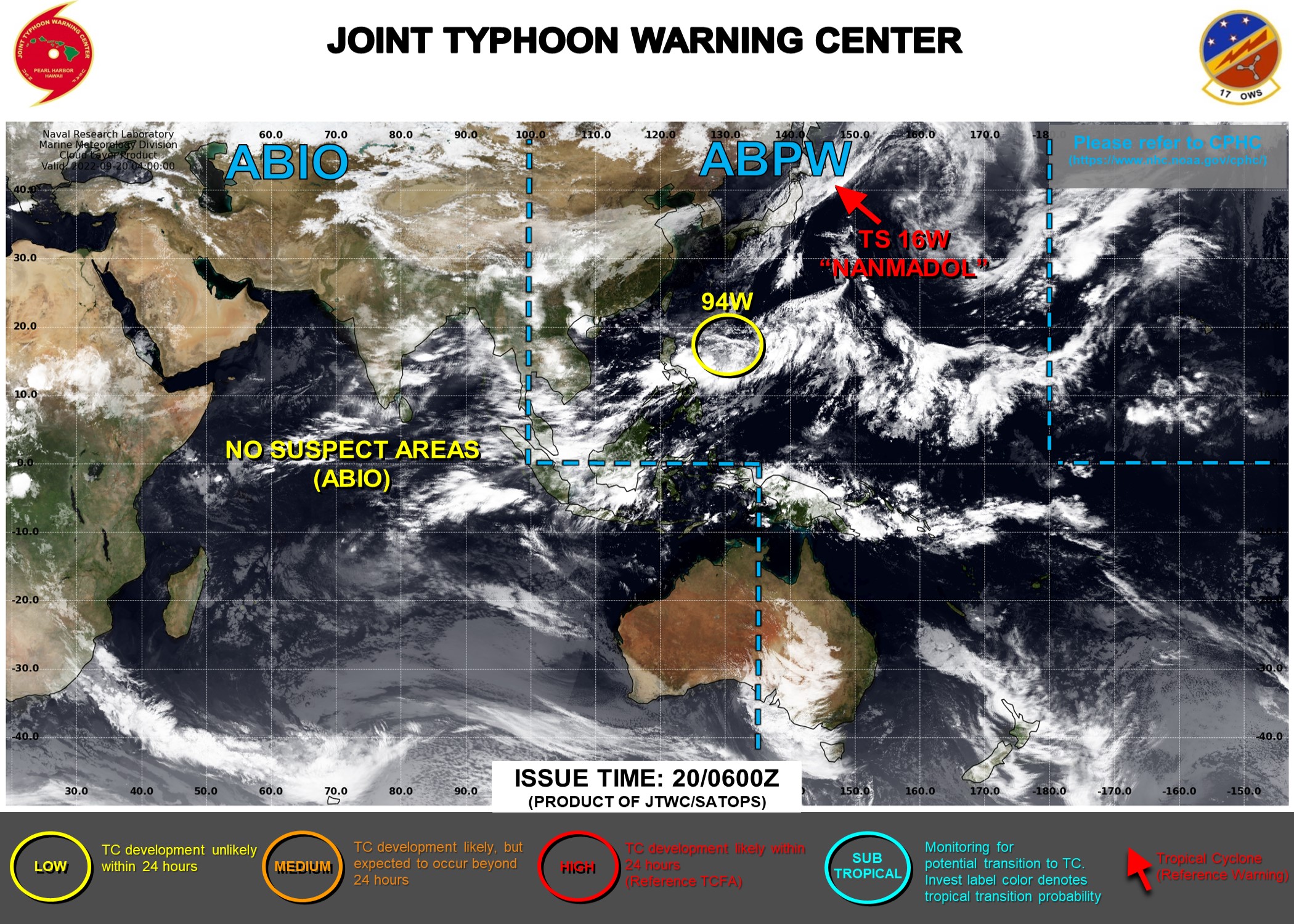
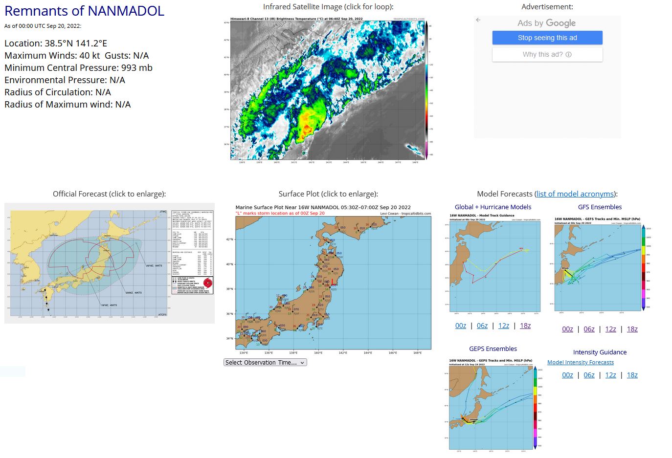
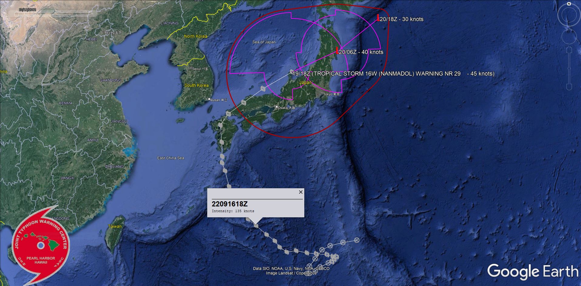
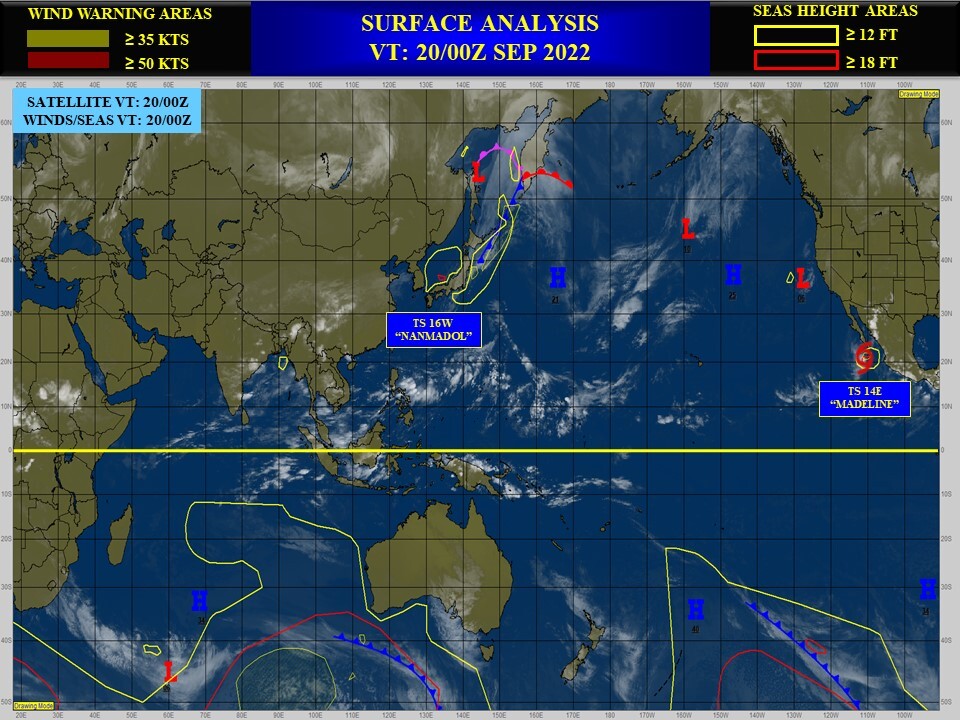
WESTERN NORTH PACIFIC: REMNANTS OF 16W(NANMADOL). ESTIMATED LOCATION AND INTENSITY AT 20/00UTC. WARNING 29/FINAL ISSUED AT 19/21UTC.
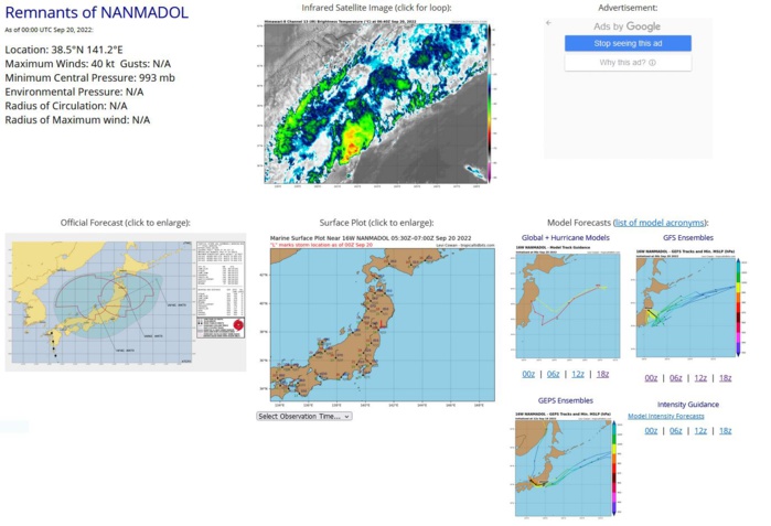
192100Z POSITION NEAR 37.8N 138.3E. 19SEP22. TROPICAL STORM (TS) 16W (NANMADOL), LOCATED APPROXIMATELY 263 NM SOUTHWEST OF MISAWA, JAPAN, HAS TRACKED EAST-NORTHEASTWARD AT 26 KNOTS OVER THE PAST SIX HOURS. ANIMATED ENHANCED INFRARED SATELLITE IMAGERY, A 191852Z SSMIS 91GHZ IMAGE AND RADAR IMAGERY INDICATE THAT THE SYSTEM HAS COMPLETED EXTRA-TROPICAL TRANSITION WITH A BROAD, POORLY-DEFINED LOW-LEVEL CIRCULATION ABSORBED WITHIN THE FRONTAL BAND, WHICH EXTENDS TO THE SOUTHWEST OVER CENTRAL HONSHU AND TO THE NORTHEAST INTO NORTHERN HONSHU AND HOKKAIDO. THE INITIAL POSITION IS BASED ON A 191700Z RJTD RADAR FIX AS WELL AS SURFACE OBSERVATIONS FROM WAJIMA (37.4N 136.9E). AS THE SYSTEM CENTER TRACKED OVER WAJIMA, THE WINDS SWITCHED FROM SOUTHERLY AT 16 KNOTS AT 191600Z TO NORTHERLY AT 37 KNOTS WITH A MINIMUM SLP OF 987.2MB. THE INITIAL INTENSITY OF 45 KNOTS IS EXTRAPOLATED FROM RECENT ASCAT DATA, WHICH SHOWED A SMALL PATCH OF 50 KNOTS OVER THE NORTHWEST QUADRANT OF THE SYSTEM, BUT IS HEDGED ABOVE AN RJTD DVORAK INTENSITY ESTIMATE OF T2.5 (35 KNOTS). TS 16W IS EMBEDDED WITHIN THE MIDLATITUDE WESTERLIES NEAR THE JET AND IS TRACKING EAST-NORTHEASTWARD ALONG THE NORTHWESTERN FLANK OF A DEEP-LAYERED SUBTROPICAL RIDGE. THE SYSTEM WILL CONTINUE TRACKING EAST-NORTHEASTWARD AS A COLD-CORE, EXTRATROPICAL LOW THROUGH TAU 24 WITH STEADY WEAKENING DUE TO STRONG VERTICAL WIND SHEAR (40-60 KNOTS) AND FRICTIONAL EFFECTS. NUMERICAL MODEL GUIDANCE IS IN FAIR AGREEMENT WITH MANY MODELS INDICATING THE SYSTEM WILL DISSIPATE OVER THE NEXT 12 HOURS ALONG THE FRONTAL BOUNDARY. THIS IS THE FINAL WARNING ON THIS SYSTEM BY THE JOINT TYPHOON WRNCEN PEARL HARBOR HI. THE SYSTEM WILL BE CLOSELY MONITORED FOR SIGNS OF REGENERATION. MAXIMUM SIGNIFICANT WAVE HEIGHT AT 191800Z IS 22 FEET.
1622091100 241N1424E 20
1622091106 240N1412E 20
1622091112 238N1401E 20
1622091118 235N1394E 20
1622091200 228N1388E 20
1622091206 222N1383E 20
1622091212 216N1381E 25
1622091218 216N1383E 25
1622091300 218N1388E 25
1622091306 221N1392E 25
1622091312 224N1399E 30
1622091318 225N1402E 35
1622091400 227N1404E 40
1622091406 229N1406E 45
1622091412 229N1403E 45
1622091418 231N1398E 50
1622091500 232N1389E 55
1622091506 233N1381E 65
1622091512 235N1372E 75
1622091518 234N1364E 85
1622091600 238N1358E 110
1622091606 243N1354E 115
1622091612 248N1347E 130
1622091618 255N1338E 135
1622091700 260N1331E 130
1622091706 267N1325E 130
1622091712 275N1320E 125
1622091718 285N1314E 115
1622091800 297N1310E 105
1622091803 303N1307E 100
1622091806 308N1307E 95
1622091812 319N1306E 80
1622091818 332N1304E 70
1622091900 341N1311E 60
1622091906 350N1325E 55
1622091912 361N1343E 50
1622091918 374N1371E 45
1622092000 385N1412E 40
NNNN
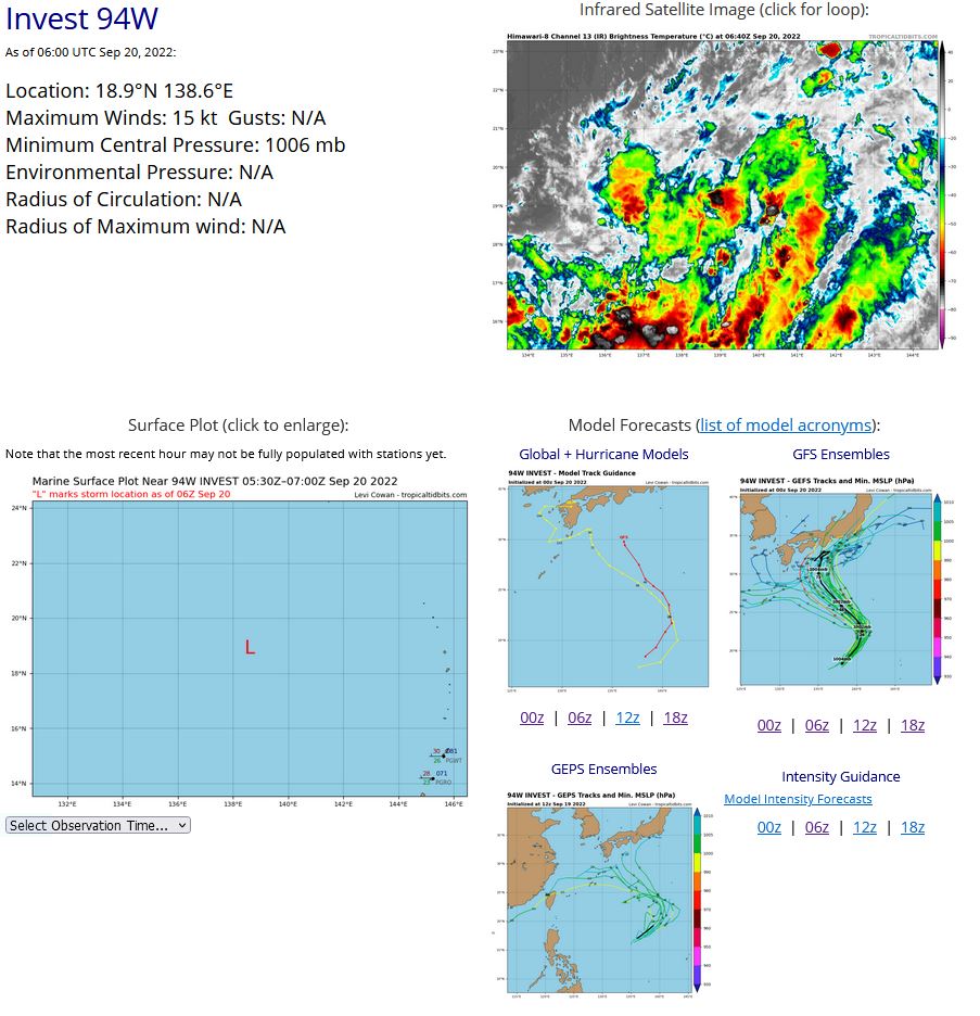
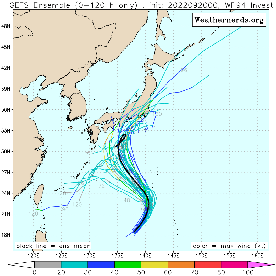
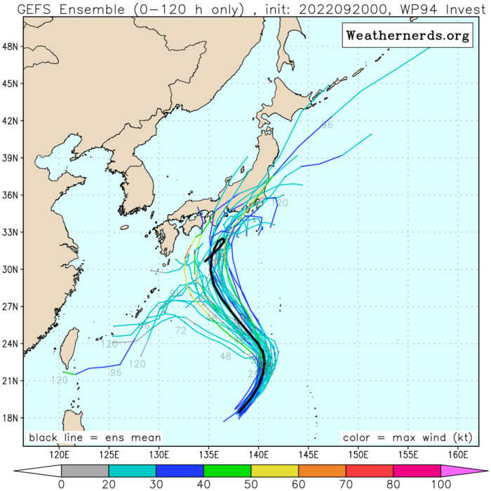
WESTERN NORTH PACIFIC: INVEST 94W. ESTIMATED LOCATION AND INTENSITY AT 20/06UTC. ADVISORY(ABPW) ISSUED AT 20/06UTC.
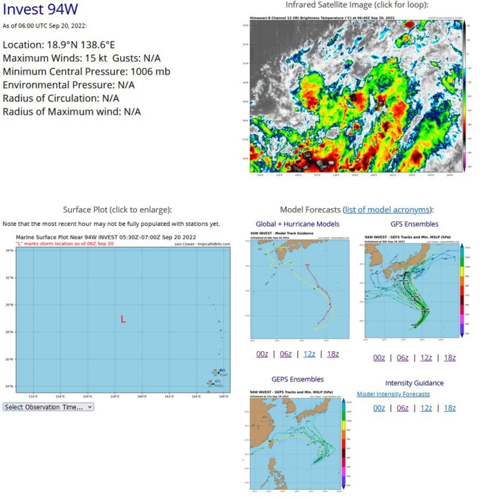
AN AREA OF CONVECTION (INVEST 94W) HAS PERSISTED NEAR 18.5N 138.0E, APPROXIMATELY 485 NM NORTHWEST OF GUAM. ANIMATED MULTISPECTRAL SATELLITE IMAGERY DEPICTS A BROAD LOW LEVEL CIRCULATION (LLC) WITH WEAK FORMATIVE BANDING AND THE MAJORITY OF THE CONVECTION LOCATED IN THE SOUTHERN PERIPHERY. A 200030 ASCAT-B BULLSEYE PASS REVEALS AN ELONGATED LLC WITH MAINLY 10-15KT WINDS AND A SWATH OF 20-25KT WINDS ASSOCIATED WITH THE CONVECTION TO THE SOUTH. CURRENTLY 94W IS POSITIONED ALONG THE SOUTHERN EDGE OF THE TUTT WITH WESTERLIES OVERHEAD INHIBITING DEVELOPMENT. THE OVERALL ENVIRONMENT IS STILL MARGINALLY FAVORABLE DEFINED BY LOW (5-10KT) VERTICAL WIND SHEAR AND WARM (29-30C) SEA SURFACE TEMPERATURES. GLOBAL MODELS ARE IN GENERAL AGREEMENT THAT 94W WILL TRACK NORTHWARD BUT DIFFER IN INTENSITY WITH GFS BEING THE MOST AGGRESSIVE SHOWING SLOW TO MODERATE DEVELOPMENT OVER THE NEXT 24-48 HOURS. MAXIMUM SUSTAINED SURFACE WINDS ARE ESTIMATED AT 13 TO 18 KNOTS. MINIMUM SEA LEVEL PRESSURE IS ESTIMATED TO BE NEAR 1006 MB. THE POTENTIAL FOR THE DEVELOPMENT OF A SIGNIFICANT TROPICAL CYCLONE WITHIN THE NEXT 24 HOURS IS LOW.
WP, 94, 2022091912,171N, 1361E, 15,1006
WP, 94, 2022091918,177N, 1371E, 15,1006
WP, 94, 2022092000,185N, 1380E, 15,1006
WP, 94, 2022092006,189N, 1386E, 15,1006
WP, 94, 2022091918,177N, 1371E, 15,1006
WP, 94, 2022092000,185N, 1380E, 15,1006
WP, 94, 2022092006,189N, 1386E, 15,1006
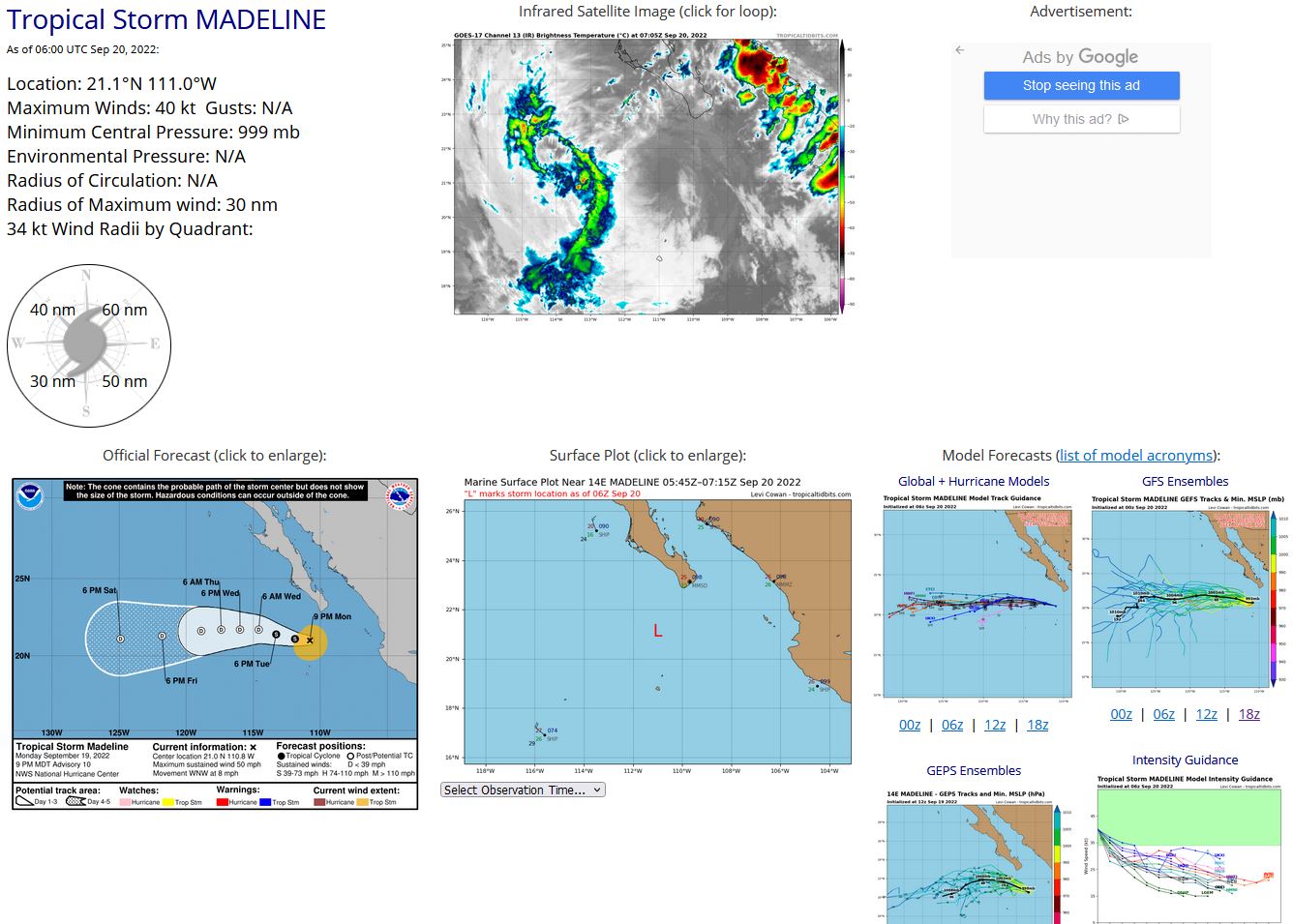
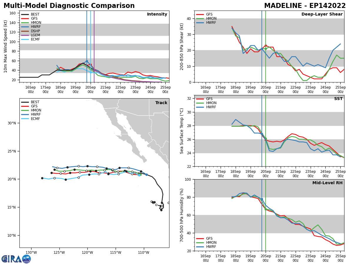
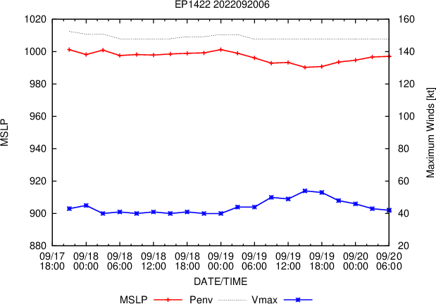
EASTERN NORTH PACIFIC: TS 14E(MADELINE). ESTIMATED LOCATION AND INTENSITY AT 20/06UTC. NHC COMMENTS.
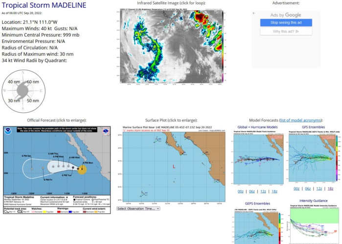
000 WTPZ44 KNHC 200243 TCDEP4 Tropical Storm Madeline Discussion Number 10 NWS National Hurricane Center Miami FL EP142022 900 PM MDT Mon Sep 19 2022 Madeline is on a gradual decline. The deep convection that is confined to the west of the cyclone's low-level center is slowly decaying in the presence of 20 kt of east-northeasterly shear and marginal SSTs of 26 degrees C. The latest Dvorak T-numbers from TAFB, SAB, and the UW-CIMSS ADT have decreased from 6 h ago, and a blend of their CI values suggest that the initial intensity has decreased to 45 kt. Madeline continues to move west-northwestward, or 285/7 kt. An ongoing west-northwestward motion is expected during the next day or so while the storm remains steered by a deep-layer ridge centered over southern Texas. After that time, a turn to the west is expected when the system becomes shallow and moves within the low-level trade winds. The NHC track forecast is little changed from the previous one and is near the various multi-model consensus tracks. The east-northeasterly shear is expected to persist while Madeline moves into a region of drier air and over cooler SSTs. Therefore steady weakening is expected, and the cyclone is expected to degenerate into post-tropical remnant low, devoid of persistent organized deep convection, by early Wednesday. The latest NHC intensity forecast was nudged slightly lower through 48 h due to the decrease in the initial intensity, but remains slightly higher than the HCCA and IVCN consensus. FORECAST POSITIONS AND MAX WINDS INIT 20/0300Z 21.0N 110.8W 45 KT 50 MPH 12H 20/1200Z 21.1N 111.9W 40 KT 45 MPH 24H 21/0000Z 21.4N 113.3W 35 KT 40 MPH 36H 21/1200Z 21.7N 114.6W 30 KT 35 MPH...POST-TROP/REMNT LOW 48H 22/0000Z 21.7N 116.0W 30 KT 35 MPH...POST-TROP/REMNT LOW 60H 22/1200Z 21.7N 117.4W 25 KT 30 MPH...POST-TROP/REMNT LOW 72H 23/0000Z 21.6N 118.9W 25 KT 30 MPH...POST-TROP/REMNT LOW 96H 24/0000Z 21.3N 121.8W 25 KT 30 MPH...POST-TROP/REMNT LOW 120H 25/0000Z 21.1N 124.9W 20 KT 25 MPH...POST-TROP/REMNT LOW $$ Forecaster Latto
1422091900 191N1076W 45
1422091906 199N1080W 50
1422091912 204N1085W 55
1422091918 208N1095W 50
1422092000 209N1105W 45
1422091906 199N1080W 50
1422091912 204N1085W 55
1422091918 208N1095W 50
1422092000 209N1105W 45
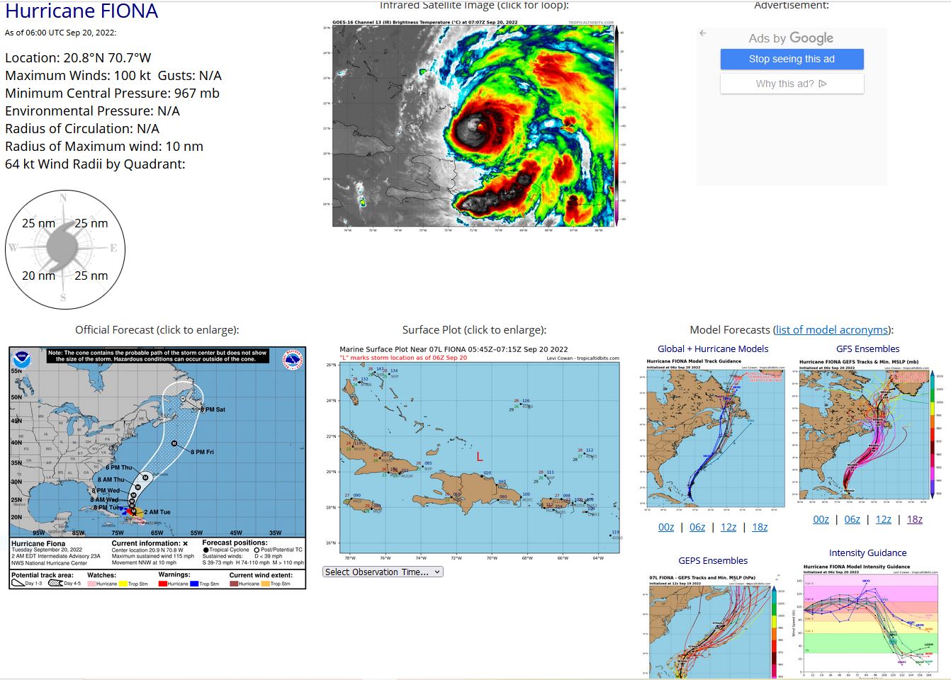
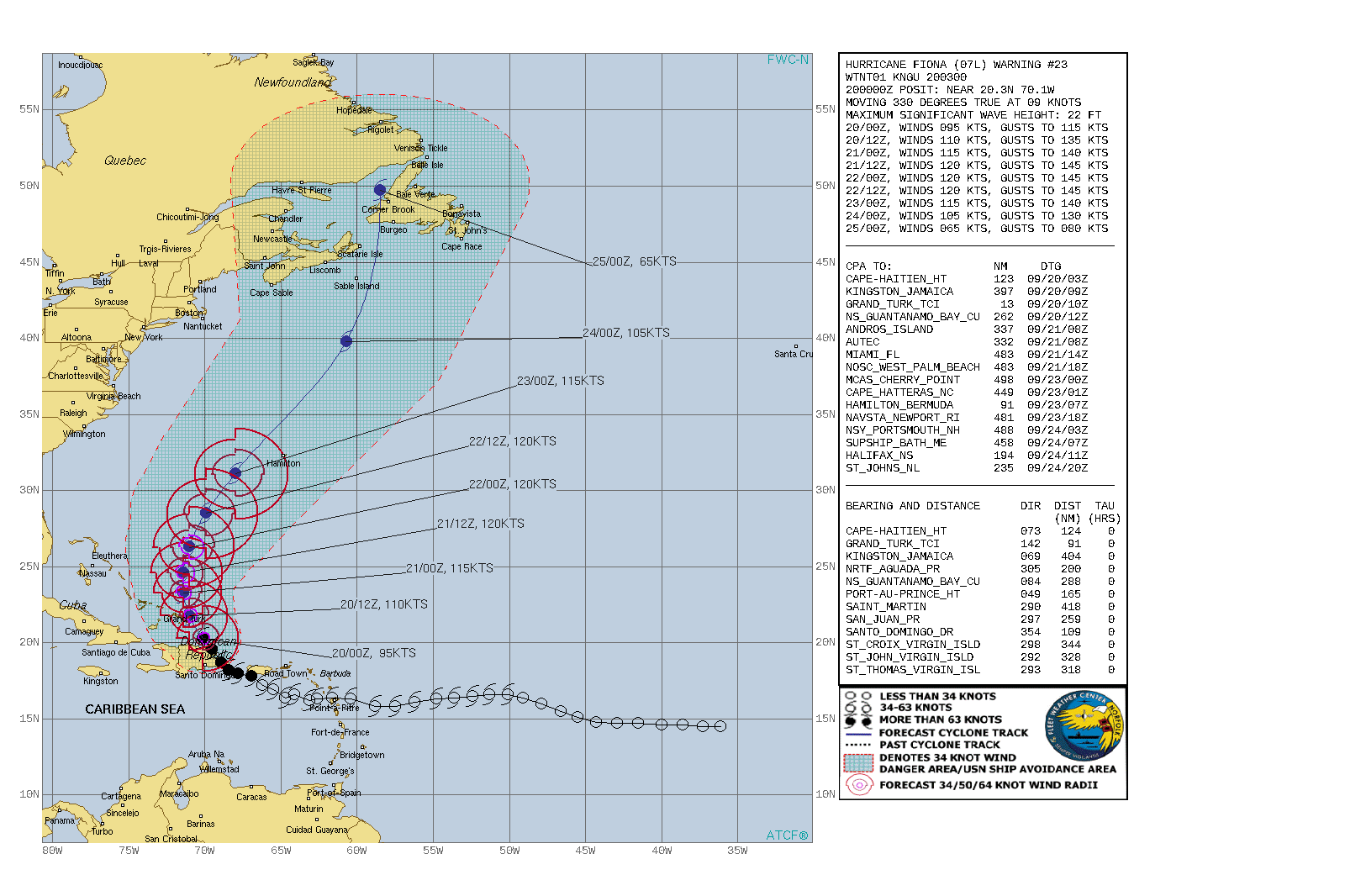
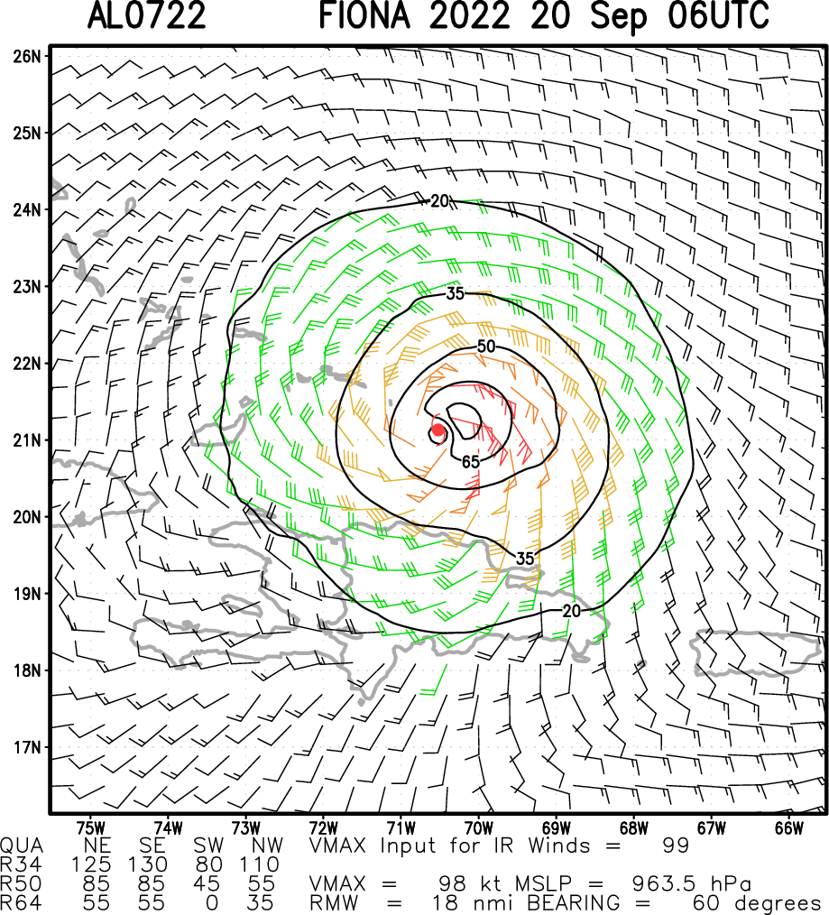
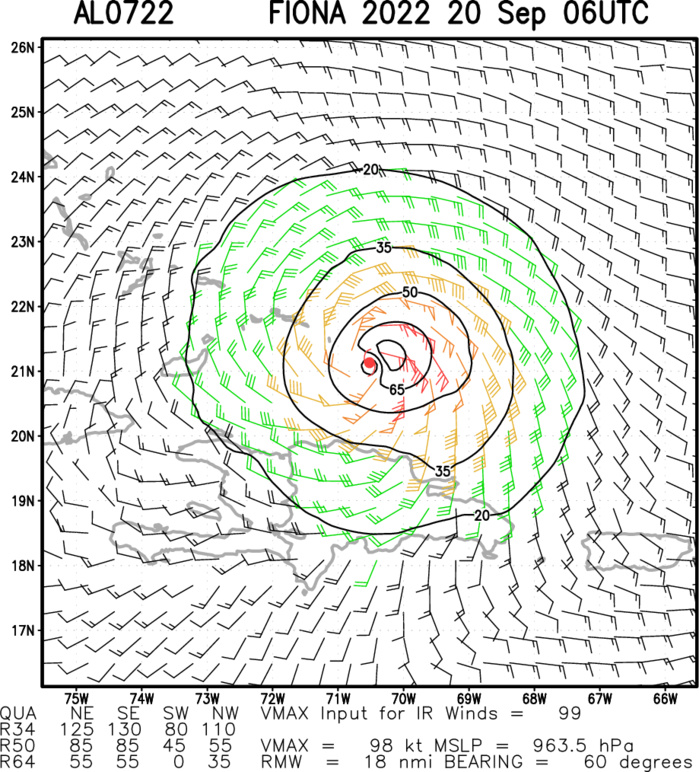
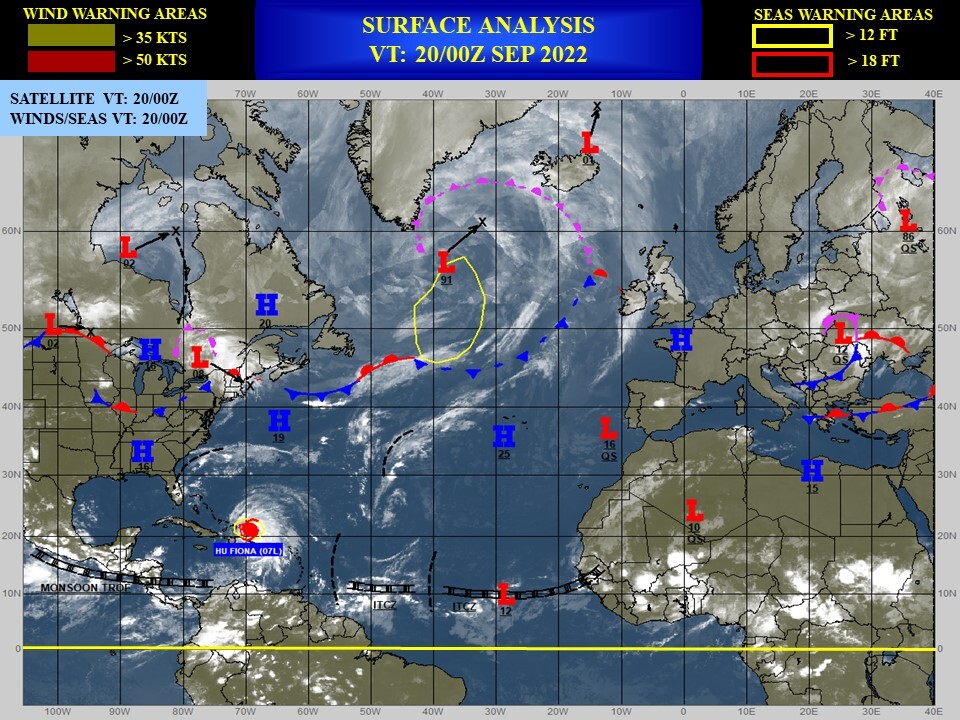
NORTH ATLANTIC: HU 07L(FIONA). ESTIMATED LOCATION AND INTENSITY AT 20/06UTC. WARNING 23 ISSUED AT 20/03UTC. NHC COMMENTS.
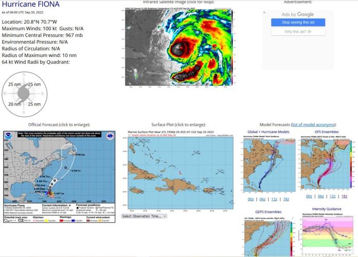
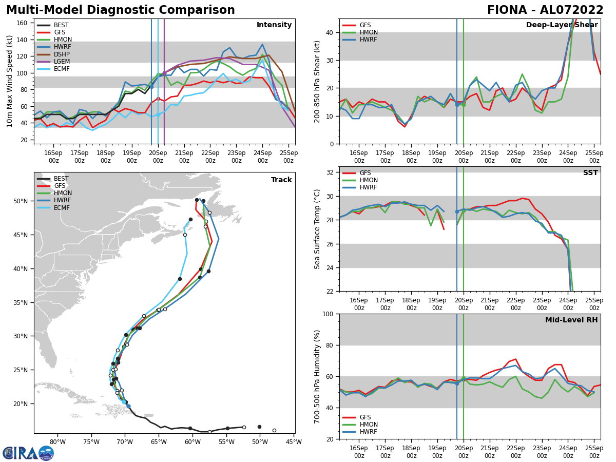
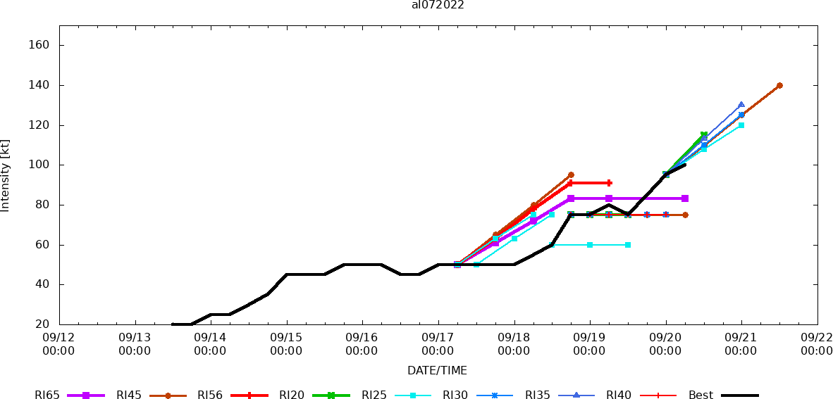
000 WTNT42 KNHC 200253 TCDAT2 Hurricane Fiona Discussion Number 23 NWS National Hurricane Center Miami FL AL072022 1100 PM EDT Mon Sep 19 2022 The satellite presentation of the hurricane has improved significantly this evening. The eye has warmed and become more distinct and the surrounding ring of deep convection has cooled and is more symmetric. More recently, the eye has become smaller in size and this has also been observed by both NOAA and Air Force Reserve Hurricane Hunter aircraft that have been sampling the storm this evening. The aircraft have reported that the eye has shrunk to around 10 n mi in diameter. The NOAA plane has measured a peak flight level wind of 104 kt at around 8000 ft, while the Air Force aircraft has reported a peak 700-mb flight-level wind of 93 kt. Peak SFMR winds of 94-96 kt have also been found, and these data support increasing the initial intensity to 95 kt. The hurricane's outflow is somewhat restricted over the western portion of the circulation owing to some moderate southwesterly shear of the storm. Although this shear is not forecast to abate much, the intensity guidance indicates that warm water and a moist atmosphere should allow for continued intensification during the next 24 to 48 hours. Given the recent improvement in structure, the updated NHC intensity forecast calls for a slightly faster rate of strengthening during the next 12 to 24 hours, and it is at the upper end of the intensity guidance. The official forecast shows Fiona becoming a major hurricane overnight, and brings the hurricane to category 4 status in a day or so. Eyewall replacement cycles are likely to cause some fluctuations in intensity in the 24-72 h time period. By day 4, the hurricane is forecast to interact with a strong mid-tropospheric trough, which will start the system's extratropical transition. The process is forecast to be complete by the end of the period, and Fiona is expected to remain a powerful extratropical cyclone through day 5. The initial motion estimate is 330/9 kt. There track forecast philosophy again remains the same as the previous few forecast cycles. The hurricane should gradually turn north while moving around the western periphery of a mid-level ridge. After 72 hours, Fiona is forecast to turn north-northeastward and accelerate as a strong mid-level trough nears the northeastern United States. The track guidance remains tightly clustered and the NHC forecast is similar to the previous advisory, near the middle of the guidance envelope. Key Messages: 1. Heavy rains from Fiona will continue across parts of Puerto Rico and across northern and eastern Dominican Republic through tonight. These rainfall amounts will continue to produce life-threatening and catastrophic flooding along with mudslides and landslides across Puerto Rico. Life-threatening flash and urban flooding is likely for eastern portions of the Dominican Republic. 2. Hurricane conditions are expected over the Turks and Caicos, with tropical storm conditions over the southeastern Bahamas, beginning late tonight or early Tuesday. 3. Interests in Bermuda should monitor the progress of Fiona. FORECAST POSITIONS AND MAX WINDS INIT 20/0300Z 20.6N 70.3W 95 KT 110 MPH 12H 20/1200Z 21.8N 71.0W 110 KT 125 MPH 24H 21/0000Z 23.3N 71.4W 115 KT 130 MPH 36H 21/1200Z 24.6N 71.4W 120 KT 140 MPH 48H 22/0000Z 26.3N 71.0W 120 KT 140 MPH 60H 22/1200Z 28.5N 69.9W 120 KT 140 MPH 72H 23/0000Z 31.1N 68.0W 115 KT 130 MPH 96H 24/0000Z 39.8N 60.7W 105 KT 120 MPH 120H 25/0000Z 49.7N 58.5W 65 KT 75 MPH...POST-TROP/EXTRATROP $$ Forecaster Brown
0722091900 180N 678W 75
0722091906 182N 684W 80
0722091912 187N 689W 75
0722091918 196N 695W 85
0722092000 203N 701W 95
0722092006 208N 707W 100
0722091906 182N 684W 80
0722091912 187N 689W 75
0722091918 196N 695W 85
0722092000 203N 701W 95
0722092006 208N 707W 100
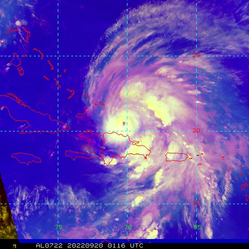
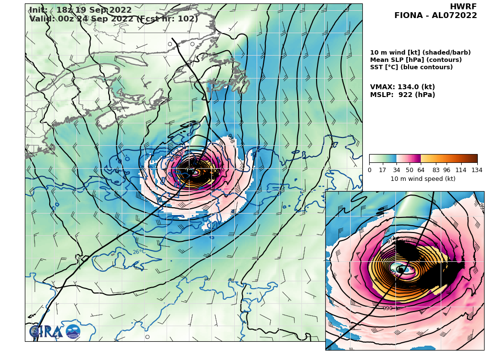
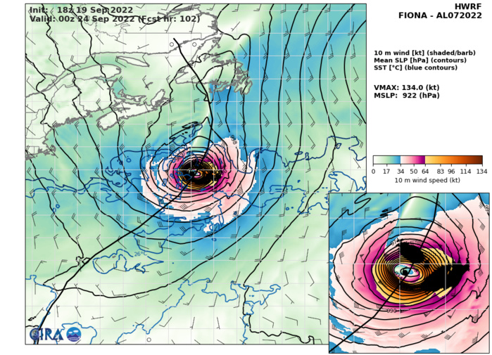
HWRF AT 19/18UTC: 134KT AT +102H.
NORTH ATLANTIC: INVEST 97L. ESTIMATED LOCATION AND INTENSITY AT 20/06UTC. NHC COMMENTS.
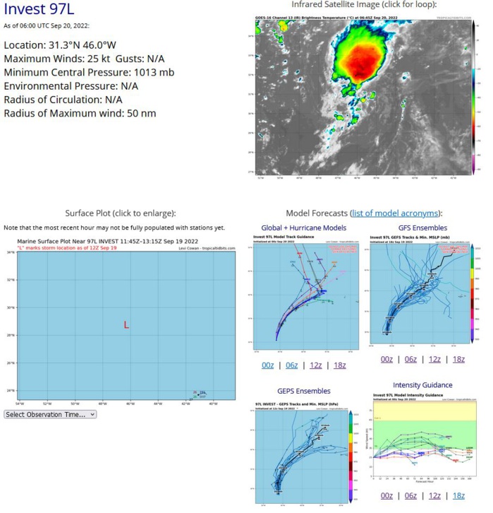
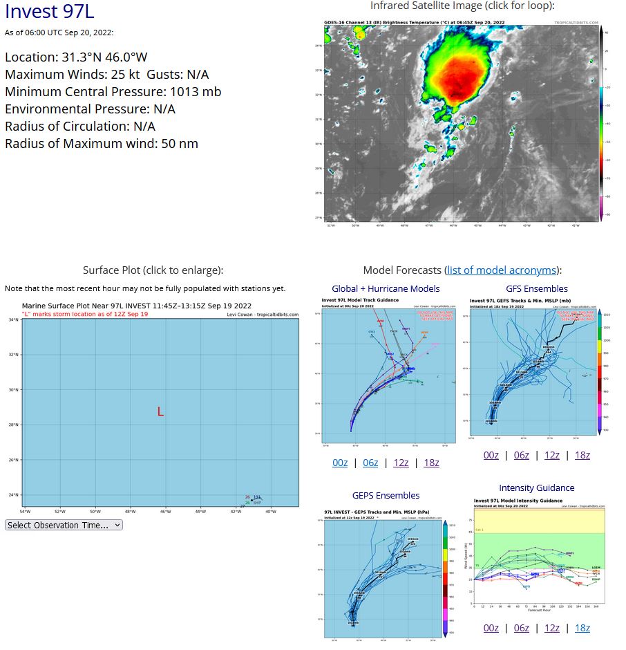
ZCZC MIATWOAT ALL TTAA00 KNHC DDHHMM Tropical Weather Outlook NWS National Hurricane Center Miami FL 200 AM EDT Tue Sep 20 2022 For the North Atlantic...Caribbean Sea and the Gulf of Mexico: Active Systems: The National Hurricane Center is issuing advisories on Hurricane Fiona, located just southeast of the Turks and Caicos islands. 1. Central Subtropical Atlantic: Shower and thunderstorm activity continues to increase in association with an area of low pressure located over the central subtropical Atlantic. Environmental conditions appear marginally favorable for additional development, and a tropical depression is likely to form over the next couple of days before upper-level winds become less conducive later this week. The system should generally move northward or northeastward while remaining over the open waters of central subtropical Atlantic. * Formation chance through 48 hours...medium...60 percent. * Formation chance through 5 days...medium...60 percent. 2. Central Tropical Atlantic: A tropical wave located several hundred miles east of the Windward Islands is producing a broad area of disorganized showers and thunderstorms. Gradual development of this system is forecast during the next several days as the system approaches the Windward Islands, and a tropical depression could form toward the latter part of this week or weekend as the system moves into the eastern and central Caribbean sea. * Formation chance through 48 hours...low...10 percent. * Formation chance through 5 days...medium...40 percent. Forecaster Papin
AL, 97, 2022091800,223N, 445W, 15,1017
AL, 97, 2022091806,234N, 448W, 20,1017
AL, 97, 2022091812,248N, 451W, 20,1017
AL, 97, 2022091818,266N, 456W, 20,1017
AL, 97, 2022091900,278N, 460W, 25,1015
AL, 97, 2022091906,284N, 462W, 25,1014
AL, 97, 2022091912,287N, 463W, 25,1014
AL, 97, 2022091918,296N, 458W, 25,1014
AL, 97, 2022092000,304N, 458W, 25,1014
AL, 97, 2022092006,313N, 460W, 25,1013
