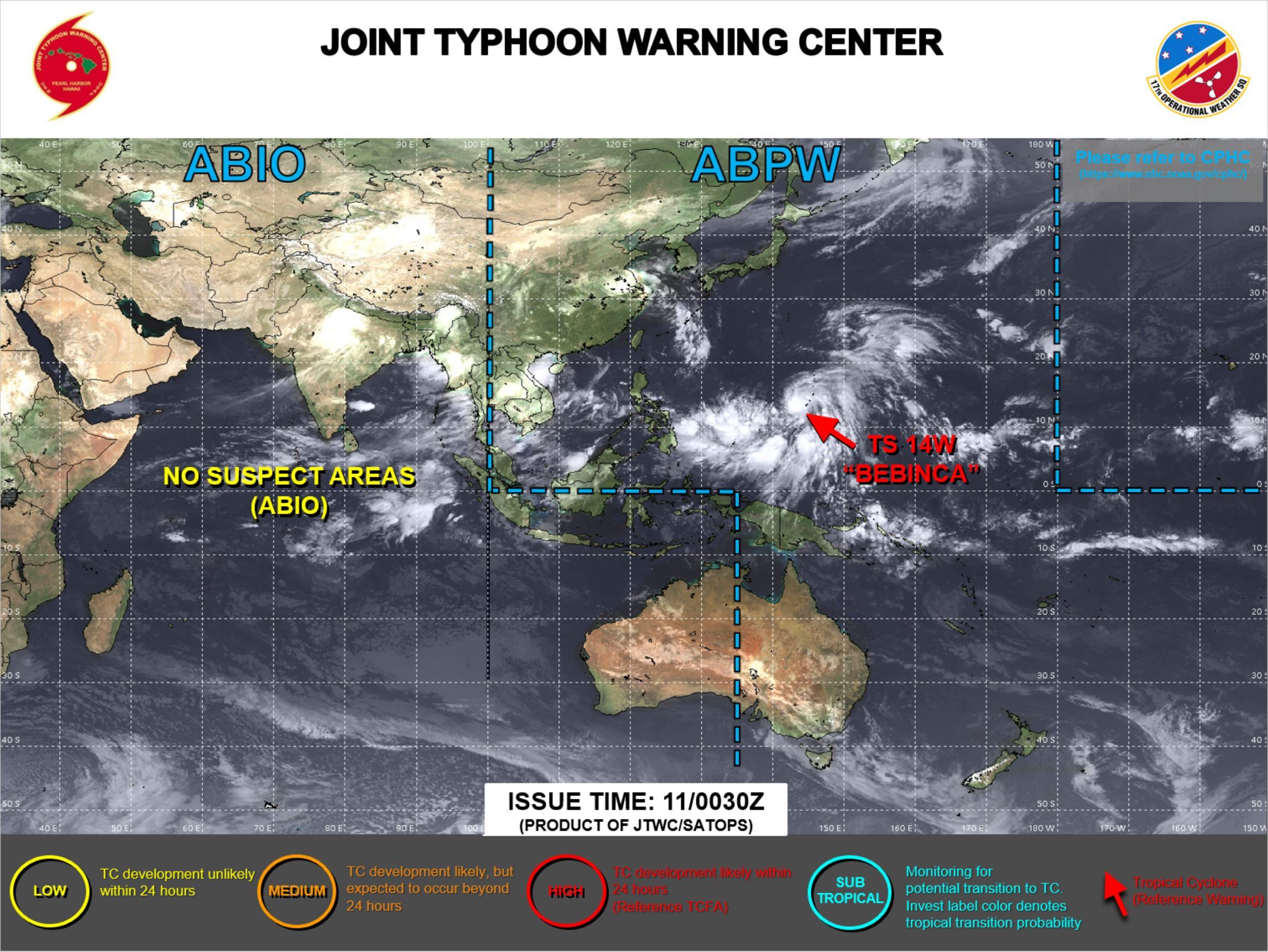
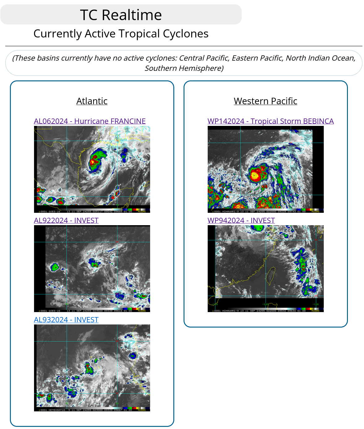
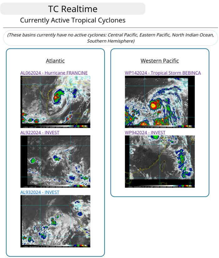
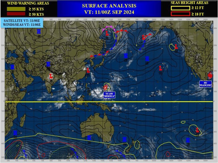
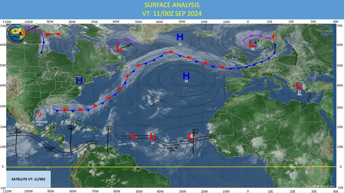
CLICK ON THE IMAGERIES BELOW TO GET THEM ENLARGED
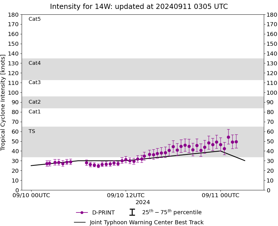
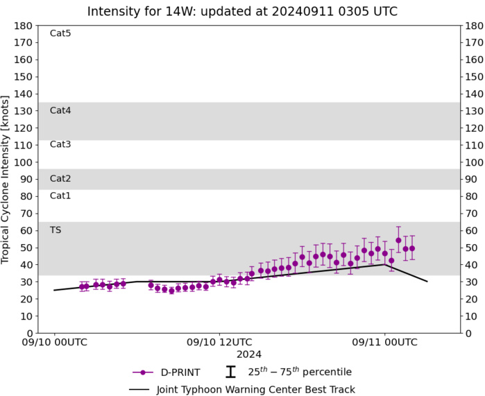
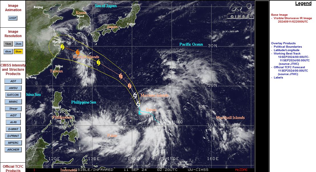
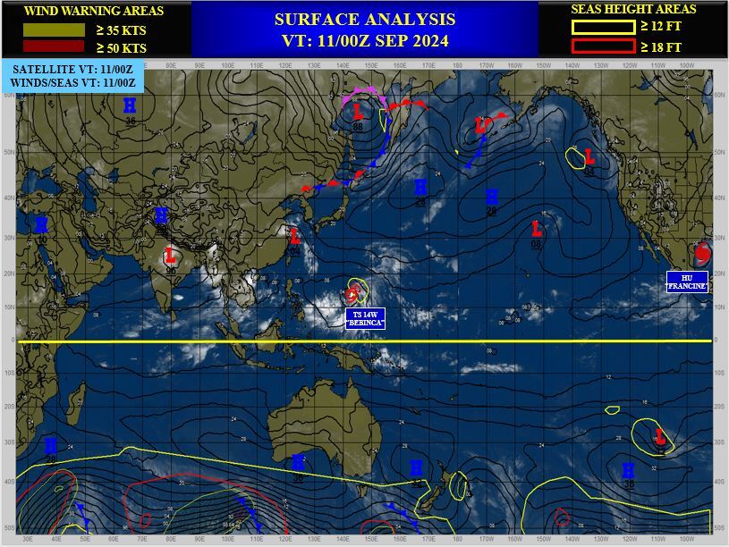
WESTERN NORTH PACIFIC: TD 14W(BEBINCA). 11/00UTC ESTIMATED LOCATION AND INTENSITY. INTENSITY IS 30 KNOTS: + 5 KNOTS OVER 24 HOURS
1424090900 105N1482E 15
1424090906 105N1480E 15
1424090912 104N1476E 20
1424090918 107N1471E 20
1424091000 110N1466E 25
1424091006 117N1460E 30
1424091012 126N1454E 30
1424091018 132N1444E 35
1424091100 137N1421E 30
WARNING 5 ISSUED AT 11/03UTC
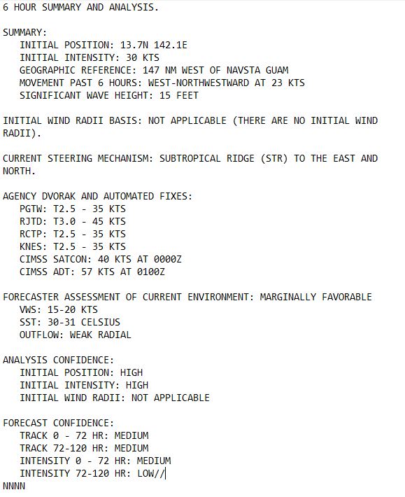
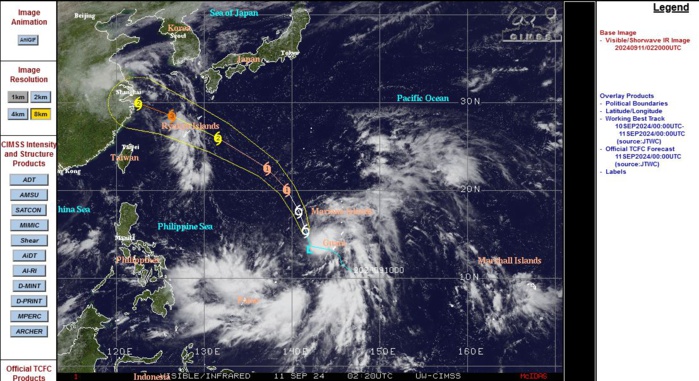
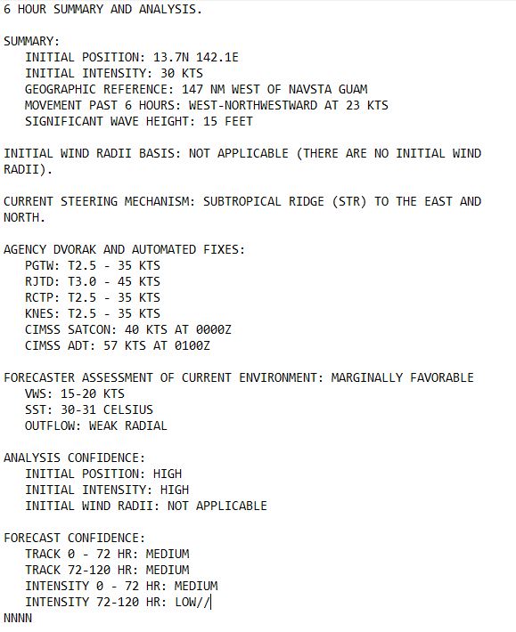
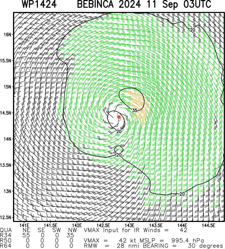
SATELLITE ANALYSIS, INITIAL POSITION AND INTENSITY DISCUSSION: ANIMATED MULTISPECTRAL SATELLITE IMAGERY (MSI) DEPICTS TROPICAL DEPRESSION (TD) 14W AS REMAINING STEADY IN SLOW INTENSIFICATION, WITH PERSISTENT CONVECTION LOCATED JUST TO THE SOUTHEAST OF THE LOW-LEVEL CIRCULATION CENTER (LLCC). MODERATE VERTICAL WIND SHEAR (VWS) OF 20 KTS HAS BECOME EVIDENT AS TD 14W HAS STRUGGLED TO CONSOLIDATE OVER THE LAST FEW HOURS WITH A SLIGHTLY TILTED VERTICAL STRUCTURE TO THE SOUTHEAST. PARTIALLY EXPOSED LOW-LEVEL CONVECTIVE BANDING CONTINUES TO NEATLY WRAP AROUND THE WESTERN PERIPHERY OF THE SYSTEM, WHILE MUCH OF THE EASTERN FLANK REMAINS OBSCURED BY SCATTERED CONVECTIVE CELLS AND CIRRUS BLOWOFF. DESPITE THE WEAK RADIAL AND POLEWARD OUTFLOW, TD 14W HAS STRUGGLED TO INTENSIFY AS EXPECTED OVER THE LAST FEW HOURS. THE INITIAL POSITION IS PLACED WITH HIGH CONFIDENCE BASED ON A 110016Z ASCAT-B PASS SHOWING SWATHS OF 30 KTS WITHIN THE NORTHEASTERN QUADRANT. THE INITIAL INTENSITY IS ASSESSED WITH HIGH CONFIDENCE BASED ON THE AFOREMENTIONED ASCAT-B PASS AND AGENCY INTENSITY ESTIMATES LISTED BELOW.
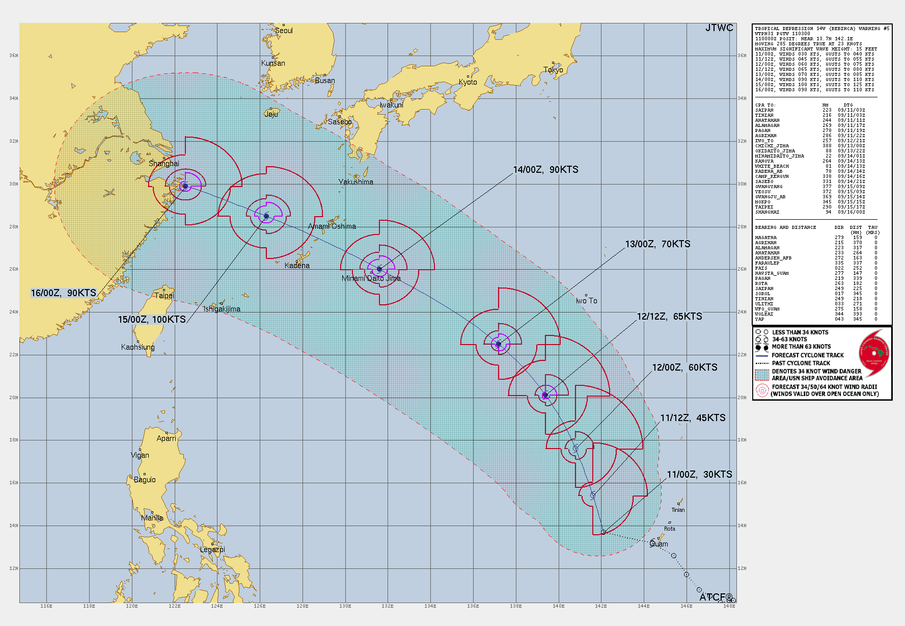
TC Warning Graphic
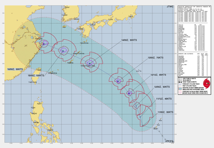
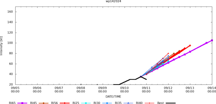
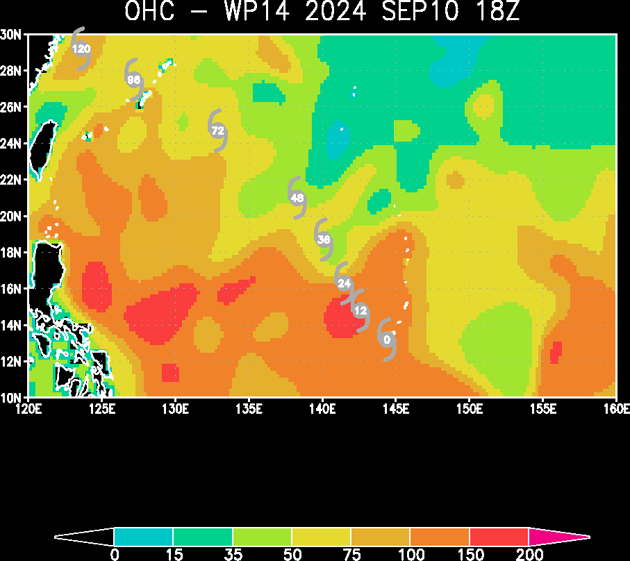
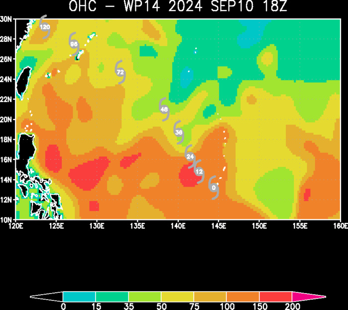
FORECAST REASONING. SIGNIFICANT FORECAST CHANGES: INITIAL INTENSITY DECREASED FROM 6 HOURS AGO DUE TO A RECENT 110016Z ASCAT-B PASS. FORECAST DISCUSSION: TD 14W HAS REMAINED STEADY IN INTENSITY OVER THE LAST FEW HOURS, HOWEVER, IS FORECASTED TO INTENSIFY AND TRACK NORTH-NORTHWESTWARD ALONG THE WESTERN PERIPHERY OF THE STR UNTIL TAU 48. AFTER TAU 48, TD 14W WILL BEGIN TO TRACK NORTHWESTWARD THROUGHOUT THE REMAINDER OF THE FORECAST PERIOD UNTIL TAU 120 AS THE SYSTEM APPROACHES COASTAL CHINA. IN REGARD TO INTENSITY, TD 14W WILL STEADILY INTENSIFY THROUGH TAU 48 AS ENVIRONMENTAL CONDITIONS REMAIN LARGELY CONDUCIVE WITH LOW VERTICAL WIND SHEAR, WARM SEA SURFACE TEMPERATURES OF ABOVE 29 C, AND SUPPORTIVE OCEAN HEAT CONTENT VALUES. AFTER TAU 48, AMPLIFIED UPPER-LEVEL DIVERGENCE WILL ALLOW FOR INCREASED INTENSIFICATION AS THE SYSTEM BEGINS TO MOVE NORTHWESTWARD TO A MAXIMUM OF 100 KTS AFTER THE RYUKU ISLANDS. NEAR THE END OF THE FORECAST PERIOD, TD 14W IS EXPECTED TO SLIGHTLY WEAKEN AS DRY AIR ENTRAINS FROM THE WESTERN SEMICIRCLE, INTO THE SOUTHERN QUADRANT.
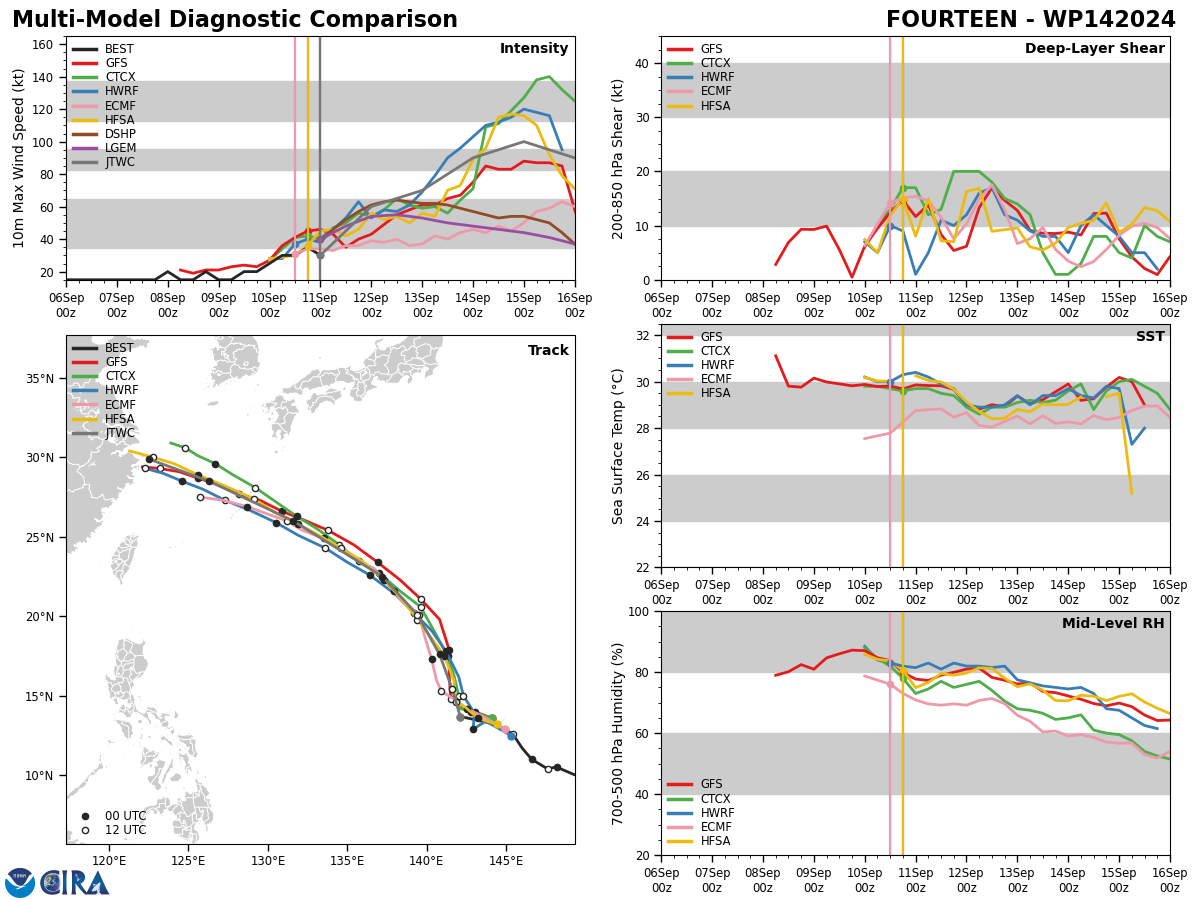
Model Diagnostic Plot
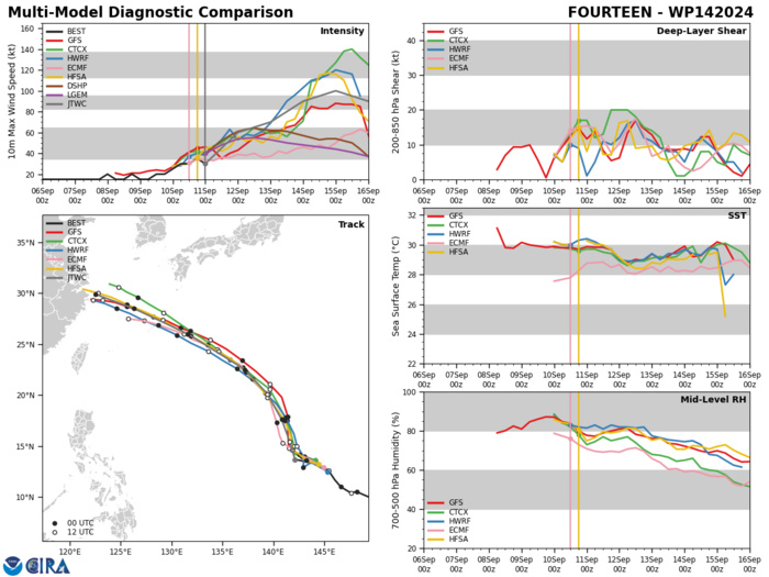
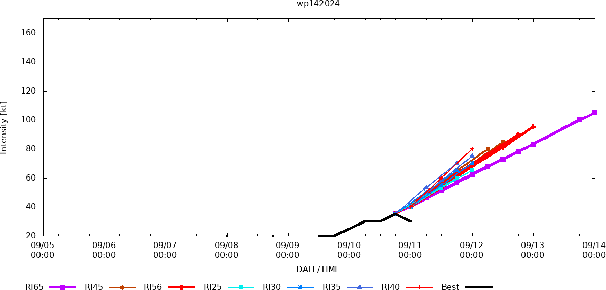
MODEL DISCUSSION: NUMERICAL MODEL GUIDANCE IS IN GOOD AGREEMENT WITH A 45 NM CROSS TRACK SPREAD BY TAU 12. AFTER TAU 12, CROSS-TRACK SPREAD BEGINS TO GRADUALLY INCREASE TO 120 NM BY TAU 72 LENDING MEDIUM CONFIDENCE TO THE JTWC FORECAST TRACK. FOLLOWING TAU 72, THE NUMERICAL MODEL GUIDANCE TRACK SPREAD BEGINS TO INCREASE SIGNIFICANTLY, LENDING LOW CONFIDENCE TO THE FORECAST TRACK BETWEEN TAU 72 AND TAU 120. INTENSITY GUIDANCE IS ASSESSED WITH MEDIUM CONFIDENCE THROUGH TAU 72, AS STEADY TO MODERATE INTENSIFICATION IS FORECASTED. AFTER TAU 72, THE INTENSITY GUIDANCE CONTINUES TO REMAIN LESS RELIABLE AS MESOSCALE MODEL GUIDANCE INDICATES RAPID INTENSIFICATION AFTER TAU 66, WHILE DETERMINISTIC MODEL GUIDANCE (GFS AND ECMWF) ILLUSTRATE A GRADUAL INCREASE IN INTENSITY UNTIL TAU 108, THEN DECREASE INTO THE END OF THE FORECAST PERIOD. THE JTWC INTENSITY FORECAST ALIGNS CLOSELY WITH THE DETERMINISTIC NUMERICAL MODEL GUIDANCE THROUGH TAU 72, WHILE INDICATING A PERIOD OF AMPLIFIED INTENSIFICATION TO 100 KTS BY TAU 96.
Rapid Intensification Guidance
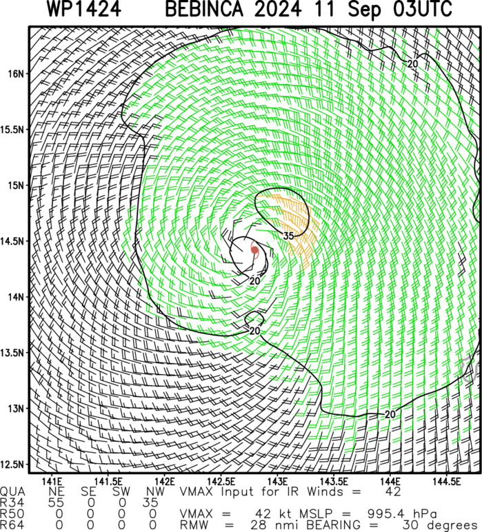
Multiplatform Satellite Surface Wind Analysis (Experimental)
Ocean Heat Content & Forecast Track
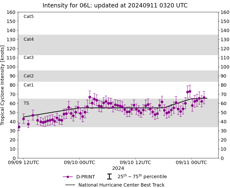
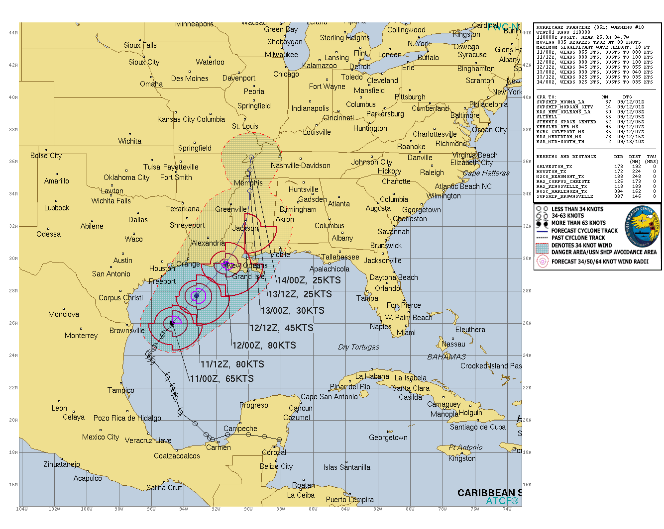
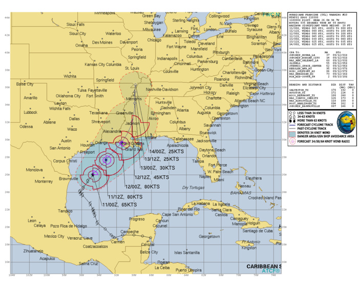
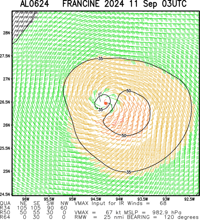
NORTH ATLANTIC/GULF OF MEXICO: HU 06L(FRANCINE): 11/00UTC ESTIMATED LOCATION AND INTENSITY. INTENSITY IS 65 KNOTS/CAT 1 US: + 10 KNOTS OVER 24 HOURS
0624090900 218N 946W 45
0624090906 220N 947W 45
0624090912 227N 950W 45
0624090918 237N 959W 50
0624091000 239N 961W 55
0624091006 241N 962W 55
0624091012 245N 958W 55
0624091018 253N 953W 55
0624091100 260N 947W 65
0624090906 220N 947W 45
0624090912 227N 950W 45
0624090918 237N 959W 50
0624091000 239N 961W 55
0624091006 241N 962W 55
0624091012 245N 958W 55
0624091018 253N 953W 55
0624091100 260N 947W 65
WARNING 10 ISSUED AT 11/03UTC
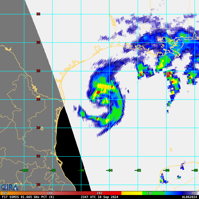
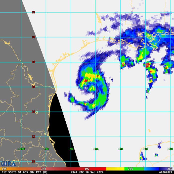
85 – 92 GHz Polarization-Corrected Brightness Temperature
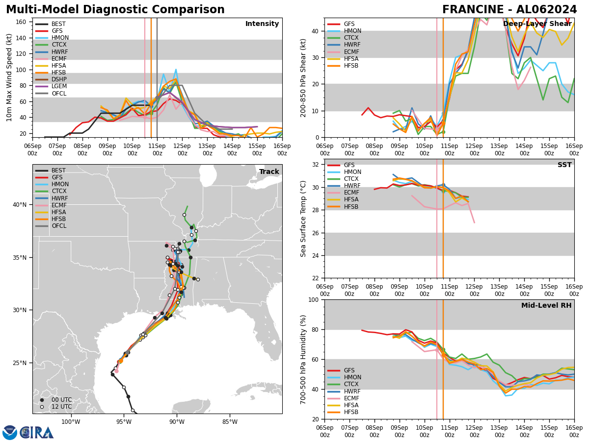
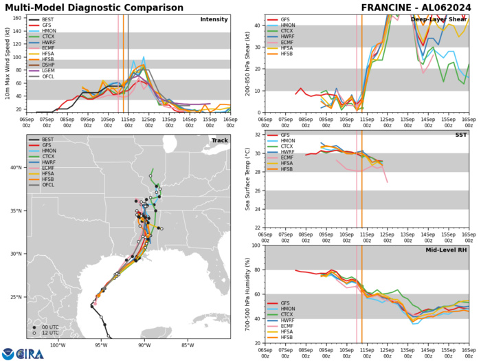
Model Diagnostic Plot
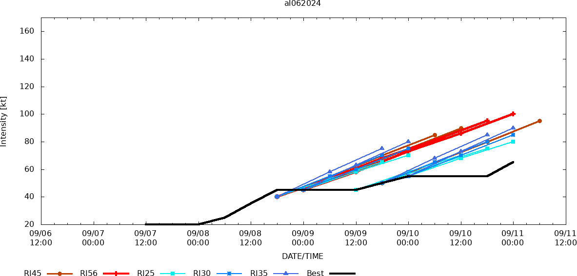
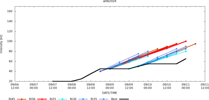
Rapid Intensification Guidance
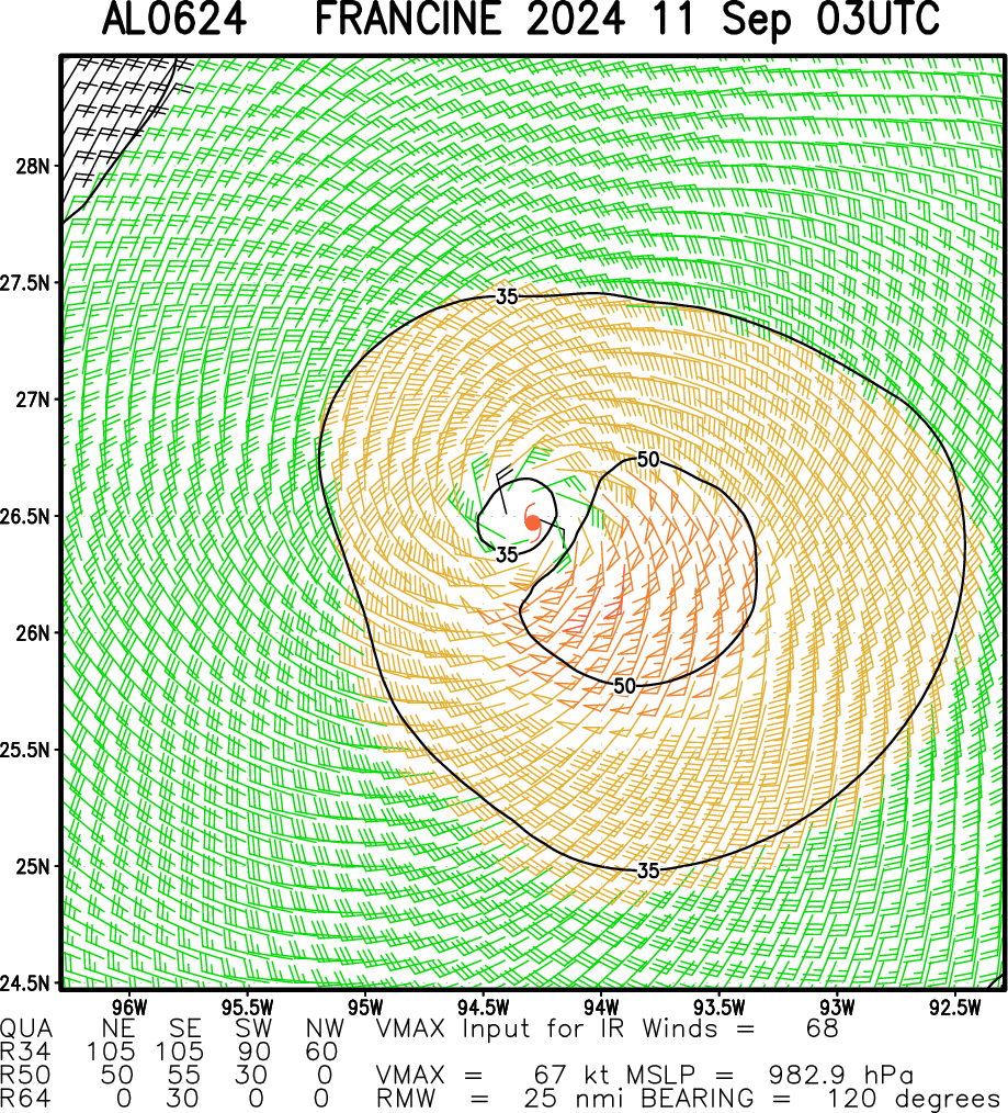
Multiplatform Satellite Surface Wind Analysis (Experimental)
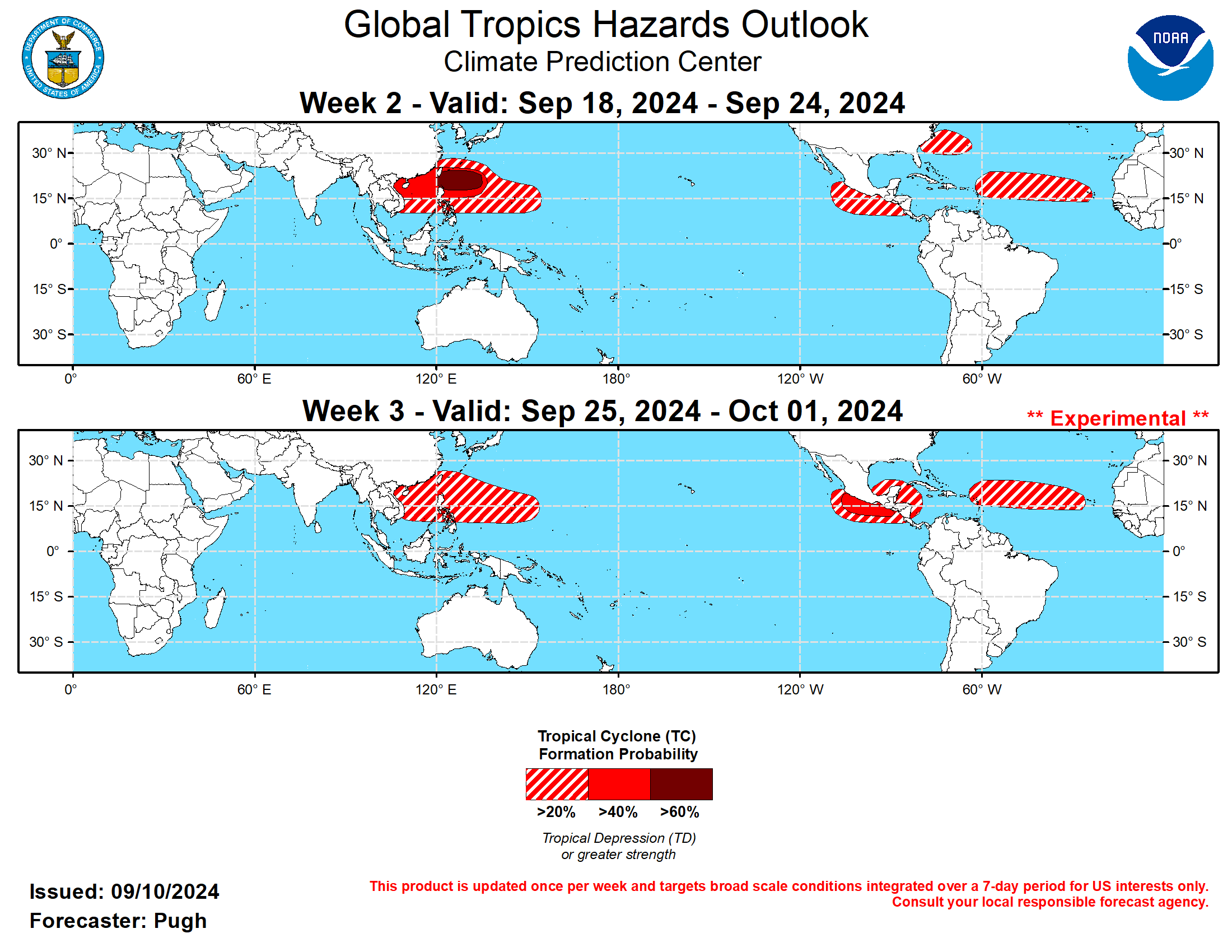
Last Updated - 09/10/24 3 WEEK TROPICAL CYCLONE FORMATION PROBABILITY
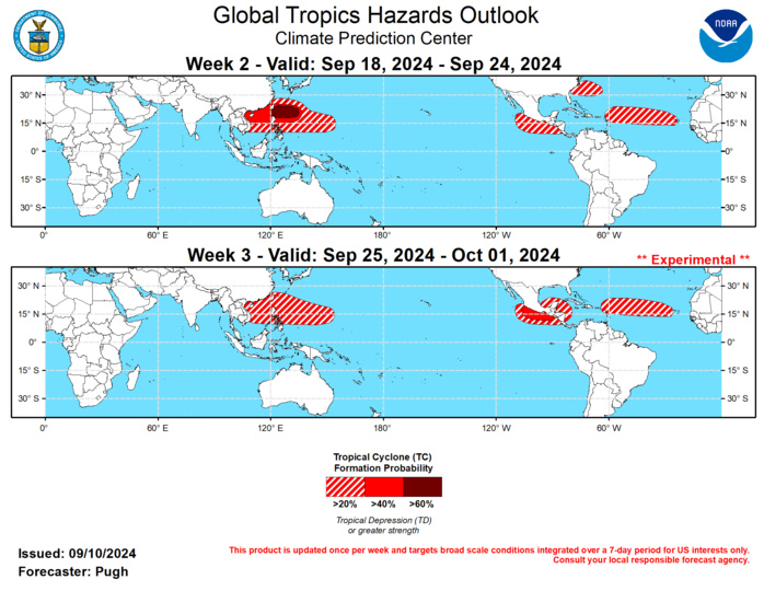
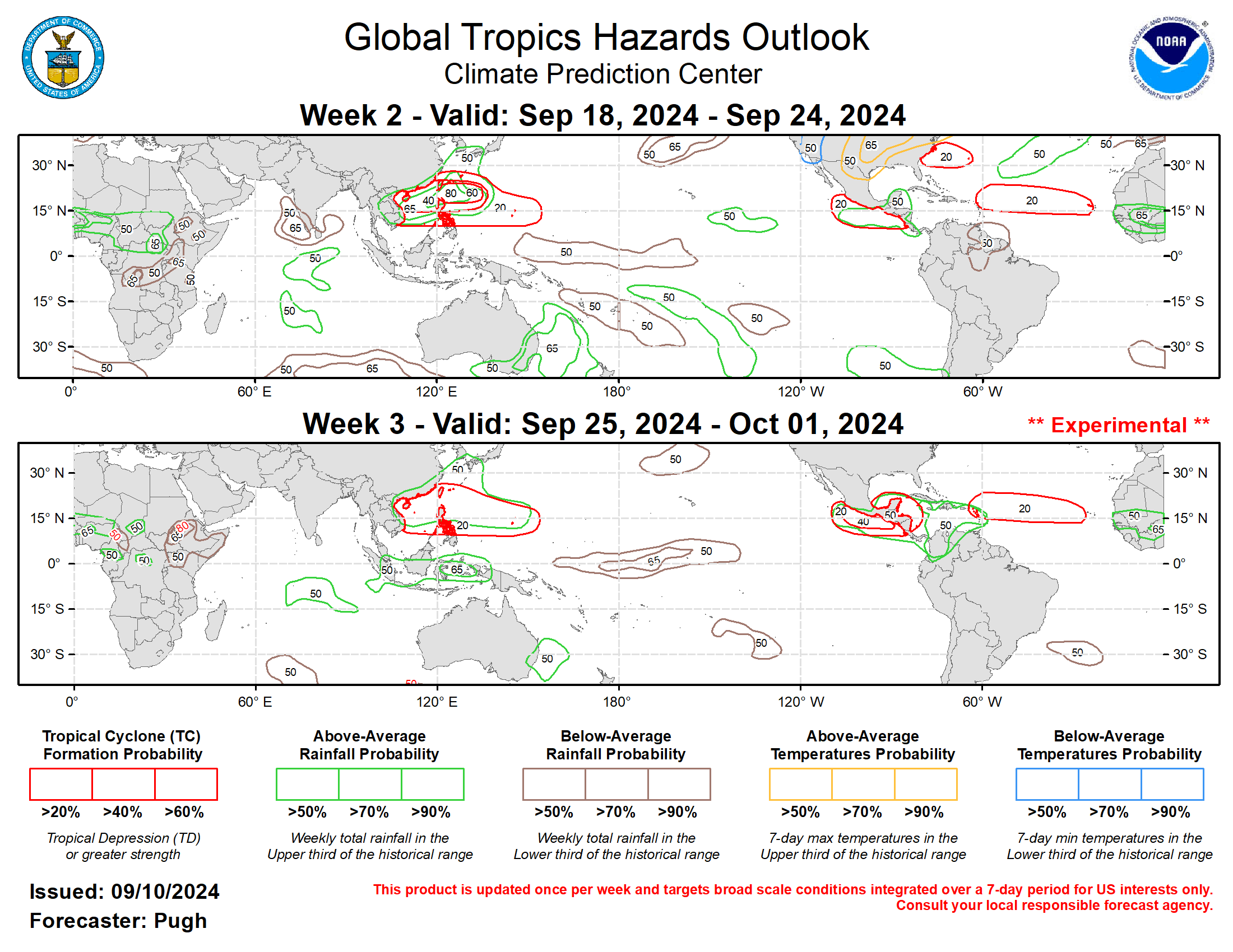
GTH Outlook Discussion Last Updated - 09/10/24 Valid - 09/18/24 - 10/01/24 A well-defined Madden Julian Oscillation (MJO) propagated eastward from the Indian Ocean to the Maritime Continent during the latter half of August. By early September, the eastward propagation of the MJO slowed due to interaction with Equatorial Rossby waves. The emerging low-frequency state with a transition to La Nina is also likely contributing to this slower progression. Dynamical models diverge on the MJO evolution during the next two to three weeks. The ECMWF and CFS models maintain a coherent MJO with it resuming eastward propagation to the Western Hemisphere, while the GEFS depicts a weaker MJO. The weeks 2 and 3 GTH outlook leaned towards the ECMWF and CFS model solutions. Tropical Storm Francine developed in the southwestern Gulf of Mexico on September 9 and is forecast to make landfall as a hurricane along the Louisiana Gulf Coast on September 11. Francine was the 1st tropical cyclone to form over the Atlantic basin since Hurricane Ernesto which developed on August 12. Please refer to the National Hurricane Center (NHC) for the latest updates and forecasts on Francine. The NHC is monitoring a pair of tropical waves over the Central Tropical Atlantic and at least one of these is likely to become a tropical cyclone (TC) during the next week. An amplified 500-hPa trough over the Central Atlantic would favor a north to northeastward track (east of 70W) of this potential TC. Many GFS and ECMWF ensemble members continue to spin up a subtropical low pressure system or TC between the East Coast of the United States and Bermuda from September 18 to 24. This would be consistent with the predicted longwave pattern that features an anomalous 500-hPa ridge over the higher latitudes of eastern North American to the north of a mid-level trough. Therefore, from September 18 to 24, a 20 to 40 percent chance of TC development is posted for portions of the western Atlantic. Climatology and the expectation for atmospheric Kelvin waves to cross the western Hemisphere support a 20 to 40 percent chance of TC genesis across the Main Development Region of the Atlantic for both weeks 2 and 3. By the end of September, the MJO is expected to also provide a more favorable large-scale environment for TC development across the southern Gulf of Mexico and western Caribbean Sea. Over the East Pacific, a TC may form near the southern Baja Peninsula prior to week-2. Regardless of development, it is forecast to bring a northward surge of enhanced low to mid-level moisture to the west-central United States. A continued eastward propagation of the MJO, per the ECMWF and CFS models, would result in an elevated chance (20-40 percent) of TC formation across the East Pacific during week-2 with chances increasing to 40-60 percent by week-3 (September 25-October 1). On September 6, Super Typhoon Yagi made landfall on Hainan Island in southern China and then tracked westward into northern Vietnam. Yagi was the 2nd strongest tropical cyclone globally of 2024, behind Hurricane Beryl in the Atlantic. Another TC (Tropical Depression 14W) developed in the West Pacific on September 10. The Joint Typhoon Warning Center forecasts this TC to strengthen as it tracks northwestward, between Taiwan and southern Japan. Based on MJO composites and dynamical model guidance, the West Pacific is forecast to remain active through mid to late September. A greater than 60 percent chance of TC development is posted for the West Pacific from September 18 to 24 with a broader 40 to 60 percent chance area covering the South China Sea. By week-3 (September 25 to October 1), MJO composites and dynamical model probabilities favor a decreasing chance (20-40 percent) of TC formation for the West Pacific.
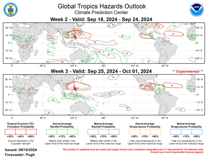
The precipitation outlook for weeks 2 and 3 was based on the historical skill weighted blend of the GEFS, CFS, ECCC along with MJO precipitation composites for phases 7, 8, and 1, and the low-frequency base state with enhanced (suppressed) rainfall over the Maritime Continent (equatorial Central Pacific). Since the MJO is expected to propagate eastward to the western Hemisphere, a trend towards wetter conditions is forecast for Central America and the Caribbean Sea region from weeks 2 to 3.
