CLICK ON THE IMAGERIES BELOW TO GET THEM ENLARGED
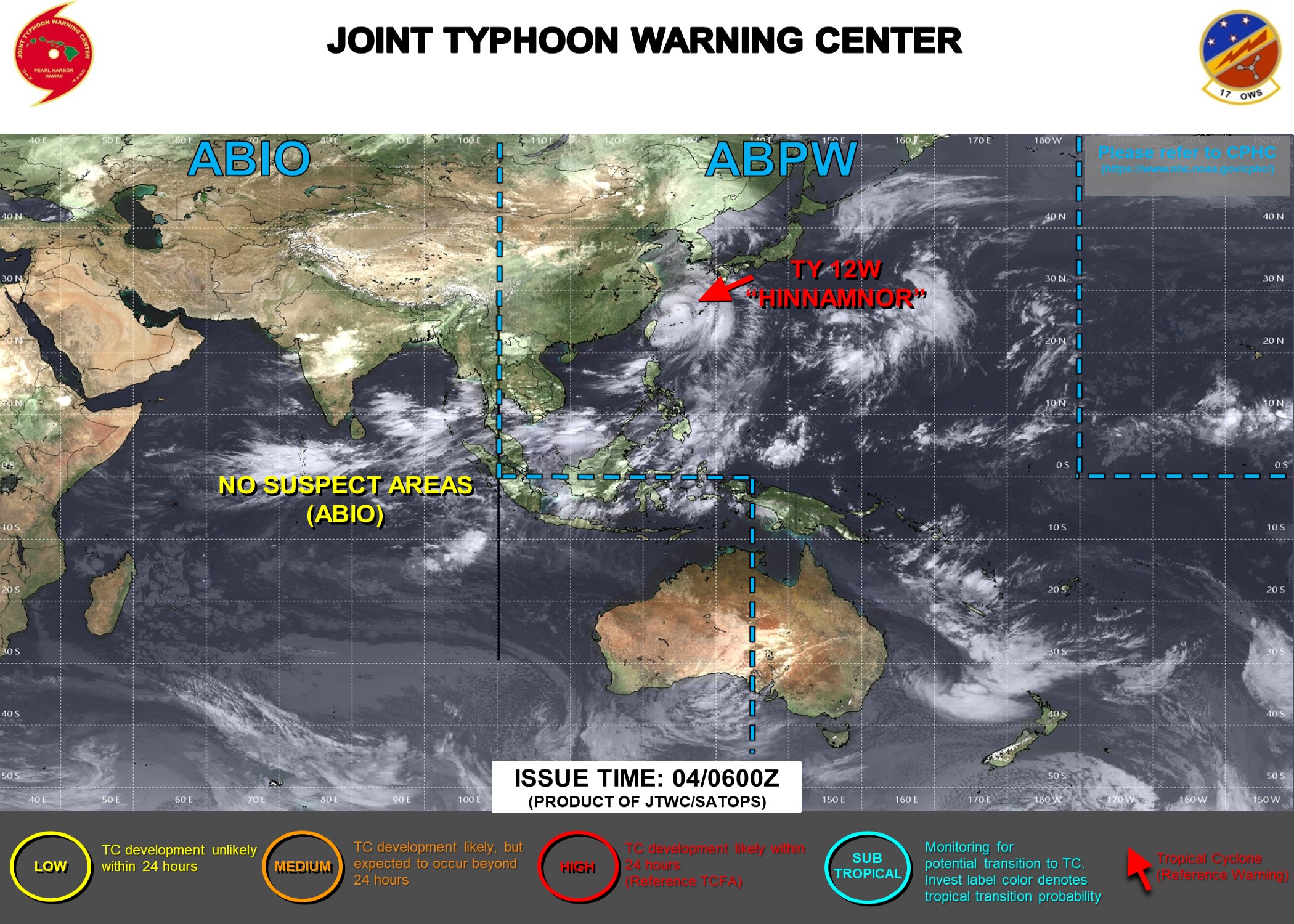
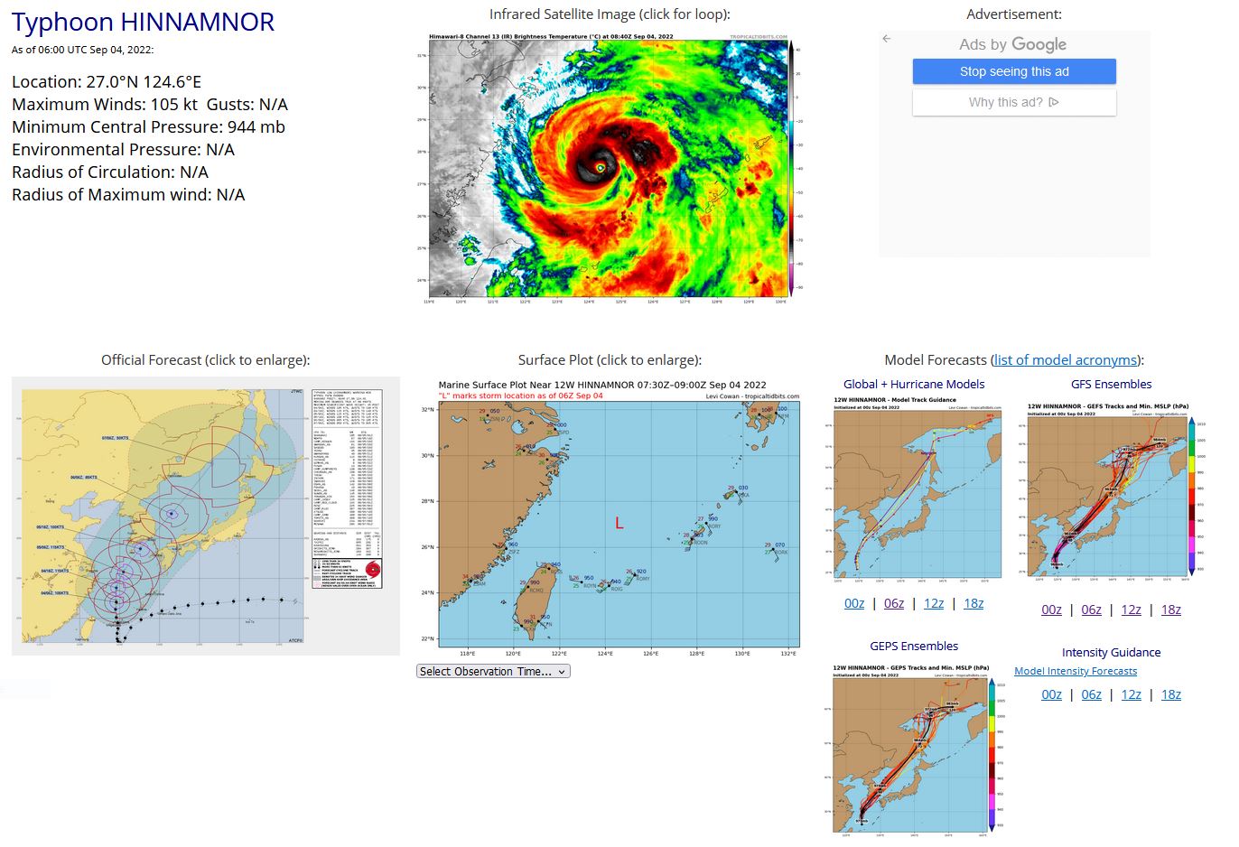
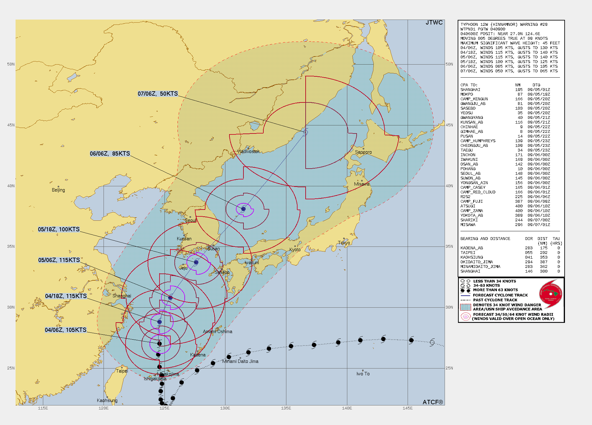
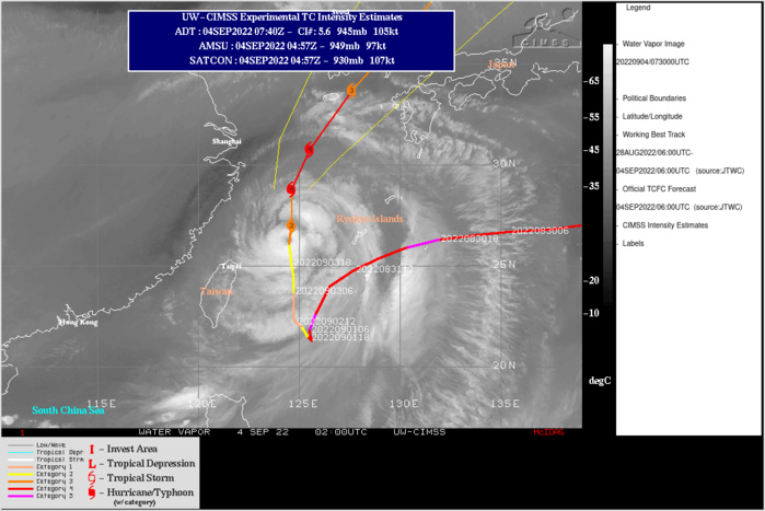
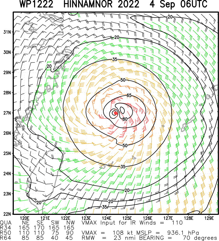
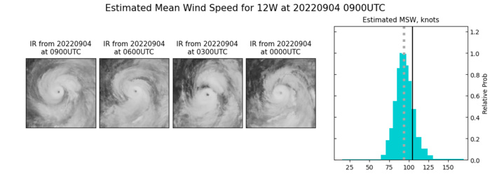
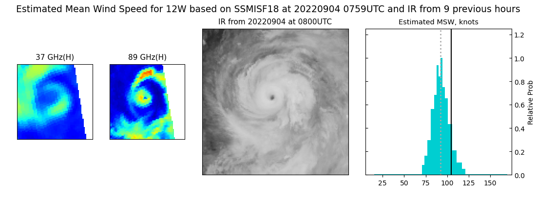
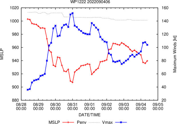
WESTERN NORTH PACIFIC: TY 12W(HINNAMNOR). ESTIMATED LOCATION AND INTENSITY AT 04/06UTC. WARNING 29 ISSUED AT 04/09UTC.
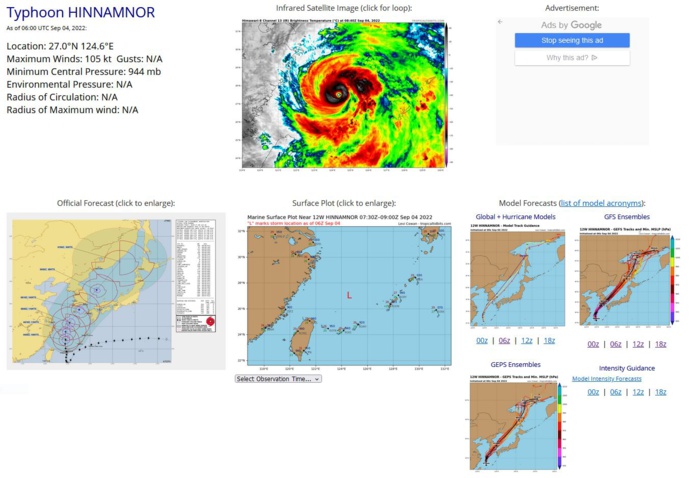
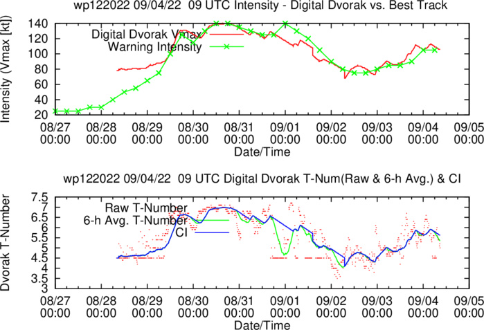
SATELLITE ANALYSIS, INITIAL POSITION AND INTENSITY DISCUSSION: ANIMATED MULTISPECTRAL SATELLITE IMAGERY (MSI) DEPICTS A SMALL 10NM EYE SURROUNDED BY SPIRAL BANDS OF DEEP CONVECTION. THE WESTERN PERIPHERY OF THE SYSTEM CONTINUES TO SHOW SIGNS OF DRY AIR ENTERTAINMENT BUT THIS HAS NOT PREVENTED 12W FROM CONSOLIDATING AND INTENSIFYING. A 040430Z AMSR2 89GHZ MICROWAVE IMAGE REVEALS THAT TY 12W HAS A SMALL COMPACT INNER CORE WITH A SIZABLE MOAT AND MUCH LARGER SECONDARY EYEWALL. SHORT TERM POSITIONING REMAINS DIFFICULT DUE TO A SIZABLE AMOUNT OF TROCHOIDAL MOTION AS THE SYSTEM PROPAGATES NORTHWARD. THE INITIAL POSITION IS PLACED WITH MEDIUM CONFIDENCE BASED ON MSI AND AMSR2 IMAGERY. THE INITIAL INTENSITY OF 105 KTS IS ASSESSED WITH HIGH CONFIDENCE BASED ON THE PGTW, KNES AND CIMSS ADT ALL INDICATING 102 KTS WITH AN UPWARD TREND OVER THE PAST SEVERAL HOURS.
WP, 12, 2022090300,231N, 1247E, 80, 963
WP, 12, 2022090306,237N, 1248E, 85, 959
WP, 12, 2022090312,244N, 1248E, 85, 952
WP, 12, 2022090318,251N, 1246E, 90, 952
WP, 12, 2022090400,261N, 1245E,105, 941
WP, 12, 2022090406,270N, 1246E,105, 944
WP, 12, 2022090306,237N, 1248E, 85, 959
WP, 12, 2022090312,244N, 1248E, 85, 952
WP, 12, 2022090318,251N, 1246E, 90, 952
WP, 12, 2022090400,261N, 1245E,105, 941
WP, 12, 2022090406,270N, 1246E,105, 944
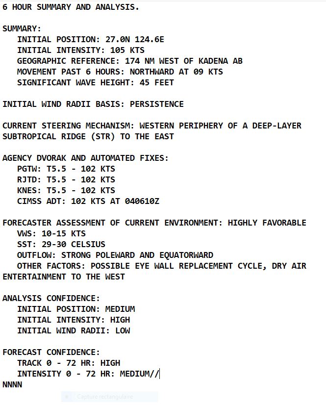
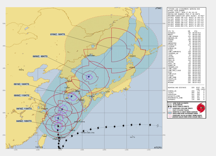
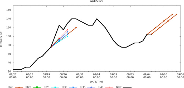
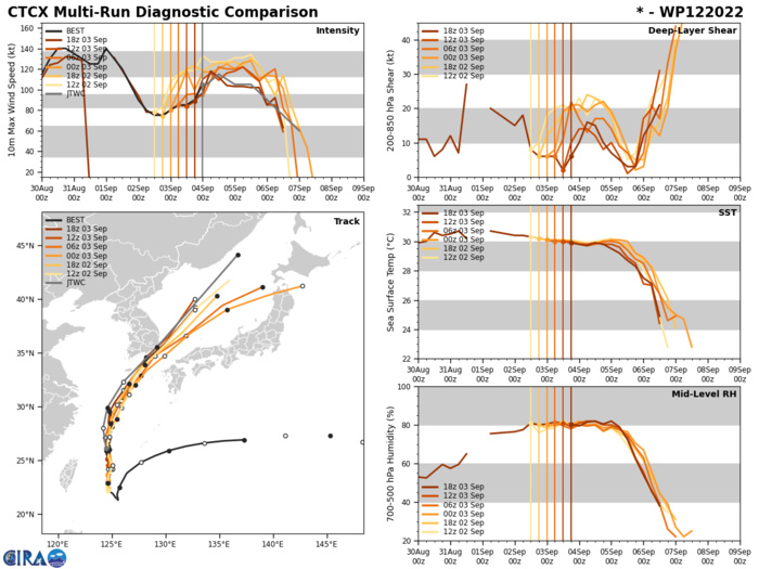
FORECAST REASONING. SIGNIFICANT FORECAST CHANGES: THERE ARE NO SIGNIFICANT CHANGES TO THE FORECAST FROM THE PREVIOUS WARNING. FORECAST DISCUSSION: STILL TRACKING GENERALLY NORTHWARD UNDER THE STEERING INFLUENCE OF THE STR TO THE EAST, TY 12W HAS SHOWN CONSISTENT CONSOLIDATION AND INTENSIFICATION OVER THE PAST SEVERAL HOURS. THROUGH TAU 12, THE SYSTEMS ENVIRONMENT WILL REMAIN HIGHLY FAVORABLE, CHARACTERIZED BY WARM SEA SURFACE TEMPERATURES (29C-30C), LOW VERTICAL WIND SHEAR (10-15KTS) AND VIGOROUS DUAL-CHANNEL OUTFLOW BOTH POLEWARD AND EQUATORWARD. UNFORTUNATELY FOR 12W, THE CURRENT CONCENTRIC EYEWALL SETUP, AND INCREASING M-PERC EYEWALL REPLACEMENT CYCLE (ERC) PROBABILITIES SUGGEST THAT ERC WILL TAKE PLACE IN THE NEAR FUTURE AND THE SYSTEMS INTENSITY WILL LIKELY NOT RECOVER. BECAUSE OF THIS, TY 12W IS LIKELY TO REACH PEAK INTENSITY WITHIN THE NEXT 12-18 HOURS. BY TAU 24, THE SYSTEM WILL STEADY UP ON A GENERALLY NORTHEASTWARD TRACK AS IT ROUNDS THE STR AND ACCELERATES TOWARDS THE KOREAN PENINSULA. NEAR TAU 36, NOW OVER COOLER WATERS AND INTERACTING WITH THE PENINSULA ITSELF 12W WILL CONTINUE TO WEAKEN, ALL THE WHILE THE STRONG UPPER-LEVEL LOW AND TROUGH MOVING IN FROM THE WEST WILL BOMBARD THE SYSTEM WITH VERTICAL WIND SHEAR AND FURTHER ACCELERATE 12W NORTHEASTWARD. THIS INTERACTION WITH THE PASSING TROUGH WILL BEGIN TO ROB THE SYSTEM OF ITS TROPICAL CHARACTERISTICS AND THEREBY START EXTRATROPICAL TRANSITION (ETT) AS THE SYSTEM PASSES OVER THE SOUTHERN COAST OF SOUTH KOREA. BY TAU 48 THE SYSTEM WILL STILL HAVE MUCH OF ITS FORMER INTENSITY AS IT PROGRESSES THROUGH ETT. NEAR TAU 72, NOW DEVOID OF ITS TROPICAL CHARACTERISTICS AND FULLY INCORPORATED IN THE MIDLATITUDE TROUGH, 12W IS FORECAST TO COMPLETE ETT.
CLICK ON THE IMAGERY BELOW TO GET IT ANIMATED

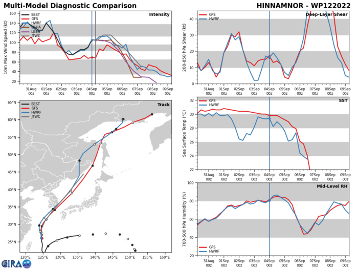
MODEL DISCUSSION: NUMERICAL MODELS ARE IN TIGHT AGREEMENT THROUGH TAU 48 WITH A 100NM SPREAD IN THE SOLUTION, BY TAU 72 THERE IS ADDITIONAL CROSS TRACK DISCREPANCY AS VARIOUS MODELS ATTEMPT TO RESOLVE THE COMPLETION OF ETT. DUE TO THIS TIGHT AGREEMENT THE JTWC FORECAST TRACK IS PLACED WITH HIGH CONFIDENCE. RELIABLE MODEL INTENSITY GUIDANCE IS IN FAIR AGREEMENT WITH SEVERAL RAPID INTENSIFICATION AIDS TRIGGERING DUE TO THE ABOVE MENTIONED HIGHLY FAVORABLE ENVIRONMENT, HOWEVER, DECAY-SHIPS (NVGM AND GFS) HAVE SHOWN A CONSISTENTLY OPPOSING STORY WITH STAGNATION AND WEAKENING THROUGH THE FORECAST PERIOD. THE JTWC INTENSITY FORECAST IS THEREFORE PLACED WITH MEDIUM CONFIDENCE DUE TO THE UNCLEAR EXTENT THAT ERC WILL PLAY IN THE SYSTEMS SHORT TERM INTENSIFICATION TREND AND THEREFOR ITS LONG TERM FORECAST INTENSITY.
EASTERN NORTH PACIFIC: TD 11E(JAVIER). WARNING 11/FINAL ISSUED AT 04/10UTC. NHC COMMENTS.
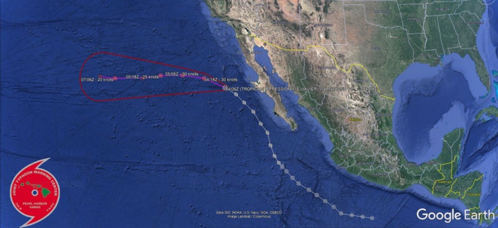
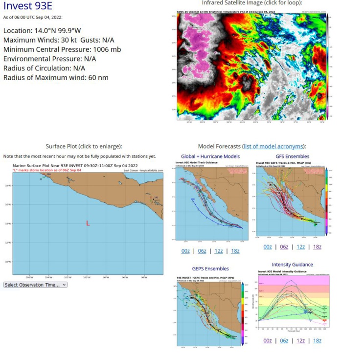
000 WTPZ41 KNHC 040837 TCDEP1 Post-Tropical Cyclone Javier Discussion Number 11 NWS National Hurricane Center Miami FL EP112022 200 AM PDT Sun Sep 04 2022 There has been no significant deep convection associated with Javier for nearly 16 hours, and it's doubtful that any organized deep convection will attempt a comeback. Accordingly, Javier has become a post-tropical remnant low and this will be the final NHC advisory on this system. The initial intensity is lowered to 30 kt, which is in agreement with subjective satellite intensity estimates from TAFB and SAB. The remnant low should continue to gradually spin down over cooler sea surface temperatures during the next several days, and the deterministic models indicate that the surface circulation will become a trough of low pressure toward the end of the week. The NHC intensity forecast is similar to the previous one and is close to the intensity model consensus. The low continues to move away from the Baja California peninsula and the initial motion estimate is 295/13 kt. The cyclone should turn westward soon in the low-level trade flow as a shallow remnant low and maintain this general heading until it dissipates in 5 days. This is the final NHC advisory on Javier. For additional information on the remnant low please see High Seas Forecasts issued by the National Weather Service, under AWIPS header NFDHSFEPI, WMO header FZPN02 KWBC, and on the web at ocean.weather.gov/shtml/NFDHSFEPI.php FORECAST POSITIONS AND MAX WINDS INIT 04/0900Z 27.2N 118.5W 30 KT 35 MPH...POST-TROPICAL 12H 04/1800Z 27.8N 120.5W 30 KT 35 MPH...POST-TROP/REMNT LOW 24H 05/0600Z 27.9N 123.1W 30 KT 35 MPH...POST-TROP/REMNT LOW 36H 05/1800Z 27.6N 125.8W 25 KT 30 MPH...POST-TROP/REMNT LOW 48H 06/0600Z 27.1N 128.0W 25 KT 30 MPH...POST-TROP/REMNT LOW 60H 06/1800Z 26.8N 130.0W 20 KT 25 MPH...POST-TROP/REMNT LOW 72H 07/0600Z 26.6N 131.6W 20 KT 25 MPH...POST-TROP/REMNT LOW 96H 08/0600Z 26.5N 133.7W 20 KT 25 MPH...POST-TROP/REMNT LOW 120H 09/0600Z...DISSIPATED $$ Forecaster Roberts
EP, 11, 2022083006,129N, 1003W, 20,1008
EP, 11, 2022083012,132N, 1015W, 20,1008
EP, 11, 2022083018,135N, 1028W, 20,1007
EP, 11, 2022083100,138N, 1041W, 20,1007
EP, 11, 2022083106,146N, 1050W, 20,1007
EP, 11, 2022083112,153N, 1060W, 20,1007
EP, 11, 2022083118,160N, 1070W, 30,1007
EP, 11, 2022090100,166N, 1079W, 30,1006
EP, 11, 2022090106,173N, 1091W, 30,1005
EP, 11, 2022090112,179N, 1098W, 30,1004
EP, 11, 2022090118,186N, 1105W, 30,1003
EP, 11, 2022090200,191N, 1110W, 30,1003
EP, 11, 2022090206,195N, 1114W, 35,1000
EP, 11, 2022090212,202N, 1119W, 40,1000
EP, 11, 2022090218,213N, 1124W, 40,1000
EP, 11, 2022090300,226N, 1128W, 45, 999
EP, 11, 2022090306,235N, 1136W, 45, 999
EP, 11, 2022090312,247N, 1145W, 45, 999
EP, 11, 2022090318,256N, 1156W, 40,1000
EP, 11, 2022090400,264N, 1166W, 40,1000
EP, 11, 2022090406,270N, 1179W, 30,1002
NORTH ATLANTIC: ESTIMATED LOCATION AND INTENSITY AT 04/06UTC. NHC COMMENTS.

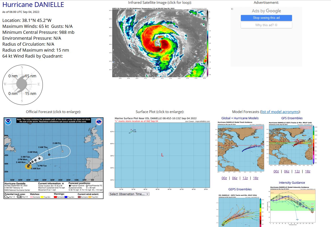
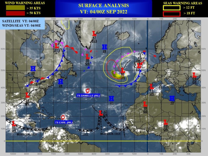
000 WTNT45 KNHC 040838 TCDAT5 Hurricane Danielle Discussion Number 13 NWS National Hurricane Center Miami FL AL052022 500 AM AST Sun Sep 04 2022 There has been little overall change in the satellite presentation of Danielle overnight. Curved convective bands wrap around the center, with a large ragged banded eye-like feature evident at times. There is a large range in the satellite intensity estimates this morning with objective estimates much lower than the subjective Dvorak T-numbers from TAFB and SAB. Although the SAB Dvorak estimate increased to T4.5 (77 kt) at 06Z, given the general steady state of the system's organization since the previous advisory, the initial intensity remains 65 kt, which is a blend of the various estimates and is in agreement with the latest TAFB Dvorak satellite classification. Danielle is forecast to remain over SSTs of around 27C and in a low shear environment during the next 24 to 36 hours. As a result, most of the intensity guidance calls for some intensification during that time, and the NHC forecast follows suit. After that time, gradually decreasing sea surface temperatures along the forecast track should cause slow weakening. By days 4 and 5, increasing shear and the system's transition into a post-tropical cyclone are likely to cause additional weakening. The NHC intensity forecast is a blend of the IVCN and HFIP corrected consensus models. The hurricane has been meandering overnight but a slow northward motion should begin this morning. Danielle is forecast to gradually accelerate to the northeast beginning on Monday as deep-layer trough moves over eastern Canada. By 72 hours, the storm should turn east-northeastward within the mid-latitude westerly flow. The latest dynamical model guidance predicts a slightly faster motion over much of the forecast period, and the NHC forecast has been adjusted accordingly. The new forecast is not as fast as the TCVA consensus model, therefore future modifications regarding the forward speed of the cyclone may be required. FORECAST POSITIONS AND MAX WINDS INIT 04/0900Z 38.1N 45.2W 65 KT 75 MPH 12H 04/1800Z 38.5N 45.1W 70 KT 80 MPH 24H 05/0600Z 39.2N 44.6W 75 KT 85 MPH 36H 05/1800Z 40.3N 43.7W 80 KT 90 MPH 48H 06/0600Z 41.2N 42.4W 75 KT 85 MPH 60H 06/1800Z 42.1N 40.6W 75 KT 85 MPH 72H 07/0600Z 43.1N 38.1W 70 KT 80 MPH 96H 08/0600Z 45.3N 32.0W 60 KT 70 MPH 120H 09/0600Z 47.1N 23.7W 50 KT 60 MPH...POST-TROP/EXTRATROP $$ Forecaster Brown
AL, 05, 2022090300,379N, 434W, 65, 988
AL, 05, 2022090306,380N, 435W, 60, 990
AL, 05, 2022090312,381N, 439W, 60, 990
AL, 05, 2022090318,380N, 447W, 60, 990
AL, 05, 2022090400,380N, 450W, 65, 988
AL, 05, 2022090406,381N, 452W, 65, 988
NORTH ATLANTIC: TS 06L(EARL). ESTIMATED LOCATION AND INTENSITY AT 04/06UTC. NHC COMMENTS.
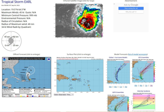
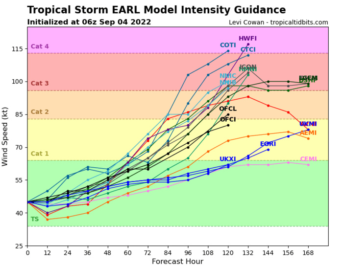
000 WTNT41 KNHC 040835 TCDAT1 Tropical Storm Earl Discussion Number 6 NWS National Hurricane Center Miami FL AL062022 500 AM AST Sun Sep 04 2022 Satellite imagery, surface observations, and WSR-88D radar data from Puerto Rico indicate that Earl remains disorganized due to ongoing southwesterly vertical wind shear, and that the center is rather tricky to locate. One vorticity center, associated with a fresh convective burst, is located just north of the Virgin Islands. However, TAFB and SAB fixed on another cloud area farther north, while the radar data suggests another vorticity center in the deep convection to the northeast of the Virgin Islands. The advisory position is a mean center between these features and is a little north of the new burst. The satellite intensity estimates are unchanged from earlier, so the initial intensity remains 45 kt. The storm has slowed its forward motion, which is now 285/7 kt. The track guidance is in good agreement that a break will form in the subtropical ridge as a mid- to upper-level trough develops to the northwest of Earl beginning later today. This should cause the cyclone to turn northwestward during the next 12-24 h, with a northward motion likely from 24-72 h and a north-northeastward motion from 72-120 h. The track models are in good agreement on the general direction of motion. However, while the GFS is slower than its previous forecast it is still faster than the rest of the guidance. The new forecast track is nudged to the right of the previous forecast based on the overall shift of the guidance envelope. During the first 72 h, it is in best agreement with the GFS and UKMET ensemble means, and after that time it lies close to the various consensus models. The ongoing shear is expected to continue through at least the next 72 h, and thus only gradual strengthening is likely during this time as Earl moves over warm sea surface temperatures in a moist environment. After that time, the cyclone could interact with the aforementioned trough in such a way to leave Earl in a more favorable environment for intensification, and the dynamical models forecast significant strengthening toward the end of the forecast period. The new intensity forecast has only minor adjustments from the previous forecast, and for the first 72 h it is close to the bulk of the intensity guidance. After it time, the forecast is below that of most of the guidance due to the uncertainty of how favorable the environment will be. Tropical-storm-force winds are still forecast to remain on the northern and eastern side of the circulation, and are not expected to move across the northern Leeward Islands, the Virgin Islands, or Puerto Rico. However, gusty winds in squalls are possible at these locations through tonight. KEY MESSAGES: 1. Heavy rainfall from Earl is expected to lead to limited flash, urban, and small stream flooding impacts over the Leeward Islands, U.S. and British Virgin Islands, and Puerto Rico today. Rapid rises on rivers and mudslides in areas of steep terrain are possible in Puerto Rico. 2. Earl is forecast to pass to the north of the the Virgin Islands and Puerto Rico today, and gusty winds, especially in squalls, area possible on those islands. FORECAST POSITIONS AND MAX WINDS INIT 04/0900Z 19.5N 64.9W 45 KT 50 MPH 12H 04/1800Z 20.1N 65.6W 45 KT 50 MPH 24H 05/0600Z 21.1N 66.2W 50 KT 60 MPH 36H 05/1800Z 22.0N 66.5W 50 KT 60 MPH 48H 06/0600Z 23.0N 66.6W 55 KT 65 MPH 60H 06/1800Z 24.0N 66.7W 60 KT 70 MPH 72H 07/0600Z 25.0N 66.5W 60 KT 70 MPH 96H 08/0600Z 26.5N 65.5W 70 KT 80 MPH 120H 09/0600Z 28.5N 63.5W 85 KT 100 MPH $$ Forecaster Beven
AL, 06, 2022090300,183N, 598W, 35,1005
AL, 06, 2022090306,186N, 609W, 35,1005
AL, 06, 2022090312,189N, 619W, 35,1003
AL, 06, 2022090318,191N, 629W, 45, 999
AL, 06, 2022090400,194N, 638W, 45, 999
AL, 06, 2022090406,195N, 645W, 45, 999
AL, 06, 2022090306,186N, 609W, 35,1005
AL, 06, 2022090312,189N, 619W, 35,1003
AL, 06, 2022090318,191N, 629W, 45, 999
AL, 06, 2022090400,194N, 638W, 45, 999
AL, 06, 2022090406,195N, 645W, 45, 999
