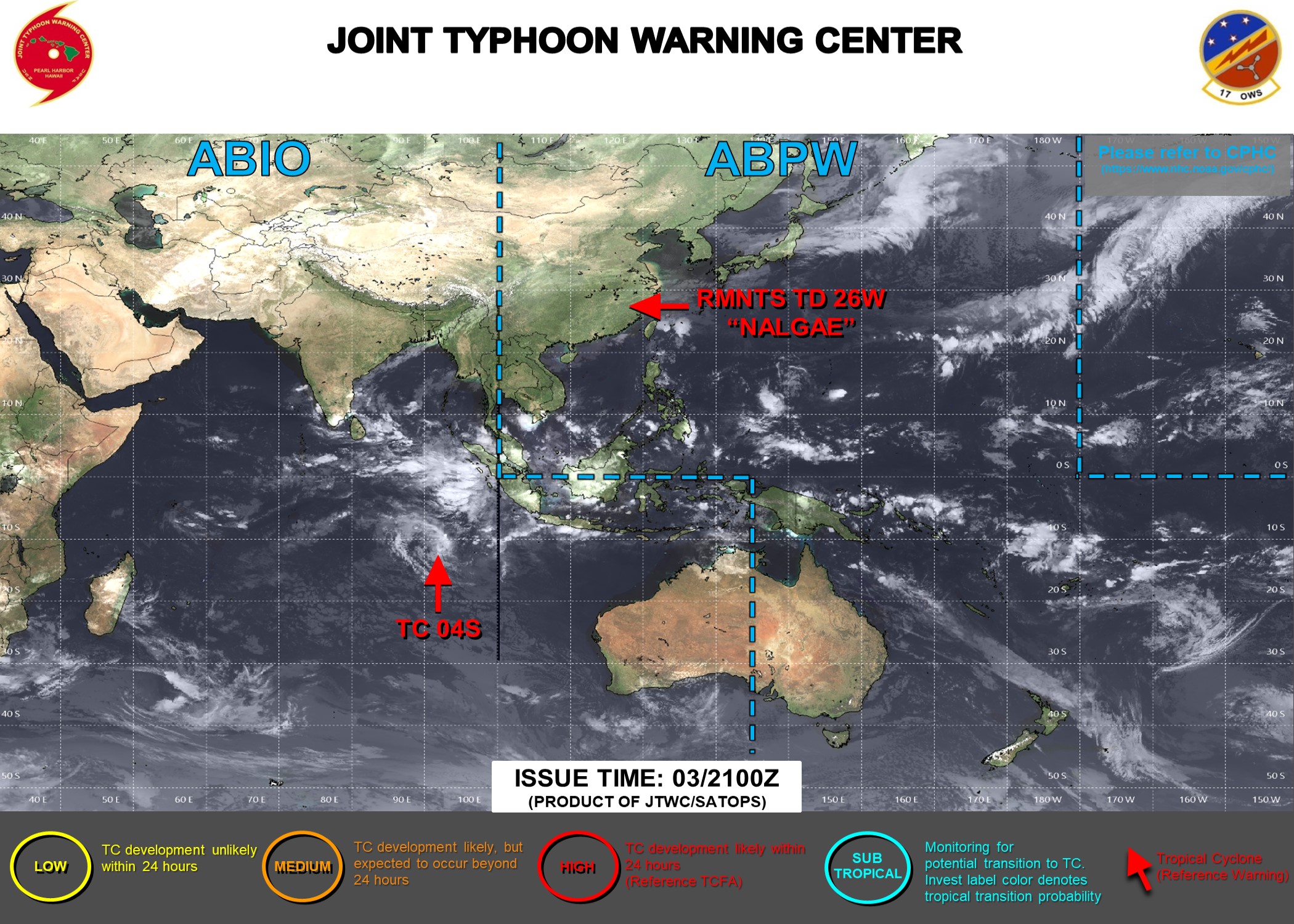
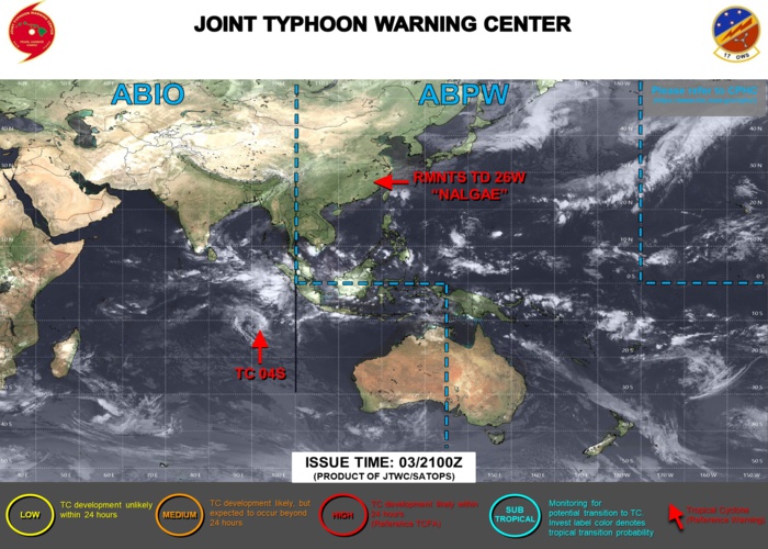
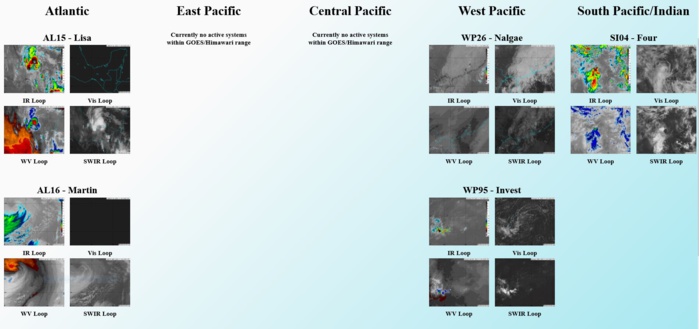
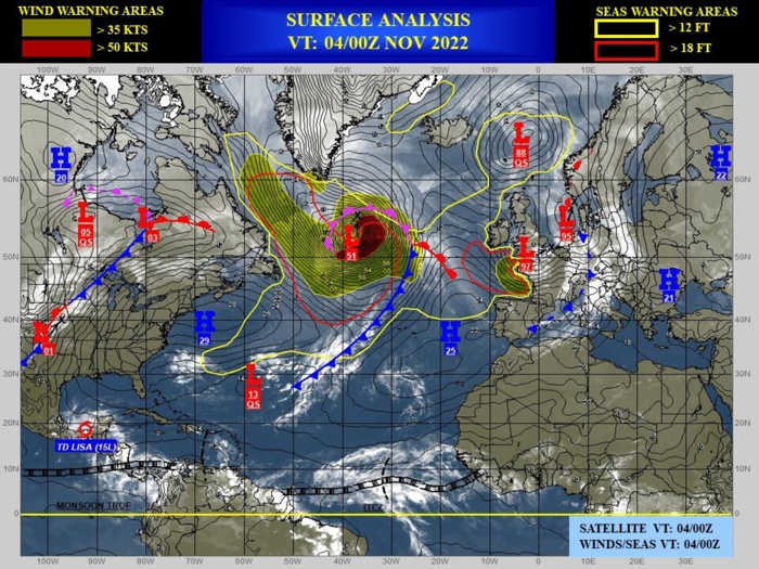
CLICK ON THE IMAGERIES BELOW TO GET THEM ENLARGED
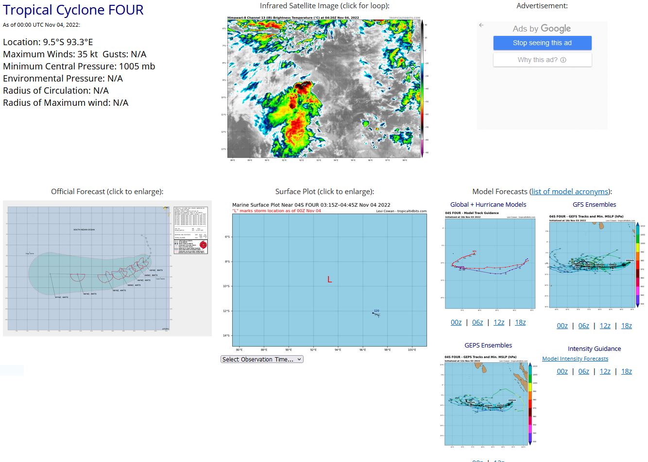
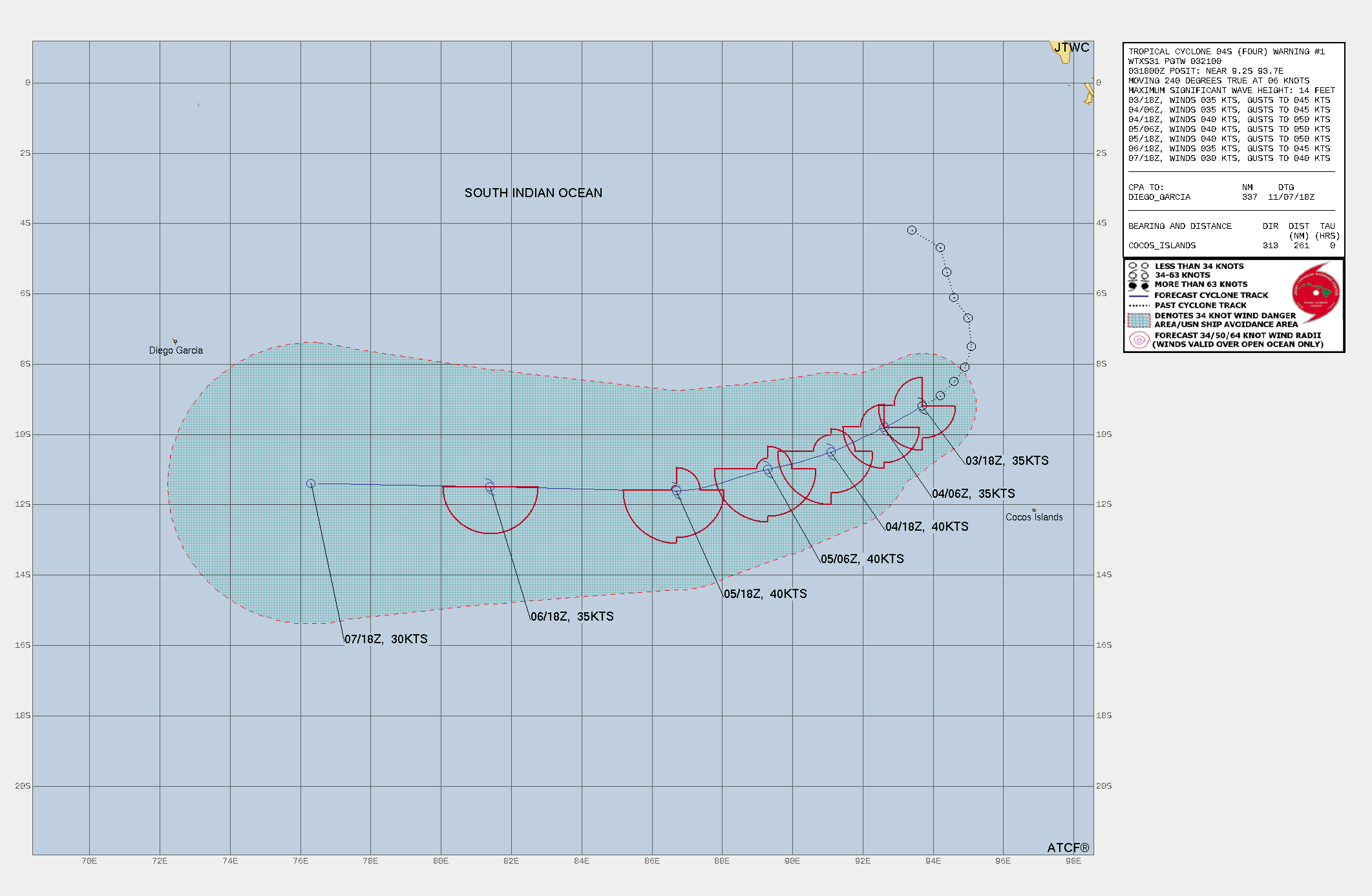
SOUTH INDIAN OCEAN: TC 04S. ESTIMATED LOCATION AND INTENSITY AT 04/00UTC. WARNING 1 ISSUED AT 03/21UTC.
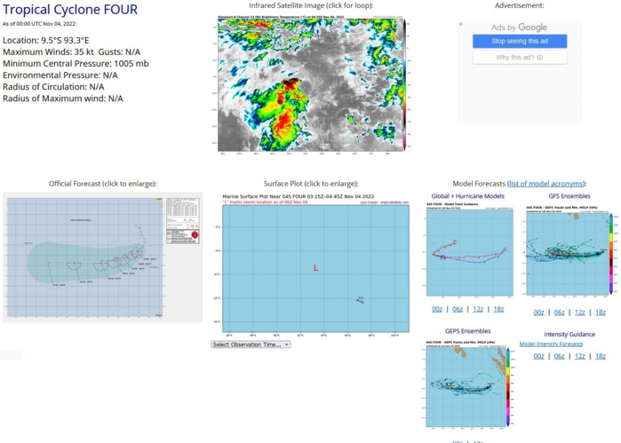
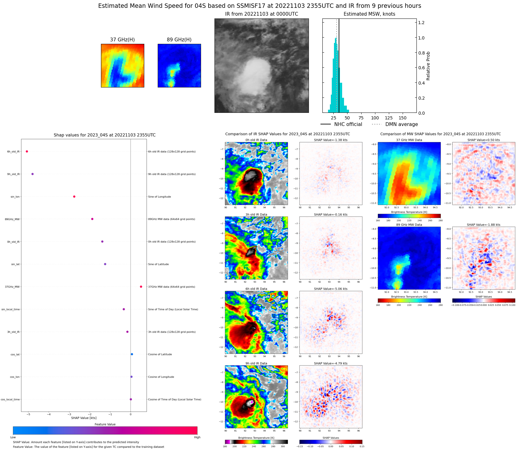
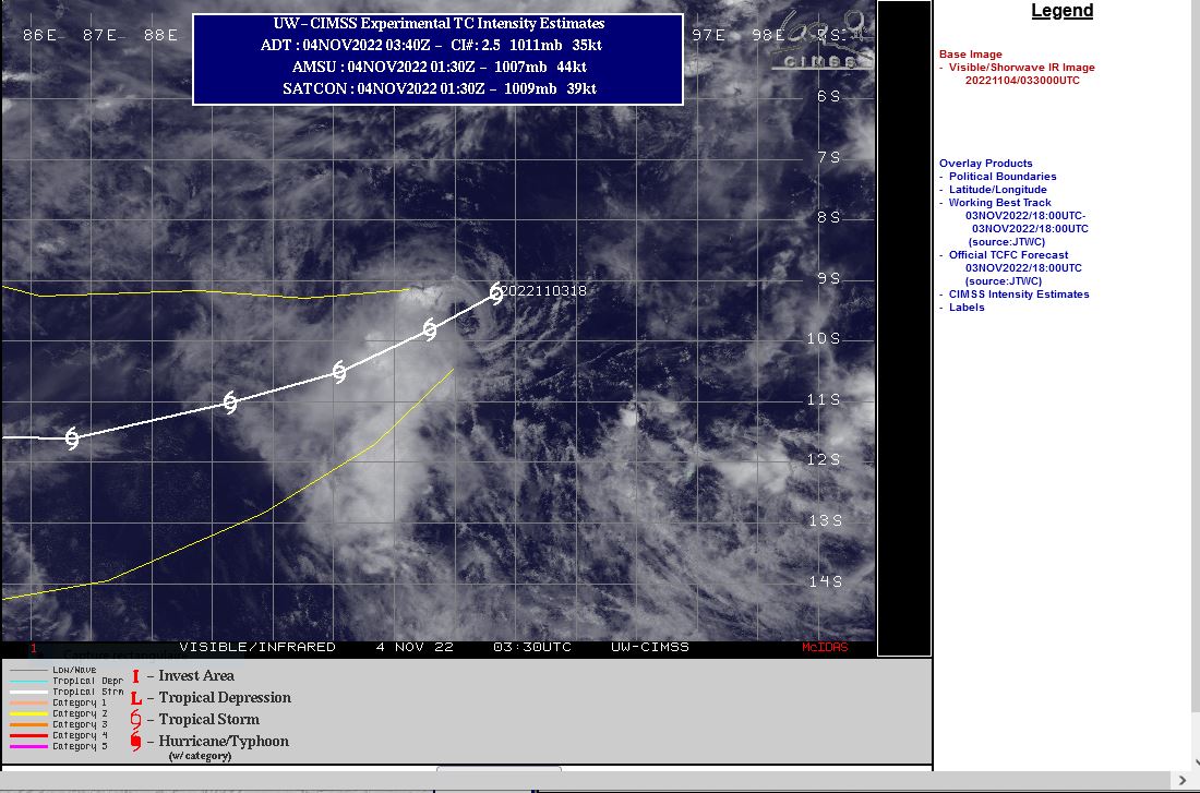
SATELLITE ANALYSIS, INITIAL POSITION AND INTENSITY DISCUSSION: ANIMATED ENHANCED INFRARED (EIR) SATELLITE IMAGERY DEPICTS A PARTIALLY EXPOSED LOW LEVEL CIRCULATION CENTER (LLCC) WHICH IS DISPLACED TO THE NORTHEAST OF AN AREA OF FLARING CONVECTION. A 031504Z AMSU-B 89GHZ MICROWAVE IMAGE REVEALED A DISORGANIZED AREA OF CONVECTION ORIENTED DOWN THE SHEAR VECTOR, AND SHALLOW BANDING FEATURES OUTLINING THE LLCC. THE INITIAL POSITION IS ASSESSED WITH HIGH CONFIDENCE BASED ON THE EXPOSED LLCC IN THE SHORTWAVE INFRARED IMAGERY SUPPORTED BY THE AMSU-B IMAGERY. WHILE THE SYSTEM IS NOT ALL THAT ORGANIZED CONVECTIVELY SPEAKING, A SERIES OF WINDSPEED SENSORS HAVE PASSED OVER THE SYSTEM OVER THE PAST SIX HOURS OR SO, INCLUDING A 031124Z SMOS, 031206 SMAP AND A 031508Z ASCAT-B PASS, AND ALL SHOWED WELL DEFINED LLCC WITH A BAND OF 35-40 KNOT WINDS IN PLACE ACROSS THE SOUTHERN SEMICIRCLE OF THE CIRCULATION, LENDING HIGH CONFIDENCE TO THE INITIAL POSITION. THE SYSTEM IS MOVING TOWARDS THE WEST-SOUTHWEST ALONG THE WESTERN PERIPHERY OF A DEEP SUBTROPICAL RIDGE (STR) CENTERED TO THE EAST. THE ENVIRONMENT IS ASSESSED AS MARGINAL, WITH WARM SSTS AND MODERATE POLEWARD OUTFLOW OFFSET BY MODERATE NORTHEASTERLY VERTICAL WIND SHEAR (VWS).
SH, 04, 2022110112,42S, 934E, 20, 1007, DB
SH, 04, 2022110118,47S, 942E, 20, 1007, DB
SH, 04, 2022110200,54S, 944E, 20, 1006, DB
SH, 04, 2022110206,61S, 946E, 25, 1007, TD
SH, 04, 2022110212,67S, 950E, 25, 1007, TD
SH, 04, 2022110218,75S, 951E, 25, 1004, TD
SH, 04, 2022110300,81S, 949E, 30, 1004, TD
SH, 04, 2022110306,85S, 946E, 30, 1004, TD
SH, 04, 2022110312,89S, 942E, 30, 1004, TD
SH, 04, 2022110318,93S, 939E, 35, 1004, TS
SH, 04, 2022110400,95S, 933E, 35, 1005, TS
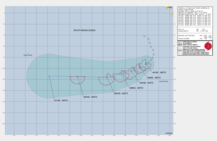
FORECAST REASONING. SIGNIFICANT FORECAST CHANGES: THIS INITIAL PROGNOSTIC REASONING MESSAGE ESTABLISHES THE FORECAST PHILOSOPHY. FORECAST DISCUSSION: TC 04S WILL CONTINUE TRACKING WEST-SOUTHWEST OF THE FIRST 36 HOURS OF THE FORECAST ALONG THE WESTERN SIDE OF THE STR CENTERED TO THE EAST. THE SYSTEM WILL GRADUALLY SLIDE OVER TO A MORE WESTWARD TRAJECTORY AS IT COMES UNDER THE STEERING INFLUENCE OF A STRONG, DEEP STR THAT WILL SET UP SHOP AROUND THE LINE OF THE 20TH LATITUDE. THAT WILL KEEP THE SYSTEM FROM MOVING FURTHER POLEWARD AFTER ABOUT TAU 36. WITH THE LOW LEVEL STRUCTURE BEING AS WELL-DEFINED AS IT IS, WITH A WIND FIELD THAT IS BETTER ORGANIZED THAN THE GLOBAL MODELS ARE DEPICTING, IT HAS A BRIEF WINDOW OF OPPORTUNITY IN WHICH TO INTENSIFY A BIT. THE LATEST IMAGERY SHOWS THE CONVECTION BLOWING OFF RAPIDLY TO THE SOUTHWEST, BUT ANOTHER ROUND OF CONVECTIVE DEVELOPMENT IS LIKELY TO POP-OFF IN THE NEXT 12 TO 24 HOURS. THE ECMWF IN PARTICULAR IS ON BOARD WITH A REDUCTION IN THE NORTHEASTERLY SHEAR COMPONENT AFTER TAU 12, WHICH WILL ALLOW FOR THE SYSTEM TO BECOME MARGINALLY BETTER ORGANIZED AND INTENSIFY UP TO A PEAK OF 40 KNOTS BY TAU 24. CONDITIONS REMAIN STEADY STATE FROM THERE UNTIL ABOUT TAU 48, WHERE SHEAR WILL START PICKING UP ONCE MORE AND THE SYSTEM WILL FEEL THE EFFECTS OF SOME DRY AIR ENTRAINMENT, LEADING TO A SLOW DECREASE IN INTENSITY THROUGH THE REMAINDER OF THE FORECAST. THE SYSTEM IS EXPECTED TO WEAKEN BELOW 35 KNOTS BY TAU 96, BUT THE REMNANT CIRCULATION IS VERY LIKELY TO CONTINUE TRACKING WESTWARD AS A DISTINCT ENTITY FOR SOME TIME AFTERWARDS.
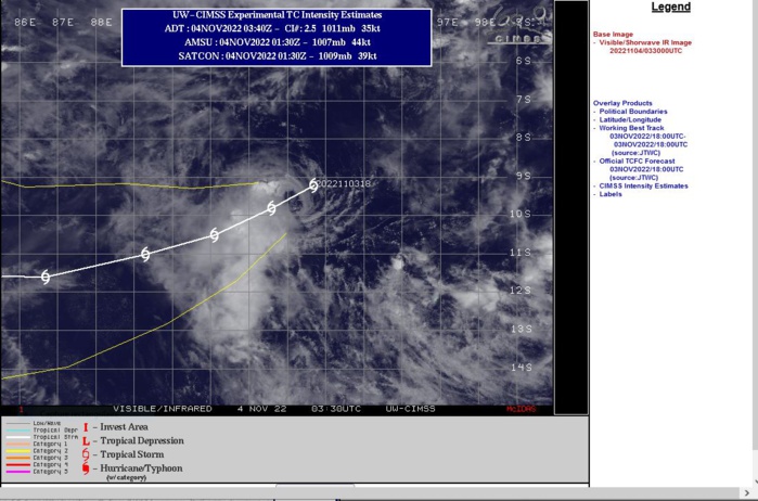
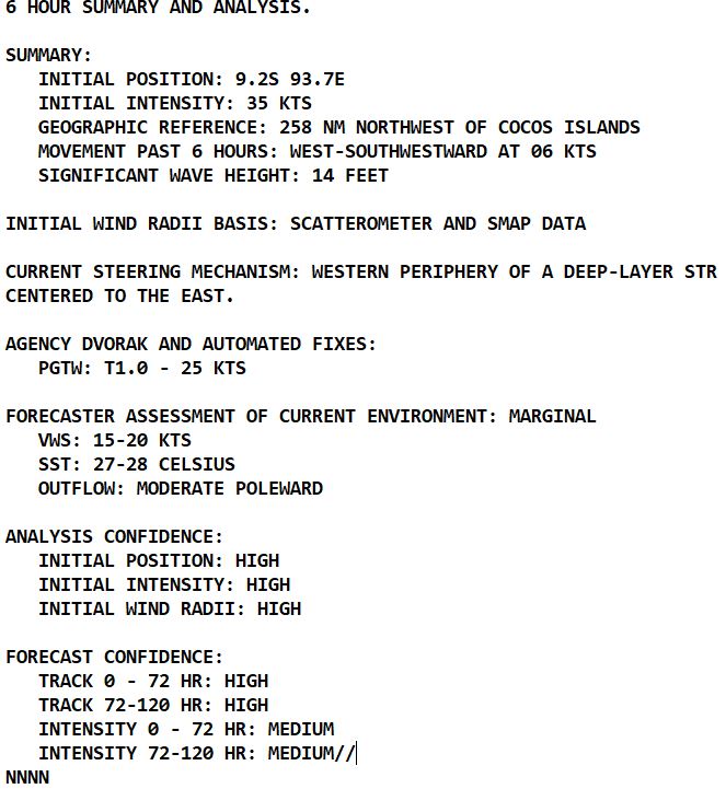
EXPOSED LOW LEVEL CIRCULATION CENTER(LLCC) DEPICTED ON RECENT VISIBLE IMAGERY.
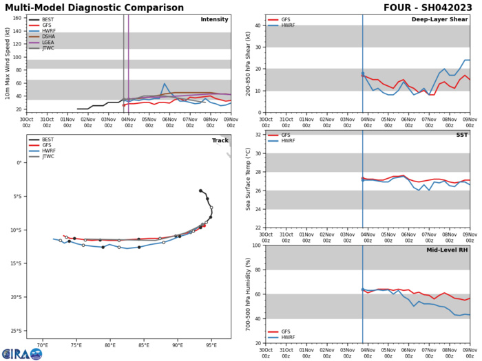
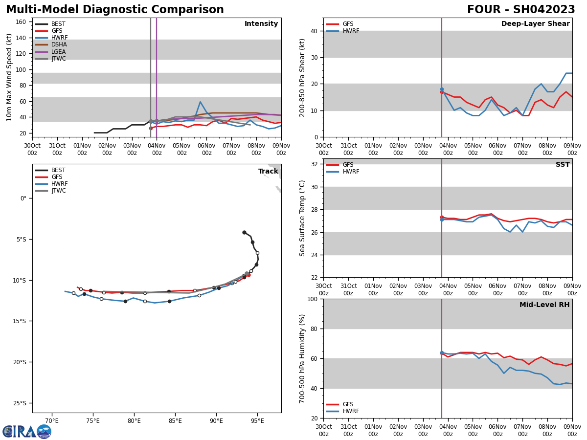
MODEL DISCUSSION: TRACK GUIDANCE IS IN GOOD AGREEMENT, WITH MINIMAL SPREAD IN EITHER THE DETERMINISTIC CONSENSUS MEMBERS OR THE GEFS AND ECENS ENSEMBLES, THROUGH TAU 96. THUS THE JTWC FORECAST, WHICH LIES ON THE NORTHERN SIDE OF THE ENVELOPE, IS PLACED WITH HIGH CONFIDENCE. INTENSITY GUIDANCE IS MIXED, WITH THE DECAY-SHIPS (NAVGEM) INDICATING INTENSIFICATION UP TO 50 KNOTS, WHILE THE MAJORITY OF THE RELIABLE GUIDANCE CONCURS ON A PEAK AROUND 40 KNOTS FOLLOWED BY A SLOW AND GRADUAL WEAKENING THEREAFTER THOUGH THE HWRF WEAKENS THE SYSTEM MORE RAPIDLY THAN THE OTHER GUIDANCE. THE JTWC FORECAST CLOSELY FOLLOWS THE HWRF SOLUTION WITH MEDIUM CONFIDENCE.
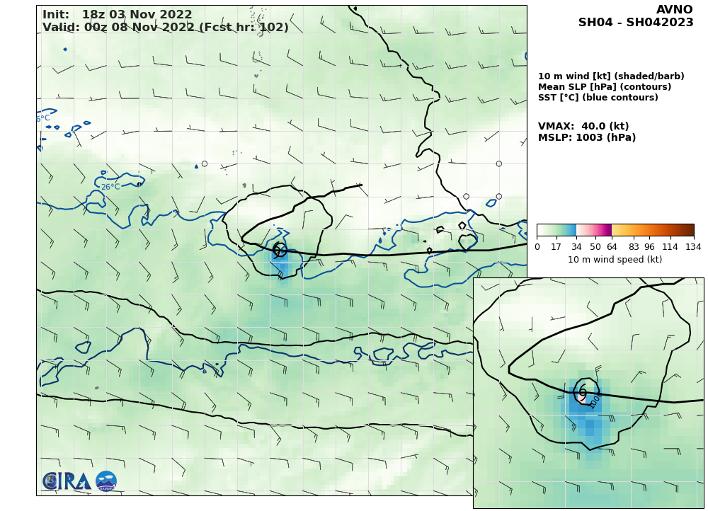
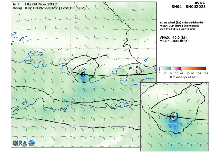
AVN AT 03/18UTC: 40KT AT +102H. ATTACHED IS HWRF.
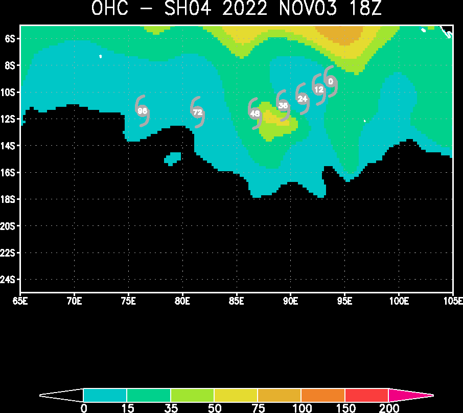
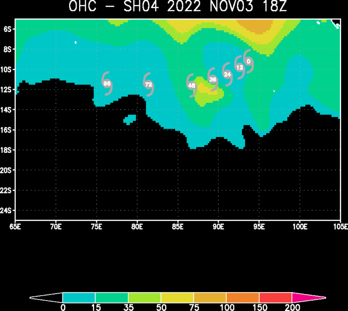
OCEAN HEAT CONTENT
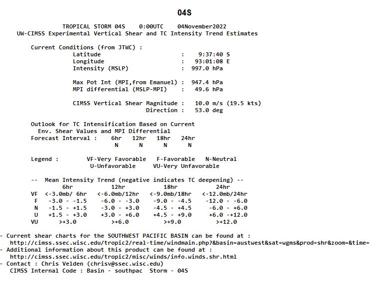
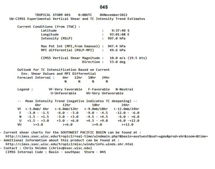
UW-CIMSS Experimental Vertical Shear and TC Intensity Trend Estimates
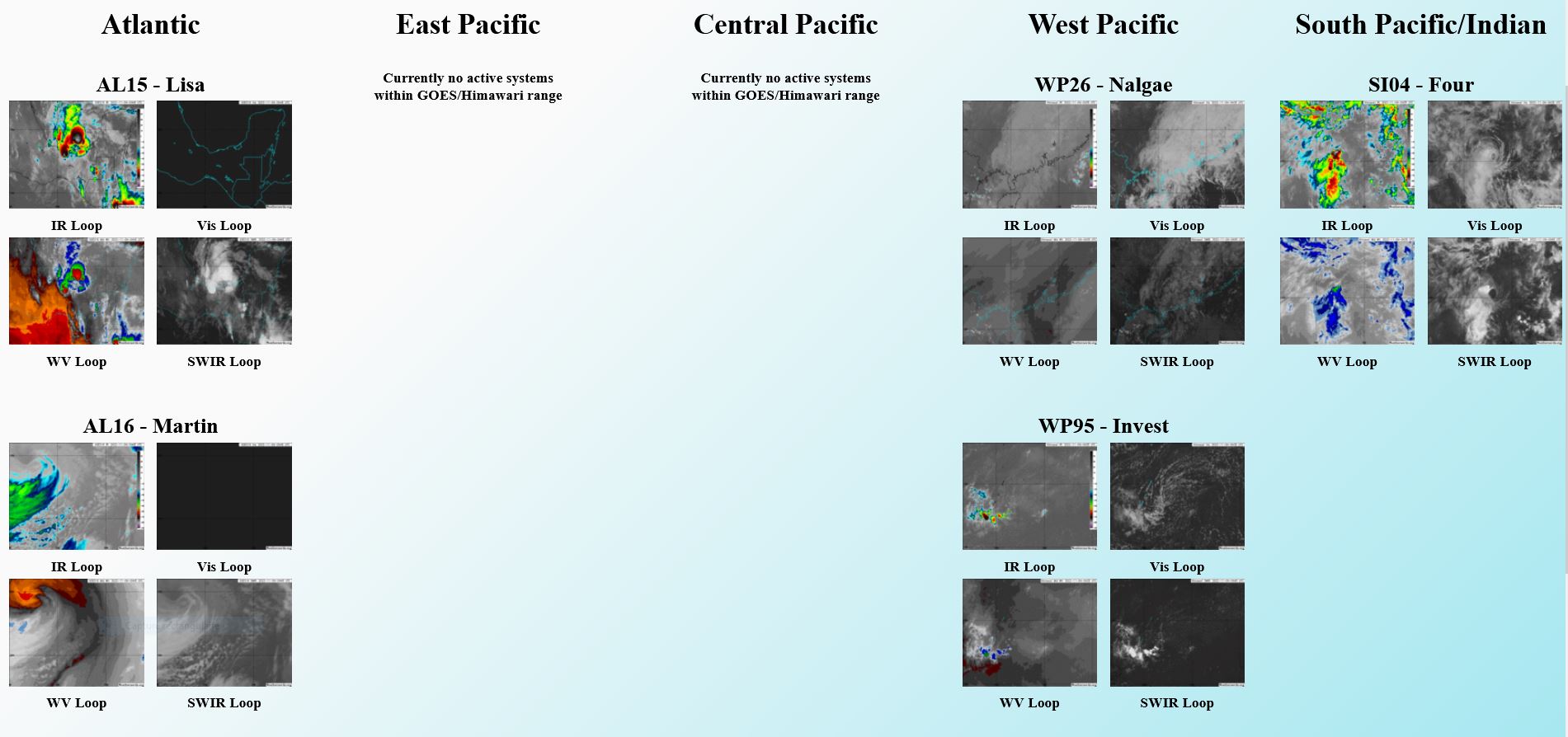
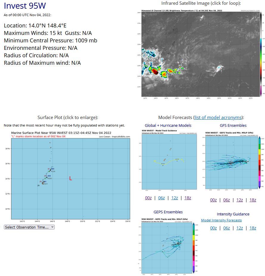
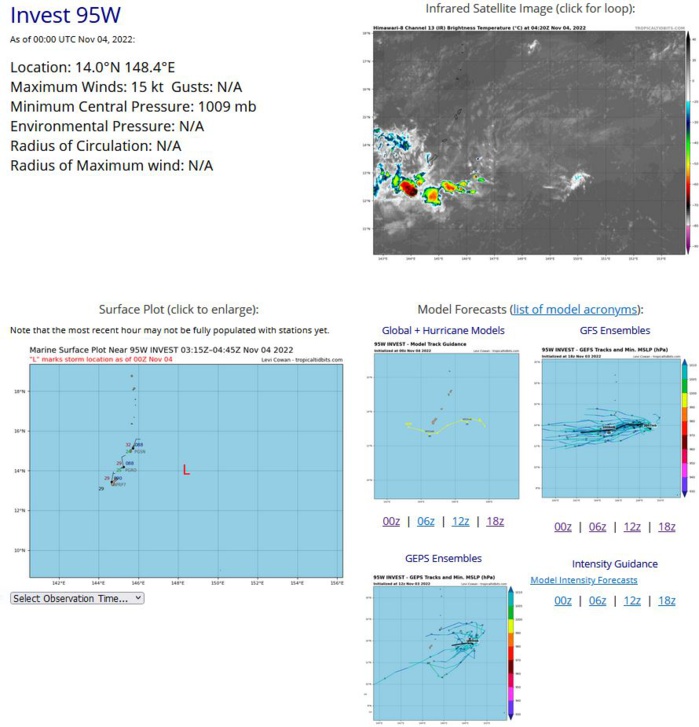
WESTERN NORTH PACIFIC: INVEST 95W. ESTIMATED LOCATION AND INTENSITY AT 04/00UTC.
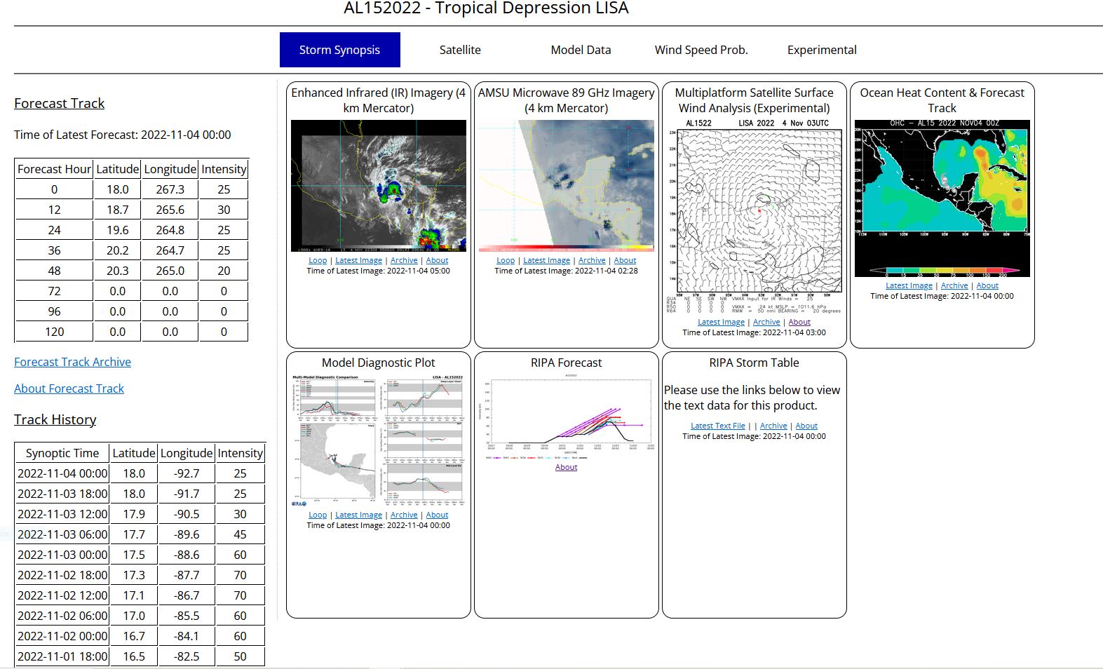
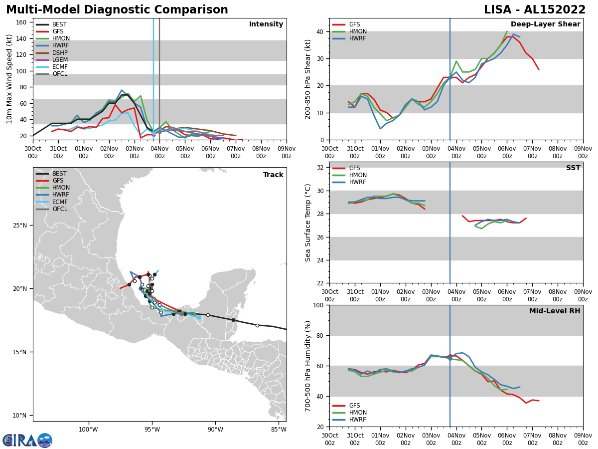
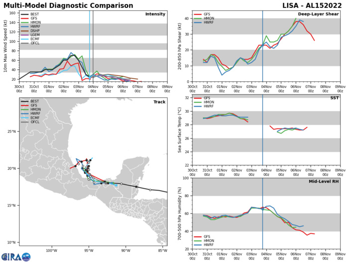
NORTH ATLANTIC OCEAN:TD 15L(LISA). ESTIMATED LOCATION AND INTENSITY AT 04/00UTC. NHC COMMENTS.
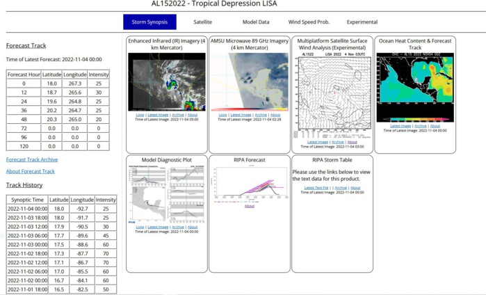
Tropical Depression Lisa Discussion Number 18 NWS National Hurricane Center Miami FL AL152022 1000 PM CDT Thu Nov 03 2022 Satellite imagery, radar data, and surface observations indicate the center of Lisa is still inland over southeastern Mexico. The precipitation associated with the depression has maintained some organization in radar data from Sabancuy tonight. Showers and thunderstorms wrap most of the way around the center, with some fragmented outer bands noted around the northern portion of the circulation offshore of southeastern Mexico. A couple of Pemex buoys in this region have reported sustained winds of 20 kt or so during the past few hours, and the initial intensity of the depression is held at 25 kt for this advisory. Lisa is still moving westward at 275/10 kt. A west-northwestward to northwestward motion is expected on Friday and Friday night as the cyclone moves around a low- to mid-level ridge. Then, the models indicate the shallow vortex will likely stall and meander within the weak low-level environmental flow over the southwestern Gulf. The NHC track forecast is similar to the previous one and remains near the multi-model consensus aids. Although Lisa is forecast to emerge over the warm waters of the Bay of Campeche early Friday, strong south-southwesterly upper-level winds and drier mid-level air should inhibit any significant development. In fact, model-simulated satellite imagery from the GFS and ECMWF show all convection being stripped away from the center during the next 24-48 h by 25-30 kt of deep-layer shear. Therefore, the official intensity forecast keeps Lisa a depression, and it calls for the cyclone to become a remnant low in 48 h and dissipate on Sunday night. Key Messages: 1. Isolated flash flooding is possible across portions of southeastern Mexico. FORECAST POSITIONS AND MAX WINDS INIT 04/0300Z 18.1N 93.1W 25 KT 30 MPH...INLAND 12H 04/1200Z 18.7N 94.4W 30 KT 35 MPH...OVER WATER 24H 05/0000Z 19.6N 95.2W 25 KT 30 MPH 36H 05/1200Z 20.2N 95.3W 25 KT 30 MPH 48H 06/0000Z 20.3N 95.0W 20 KT 25 MPH...POST-TROP/REMNT LOW 60H 06/1200Z 19.8N 95.0W 20 KT 25 MPH...POST-TROP/REMNT LOW 72H 07/0000Z...DISSIPATED $$ Forecaster Reinhart
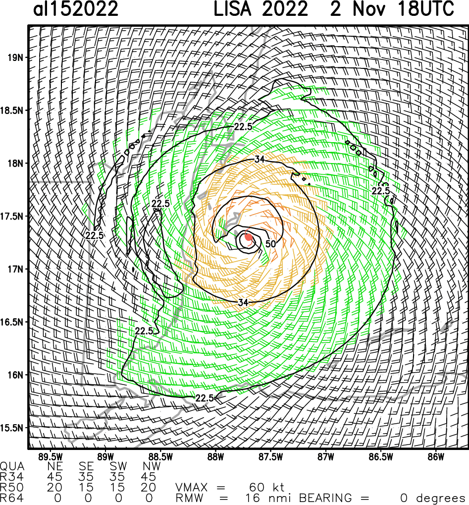
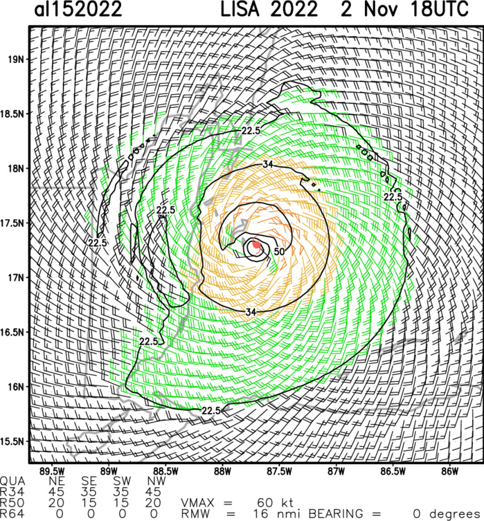
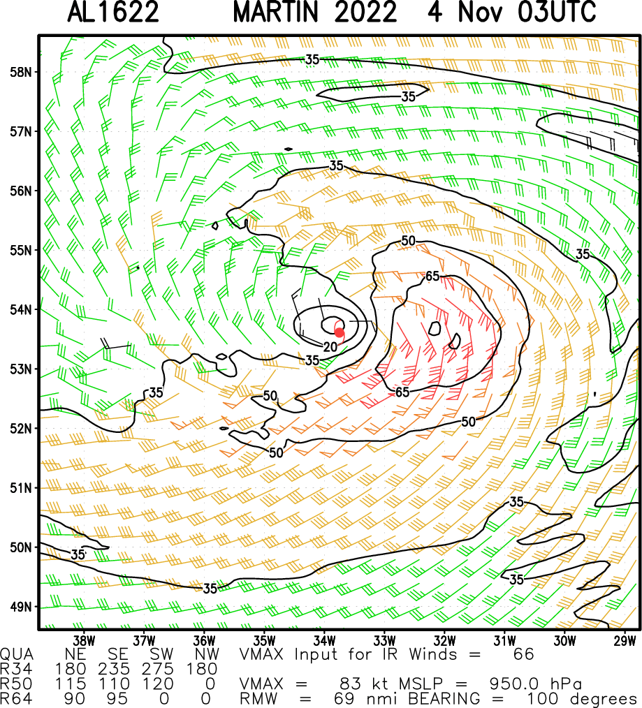
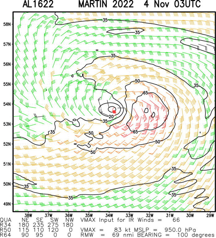
Aircraft-based Tropical Cyclone Surface Wind Analysis
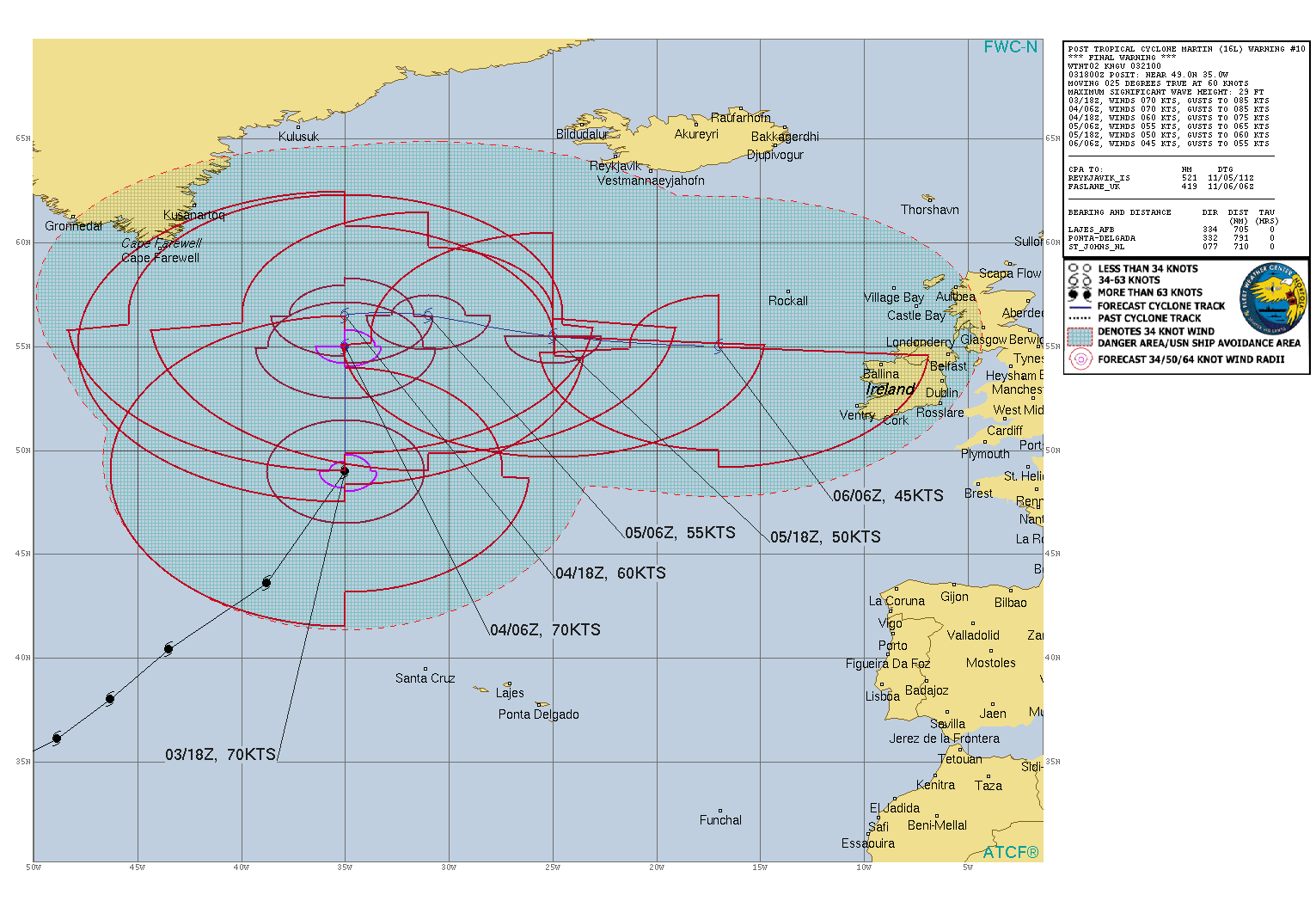
NORTH ATLANTIC OCEAN:PTC 16L(MARTIN). WARNING 10/FINAL ISSUED AT 03/21UTC. NHC COMMENTS.
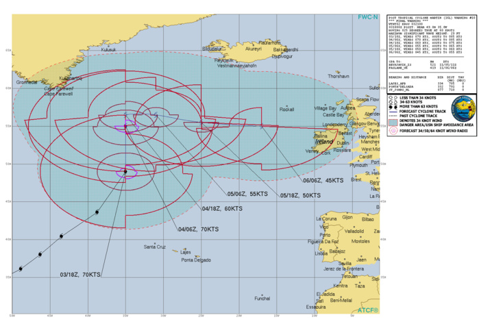
Post-Tropical Cyclone Martin Discussion Number 10 NWS National Hurricane Center Miami FL AL162022 900 PM GMT Thu Nov 03 2022 ASCAT-C data that was not available until after the issuance of the last advisory, but was valid at 1317 UTC, showed that Martin likely became frontal earlier today and the system no longer has a well-defined circulation. In addition, both TAFB and SAB evaluated the system as extratropical at 1800 UTC. Therefore, Martin is now classified as post-tropical and this will be the last NHC advisory. While Martin does not currently appear to have a well-defined center, the powerful post-tropical cyclone is expected to redevelop a well-defined center as it occludes over the next 12 to 24 h. Martin is moving at a remarkable clip of 50 kt, but should begin to slow down soon and turn north-northwestward during the next few hours. After that, the cyclone is forecast to move relatively slowly on Friday before picking up speed toward the east-southeast or east through the early weekend. Martin's maximum winds are still forecast to slowly decrease over the next few days, however the combination of Martin and other non-tropical low pressure systems are still expected to produce hazardous wind and seas over a very wide area of the North Atlantic for the next couple of days. Additional information on marine hazards can be found in High Seas Forecasts issued by the National Weather Service, the UK Met Office, and Meteo France. Links to each product are provided below. * National Weather Service: AWIPS Header NFDHSFAT1, WMO header FZNT01 KWPC, and online at ocean.weather.gov/shtml/NFDHSFAT1.php * UK Met Office: WMO header FQNT21 EGRR and online at www.metoffice.gov.uk/weather/specialist-forecasts/coast-and-sea/high -seas-forecast/ * Meteo France: WMO header FQNT50 LFPW and online at www.meteofrance.com/previsions-meteo-marine/bulletin/grandlarge/ metarea2. FORECAST POSITIONS AND MAX WINDS INIT 03/2100Z 50.5N 34.5W 70 KT 80 MPH...POST-TROPICAL 12H 04/0600Z 55.0N 35.0W 70 KT 80 MPH...POST-TROP/EXTRATROP 24H 04/1800Z 56.5N 35.0W 60 KT 70 MPH...POST-TROP/EXTRATROP 36H 05/0600Z 56.5N 31.0W 55 KT 65 MPH...POST-TROP/EXTRATROP 48H 05/1800Z 55.5N 25.0W 50 KT 60 MPH...POST-TROP/EXTRATROP 60H 06/0600Z 55.0N 17.0W 45 KT 50 MPH...POST-TROP/EXTRATROP 72H 06/1800Z...DISSIPATED $$ Forecaster D. Zelinsky
