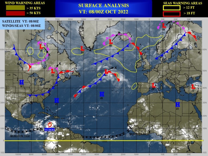
CLICK ON THE IMAGERIES BELOW TO GET THEM ENLARGED
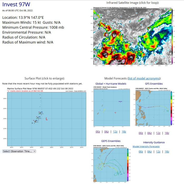
WESTERN NORTH PACIFIC: INVEST 97W. ESTIMATED LOCATION AND INTENSITY AT 08/06UTC.
WP, 97, 2022100718,130N, 1465E, 15, 1010, DB
WP, 97, 2022100800,135N, 1468E, 15, 1010, DB
WP, 97, 2022100806,139N, 1470E, 15, 1008, DB
WP, 97, 2022100800,135N, 1468E, 15, 1010, DB
WP, 97, 2022100806,139N, 1470E, 15, 1008, DB
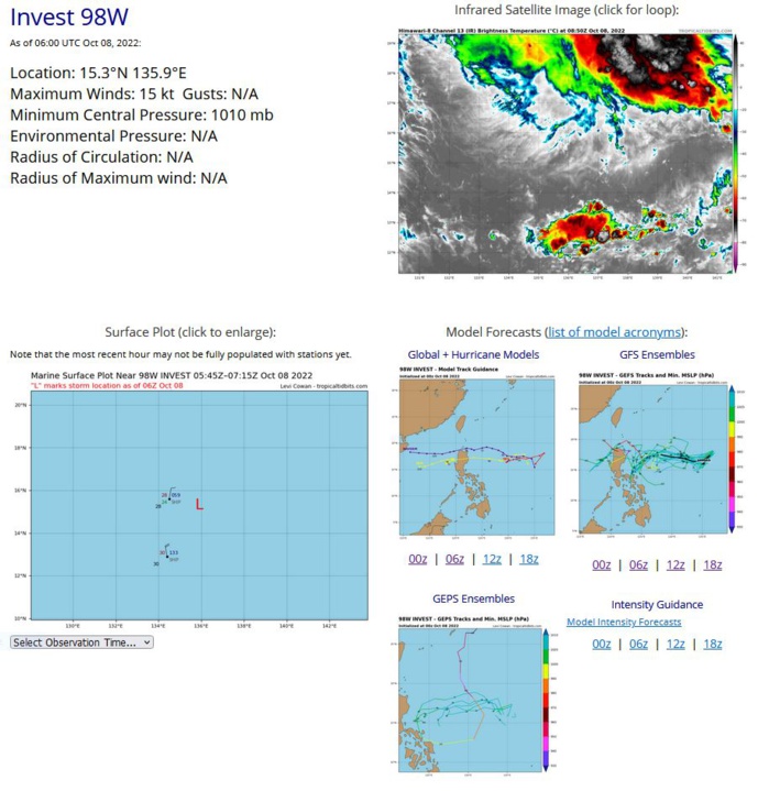
WESTERN NORTH PACIFIC: INVEST 98W. ESTIMATED LOCATION AND INTENSITY AT 08/06UTC.
WP, 98, 2022100718,147N, 1374E, 15, 1005, DB
WP, 98, 2022100800,150N, 1367E, 15, 1005, DB
WP, 98, 2022100806,153N, 1359E, 15, 1010, DB
WP, 98, 2022100800,150N, 1367E, 15, 1005, DB
WP, 98, 2022100806,153N, 1359E, 15, 1010, DB
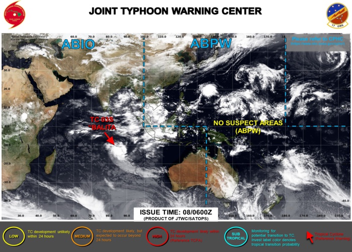
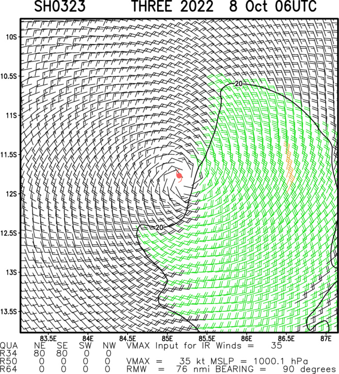
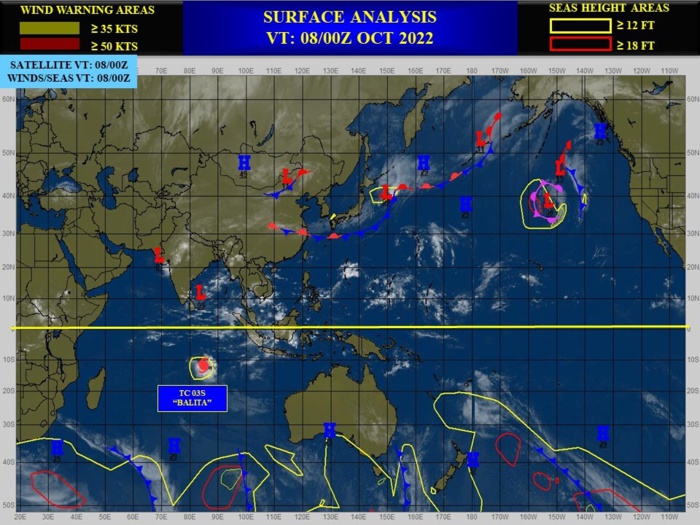
SOUTH INDIAN OCEAN: TC 03S(BALITA). ESTIMATED LOCATION AND INTENSITY AT 08/06UTC. WARNING 5 ISSUED AT 08/03UTC.
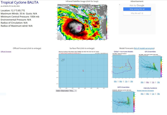
SATELLITE ANALYSIS, INITIAL POSITION AND INTENSITY DISCUSSION: ANIMATED ENHANCED INFRARED (EIR) SATELLITE IMAGERY DEPICTS A GROWING REGION OF DEEP CONVECTIVE ACTIVITY FULLY OBSCURING THE LOW LEVEL CIRCULATION CENTER. A 072159Z SSMIS 91GHZ MICROWAVE IMAGE REVEALS A FRAGMENTED ALBEIT IMPROVED PRIMARY CONVECTIVE BAND AND TIGHTLY WRAPPING LOW LEVEL CLOUD LINES IN ALL QUADRANTS. THE INITIAL POSITION IS PLACED WITH MEDIUM CONFIDENCE BASED ON EIR AND SSMIS IMAGERY. THE INITIAL INTENSITY OF 35 KTS IS ASSESSED WITH MEDIUM CONFIDENCE BASED ON DVORAK INTENSITY ESTIMATES AND CIMSS AUTOMATED INTENSITY ESTIMATES INDICATING A RANGE FROM 32KTS - 45KTS.
SH, 03, 2022100600,95S, 867E, 35, 1001, TS
SH, 03, 2022100606,95S, 865E, 35, 998, TS
SH, 03, 2022100612,94S, 863E, 35, 999, TS
SH, 03, 2022100618,94S, 861E, 35, 998, TS
SH, 03, 2022100700,96S, 855E, 35, 1000, TS
SH, 03, 2022100706,99S, 851E, 35, 1001, TS
SH, 03, 2022100712,105S, 851E, 35, 1000, TS
SH, 03, 2022100718,111S, 853E, 35, 1001, TS
SH, 03, 2022100800,116S, 855E, 35, 1002, TS
SH, 03, 2022100806,121S, 857E, 35, 1004, TS
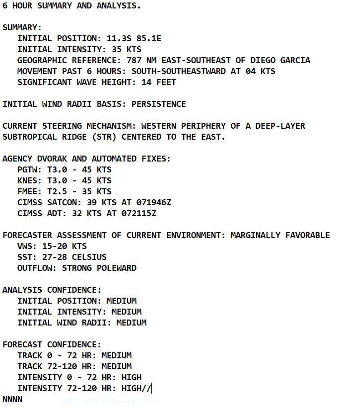
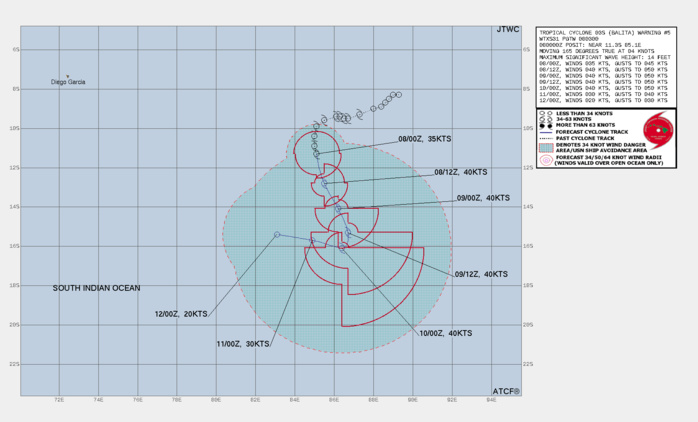
FORECAST REASONING. SIGNIFICANT FORECAST CHANGES: THERE ARE NO SIGNIFICANT CHANGES TO THE FORECAST FROM THE PREVIOUS WARNING. FORECAST DISCUSSION: TC 03S (BALITA) CONTINUES ITS GENERALLY SOUTHWARD MARCH UNDER THE STEERING INFLUENCE OF THE STR TO THE EAST. AS EVIDENCED BY THE IMPROVED CONVECTIVE ENVELOPE, 03S IS ENTERING A SHORT WINDOW OF POSSIBLE RE-INTENSIFICATION BACK TO 40KTS. OVER THE NEXT 12 HOURS, AS THE SYSTEM NEARS THE STR AXIS, VERTICAL WIND SHEAR (VWS) VALUES ARE PROJECTED TO DROP POTENTIALLY ALLOWING THE STRONG OUTFLOW AND CONVECTIVE RECONSOLIDATION TO BOOST INTENSITY. BY TAU 24 AND THROUGH TAU 36, 03S WILL BE ON A SOUTH-SOUTHEASTWARD COURSE DUE TO A PASSING 500MB TROUGH REORIENTING THE STEERING RIDGE. BY TAU 48 THE SYSTEM WILL EXECUTE A HARD WESTWARD TURN AS SHEAR VALUES INCREASE, DRY AIR ENTRAINMENT INTENSIFIES AND OHC VALUES DROP. THESE FACTORS COALESCE TO STEADILY WEAKEN THE SYSTEM THROUGH TAU 72 AND RESULT IN FULL DISSIPATION BY TAU 96.
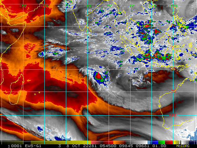
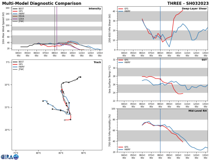
MODEL DISCUSSION: NUMERICAL MODEL GUIDANCE IS IN FAIR AGREEMENT ABOUT THE OVERALL TRAJECTORY OF 03S THOUGH CROSS TRACK AND ALONG TRACK VARIABILITY DOES INCREASE WITH TIME. NAVGEM IS A CLEAR SOUTHERLY OUTLIER WITH THE BULK OF THE GUIDANCE INDICATING A 150NM WIDE SPREAD AS VARIOUS MODELS EXECUTE THE WESTWARD TURN, AFTER WHICH ALONG TRACK SPREAD BECOMES DOMINATE. FOR THESE REASONS THE JTWC FORECAST TRACK IS PLACED WITH MEDIUM CONFIDENCE. RELIABLE MODEL INTENSITY GUIDANCE IS IN GOOD AGREEMENT WITH THE JTWC FORECAST INTENSITY. ALL MEMBERS INDICATE THAT 03S WILL BRIEFLY INTENSIFY FOLLOWED BY A STAGNATION PERIOD AND FINALLY WEAKENING UNTIL DISSIPATION. AS A RESULT THE JTWC FORECAST INTENSITY IS PLACED WITH HIGH CONFIDENCE.
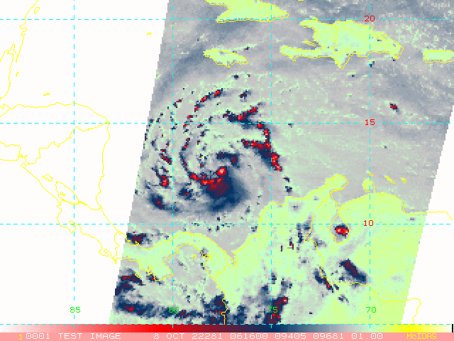
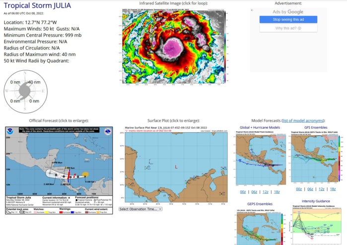
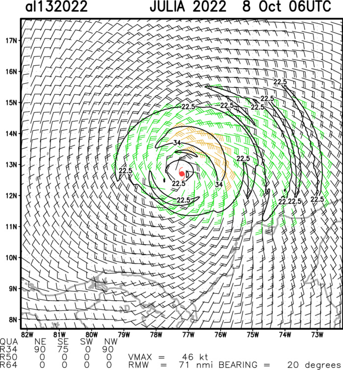
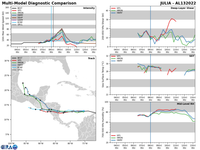
NORTH ATLANTIC: TS 13L(JULIA). ESTIMATED LOCATION AND INTENSITY AT 08/06UTC. WARNING 8 ISSUED AT 08/09UTC. NHC COMMENTS.
AL, 13, 2022100700,118N, 691W, 30, 1004, TD
AL, 13, 2022100706,121N, 706W, 30, 1004, TD
AL, 13, 2022100712,125N, 723W, 35, 1002, TS
AL, 13, 2022100718,129N, 739W, 35, 1002, TS
AL, 13, 2022100800,128N, 753W, 40, 999, TS
AL, 13, 2022100806,127N, 772W, 50, 999, TS
AL, 13, 2022100706,121N, 706W, 30, 1004, TD
AL, 13, 2022100712,125N, 723W, 35, 1002, TS
AL, 13, 2022100718,129N, 739W, 35, 1002, TS
AL, 13, 2022100800,128N, 753W, 40, 999, TS
AL, 13, 2022100806,127N, 772W, 50, 999, TS
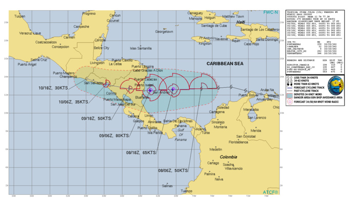
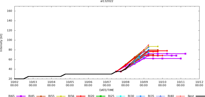
WTNT43 KNHC 080852 TCDAT3 Tropical Storm Julia Discussion Number 8 NWS National Hurricane Center Miami FL AL132022 500 AM EDT Sat Oct 08 2022 Julia is a strengthening tropical cyclone. Satellite imagery has shown an increase in persistent and deep convection occurring over the center, with an expanding area of cloud top temperatures colder than -80 deg C. Overnight data from the Air Force Hurricane Hunters indicated the vertical structure of Julia is still organizing, with evidence of multiple low-level centers noted in the 850-mb flight level wind data. But, the aircraft reported flight-level winds of 59 kt and believable SFMR retrievals of 45-50 kt on its last pass through the northeastern quadrant of the cyclone. Based on these data, the initial intensity is set at 50 kt for this advisory. Weak deep-layer shear, abundant mid-level moisture, and SSTs around 29.5 degrees Celsius appear conducive for steady to rapid intensification of Julia during the next 24 h as it approaches Central America. In fact, the SHIPS Rapid Intensification Index shows a 63 percent chance of a 30 kt increase in intensity during the next 24 h. Given the strengthening noted tonight and the improved satellite structure, the NHC forecast calls for Julia to rapidly intensify into a hurricane later today and continue strengthening through landfall on Sunday. This forecast lies between the multi-model consensus aids and the stronger SHIPS and LGEM guidance. After landfall, the cyclone is forecast to weaken as it moves across the terrain of Central America. The estimated initial motion is westward at 265/16 kt. Julia is expected to continue moving quickly westward for the next day or so along the southern periphery of a strong mid-level ridge to its north. This motion should bring the center of Julia near San Andres and Providencia Islands this evening and over the coast of Nicaragua within the warning area early Sunday. Based on a southward shift in the track guidance, the NHC forecast has been adjusted in that direction to bring it closer to the multi-model consensus. As a result, the government of Nicaragua has extended Hurricane and Tropical Storm Warnings southward along the coast. There is still above average uncertainty regarding the future of Julia after landfall. While some models (HWRF, HMON, GFS) show the center largely remaining over land and dissipating, others (ECMWF and UKMET) show low-level vorticity associated with Julia or its remnants emerging over the eastern Pacific waters early next week. While it appears unlikely that the surface circulation would survive the topography of Nicaragua, this scenario could become more likely if there are additional southward adjustments to the track. For now, the NHC forecast shows weakening and dissipation by 72 h near the coast of Central America, but interests along the Pacific coasts of El Salvador, Honduras, and Nicaragua should monitor forecast updates. Regardless, the set up is likely to lead to heavy rains over Central America for several days, which could cause life-threatening flash floods and mudslides, especially in areas of mountainous terrain. Key Messages: 1. Julia is forecast to strengthen into a hurricane later today, and a Hurricane Warning is in effect for portions of the Nicaragua coast and the islands of Providencia and San Andres. Hurricane-force winds and a dangerous storm surge are expected in areas where the core of the system crosses the islands tonight and moves onshore in Nicaragua on Sunday. 2. Life-threatening flash flooding and mudslides are expected across portions of Central America this weekend. Flash flooding is possible across the Isthmus of Tehuantepec in Mexico early next week.
Aircraft-based Tropical Cyclone Surface Wind Analysis
