CLICK ON THE IMAGERIES BELOW TO GET THEM ENLARGED
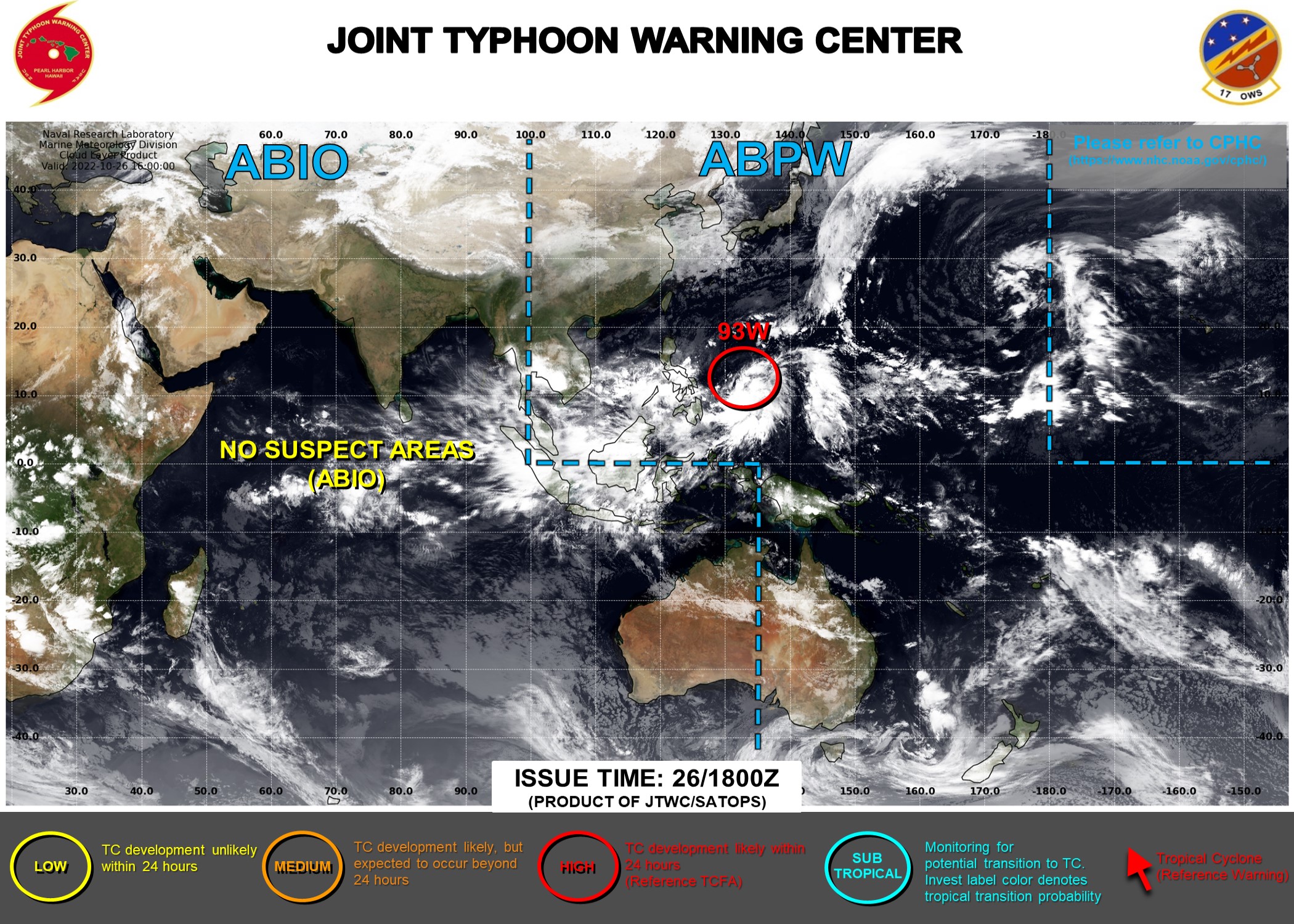
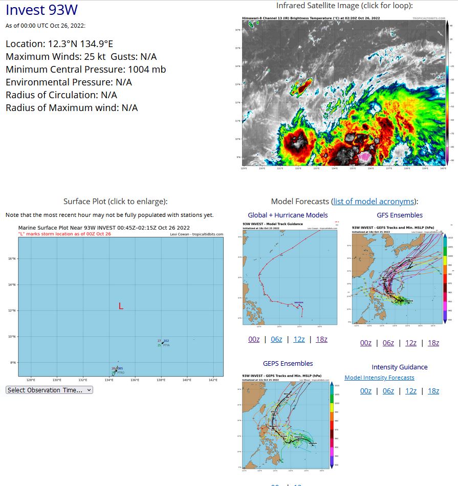
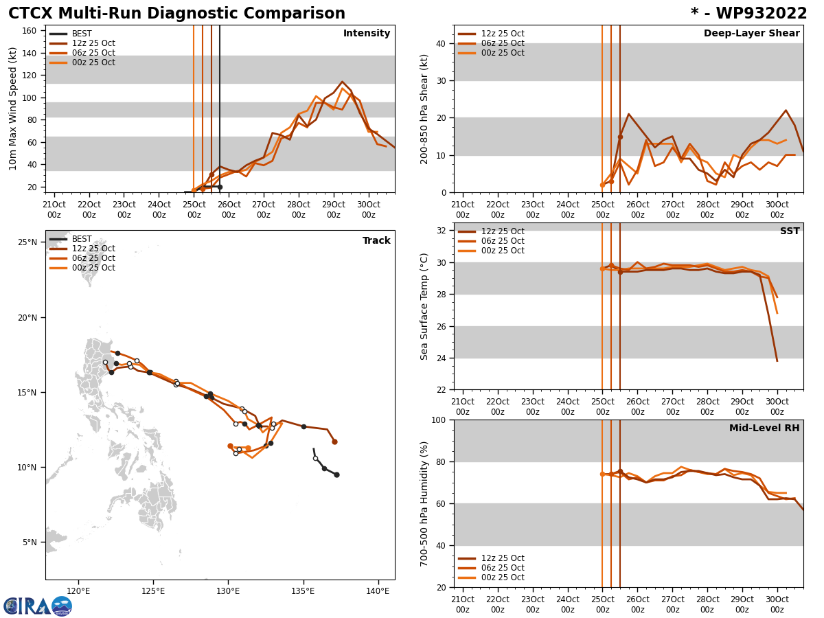
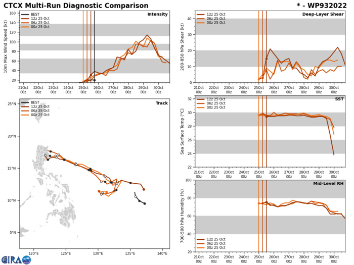
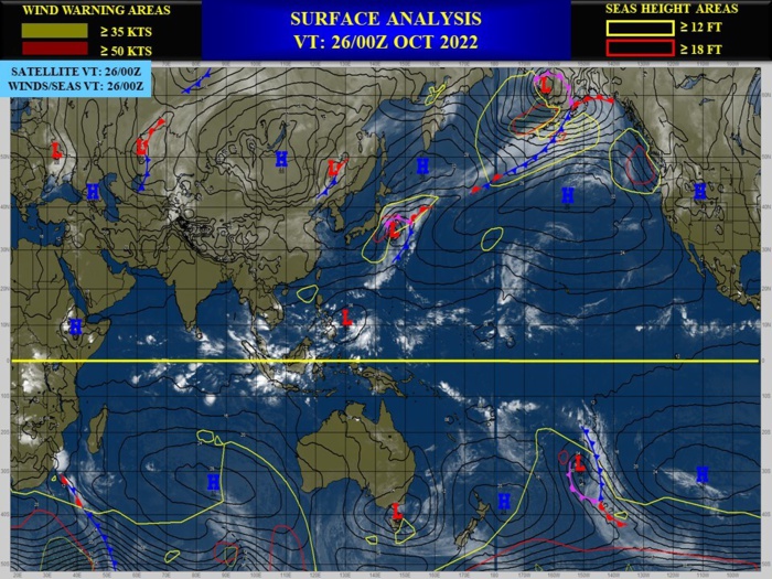
WESTERN NORTH PACIFIC: INVEST 93W. ESTIMATED LOCATION AND INTENSITY AT 26/00UTC.
WP, 93, 2022102418,95N, 1372E, 15, 1010, DB
WP, 93, 2022102500,99N, 1364E, 15, 1006, DB
WP, 93, 2022102506,103N, 1361E, 20, 1006, DB
WP, 93, 2022102512,106N, 1358E, 20, 1005, DB
WP, 93, 2022102518,112N, 1357E, 20, 1003, DB
WP, 93, 2022102600,123N, 1349E, 25, 1004, DB
WP, 93, 2022102500,99N, 1364E, 15, 1006, DB
WP, 93, 2022102506,103N, 1361E, 20, 1006, DB
WP, 93, 2022102512,106N, 1358E, 20, 1005, DB
WP, 93, 2022102518,112N, 1357E, 20, 1003, DB
WP, 93, 2022102600,123N, 1349E, 25, 1004, DB
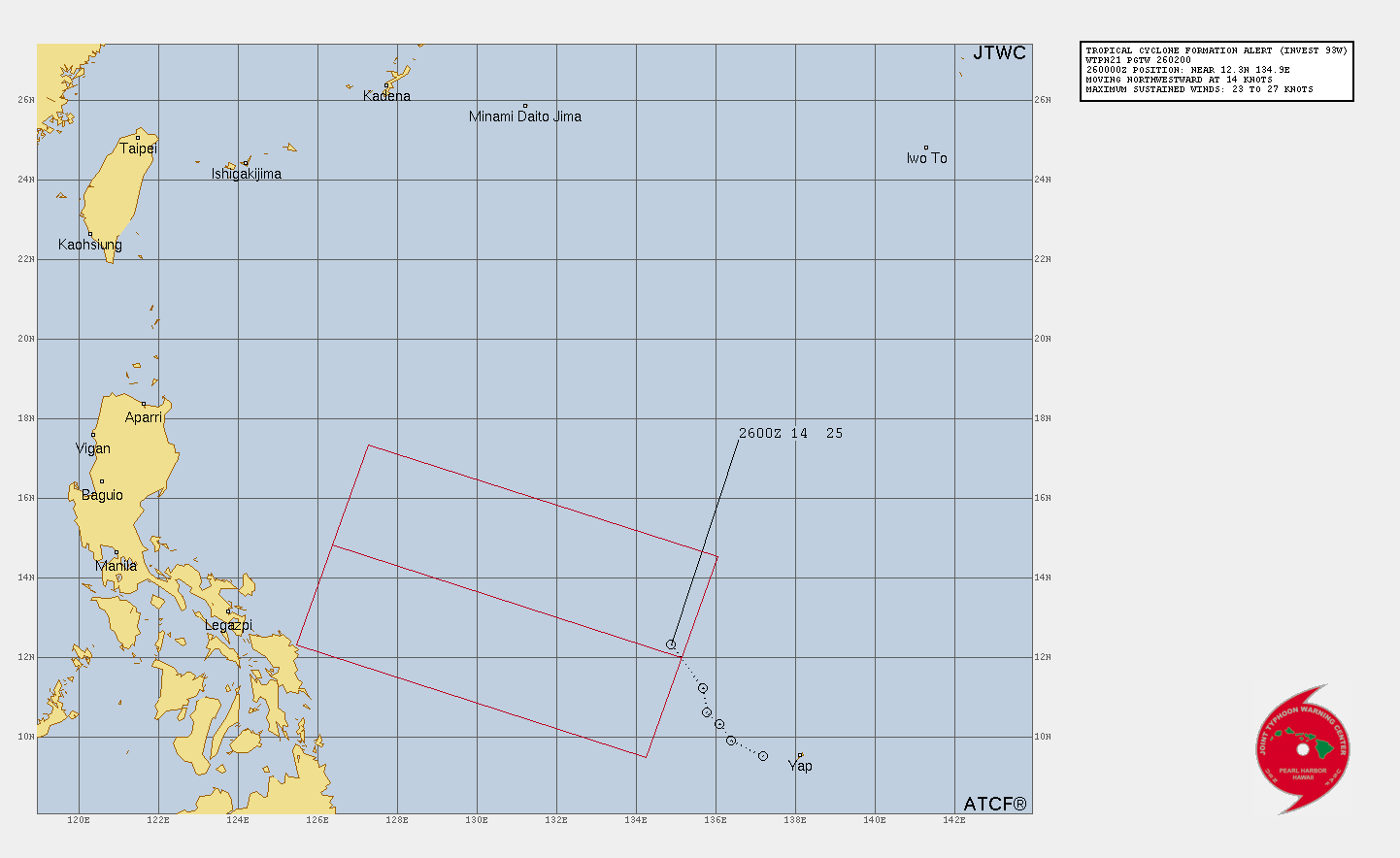
TROPICAL CYCLONE FORMATION ALERT ISSUED AT 26/0230UTC.
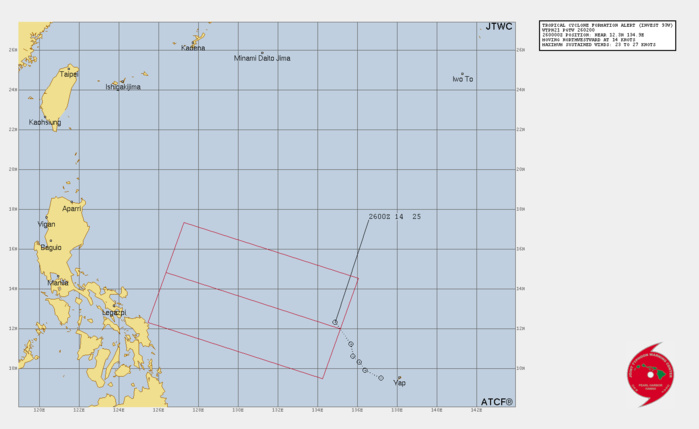
THE AREA OF CONVECTION (INVEST 93W) PREVIOUSLY LOCATED NEAR 11.6N 130.2E IS NOW LOCATED NEAR 12.3N 134.9E, APPROXIMATELY 935 NM SOUTH-SOUTHEAST OF KADENA, JAPAN. ANIMATED MULTISPECTRAL IMAGERY (MSI) DEPICTS A CONSOLIDATING LOW LEVEL CIRCULATION WITH FLARING, DISORGANIZED CONVECTIVE BANDING EXTENDING IN A SOUTHWEST TO NORTHEAST ORIENTATION IN THE SOUTHERN HALF OF THE SYSTEM. A 260011Z ASCAT METOP-B PASS REVEALS A NICE SIZED WIND FIELD OF 15-20 KNOTS WRAPPING TOWARDS THE LLCC WITH A PLETHORA OF 25-30 KNOTS WINDS EMBEDDED IN THE EASTERN SECTION. 93W STILL HAS SOME WORK TO DO TO GET DOWN TO A MORE CONSOLIDATED AND VERTICALLY STACKED SYSTEM, BUT ENVIRONMENTAL CONDITIONS ARE HIGHLY FAVORABLE WITH GOOD RADIAL OUTFLOW ALOFT, LOW (5-10KTS) VERTICAL WIND SHEAR (VWS), WARM (30-31C) SEA SURFACE TEMPERATURES (SST), AND INCREASES IN THE 850MB VORTICITY SIGNATURES. DETERMINISTIC AND PROBABILISTIC MODELS ARE IN ALIGNMENT THAT THE EASTERN PERIPHERY OF THE LARGER CIRCULATION WILL CONSOLIDATE MORE INTO A WELL-DEFINED CIRCULATION CENTER, AND RAPIDLY DEEPEN AND INTENSIFY AS IT WANDERS TOWARDS THE NORTHWEST OVER THE NEXT 24-36 HOURS. MAXIMUM SUSTAINED SURFACE WINDS ARE ESTIMATED AT 23 TO 27 KNOTS. MINIMUM SEA LEVEL PRESSURE IS ESTIMATED TO BE NEAR 1003 MB. THE POTENTIAL FOR THE DEVELOPMENT OF A SIGNIFICANT TROPICAL CYCLONE WITHIN THE NEXT 24 HOURS IS UPGRADED TO HIGH.
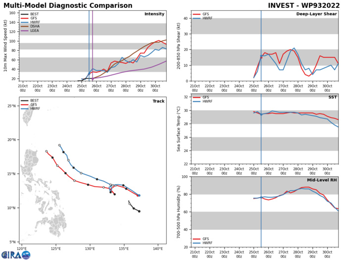
DETERMINISTIC AND PROBABILISTIC MODELS ARE IN ALIGNMENT THAT THE EASTERN PERIPHERY OF THE LARGER CIRCULATION WILL CONSOLIDATE MORE INTO A WELL-DEFINED CIRCULATION CENTER, AND RAPIDLY DEEPEN AND INTENSIFY AS IT WANDERS TOWARDS THE NORTHWEST OVER THE NEXT 24-36 HOURS.
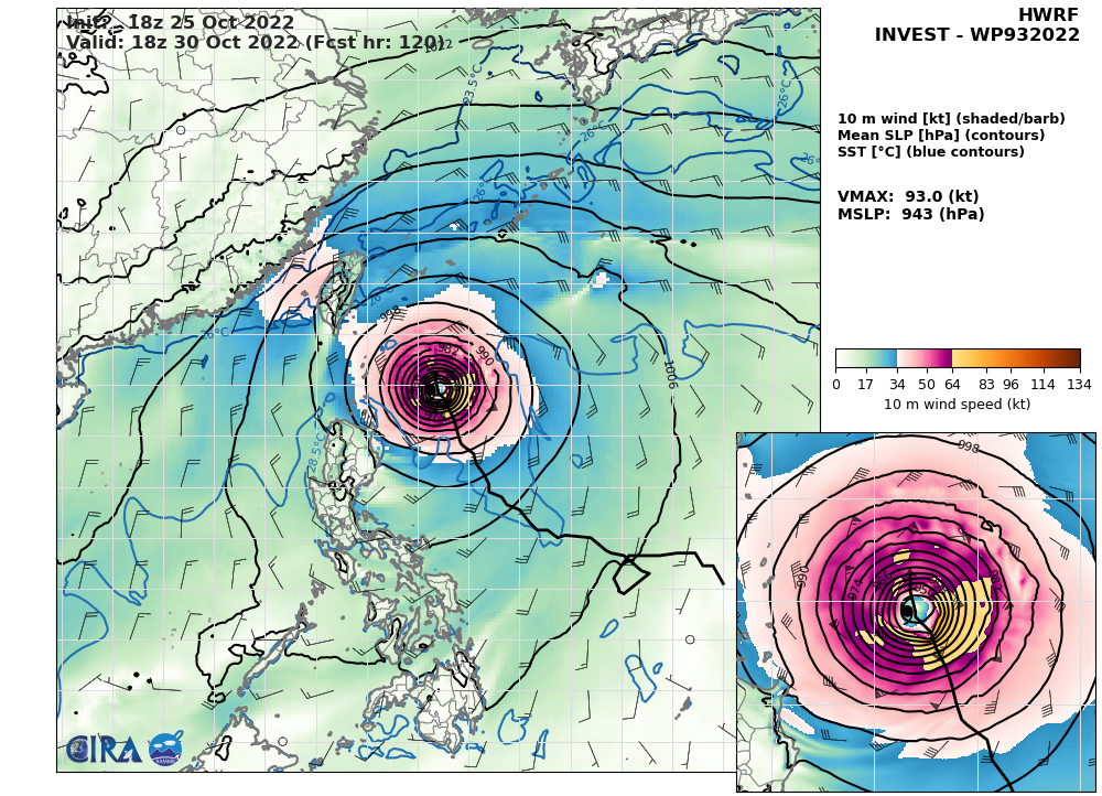
HWRF AT 25/18UTC: 93KT AT +120H.
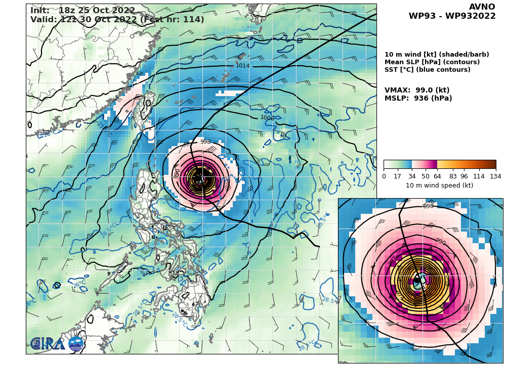
AVN AT 25/18UTC. 99KT AT +114H.
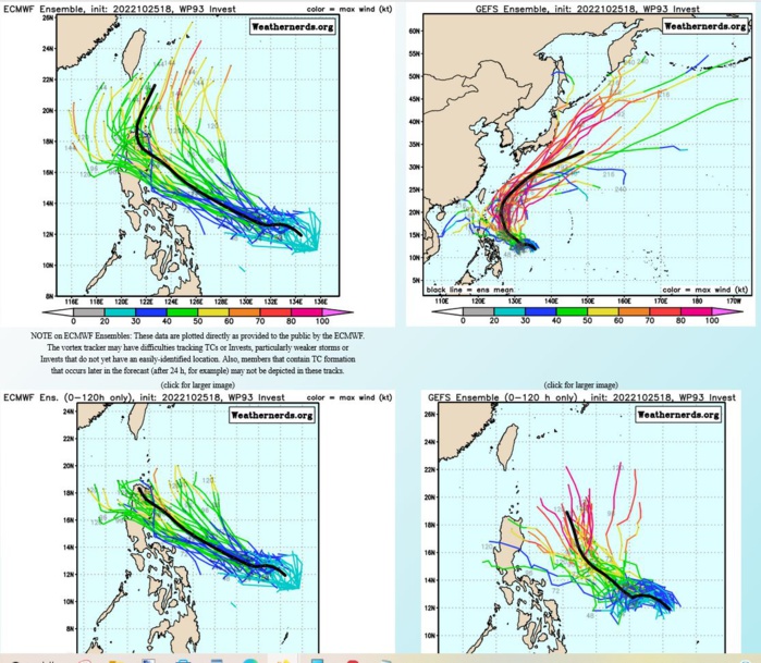
ECMWF/GEFS
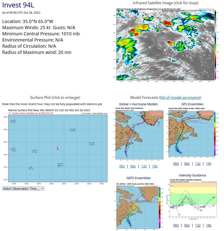
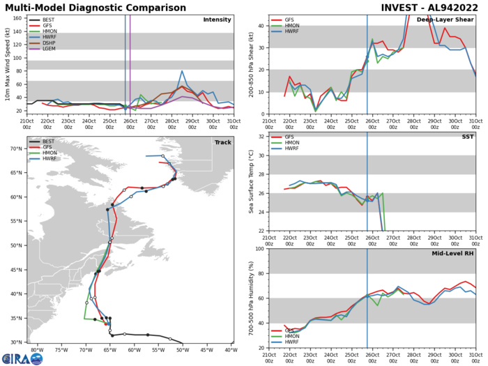
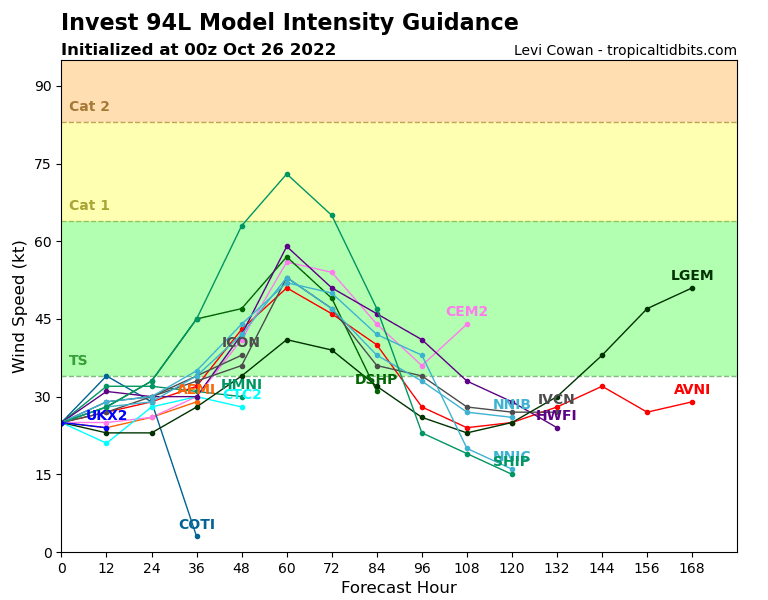
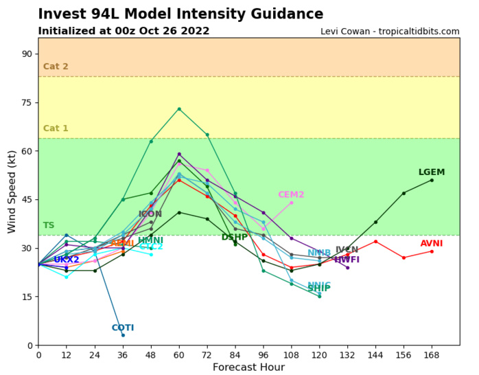
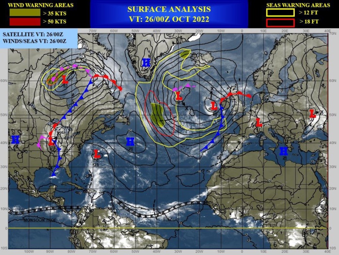
NORTH ATLANTIC: INVEST 94L. ESTIMATED LOCATION AND INTENSITY AT 26/00UTC. NHC COMMENTS.

Tropical Weather Outlook NWS National Hurricane Center Miami FL 800 PM EDT Tue Oct 25 2022 For the North Atlantic...Caribbean Sea and the Gulf of Mexico: 1. Northwestern Atlantic: Shower and thunderstorm activity remains limited in association with an area of low pressure located about 150 miles north of Bermuda. The low is accelerating northward towards cooler waters and into an area of strong upper-level winds, and development is looking increasingly unlikely. * Formation chance through 48 hours...low...10 percent. * Formation chance through 5 days...low...10 percent.
AL, 94, 2022102018,325N, 370W, 25, 1011, DB
AL, 94, 2022102100,315N, 372W, 30, 1011, DB
AL, 94, 2022102106,306N, 378W, 30, 1011, DB
AL, 94, 2022102112,299N, 394W, 35, 1011, LO
AL, 94, 2022102118,293N, 411W, 35, 1011, LO
AL, 94, 2022102200,286N, 428W, 35, 1011, LO
AL, 94, 2022102206,284N, 442W, 35, 1012, LO
AL, 94, 2022102212,283N, 456W, 30, 1013, LO
AL, 94, 2022102218,287N, 470W, 30, 1014, DB
AL, 94, 2022102300,291N, 488W, 30, 1015, DB
AL, 94, 2022102306,300N, 506W, 30, 1015, DB
AL, 94, 2022102312,307N, 526W, 30, 1016, DB
AL, 94, 2022102318,313N, 547W, 30, 1015, DB
AL, 94, 2022102400,315N, 572W, 30, 1015, DB
AL, 94, 2022102406,315N, 598W, 30, 1015, DB
AL, 94, 2022102412,317N, 620W, 30, 1014, DB
AL, 94, 2022102418,315N, 636W, 30, 1013, LO
AL, 94, 2022102500,314N, 645W, 30, 1010, LO
AL, 94, 2022102506,318N, 651W, 30, 1010, LO
AL, 94, 2022102512,325N, 650W, 30, 1010, LO
AL, 94, 2022102518,336N, 649W, 25, 1010, LO
AL, 94, 2022102600,350N, 650W, 25, 1010, LO

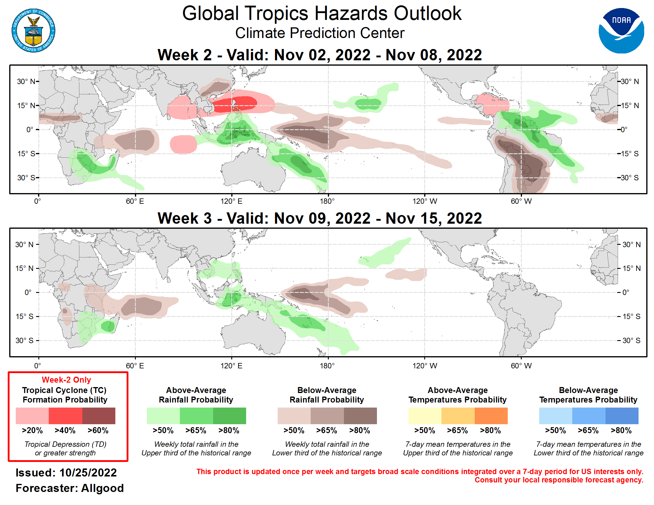
Valid - 11/02/22 - 11/15/22 Following a period of active Madden-Julian Oscillation (MJO) activity that crossed the Indian Ocean and Maritime Continent during early October, the intraseasonal signal became less apparent through late October. The RMM-based MJO index exhibits a fairly high amplitude signal over the West Pacific (Phase-6), albeit without an established eastward propagation, while the CPC velocity potential based MJO index is weak, reflecting an incoherent upper-level pattern. Destructive interference with the ongoing La Niña across the Equatorial Pacific is likely the culprit for the breakdown in the MJO signal, as it has been for the past several months. Unlike previous events, however, the intraseasonal signal this time has contributed to widespread convection across the Northwest Pacific that is moving slowly poleward. This convective feature aliases well into RMM Phase-6 precipitation composites, and may be contributing to the high amplitude of the RMM-based MJO index. Dynamical model MJO index forecasts are fairly consistent, depicting a potential for a brief retrogression of the signal tied to Rossby wave activity over the Maritime Continent, and then fairly rapid eastward propagation, with the index shifted notably towards the West Pacific, suggesting at least a temporary weakening of the La Niña base state over the next several weeks as Kelvin waves traverse the globe. Dynamical model forecasts do not depict a breakdown of the enhanced trade wind regime over the Pacific, though pronounced envelopes of low-level westerly wind anomalies are possible both north and south of the Equator. Since these westerly wind events are not centered on the Equator, it is unlikely that this activity will substantially weaken the cold ENSO event; however, it is possible that a weak downwelling oceanic Kelvin wave may be initiated heading into the Boreal winter season. Two tropical cyclones (TCs) formed during the past week. Hurricane Roslyn formed over the East Pacific on 20 October, strengthening to Category-3 intensity on the Saffir-Simpson scale with sustained winds of 115kt prior to landfall in the Nayarit state along Mexico’s southern coast. Hurricane Roslyn brought widespread winds, flooding, and surge impacts to a region recently impacted by Hurricane Orlene. Tropical Storm Sitrang formed over the northern Bay of Bengal on 23 October before moving inland over Bangladesh and generating widespread flooding. Following a brief break in TC formations, the West Pacific is favored to become active again, with the Joint Typhoon Warning Center currently monitoring Invest 93W east of the Philippines. With a continuation of enhanced convection across the Northwest Pacific favored, the potential for tropical cyclogenesis will continue into the Week-2 period, with dynamical models showing potential formations across either the South China Sea or east of the Philippines. There is also a potential for disturbances emerging over the Bay of Bengal to develop into a TC during Week-2. Additionally, Rossby wave activity favors a potential for westerly wind bursts over the eastern Indian Ocean, which may provide an opportunity for TC development over the southern Indian Ocean. Across the Atlantic basin, the TC climatology decreases rapidly in early November; however, any remnant MJO signal that crosses over the Western Hemisphere during Week-2 may provide a favorable environment for TC development over the western Caribbean Sea, and this potential is highlighted by both the GEFS and ECMWF ensemble systems. The precipitation outlook for Weeks 2-3 is based on a consensus of GEFS, ECMWF, and CFS ensemble model guidance, and the expectation that the atmospheric response to ongoing La Niña conditions will remain the dominant driver of global tropical convective anomalies despite any destructive interference from remnant MJO or Kelvin wave activity. Therefore, a dipole of enhanced (suppressed) convection across the Maritime Continent (central Pacific) is the most prominent feature. Suppressed convection is favored for the western Indian Ocean during both Week-2 and Week-3, and a dipole of suppressed (enhanced) rainfall across southern Brazil, northern Argentina, Paraguay, and Uruguay (northern South America to the tropical Atlantic) is favored for Week-2. Below-average temperatures are favored across eastern Australia and much of South America during early Week-2, but freezing temperatures in agriculturally vulnerable locations is not anticipated.
