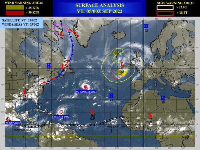
CLICK ON THE IMAGERIES BELOW TO GET THEM ENLARGED
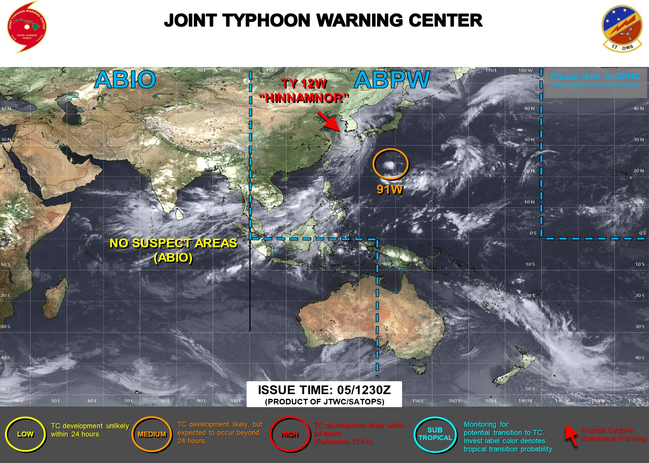
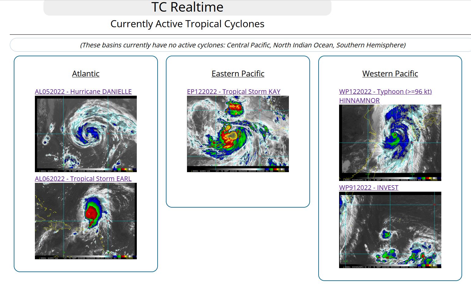
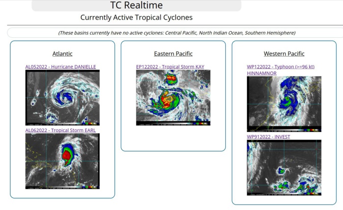
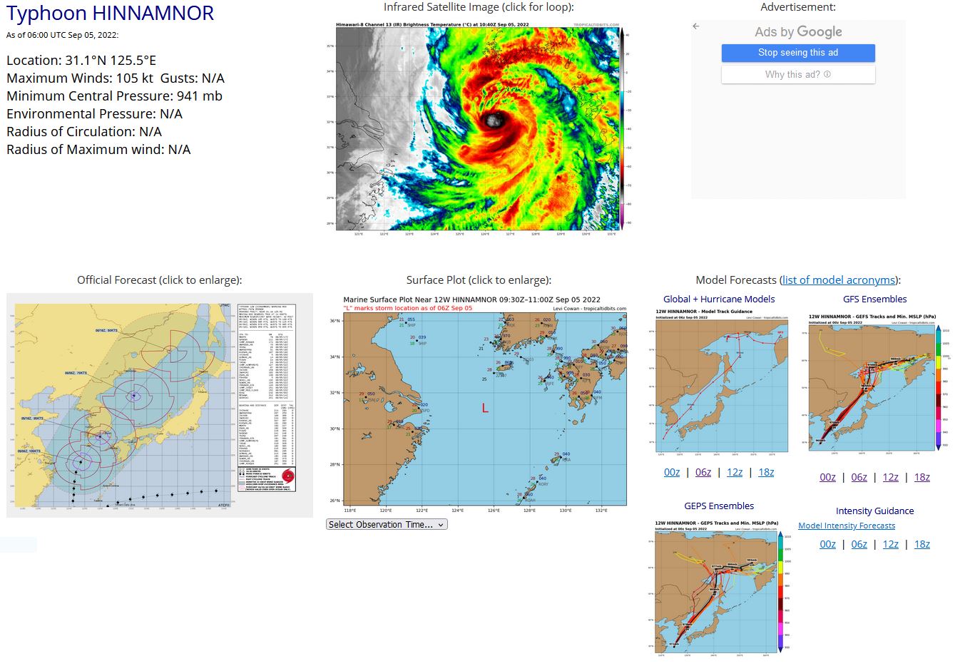
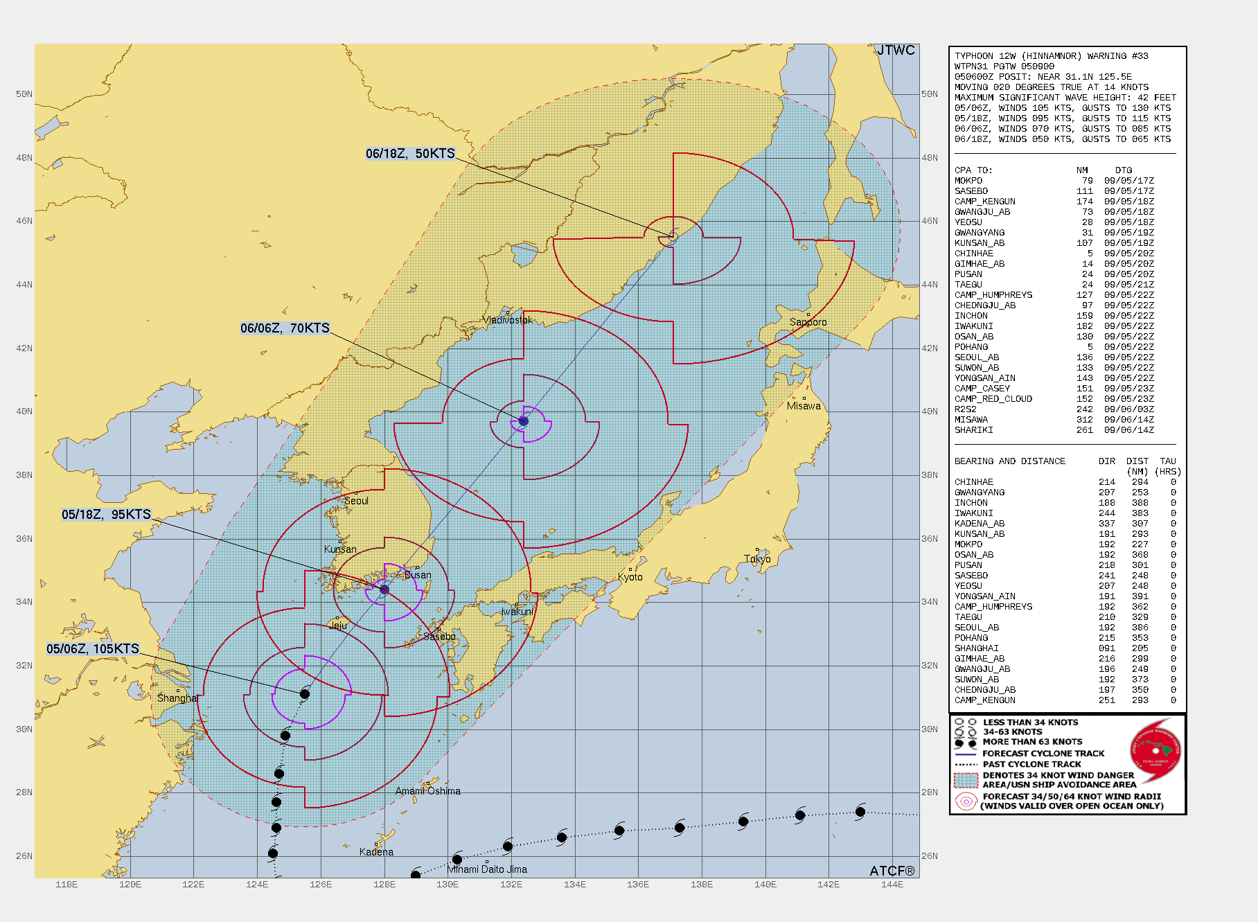
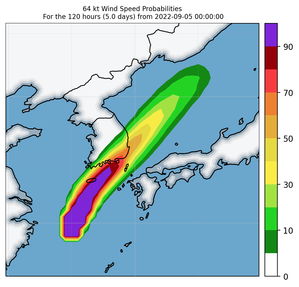
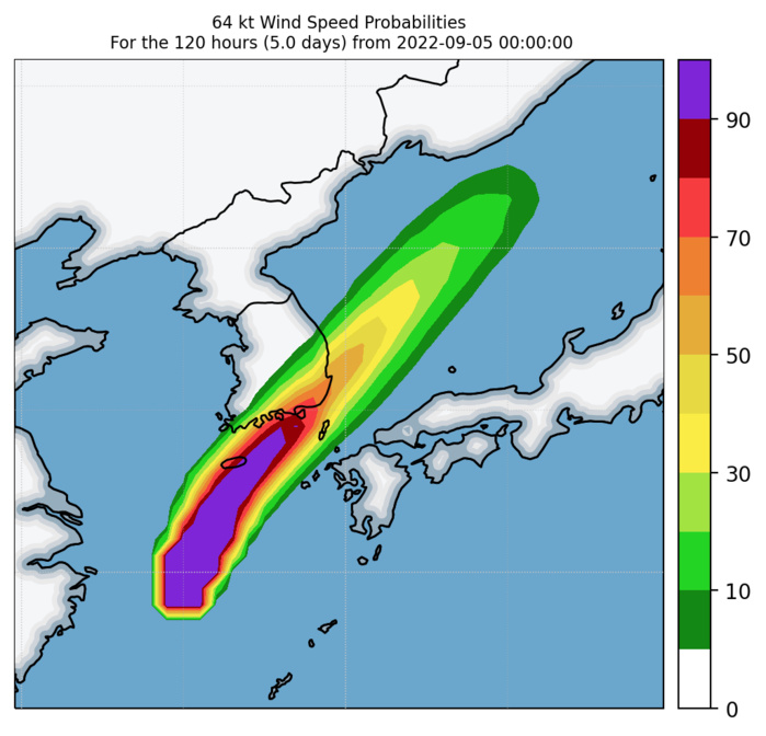
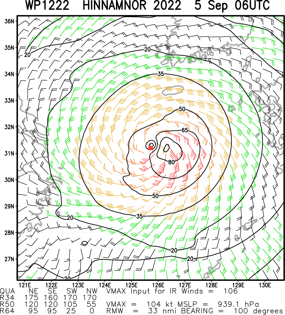
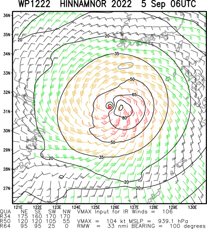
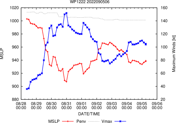
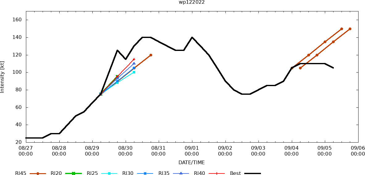
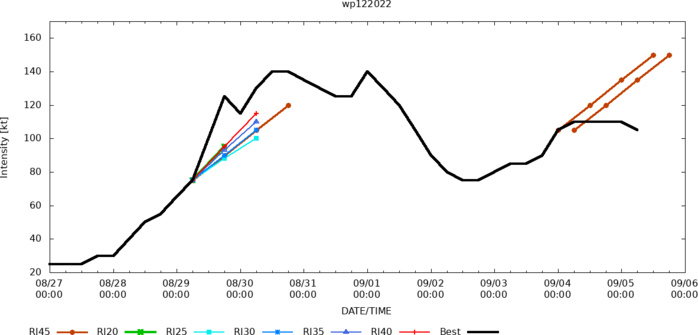
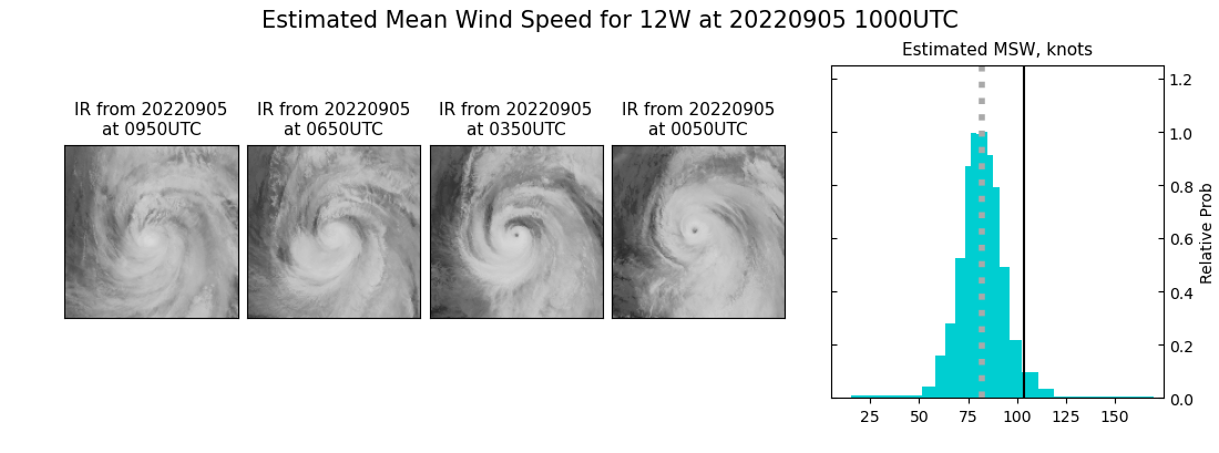
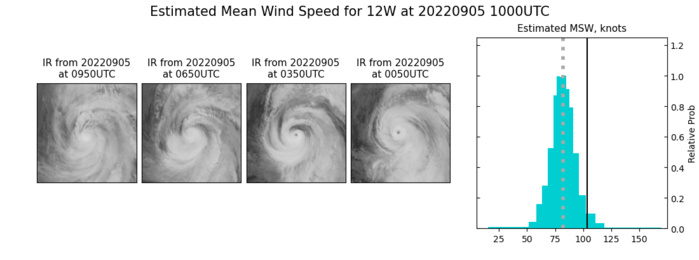
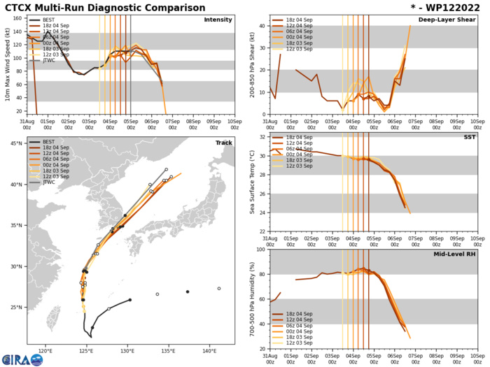
WESTERN NORTH PACIFIC: TY 12W(HINNAMNOR). ESTIMATED LOCATION AND INTENSITY AT 05/06UTC. WARNING 33 ISSUED AT 05/09UTC.
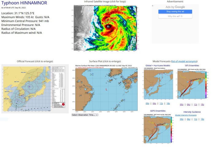
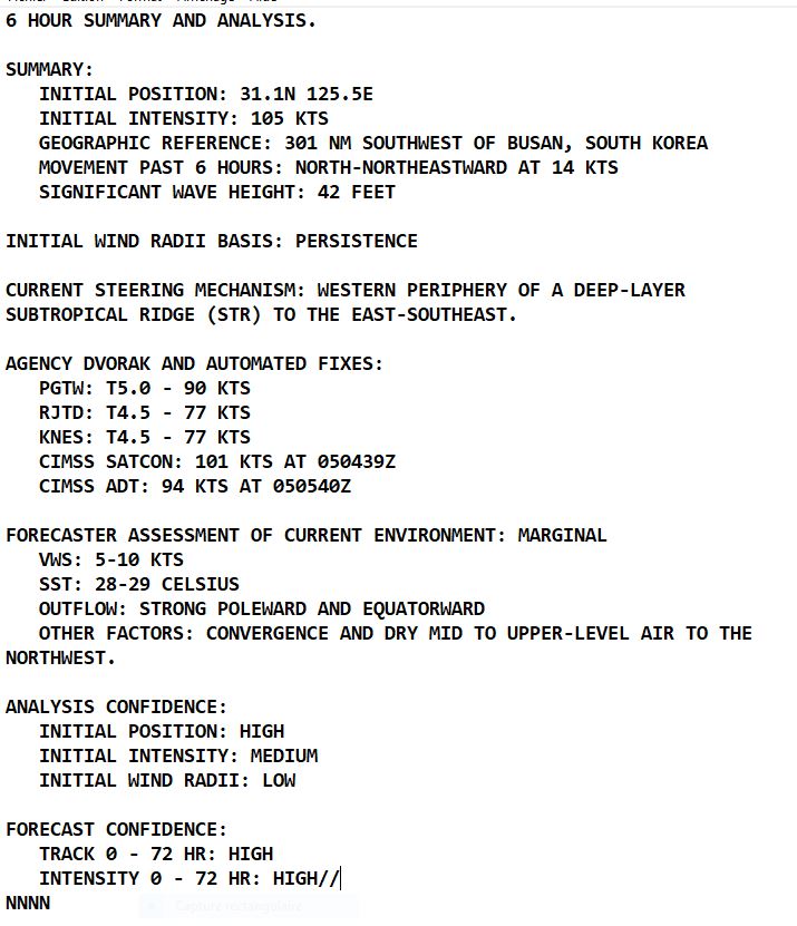
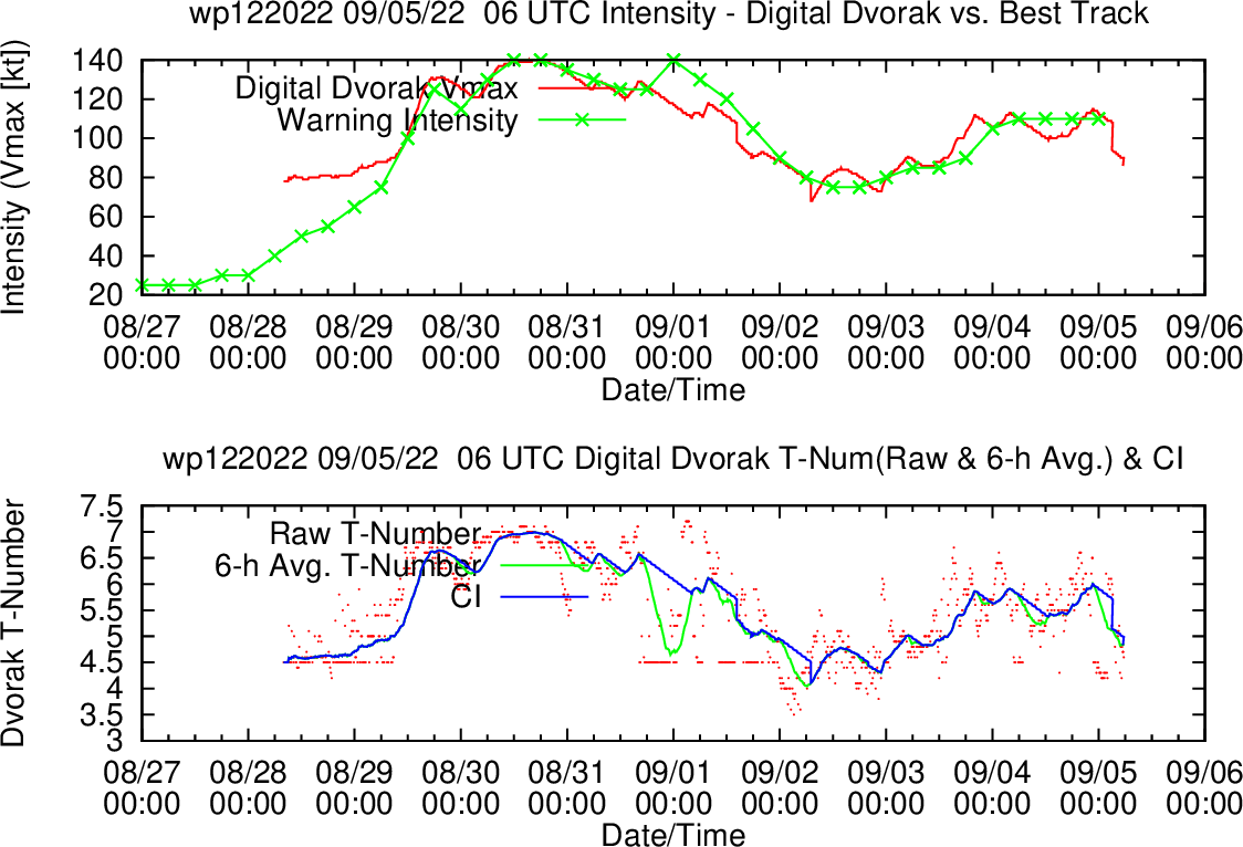
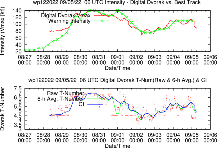
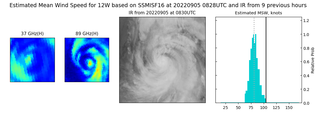
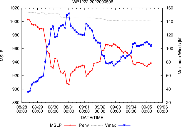
SATELLITE ANALYSIS, INITIAL POSITION AND INTENSITY DISCUSSION: ANIMATED MULTISPECTRAL SATELLITE IMAGERY (MSI) DEPICTS A WELL DEFINED, TIGHTLY WRAPPED CIRCULATION WHO'S EYE HAS SLOWLY FILLED OVER THE PAST FEW HOURS. A 050514Z AMSR2 89GHZ COLOR COMPOSITE MICROWAVE IMAGE REVEALS THAT 12W HAS MAINTAINED A SMALL CORE SURROUNDED BY AN INTERMITTENT SECONDARY EYEWALL LIKE FEATURE THAT HAS FRAGMENTED AND REFORMED SEVERAL TIMES OVER THE PAST 12-24 HOURS. THIS CORE STRUCTURE WHILE CERTAINLY A-TYPICAL HAS ALLOWED 12W TO DELAY ITS IMPENDING WEAKENING. THE INITIAL POSITION IS PLACED WITH HIGH CONFIDENCE BASED ON MSI AND AMSR2 IMAGERY. THE INITIAL INTENSITY OF 105 KTS IS ASSESSED WITH MEDIUM CONFIDENCE BASED ON THE NOTABLE DECLINE OF ALL AGENCY DVORAK INTENSITY ESTIMATES, WHILE THE SYSTEMS CORE STRUCTURE APPEARS MOSTLY INTACT. FURTHERMORE, WHILE AGENCY DVORAK INTENSITY ESTIMATES WILL GENERALLY MAKE AN INITIAL DROP WHEN AN EYE FILLS, CIMSS ADT AND SATCON HAVE ALSO DROPPED.
WP, 12, 2022090400,261N, 1245E,105, 941
WP, 12, 2022090406,269N, 1246E,110, 939
WP, 12, 2022090406,269N, 1246E,110, 939
WP, 12, 2022090412,277N, 1246E,110, 938
WP, 12, 2022090418,286N, 1247E,110, 937
WP, 12, 2022090500,298N, 1249E,110, 937
WP, 12, 2022090506,311N, 1255E,105, 941
WP, 12, 2022090512,325N, 1265E,100, 943
WP, 12, 2022090406,269N, 1246E,110, 939
WP, 12, 2022090406,269N, 1246E,110, 939
WP, 12, 2022090412,277N, 1246E,110, 938
WP, 12, 2022090418,286N, 1247E,110, 937
WP, 12, 2022090500,298N, 1249E,110, 937
WP, 12, 2022090506,311N, 1255E,105, 941
WP, 12, 2022090512,325N, 1265E,100, 943
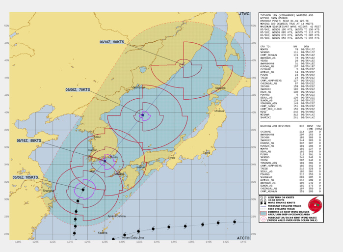
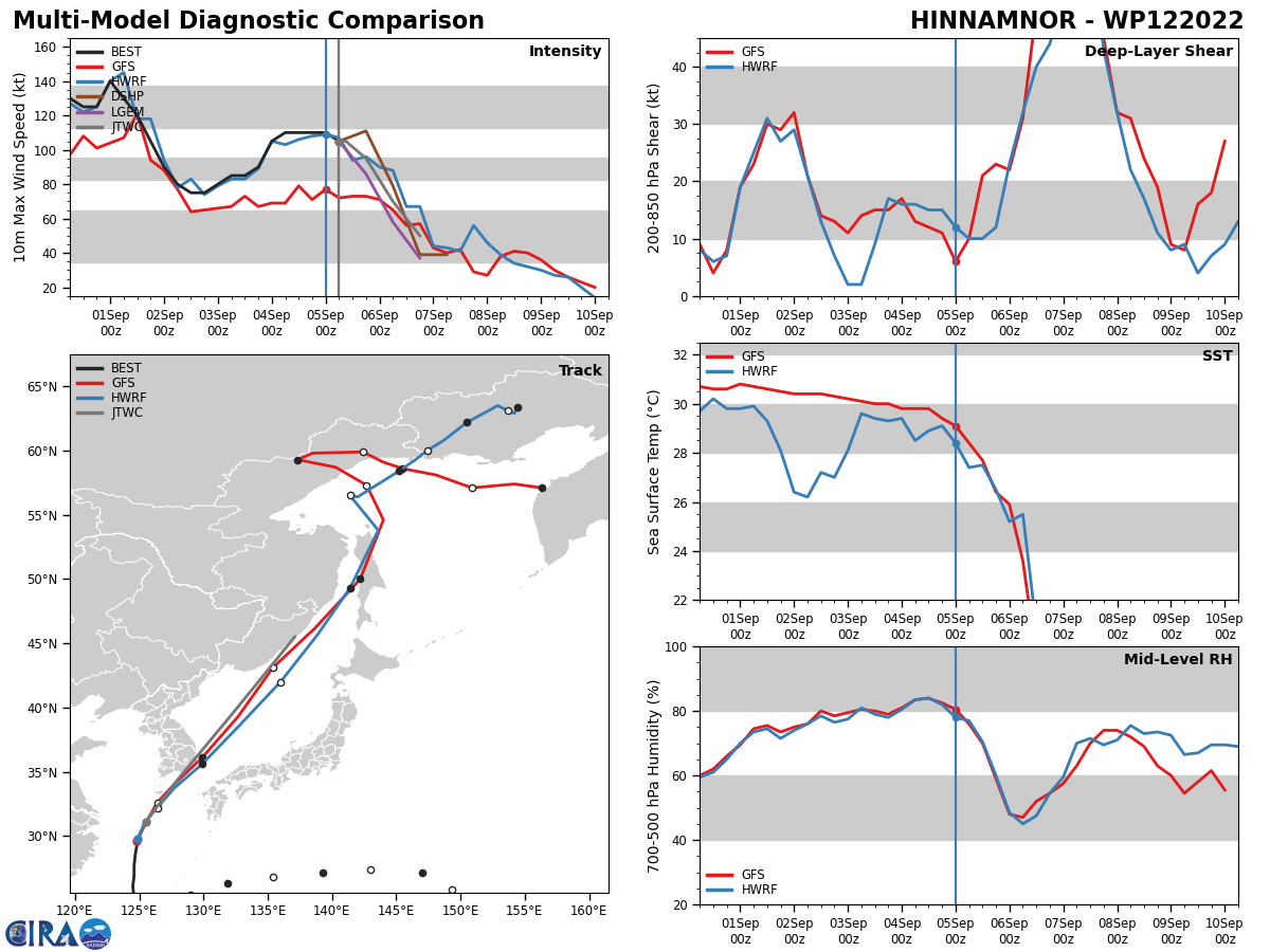
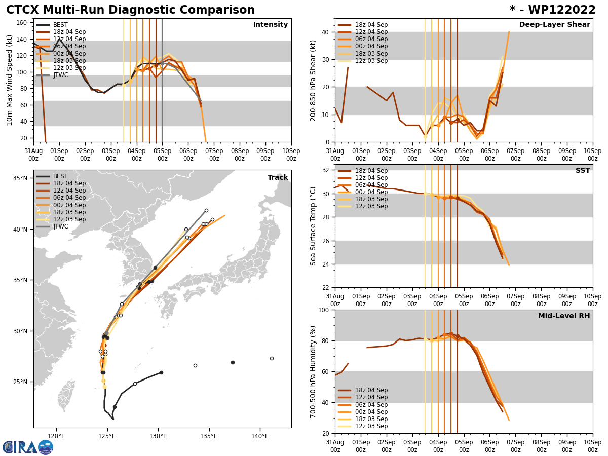
FORECAST REASONING. SIGNIFICANT FORECAST CHANGES: THERE ARE NO SIGNIFICANT CHANGES TO THE FORECAST FROM THE PREVIOUS WARNING. FORECAST DISCUSSION: HAVING STEADIED UP ON A NORTH-NORTHEASTWARD HEADING, 12W IS NEARING THE PRECIPICE OF ITS FINAL WEAKENING STAGE. THOUGH THE SYSTEM HAS MAINTAINED A STRONG CORE STRUCTURE, A VAST FIELD OF CONVERGENT FLOW AND UPPER LEVEL DRY AIR HAS CONTINUED IMPINGING THE WESTERN FLANK OF 12W. OVER THE NEXT 12 HOURS, TRACK SPEEDS WILL CONTINUE TO INCREASE AS THE SYSTEM CONTINUES TO ROUND THE STR, AND CLOSES ON THE KOREAN PENINSULA. AS THIS HAPPENS THE ENVIRONMENT WILL CONTINUE TO RAPIDLY DEGRADE CHARACTERIZED BY FALLING SEA SURFACE TEMPERATURES, INCREASING VERTICAL WIND SHEAR AND DRY AIR ENTERTAINMENT WHICH WILL ALL WEAKEN THE SYSTEM. SHORTLY AFTER TAU 12, AS THE SYSTEMS PASSES OVER THE KOREAN PENINSULA IT BEGINS TO INTERACT WITH A VERY STRONG, MIDLATITUDE TROUGH AND UPPERLEVEL JET MAX AND BEGINS A RAPID TRANSITION TO AN EXTRA-TROPICAL LOW. BY TAU 24, NOW WELL INTO THE SEA OF JAPAN, 12W WILL STILL HAVE MUCH OF ITS FORMER INTENSITY DUE TO THE EXTREME DYNAMICAL FORCES ASSOCIATED WITH THE TROUGH AND SPEED OF TRANSITION. SHORTLY AFTER TAU 24, 12W WILL BE ROBED OF ITS LAST REMAINING TROPICAL CHARACTERISTICS, LEAVING A STRONG STORM-STRENGTH EXTRA-TROPICAL LOW IN THE SEA OF JAPAN NO LATER THAN TAU 36.
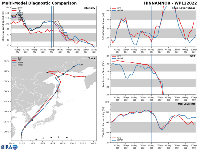
MODEL DISCUSSION: NUMERICAL MODELS ARE IN TIGHT AGREEMENT WITH THE JTWC FORECAST TRACK, SHOWING A GENERALLY NORTH-NORTHEASTWARD TRACK THROUGH THE FORECAST PERIOD. BY TAU 36 THERE IS A SLIGHT AMOUNT OF CROSS TRACK VARIANCE AS MODELS ATTEMPT TO RESOLVE THE MOVEMENT OF THE EXTRA-TROPICAL LOW. FOR THESE REASONS THE JTWC FORECAST TRACK IS PLACED WITH HIGH CONFIDENCE. RELIABLE MODEL INTENSITY GUIDANCE IS IN GOOD AGREEMENT WITH THE JTWC FORECAST INTENSITY GUIDANCE, WITH ALL MEMBERS WEAKENING 12W OVER THE NEXT 12 HOURS, AFTER WHICH ALL MEMBERS SHARPLY WEAKEN THE SYSTEM THROUGH THE FORECAST PERIOD. FOR THIS REASON THE JTWC FORECAST INTENSITY IS ALSO PLACED WITH HIGH CONFIDENCE.
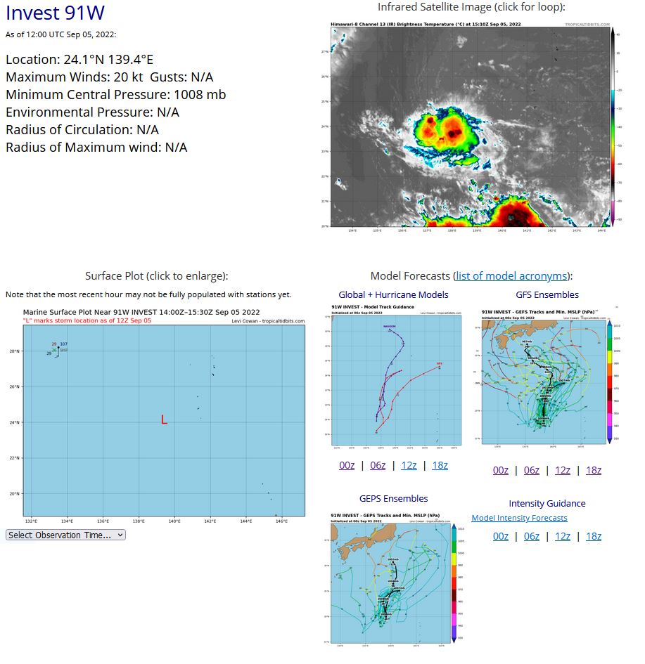
WESTERN NORTH PACIFIC: INVEST 91W. ESTIMATED LOCATION AND INTENSITY AT 05/06UTC. ADVISORY(ABPW) ISSUED AT 05/1230UTC.
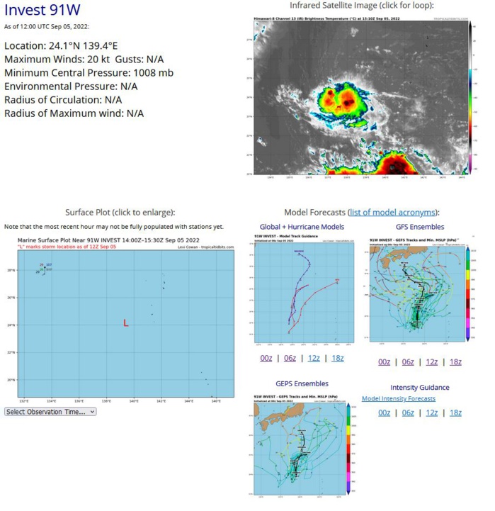
THE AREA OF CONVECTION (INVEST 91W) PREVIOUSLY LOCATED NEAR 24.4N 140.7E IS NOW LOCATED NEAR 24.4N 139.5E, APPROXIMATELY 100 NM WEST- SOUTHWEST OF IWO-TO, JAPAN. ANIMATED INFRARED SATELLITE IMAGERY AND A 051130Z HIMAWARI-8 INFRARED SATELLITE IMAGE DEPICTS A PARTIALLY EXPOSED, CONSOLIDATING LOW LEVEL CIRCULATION CENTER (LLCC) WITH DEEPENING CONVECTION TO THE WEST AND SOUTHWEST. INVEST 91W DISPLAYS FAVORABLY LOW (5-10KTS) VERTICAL WIND SHEAR (VWS) ACCOMPANIED WITH WARM (30-31C) SEA SURFACE TEMPERATURES (SST) AND EQUATORIAL OUTFLOW ALOFT. BASED ON MODEL GUIDANCE 91W WILL GRADUALLY BUILD AND HEAD GENERALLY SOUTHWESTWARD OVER THE NEXT 24 HOURS. MAXIMUM SUSTAINED SURFACE WINDS ARE ESTIMATED AT 15 TO 20 KNOTS. MINIMUM SEA LEVEL PRESSURE IS ESTIMATED TO BE NEAR 1008 MB. THE POTENTIAL FOR THE DEVELOPMENT OF A SIGNIFICANT TROPICAL CYCLONE WITHIN THE NEXT 24 HOURS IS UPGRADED TO MEDIUM.
WP, 91, 2022090312,250N, 1471E, 15,1010
WP, 91, 2022090318,255N, 1466E, 15,1010
WP, 91, 2022090400,256N, 1458E, 15,1009
WP, 91, 2022090406,255N, 1452E, 15,1007
WP, 91, 2022090412,253N, 1444E, 15,1008
WP, 91, 2022090418,249N, 1435E, 15,1007
WP, 91, 2022090500,246N, 1421E, 15,1007
WP, 91, 2022090506,244N, 1407E, 15,1006
WP, 91, 2022090512,241N, 1394E, 20,1008
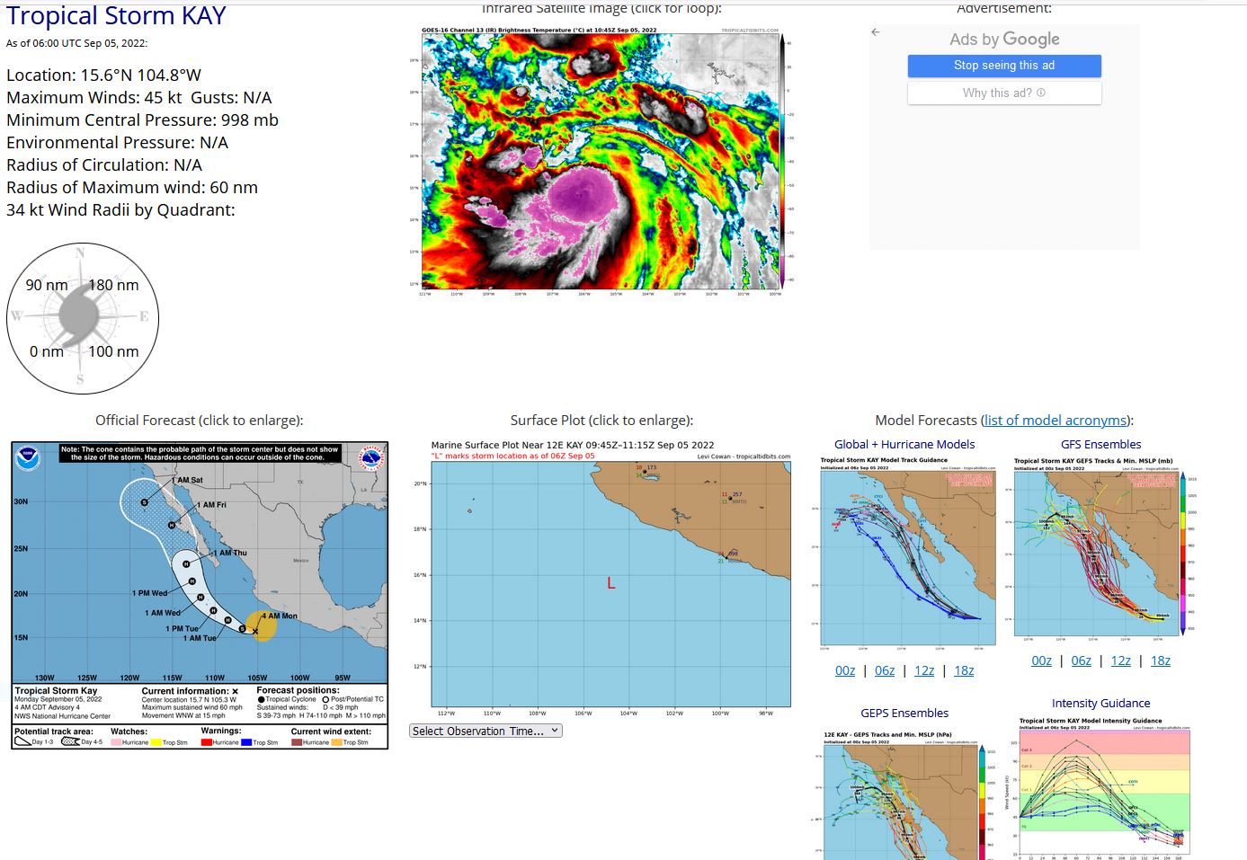
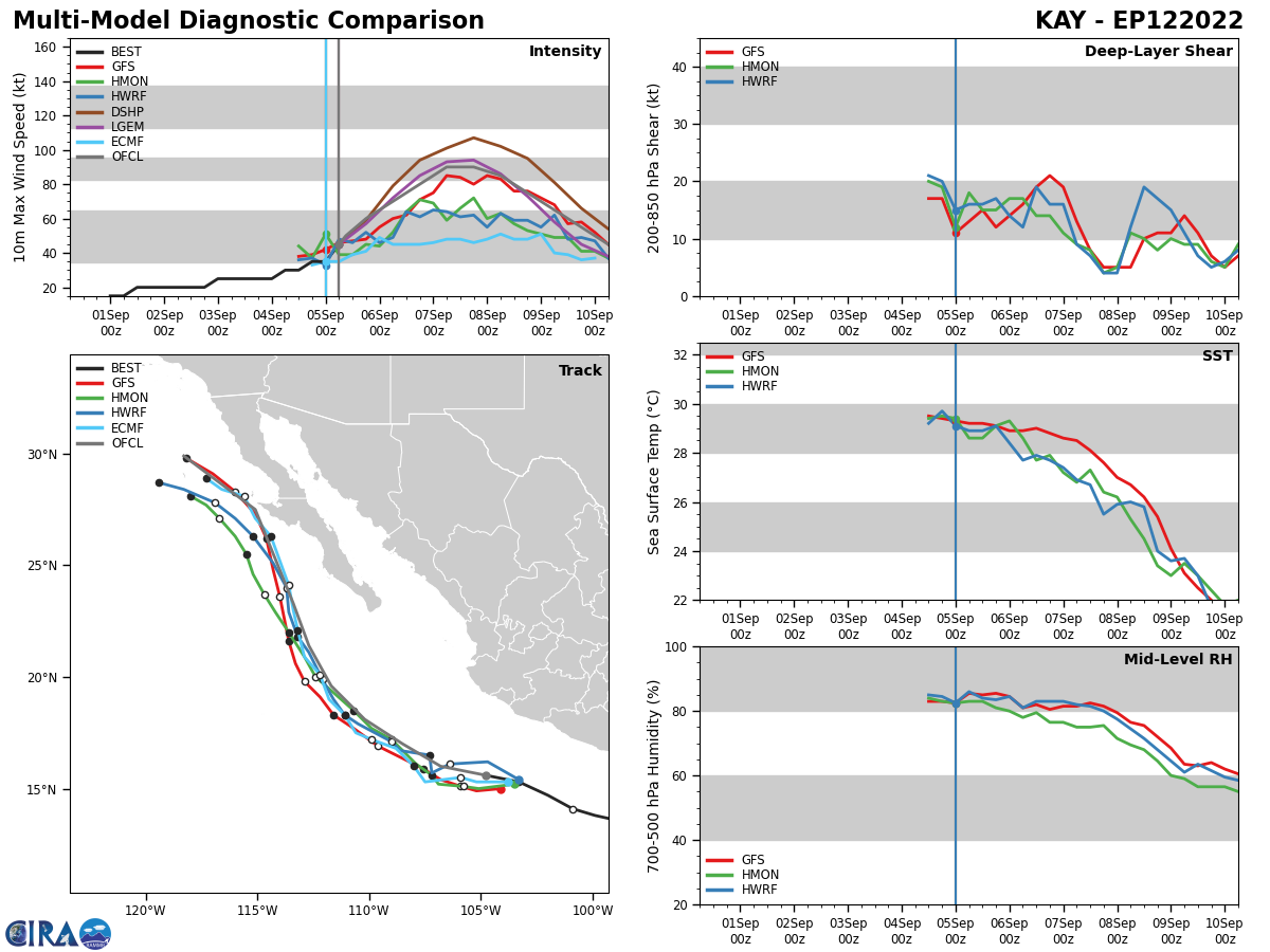
EASTERN NORTH PACIFIC: TS 12E(KAY). ESTIMATED LOCATION AND INTENSITY AT 05/06UTC. NHC COMMENTS.
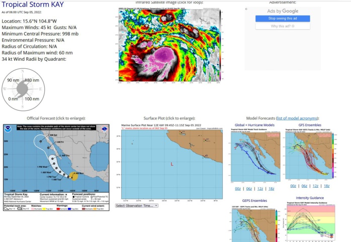
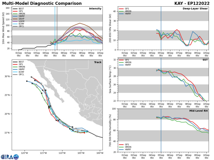
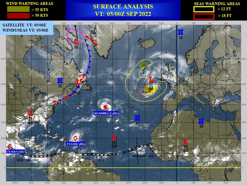
000 WTPZ42 KNHC 050857 TCDEP2 Tropical Storm Kay Discussion Number 4 NWS National Hurricane Center Miami FL EP122022 400 AM CDT Mon Sep 05 2022 Deep convection has increased in a band around the southern and eastern portions of the circulation overnight. A couple of ASCAT passes from around 0345-0445 UTC revealed peak winds of 38-41 kt, and a much larger wind field over the northeastern quadrant than previous estimated. The ASCAT data, a TAFB Dvorak classification of T3.0 and UW/CIMSS SATCON all supported a 45 kt intensity around 0600 UTC. Since the convective organization has continued to increase over the past few hours, the initial intensity for this advisory has been set at 50 kt. Although Kay is currently within an area of light to moderate northeasterly shear, it will be moving over SSTs of 28-29 degrees Celsius during the next couple of days which should allow steady strengthening. Most of the dynamical model guidance also predicts significant deepening of Kay during that time, giving more confidence to the forecast. The updated NHC intensity forecast shows a slightly faster rate of strengthening in the short term and now calls for Kay to become a hurricane within 24 hour. The new forecast also calls for a slightly higher peak intensity than before. After 60 h, cooler SSTs along the storm's track are likely to induce gradual weakening, but Kay is forecast to remain a large hurricane when it passes near the southern and central portions of the Baja California peninsula. The latest NHC intensity prediction again lies between the IVCN and HCCA aids. Kay appears to have wobbled back left since the previous advisory, but the longer term motion is 290/13 kt. Kay should remain on a west-northwestward heading through tonight, but by Tuesday a northwestward motion around the western periphery of a mid-level ridge over Mexico is expected to begin. A turn to the north-northwest is forecast by midweek and the guidance is in good agreement that Kay will move in the direction of the southwest and west-central coast of the Baja peninsula. Although there has been some increase in model spread this cycle with the UKMET keeping the system farther offshore, the typically reliable GFS and ECMWF are near the eastern side of the guidance envelope and are in good agreement on Kay moving very close to or over a portion of the west coast of the Baja peninsula. The NHC track forecast is near a blend of those models and is very similar to the previous track. Users are reminded not to focus on the exact details of the long-range forecast as wind and rainfall impacts are likely to extend far from the center of the hurricane. Tropical Storm or Hurricane Watches will likely be required later today for portions of the Baja California peninsula, and interests there should closely monitor the latest forecast updates. KEY MESSAGES: 1. Although the center of Kay is expected to stay offshore of southwest mainland Mexico, heavy rainfall could lead to flash flooding, including landslides, across portions of the Mexican Riviera and western Mexico through Wednesday night. 2. Kay is forecast to strengthen into a hurricane while it moves northward toward the Baja California peninsula later this week. While the details of the long-range track and intensity forecasts are uncertain, there is increasing risk of wind and rainfall impacts in the Baja California peninsula during the middle and latter parts of the week. Interests there should closely monitor updates to the forecast as tropical storm or hurricane watches will likely be required for a portion of that area later today. FORECAST POSITIONS AND MAX WINDS INIT 05/0900Z 15.7N 105.3W 50 KT 60 MPH 12H 05/1800Z 16.0N 106.8W 60 KT 70 MPH 24H 06/0600Z 17.0N 108.5W 70 KT 80 MPH 36H 06/1800Z 18.1N 110.2W 80 KT 90 MPH 48H 07/0600Z 19.6N 111.7W 90 KT 105 MPH 60H 07/1800Z 21.4N 112.7W 90 KT 105 MPH 72H 08/0600Z 23.3N 113.4W 85 KT 100 MPH 96H 09/0600Z 27.5N 115.1W 65 KT 75 MPH 120H 10/0600Z 29.9N 118.3W 45 KT 50 MPH $$ Forecaster Brown
EP, 12, 2022090400,136N, 990W, 25,1006
EP, 12, 2022090406,138N, 999W, 30,1006
EP, 12, 2022090412,141N, 1009W, 30,1005
EP, 12, 2022090418,147N, 1020W, 35,1004
EP, 12, 2022090500,153N, 1033W, 35,1002
EP, 12, 2022090506,156N, 1048W, 45, 998
EP, 12, 2022090406,138N, 999W, 30,1006
EP, 12, 2022090412,141N, 1009W, 30,1005
EP, 12, 2022090418,147N, 1020W, 35,1004
EP, 12, 2022090500,153N, 1033W, 35,1002
EP, 12, 2022090506,156N, 1048W, 45, 998
NORTH ATLANTIC: HU 05L(DANIELLE). ESTIMATED LOCATION AND INTENSITY AT 05/06UTC. NHC COMMENTS.
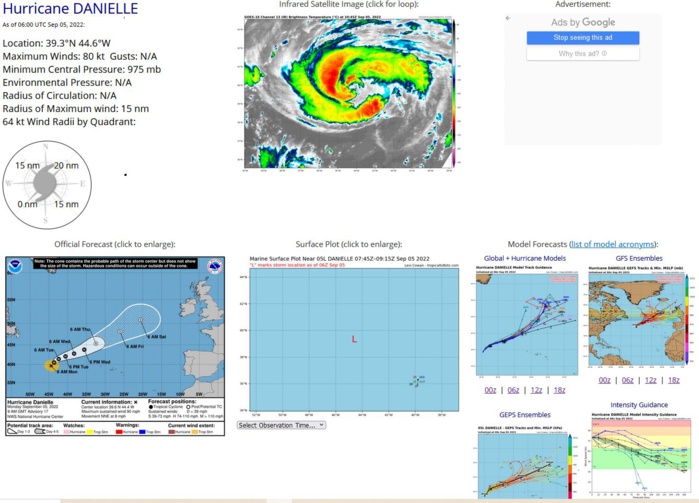
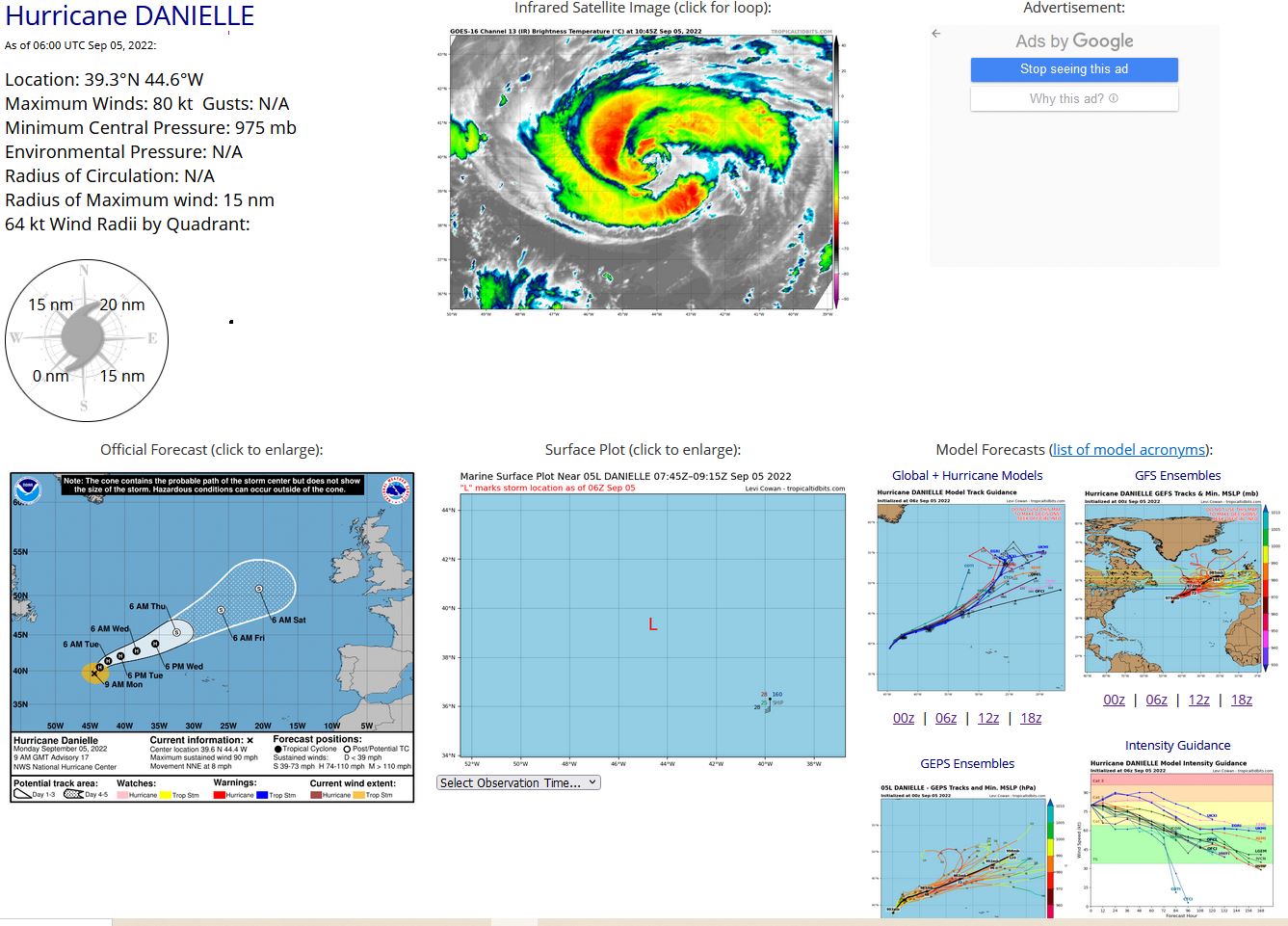
404 WTNT45 KNHC 050841 TCDAT5 Hurricane Danielle Discussion Number 17 NWS National Hurricane Center Miami FL AL052022 900 AM GMT Mon Sep 05 2022 There's been little change in Danielle's cloud pattern during the past 6 hours, and a clear symmetric warm 13C banding eye feature has persisted and has intermittently been closing off. The satellite intensity estimates haven't changed, and the initial intensity is held at 80 kt for this advisory. Little change in strength is forecast through today. Afterward, the cyclone should slowly weaken through the entire period as it moves over cooler water while increasing southwesterly shear disrupts the upper outflow pattern. The CMC, UKMET, and the GFS agree with Danielle to begin an extratropical transition around 36 hours and complete its change by 72 hours (Thursday). This cyclone transformation timeline is reflected in the NHC forecast, and the predicted 5-day intensity closely follows the IVCN and HCCA aids. The hurricane's initial motion is estimated to be 030 at 7 kt, a little faster than previously noted. Danielle should continue to accelerate and move north-northeastward to northeastward through early Tuesday in response to a mid-latitude baroclinic system approaching from the northwest, out of the Canadian Maritimes. By Tuesday night, the cyclone should turn toward the east-northeast within the mid-latitude westerly steering flow and continue in this general motion for 60 hours. A turn back toward the northeast is forecast as an extratropical cyclone on Thursday. It's worth mentioning that earlier today, there was quite a bit of uncertainty (global model cross-track spread) about Danielle's trajectory beyond the mid-period. The GFS and the UKMET predict Danielle will turn back toward the northeast Wednesday in the southwesterly peripheral flow of a larger baroclinic low approaching the cyclone from the northwest Atlantic. However, the ECMWF 12 and 18z runs showed considerably less baroclinic low influence while continuing toward the east-northeast, southwest of the British Isles. The latest 00z run, subsequently, has trended more toward the GFS/UKMET solution, which has resulted in some increase in track forecast confidence. Accordingly, the NHC forecast is again adjusted slightly north of the previous one to align more with a consensus (TVCA) of the models mentioned above. FORECAST POSITIONS AND MAX WINDS INIT 05/0900Z 39.6N 44.4W 80 KT 90 MPH 12H 05/1800Z 40.5N 43.6W 80 KT 90 MPH 24H 06/0600Z 41.4N 42.4W 75 KT 85 MPH 36H 06/1800Z 42.1N 40.6W 75 KT 85 MPH 48H 07/0600Z 42.8N 38.3W 70 KT 80 MPH 60H 07/1800Z 43.8N 35.6W 65 KT 75 MPH 72H 08/0600Z 45.3N 32.5W 60 KT 70 MPH...POST-TROP/EXTRATROP 96H 09/0600Z 48.2N 26.1W 55 KT 65 MPH...POST-TROP/EXTRATROP 120H 10/0600Z 50.8N 20.6W 50 KT 60 MPH...POST-TROP/EXTRATROP $$ Forecaster Roberts
AL, 05, 2022090400,380N, 450W, 65, 988
AL, 05, 2022090406,381N, 452W, 65, 988
AL, 05, 2022090412,381N, 453W, 70, 983
AL, 05, 2022090418,383N, 452W, 75, 979
AL, 05, 2022090500,387N, 449W, 80, 975
AL, 05, 2022090506,393N, 446W, 80, 975
AL, 05, 2022090406,381N, 452W, 65, 988
AL, 05, 2022090412,381N, 453W, 70, 983
AL, 05, 2022090418,383N, 452W, 75, 979
AL, 05, 2022090500,387N, 449W, 80, 975
AL, 05, 2022090506,393N, 446W, 80, 975
NORTH ATLANTIC: TS 06L(EARL). ESTIMATED LOCATION AND INTENSITY AT 05/06UTC. NHC COMMENTS.
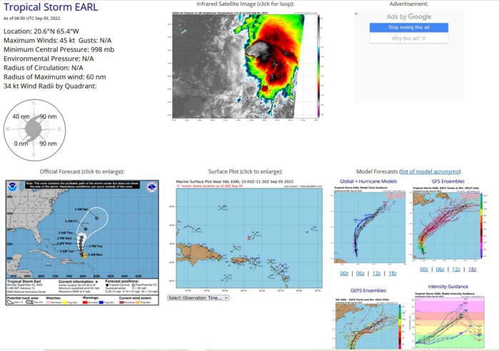
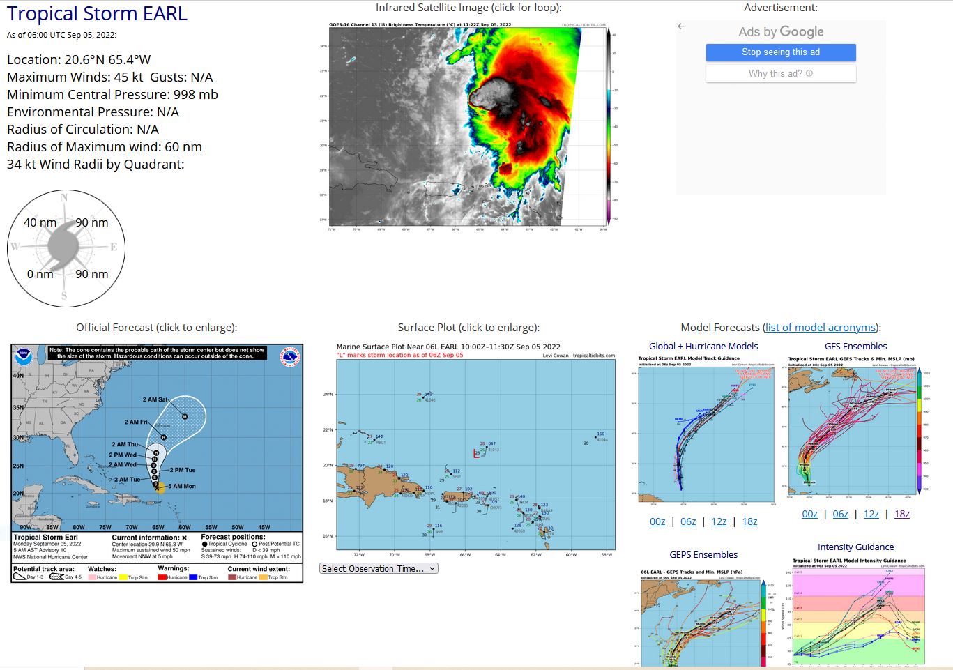
242 WTNT41 KNHC 050852 TCDAT1 Tropical Storm Earl Discussion Number 10 NWS National Hurricane Center Miami FL AL062022 500 AM AST Mon Sep 05 2022 Satellite imagery this morning shows that Earl continues to produce strong convection to the northeast of the center. However, data from the SHIPS model and analyses from CIMSS at the University of Wisconsin indicate that there is now 20-25 kt of southwesterly vertical shear impacting the cyclone. As a result, the low-level center remains located near or just outside of the southwestern edge of the main convective mass. Satellite intensity estimates have changed little since the last advisory, and data from NOAA buoy 41043 suggests the central pressure is still in the 998-1000 mb range. Based on this, the initial intensity remains 45 kt. Earlier scatterometer data showed that the circulation center was elongated from northeast to southwest, and recent wind obs suggest the northeast end of the elongation is near the NOAA buoy. Earl is turning more northward, with the initial motion now 335/4 kt. For the next three days or so, the storm should move slowly northward in the flow between the subtropical ridge to the east and a mid- to upper-level trough to the west and northwest. After that, a motion more toward the northeast is expected as Earl reaches the southern edge of the mid-latitude westerlies. The large-scale models are in poor agreement on the features in the westerlies that Earl will encounter, with the GFS showing stronger flow and a faster motion than the UKMET and ECMWF. The new forecast track is changed little through 60 h, then it is nudged a little westward based on a shift in the guidance envelope. The track lies close to the various consensus models, and the speed at the end is a compromise between the faster GFS and the slower UKMET/ECMWF. The large-scale models suggest that the current shear will persist for about the next 48 h. After 48-60 h, Earl may find a region of lighter shear that could allow more significant strengthening. The new intensity forecast is a little slower to intensify Earl through 48 h based on the shear forecast, and it is possible that Earl could strengthen less than forecast during this time. Later on, the new forecast is similar to the previous forecast. It should be noted that if Earl does find a more favorable environment later in the forecast period, there are several models with a higher 120-h forecast intensity than the current official forecast of 105 kt. While tropical-storm-force winds are still forecast to stay north of the northern Leeward Islands, the Virgin Islands, and Puerto Rico, training rainbands are producing heavy rainfall over portions of these islands. Users should refer to products issued by local weather offices in these areas. KEY MESSAGES: 1. Heavy rainfall from Earl is expected to lead to limited flash, urban, and small stream flooding impacts over the Leeward Islands, U.S. and British Virgin Islands, and Puerto Rico today. Rapid rises on rivers and mudslides in areas of steep terrain are possible in Puerto Rico. Considerable flood impacts cannot be ruled out in areas that receive heavier rainfall totals. 2. Earl is forecast to remain to the north of the the Virgin Islands and Puerto Rico today, but gusty winds, especially in squalls, remain possible on those islands for a few more hours. FORECAST POSITIONS AND MAX WINDS INIT 05/0900Z 20.9N 65.3W 45 KT 50 MPH 12H 05/1800Z 21.7N 65.5W 50 KT 60 MPH 24H 06/0600Z 22.9N 65.7W 55 KT 65 MPH 36H 06/1800Z 24.0N 65.8W 60 KT 70 MPH 48H 07/0600Z 25.1N 65.9W 60 KT 70 MPH 60H 07/1800Z 26.2N 65.7W 70 KT 80 MPH 72H 08/0600Z 27.3N 65.4W 75 KT 85 MPH 96H 09/0600Z 30.0N 64.0W 90 KT 105 MPH 120H 10/0600Z 33.5N 60.0W 105 KT 120 MPH $$ Forecaster Beven
AL, 06, 2022090400,194N, 638W, 45, 999
AL, 06, 2022090406,195N, 641W, 45, 999
AL, 06, 2022090412,197N, 646W, 45, 998
AL, 06, 2022090418,200N, 650W, 45, 998
AL, 06, 2022090500,201N, 653W, 45, 998
AL, 06, 2022090506,206N, 654W, 45, 998
