CLICK ON THE IMAGERIES BELOW TO GET THEM ENLARGED
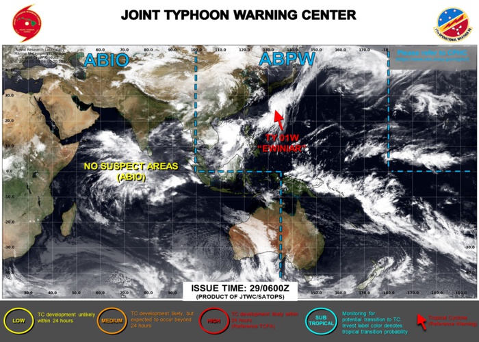
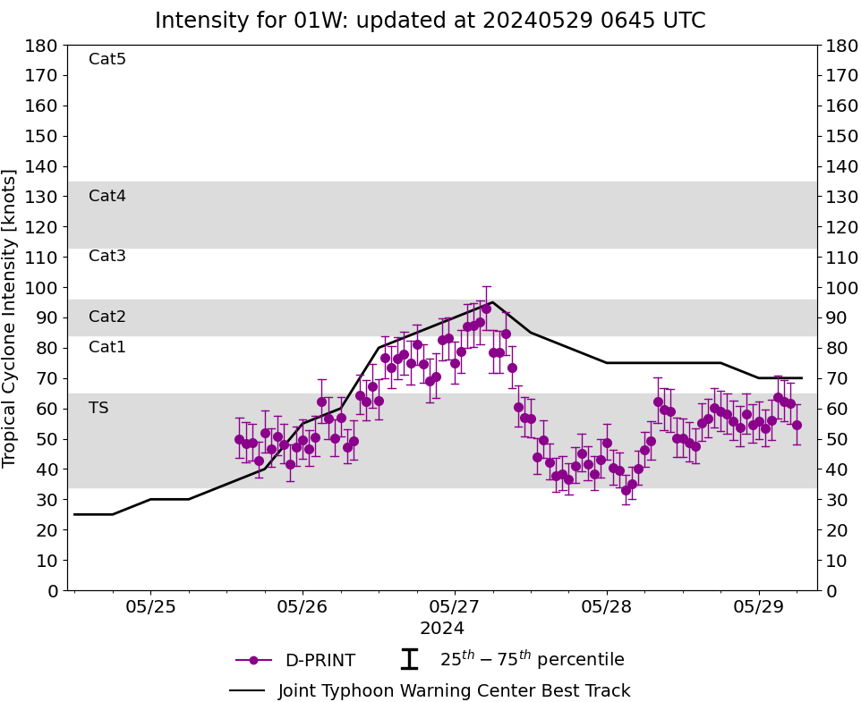
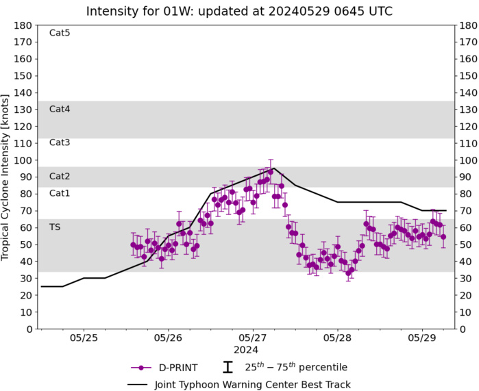
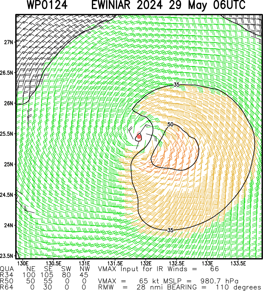
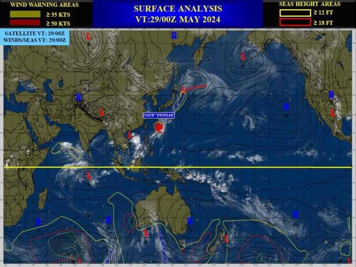
WESTERN NORTH PACIFIC: TY 01W(EWINIAR). ESTIMATED LOCATION AND INTENSITY AT 29/06UTC. INTENSITY IS 65 KNOTS/CAT 1 US:-10 KNOTS OVER 24H
0124052600 141N1214E 55
0124052606 145N1218E 60
0124052612 149N1223E 80
0124052618 155N1225E 85
0124052700 158N1228E 90
0124052706 163N1234E 95
0124052712 170N1239E 85
0124052718 178N1247E 80
0124052800 185N1255E 75
0124052806 199N1268E 75
0124052812 213N1281E 75
0124052818 228N1295E 75
0124052818 228N1295E 75
0124052900 243N1308E 70
0124052906 257N1324E 65
WARNING 19 ISSUED AT 29/09UTC
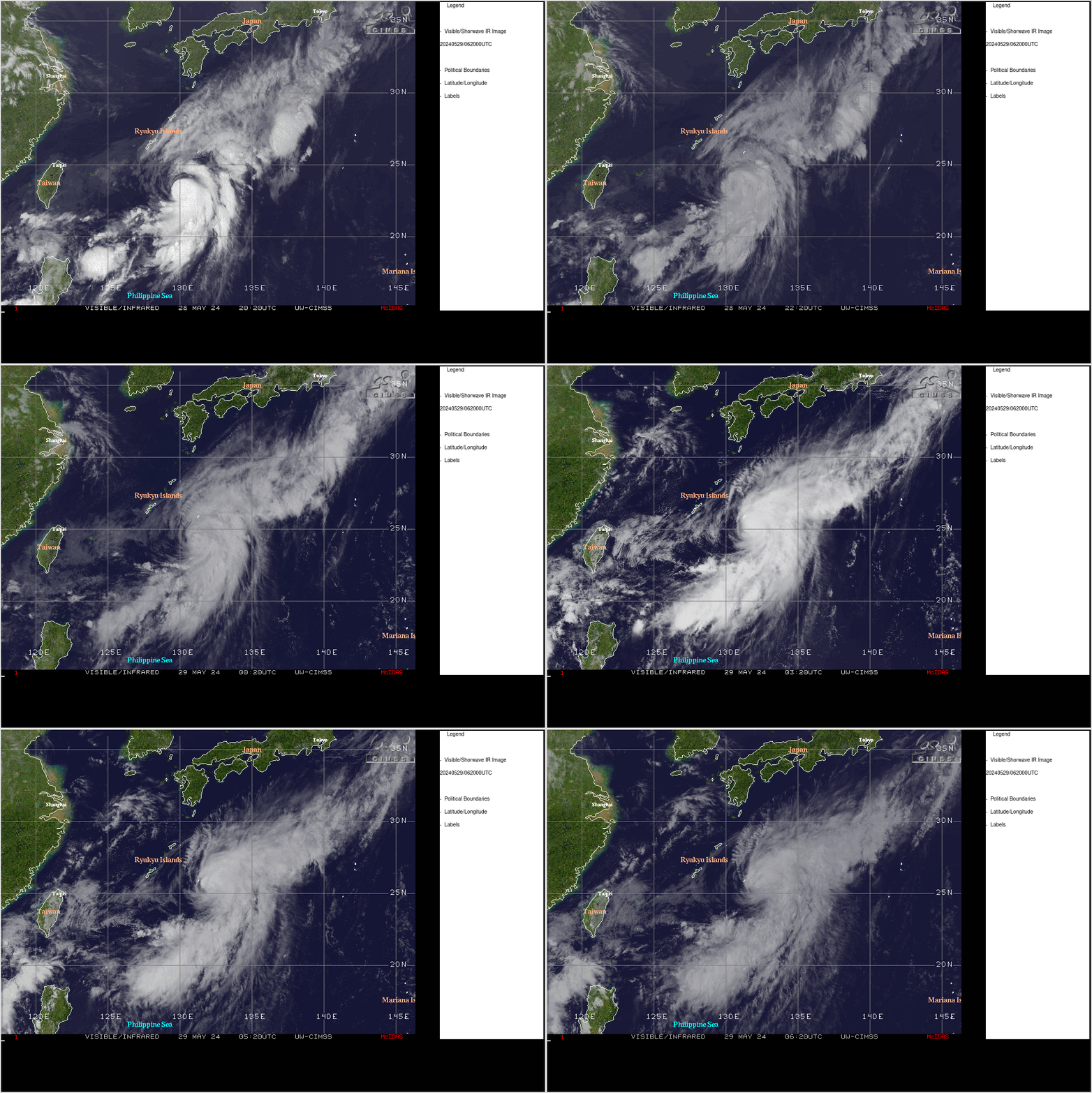
CLICK ON THE IMAGERY BELOW TO GET IT ANIMATED AND ENLARGED
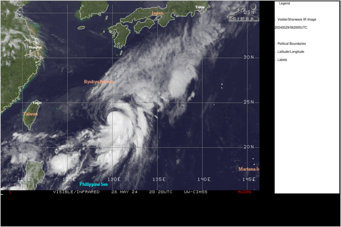
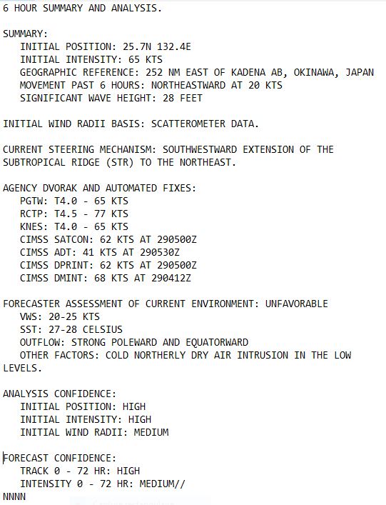
SATELLITE ANALYSIS, INITIAL POSITION AND INTENSITY DISCUSSION: ANIMATED MULTISPECTRAL SATELLITE IMAGERY (MSI) DEPICTS A DISTINCT LOW-LEVEL CIRCULATION CENTER (LLCC) WRAPPING TIGHTLY BENEATH THE WESTERN EDGE OF THE SYSTEM'S CONVECTIVE CURVED BANDING. THE ASYMMETRIC CONVECTION HAS CONTINUED TO WARM OVER THE LAST FEW HOURS, SIGNIFYING THE BEGINNING STAGES OF THE EXPECTED WEAKENING TREND FOR TYPHOON (TY) 01W. MODERATE VERTICAL WIND SHEAR (VWS) OF 20-25 KTS CONTINUES TO REMAIN EVIDENT THROUGHOUT THE REMAINING CIRRUS SHIELD, WITH OBSERVABLE STRIATIONS THROUGHOUT THE EASTERN PERIPHERY OF THE SYSTEM ON ANIMATED WATER VAPOR IMAGERY. STRONG DUAL-CHANNEL UPPER-LEVEL OUTFLOW HAS PERSISTED THROUGH THE PREVIOUS SIX HOURS, WITH A POWERFUL LONGWAVE TROUGH INDUCED POLEWARD CHANNEL, AND THE CONTINUOUS SOUTHWARD CHANNEL OVER THE PHILIPPINE SEA. THE INITIAL POSITION IS PLACED WITH HIGH CONFIDENCE BASED ON EXTRAPOLATION FROM THE 282121Z RCM-3 SAR IMAGE AND THE RJTD RADAR FIX FROM MINAMI-DAITO JIMA. THE INITIAL INTENSITY OF 70 KTS WAS ASSESSED WITH MEDIUM CONFIDENCE BASED ON THE SUBJECTIVE AGENCY ESTIMATES LISTED BELOW.
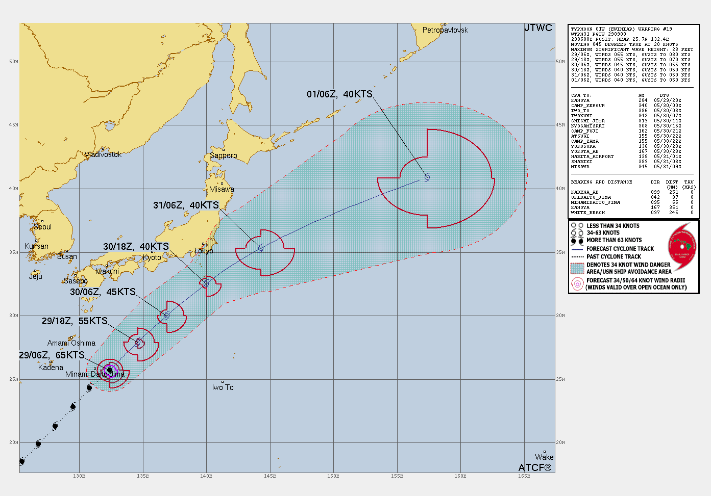
TC Warning Graphic
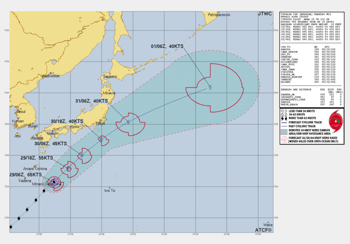
FORECAST REASONING. SIGNIFICANT FORECAST CHANGES: THERE ARE NO SIGNIFICANT CHANGES TO THE FORECAST FROM THE PREVIOUS WARNING. FORECAST DISCUSSION: TY 01W IS FORECASTED TO CONTINUE TO TRACK NORTHEASTWARD AROUND THE WESTERN AND NORTHWESTERN PERIPHERY OF THE DEEP-LAYER SUBTROPICAL STEERING RIDGE THROUGH TAU 72 OF THE FORECAST. THE TYPHOON IS EXPECTED TO BEGIN ENTERING A GENERALLY NON-CONDUCIVE ENVIRONMENT FOR FURTHER INTENSIFICATION AS MODERATE TO STRONG VWS (20-30 KTS) WILL INCREASE THROUGHOUT THE NEXT 12 HOURS. ALTHOUGH SEA SURFACE TEMPERATURES REMAIN WARM (26-28 C) AND UPPER-LEVEL OUTFLOW IS SUPPORTIVE OF FURTHER DEEPENING IN THE PHILIPPINE SEA, THE INFLUENCE FROM THE MID-LATITUDE WESTERLIES WITH STRONG VWS WILL CAUSE CONTINUED WEAKENING UNTIL EXTRATROPICAL TRANSITION TO AN ASYMMETRIC COLD-CORE BAROCLINIC LOW. AS TY 01W CONTINUES TO TRACK NORTHEASTWARD BETWEEN TAU 12 AND TAU 18, COOL SEA SURFACE TEMPERATURES (25-27 C) WILL AID IN THE STEADY WEAKENING OF THE SYSTEM. INTO TAU 36, THE TYPHOON WILL BEGIN UNDERGOING EXTRATROPICAL TRANSITION AS DRY AIR ENTRAINS INTO THE CORE STRUCTURE, AND COLD-AIR ADVECTION AMPLIFIES FROM THE NORTHWEST AND LASTS THROUGH THE REMAINDER OF THE 72 HOUR FORECAST.
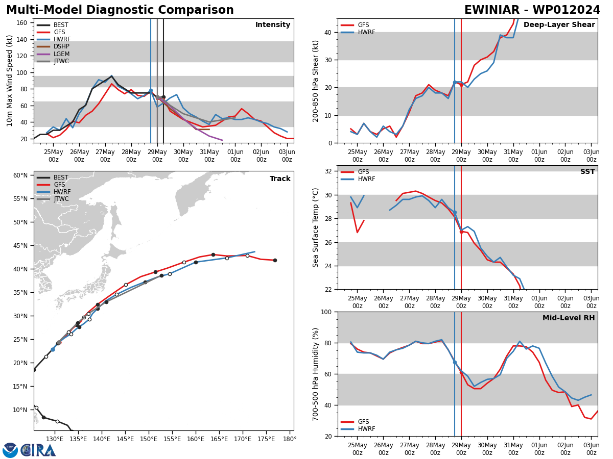
Model Diagnostic Plot

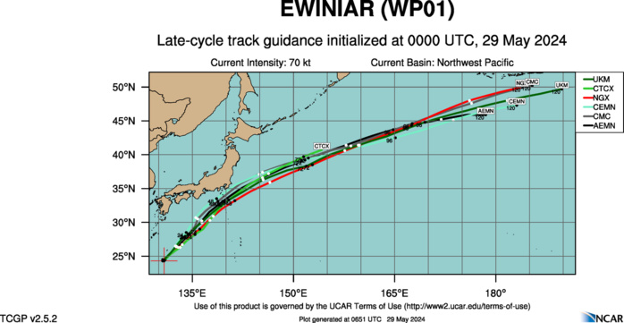
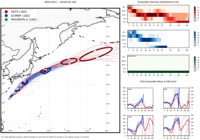
MODEL DISCUSSION: THE DETERMINISTIC AND ENSEMBLE MODELS ARE IN VERY STRONG AGREEMENT THAT TY 01W WILL TRACK TO THE NORTHEAST THROUGH TAU 72 ALONG THE NORTHWEST PERIPHERY OF THE SUBTROPICAL STEERING RIDGE. GFS AND ECMWF ENSEMBLE MEMBERS NO LONGER EXHIBIT SOLUTIONS WITHIN MAINLAND JAPAN, WHILE THE JTWC CONSENSUS (CONW) IS IN COMPLETE AGREEMENT THAT TY 01W WILL REMAIN TO THE EAST THROUGHOUT THE REMAINDER OF THE 72 HOUR FORECAST PERIOD. CROSS-TRACK SPREADS THROUGHOUT TAU 72 REMAIN BELOW 73NM. INTENSITY GUIDANCE REMAINS IN GOOD AGREEMENT THAT A STEADY WEAKENING TREND IS FORECASTED THROUGH EXTRATROPICAL TRANSITION, HOWEVER, SLIGHT REINTENSIFICATION IS INDICATED ON GFS, ECMWF, HAFS-A, AND COAMPS-TC AFTER TAU 48, AND AS THE EXPECTED ASYMMETRIC BAROCLINIC EXTRATROPICAL LOW DEEPENS BETWEEN TAU 48 AND TAU 72.
Ensemble Track Ellipses
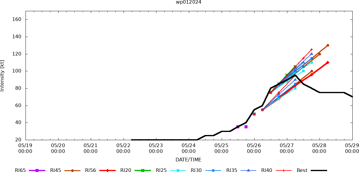
Rapid Intensification Guidance
Multiplatform Satellite Surface Wind Analysis (Experimenta
UPDATED SATELLITE BULLETIN AT 29/0530UTC
TPPN10 PGTW 290546
A. TYPHOON 01W (EWINIAR)
B. 29/0530Z
C. 25.56N
D. 132.20E
E. THREE/GK2A
F. T3.5/4.0/W1.0/24HRS STT: W0.5/03HRS
G. IR/EIR/VIS/MSI
H. REMARKS: 28A/PBO LRG CDO/ANMTN. LLCC EMBEDDED 20NM IN SHEARED
DENSE OVERCAST YIELDS A DT OF 3.5. MET AND PT AGREE. DBO DT.
I. ADDITIONAL POSITIONS:
29/0035Z 24.43N 130.90E MMHS
29/0121Z 24.58N 130.97E MMHS
HUYNH
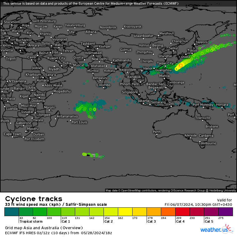
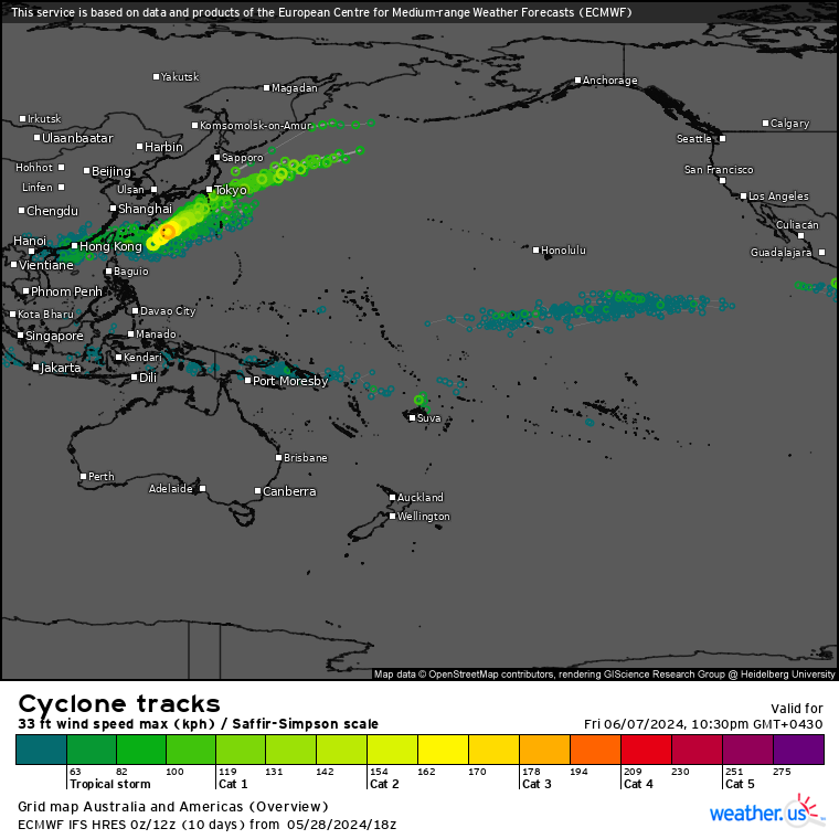
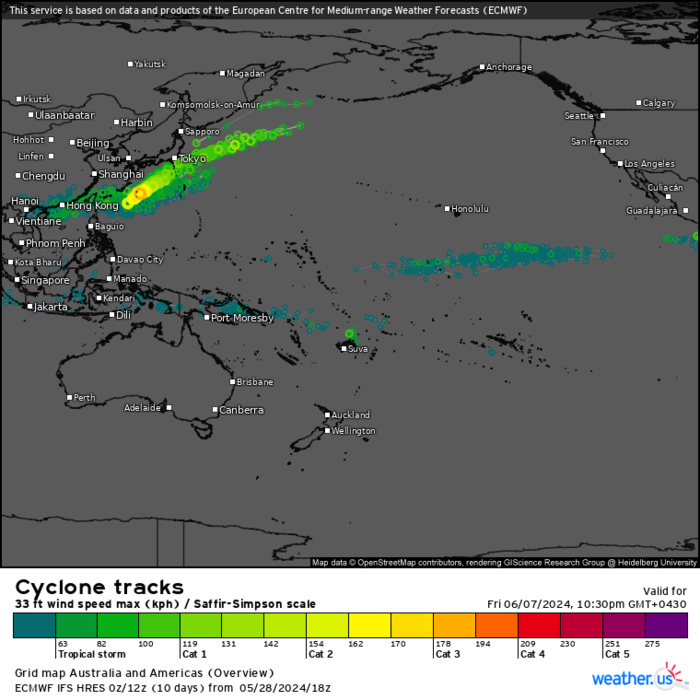
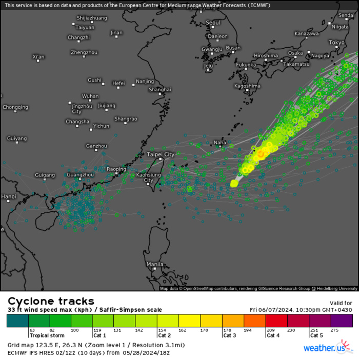
ECMWF Storm Tracks (Ensemble) : 05/28 18UTC+ 10 DAYS
ECMWF Storm Tracks (Ensemble) : 05/28 18UTC+ 10 DAYS
ECMWF Storm Tracks (Ensemble) : 05/28 18UTC+ 10 DAYS
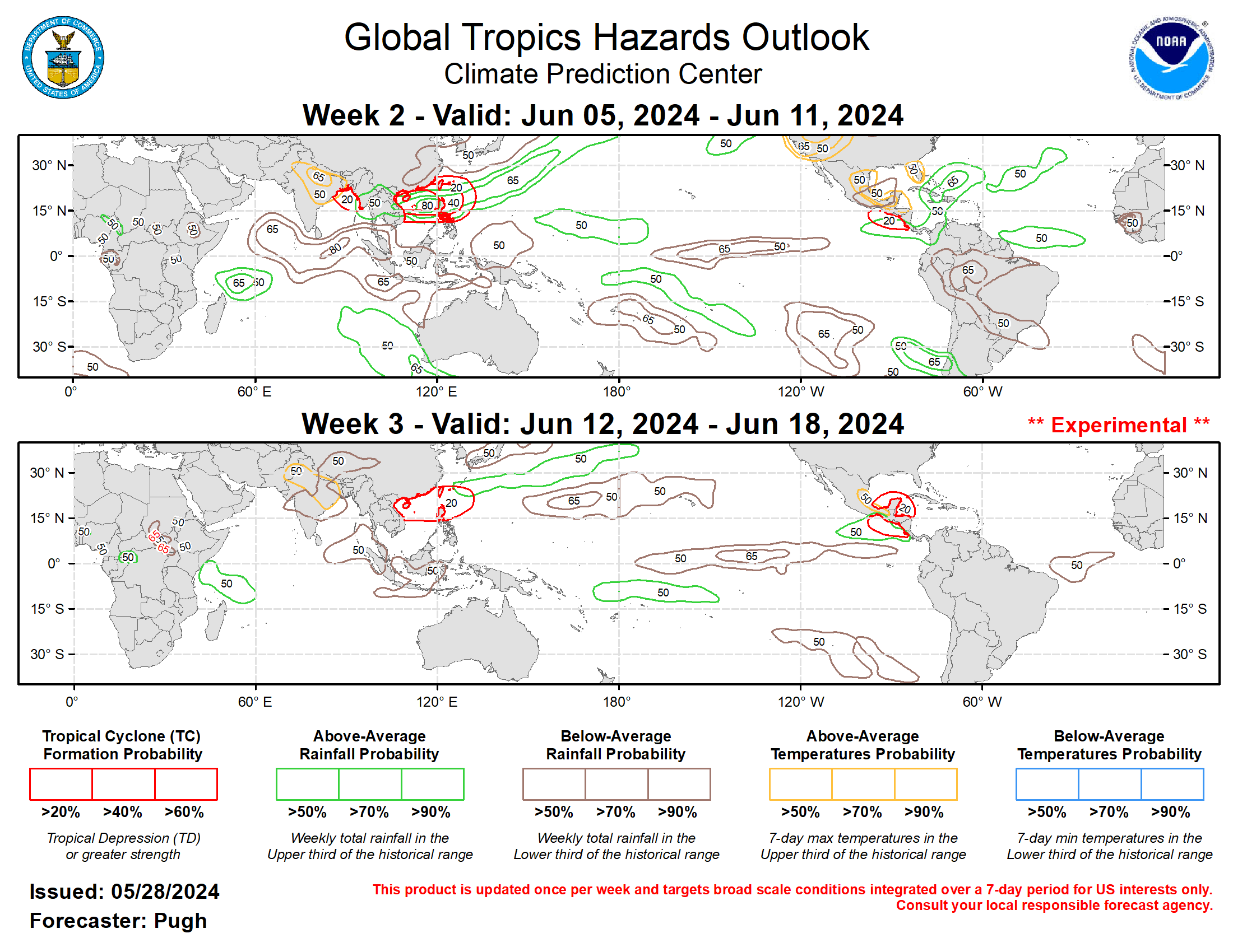
Last Updated - 05/28/24 3 WEEK TROPICAL CYCLONE FORMATION PROBABILITY
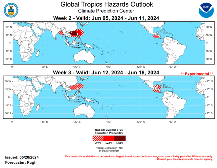
GTH Outlook Discussion Last Updated - 05/28/24 Valid - 06/05/24 - 06/18/24 The MJO strengthened and propagated eastward over the Indian Ocean during the latter half of May. The RMM-based MJO index depicts this amplitude increase since mid-May with a eastward shift from phase 2 (Indian Ocean) to phase 4 (Maritime Continent). The 200-hPa velocity potential anomaly observations became more coherent with a wave-1 pattern this past week, featuring enhanced upper-level divergence (convergence) over the eastern (western) Hemisphere. According to the ECMWF model forecasts of the RMM-based index and 200-hPa velocity potential anomalies, the MJO would continue propagating eastward through mid-June with its enhanced phase overspreading the Americas and tropical Atlantic during weeks 2 and 3. However, the GEFS favors a slower speed with anomalous upper-level divergence only making it to around the Date Line by week-3. Also, a larger spread exists among the GEFS members with its RMM index forecasts. Tropical Cyclone Remal developed over the Bay of Bengal on May 25 and then tracked to the north, making landfall near the border of Bangladesh and India. Heavy rainfall (locally more than 200 mm) triggered flooding across northeastern India and Bangladesh. The first tropical cyclone (TC) in the West Pacific basin of 2024 formed on May 25, as Ewiniar developed near Luzon of the Philippines. The Joint Typhoon Warning Center indicates that Ewiniar tracks northeast and gradually weakens when it reaches the middle latitudes near or offshore of central Japan. During week-2 (June 5-11), the most likely area (> 60 percent chance) for TC genesis is forecast across the South China Sea which is supported by dynamical models and MJO composites for phase 6. A broader 40 to 60 percent area for TC genesis extends east of the Philippines. The GEFS and ECMWF models favor a 20 to 40 percent chance of TC development across the northeastern Bay of Bengal for week-2. By week-3 (June 12-18), the outlook for favored areas of TC genesis becomes more uncertain due to diverging model solutions on the MJO evolution. Based on MJO composites for phase 7 and recent model support, a 20 to 40 percent chance of TC development is posted for the South China Sea and to the northeast of the Philippines. Based largely on the ECMWF model, a 20 to 40 percent chance of TC development is posted for the East Pacific during week-2 and this slightly favored area expands east to include the western Caribbean Sea and southwestern Gulf of Mexic

The precipitation outlook for weeks 2 and 3 are based on a historical skill weighted blend of the GEFS, CFS, ECCC, and ECMWF models along with considerations of MJO precipitation composites for phases 6, 7, and 8. During week-2 (June 5-11), an axis of increased above-average rainfall probabilities is forecast from Southeast Asia northeastward to the Northwest Pacific. Multiple TCs could be ongoing during this 7-day period across the South China Sea and northeast of the northern Philippines. Another favored area of above-average rainfall with probabilities exceeding 65 percent extends from eastern Cuba to the Bahamas. By week-3 (June 12-18), a drying trend compared to week-2 is anticipated for Southeast Asia. Based on dynamical model output but also consistent with the MJO, increased above-average temperature probabilities are forecast for northern India and eastern Pakistan during weeks 2 and 3. Above-average temperatures are also strongly favored for western areas of the United States, Florida, southern Texas, and parts of Mexico to Central America during week-2.
