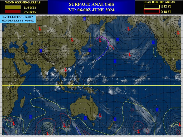
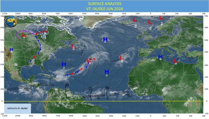
CLICK ON THE IMAGERIES BELOW TO GET THEM ENLARGED
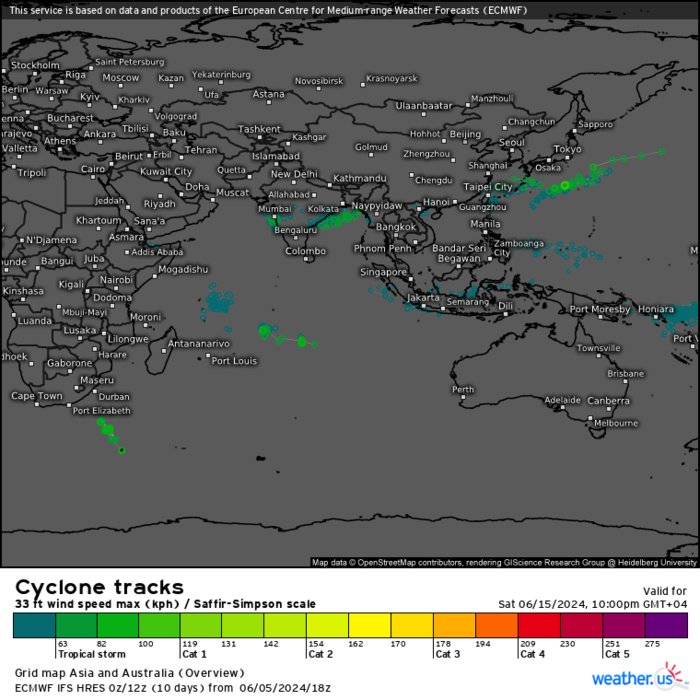
ECMWF Storm Tracks (Ensemble) : 06/05 18UTC+ 10 DAYS
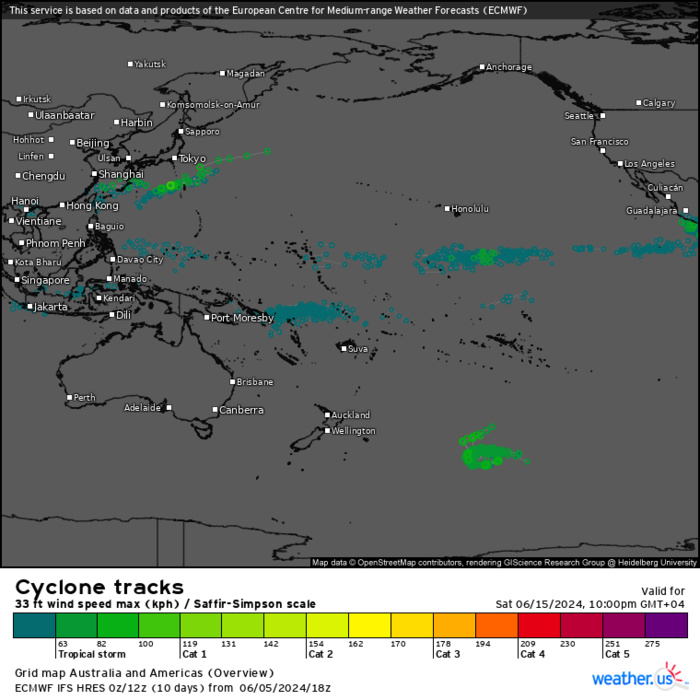
ECMWF Storm Tracks (Ensemble) : 06/05 18UTC+ 10 DAYS
Last Updated - 06/04/24 3 WEEK TROPICAL CYCLONE FORMATION PROBABILITY
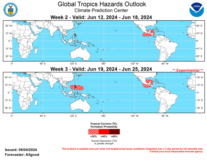
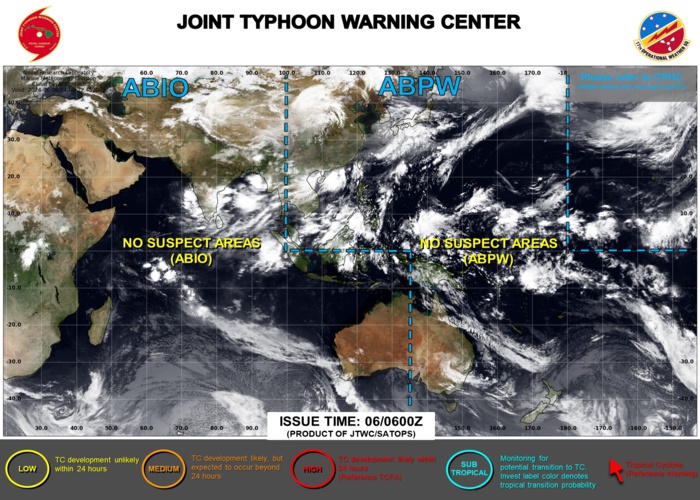
GTH Outlook Discussion Last Updated - 06/04/24 Valid - 06/12/24 - 06/25/24 The Madden-Julian Oscillation (MJO) signal that strengthened last week quickly weakened over the first few days of June. Multiple competing modes of variability resulted in an increasingly incoherent intraseasonal depiction. A Kelvin wave (KW) propagated across the Pacific while the primary MJO enhanced convective envelope remained over the Maritime Continent. Additionally, equatorial Rossby wave (ERW) activity continues to strongly influence the pattern over the Maritime Continent and eastern Indian Ocean, which may have contributed to the sharp “left turn” of the RMM-based MJO index into the unit circle over the past several days. Low frequency signals are also destructively interfering with the MJO, including persistent low-level westerlies over the Indian Ocean and enhanced trades across the equatorial Pacific. While a remnant MJO signal is now nearing the West Pacific, the incoherent structure decreases its predictability moving forward in time. Dynamical model MJO index forecasts generally depict weak MJO activity over the next several weeks, including the ECMWF, which has backed off on robust MJO activity shown in previous model runs. In contrast to the past month, where much of the signal looped across the Indian Ocean and Maritime Continent, there is a weak presentation of a signal crossing the Pacific during Week-2, and the Western Hemisphere during Week-3. This may help effect a pattern change, with increasing wetness across the tropical Americas and drier conditions across the Indian Ocean basin. The Joint Typhoon Warning Center upgraded a system over the South China Sea to tropical depression status just prior to landfall over southeastern China last week. Elsewhere, no tropical cyclones developed. Global accumulated cyclone energy (ACE), a metric depicting tropical cyclone activity, remains below average for the calendar year. During Week-2, any remnant MJO activity coupled with an increasingly active Central American Gyre (CAG) may increase the potential for early season tropical cyclone development, either across the far East Pacific basin, the far western Caribbean, or the southern Gulf of Mexico. A decaying frontal boundary draped across the western Atlantic may provide a source for potential tropical cyclone development near or north of the Bahamas, but potential is too low to include a hazard on this outlook. Across the Eastern Hemisphere, with a fairly weak monsoon trough in place and an active Meiyu Front feature, there is a low potential for tropical cyclone development. During Week-3, a similar pattern is favored to remain in place across the East Pacific and western Atlantic basins, and there is an increasing signal in both the GEFS and ECMWF supporting a potential for tropical cyclone development in the vicinity of the Philippines.
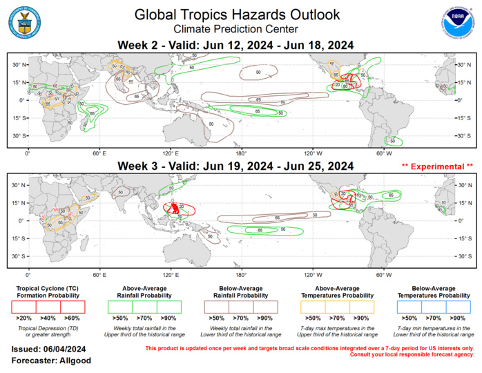
Forecasts for above- and below-average precipitation are based on the low frequency signals, a potential for weak MJO activity crossing the Pacific and Western Hemisphere, and a skill-weighted consensus of dynamical model guidance, including the GEFS, ECMWF, CFS, and EC model systems. Unusually strong low-level westerly wind anomalies are favored for the far East Pacific, which, on top of an active CAG, may promote heavy to excessive rainfall across portions of Central America, particularly across western Guatemala, El Salvador, and Nicaragua. These enhanced westerlies are favored to persist throughout the outlook period, which increases the potential for flooding. In contrast, drier than average conditions are favored to continue across South Asia, maintaining a regime of excessive heat across portions of India. Increased monsoon rainfall may overspread southern India during Week-3.
