
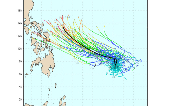
 by 120hours, 14/03utc update")
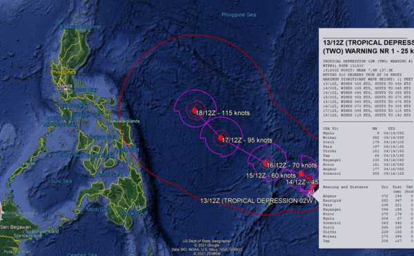
 will be intensifying, forecast to reach US/CAT 4 by 120hours, 13/15utc update")
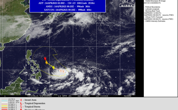
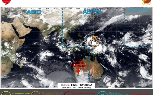
 issued for Invest 94W, 13/0330utc")
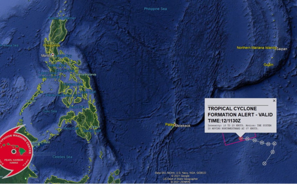
 issued for Invest 94W, 12/1130utc")

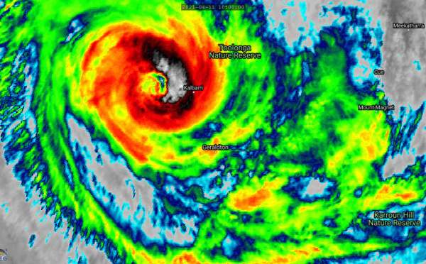
, 70knots/US CAT1 has made landfall, 170km/h gust recorded East of Kalbarri( ABC live report), 11/12utc")
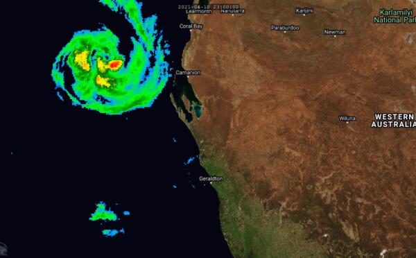
 70knots/US CAT1 is peaking and rapidly moving towards Geraldton area, 28P peaking at 40knots, Invest 94W, 91S and 93S: updates at 11/09utc")
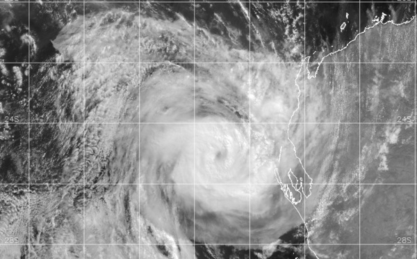
: US/CAT 1(65knots) is rapidly approaching Geraldton area,28P short-lived, Invests 94W, 91S and 93S under watch, 11/03utc update")
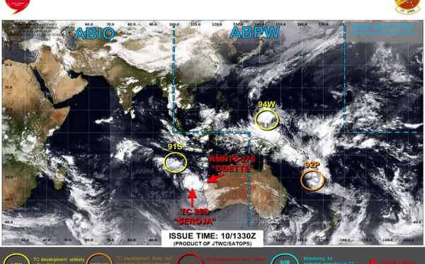
 is approaching WA coastline while slightly intensifying/Invest 92P tracked across New Caledonia, Invest 94W now on the map, 10/15utc update")
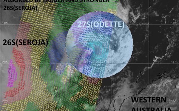
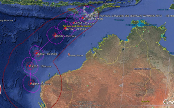
 being absorbed in 26S(SEROJA). 26S will be approaching Geraldton(WA) after 24hours. Invest 92P: 30knot system, 10/03utc update")
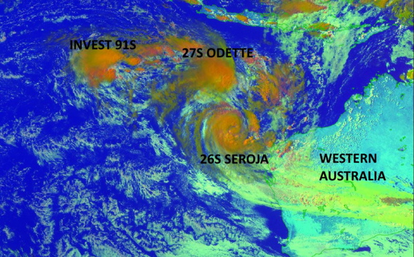
 rotates around 26S(SEROJA) which will absorb it by 48hours while intensifying. Invests 91S and 92P still monitored closely, 09/09utc update")
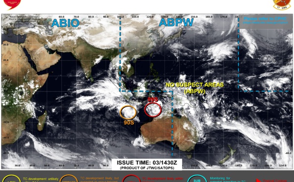
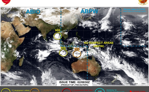
. Invests 91S and 92P under monitoring,08/09utc update")
 forecast to intensify and absorb TC 27S by 96hours, Invest 91S now monitored to the East of 90°Est, 07/09utc update")

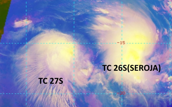
 forecast to intensify significantly after 48h/ 27S: slow-moving, 06/03utc update")
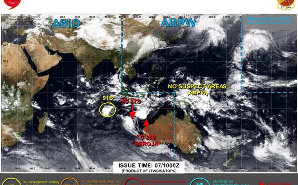
 could reach US/CAT 3 by 96hours. 27S slow-moving 550km South of Christmas island, 05/03utc update")

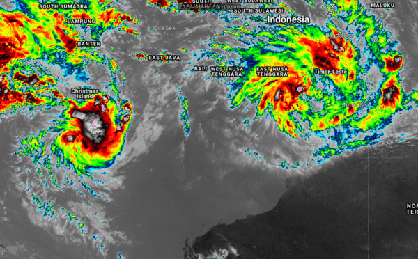


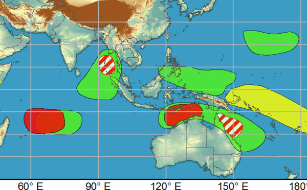
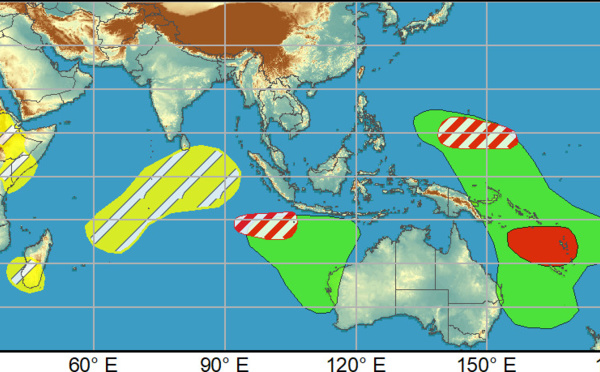
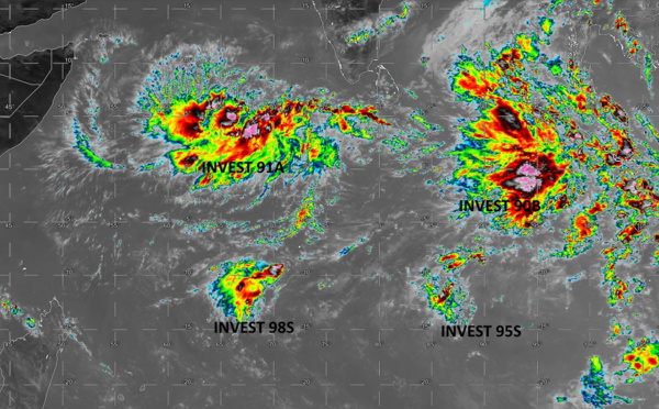
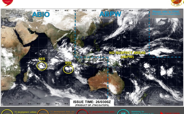
: 4 Invest Areas being monitored, 29/06utc update")

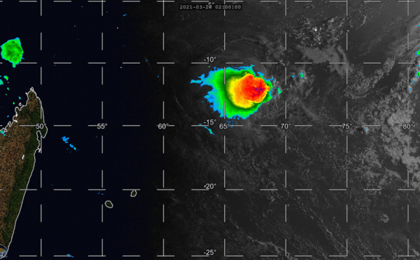
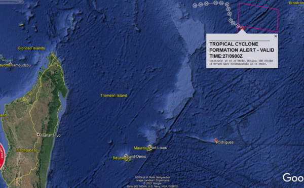
 issued for Invest 98S, 27/09utc update")

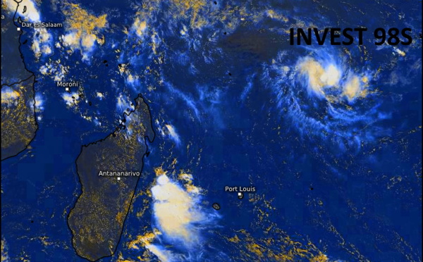


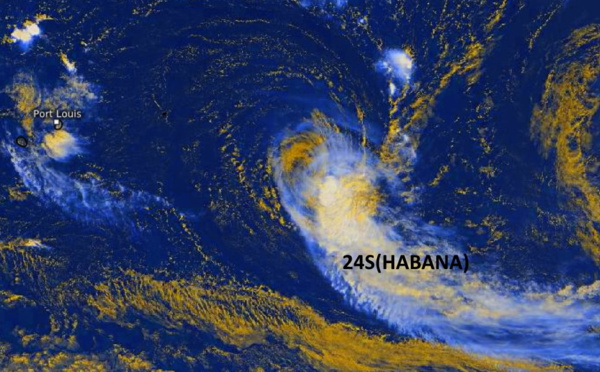
 shows subtropical characteristics with strong winds removed from the center, 16/09utc update")
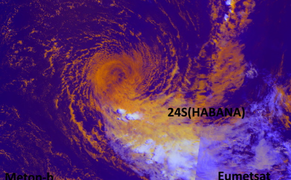
, 50knots, weakening, should be slowly approaching the Mascarenes as a residual system ,15/09uc update")
Les News
TC 22P(PAUL)// Remnants of TC 21S(OLGA)// ECMWF 10 Day Storm Tracks// 1103utc
04/11/2024
- PATRICK HOAREAU
TC 21S(OLGA) SAR reveals still a bit stronger than expected// INVEST 97P// ECMWF 10 Day Storm Traccks// 0903utc
04/09/2024
- PATRICK HOAREAU
TC 21S(OLGA) peaked as a powerful CAT 4 US// ECMWF 10 Day Storm Tracks// 0803utc
04/08/2024
- PATRICK HOAREAU
TC 21S(OLGA) reaches CAT 3 US still intensifying// ECMWF 10 Day Storm Tracks// 0709utc
04/07/2024
- PATRICK HOAREAU
TC 21S(OLGA) intensifying and peaking within 24H may reach CAT 2 US// ECMWF 10 Day Storm Tracks, 0615utc
04/06/2024
- PATRICK HOAREAU
Tropical Cyclone Formation Alert for INVEST 96S// ECMWF 10 Day Storm Tracks// 0509utc
04/05/2024
- PATRICK HOAREAU

Liens utiles
TC 21S(OLGA) SAR reveals still a bit stronger than expected// INVEST 97P// ECMWF 10 Day Storm Traccks// 0903utc
TC 21S(OLGA) peaked as a powerful CAT 4 US// ECMWF 10 Day Storm Tracks// 0803utc
TC 21S(OLGA) reaches CAT 3 US still intensifying// ECMWF 10 Day Storm Tracks// 0709utc
TC 21S(OLGA) intensifying and peaking within 24H may reach CAT 2 US// ECMWF 10 Day Storm Tracks, 0615utc
Tropical Cyclone Formation Alert for INVEST 96S// ECMWF 10 Day Storm Tracks// 0509utc
S'identifier